
-
 5198 Hits
-
 80.49% Score
-
 12 Votes
|
|
Route |
|---|---|
|
|
16.19396°S / 71.53205°W |
|
|
Download GPX » View Route on Map |
|
|
Hiking, Mountaineering |
|
|
Spring, Summer, Fall, Winter |
|
|
Most of a day |
|
|
F |
|
|
Overview
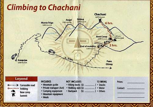
Reading from agencies’ websites, this is not the normal route up Chachani, but it is neither an obscure route. We met one guided group and two locals. I named it "Northern scree route" since it climbs almost from directly North on a scree. Please comment if you know another name.
This is a hike and not a climb. It is achievable by fit and acclimatized hikers without previous mountaineering experience, like the Azufrera route. It can be done in one or, more often, two days.
Some trivia, or how I got lost, alone, in the dark, with no map, and with the wrong route description...
The only map I found in Arequipa...
I arrived in town before dawn, took a nap, wandered around until trekking agencies opened, and looked for transport. Group tours were leaving around 8 am and my friend would arrive in town only at 9:30 am, so that would not work; and I had to head back for Bolivia the next evening, so we had to leave the same day. Only one agency could do it (Ok Peru Viajes Y Turismo, Jerusalén 301), for 400S/. Do yourself a favor and search earlier than me...
I downloaded the route description for the Azufrera route, tried and failed to find a map, met my friend, shopped for food, packed, and swiftly left at noon, 4 awake hours after getting in Arequipa. Little did I know that our driver would not bring us to the Azufrera trail head. It is only after the trip, while trying to understand how we failed to follow the route description and got lost, that I found out we were on another route…
Getting There
Drive to trail head
See the mountain’s main page. Agencies say that a high clearance vehicle is required, but with some off-road driving skills, a normal car can get to the trail head. Do not expect any taxi driver to accept such task.
From Arequipa, follow the road between El Misti and Chachani and turn left at the Reserva Nacional Salinas Y Aguada Blanca sign until S16°10.507’ W71°26.187’. Alternatively, follow the road West and North of Chachani, and turn right to reach the same spot. It is 9.2 km horizontally and 1000 meters vertically from the trail head. Follow a dirt track West and keep right at a fork at 1.7 km. The left track will lead to the Azufrera trail head. The track ends at the trail head on a col at 5094 meters. Camping is possible there, but go slightly further to avoid the high winds that blow through the col.
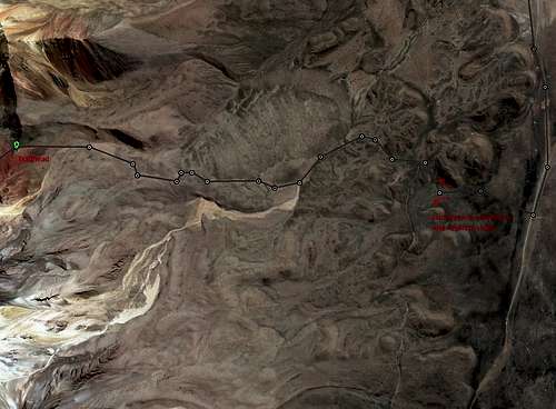
The drive took us 2 hours, driving Peruvian style…Useful maps
3D satellite map, looking SSE

Topo map from US Defense Mapping Agency, North is up
Route Description
Approach
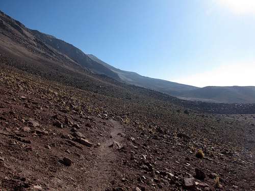
Easy to follow trail
From the col, a well-worn trail heads WSW, descending to 5048 meters.
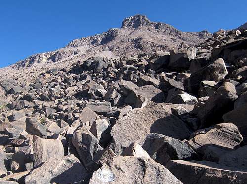
Talus
After 1 km, the trail meets a 200-meter-wide talus. Some signs painted on the boulders guide hikers, but feel free to route find, keeping the same general direction. This scramble will definitely drain some energy.
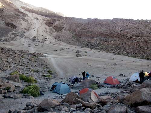
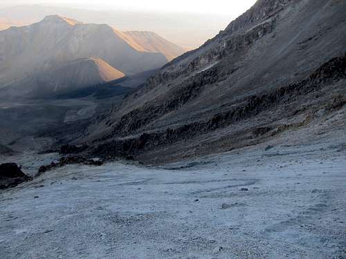
Campsite
Other lower campsite
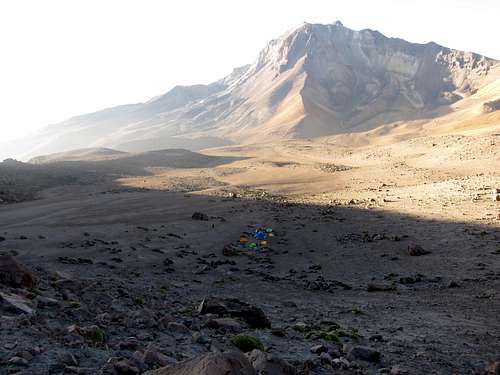
From the campsite, a scree is visible SSW, with a rocky ridge on its right and another scree partly visible behind. Take mental note or a picture!
The 2.5 km approach took us 1 hour 40 minutes, with full camping gear.
Ascent
An alpine start is warranted if there is snow. Else, enjoy more sleep.
We were told to be on the road at 1 am and out before noon even if there was no snow, the afternoon heat being the reason. The truth is that they will bring the next day’s hikers in around 10:30 am, so they want to minimize their drivers’ and cars' downtime. Clever. We left at 3:20 am, but only because I wanted to see some Arequipa in the afternoon in my short 40-hour passage in Peru.
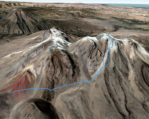
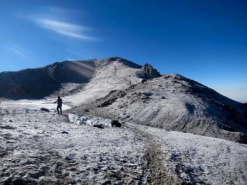
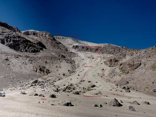 Keep this image in mind. The green line approximates the way I took. The blue line is what I believe would be the easiest way up on scree.
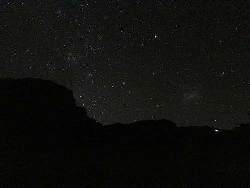
If lost, aim right and up
Finding the trail again at 5700m
Between 5300 and 5350, I “lost” my friend for altitude sickness and soon after the trail. Should you get lost too, look up and aim to the right of the highest visible point. I found a trail back at 5700 meters, 1.8 horizontal km from camp, but I cannot confirm a continuous link from 5350 meters (there is probably one).
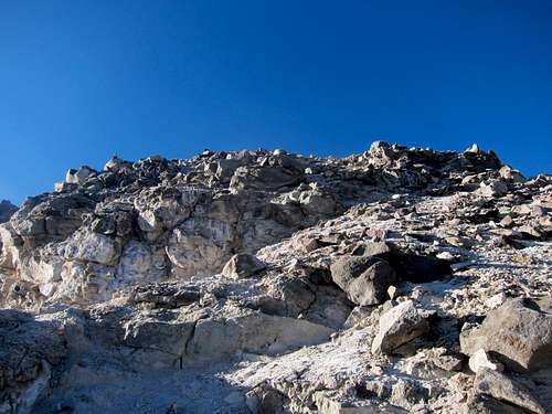
Rock field
Traverse
The trail ascends close to a ridge and traverses left (East). There is some exposure here. On scree or dry snow, the traverse is easy; on ice or wet snow, this is the technically hardest part of the climb, but is short.
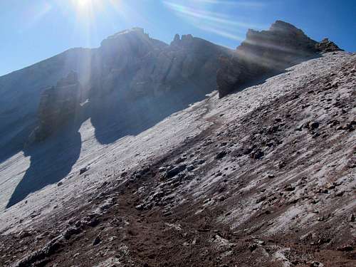
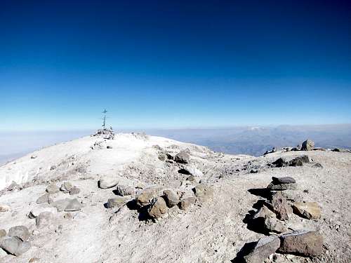
Crater, penitentes, and final slope
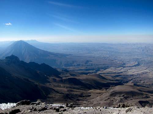
Get up the ridge, which becomes the crater rim. The summit can now be seen on the opposite side. Head down around the crater, which was beautifully decorated with penitentes when I was there, and walk up the final slope.
The 2.7 km ascent took me 4 hours. The guided group I met took 5.5 hours. One local made it in 3 hours…
Descent
The same way as the ascent. Wet snow can be tricky after sunrise, but may allow glissading. Watch for rock fall if glissading on scree and warn downhill climbers.
The 2.3 km descent took me 1 hour 5 minutes doing some semi-glissade on the upper slope and some scree-skiing on the lower slope. Expect 1.5 to 2 hours if walking.
The 2.4 km return to the trail head took us 1 hour 10 minutes.
Total vertical: +1079m, -85m
In early October 2016, my feet never touched snow (except for the fun of kicking a penitente!). Crampons and ice ax are required if there is significant snow.
Sand stakes may be overkill, but having some rope to tie the tent to rocks is wise as the ground is loose on the campsite.
When to climb and other practical information
There will be more snow and cloud in the summer and fall, and more scree in the winter and spring, so the choice is yours. See the main page for more on weather, water and camping.See the main page for prices, guides and navigation. Again, this is more a hike than a climb, and can easily be done unguided. Avoid guides who insist on an alpine start in dry season.Doing the hike in one day may be easier than in two. I do not know if the benefit of one night at 5200 meters on acclimatization outweighs the short night most people get at that altitude.
If altitude sickness strikes at the campsite, going down to the trail head will only get you 100 meters lower. So walk further down the car track if it gets really bad.
![View from Arequipa]()
Sunset on Chachani from Arequipa
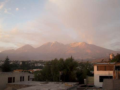
Sunset on Chachani from Arequipa
If you climbed on snow, congratulations, you just did some mountaineering! If you climbed on scree, you now hate scree. I now hate scree.