
Viewing: 1-1 of 1

mrchad9 - Sep 9, 2013 10:31 pm - Voted 10/10
The best!One of the most enjoyable routes I've ever been on. Brings back great memories. Thanks for posting!
Viewing: 1-1 of 1
|
|
Trip Report |
|---|---|
|
|
48.79318°N / 125.11558°W |
|
|
Jul 28, 2013 |
|
|
Hiking |
|
|
Summer |
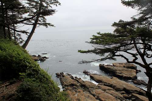
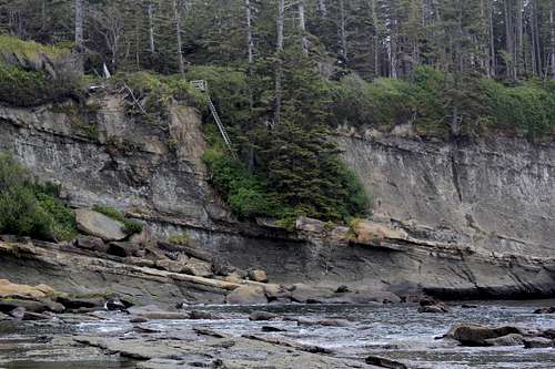
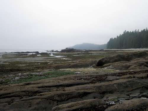
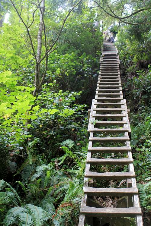
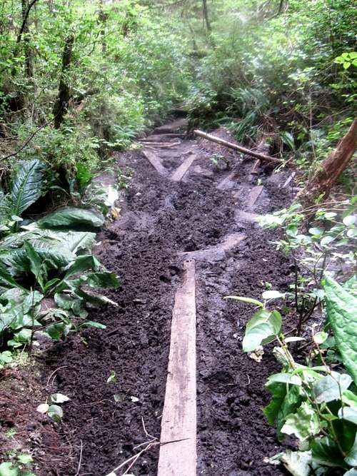
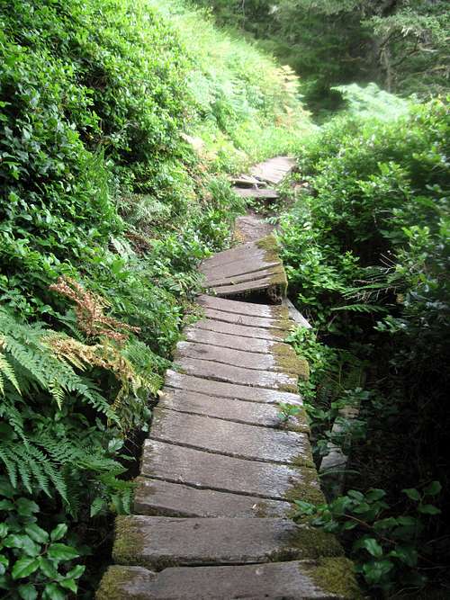
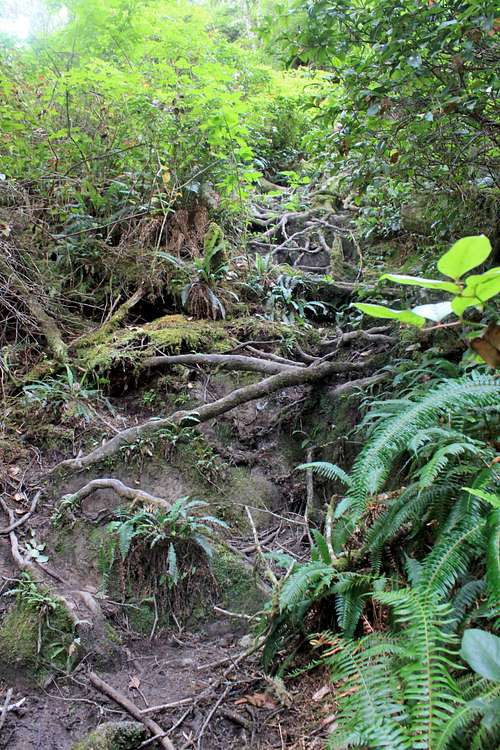
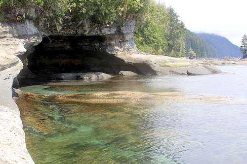
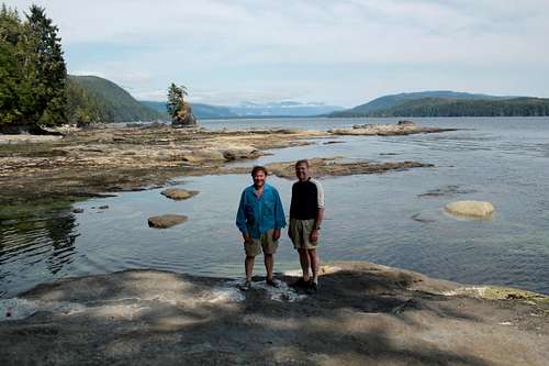
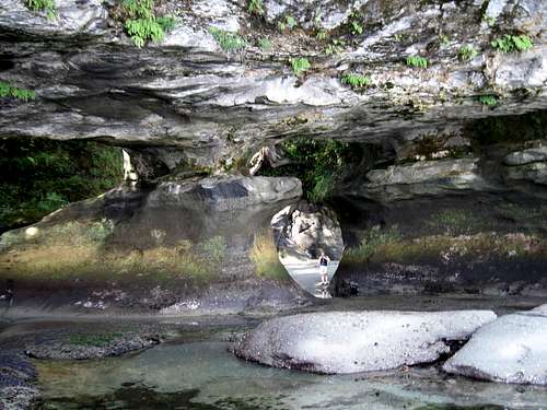
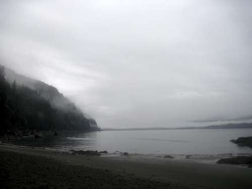
The West Coast Trail is a well-known multi-day hike in British Columbia that follows the coastline and, depending upon the tide, allows one to hike rock shelves and beaches, while still hiking inland along part of the trail. It is only 75 km long, and usually takes 5-6 days, due to timing issues with tides, buses to get to remote trailheads, and the need for an orientation session before the permit is issued. Besides tide issues, which can close portions of the trail, the trail is well-known for mud and ladders. Also, as it is in a rain forest, rain and humidity play their role.
The trail is very beautiful and was definitely something I enjoyed. It is not as hard as advertised, given the lack of any real elevation gain or mountains, but it is different and something to be experienced. Also, it makes for a great adventure and opportunity to visit British Columbia and see Victoria.
I hiked the West Coast Trail over six days with my brother Ed from July 28-August 2, 2013; we went North to South, which is the route I would recommend. Days 1 and 6 were partial days and travel days on the bus. Although there are many theories on which way the trail should be hiked, if you are taking the bus to get to the trailhead, going this way allows you to do your orientation on the first day and then hike 12km over the least interesting portion of the whole hike on Day 1. It also gives you plenty of time on Day 6 to leisurely hike out and catch the ferry, then the bus back, after grabbing some refreshments at the local hotel while waiting for the bus. Finally, it means that your Days 4 and 5 have a lot of interesting things to see, and you end on a bang, instead of a whimper or let down, which I would find to be the case going the other way. The campsites we stayed at are as follows:
Day 1 Michigan Creek (12km from start)
Day 2 Tsusiat Falls (25 km from start)
Day 3 Carmanah Creek (46 km from start)
Day 4 Camper Creek (62 km from start)
Day 5 Thrasher Cove (69-70 km from start)
I took a great many pictures and have much more to say about this trip, but it is too much for a trip report such as this, and will be dealt with in a different forum. So this will be short and only offer a few glimpses of some characteristics of the trip. However, I will say this—it was a fun trip. I am glad I wore mountaineering boots, not because of the terrain, but because they were waterproofed and worked well with long gaiters. This is a trip where it is handy to have a dry set of clothes at night. It never got very cold, and I used a 55 degree bag liner instead of a bag, coupled with an REI Quarter Dome tent with rain fly. There is food along the way at two locations, so bring Canadian money along on the trip. The mandatory ferry crossings are covered in your permit, which is expensive.
This is a trip well worth doing for something a lit bit different. The scenery is well worth it, as are many other aspects of this rather unique hike. It requires a fair amount of planning for this trip, especially if you do not live near the trail, and even more so now
that the permits are being issued all at once on a single day for the prime season. My biggest piece of advice for anybody planning this trail is to check your plan and when you will hit Owen Pt and make sure that the schedule you are selecting will allow you to be there at a tide of 6 ft. or less for the day you plan on passing through it; you do not want to miss the beach hike around Owen Pt as it is one of the highlights of the whole hike, and another reason I enjoyed going North to South so we finished on a high note.
One of the most enjoyable routes I've ever been on. Brings back great memories. Thanks for posting!
Comments
Post a Comment