Toggle navigation
Mountains
Routes
Images
Trip Reports
Forum
What's New
People
Areas & Ranges
Articles
Trailheads
Canyons
Huts & Campgrounds
Albums
Logistical Centers
Fact Sheets
Lists
Custom Objects
Gear
Plans & Partners
WELCOME TO SUMMITPOST
SIGN IN
REGISTER
Blacks Fork Ridge Loop
Additional Parents
Image
West Oweep Peak
View High-Resolution Image
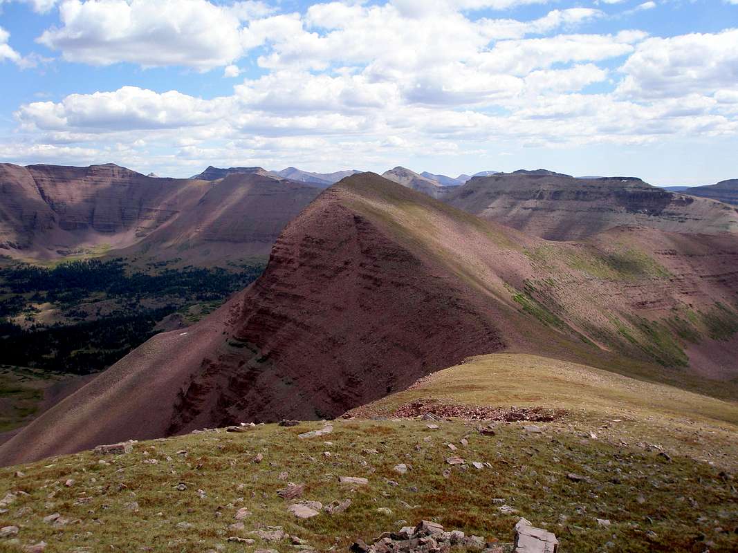
West Oweep Peak
West Oweep Peak (12507') is in the middle of the picture as viewed from the west. Oweep Peak (12531') is the long flat topped ridge to the back and right. August-28-2009
« PREV
NEXT »
ZeeJay
on
Sep 10, 2009 7:40 am
Comments & voting
Other parents
Lat/Lon:
40.77103°N / 110.5335°W
Image Type(s):
Hiking
Image ID:
551744
5553 Hits
86.37
% Score
22
Votes
Log in to vote
Comments
No comments posted yet.
to post!
Don't have an account?
Blacks Fork Ridge Loop
(Route)
« PREV
Viewing
#4 of 45
GALLERY
NEXT »
ZeeJay's Image Gallery
« PREV
Viewing
#111 of 1388
GALLERY
NEXT »
High Uintas Wilderness
(Area/Range)
Loading....
South Blacks Fork Peak
(Mountain/Rock)
Loading....
West Oweep Peak
(Mountain/Rock)
Loading....
Squaw Benchmark Ridge Loop
(Route)
Loading....
×
You need to login in order to vote!
User Name
Password
Remember me
Forgot your password?
Log me out when I close my browser.
Keep me logged in all the time.
sign in as a user
Don't have an account?
Register now for FREE
Rating available
Suggested routes for you
People who climb the same things as you
Comments Available
Create Albums
Register Here


