|
|
Mountain/Rock |
|---|---|
|
|
49.01688°N / 114.04613°W |
|
|
Hiking, Mountaineering, Skiing |
|
|
Spring, Summer, Fall, Winter |
|
|
7923 ft / 2415 m |
|
|
Overview
Forum Peak is one of the twenty-five named peaks in Waterton Lakes National Park. It is located in Alberta but just east of the BC border and just north of the Canada/USA border. Cameron lake lies below its eastern aspect.0.7 km NxNW (338.2°) of Forum Peak lies Forum Lake, and Forum Lake is in British Columbia. The peak apparently is named after the lake, and not the other way around.

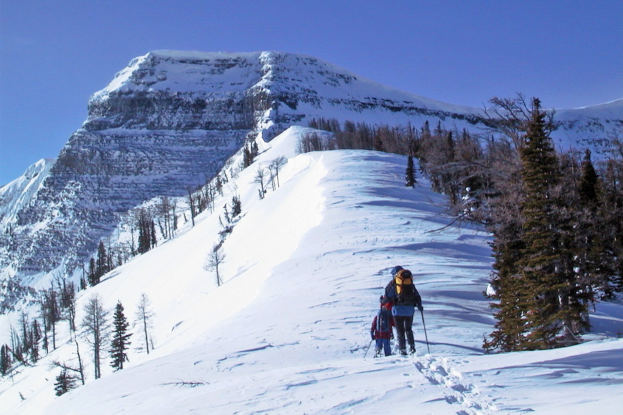
Snowshoers on the north ridge head south toward the summit of Forum Peak.
Photo belongs to bobspirko.ca
Getting There
As indicated Forum Peak is located in Waterton Lakes National Park in Alberta, Canada. This Park is situated 270 km (162 miles) south of Calgary, Alberta, 43 km (27 miles) west of Cardston, Alberta, and about 80 km (48 miles) from the St. Mary entrance to Glacier National Park, Montana. When driving to Waterton Lakes National Park it can only be accessed from its eastern side.From Calgary take Highway 2 south to Fort Macleod, then west on Highway 3 to Pincher Creek, then south again on Highway 6. The drive requires about three hours.
From Cardston take Highway 5 west, through the village of Mountain View. The drive is less than 40 minutes.
From Glacier National Park, Montana, take the Chief Mountain International Highway (closed in the winter). From the St. Mary entrance of GNP it is approximately a 1 hour drive. In the winter take Montana Highway 89 to Alberta Highway 2 to Cardston, then Highway 5 to Waterton.
Once you arrive at the Park follow the entrance parkway (Highway 5) toward the town site, which is located 8 km (4.8 miles) down the road. En route, you will pass Mount Crandell, which is located directly across the highway from the famous Prince of Wales Hotel, about 1 km (0.6 miles) shy of the town. As you pass Mount Crandell, and start down the hill watch for the Akamina Parkway (aka Cameron Lake Road) on the right, as you will want to take that road.
The trailhead for Forum Peak is labeled Akamina Pass and is just shy of the parkways end at Cameron Lake. As you drive up the road you will pass the Rowe Lakes trailhead located 10.2 km up this narrow winding road; after which you should watch the right side of the road for the Akamina Pass sign. Parking is on the left side of the road, across from the sign.
Route
Find your way up the Akamina Parkway and park at the Akamina Pass trailhead (see getting there). The Akamina pass trail is an old 4X4 road - follow it up hill basically in a westward direction. After just shy of one mile you will come to a cut line running perpendicular to the trail. The cut line is the Alberta/British Columbia border, and is labeled as such. The cut line is also the border between Waterton Lakes National Park and Akamina-Kishinena Provincial Park.Turn left (to the south), and follow the cut line. When there is no snow, hikers will have to deal with a lot of dead fall as they wander along the cut line. With in 3/4 of a mile the elevation will drop considerable and at the lowest point a seemingly impossibly steep hill will become the next obstacle. Make your way up the hill and once you get above the tree line you will notice that you are on the north ridge of Forum Peak with the peak directly ahead of you to the south. Continue on to the peak.
The author likes to go up to Forum Peak in the winter on skis. It's a fun tour, and there are several good ski runs off the ridge, in an easterly direction, that drop you next to Cameron Lake.
You could also stay on the Akamina pass trail, rather than turning off at the cut line, and wander up to Forum Lake by following the trail markers. But once at the lake you'd have to make your way back to the north ridge, and scramble up. That would be a longer hike.
Here is a map.
Red Tape
You have to pay an entrance fee to get into Waterton. Both Wateron and Akamina-Kishinena Provincial Park will have camping and fire restriction that you should enquire about if you plan to spend the night.When to Climb
You can do this one any time of the year. In winter it makes a fun ski tour.Camping
Check with Akamina-Kishinena Provincial Park if you plan to camp on the BC side of the cut line.There are 9 wilderness campsites in Waterton. You should contact the park to make reservations for wilderness campsites.
Additionally Parks Canada operates three vehicle-accessible campgrounds in Waterton Lakes National Park. Click here for details.


