#1 - May 17th, 2014 - Laboring up Tabor
Back in 2012 I had hiked several peaks with Brett, including Ibapah out in the West Desert. Since then he had finished most of his Utah 2000 foot prominence peaks, but back issues put him out of commission for a bit. Now, he wanted to get as many P2K’s out west as possible before moving to North Carolina in the fall for grad school. Schooling parts aside I was in the same boat, and we made plans to tentatively go for a 3 peak day in Northeast Nevada.
Tentative because it would depend entirely on the Bruins' Playoff scheduling. I would be out for long multi-peak days if they had beaten Montreal during the week and advanced to the ECF, but alas after a spineless and disappointing Game 7 effort, there I was meeting Brett at the Flying J in Wells early on a Saturday morning, so that he could park his minivan and we started our carpool up to Tabor which, as the highest point of the small Snake Range north of Wells (not to be confused with the one down in Great Basin National Park), served as the first goal of the day.
The road was good to the Tabor Pines Campground but deteriorated quickly afterwards, getting progressively rockier and steeper, and I progressively more apprehensive about continuing in the 4Runner. Brett urged me on, however, in the name of our multi-peak timetables.
I edged the 4Runner over several bumpy rocky sections that I normally wouldn’t have chanced. What makes this road scary is that you crest several small hills with no idea of what condition the road is on the other side.
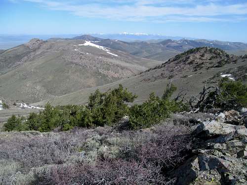
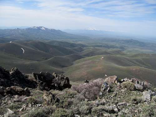
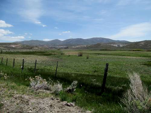
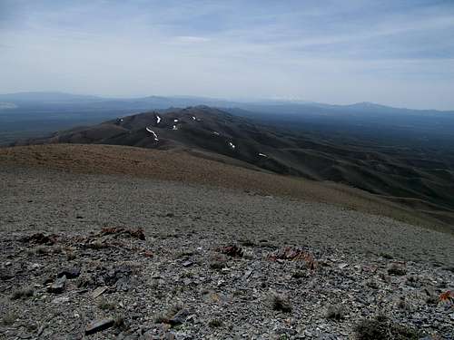
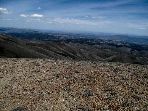
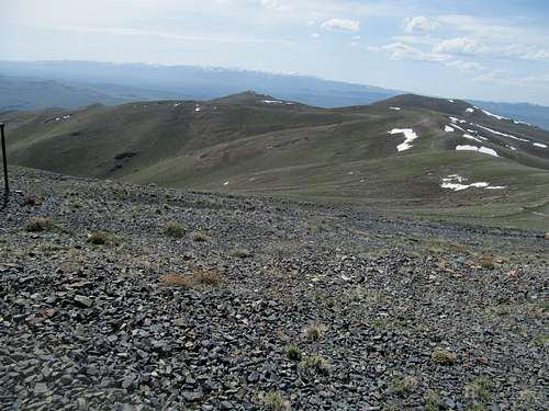
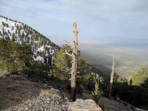
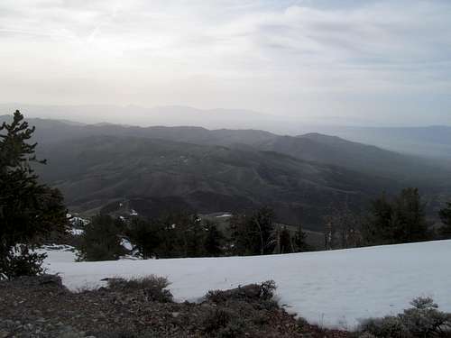
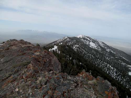
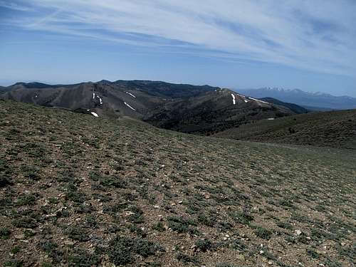
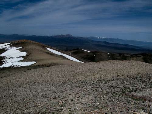
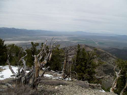
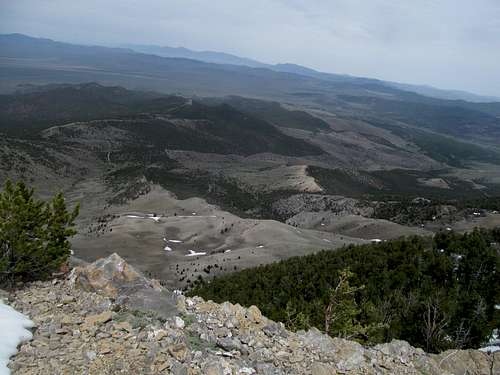
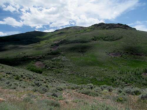
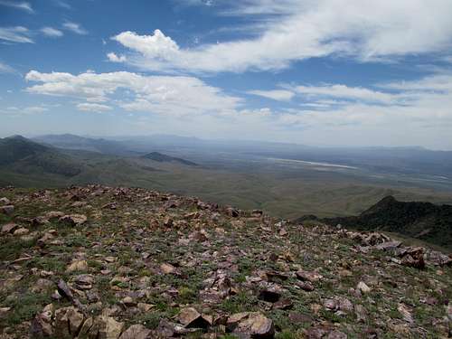
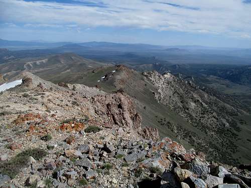
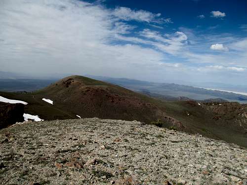
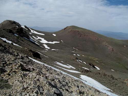
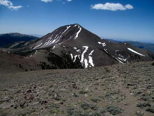
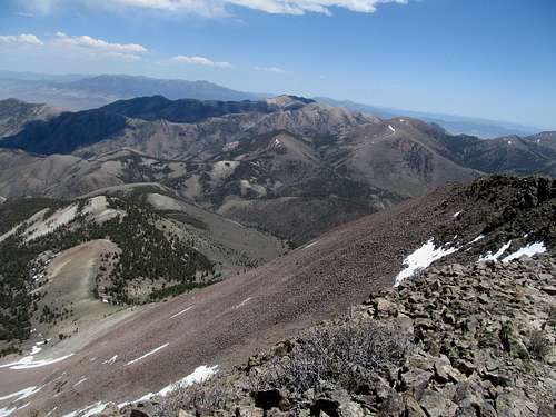
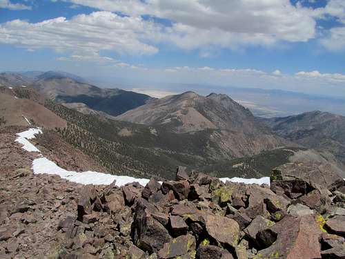
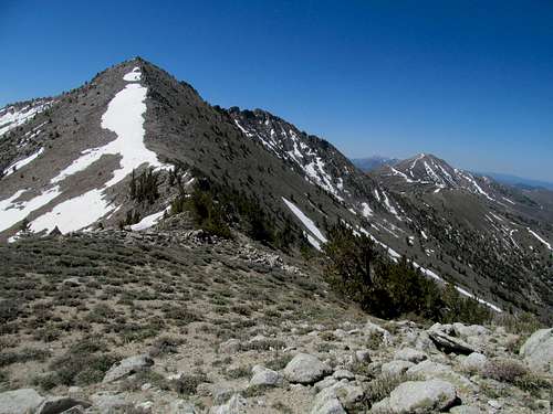
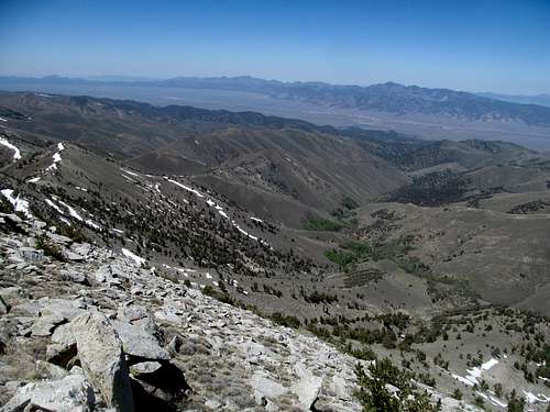
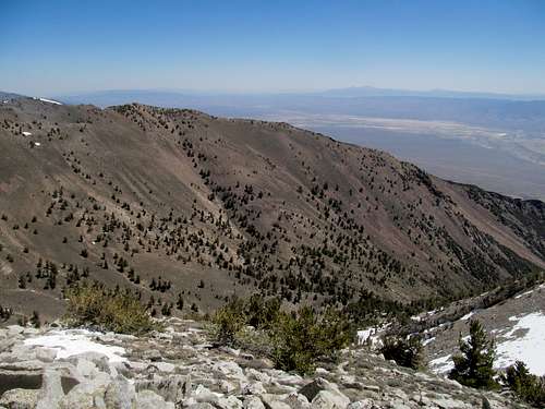
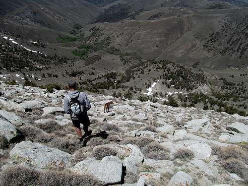
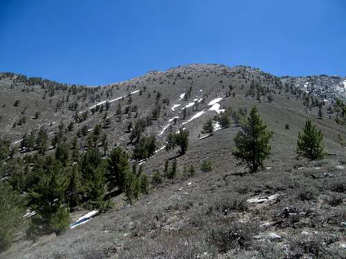
I parked with maybe maybe 1200-1500 feet of gain left to spare and we walked up the rest of the steep road, traversing through some light brush to reach the top.
After a lot of hours spent on stairmasters with a backpack, Brett was much faster than two years ago and left me unexpectedly gasping for air trying to keep up with him.
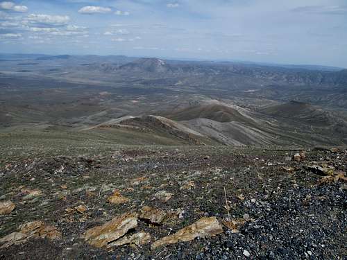
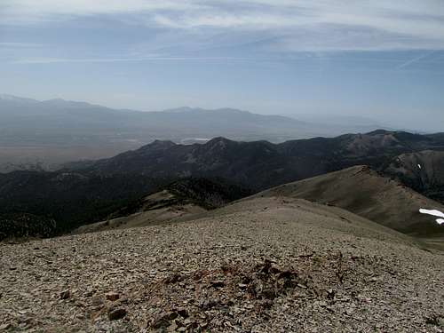
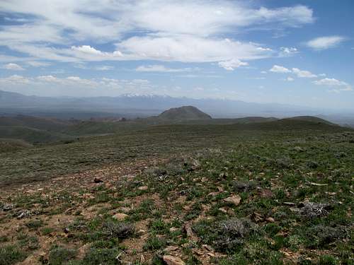
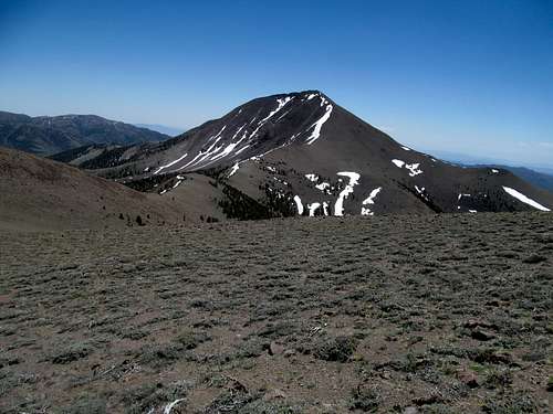
I wasn’t too far behind, and we took scope of the views of our next goal, Knoll Mountain, before heading down.
#2 - They See me Knollin'
(...they hatin'...)
Beyond being merely a Nevada 2K, I had always beheld Knoll with some extra if unmerited esteem. This was mostly because of the clump of mountains south of Twin Falls has no P2K's (though its range highpoint, Monument, comes close), and several sites listed Knoll as the line parent for that area; as a result, I vaguely assumed that Knoll was a highpoint for a long line of mountains stretching past both states, though from the summit I quickly realized that the two ranges are quite distant and separate. Pictures of Knoll seemed pretty cool, but perhaps the idea of its aesthetic splendor may very well exceed its reality.
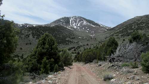
Brett had figured that we’d backtrack to Wells before heading up US-93, but I thought a shortcut via dirt roads, looping north along O’Neill Deeth then back east along O’Neill Co Road would be worth pursuing. All in all the roads were good gravel but had enough steep curvy twists and turns to prevent constant 50 mph cruising, and I honestly don’t know which route would have been faster. We got there though and once more drove a steadily deteriorating road to the small pass to the north of Knoll Mountain.
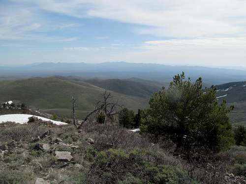
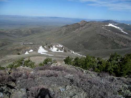
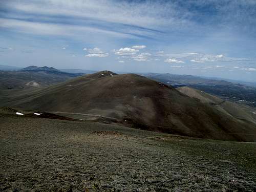
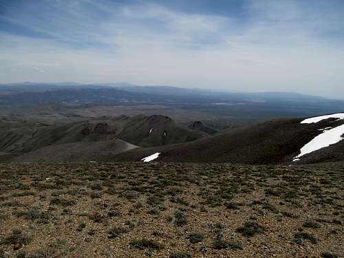
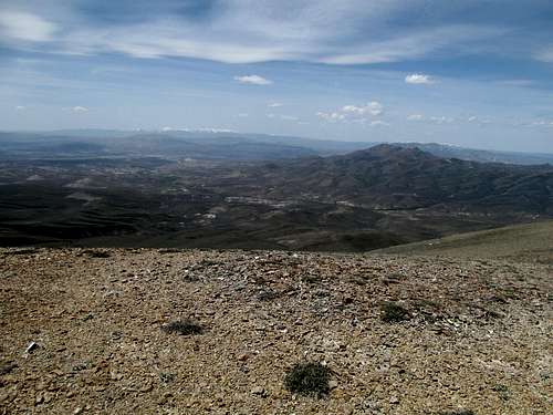
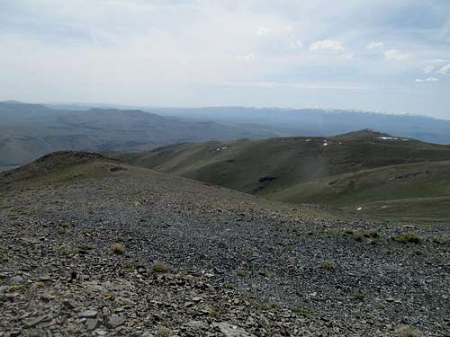
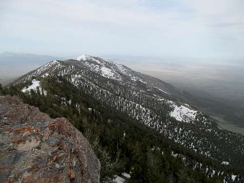
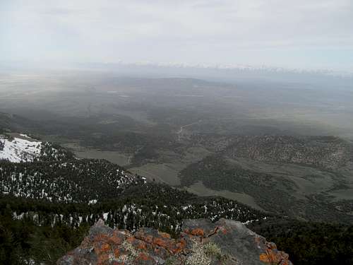
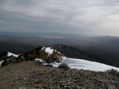
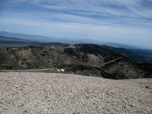
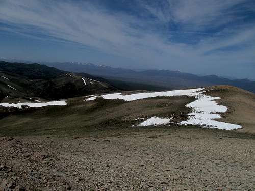
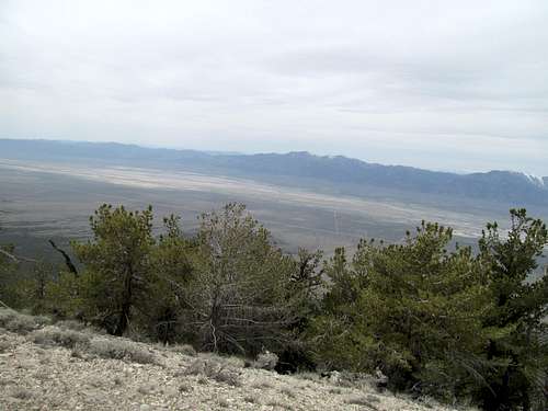
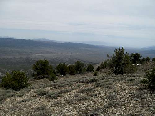
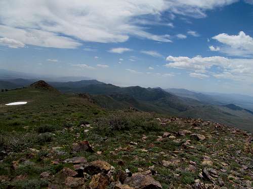
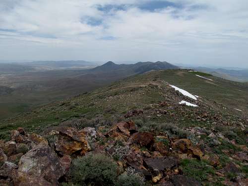
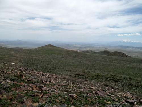
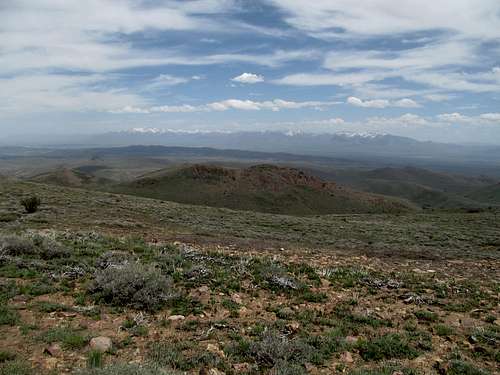
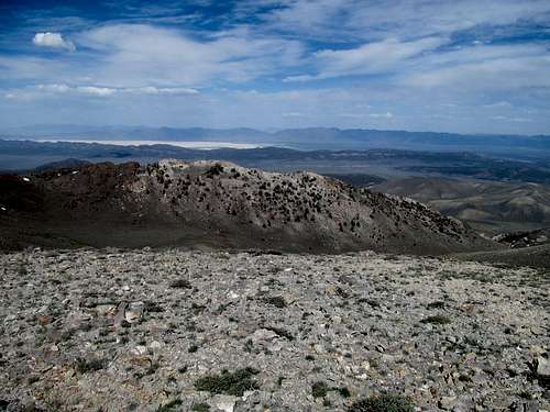
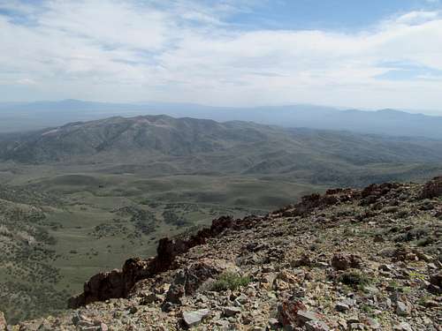
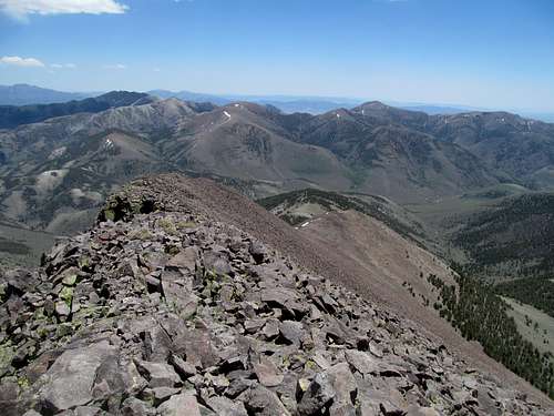
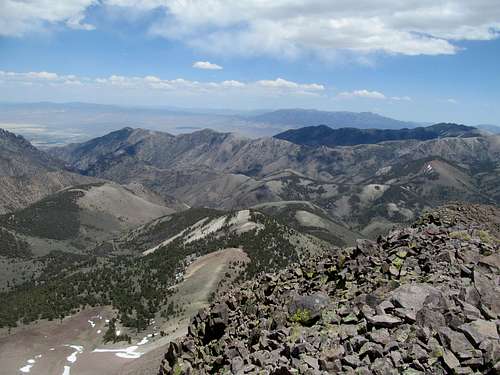
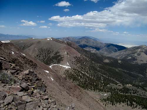
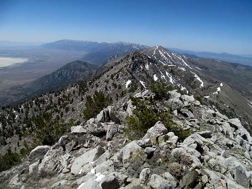
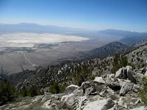
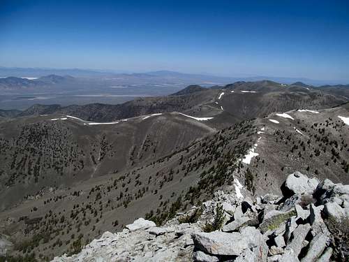
The initial 600 feet or so of ascent represented the crux of effort required to surmount Knoll. It was an easy stroll over a few bumps to the final true summit, which had some cool views of the barren line of hills leading south.
Northeast Nevada is has some surprisingly interesting peaks…even setting the high peaks like Pilot, Schell, Ruby and Hole in the Mountain aside, you have a lot of intriguing mid elevation ranges such as Goshute, Toano and the such with ample vegetation, rugged Bristlecones, and a sky island feel unique to this part of the Basin and Range. Further west towards Reno, however, the rain shadow caused by the ramp of the Sierras which jump starts precipitation further east leaves lines of ranges set at a similar elevation as their eastern neighbors, but barren, bald, and lacking the evocative nature of their cross state counterparts. Despite some more interesting ranges (McAfee, Jarbidges) west of here, Knoll and Tabor certainly seem to fall into the duller Western Navada Category. But the views were still pretty good, especially towards the aforementioned Jarbidge Range, and the interesting nature of the Knoll Mountain topography made up for the lack of vegetation.
#3 - Ridin' Dirty up Ellen D
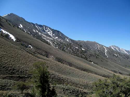
We descended and were a short distance away from our next destination, Ellen D Mountain. For me, this would be part 1 in a weekend of redemption and unfinished business. Two years ago I had been turned back, ironically, on this peak with a good road to the top, partly from a locked gate, partly from the rough road I had to travel to bypass he gate, and partly because after traversing maybe .75 miles or so I realized that I had left my headlights on back in a Camry. An atypical peak to fail on, but the blow softened by a successful ascent of Toano later that day.
So an odd mountain to be seeking redemption on for sure, but failure doesn’t play favorites. This attempt went much smoother with the 4Runner as opposed to the Camry (as much as I miss that old trooper bless her soul). I was able to find the road and the sideroads by memory. The main throughway was still locked, but this time the side road to the left made for a much easier ride before it looped back on the main gravel road.
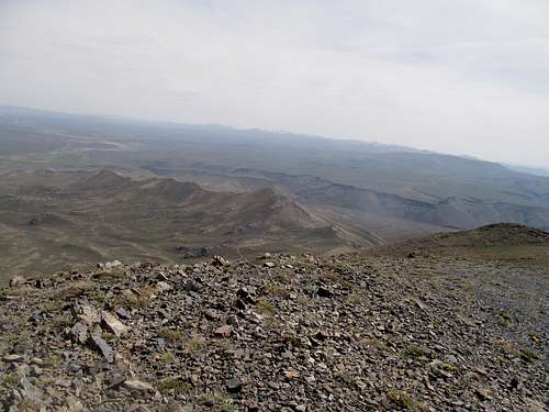
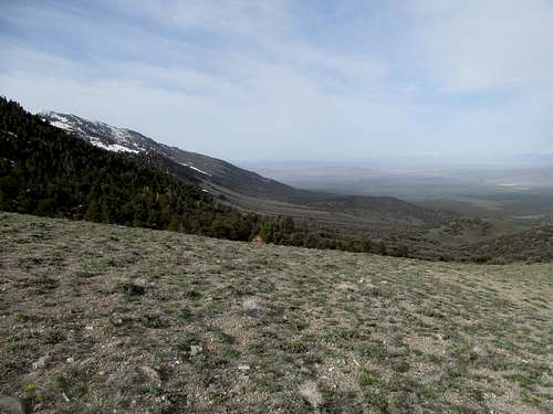
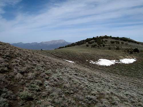
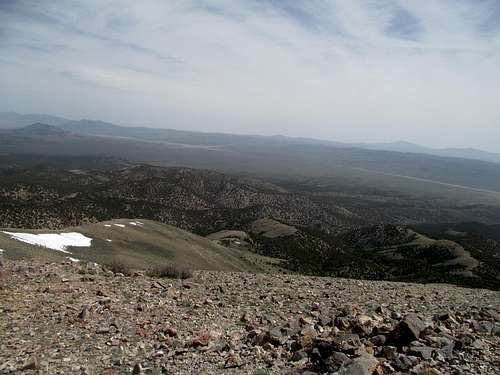
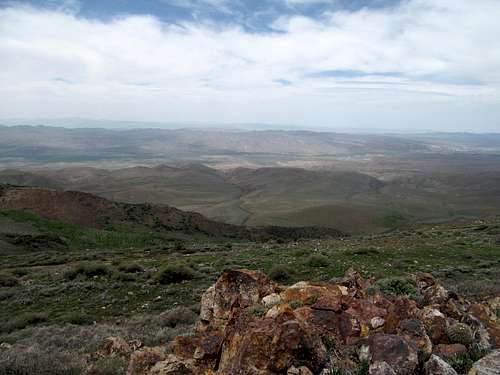
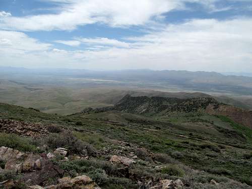
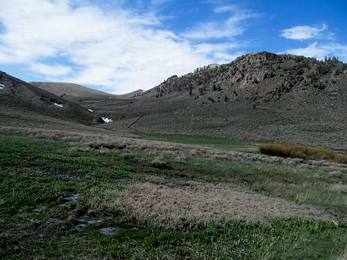
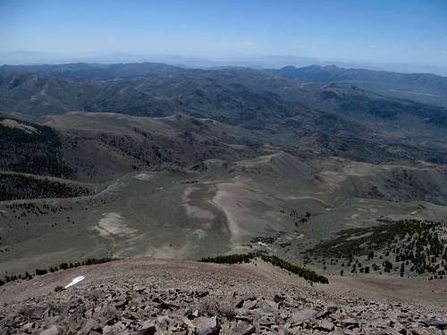
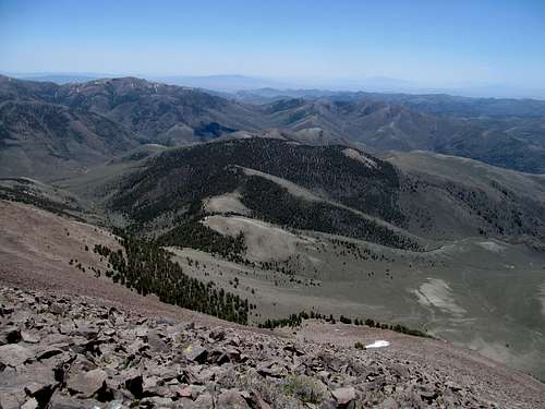
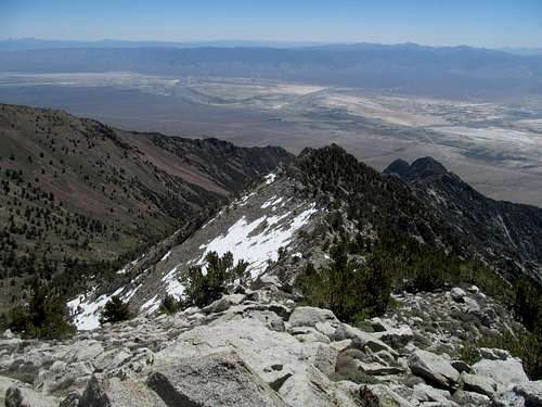
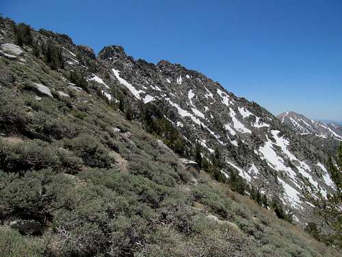
The foothills of Ellen D are actually quite interesting, with copious amounts of boulder strewn hills similar to the Big Rocks area further down near Pioche, or perhaps City of Rocks to the north (which I’ve never been).
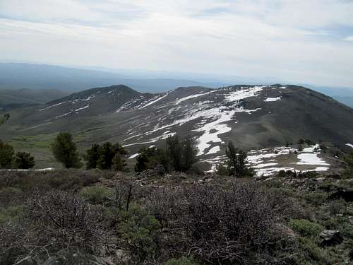
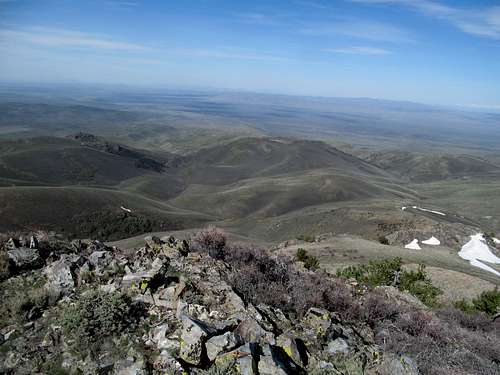
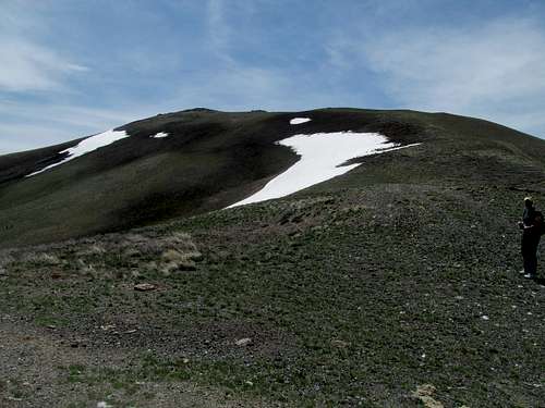
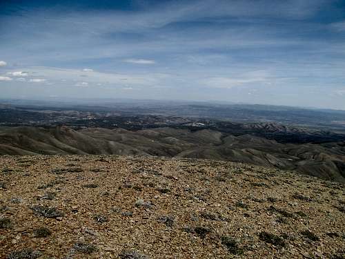
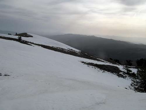
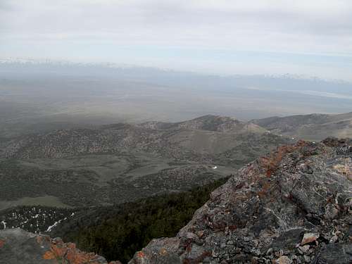
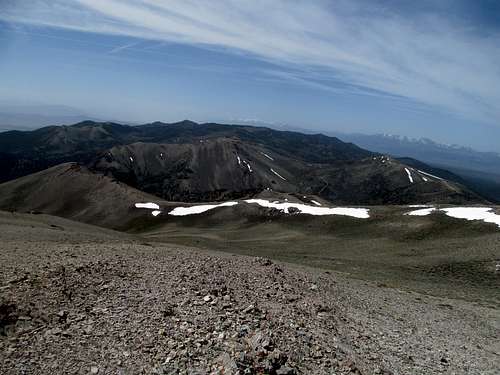
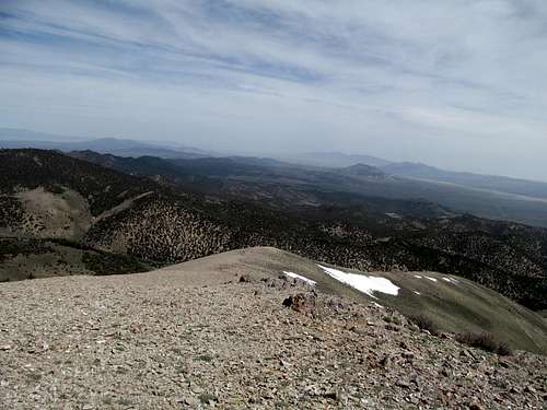
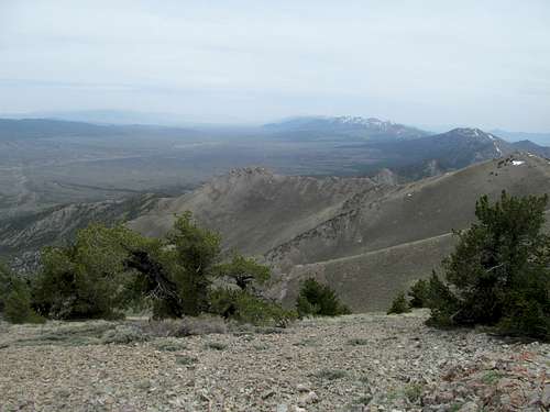
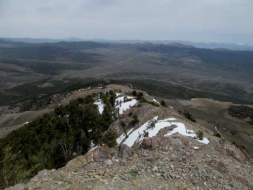
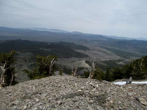
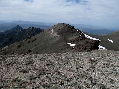
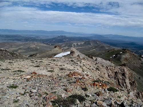
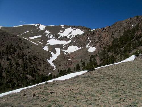
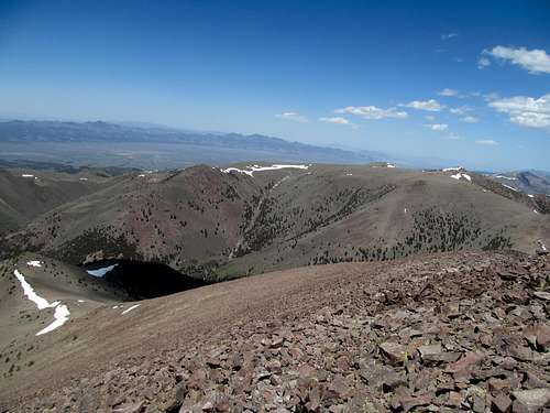
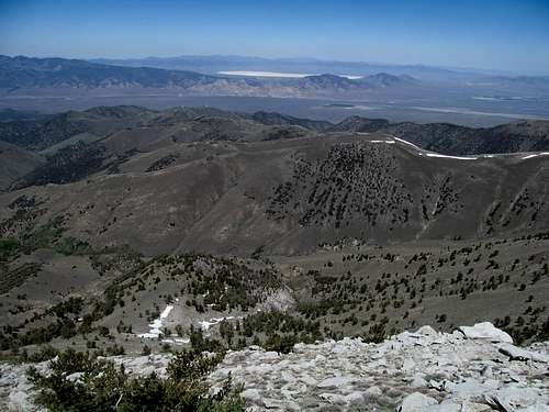
The road certainly got rockier, and we had to park about 400 feet short of the summit with a snowdrift in the way, skipping the road and cutting it steeply and straight up to the highpoint.
Great but, considering the first two peaks of the day, similar views, and with the wind picking up in the late afternoon we didn’t tally long.
We parted in Wells, me to grab some junkfood and crash early at a motel to prep for an ambitious Sunday, and Brett to drive his van further west to tag his fourth of the day on Elko, a peak I had to bow out on from sheer exhaustion, even though most of it came from the driving.
#4 - May 18th, 2014 - Sprucin' up the joint
I knew Dean and Dennis were camped near Baldy peak between Wendover and Ely, aiming for a quick ascent, then swinging over to Becky and White Horse Peaks. I hoped to join them but needed to get unfinished business #2 for the weekend out of the way.
Spruce Mountain I had gotten more than two years prior as well, with Matt (mtybumpo); the problem was that I had forgotten my camera that trip, and it wouldn’t have been of much use anyway since we ascended to a viewless, cloud socked summit. For a major range highpoint covering such a major area, I’d make the rare exception for a repeat to return and get the views.
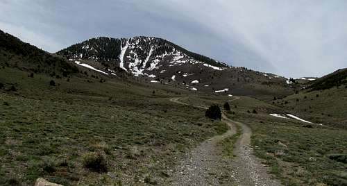
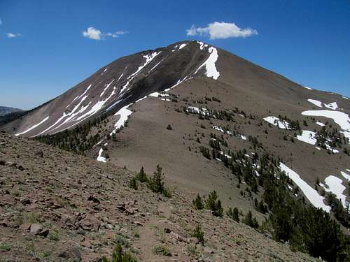
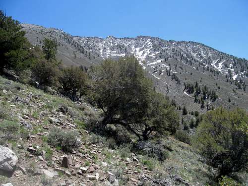
As such I was up driving at dawn south from Wells, retracing the road through the ghost town of Sprucemont and up the rugged rocky road along the west northwest face of the mountain. Matt had driven his truck the last time around and I had thought the road rougher than a roidhead’s face, but though it was certainly no place for a Camry past the ghost town, it was pretty basic by 4Runner standards at this point.
Brett and I had considered this peak for #4 on Saturday, but a late afternoon and the snowy visage of Spruce’s north face discouraged us. I had plenty of daylight today, but with tentative plans to meet up with D-Squared, I was still concerned about my timetable and how far up the peak I could drive. With Matt we had made it to a spot west of the summit at around 8,300 ft…but with better conditions I managed to push the truck through light snow until a major drift stopped me where the road rounded northwest of the summit at a small saddle around 8,700’.
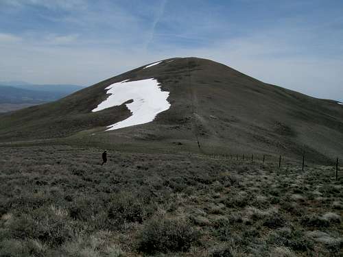
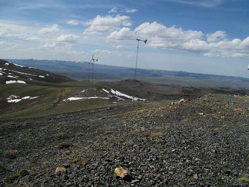
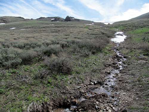
Like Ellen D, I decided to finish part deux of unfinished business by taking the direct route rather than following the road to the summit. Much of the lower reaches on the northwest slope was snow free, and I tried to angle for the dry sagebrush strewn dirt as much as possible as it was the path of least resistance.
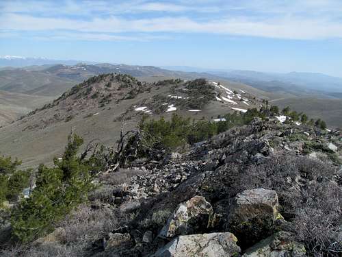
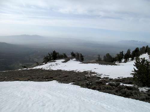
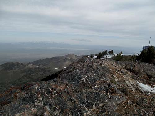
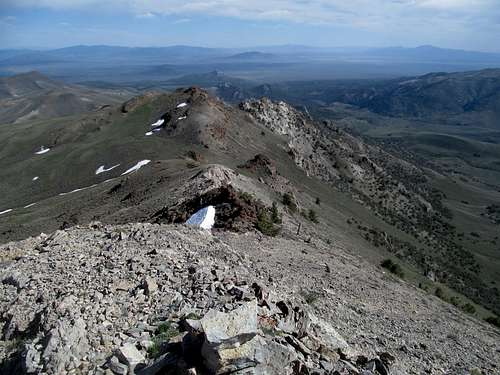
There were a few light patches of steeper, hardened snow to traverse across. I arrived at a clearing within sight of the main road level off to the left, and the main summit ridge past that and the radio facilities in sight. I made for the road and found the best footing alongside it.
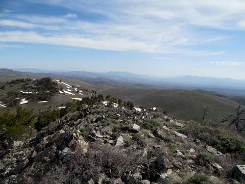
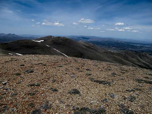
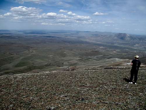
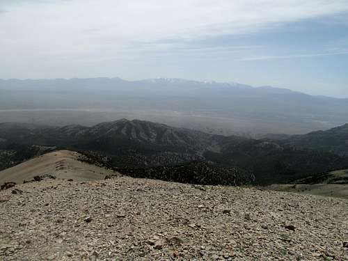
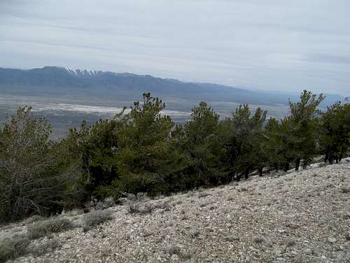
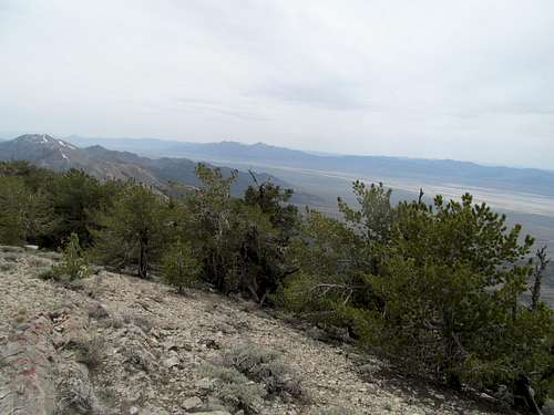
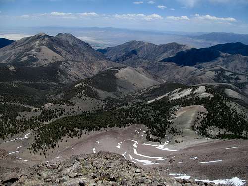
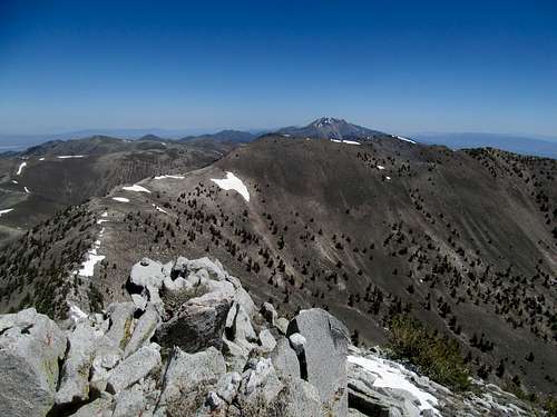
The views made this summit effort worth repeating, with much of northeast Nevada from the Rubies to the Schell Creeks sitting under oppressive morning cloud cover.
#5 - Chasing Legends on Baldy
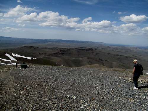
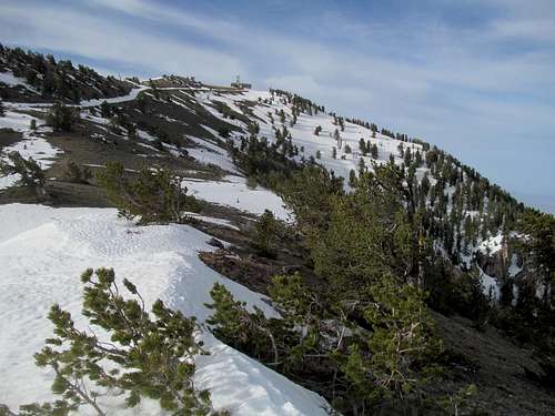
I retraced my steps for a quick descent down, then continued south along US-93 to Baldy Mountain’s trailhead. Having driven the barren stretch from Wendover to Ely countless times along 93-A, Baldy always seemed to me a cipher; despite its high and prominent stature above treeline it reveals itself to the paved highway masses only for a few fleeting miles past the Goshute Range, and for that reason it had long intrigued me.
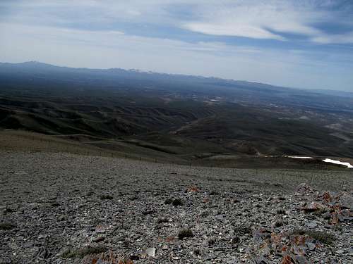
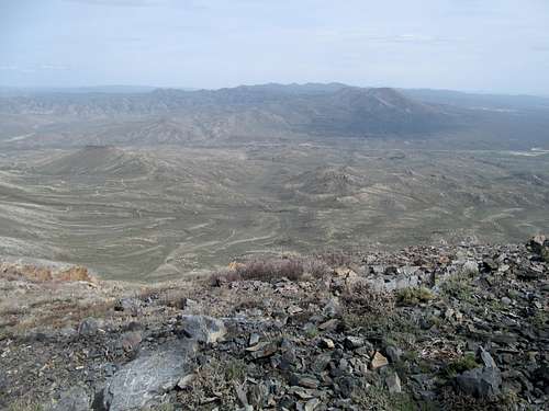
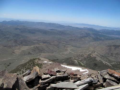
The reality was slightly less interesting though, as the peak is completed via a long drive along dirt roads, steep and rocky to the end, then follow some goat trails and sagebrush first to a disappointing false summit, then to a slightly rocky true summit.
The peak and the summit area reminded me of the Deep Creek Range in Southern Idaho.
No signs of Dean and Dennis, who had been planning to hit this peak early in the morning. I took pictures, including striking views of Becky Peak, my third and last destination for the day, and headed down.
#6 - Finding Legends on Becky
I had a minor setback after taking the wrong road leaving Baldy and chased my own tail for about ten minutes or so before eventually finding my way back to the “main” gravel road. It only make sense to do these two peaks in one fell swoop, seeing as the turnoff for Baldy is only a few miles past the Becky turnoff along the aforementioned “main” dirt road leading south from 93-A.
The good gravel road leads past a few sheep grazing areas, still fertile in snowmelt season. Taken to its terminus the road brings you towards, under, and past the north face of Becky, ascending a high plateau east of the peak. The SP directions made no mention of a sharp left turn down an initially not well defined road at a small water trough directly north of the peak. Not knowing the turnoff, I took a right turn along the better road heading up a hill, but with the help of the GPS, soon realized that I was swerving way too northwest of the peak.
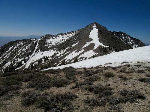
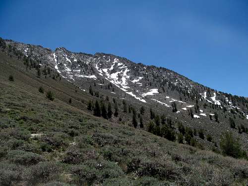
I backtracked and after some tentative forays, decided to take the fainter road heading south directly towards the peak. Becky loomed large and impressive with its snow laden north facing couloirs.
Directly below the north face, before the road had had a chance to swing up and to the left, a giant snowdrift blocked my progress, and I had to bang a u-turn and start my sixth and last peak of the weekend a few hundred feet below the standard trailhead.
I had assumed though Dean and Dennis had gotten a head start on me that I was still following their tracks. However by the time I parked I still saw no sign of the dynamic D’s, and there was no way they could have driven over that giant ass drift.
Wary of ticks this time of year, I cautiously drifted through the sagebrush up to the high plateau. Here and further down the road I saw two very hardy peakbagging trucks. So the mystery was solved; Dean and Dennis had made it here either by driving over the snow (unlikely), around it (equally unlikely), or following an alternate route (likely).
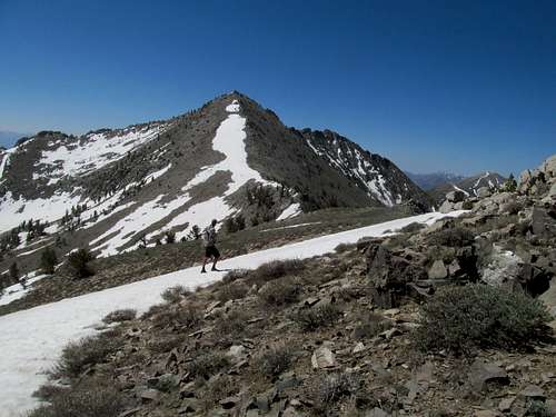
I heard yelling from above and figured that they had spotted me first. I saw movement on the summit ridges above but lost sight of them as I climbed the brutally steep east slopes of the peak. Midway up I finally bumped into the two. We chatted for a bit on the side of the mountain, then parted (they would later get White Horse for their third peak of the day as well). Indeed they had known about the snow and ended up driving up via a southern approach instead.
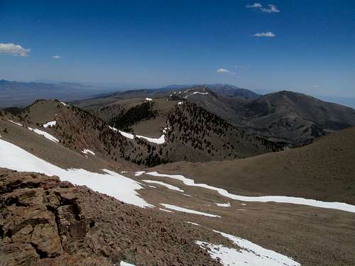
The day was gloomy but the summit views were brilliant despite the cloud cover. The true summit of required some easy but slightly time consuming ridge walking upon reaching the crest, and the views south at the spine of the Schell Creek Range provided me my first true alpine views of the year.
I enjoyed the steep relief provided by Becky in every direction, then descended. Dean and Dennis’s trucks had already departed, and I brushed myself off upon reaching mine, thankful that I had survived my first weekend in Nevada of the year with six peaks, closure on two unfinished business peaks, a chance to chat with a couple of prominence legends, and zero ticks.
#7 - May 30th, 2014 - Itchin' for Pinyon
The next week was Indian and Needle in the Utah West Desert before a Memorial Day weekend in Vegas. As mentioned in a prior trip report, I would’ve preferred a longer climbing trip for that weekend but couldn’t say no to the friends flying in. Instead I’d have to get my fix the week afterwards, taking a day off for more slack to reach the Nevada hinterlands.
Greg had left Salt Lake Memorial Day Weekend, taking off for said hinterlands for several peaks before hitting up Mt. Tom and Dubois in California as well. The plan was to meet him on his swing back to Salt Lake, possibly on Toiyabe unnamed 11,085 Sunday.
With my extra day I left Utah on Friday with two peaks on my agenda: the Pinon Mountains highpoint outside of Carlin, then the Roberts Creek Highpoint towards Eureka. After gassing up in Carlin, I drove down NV 278 and turned off the dirt roads on the left into the range, but even minor differences in odometer readings and GPS waypoints meant probably 45 minutes to an hour of wandering around lost. The key was a right turn that was not obvious on the way up, and another turn shortly afterwards. Never seeing that first turn, I tried the second turnoff several times despite the rough road disappearing in thick grass above. I tried continuing along the road, which got equally as rough as the offshoot, past several mining areas to no avail. I had GPS waypoints towards the peak but no Topo downloaded for Nevada, so I knew that I was straying away from my destination without actually knowing how to get there.
I was about to give up and just go for Roberts Creek when I finally spotted the correct turnoff on the way down. It was more obvious from this angle, and though I still wasn’t sure it was the right road I figured it was worth one more try. More and more it matched the beta and I was assured I was finally enroute to an easy drive up when, maybe 1.5-2 miles from the summit, I got stopped by a snowdrift. Familiar story, but running behind I fasted walked up the road to the summit, where the small rocks made it slightly tricky for my sneakers.
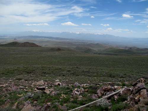
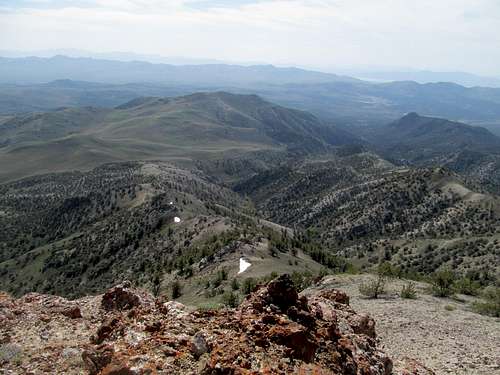
What should have been morning views atop Pinon now featured high noon lighting, but at least that made for a clear view of the magnificent Rubies glistening to the east.
#8 - Stayin' Fleek on Roberts Creek
More routefinding issues lay ahead this afternoon. A small turnoff crossing Vinini Creek wasn’t readily apparent, and I spent close to another hour going back and forth to the highway and pursuing the various dirt and gravel options, including one that followed at the edge of the south (left) bank of the creek, before trying the stream crossing and finding that it eventually widened into a reasonable road leading past several campgrounds to the base of the peak.
The road was good to an intersection, where a sideroad split right. Another junction further would have brought you to the main peak access road, but the first right option seemed very wide and relatively smooth heading up a hilly ridge parallel to junction road 2 and the main Roberts Creek Ridge. I drove up the first steep hill then parked, dipping slightly west through a wide drainage and meeting up with the other, rockier road.
This I walked past a small pond and further up to a saddle leading guarding behind it a green and fertile meadow southeast of the peak.
Reading other TR’s in hindsight I realized that most followed the road all the way to another saddle northeast of the peak before heading up to the top. Not knowing this I decided to start directly through the sagebrush on Robert Creek’s Southeast slopes, eventually traversing past some small pinnacles around 9,900 feet. The slope turned into a surprisingly delightful ridge scramble all the way to the summit.
I had been dismayed to be so far behind schedule but the late evening sun engulfed everything from the rarely lush basin below to summit views in all directions with an eerie and barren glow.
I enjoyed the fleeting views and started down the slopes directly southeast from the summit, foregoing the ridge scramble on the return.
The bittersweet curtain call of spring followed me along the road, where I joined up and headed west for points unknown along US-50, following the so-called loneliest highway further than I ever had before. I chased the sun’s golden rays past silken visages of the Monitors and Toquima Ranges, and cresting a valley saw for the first time the lofty heights of the Toiyabes towering far above the shy, silent din of the desert.
What surprised me about the town of Austin, perhaps the appropriate capitol of nowhere, was that it lay on a high bench of the Toiyabes, as opposed to a low valley. After hours of solitude, several sudden and sharp switchbacks pop you down into a collection of old buildings that barely passes for a town. Here, I felt as alone and forsaken as US-50’s moniker indicated, and gazed west forlornly at the vast valley below; somewhere beyond that was Fallon, then true civilization in Reno!
But that was not to be. I had business here, Arc Dome tomorrow, but first, as I would be camping out the following night with Greg, a day’s worth of camping food needed to procured. As such, after grabbing a satisfying dinner at a local diner I went to a bar next door to get a large pizza to go. The pizza wasn’t much, but my fellow patrons were friendly; one was a local historian with family ties to some of the region's original mining barons, and I was impressed by his genuine love for this lonely town.
After chatting with the locals for a bit while waiting for the pizza, I turned in at my slightly overpriced motel prepping my mind and nerves for two more days deep down nowhere ave.
#9 - May 31st, 2014 - Arc Dome Delight
I was slightly concerned about snow, having seen plenty on Bunker Hill and the north facing slopes of the Toiyabe on the way into Austin. Saturday morning shone bright, beautiful, sunny, and crystal clear above me as I continued the trek west and down into the Reese River valley. My reception was clear too until when it suddenly died, and I was sad.
As the mass of Arc Dome and its broader neighbor to the north expanded upon my windshield my worries began to dissipate. Not much snow remained, and I started up the trail past the quiet Columbine Campground, where several vehicles were parked but few people sighted.
It’s not everyday you surprise a mountain lion in the wild. Not any day, even. And it should never be a surprise for the damn lion. Yet I was walking as usual with my phone in my front pocket, sports radio (Glenn Ordway and the Big Show with the aforementioned Big O) blaring, when I crested a small flat wooded section of the trail. I saw something ahead of me, maybe twenty or thirty yards away. My first thought was, “that’s not a deer”. Then, “I don’t think that’s a deer”. Then, “holy shit that’s a mountain lion”.
Well sheeeeeeeeeeeeeeeeeeeeeee-it. I had maybe one second to think and decide my next action, which may very well be my last. I knew a lot about bear etiquette, and even had an encounter with a black bear on Bloody Dick Peak in Montana, when it sprinted down the mountain away from me as frantically as possible. Mountain lions were different though, and the only scouting report I had on them was that they were supposedly always aware of your presence, and never the other way around. Well, I had somehow snuck up on this one, fat blowhards from Boston talking about the (lackluster) Red Sox pitching line-up and all, and despite it all it seemed oblivious to me, back facing me sauntering in the same direction further down the trail, no care in the world. Should I yell at the mountain lion? I can’t run, right? Then it’d see me as prey and give chase. Should I wave my arms in the air and make myself look big? Wasn’t that a bear tactic? Would it even work on mountain lions.
All this happened in about a second. I decided the worst thing I could do was surprise it and catch it off guard. So I shouted in a loud, assertive voice, something to the effect of “hey there”, my intent to let the lion know, hopefully as calmly and pleasantly as possible, that I was here. He/she looked back at me, in a face I think most resembled casual condescendence. I don’t know what I would’ve done had it decided that I was a threat, or dinner, or both. Perhaps I could’ve tried to fight it and stab it with my lame hiking/ski poles, but that would’ve been the extent of my resistance. Instead it seemed to shake its head in contempt, then slowly jog away along the trail as if thinking to itself “I don’t feel like dealing with this shit today.”
To say I was on edge for awhile would be a clear understatement, and I couldn’t help a periodic glance behind my shoulder all the way up the trail as it ascended through a wide drainage and past the forest. I felt like I should feel safer above the trees? I mean unlike bears, mountain lions don’t hang out above timberline right? Right?
My next obstacle was snow. I crested at a small bump, where the trail turned left and took a few switchbacks down to a snug notch north of the vast high plateau culminating in the unofficially named “North Arc Dome”. My ratio of human to mountain lion encounters on this peak as 1:1, and the former occurred here, a Californian seeming couple coming the other way. Ahead the trail went through a small boulder field and up, where it visibly traversed very dry north facing terrain on the left side of a drainage to parts unknown.
And yet the two were telling me that they, also attempting Arc Dome, had been turned back by snow just ahead. I warned them to be on the lookout for mountain lions in the direction they were headed, and I thought my warning to be a little more legit, but their words planted a seed of doubt in my head, and my imagination usually allows such seeds to grow quickly and fervently.
I was still befuddled walking the completely dry trail until it crossed over to the right side of the drainage near its terminus, where a thick wall of slightly corniced snow guarded the top of this northeast facing ridge. A slight obstacle no doubt, but easily overcome by some common sense routefinding and a short detour up and around the far edge of the snowfield, nothing major.
The wide plateau was scenic but slightly chilly at times, then eventually dry and boring. Near its edge the still slightly distant views of Arc Dome provided modest inspiration. The sheer magnitude of this high grassy plateau was pretty impressive, and like no other place I've hiked.
I jogged down the six to hundred feet or so to the rather long saddle north of Arc Dome. The traverse over was deceivingly long, with several ups and downs, but I finally trudged up the good trail to the top of the Toiyabes. The trail reminded me of the one up Wheeler, one of Nevada's other ultras, in which its quality prevailed despite the increasing density of the talus higher and higher. And, despite a prominent line of snow along the ridge, my boots stayed dry due to the trail swinging right halfway up the summit.
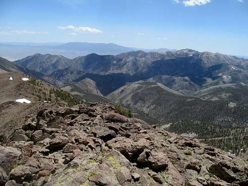
Across and to the southeast was Toiyabe Dome, a much longer and more difficult effort that Greg was experiencing right now. I enjoyed the magnificent views in every direction.
East were the Toquimas and Jefferson, the monarch of Central Nevada looking small and awkward. South the mountains seem to abruptly end, and I knew that somewhere not too far past its denouement was the town of Tonopah.
North tied for best views with those of Toiyabe Dome, the range stretching forever towards my, our, next destination, the internet elusive Toiyabe 11,085, but west was perhaps equally entrancing, long lines of linear ridges stretching to places far beyond my footsteps or tiremarks. Somewhere past all that was, indeed, Reno, and civilization, and even California. And perhaps I would’ve been tempted that way, if it weren’t for the fact that I had a rendezvous with Greg after we were both finished with our respective domes for the day
.
I descended, then had the dreadful renascent back up North Arc Dome. It sucked, big time, and I made sure to tag the summit to get the ranked peak on the way back.
I decided to loop the way down, the more westerly drainage to return back to the trailhead, and perhaps avoid re-encountering my friend Mr. Purrballs. It was easier said than done; I had downloaded some GPS tracks but the trail junction off and down the plateau was hard to find and follow.
The trail eventually widened into a track that seemed to have lived a past life as a jeep road, but then it looped southwest, the opposite direction of the trailhead, and I was never entirely sure my I was on the right route until it finally looped back northeast, descending several switchbacks to a scenic fenced in meadow.
The scenery here was mild, burgeoning, and pastoral. Apparently it was part of the Toiyabe Crest Trail as well. What passed for that was dry and arid, especially up on the plateau, and I imagined that this would not be a pleasant thru-hike for those inclined to do so in the summer. Were I to follow it all the way I’d find myself enroute to tomorrow’s peak, but obviously I opted the rather dull walk through golden aspen back to the car, where 15 miles and hunger made even cardboard pizza delicious.
#10 - June 1st, 2014 - 11,085
I arrived at the Camry accessible trailhead for Toiyabe 11,085 before Greg, which was logical. He had endured a more strenuous day than I on Toiyabe Dome, and had much further to drive to boot.
I did some light reading sitting on a rock until Greg arrived. We discussed our options for the next day; both of us had surveyed the route possibilities for this obscure and unnamed P2K, exceedingly obscure despite the fact that it’s one of Nevada’s highest and most majestic 11ers. In particular we were both planning to follow a good peakbagger TR that followed the Washington Creek trail to join the Toiyabe Crest Trail north, hit a saddle north of the peak, then swing back south up the north ridge to the top.
The peak looked snowy from the Reese River Valley road from the west, especially in the morning light. Returning towards its base in the afternoon, it became apparent the bright glare coming from the upper reaches of the peak likely came for its uncharacteristic granite outcrops and not the slushy stuff.
We chilled, downed some liquor, I retreated to the comforts of my 4Runner and endured yet another night of “camping”.
We made good progress up Washington Creek the next morning, running busily as if it were something out of Montana or Idaho…late August or September MT/ID, mind you, but still impressive for central Nevada.
The trail got a little obscure, surprisingly, up near its junction with the TCT, and we wondered what kind of desert fanatic would try to thru hike this thing, beautiful as this mountain range was.
We eyed a good ridge going up the western aspect of the summit, but decided to pursue our original route up the peak’s north ridge. Greg reasoned especially that the approach to the upper ridge looked like thick sagebrush, which would be easier to descend than ascend.
My biggest regret this trip, seeing as we did end up descending that west ridge, was that I did not take any pictures north at Bunker Hill when initially gaining the saddle along the TCT. The views of that hunk of talus were spectacular, and remained so as we cut off the trail and started up initially the western slopes of Peak 10,863.
The route avoids that ranked subpeak en route to 11,085, but by that time the mass of 11,085’s lumpy and dull northern neighbor ends up inhibiting your line of vision towards the funky colors of Bunker Hill’s rocks. I thought it an odd coincidence that a peak named Bunker Hill would stand so close to a “Washington” Creek, and many of the names Greg and I bantered around for this peak may have had a historic or patriotic theme.
The traverse to the base of the summit block was a little annoying, with some rocks and brush, and the final ascent steep with some minor scrambling. The experience was unlike any other though, especially in central Nevada, which has some pretty cool, pretty high mountain ranges, but this one massif was literally a slice of the Sierras, peak-jacked and placed a full day’s drive from its rightful home at the edge, and not in the bowels, of the Great Basin.
Views were magnificent, perhaps even better than Arc Dome. The sharp drop and contrast to the Big Smoky Valley to the east was closer and more pronounced, and the long spine of the Toiyabe’s stretching down to its two southern culminating domes a once in a lifetime sight. Not to be forgotten too were massively cliffy and pinnacles guarding the range’s eastern flanks from its slightly higher neighbors, Mt. Jefferson and the Toquimas.
As mentioned, we opted for the West Ridge to descend. It was quicker, and Greg, never usually a slouch, was massively tired from his ten day odyssey to California and back.
The steep going was easy on the way down, and the sagebrush presented minimal difficulty.
I had bantered around the idea of driving up Lewis, a P4K north, after 11,085. Greg, exhausted and homesick, was lukewarm to the idea, and after 11,085 I was pretty satisfied with the sights and scenes of the weekend. Despite a stint in the wilderness sans civilization and cell phone reception for far long that I’d usually tolerate, I felt some pangs of regret leaving this magnificent range, and soaked up the Serengeti like atmosphere on the drive out to Battle Mountain, perhaps as much of a letdown as civilization is capable of granting.
Comments
No comments posted yet.