
Comments
No comments posted yet.
|
|
Trip Report |
|---|---|
|
|
45.88487°N / 10.84042°E |
|
|
Nov 30, 0000 |
|
|
Mountaineering |
|
|
Spring |
Occupying a strategically important part of central Europe,Lake Garda has often been at the centre of important historical events. The Romans fought Germanic invaders along the shore of what they knew as “Lake Banacus”, whilst in 1797 Napoleon Bonaparte’s army fought the Austrian army on Lake Garda’s Eastern shore. At the southern end of the lake, the Battle of Solferino was an instrumental event in the creation of the Kingdom of Italy in 1861.
By the beginning of the 20th century, the Austro– Hungarian (Hapsburg) empire controlled the Northern end of the lake around Riva del Garda and had established a chain of modern fortifications to defend their empire from any Italian expansionist ideas.
Italy declared war on the Austro – Hungarian empire in 1915 and now, over 100 years later, the remnants of that conflict form the basis for many walks and ferrata routes in the surrounding mountains.
We had visited Riva del Garda in the past and had undertaken a walk (on “The path of Peace” one of a series of paths that commemorate the First World War activities in the area) up to the fort at Monte Brione (overlooking the town). Later in that week, we had a good day on the hills above Limone but then the weather had changed and not much else had been achieved.
We were left with a feeling that there was more to be done here and that we needed to return. Time passed and we had no plans to go back but then, when an opportunity for a new job for Marie presented itself, it seemed like an idea to take a week’s holiday in late May.
Where would be a good place to go? Consequently, we found ourselves returning to Riva del Garda.
When we have week long trips we have our own tried and tested formula for a successful trip. Although we try to keep fit by walking at weekends, there are no mountains in the south east of England and no substitutes for the real thing. So, having arrived on Saturday and spent the day unpacking and finding our bearings, we always have an easy day, the next day.
The drawbacks to this are:
a - that could be the best (weather)day of the week
b - sometimes the day can be too easy and feel a bit disappointing
c - that a miscalculation is made and that the first day is much longer than intended!
With no clear favourite objective for an easy day, I tried to come up with something.
“Ok, if we get the bus to Torbole, then walk up to Naga, we can get up to Malga Zures and back. Looks like it’s about 90 mins up and about an hour back”. I was pleased with my plan.
“Except, it’s Sunday and we’ve missed the early bus so will have to wait until after lunch when it will be too hot and too late to start”. Marie had discovered a flaw in the plan!
So we had to start by walking to Torbole as well… adding an extra 3 miles to the start of the “short day”.
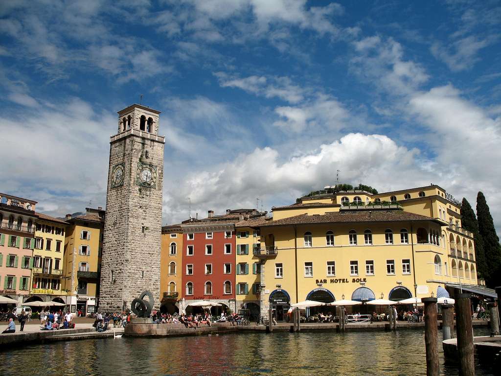
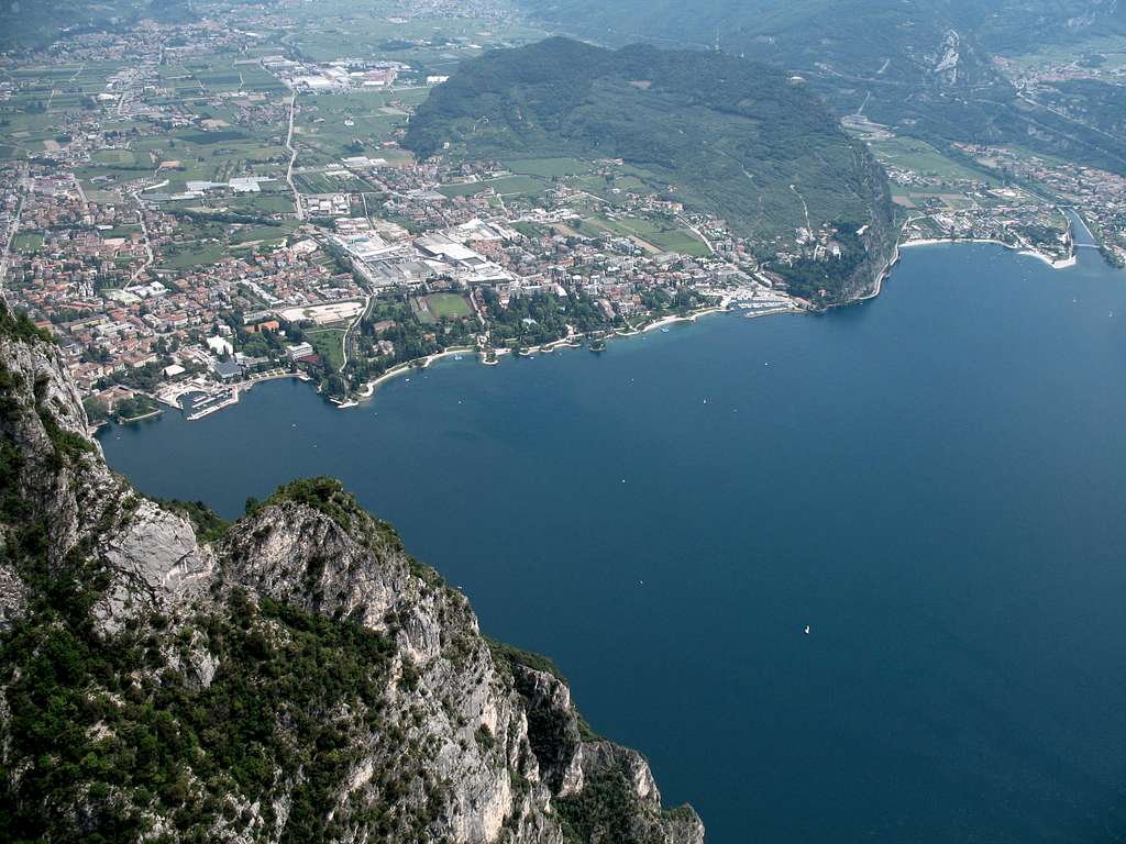
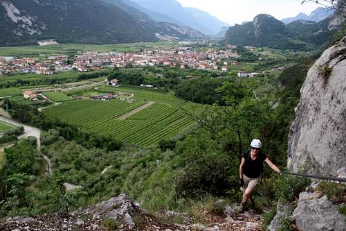
It was a lovely morning as we set off around the back side of Riva, looking up at Monte Brione and passing Olive groves, vineyards and (rather surprisingly) several garden centres. We reached the lake side at Porto San Niccolo and re-joined the throngs enjoying their Sunday morning.
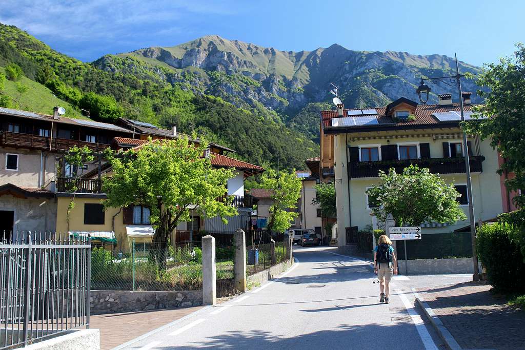
One of the features of visiting this area is the multitude of cyclists that are attracted to the flat ground around the north end of the lake. The roads are pretty busy and consequently, they nearly all ride on the pavement, so any walk carries the added need to be aware of this at all times and be ready to jump to one side or other to avoid a collision. By the time we had walked to Torbole, it was a relief to leave the lake front and head upwards on the quiet, shady streets.
The walk from Torbole to Nago started on quiet streets and moved upwards on the Via San Lucia. Originally, this road was built by the Romans as a way to travel from Lake Garda to the Val d’ Adige. Nowadays, it is a rough track through luxurious, private villas often with a vineyard. The views back towards Lake Garda are beautiful as more height is gained and the valley opens out.
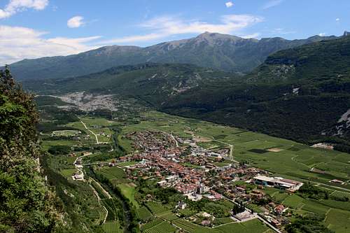
Soon we reached Nago, a quiet Italian town set on a hillside overlooking the lake. We noticed a small painting on the wall of a house to our left. This commemorates an event in 1439 when, during the Visconti war, the Venetians transported their fleet (using “Volunteers” to move the boats) along this very track and down to Lake Garda.
We turned right at this point and continued past the quiet houses and on to the San Giuseppe icon and the beginning of another “Path of Peace”.
When Italy declared war on Austria – Hungary on 23 May 1915, they did not advance immediately and the Austrians used this period to consolidate their existing positions in the mountains that had been under construction since the 1860s.
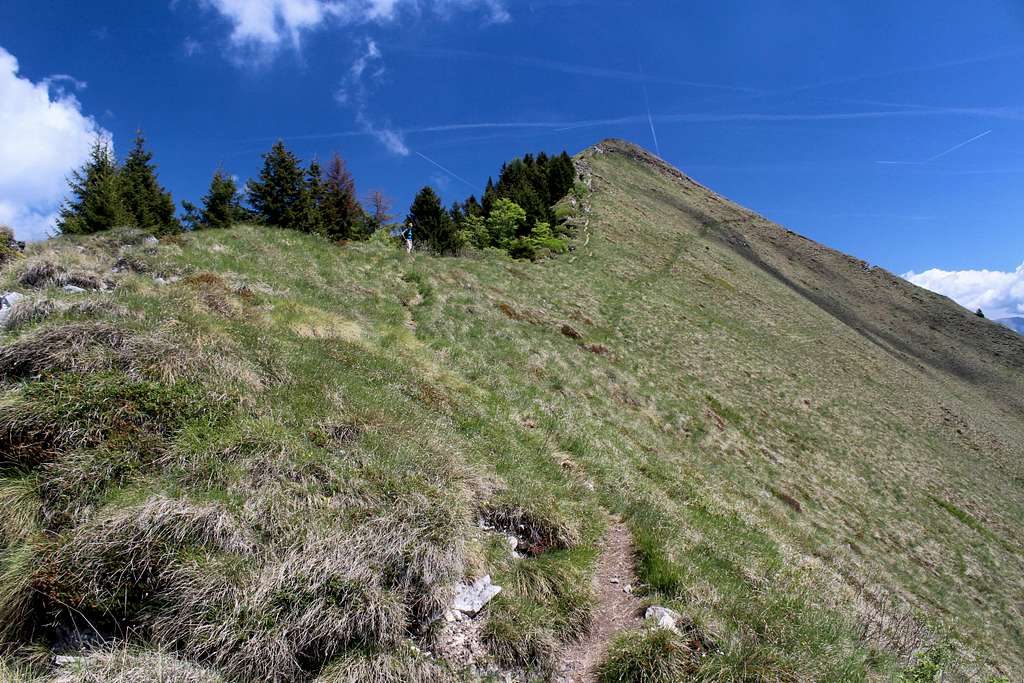
One of the actions they took was to withdraw their troops from Mount Altissimo in the Baldo range, back to the line of fortifications around Segrom, Malga Zures and the Dosso Alto area in the hills at the Northeast end of Lake Garda.
It was this area we were walking in.
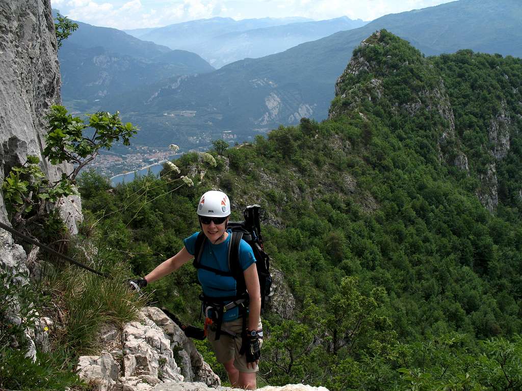
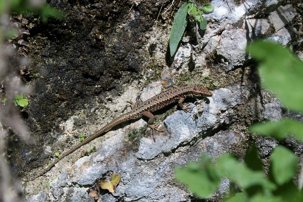
We watched Buzzards wheeling around in the sky, catching the thermals rising from the hot, dusty fields. Lizards were constant companions, sitting on the dry stone walls and scuttling away as we passed and once, I frightened a black snake that was basking on a sunny rock!
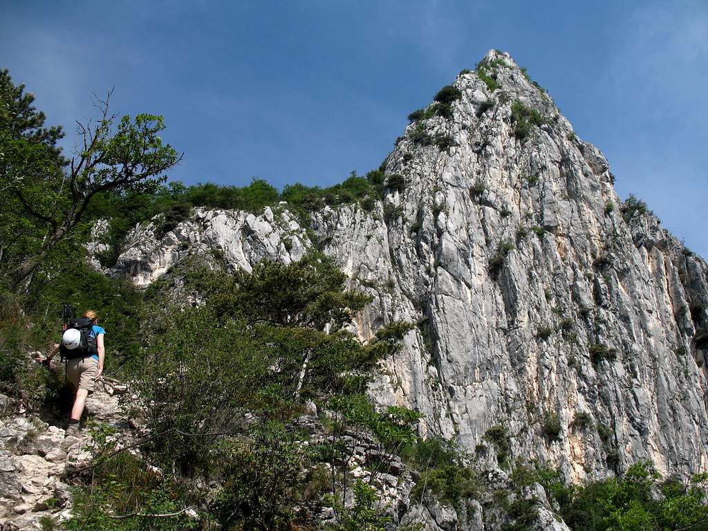
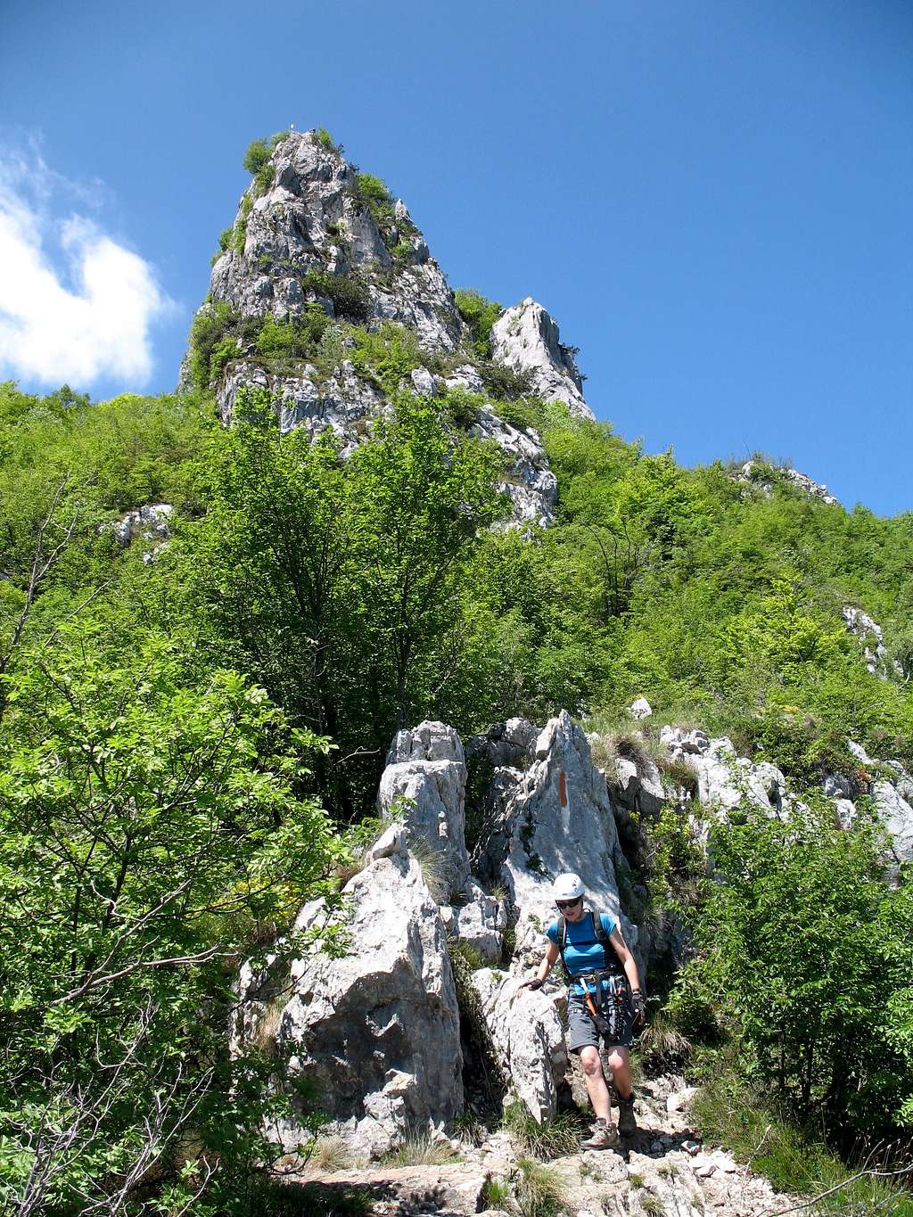
By now, it was getting really hot and it was good to get onto the shady path especially as the way up was quite steep in places.
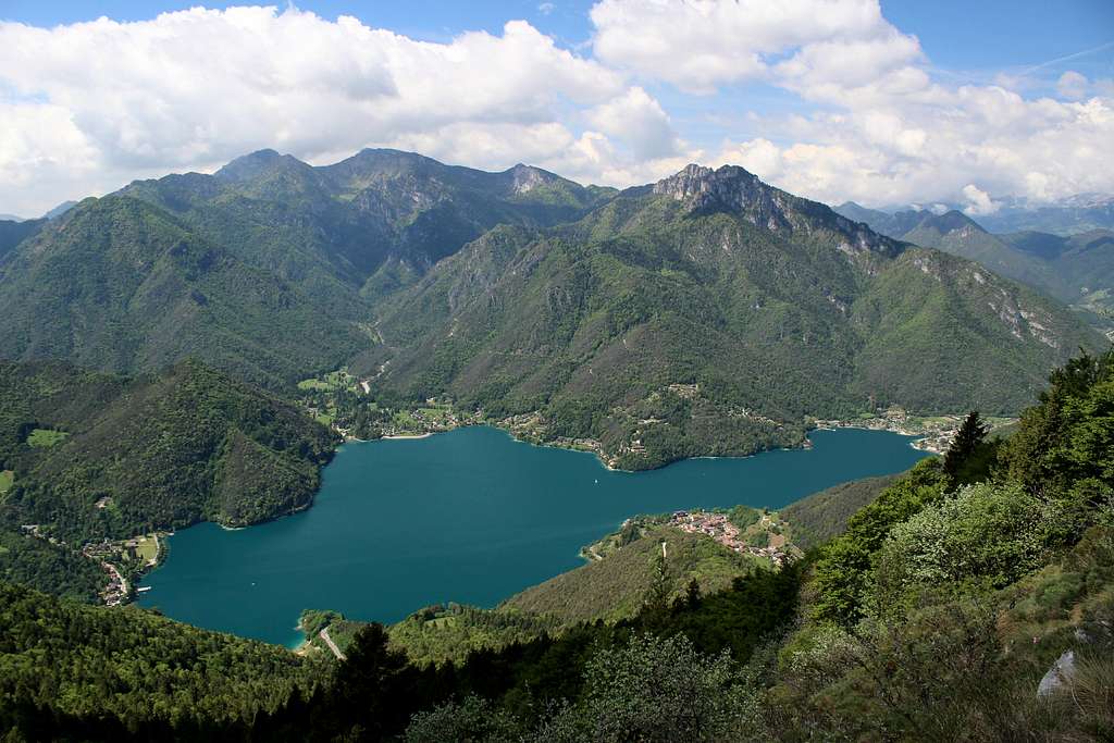
As we went further, we enjoyed superb views over Nago, Lake Garda and the hills and mountains around the Northern end of the lake. The route passed through the remains of military fortifications and troop shelters amongst the caves hidden in the cool shade of the trees.
We reached the view point of Malga Zures at about 2.30 pm and ate lunch overlooking the lake with its windsurfers and sailing boats, the various towns now visible below and the snow covered Brenta Dolomites to the North.
Now, the simple thing would have been to have re-traced our steps back down to Nago or even followed the road but instead, I noticed on the map, path no 601. This seemed to head down to Torbole in a series of long zigzags through a wooded hillside. We agreed this would be better!
I have to admit at this point that I made a map reading error and took us upwards on a road. After about 10 minutes, I realised the error and we picked up another path to take us back to our desired route.
We reached what we thought was the correct way, a wide dusty track but didn’t find any sign posts to confirm this – no matter, we continued on. Pretty soon it was clear this was the wrong route too as it headed (as far as we could see) in a south westerly direction parallel to the lake shore below. We consulted the map again.
“Look down there”, Marie pointed. “There’s a track through the trees”.
“Yep”, I agreed. “That must be it”.
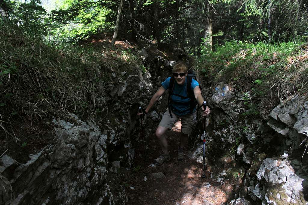
We scrambled down through the undergrowth and soon we were on a good but rough track that descended in a series of zig zags, finally, we were back on the correct route.
Except that it didn’t seem to quite follow the map! It seemed steeper and didn’t have the long zig zags that the map showed.
I put these thoughts to the back of my mind as we were descending ok albeit on what seemed like a much longer route than expected.
We descended mostly in the shade with occasional views and met no one. Time was moving on so we tried to go quickly and Marie picked up a long stick to use as a walking pole as she hadn't bought hers with her.... it was only a short walk after all!
It was only at the bottom that we realised we had descended a new Mountain bike route! (Walkers forbidden!)
Luckily, no one was using it but we had no idea what happened to path 601!
We arrived back in Torbole at about 5.30, managed to get a bus around 6.00 from Porto San Niccolo and got back to the hotel around 6.20.
700m of height gain over 10 miles in hot sun, taking about 8 hours… so much for an easy first day!
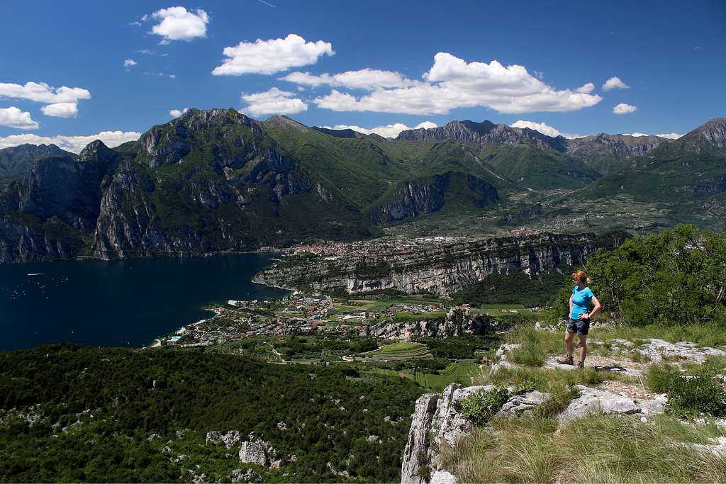
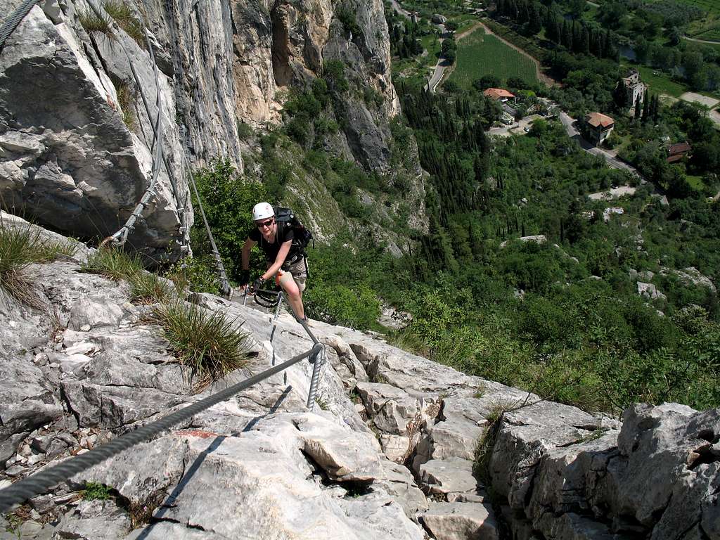
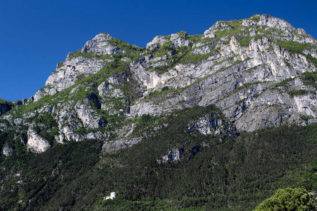
An earlier start and after a short bus ride by 9.30 we are walking through the nearby town of Arco, about 4 miles north of Riva, heading towards the Sentiero Attrezzato dei Colodri, a ferrata that picks a way up the limestone cliffs in between the hard rock climbs that the area is famous for.
According to “Little Mole” on SP, this route was created as a quick descent route for the climbers and consequently, I expected it to be crowded. Not only did we have our ascent more or less to ourselves but there were no climbers anywhere on the cliffs. I can only imagine that late May is now considered too hot for climbing?
The route is marked as path no 431b on the map and it begins opposite the campsite by the Sarca river.
3 people were just starting up the cables as we arrived at the bottom of the route but we never saw them again.
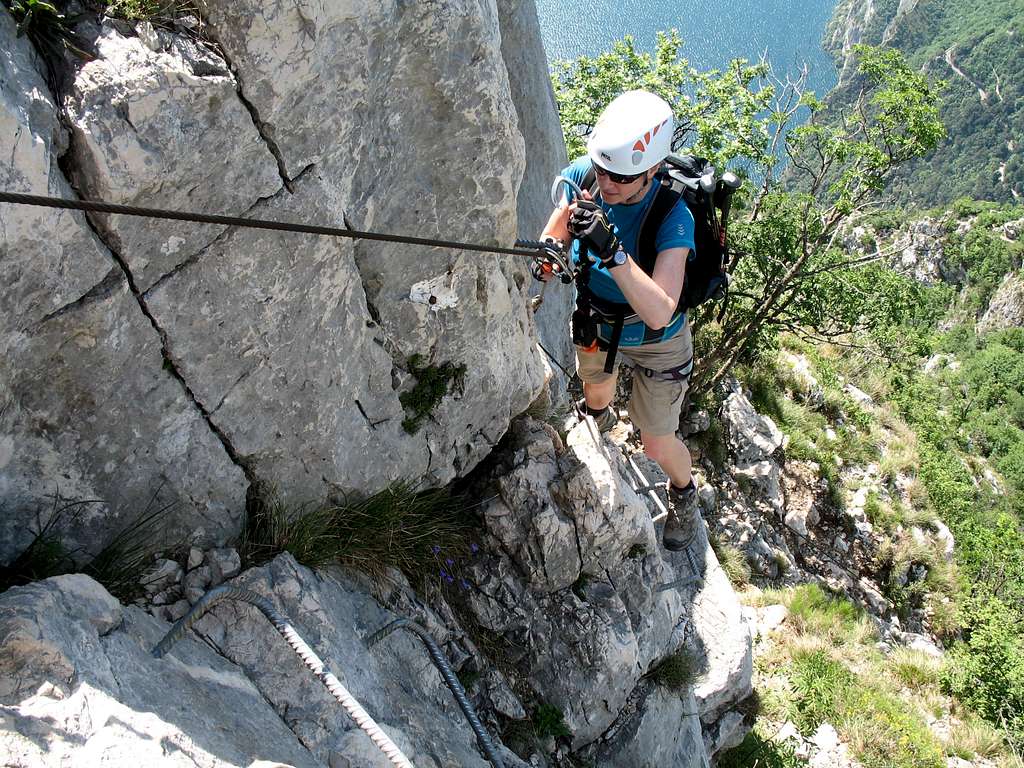
The route is pretty straight forward as it zig zags up a series of slabs, gradually gaining height.The route is in the sun all the time and we had little relief from the heat as the breeze that comes off Lake Garda and is prevalent on all the routes near to it, does not reach this far “inland”. Consequently, it was really hot and frequent stops for water were required. We enjoyed great views of the Sarca river and the adjoining campsite although it looked quiet at this time of the year.
The route is well protected and has some pleasant, exposed positions but it seemed to pass much quicker than we expected. In no time we were looking down on the Towers that feature in so many photos of the Arco area. There was a short, steep section near the top (which I tried to climb by just using the rock, following the guide book suggestion) but the stemples got in the way, so I gave in to the inevitable… or at least that’s my excuse!
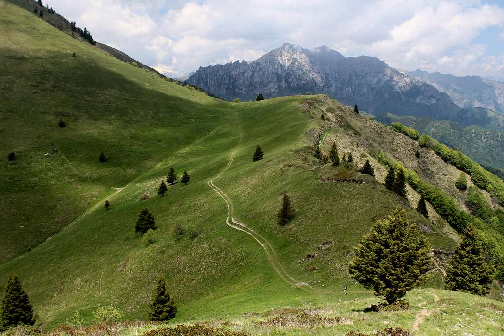
At the top of the route, we put away our ferrata gear and headed to the huge summit cross. From here, we had planned to follow a route in our walking guide which headed north towards Monte Colt on a path following the ridge just below the summit.
I won’t try to document our wanderings while we looked for this path but after about an hour we gave up when Marie found the path down to the Santa Maria church. Just above this we did find a path that paralleled our chosen route (path no 431) but when I asked “Should we go back up”, Marie replied “I can’t be bothered now!”
It was difficult to come up with a good argument to counter that as I was feeling pretty unenthusiastic too. I think the long first day plus the heat had sapped our strength and we had done the ferrata anyway.
We had some food and water near the church and watched cattle being driven down the road towards the town.
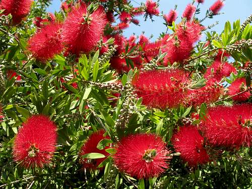
We descended back to Arco and paid a visit to the Arboretum on the way. A superb collection of trees and shrubs in a lovely setting. We particularly liked the Bottlebrush trees and the pond with Terrapins and giant Carp.
Back to Riva for a late lunch at the “Bar Roma”, beer and pizza at a shady outside table with a breeze!
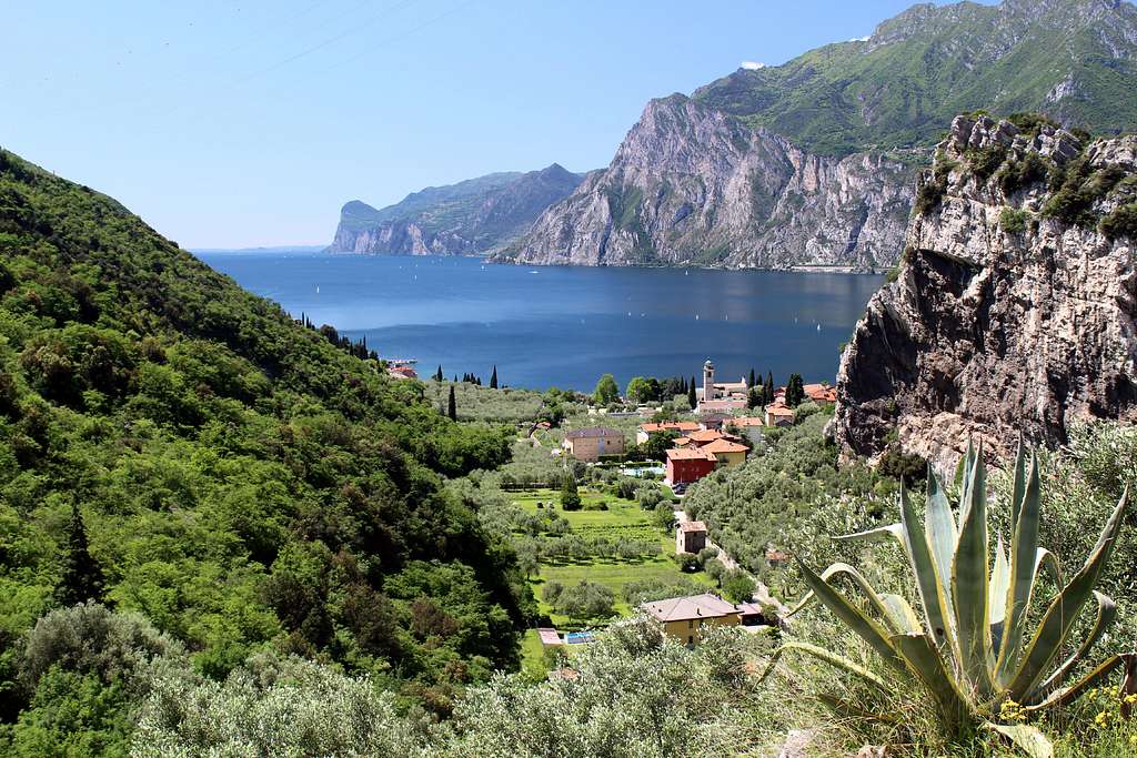
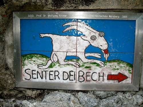
We awoke to clear blue skies but the view across the lake was a bit hazy. By 9.00 we had caught a bus to Biacesa in the Val di Ledro and were setting out on Senter del Bech , heading towards the Fausto Susatti ferrata upto the top of Cima Capi.
This route can be started from Riva itself without the need for a bus journey. The route from Biacesa is a similar distance from the ferrata but starts about 400m higher thus cutting down the ascent needed at the start.
We followed the signposted route from the town through the ubiquitous Olive groves and vineyards, contouring above the Val di Ledro. There is only one path but at one point it loses height quite steeply, this isn’t really shown on the map and made us wonder if we were going wrong but the height is soon regained.
It was lovely and cool in the shade and we made good time to the headland overlooking Lake Garda arriving after about an hour.
At this point, we encountered the first WW1 ruins of the day. This was the Austro – Hungarian front line during the conflict, overlooking Lake Garda (with Riva behind the lines) and the Italians in the hills opposite above Pregasina.
The fortifications set up on this side of the lake became known as “The coast of Salo”.
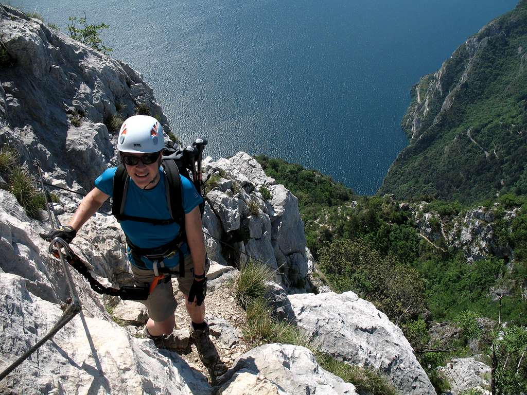
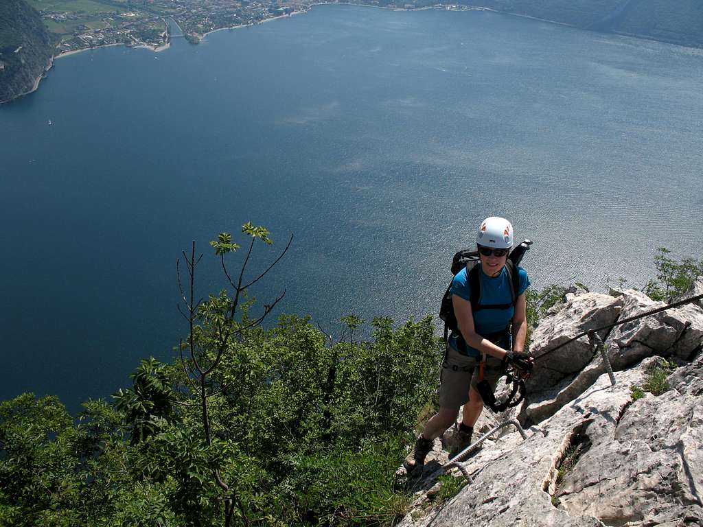
Rounding the headland, we met path 405 which comes up from Riva and got our first view of the ridge which rises up to the top of Cima Capi and which the ferrata is situated on. We stopped to put our gear on at the start of the cables.
Just as we were getting ready, a German couple arrived to do the route. These were only the second and third persons we had seen and wanting to stay in front, I started off as quickly as I could. Once we had put some distance between us and them, we didn’t meet them again until we stopped at the summit.
Our English language guidebook gives this route the same grade as the Colodri route but I thought it was a little harder because of the steepness of the rock and the exposure, but this is a small point and I know from years of climbing that grades can often be contentious and everyone has their own opinion!
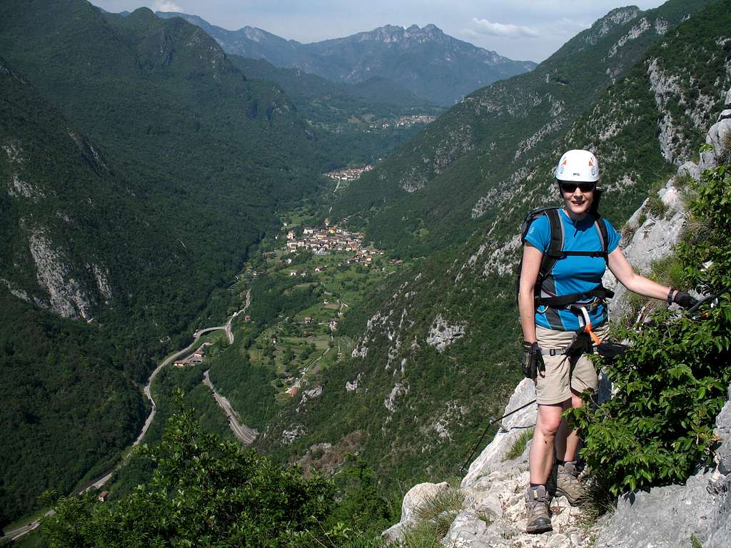
Having said that, the route is well protected and in a spectacular position overlooking Biacesa and the Val di Ledro to the south and has amazing views of Lake Garda and the town of Riva to the East and North.
“This is what the game’s all about” I remarked happily as we climbed up.
Every now and then we came across evidence of gun placements and shelters for the troops, set in the most incredible positions. I couldn't imagine being here and having to try to avoid being shot at!
This is a really photogenic route and I ended up taking lots of similar shots in a desire not to miss anything.
“It’s awful that a war was fought in such a beautiful place”, Marie vocalised my (and probably many others) thoughts on a peaceful morning.
By 11.00 we had reached the summit with its metal Italian flag. The sunshine of earlier had been replaced by high cloud and there was a humid feel to the atmosphere which hinted at possible thunderstorms later.
Marie and I stopped for a bite to eat and chatted to the German couple who then continued on.
After a while, we descended to the big “H” on the col and I took more photos!
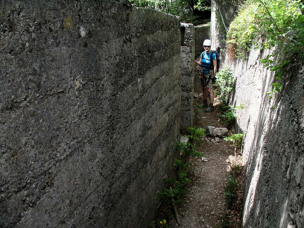
From here we continued on path 405 until path 406 – Sentiero A Mario Foletti – headed west and downwards. We were immediately walking through concrete WW1 trenches, complete with sniper positions and heavy gun platforms, all strangely incongruous in the mountain setting.
These fortifications form part of the defences built by the Austrians around the mountain of Cima Rocca (1089m) which was used as an excellent viewpoint (along with those of nearby Cima D’Oro) over to the Italian fortifications on the south side of the Valle di Ledro.
Soon, we reached the next set of cables.
Via ferrata Foletti descends (ascends) the cliff face above the Valle di Ledro and was parallel to our earlier walking path (Senter del Bech).
Again, we had fantastic views beneath our feet of the Valley and also looking back to Cima Capi.
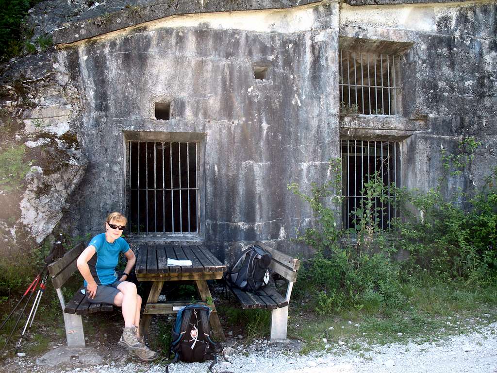
We reached the Arcioni bivouac hut, took our gear off and enjoyed a drink and a Jelly baby!
Then, it was down to Biacesa for the 3.21 bus back to Riva for a Beer and Pannini under clear blue skies (no sign of thunderstorms!).
A superb day!
A cloudy but still warm morning lead us to have an “easier” day although, the ascent and descent was about the same as on Cima Capi.
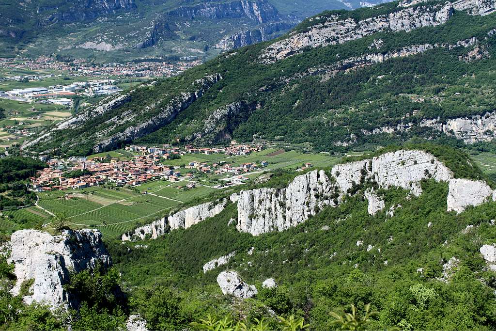
This wasn’t a proper ferrata, more a steep path cum scramble with cable protection, created by a local man to aid travel between nearby villages. After a bus ride, we found the route from Dro up through the woods and towards the long limestone cliff and the start of the stone steps and cables. When we stopped for a drink under gloomy trees, I was immediately set upon by monster Mosquitos who drove me out in to the open again. As we ascended, the weather improved and the sun came out.
The going was pretty easy and height was gained quickly. There are good views of the Sarca valley and as we looked across towards Drena on the opposite side of the valley, I was reminded of towns in Morocco.
Beyond the town of Dro, an area covered by an expanse of grey rocks is visible. This is known as "Biotopo Marocche di Dro" according to the map. Formed in the post - glacial period, it resembles a lunar landscape and has a cycle path and walking trail along the edge of it.
I understand that fossilised Dinosaur footprints have been discovered and are visible but we didn't get to see these.
Once the top of the cliff is reached, the path heads southwards and parallel to the rim, in and out of trees and with good views of the valley. The undergrowth is quite thick and we spotted lots of small, green Cotinus plants amongst the wild flowers and bushes. As ever, our constant companions - the Lizards - scuttled around in the undergrowth.
We reached a picnic area with tables and a viewpoint. The locals move logs down from the hillside using a cable run (a bit like a “Tyrolean traverse” setup)and we saw several of these along the way. The path turned into a forest track and then our route dropped off the track and back into the woods.
We came to a limestone cliff, dripping with water and a sign telling us not to drink it!
The ground at the bottom was quite boggy and there were all sorts of insects flitting around. Not surprisingly, our friends the Lizards were running all over the rock. As we approached a bush, a rustle in the undergrowth alerted me. We had seen some big lizards from a distance but this sounded like a big one close at hand.
I motioned for Marie to stop while I crept around the bush and peered in, I could see something moving amongst the shadowy twigs…
… suddenly, like the proverbial “Bat out of Hell”, a huge snake shot out of the bush and away from me. Marie barely had time to squeal before it had slithered over her boots and away into the undergrowth.
How we laughed (not!).
The route returned to the cliff and descended somewhat more steeply in the sunshine towards Ceniga. At first, we scrambled down the rather dirty and overgrown, rocky pathway but soon this became more exposed.
We used the cables as handrails and descended the strange, wooden ladder- like constructs designed to aid our descent. Again, this is more of a protected walkway than a ferrata route.
Back in the open it was really hot again and we descended through the vineyards between the cliff and the Sarca river.
Originally, we had planned to return to Dro but we noticed the Roman bridge crossing the river nearby, so we detoured towards it and on to Ceniga to get a bus back to Riva for the usual late lunch treats!
Another lovely clear morning and another bus ride up past Biacesa and on to Mezzolago in the Val di Ledro. We set off at about 9.15 towards Cima D’oro (the Golden peak) which looked like a grassy hill top, quite a contrast from the normal Limestone crags. We had been joined on the bus by a class of primary school aged children accompanied by two teachers, out for a day in the cooler, higher valley. We thought they might be going for a swim in the blue waters of Lake Ledro.
They were boisterous but well behaved and I didn’t envy the teachers their responsibilities for a day in the mountains.
Although the bus had bought us up to about 670m, there was still about another 1100m to go to the summit at 1802m, so I had chosen the most direct route on the map, using path no 453. We walked up a road leading away from the lake side and past the last houses to a sign by a car park.
The sign told us that the way to the summit is now via a specially prepared “botany trail” (Sentiero Botanico) and the “Sentiero Austroungarico1915 - 1918” route, neither of which were on my map. Our chosen route was not shown by the sign!
“What do you think”, I asked. “I don’t like to go off the main route on the map but this seems to be the way they want us to go”.
“You do remember what happened on Sunday with the Mountainbike route? Marie replied.
Eventually, we decided to follow the signposted route and this turned out to be a good decision.
The Sentiero Botanico wends its way up through the forest, crossing a major forestry track every now and then.
The going wasn't too steep and was pleasantly cool in the shade of the trees.
On this day, we seemed to be the only people on it and we heard for the first time the sound that was to serenade us for most of the day, the call of a Cuckoo.
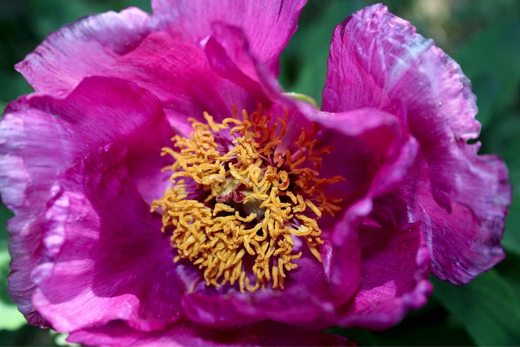
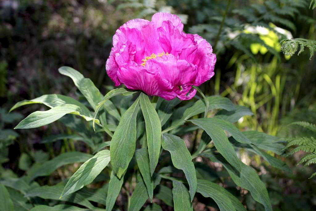
True to its name, we passed a proliferation of flowers - wild Peonies, Aquileiga, wild Strawberry plants and other flowers I couldn’t identify.
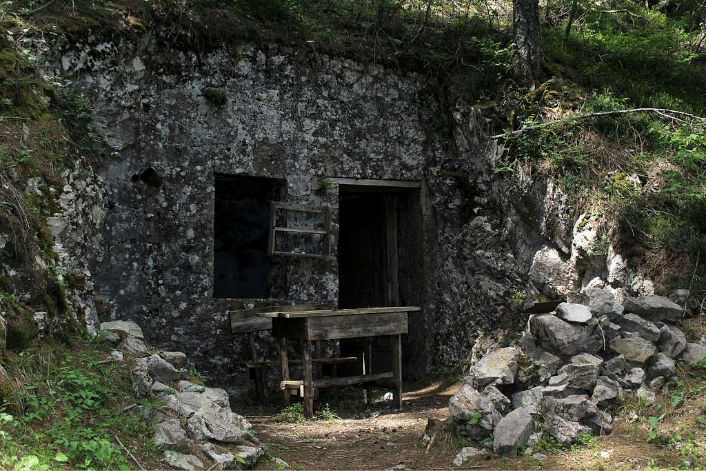
After some time on this trail, we emerged onto the forestry track and followed this upwards to an open viewpoint with superb views down to Lake Ledro and the hills on the opposite side of the valley. Again, we were looking down into a concrete gun fortification built when the “viewpoint” was used for more than its scenic value. The first installation is a gun placement looking towards the Italian positions that were across the valley on the Mountains of Corno and Carone.
This is the start of the “Austroungarico trail”, a trail taking us up through the fortifications and acting as a commemoration of the First World war in these parts.
We read on one of the information boards that Cima D’Oro was one of the pillars of the Austrian defences set up on this side of the valley. The site was manned by the “Standschutzen” of the Lana battalion and the Kaiserjager of the 5th Streffkompanie of the 1stRegiment.
The Standschutzen were originally made up of men from shooting clubs and were often either too old or too young to be called up for active service. However, despite their ages they were excellent riflemen, they were often Alpine born and bred so were at home in the high mountains and had excellent local mountain knowledge.
Behind the ridge, the trail climbs up the original “trench”, cut into the limestone rock and with more shelters and tunnels along the way, it was quite gloomy in the forest shade. Every now and then a view towards the enemy positions appears at breaks in the trees.
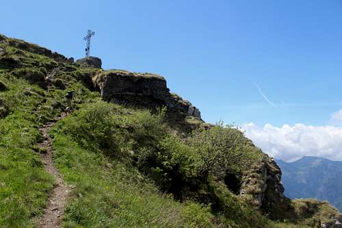
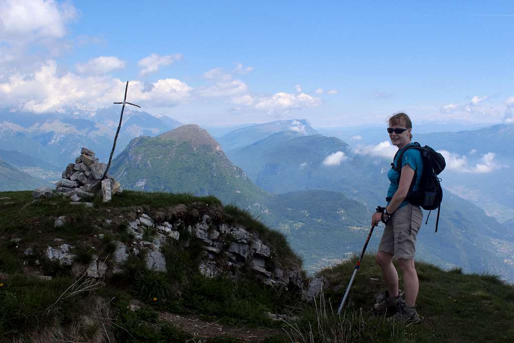
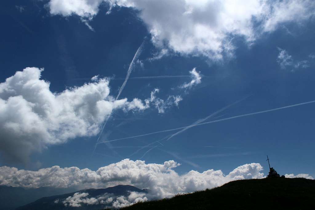
The path rises through the trees until we arrived at a memorial cross at the top of the ridge at the south summit, overlooking the valley. Information plaques showed photographs and the names of men killed defending this mountain and again, it was hard to imagine this lovely area was once a war zone!
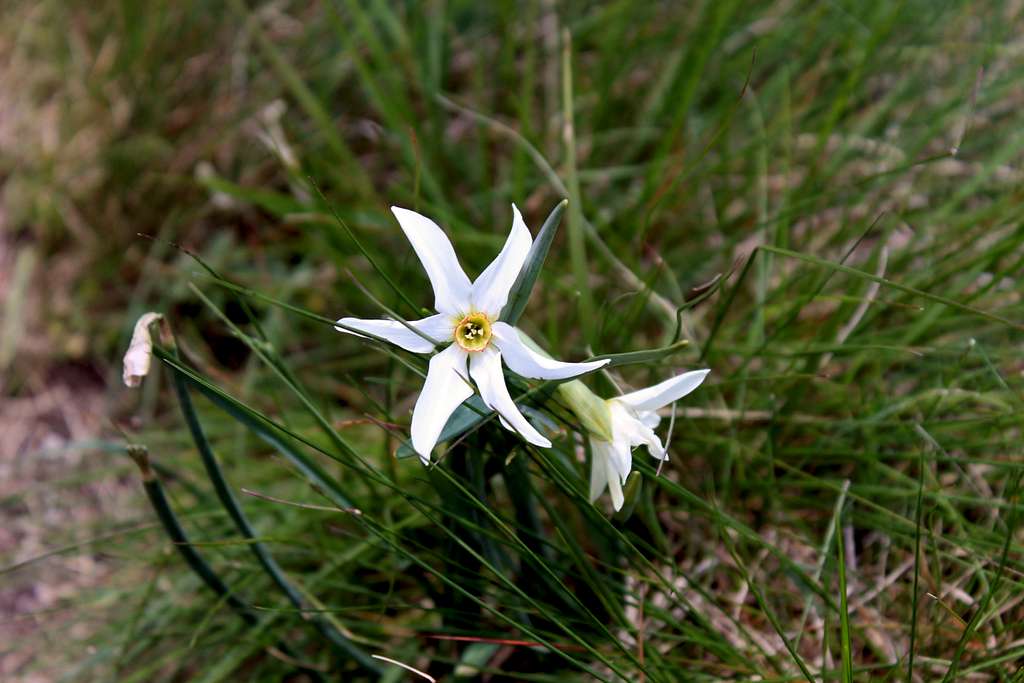
Once on the open hillside, it is a short distance up the grassy ridge – always besides an overgrown wartime trench – to the makeshift cross on the summit. As we were there in May, the hillside was adorned with wildflowers and Marie got a long way ahead of me as I stopped to photograph Poppies, Narcissi, Gentians and the like as we summited in the sunshine.
“There is Cima Capi where we were on Tuesday (now far below us) and Arco, Riva and that lake must be Lake Tenno, I think”.
“What about the snowy mountains in the distance”, Marie asked.
“I think they are the Brenta Dolomites but I don’t know what we’re looking at. That is Cima Pari”. I said, pointing to the adjacent grassy hillside.
We left the summit at around 1.00pm as a few clouds were gathering – they came to nothing!
We descended the grassy north ridge to Malga Dromae to pick up path no 453 (my original choice of ascent route) and followed it all the way down to Mezzolargo. It is not well marked and quite rough in places. It drops from the open hillside back into the forest and emerges at our starting point by the car park. Clearly, following the local advice and route knowledge paid off in this case.
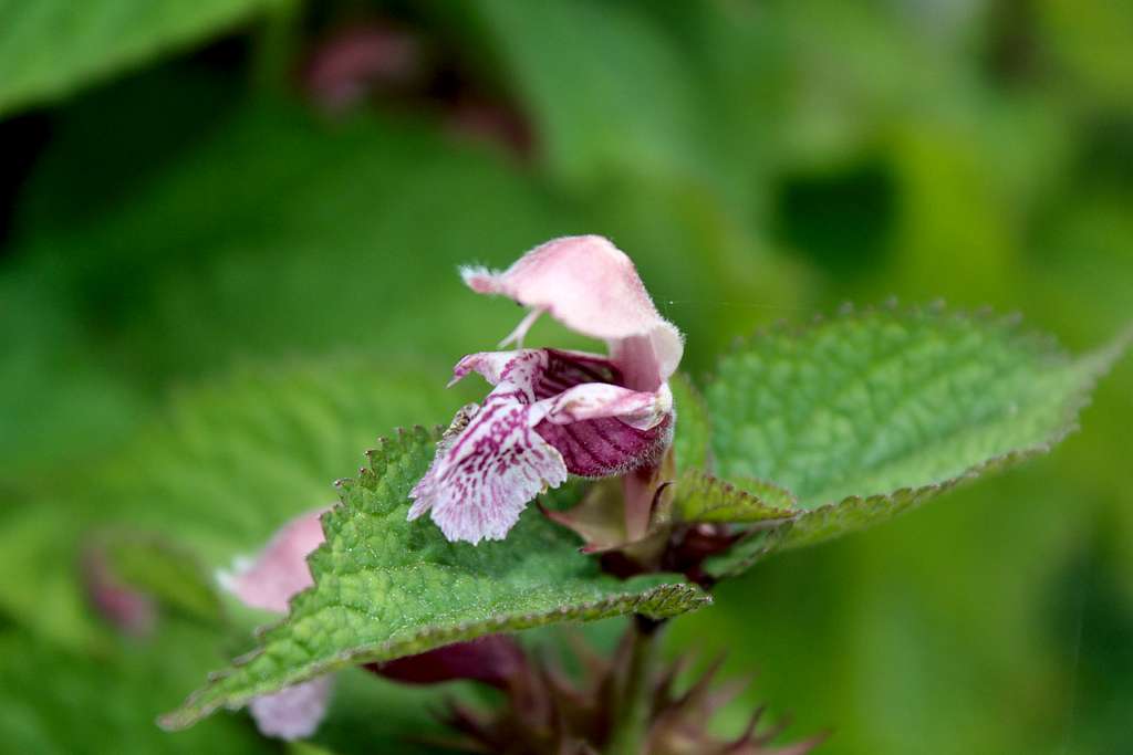
On the way down I photographed a beautiful, Orchid - like Stinging Nettle! I have never seen these in the UK!
(After some research, I think this may be Common Hemp Nettle – Galaeopsis Tetrahit – not a nettle but a member of the Mint family and non – stinging!)
We were back at the bus stop for 3.20 in plenty of time to catch the bus back to Riva.
Another lovely day in the Italian mountains.
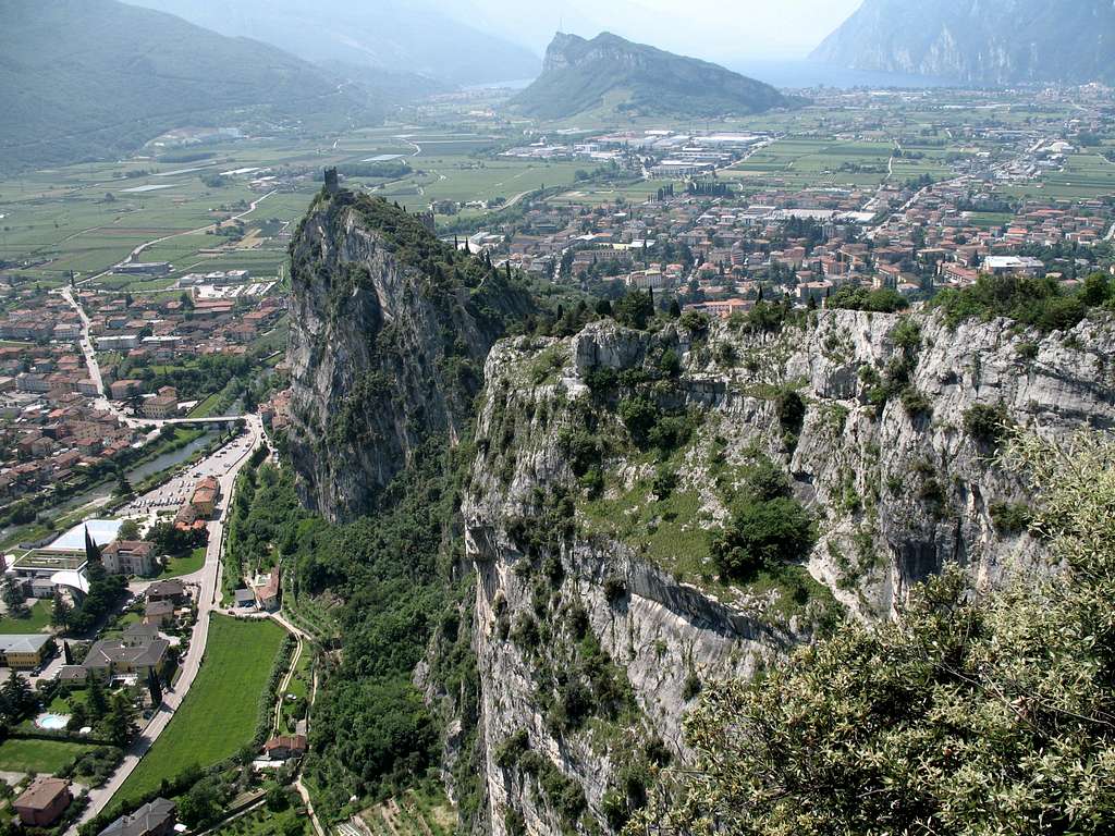
For once it was grey first thing but the forecast was good so we set off early to walk into town. Our chosen route ascends the cliffs directly above the town of Riva del Garda and promised to deliver spectacular views of the northern end of the lake and the surrounding area.
Our first objective was to reach the Bastione, the white tower visible from all over the town. For those interested in the history of this area, this was built in the 16th century but sacked by the French in the 18th century. It’s possible to explore some of the ruins if you have time.
The route leading up to this is well signposted and we joined the cobbled road that rises in pleasant, shaded zig zags. This is the start for a variety of days out from Riva and looking back, we saw a procession of climbers following us.
We reached the Bastione and stopped for some water and to admire the views. We had a quick look at the ruins but were anxious to get a move on, so we soon carried on, heading now for the Capanna Barbara and Chiesa Santa Barbara.
The path loses its cobble stones and becomes a rougher mountain track after the Bastione. We had passed and been passed by quite a few people during the ascent so far but were on our own when we rounded a corner and were confronted by a large signpost with a dramatic caricatured image of a construction worker clearly telling us to stop, followed by several lines of writing in Italian.
Marie is the linguist of the two of us so she translated what I had already guessed.
“It’s says the path is closed due to repair work”.
“So we can’t continue? Where have all the people in front of us gone?
Marie shrugged.
“So where can we go?” All this was very confusing as it was clearly closed (red tape across the path had fallen to the ground) but all the people in front of us had carried on.
As we were debating this a man talking on his phone came up the path. Without a pause, he stepped over the tape and carried on.
“Perhaps he’s one of the workers?” Marie suggested.
He was dressed in shorts, T-shirt and trainers.
“He didn’t look like a construction worker”. I replied
Just then, two young women came up the path chatting. They glanced at the sign and one made a comment then, they continued.
“They definitely weren’t construction workers”, I said.“Come on”.
We carried on, later we passed other similar signs that had been moved off the path and into the bushes but we never saw any construction work.
We passed the Capanna Barbara (a bar come Rifugio) and walked to the viewpoint below the Chiesa (a chapel overlooking Riva) but more people were arriving with ferrata gear.
A large, yellow sign directed us to the start of the route and we put our gear on as quickly as possible, looking up we could see a procession in front of us. Now we were out of the shade and in to the sun we could feel it was going to be a hot day.
We started scrambling up the initial rocky slabs and caught up to a couple who were moving quite slowly at the first cables. Immediately, the woman directed Marie to go first, we thanked them and continued. This seemed to be the protocol for the first part of the route.
“I can feel this is harder than the other routes” Marie said as we went higher.
The scrambling was a bit steeper and already, it seemed quite exposed but we made good progress. Two Italians caught us up and we let them pass, then we passed another couple and then we let three Germans pass us before we reached the foot of the first ladder.
“It says, only three climbers on the ladder at one time”, Marie translated the sign at the bottom.
“Yes, we wait otherwise it is dangerous”, the German in front of us re-iterated the sign in case I had another idea. It seemed reasonable to me, so we chatted to them while we waited.
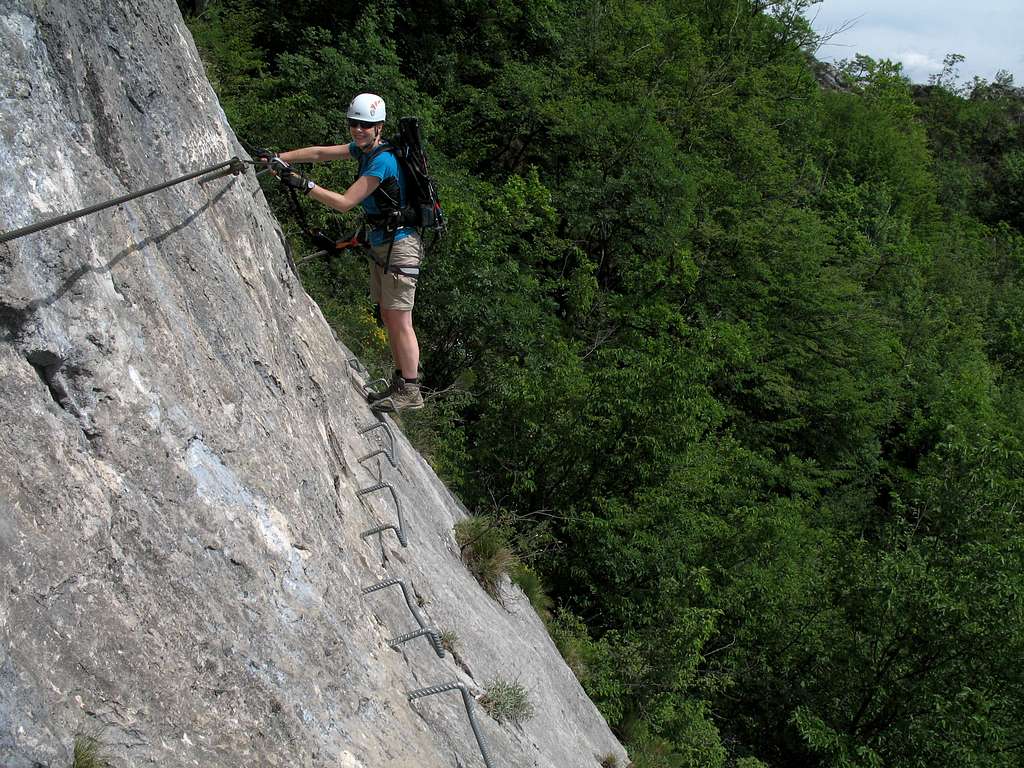
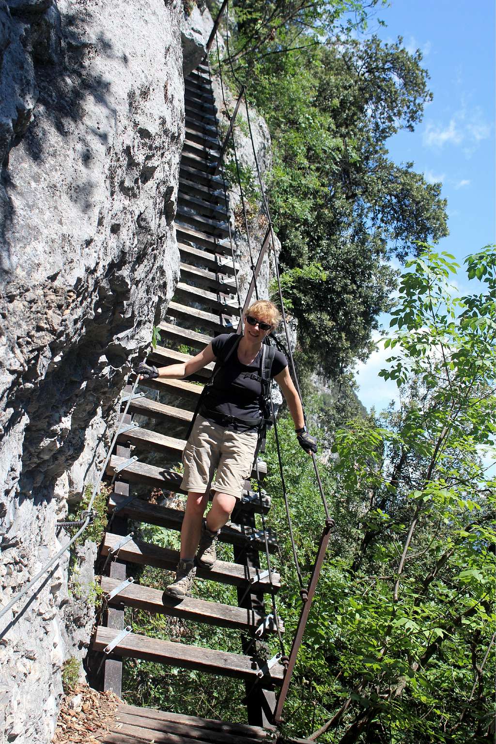
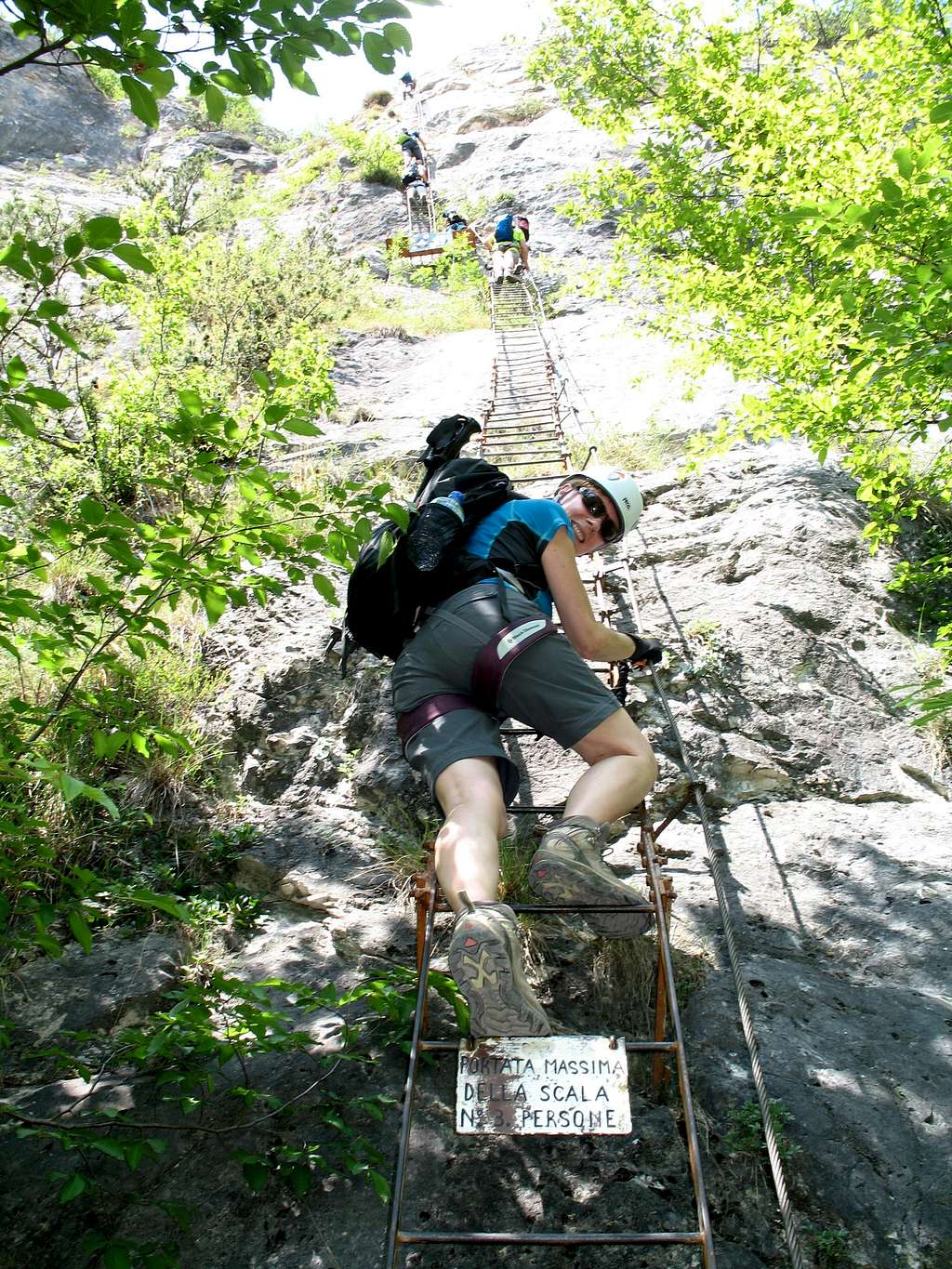
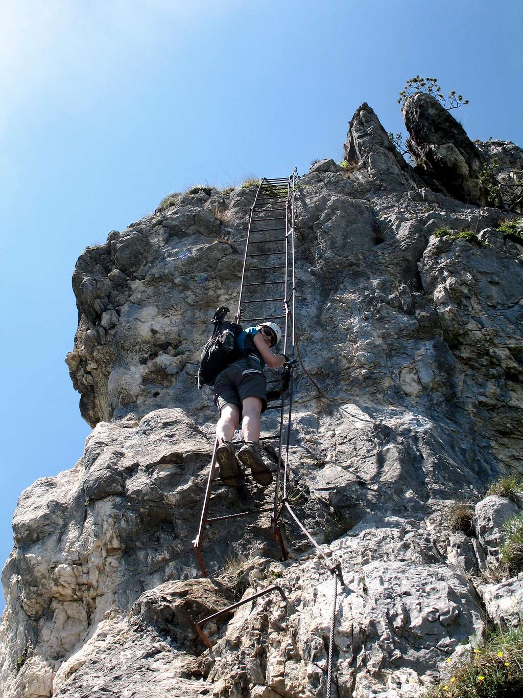
The first two ladders are 20m and 15m respectively and are joined together by a hanging platform. Ladder 1 started off at a reasonable angle up the slabby rock.
The angle increased a little as we reached the top of this and stepped left onto the hanging platform. Here, it was more exposed and we waited while the Germans in front were ascending the steep ladder ahead of us. Behind me, four more people were coming up and the platform was swaying every time someone moved. I was reminded of films I have seen of sailors climbing the rigging of a tall ship, at least we were clipped in!
The second ladder is much steeper and coupled with the growing feeling of “nothing” behind me, the exposure increased, it was a relief to get to the top.
Marie had scrambled further up and stopped.
“I think I need some sugar after that!” she said and we stopped to eat an energy bar.
The group who had been coming up fast behind me on the ladder didn’t appear so we continued scrambling up the rough path over rocks and through bushes. I was baking in my helmet but didn't dare to take it off in case of any rock falling from above.
Up ahead, I could see the next set of ladders and a line of figures ascending ladder no 4 which I knew was the biggest.
Ladder no 3 was a short 7m, then a short scramble up to the bottom of ladder no 4 and our German friends.
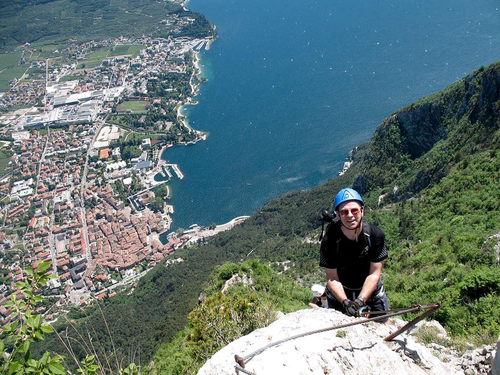
At 40m long, it soared upwards. Like before, it started at an ok angle. It was set on a slab which steepens as it gets higher. On the right was the main rock face and on the left and way below, was Lake Garda and Riva!
It’s impossible to move quickly up these ladders as after 2 or maybe 3 steps you have to stop to unclip and re-clip your lanyards as you reach each supporting bracket. This makes it a very stop - start route and more than once I went too far and had to step back down a step or reach downwards to unclip.
As the top part is just about vertical, I could really feel the exposure. I decided to take a photo looking down the ladder (even though the people following me were all coming up as fast as they could) so hanging on with one hand, I held the camera out and took a shot, then got moving as soon as possible. When I looked later I had a perfect shot of the ladder with my boot on it… but no view!
Ladder no 5 followed straight after this but was short (10m) and in a rocky corner. Marie was waiting for me higher up under the trees and we continued scrambling upwards.
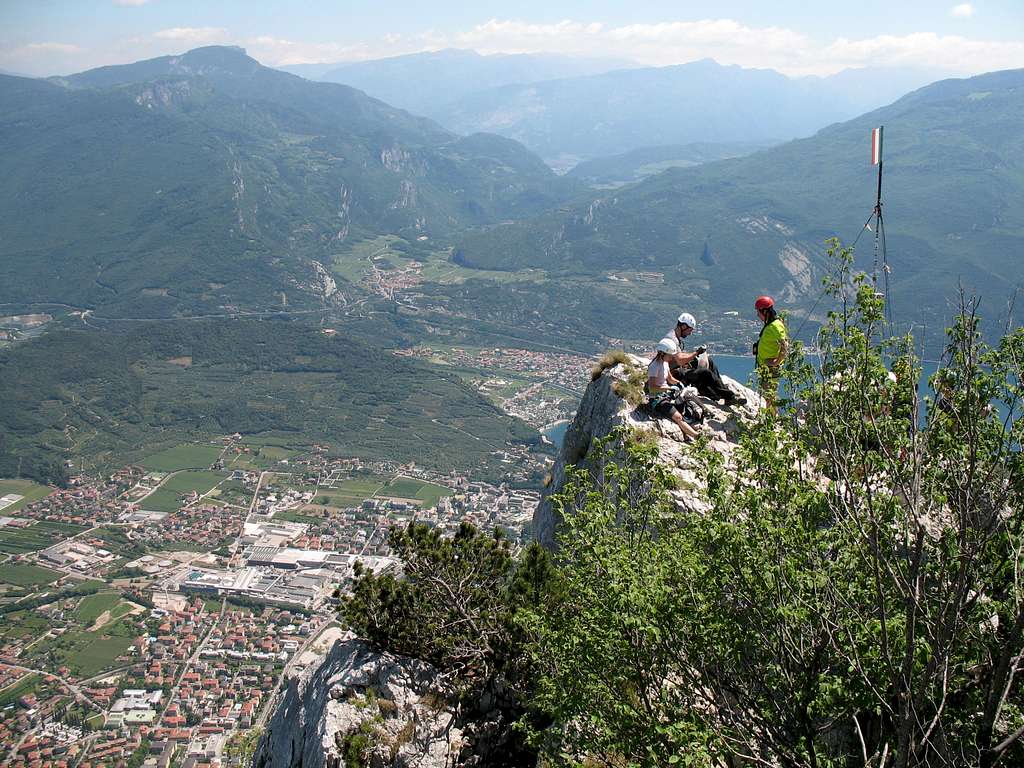
Above the trees and high up I could see the top, a rocky pinnacle witha metal flag.
We scrambled up through more trees to a ledge and onto an airy promontory overlooking Riva. We admired the view and I couldn’t help but take some more pictures.
Behind us, Ladder no 6 was attached to the rock face.
“This looks like a steep one”, Marie said.
“At least it’s quite short.” I replied
Marie started up it quickly and I followed. The breeze blew around my legs and again, I felt the exposure.
Part way up, I stopped.
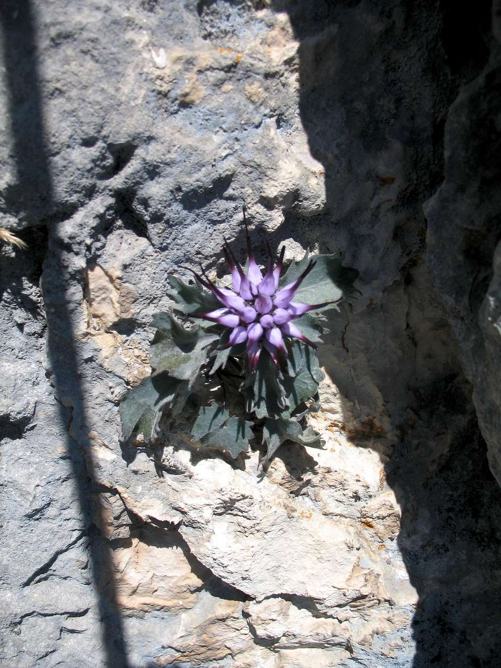
In front of me attached to the rock was a “Devil’s Claw” plant (Physoplexis Comosa) – I believe these are also known as Tufted horned Rampion.
I had never seen one before and then this was the second one I had seen today!
My earlier attempt at a photo was poor so this time I made sure it was better. An amazing plant in an amazing setting!
“Give me the camera, I’ll get a shot of you”, she said.
I did so and she took probably the best shot of the day!
The descent from the top involves a steep down climb for about 7m mostly on polished limestone holds. With all the ladders we had been up I was surprised there wasn’t one to help us down and this was probably the hardest of any actual climbing on the route.
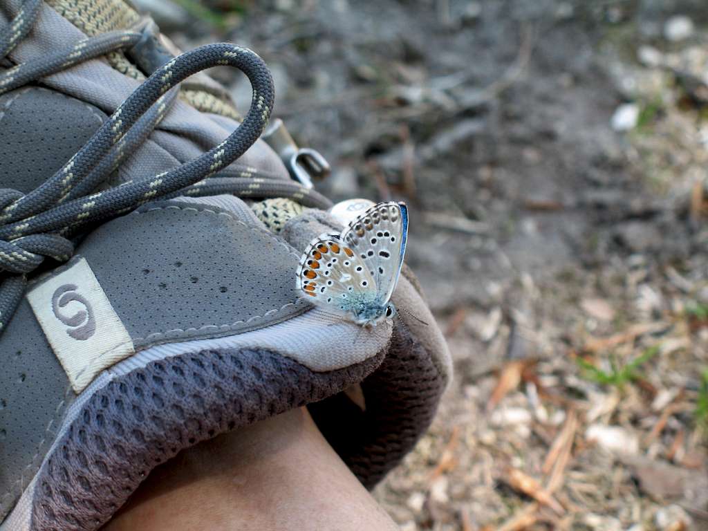
We moved away from the bottom and stopped in the shade of some trees for a bite to eat and a drink, surrounded by small blue butterflies.
“Those ladders were pretty hairy!” Marie said.
I couldn’t help but agree.
We took the path “less travelled” for our descent route (path no 418) while most took the direct descent down paths nos 413 and 404 to Chiesa Santa Barbara.
Our route was a lovely, shady descent with very few people on it.
It overlooked Tenno and Varone and continued on to the Sentiero Della Pinza,down past the San Giovanni tower and finally back to Riva in about 2 ½ hours.
By the time we reached the WW1 fort on the Sentiero Della Pinza, we had finished the last of our water.
Back in Riva, we went to the “Bar Roma” for the last time, I don’t remember beer ever tasting as good!
We had a fantastic week in Riva del Garda. Some great days exploring the mountains in this area and six new ferrata routes to tick off.
Looking around SP, there are lots of other routes to do but apart from the mountain routes, some particular memories stand out.
The relics of war that appear regularly in the most incongruous of places.
The smell of the Jasmine hedges as we walked around the town in the evening and the solitary Bottlebrush trees that seem to grow everywhere.
The profusion of flowers and butterflies during Spring.
The sound of a Cuckoo echoing around the Valle di Ledro and our old friends, the Lizards!
Beautiful weather, beautiful scenery, an abundance of flora and fauna and all set amidst the backdrop of history.
I’m sure we will return.