
Comments
No comments posted yet.
|
|
Trip Report |
|---|---|
|
|
46.53426°N / 10.61665°E |
|
|
Aug 1, 2016 |
|
|
Hiking, Mountaineering |
|
|
Summer |
After a day of hiking around the Stelvio Pass with climbs of both Monte Scorluzzo and Roetlspitz we were ready for the next step in our climbing week: The traverse of Hoher Angelus and Vertainspitze. Maarten and me were really looking forward to this route, with a special thanks to sp-members rgg and alpinbeta, who both noticed me about this route. We wanted to do the climb in two days: The first day we would ascent to the Dusseldorfer Hut from Sulden and on the second day we would make the traverse and return to Sulden. The first day would be easy, since we only had to hike up from Sulden to the Hut, which takes about 2,5 hours. Unfortunately, the weather changed and it was pouring down all day. We drove to Sulden and
decided to wait for the weather to clear, well.. at least wait for the thunder to stop, but it didn’t.. so we sat down in a small cafe in the center of Sulden and drank I think at least 5 cups of coffee.
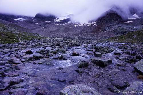
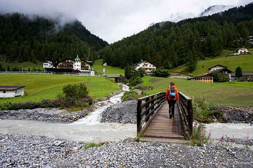 Leaving Sulden for the Dusseldorfer Hut | 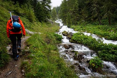 Hiking up along the river |
 Rain! but almost at the Hut | 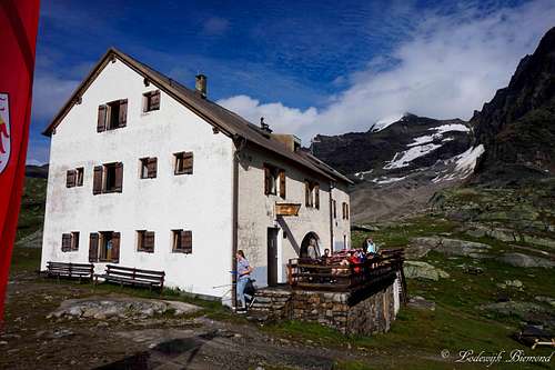 Dusseldorfer Hut with Hoher Angelus (3521m) |
But finally, somewhere at 2PM the weather increased a little bit, no more thunder, so we decided to give it a go. We wanted to take the Kanzel chairlift to fasten our ascent, but it was closed all day because of the weather. We decided to take our chances and just head up to the hut from Sulden, hoping the weather would not become worse again. The trail up the mountain was great, following a normally small stream up the valley. It was now flowing rapidly because of the rainfall. After an hour we reached the tree line and visibility started to decrease. Fortunately the trail was marked very well, so we could find our way up the mountain.
 Maarten gazing at Zebru and Ortler | 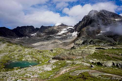 Hoher Angelus in the afternoon; the weather cleared! |
 Koenigspitze (3851m) in the evening | 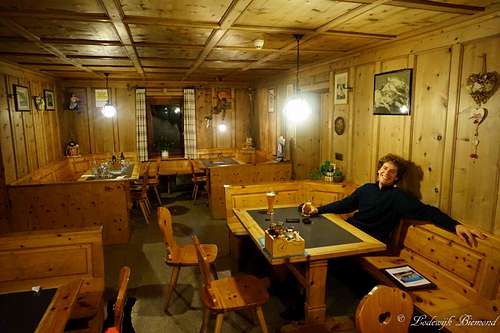 Dining Room; Enjoying some beers |
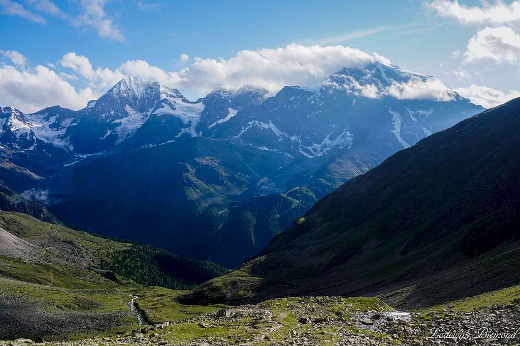
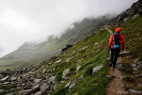
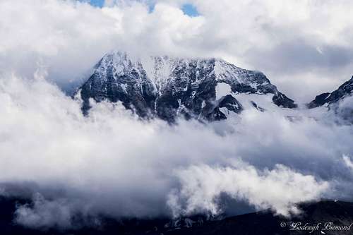
It was very peaceful up the mountain, not a single soul besides me and Maarten. It started raining again, so we rushed up the mountain. The higher we got, the harder it started raining. Eventually we reached the Dusseldorfer Hut, soaked, but happy we made it. We dried our clothes and sat down in the dining room and met three German guys, who were crossing the entire Ortler Group on foot. After having a few drinks with them the weather outside started clearing and even the sun came out. We rushed outside hoping to see the famous view towards the ‘’dreigestirn’’ Konigzpitze – Monte Zebru – Ortler and there it was. What a fantastic sight. We were hoping to stand on Ortler later that week. After enjoying the late afternoon sun and the views we had a nice dinner, of course some beers and went to bed early.
The following day we left at about 6 AM. We were a bit late and most people already left the Hut. Unfortunately the weather did not clear liked we hoped it would. There was a thick, dark cloud carpet covering all surrounding mountains. Still, the predictions were not too bad (no thunderstorms) so we decided to give the tour a go. We started with ascending Hoher Angelus along the Reinstadler, Normal route. After finding our way up to the start of the Via Ferrata we had a quick rest and an unfulfilling chat with some other climbers pointing to us we should not climb so fast (?!), which is to this day one of the weirdest conversations I ever had.
 Early morning start: No weather improvement | 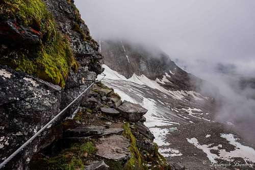 The Via Ferrata |
 Ascending the NW-ridge of Hoher Angelus | 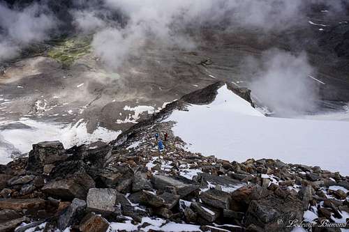 Reinstadler Route / NW-ridge |
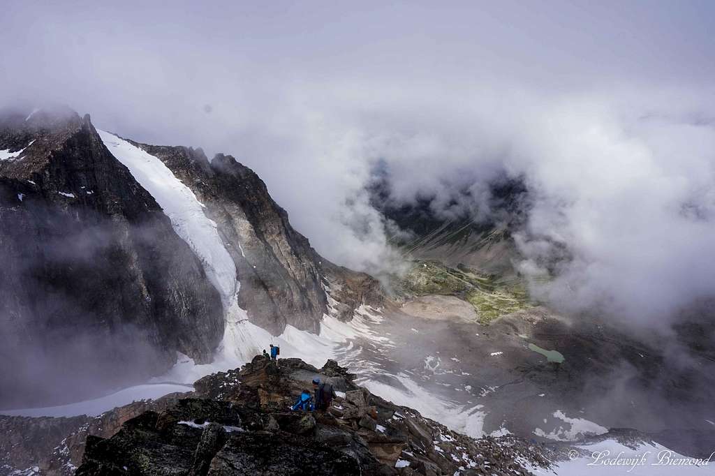
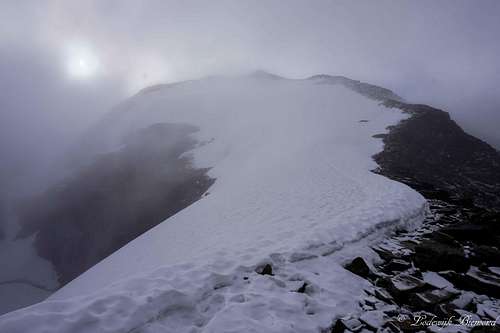
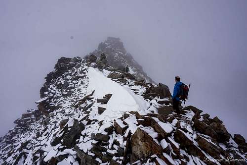 The summit Ridge | 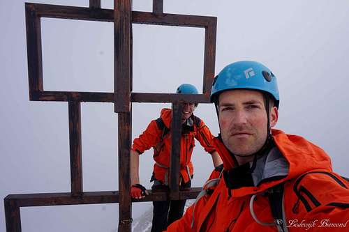 Summit selfie |
The Via Ferrata was easy but fun. After climbing for some 30 minutes we arrived on the NW-ridge of Angelus. At this point we would only have to follow the ridge adjacent to the glacier and find our way up to the summit over easy terrain (grade I climbing). There were two things making this otherwise easy ridge a little more difficult. First, there was a fresh snow layer present anywhere above 3000 meters and second, we started heading into the thick cloud layer, the one we already saw during the time we left the hut early in the morning. Despite of these two facts, the route was fun and we enjoyed our way up to our first 3500m+ mountain of the year.
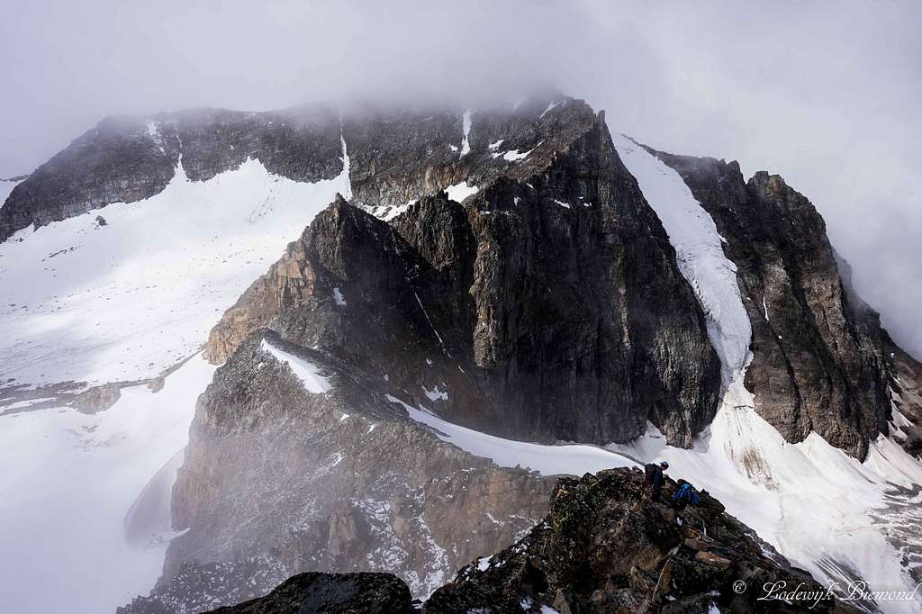
Near the summit Climbing was a little more difficult with the fresh snow present, but after a short while we were standing on top of Hoher Angelus! What a fine summit and what a fine route. We didn’t care about the visibility that was less than 10 meters and enjoyed our successful attempt. After some minutes we decided to go for part II: Vertainspitze or Cima Vertana in Italian. This summit is slightly higher and we couldn’t wait to climb it. First, we descended the summit ridge the same way we came up, but we had to find the ridge down to the Angelusscharte. This saddle point has to be reached to be able to enter the Laaser Ferner glacier. Because the bad visibility we couldn’t find the ridge to the Angelusscharte at first. But all of a sudden the weather cleared up. It was awesome, we could see the ridge we ascended, the Dusseldorfer Hut below us in the deep and our next objective was looming in the distance: Vertainspitze. What an awesome looking mountain we said to each other. The best thing was that we could also spot the start of the ridge down to the scharte, so we headed over quick and started our descent. After some 30 minutes of nice rock climbing we reached the Angelusscharte and the Laaser Ferner glacier: Time for our glacier equipment.
Maarten was filming all his equipment and explained what it was for. He is a Geography teacher in high school and uses his material for educational purposes. While getting ready the weather became worse again. Visibility was now near zero and that’s not a good thing when crossing a glacier to say the least. We had good maps but we needed a compass to navigate as well…but we both didn’t bring one. DAMN, how stupid! We only had two options left: Either wait
for the weather to clear or turn around and go back to the Dusseldorfer Hut and leave Vertainspitze for another time.
 Angelusscharte (3337m) | 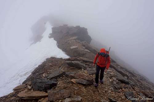 Rosimjoch (3288m) |
I wanted to go for the safest option: Return… But suddenly we spotted a group of 3 people: It turned out to be our German friends we met at the Hut the day before. They did bring all equipment necessary to cross the glacier to the Rosimjoch and they invited us to follow them and so we did. After crossing the glacier we thanked the guys at the Rosimjoch, took some photos of each other and we left. The guys were heading towards the Casati Hut and decided to bail on Vertainspitze because of the weather. To this day I am thankful we ran in those guys again, otherwise we would have gone back for sure.
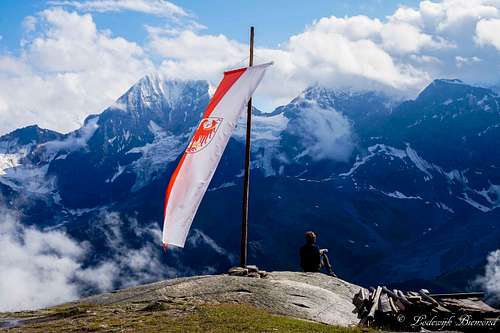
Standing at the Rosimjoch ,the weather was still awful: Near zero visibility. We had another good look at our map and decided to follow the ridge in a straight line to Vertainspitze. Although not the normal route up, the climbing was fun and a bit exposed. The ridge was narrow so route finding was not a problem, even with this weather. After a while we could spot the big snowfield beneath us for a brief moment, before it disappeared in the clouds again. We headed towards it and followed it to the base of the summit block. We met 3 groups of climbers here, all coming down from the summit. We had a little chat and were informed we were almost there. So we started our final ascent along the rocky south flank of Vertainspitze. After some 15 minutes a found myself hugging the huge summit cross. ‘’We made it’’, I shouted to Maarten, who was climbing his final meters. We said ‘’Berg Heil’’ , ate a Snickers and enjoyed being on the summit. It was quite peaceful at the time. Visibility was still near zero, but the wind stopped making the summit of Vertainspitze a really peaceful place. Especially because we were the only ones there.
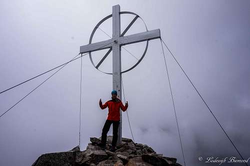 Vertainspitze (3545m) Summit Cross | 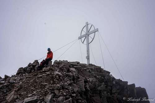 Maarten on the summit Maarten on the summit |
‘’Time to get back’’ Maarten said. He was right, we still had to get down to Sulden, almost 2000 vertical meters below us, so we left quickly. We descended the south flank back to the snowfield. After a close look on our map we entered the snowfield and followed the normal route down, at least, we thought. Orientation became a bit of a problem. We had to reach the base of the Rosimferner glacier and follow it down into the Rosim valley. At some point we thought to have reached the point we
could descent towards the glacier, but was this the right valley? One valley before it on the map was a dead end with a near vertical wall beneath it. I started doubting about our position and got a little nervous for the first time this trip.
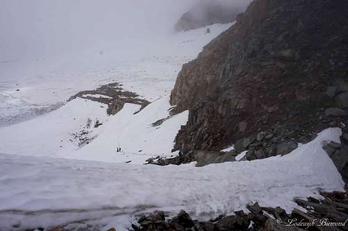
We looked at the map again and again when all of a sudden the clouds opened up a bit and we could spot the huge glacier in front of us. We saw the glacier for seconds before disappearing again in the thick cloud cover. We were relieved we were going into the correct valley. Still, the normal route curves around the steepest flank and we were standing right on it. Although quite steep, we knew we could manage and gave it a go. After down climbing the flank covered with loose rocks we managed to find the main trail down into the Rosim valley. We were happy and relieved, celebrated with a snickers bar and followed the trail down.
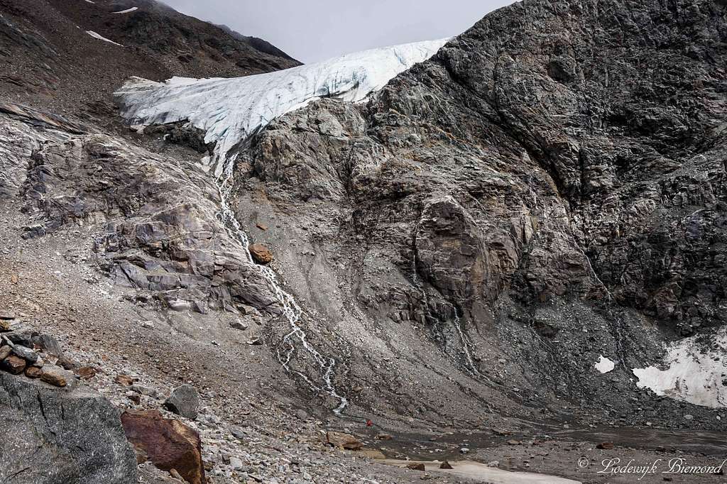
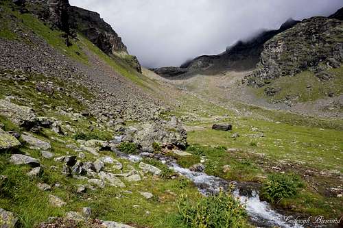
The trail was beautiful and followed the glaciers flow path down. At some point we reached the glacier tongue, what a great sight that was. We gazed up to this massive block of water and ice and descended further into the Rosim valley. The glacier tongue was a perfect backdrop while descending further down. Also we had left the thick cloud layer above us and visibility became normal again. The thick cloud carpet was still covering everything above us, like it did all day.
 Lower Rosim valley | 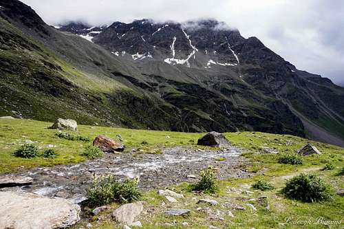 A rest at Rosimboden; almost there! |
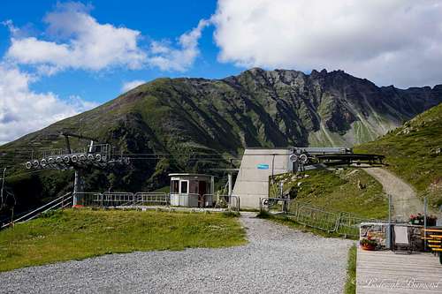 Kanzel; the lift was still operating. | 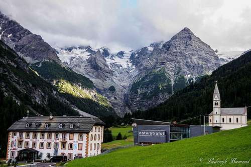 Back at Trafoi |
While following the trail down we started feeling our legs. We were getting a little tired from our 10 hour trip. We descended quickly along the trail and reached the Kanzel lift station at 2300 meters at bout 4PM and were able, after a nice cup of coffee, to take the chairlift down to Sulden. This saved us another hour and a half probably. We were very happy about our successful climb and drove back to our campsite in Trafoi were we celebrated with a very good pizza and some beers. Our acclimatization was done as well and we were now fully prepared for our main objective: The Ortler Hintergrat. More about that trip in another, still to write, TR.
Despite the lousy weather, we had a fantastic 2 day outing in the Ortler Alps!