Becca di Luseney m 3504 is a beautiful mountain in shape of pyramid located in the Pennine Alps, Aosta Valley, on the watershed amongs the Valpelline, the Valtournanche and the Valloon of Saint Barthélemy. The Normal route to summit this peak starts from the Valloon of Saint Barthélemy; it's an interesting mixed course on a mountain not too well known, a very fascinating and exciting climb, also in reason of the wild environment and the fine landscape. The route needs to be attended very early in the season, when the gully and the final ice wall are not too icy and well covered with snow.
First ascent: Adams Reilly and the alpine guides Jean Antoine Carrel and Henry Charlet, 1866 August 2nd
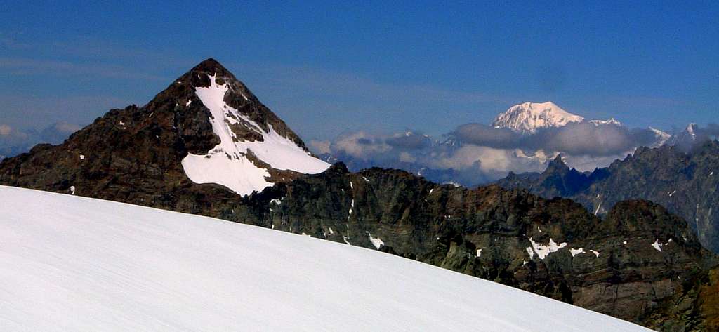
Becca di Luseney from Ghiacciaio di Cian
Getting There
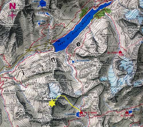
From Torino-Aosta Highway exit Nus (m 529, a few km from Aosta), enter the town and follow the signposts to Saint Barthélemy; follow the valley and turn right in a bend just before Lignan m 1633, following the road towards the alp of Praz m 1737 (27 km from Aosta). Cars cannot continue beyond the village, so leave the motor just before Praz and walk on the farm road that enters the valley, reaching the alps of Vallorsière and Champlaisant m 1927 and then almost on level the bridge over the river Saint Barthélemy. Leaving the branch to the Sanctuary of Cuney on the left, follow the path that leads to Alpe Crottes m. 2389, where the path forks. The right trail goes to the Finestra di Tsan, which leads in Valtournenche. Ignore this path and follow the left one, rising with long hairpins towards the basin of Luseney, a grassy plateau where you will find the Luseney Lake and the beautiful bivouac Luca Reboulaz m 2565 (about 3 30 h from Praz), in front of which there is a fountain.
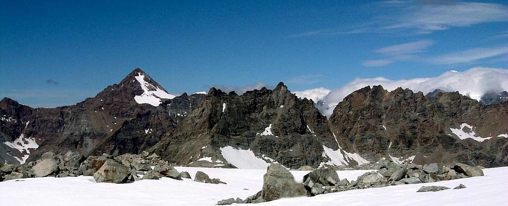
Becca di Luseney from Valpelline
Bca Luseney from Northwest
Route description
Difficulty: PD+ (Alpine) - II grade (rocky section), 45° the ice-snow section Difference in level: 940 m. from the Bivouac Luca Reboulaz
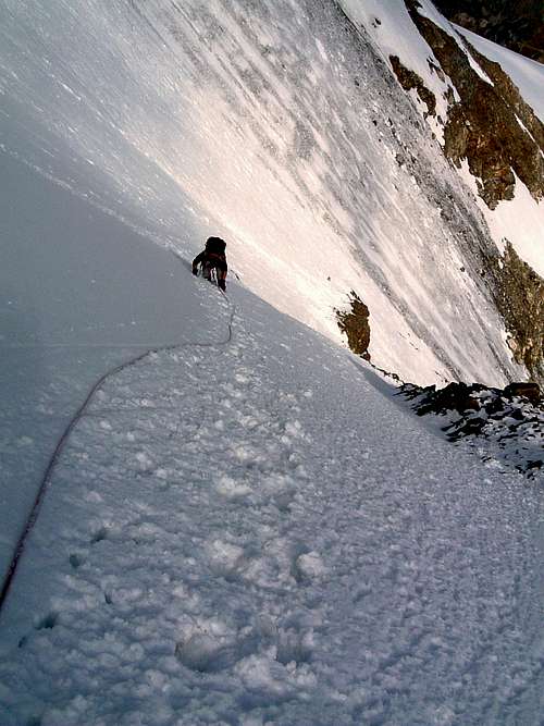
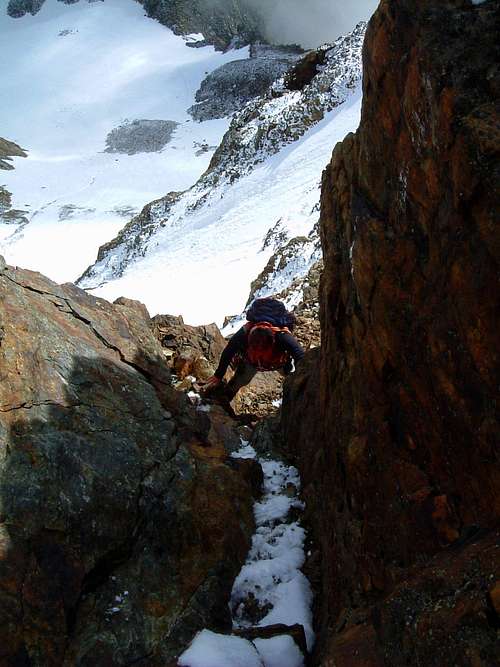
A mixed climb, alternating steep snow slopes and rocky steps on the summit crest. When the Northern slope is icy, it should not be underestimated
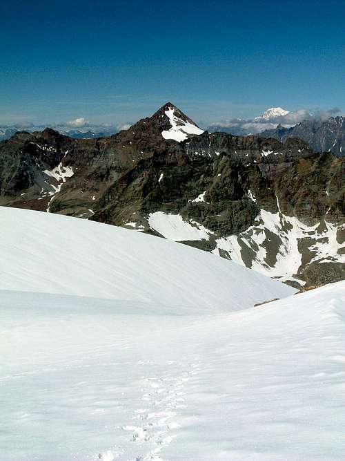
Becca di Luseney from Dome de Cian
From the bivouac leave the lake on your left and continue heading to the obvious and steep grassy slope that leads into a rocky gully, climb it without difficulty until you reach the upper basin. Climb the long scree and debris slope to reach a snowy gully (frequently icy in late summer) that descends from above, climb it with stretches of snow and other mixed passages to reach the Luseney Col m 3162.
Becca di Luseney from Dôme de Cian
Northern slope
Rock gully on the summit ridge
From the col head to the Valpelline side, crossing the Luseney Glacier slightly towards right to attack the steep North face (45°), exit it to the left just before its end, then head to the right to get the rocky ridge and mixed debris and snow, reaching the top quoting 3504 meters, where it is placed a cross.
Last steps before the summit of Becca di Luseney
Luseney, getting the summit cross
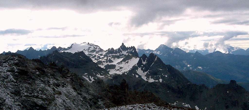
Beautiful view of all the peaks of the Saint Barthélemy Valley and the Valpelline.
Descent: reversing the same route
Essential Gear
Rope, helmet, axe and crampons, a couple of quick protections and quickdraws, a couple of rings of rope
Red tape
The approach and the climb are located in isolated and wild places. Pay attention to the banning of cars beyond Praz.
Dome de Cian and Aiguille de Cian seen from Becca di Luseney
Typical alpine building in masonry and stones of the place mainly built by volunteers, inaugurated in the summer 1993 and dedicated to the memory of Luca Reboulaz, fallen prematurely on Becca di Luseney. Set on two levels, a kitchen area on the ground floor and a room dormitory upstairs, both equipped.
Opening Times: All year round, unguarded
Number of beds: 24
Kitchen: the bivouac has a local kitchen with gas stove where you can prepare meals
Water in the nearby lake or in the fountain in front of the bivouac
Difficulty: E Hiking
Check-out: Village Praz (1777m)
Altitude: 2575 m Difference in level: 798 m
Duration of the hike: about hours 3:30 from Praz
Property: private family Reboulaz
Luseney plateau and Reboulaz Bivouac
The nice stone-building of Bivouac Reboulaz
When to climb
The best months to climb Becca di Luseney are June and July
Parents refers to a larger category under which an object falls. For example, theAconcagua mountain page has the 'Aconcagua Group' and the 'Seven Summits' asparents and is a parent itself to many routes, photos, and Trip Reports.

 4887 Hits
 86.85% Score
 23 Votes