
Comments
No comments posted yet.
|
|
Trip Report |
|---|---|
|
|
51.89524°N / 2.96766°W |
|
|
Aug 29, 2020 |
|
|
Hiking |
|
|
Fall |
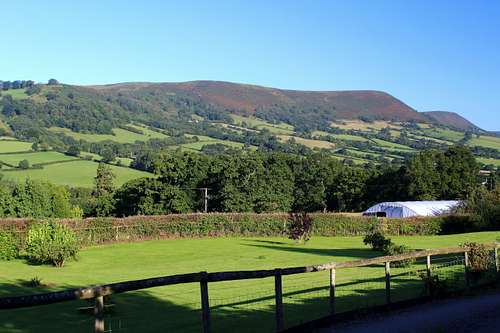
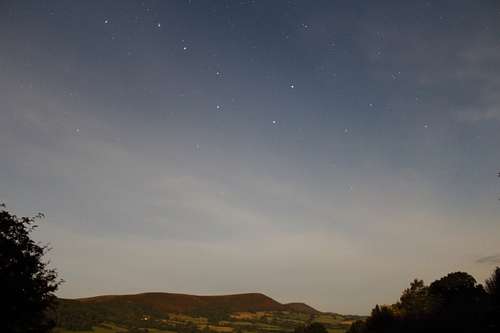
Clear blue skies welcomed us on our first morning in Pandy, South Wales. Our cottage had a wonderful view looking across the valley towards the Hatterall Ridge on the edge of the Black mountains.
Pandy is situated almost literally on the border between England and Wales, about 5 miles north of Abergavenny. Consequently, there is easy access to the long-distance footpath known as “Offa’s dyke” footpath.
Offa's dyke Path roughly follows the ancient earthwork of Offa’s dyke, thought to have been created by King Offa of Mercia (Mercia = what is now the midlands and some of the north of England) around the 8th century AD.
The footpath travels through various environments along its length and in the area we were visiting, it had it’s highest point following the crest of the Hatterrall ridge. It seemed almost too good to be true to have clear skies in Wales! So, we set out to walk as much of it as possible and combine this with the Black Mountains themselves.
We descended into the village to pick up our path. Offa’s dyke path is well signposted and easy to follow, as is The Beacons way, another long-distance path. The other, lesser, footpaths require a bit more effort to find and follow sometimes!
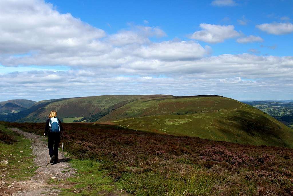
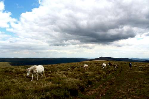
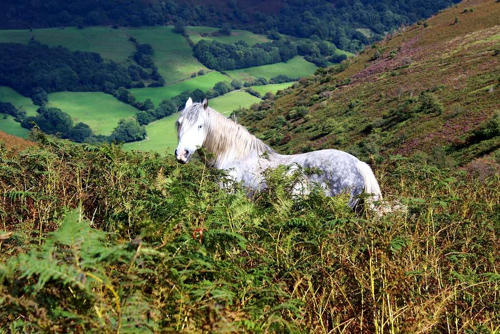
We followed the way up through pastures and farmland cattle onto the ridge and Hatterrall Hill itself. Here, the environment is one of grass and bracken with herds of sheep and the local wild ponies grazing across the hillsides.
Above us, we watched Buzzards catching thermals and wheeling upwards on the warm air. (Later in the day we identified a Red Kite – our first of many for the trip.) Although it was warm in the sun, the north wind made it seem much cooler when it caught us as we walked into it.
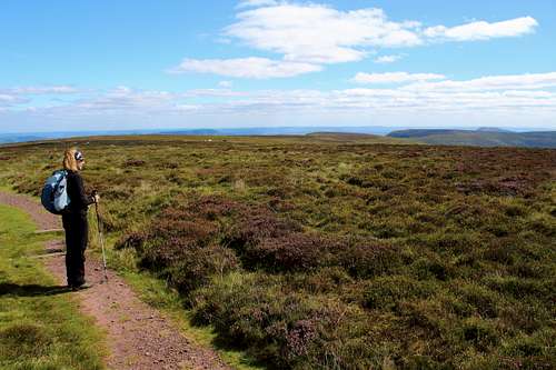
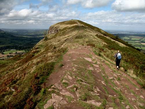
Once on the crest of the ridge at about 350m, it gradually rises and falls as it heads northwards. To the east we had far ranging views across green fields and farmland into England. To the west we could see across the Vale of Ewyas and into the heart of the Black mountains. We followed the path past cairns and old “Trig points” marking the heights at 442m and 552m.
The hillside was very open, so when we found an old shepherd’s shelter built from stones, it seemed a good place to stop for lunch. A few more clouds had appeared during the middle of the day, making it cooler and greyer in the shade.
This type of heathland is often very boggy, so it’s lucky that the Brecon Beacons National park, of which this is part, invest in the upkeep of the paths by placing “paving” stones in the boggiest parts to help walkers keep dry and to help prevent erosion of this endangered environment.
We knew we had to turn around at some point to re-trace our steps back to Pandy.
“Let’s go on until we get to a small top at 605m.” I said, having consulted the map.
“It should be easy to identify, a path comes up from Llanthony Priory.”
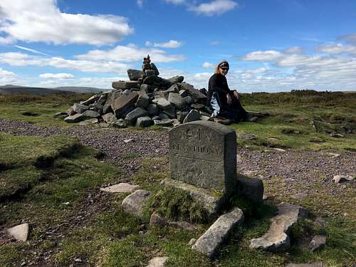
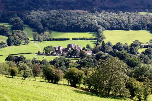
The priory is the ruin of a Norman building in the Vale of Ewyas, which fell into disuse during the reign of Henry VIII, it looks very picturesque from the surrounding hillsides. We easily identified our stopping point as the junction of the paths was obvious, there was a large cairn to mark the spot and even an old carved stone sign to point the direction to Llanthony.
We sat on the cairn stones in the warm sunshine to have a bite to eat. The surrounding heather was buzzing with bees, exploring the purple and white flowers. They started buzzing around me and as we sat there, their pestering increased. I waved my hand to try to disperse them to no avail.
“What’s the matter?” Marie asked.
“It’s the bees.” I replied. “They’re all around me.”
“Don’t worry, they won’t hurt you.” She said. “There’s none here. Are you sitting on their nest?”
I jumped up to look but there was no nest and the bees just followed me as I moved away.
We started on our return journey and after a while, the bees dispersed and I thought no more of them.
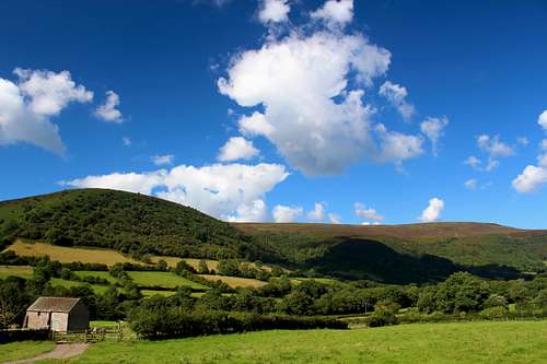
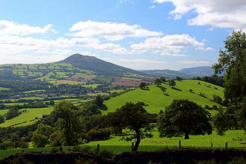
We headed back southwards in the afternoon sun, admiring the views of the Sugarloaf Mountain and Ysgyryd Fawr (aka Skirrid) standing on their own and separate from the main bulk of the Black mountains. Beyond these, we thought we could see the sun shining on the Bristol channel as the clouds began to clear.
A lovely day.
Next day was another sunny day so we drove down the long single-track road into the Vale of Ewyas and to the car park at the ruined Llanthony priory, to resume our explorations northwards.
This turned out to be a large field next to the remains of the priory with plenty of room for all the walkers that were arriving.
We picked up the footpath from the car park heading up towards Loxidge Tump (what an unusual name?) and onto the Hatterrall ridge. Soon we were back to the junction with Offa’s dyke path to continue onwards. This route was steeper but shorter than our previous day and soon we were back on the gentler path with the wide-open skies again.
The ridge here was much broader, the views further away and we met more of the local ponies grazing in the bracken than before. The weather was cloudier but still pleasant.
We had hoped to be able to walk along until we could look down on the town of Hay on Wye but that was much further than we thought.
We continued along Off’s dyke path, gradually gaining height until we realised that we were heading downhill. To be certain we had crossed over the high point of the ridge, we carried on until the path turned to the northeast and headed towards Hay Bluff. Then, we turned around to retrace our steps again. After walking for a few minutes, we saw a small pile of stones near the path and decided this must be the 703m point, the high point of the ridge. We expected a more prominent marker but that was all we could find.
Our plan had been to descend into the Vale of Ewyas and head back along the valley bottom. Although we found the start of the path, we lost it in a rough, open bog on the side of the hill. Consequently, we returned to Offa’s dyke path to repeat our outward journey.
Overall, we think we walked about 12 miles of Offa’s dyke path over these two days – most of it twice.
Next day we were back at the same starting point. This time we headed to the west side of the Vale of Ewyas, to a point shown on the map as Bal Bach. As we set off, the hillside was covered with wild flowers which attracted large “Red Admiral” butterflies and bees. Higher up, the bracken and wild ponies returned.
At Bal Bach, we turned north again and followed the track along the ridge towards Bal Mawr at 607m and later, Chwarel y fan at 670m. This ridge runs roughly parallel to the Hatterrall ridge and is a little higher.
Eastwards, the Hatterrall ridge looked endlessly long and further west we could see Waun Fach, at 810m the highest point of the Black mountains.
The hillsides were covered in a whole palette of both rich and pale autumn colours. From the deep green of the Conifer forests, the muted green of the grass, yellow flecks of Gorse flowers, burnished browns from the bracken and every now and then, a soft mist of purple from the heather flowers.
After a stop for some lunch, we continued northwards. There were more clouds in the sky today which caused periods of sunshine and then cooler shade.
As we passed the Grwyne Fawr reservoir, we watched a Kestrel hovering and swooping down on its prey. As the sun came out, I realised that the bees had returned to pester me!
We continued in warm sunshine and the swarm of bees around me got worse. We got to the cairn at Twyn Talycefn and stopped. I was waiving my arms around like a madman. The bees were all around me but none of them landed on me or stung me. Marie had no problems – even when I stood next to her to try and tempt them away!
I took off my shirt and left it with my rucksack on the ground but it was still me they wanted.
We turned around at this point… and the bees followed. Then, after about 40 minutes of sunshine, the sun went behind a cloud. Within a minute the bees had gone! They had lost interest in me and returned to the heather flowers. It was only then I realised that when this had happened two days previously, it had also been while the sun was shining. I have not experienced this before and I have no idea why I was so attractive.
At the stone known as the “Blacksmith’s Anvil”, we descended into the valley towards Capel – y - ffin and found the path at the bottom of the hill, heading back towards Llanthony. This was well signposted but went in and out of waist high bracken which was really hard going! Also, in several places, as the path was at the foot of the ridge, the ground was a sodden bog with the occasional stream to emphasize the wetness.
This route seemed a lot longer than our original high-level route and (just for reference) we should have taken the path at Ty – cwm down to the road and back to Llanthony on the tarmac. Instead, we stayed on the footpath which deteriorated into what is best described as a rocky, muddy stream which bought us down to the road.
We got back to the car at 6.00 pm. My phone has an app that measures how far we had walked, it showed as 27.9 Km – about 17 miles!
(I ought to record that Marie also has this app – her phone showed we had walked 22.4 Km - 14 miles!)
After some wet days, we decided to walk from our cottage to make the short ascent of Ysgyryd Fawr (486m) aka Skirrid. It only took us 90 minutes to walk through the fields to reach the slopes of the small hill. The most difficult part was fining the correct way as some paths seemed to be seldom used and in places, the footpath signs had been removed.
By now, the sun had appeared but the strong wind was cool. It was easy to find a way through the bracken onto the crest of the ridge and head towards the summit. Skirrid stands on its own so there was great views in all directions. The Hatterall ridge, Sugarloaf Mountain and the town of Abergavenny were all nearby but in the distance, we could see the Brecon Beacon mountains.
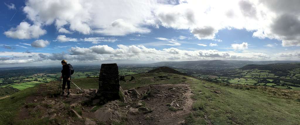
We reached the top on our own, our first real summit of the week. The weathered stones lying around are the remains of a chapel long since destroyed.
After a pause for photographs, the cool wind drove us off the top and back along the ridge to retrace our route back to our cottage. Along the way, we decided to return a different way.
We continued along a narrow road to a hamlet called Cefin, here we picked up Offa’s dyke path again. As usual, this was well marked and easy to follow and we returned to Pandy by using this.
Having been thwarted in our plan to climb Waun Fach because of a closed road, we returned, once again, on our last day to the car park at Llanthony priory in the Vale of Ewyas.
Again, we climbed up to the westerly ridge at Bal Bach but this time we turned south. For a change, we picked up the Beacons way – another well-maintained long-distance path – and met a couple of guys who had spent the night on the ridge. From their description of their night, we were glad to have been inside our cosy cottage rather than the cool, windy outdoors!
The Beacons way headed south west, then west while we continued south along the ridge. We met a few other walkers.
“It’s like Piccadilly Circus up here today!” One of them remarked.
We laughed – I think they were joking, it didn’t seem that crowded to us.
Our gentle southerly ridge ended at a place shown on the map as Twyn y Gaer, an ancient earthwork with a top at 427m. We stopped to take some photos of Skirrid and the Sugarloaf Mountain in the sunshine before our return journey. I had decided to try to complete a circuit by going across country but in the end, we elected to just retrace our steps all the way along the ridge to get back to the car. That way, we could enjoy the views over the Black Mountains with their earthy colours of green, brown and purple and say farewell to the wild ponies.
Another great walk in this area.