
-
 6702 Hits
-
 77.48% Score
-
 8 Votes
|
|
Route |
|---|---|
|
|
46.39817°N / 13.81335°E |
|
|
Download GPX » View Route on Map |
|
|
Hiking |
|
|
Summer, Fall |
|
|
Most of a day |
|
|
Medium hard hike T4/T3 |
|
|
Introduction
Crossing the summit of Bovski Gamsovec is one of the most beautiful hiking tours in Julian Alps. You do this majestic tour just in front of the face of King Triglav. Great panoramic scenery is even enriched by the wild, rocky nearby scenery, nice, blossoming meadows and herds of wild goats which have no fear of people. It can be done as a one day tour, but many hikers do it also as a part of a big trekking across the Julian Alps, coming from Vršič Pass, to Pogačnikov dom on Kriški podi and continuing into the Triglav group.
Here only the ascent route from the south on top is described. See also the sister page of the north ascent!
General Information
|
Difficulty: It's a hiking tour, with a few places protected by steel cables and pegs. On the Swiss Hiking Scale its difficulty would be graded T4/T3. The majority of the hike is T3, but there are a few short passages exceeding this difficulty grade. Steep and exposed grassy slopes in the upper part require maximum concentration. But the path over those slopes is still well beaten. Don't go over there when the slopes are wet and slippery! Those few short ferrata sections are easy (A), actually true reliefs along the otherwise unprotected route. Best season: Summer months, normally from July till October (or first snow). Do this ascent in a clear day with a good visibility! The panorama part of experience is really important. If coming in the times of mountain spring (early July), you will find the grassy slopes of Gamsovec in rich blossom! Gear: Good shoes and poles are sufficient. A helmet is always good to have. A ferrata set is recommended for less experienced. |
Tour start: The most common option is the end of the road in Vrata valley, 1000 m. Big, payable parking place there (3.5 EUR in 2015). You can do the tour also from Zadnjica valley. That means more altitude difference, as you start the tour on 650 m only.
Highest point: 2392 m.
Altitude to overcome: cca 1400 m (1750 m).
Time for ascent: 4 h 30 min from Vrata valley, 5 h 30 min from Zadnjica valley.
Route Description
Ascending Luknja Pass, 1758 m
a. From Vrata Valley
From the big parking place you continue up the valley by the road. In 5 min you reach Aljažev dom (hut), from there continue in the same direction. In another few minutes you reach the monument to fallen partisans-mountaineers. Keep right there, by the path up the valley (the path left goes on Triglav). You go by a broad path through the woods. After some 5 more minutes you reach another crossroads where you continue straight on (the path right goes to Pogačnikov dom). In the SW direction you continue by the valley, the creek of Bistrica is close on your left. So you come out of the high woods, where close to the sources of Bistrica there's another crossroads. There you keep right (a more frequented left path goes on Triglav). You gain some more altitute, then the path crosses the screes towards the right (in the W direction). After that crossing you start ascending again. The path is not pleasant any more - it's rugged, winding through the bushes and around boulders. That lasts quite some time, until you reach the screes below the western part of the Triglav wall. Now you continue up the screes - even a bit less pleasant part. But the scenery all around is great. Finally you reach a steep ravine just below the Luknja pas. Quite some danger of rock fall there! The variant by the wall is protected by a cable, but you can walk also more on the right. Do this final ascent quickly! 2 h 30 min from the parking place, overall difficulty T2.
b. From Zadnjica Valley
From the parking place you continue by the road into the valley. After some15 min the road branches and you keep by the right branch, following it almost till the end. In Zadnjica (1 h till there) the paths are branching. To the left we see a deeply cut ravine (Korita), falling from Luknja pass. But we must first continue straight and only then turn left. Now we follow the main path. Soon towards the right the path over Komar branches, but we just continue straight. A good mule track leads us in several turns above the Korita ravine. On some 1500 m towards the right branches a broad path on Dolič. We go straight again and in several turns reach Luknja pass. 3 h 15 min from the parking place, overall difficulty T2.
Luknja - Bovski Gamsovec
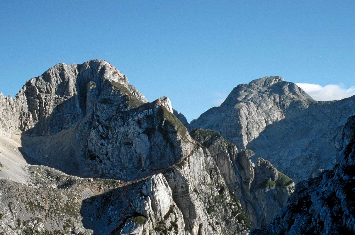
From Luknja we continue the ascent northwards. The path keeps a bit left, below the main ridge. We are crossing a karst terrain between Gamsovec and Pihavec. Shallow valleys and crossing some more steep slopes interchange. A bit above the path goes across a limestone plate. Even if there's only a meter or two of depth below us, the passage is protected by a cable. Then we continue by a shallow valley towards the summit. The path starts keeping right, but doesn't reach the main ridge. There are a few rock walls which the path detours left. So it reaches the lower part of the big basin between Gamsovec and Pihavec.
 Gamsovec from the S |
From the end of it the ascent right on the main ridge would be very steep, so the path goes already in the beginning right. By a narrow ledge it crosses right around the corner. Even if the path is well beaten and broad enough, be careful there, because the steep grassy slopes are ending below in abysses. After crossing, the path starts ascending over very steep grassy slopes - up the ridge. Again much care is needed there. Only after crossing the slopes of a distinct ridge bump, the path gets aeasy, flat and comfortable. That broad grassy ridge brings us below the summit dome. In a few turns the path ascends by the grassy slope towards the top, but then starts avoiding the summit rocks towards the right. It becomes narrow and exposed again. Over a grassy and more and more rocky terrain we gain altitude, then cross right again and there only meet the protection cables. The crossing is very exposed, but due to protection devices safe. In crossing we pass the summit and only on the place where the northern route comes on the summit ridge, we turn left. Over a few rocky steps (pegs will help us) we climb on top. From Luknja pass 2 h, difficulty T4/T3.
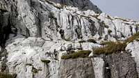
 Across steep grassy slopes |
 The summit dome |