
|
|
Area/Range |
|---|---|
|
|
45.24821°N / 24.10125°E |
|
|
Hiking, Mountaineering, Sport Climbing, Scrambling |
|
|
Spring, Summer, Fall, Winter |
|
|
6184 ft / 1885 m |
|
|
LukZem Video
Overview
 |
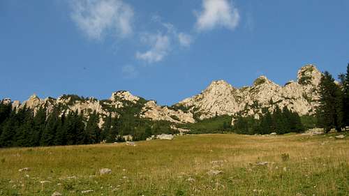
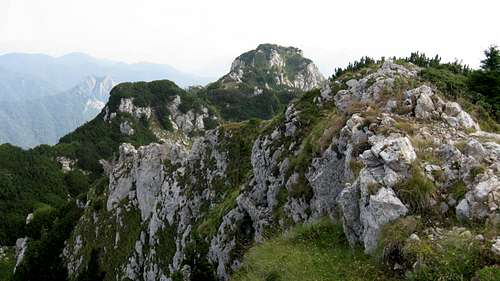
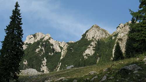
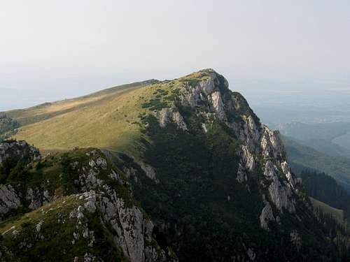
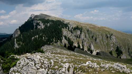
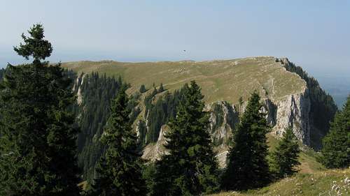
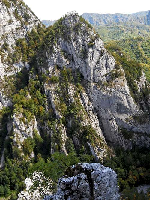
The Buila-Vânturariţa massif, a conspicuous ridge of the Căpăţânii Mountains sitting in their south-eastern part south of the main ridge and stretching from NE to SW for approximately 14 km, does look odd against the background of the bulk of the mountains, which are one of the major components of the Parâng group (which in turn comprises a major unit of the Southern Carpathians). Most of the main ridge of the Căpăţânii as well as their lateral ridges west of Buila are made up of metamorphic rocks. This results in a rather monotonous, fairly gentle relief. In contrast, the Buila-Vânturariţa ridge is made of limestone, which yields a jagged skyline, rugged cliffs and a plethora of karst features. In fact, the whole northwest side of the crest is cliffy, whereas the eastern slopes are gentler.
 |
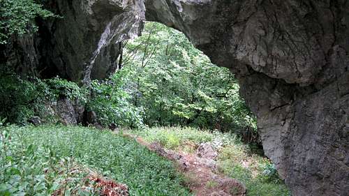
The northeast end of the Buila-Vânturariţa massif is demarcated by the upper reach of the River Olănești about 3 km south of the main ridge of the Căpăţânii Mountains, where the river has its source. The northeast part of the Buila-Vânturariţa massif, cut off from the Buila-Vânturariţa ridge proper by a spectacular gorge of the River Cheia, is dominated by Stogu (Haystack) at 1494 m.
At Claia Strâmbă (1379 m), on the southern side of the Cheia gorge, begins the Buila-Vânturariţa ridge proper with its numerous summits, of which the most distinctive are: Vânturariţa II/Mică at 1655 m, Vânturariţa I/Mare at 1885 m (the highest peak), Vioreanu at 1866 m, Stevioara at 1847 m and Buila at 1849 m. The relief is most varied in the northeast. The main ridge trail between the pass known as Curmatura din Oale and the summit of Vioreanu is very poorly waymarked, difficult to follow and recommended to experienced scramblers. The path descends the gullies and winds through shrubs resulting in problems with orientation. Beyond Curmătura Builei (Buila pass, 1540 m), at which the characteristic crags of Hornurile Popii stand guard, extends the southwest stretch of the main ridge, which tops out at 1643 m. Past that point (Vârful Piatra), the relief is becoming more and more monotonous. The southwesternmost segment of the Buila-Vânturariţa massif, between the gorges of the Costeşti and Bistrița rivers, is called Muntele Arnota and does not exceed 1184 m.
The table below lists most of the major summits of the Buila–Vânturariţa massif.
| A few words about | |||
|
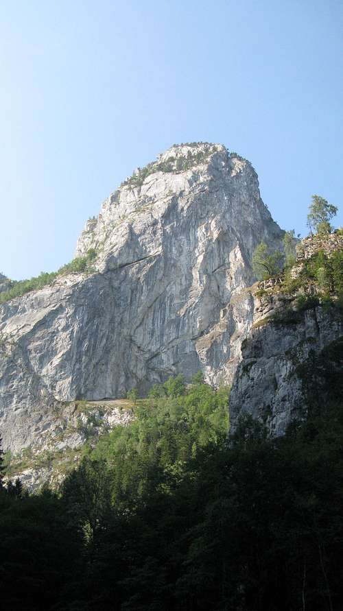
The highest summit with a sheer drop on its W face. It stands 2 km NE from the Buila pass, on the main ridge. It is reached by a red dot trail. | ||
|
The 2nd highest summit, about half a kilometer NE from Vânturariţa Mare. It can be climbed via an unmarked path, difficult access. | ||
|
It has a craggy NW face. In the central part of the main ridge, about 1 km NE from the Buila pass. A red dot traverse. | ||
|
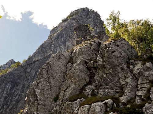
Like pretty much of the main ridge, the summit has a precipitous, cliffy NW face, which contrasts sharply with the gentle, grassy SE slope.It stands in the central part of the main ridge, about 1 km SW from Vânturariţa Mare. A red dot traverse. | ||
|
Isolated cliffs dotted with spruce trees.In the central part of the main ridge, just half a kilometre NE from the Buila pass. Red dots. | ||
|
In the southwest stretch of the main ridge, opposite Albu across the Buila pass. Red dots. | ||

|
This crag stands off the main ridge, about half a kilometer to the SSE from the Buila pass. It is reached by a blue cross trail. | ||
|
A vertical limestone wall towering almost 400 meters above the bottom of the Cheia gorge.In the NE part of the main ridge. An unmarked path to the top. | ||
|
A wild, forested jumble of crags opposite Claia Strâmba, on the NE side of the Cheia gorge. A yellow cross traverse. |
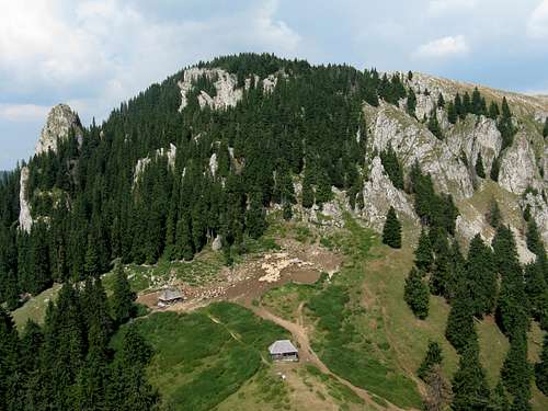
 The House of Rock
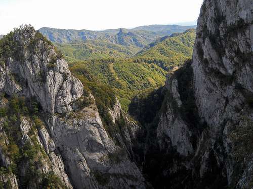 Cheia Gorge from Fotoreporter Ridge - photo by andreeacorodeanu
Rock Climbing


|
|
Getting There & Maps
Road access to the Buila-Vânturariţa massif is possible from the south – details are tabulated below.| Access routes | Trailhead at | Marks | Destinations |


However, the trekkers who want to explore other parts of the Căpăţânii Mountains as well may find it convenient to reach the Buila-Vânturariţa massif from the north. To do so, you can leave the main ridge of the Căpăţânii at the summit called Gera and descend via a lateral ridge that trends southeast towards Hădărău pass at 1308m, beyond which rises Stogu – the northernmost landmark of the Buila-Vânturariţa massif. Another place where you can leave the main ridge to head southeast for the Buila-Vânturariţa massif is Zmeuret pass (south of the village of Malaia).
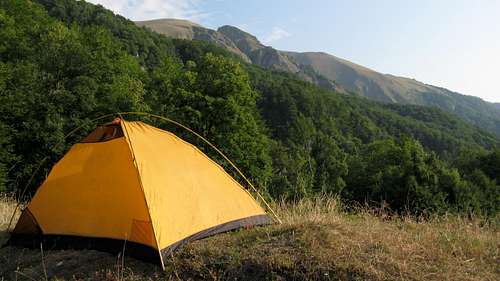
Red Tape & Camping
|
Since 2004 the Buila-Vânturariţa massif has been protected as a national park. The visitors are supposed to pay a small entrance fee, stick to the waymarked trails and camp at designated places. More information about the regulations and plenty of other information about the park is to be found on the park's website. |

|
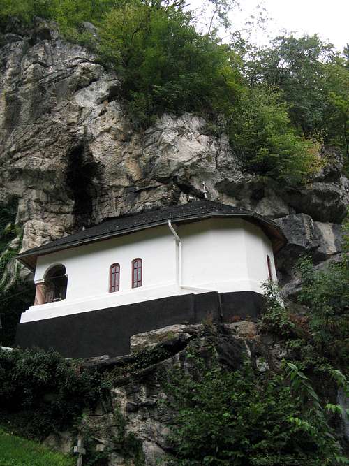
Sacred/Historical Sites
On the southeastern slopes of the Buila-Vânturariţa massif, on the outskirts of the national park, sit the Pahomie and Pătrunsa hermitages. A number of interesting Orthodox Christian monasteries can be found in the nearby villages.
|
Here is an excerpt from the book Communist Genocide in Romania written by Gheorghe Boldur-Lăţescu:
Known only by a few people – local villagers, shepherds and the nuns from Iezer Monastery – Pahomie’s monastery represents a unique historical place in Romania as it played an extraordinary role in bringing together the Christian faith and the anti-communist armed resistance for almost a decade in the mountains of Oltenia.The locals tell the story of a monastery that was built in the 18th century by an outlaw who wanted to pay for all his sins by establishing a sacred place to pray. The monastery had been destroyed by a fire, but was rebuilt at the end of the 19th century as a property of the Iezer Monastery. The exceptional prestige this place is known for among the people who live in the northern part of the Vâlcea County is due, however, to Iosaft – a monk who lived 45 years of solitary life at Pahomie until his tragic end in 1987.
|
|


