
-
 6126 Hits
-
 78.27% Score
-
 9 Votes
|
|
Canyon |
|---|---|
|
|
46.18937°N / 12.20117°E |
|
|
Hiking |
|
|
Spring, Summer, Fall |
|
|
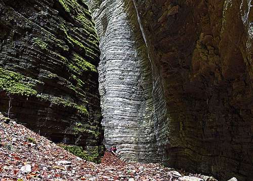
Bus del Buson gorge
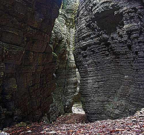
Bus del Buson canyon
Bus del Buson amphiteater
The origin
Bus del Buson is a 'relict' canyon, created by torrental waters during the last ice ages. Supposedly the whole area was lying under the glacier, which was stretching at that time down to the valley of Piave. Under the ice, torrental waters were carving the canyon through rock layers, called Biancone (deposited in seas in the lower cretacious era, some 100 million years ago). Later a landslide closed the creek path, so Ardo was forced to find its way a few tenths of meters eastwards, and it is still today carving the gorge there. So, Bus del Buson is a kind of 'fossil' canyon, 'abandoned' by its creator.
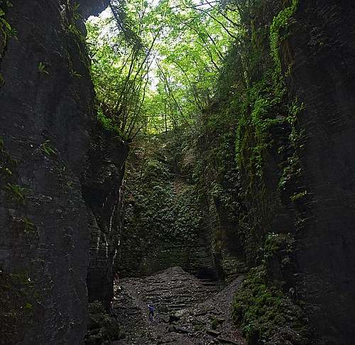
Ardo creek
The creek is some 16 km long, along its banks interesting geology is displayed - from the pure dolomia principale in the upper parts, through the various more recent limestone rocks in the lower parts, till flysh and molasse at the exit. In the upper part, many ravines are gathering waters from the southern slopes of Schiara, then below those junctions the creek is formed. It flows southwards by a spectacular, deeply carved valley, forming ponds and smaller cascades. Some places can be reached by narrow (some also very exposed) paths, other places are known only to experts. Besides the creek itself, the two most famous places in its valley are Bus del Buson and Pont de la Mortis (also: Mortiss). The latter is a narrow groove, where the creek cut its way through picturesque layers of 'Scaglia Rossa' rocks. The place can be easily visited - good path till the bridge.Col de Buson archeologic site
The nearby place, called Col de Buson, revealed a settlement which was inhabited from the Neolithic era, respectively from the second half of 5th millenium BC. The majority of artifacts is from the Copper Age. The settlement had a defense role, controlling the valey, but there are also signs of a cult place. In addition to home made items (some 20.000 of arrow points), artifacts were found proving trade connections of those people with people from far away - with Carpathian-Danubian area and especially with people, living in Ljubljana marsh. The more recent ceramic artifacts are from the early bronze age.Getting there
From Belluno drive northwards into the Bolzano village and further through the Gioz village into the valley of Ardo. A narrow asphalted road gets you to Case Bortot, where you can park (46.182608, 12.195153). That's also the southern trailhead for the Schiara Dolomites group - for the Rifugio VII Alpini. |  | <-- The trailhead: Case Bortot |
How to visit?
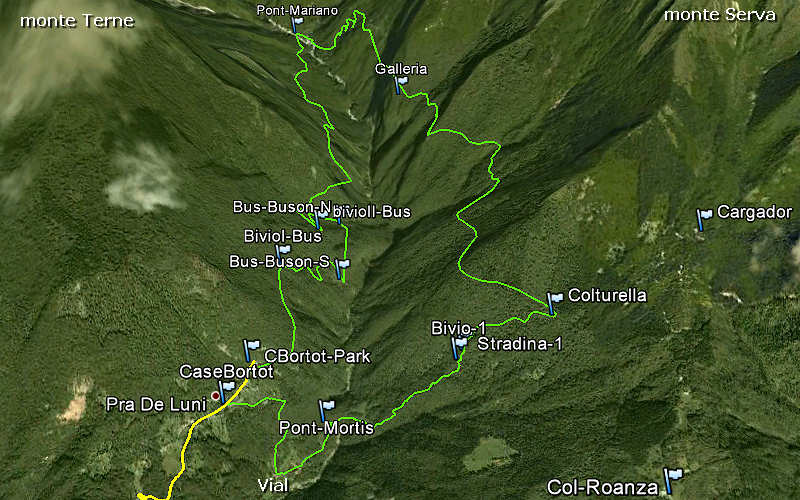
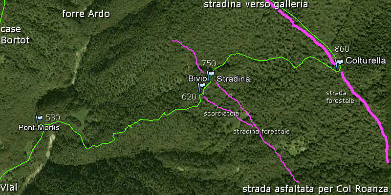
Shortest route
Easy path T2/T1 (suitable also for children), as long as you don't leave the path. Dedicate for the whole visit 1 h 30 min. From the parking lot at Case Bortot you continue almost horizontally by a broad mule track for ten minutes. So, you arrive at a first junction, where you can descend steeply right down towards the creek bed. But if you intend a round tour visit (recommended), then don't go down, but just continue a few hundred meters, and go down on the second junction. Good, broad path brings you down just to the canyon mouth. Enter the canyon there, pass comfortably through it and exit on the other side. To return, you must now steeply ascend up - some 100 meters - to the first junction.
 In Bus del Buson | 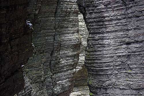 A symphony of rock layers |
Round tour
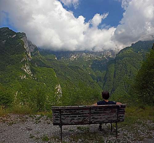
Schiara group from above the Ardo creek canyon

Borgo di Vial

On the mountain road

Pont de Mariano
 |  |
Parco Dolomiti

Water source
The Pont de la Mortis legend
It is said that old people were calling "Mortìs" the hole, formed by Ardo creek, due to the mysterious facts that there lived the 'devils', the souls of people who were guilty of crimes or who had died violently. Under the bridge the devils were playing and due to warmth of their body, the Ardo water evaporated, forming a dense fog.External links
1. Cartina Bortot (in Italian).2. Magico Veneto (in Italian).