
-
 6355 Hits
-
 73.06% Score
-
 3 Votes
|
|
Route |
|---|---|
|
|
28.35349°N / 16.48078°W |
|
|
Hiking |
|
|
Spring, Summer, Fall, Winter |
|
|
Most of a day |
|
|
Hike |
|
|
Overview
 |
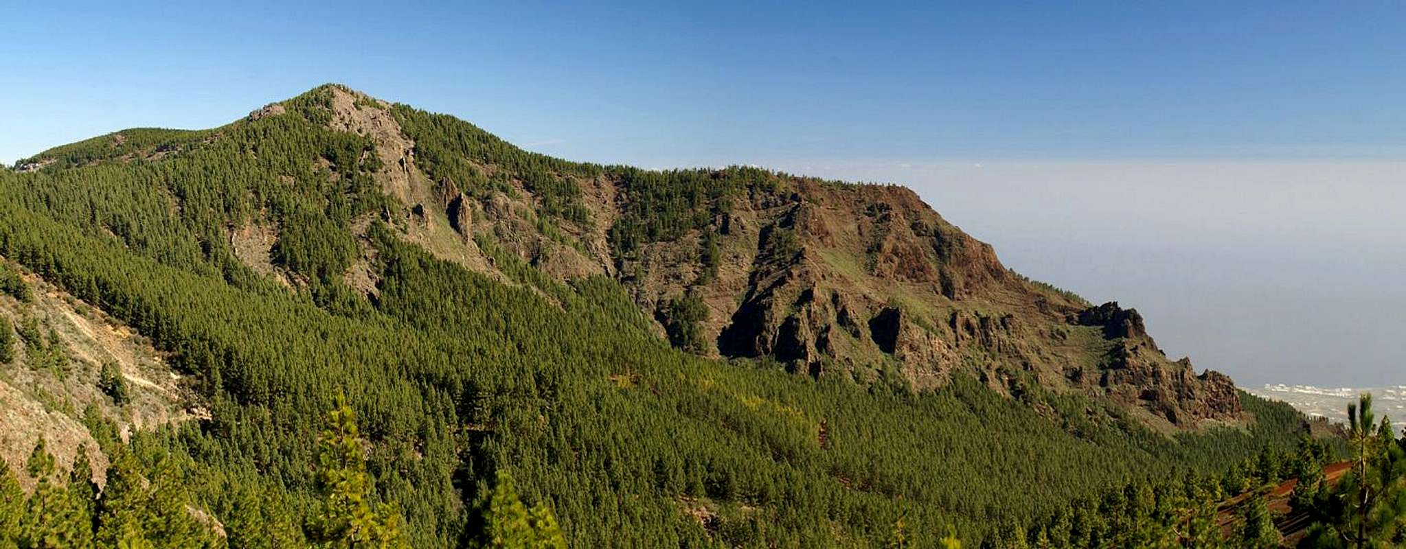
Camino de la Candelaria is a pilgrimage trail, which runs from the north coast of Tenerife to the Sanctuario of Candelaria in the south of the island. It follows age old trails which have been established in pre-Hispanic times by the original inhabitants of the Canarian Islands, the Guanches. The pilgrimage trail scales the Cumbre Dorsal Range approximately in its middle, at the Crucita Saddle (Degollada de la Crucita), which is overlooked by the summit of Montaña la Crucita.
Today the pilgrimage trail is still in use, especially during the Canarian holidays, but also at all times of the year by sincere tourist hikers. While the routes up to the Cumbre Dorsal Range are quite easy, they still scale about 1000m of elevation from Aguamansa in the north and 1600m (!!!) of elevation from Arafo in the south.
The southern route starts in the town centre of Arafo and follows roads up the mountain to the outskirts of the town. From the last houses a steep trail leads through a narrow but shallow valley to the base of Montaña de las Arenas, the site of one of the last eruptions on Tenerife in 1709. From there it leads through more or less dense pine forest directly up to the Crucita saddle. The topmost part – like on the northern side of the range – runs through brightly red tuff slopes and is worn down by pilgrimage wear.
|


Getting There
Follow the instructions on the main page which lead to Arafo. The trailhead is right in the centre of the town though you may also look for parking space higher up on Camino de la Candelaria.Route Description
  |
- Start altitude: 463m
- Summit altitude: 2054m
- Prevailing exposure: S
- Type: 4h one way
- Protection: None
From the town square of Arafo follow the road, which runs straight up the slope in direction of the Cumbre Dorsal Range. It is rather steep and narrow and will turn even steeper higher on. The road leaves the densely populated town behind, passes an old water mill to its left, and heads up into the scarcely populated fields an vineyards north of Arafo. It swings west and north (look for signs “Camino de la Candelaria”) and finally reaches the last houses of Arafo. Take care! These houses are guarded by fierce watchdogs – Dobermans and German Sheperds. Don’t get too close to the enclosing fences.
From the last houses of Arafo a narrow valley path leads up the slopes, accompanying an irrigation pipe. The path soon enters a beautiful forest of huge Canarian pines, the long needles of which form a perfect soft carpet underneath your feet. After a number of steep switchbacks you walk out into a desolation, which was created by the 1709 eruption of Montaña de las Arenas, a perfect volcano cone looming up above you to the north. Today there grow chestnut trees out of this desolation – a dire sight in winter when they look like real skeletons.
Montaña de las Arenas is passed on its eastern side, either by a straight and steep trail through the volcanic cinder, or by a dirt road which runs back and forth east of the mountain. Soon the summit is lost among the pines through which Camino de la Candelaria runs. Later, in the upper parts of the route, the forest grows thinner, later vanishes altogether. The path runs along reddish or red slopes until it reaches Degollada de la Crucita (the Crucita Saddle). Turn west for a couple of metres and head on up to Montaña la Crucita by an overgrown path. The best views can be seen some 50 – 100m north of the summit.