
|
|
Mountain/Rock |
|---|---|
|
|
46.25907°N / 8.77273°E |
|
|
Hiking, Scrambling, Via Ferrata |
|
|
Spring, Summer, Fall |
|
|
7411 ft / 2259 m |
|
|
Overview
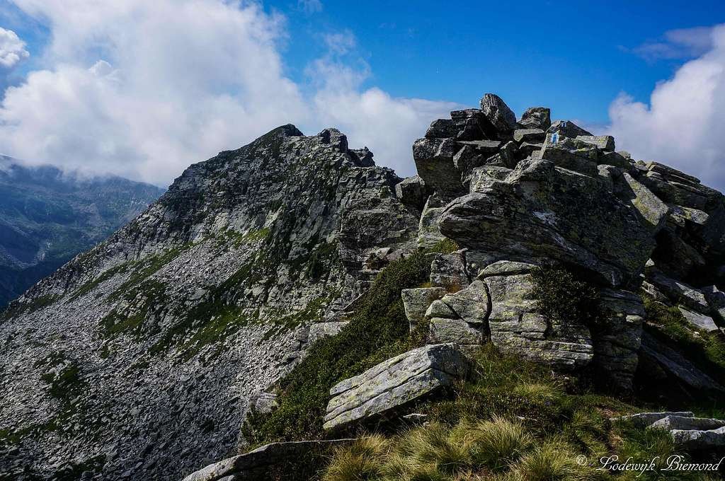
Cima Böis (2259m, N-ridge) as seen from the saddle with Madom da Sgiof
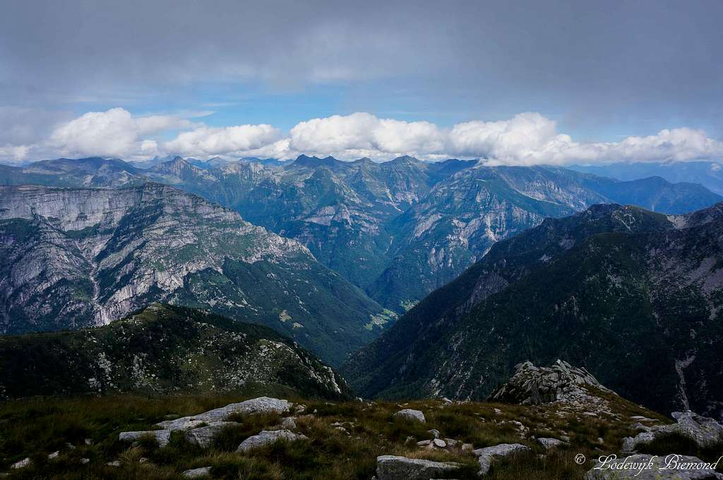
Cima di Nimi is a wild and lonely peak located in the heart of the Ticino Alps, situated on the ridge that separates the beautiful Verzasca and Maggia valleys. Cima di Nimi is one of those lonely peaks that requires a very long ascent in order to reach its summit. Wherever you start, the altitude gain is at least 1500 vertical meters (5000 ft) and a single day climb is only for those who are very fit. You will not encounter many people while climbing this beautiful peak.
Cima di Nimi appears to be a major peak when viewed from the south, but in reality Cima di Nimi (2191m) is the point where the SW and S-SE ridge meet each other. The highest point of this peak is somewhat more to the north and is officially known as Cima Böis (2259m). A small ridge , from South to North, connects the two points. Although Cima Böis is somewhat higher, Cima di Nimi is the better known peak in the area. The peaks are somewhat bound together and this is the reason to put both of them together on this SP-page. From now on I will mention only Cima di Nimi when referring to both peaks.
 Summit view into the Verzasca valley | 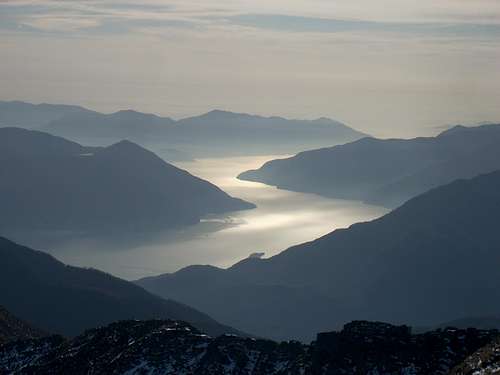 Lago Maggiore from Cima di Nimi by gmonty |
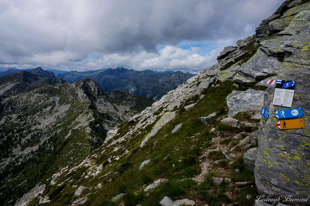
Cima di Nimi is located almost halfway on the mountain ridge separating the Maggia and Verzasca valley’s. Over the whole extent of this ridge goes a classic and famous trail called the Via Alta della Maggia, which translates more or less into: Maggia valley’s old trail. This trail, better decribed as a high alpine trail, follows the entire ridge from south to north passing many summits like Cima della Trosa, Madone, Cima di Nimi, Madom da Sgiof, Cima del Masnee and Poncione Piancasia to name a few. The route is graded T4+ and requires 6 days to complete. Whether coming from north or south, which are the two access routes on the mountain, climbing Cima di Nimi always requires climbing a part of the Via Alta.
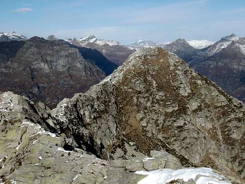
The sharp North ridge to Cima Bois; The Climbing on the ridge is fun
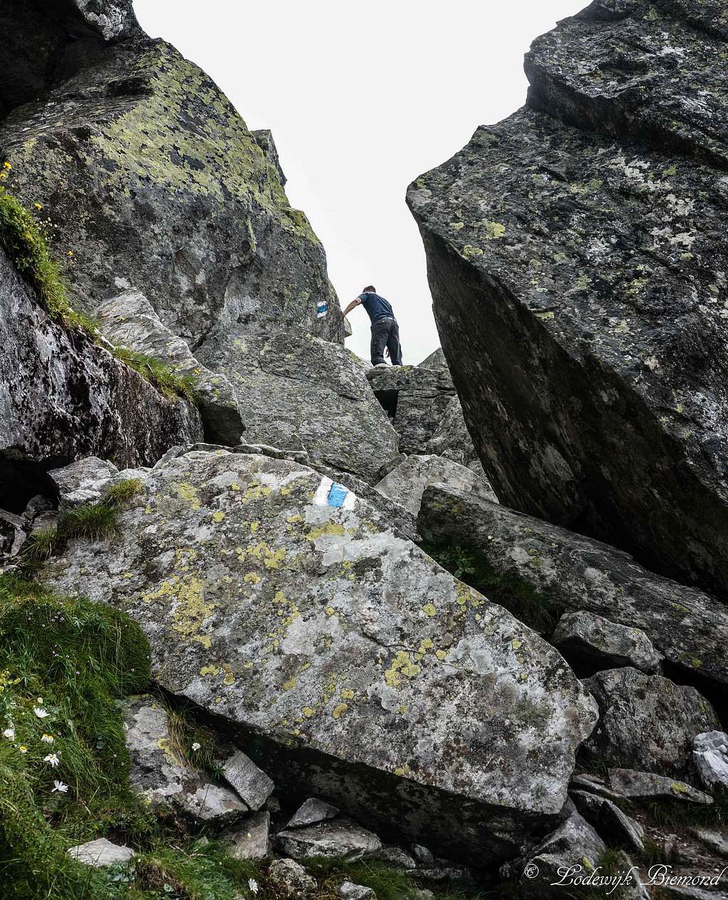
The easiest ascent route of Cima di Nimi is graded T3+. This route starts from the Maggia valley and goes up to the Rifugio Alpe Nimi and further along the South ridge to the summit. Although long, this is the easiest way to access the mountain. The other route starts from the Verzasca valley (Brione) and goes up to the scenic Rifugio Starlaresc. From the Rifugio the route passes just underneath Madom da Sgiof and over the ridge to Cima Böis and Cima di Nimi. This route is graded T4+ because of the ridge that separates Cima Böis from Madom da Sgiof. This ridge is, on the most difficult parts, secured with cables and/or steps (Via Ferrata), but involves some (fun) climbing. This is also one of theharder parts of the entire Via Alta della Maggia.
Another option for climbing Cima di Nimi is of course to do the Via Alta starting from south. On the second day you will pass Cima di Nimi. Whatever route you choose, prepare for a long day /multiple day outing in one of the most rugged and untouched places in the entire Alps.
Routes
I from Val Verzasca
 N-ridge I | 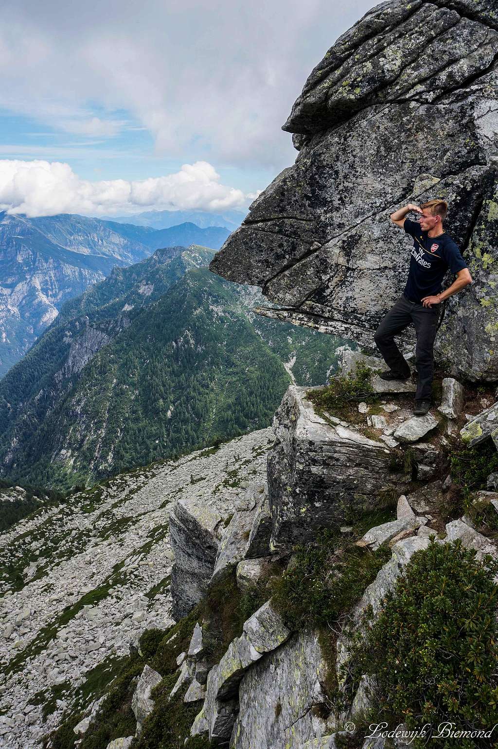 N-ridge II | 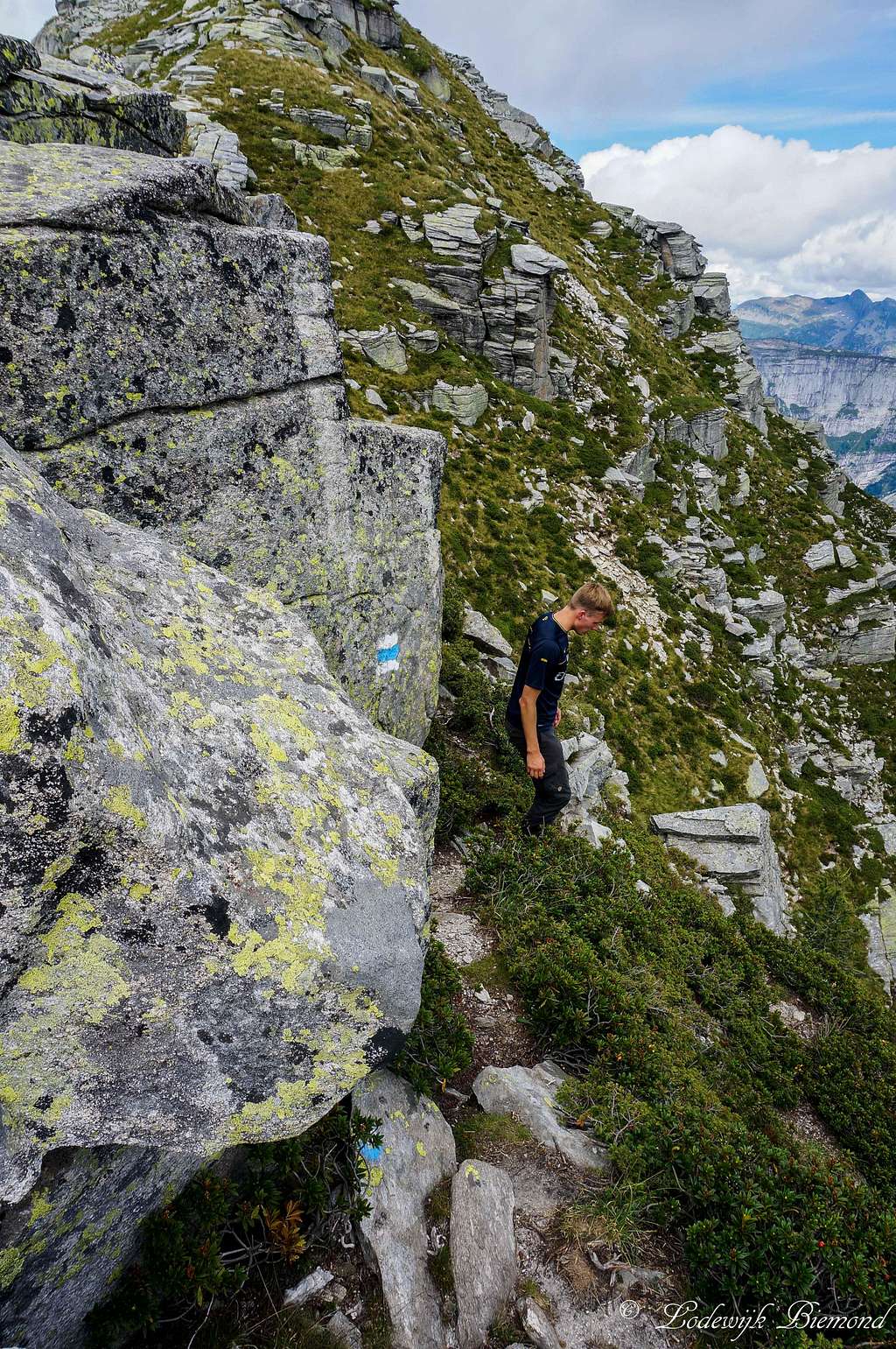 N-ridge III |
The route starts near Hotel/Restaurant Piee, which is located just outside Brione, a small village in Val Verzasca. You can recognize the start of the route by the yellow signpost along the main road just west (50 meters) of Piee. Follow the trail (well-marked, T2) towards ‘’Piano del Vald’ and ‘’Capanna Starlaresc’’. After about an hour and a half, or an hour if you are fast, you will reach Matar (1304 meters), recognizable by the yellow signpost. Shortly after passing Matar , there is a split-up in the trail. The red-white-red trail continues in straight line, but a white-blue-white marked route branches off to the right. Both routes meet up at the Capanna Starlaresc, but the white-blue trail gets you there much faster. If you take the red-white-red trail, the trail keeps heading through the forest until you reach Alpe di Sgiof and eventually Mottaruch at 2011m.
 Cima Bois (2259m) as seen from the N-ridge | 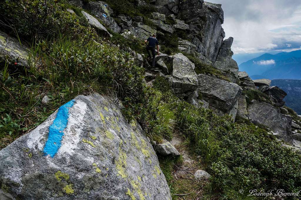 on the Marked Trail |

Route Map from Brione / Val Verzasca
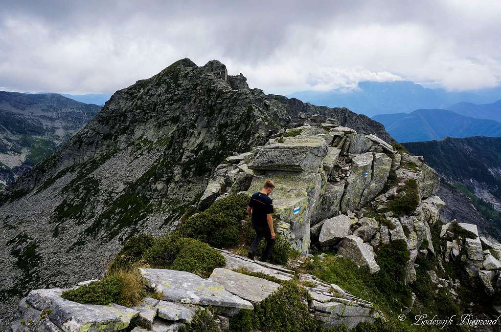
At the base of Madom da Sgiof there is another junction. The yellow signpost leads to the summit of Madom da Sgiof. The blue one indicates the Via alta della Maggia and goes to Cima di Nimi. Follow this route. Soon the route becomes more challenging and the climbing starts (T4+). The climbing is fun and the route is well-secured at the most difficult/airy parts. After about an hour you will reach Cima Böis, the true highpoint and from here a small ridge continues to Cimi di Nimi over easy terrain (T3).
II from Valle Maggia

Route Map from Gordevio / Maggia
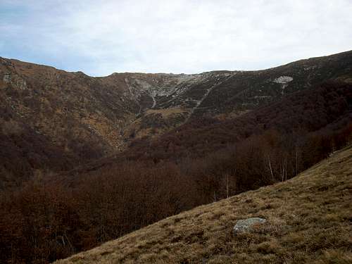
Cima di Nimi from Alpe Brunescio
III Via Alta della Maggia
On the Via alta della Maggia
Mountain Huts
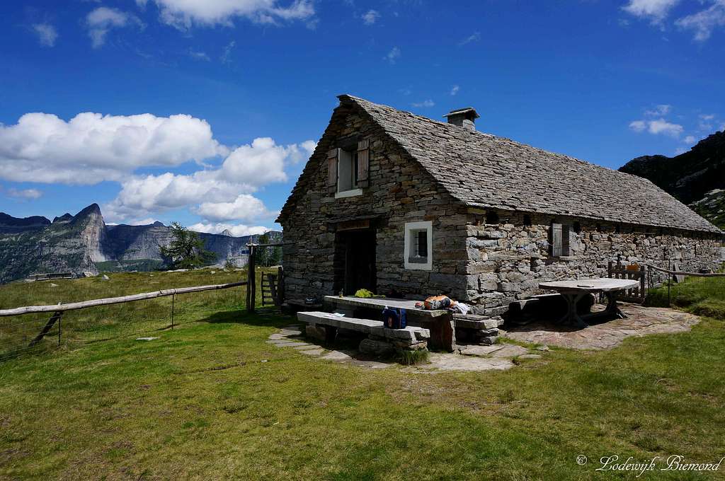
I Rifugio Alpe Nimi
Rifugio Alpe Nimi
Altitude: 1718m
Owner: Patriziato di Gordevio
Guardian: Pietro Zanoli ; pietro.zanoli@bluewin.ch
Phone number: +41 79 230 48 79
Beds: 16
Costs: CHF 25,- a night
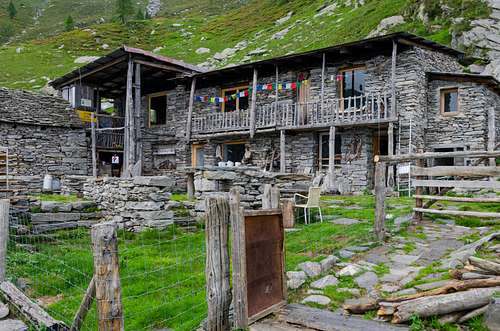
II Capanna Starlaresc
Capanna Starlaresc da Sgiof
Capanna Starlaresc da Sgiof is a very nice, unguarded mountain hut situated next to the lake carrying the same name. The hut provides all basic supplies like matrasses, blankets, a stove etc.
Reservation is not neccessary. You should bring some money to leave behind when spending the night.
Altitude: 1880m
Owner: Compadroni Starlaresc
Guardian: Raffaele Scolari ; raffasco@bluewin.ch
Phone number: +41 (0)91 745 64 02
Beds: 10
Costs: CHF 15.– / EURO 12.– a night
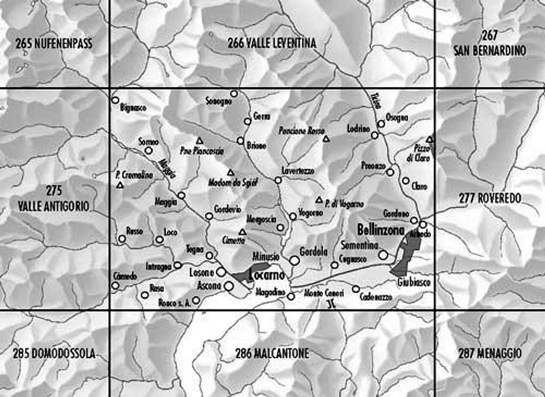
How to Get There
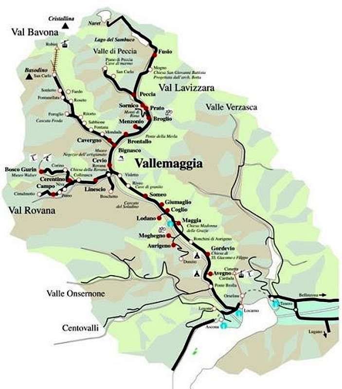
Vallemaggia MAP
Verzasca Route:
The A2 highway crosses Switzerland from north to south. On this highway take exit 47 'Bellinzona- Sud'
Now you are on the secondary road no. 2. Follow the signs to ''Locarno''
Before reaching Locarno Val Verzasca will appear on the road signs. Follow these signs until you reach Val Verzasca.
In the Verzasca valley is only one major road. Follow this road and you will first pass the village of Vogorno, than you will pass Lavertezzo and the 3rd major village is Brione. The route starts just before the actual village at Restaurant Piee, which can be recognized by the parking space in front of the Hotel/Restaurant.
A Route Planner to Brione (Restaurant Piee) on Google Maps can be found here
Maggia Route:
On the A2 highway you also take exit 47 'Bellinzona- Sud'. Now you are on the secondary road no. 2. Follow the signs to ''Locarno'' After a few miles you will reach highway no. 13 which leads to Locarno. Keep on this highway until you are in central Locarno. Eventually the signs 'Valle Maggia' will appear. Take this exit ''Via Locarno'' and keep following the Valle MAggia signs. This will lead you straight into the Maggia Valley. After passing the small town of Avegno you will enter first the village called Gordevio and soon after Maggia. Both are starting points for the route.
A Route Planner to Gordevio/ Maggia on Google Maps can be found here
When to Climb
Madom da Sgiof from Cima Bois by gmonty
The best time to climb Cima di Nimi is anywhere between May and November. It is possible that in Spring or Fall snow is present on the mountain. This will increase difficulties, especially when ascending the mountain from the North. So be sure to check the local conditions. It is advisable to climb without snow present on the mountain unless you have the proper experience. Whatever season you choose, there won't be many people on the mountain.
Maps & Books
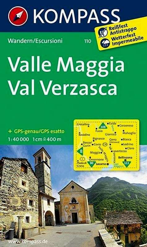 |  |
Kompass Map WK110 Valle Maggia ValVerzasca
Scale 1:50.000
ISBN13: 9783854913368
Bundes Landkarte (BLT) 276
Scale 1:50.000
| ISBN13 : | 9783302002767 |
Hotel & Camping
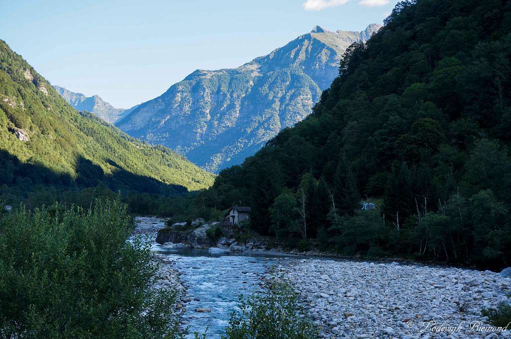
Verzasca River from Brione/ Piee
Campings in Ticino can be found on: Camping search
Personal Favourite: Camping Al Censo, Claro
Camping Al Censo
For hotels and other places to stay:Visit the Major cities: Bellinzona, Lugano or Locarno
Hotels
Personal Favourite: Camping Al Censo, Claro
Camping Al Censo
For hotels and other places to stay:Visit the Major cities: Bellinzona, Lugano or Locarno
Hotels
A good option for a hotel is Hotel Piee, since it is located directly at the starting point of the Verzasca Route up to Cima di Nimi.
Weather
This link leads to the weather in the Verzasca/Maggia area:weather Cima di Nimi by Ticino.ch
Panorama
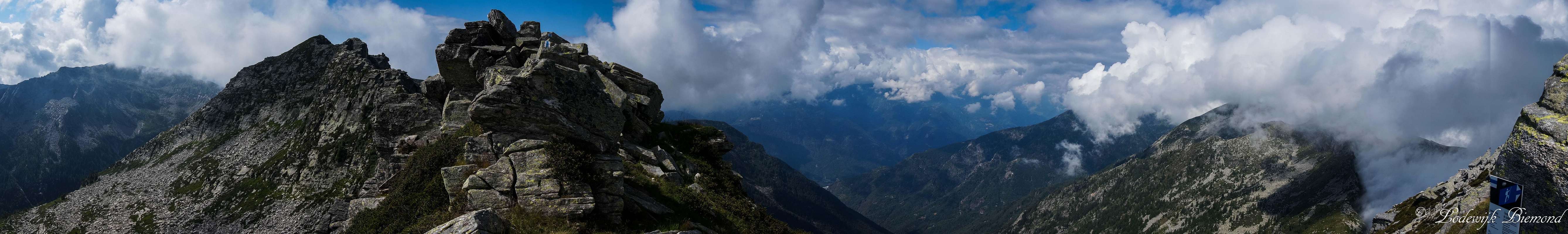  Cima Bois / Cima di Nimi Panorama from the Madom da Sgiof saddle; The large valley is Vallemaggia |