How It Began
I recently started dating this girl that goes to school in Tucson, Arizona. I have explored quite a bit of northern Arizona, but didn't really have much experience down in the southern part of the state. I guess this was because I mainly thought that the "goods" of adventuring were in northern Arizona. I had first heard of Baboquivari Peak awhile back while browsing around on Summitpost and from a friend of mine that had climbed it. Now, having a girlfriend in Tucson would give me a reason to climb it. Better yet, she was pushing for it as well.
So on March 9th I drove down late at night from Flagstaff and hit the Tucson bars with her. Saturday, we ended up sleeping in quite a bit (for obvious reasons) and then ended up climbing on Mt. Lemmon. We turned in early that night and opted to wake up at 4am to do the drive to Babaquivari Campground. Being less then 20 miles from the border, I was not about to camp out. I was a little nervous about all the illegal activity in the area, but decided to do it anyways. We settled upon doing the Southeast Arete (5.6+) and decided to approach it from the west.
The Approach
Finding the Baboquivari Campground was easy using the directions on
Mountain Project. We got to the trailhead at 6:45. We began trying to locate the start (we had parked at the far eastern part of the campground). It wasn't apparent, so I asked some dudes who had just woke up in the campground because they looked like climbers. They started pointing in NW direction at a big dome/peak and talking about the trails to it and the climbing, but it was in the opposite direction of where we knew Baboquivari was. They were obviously confused as too where Baboquivari was located, so we ended up not taking their advice. We ended up finding the trail a few minutes later just up a hill to the south of where we parked. We started hiking at 7am.
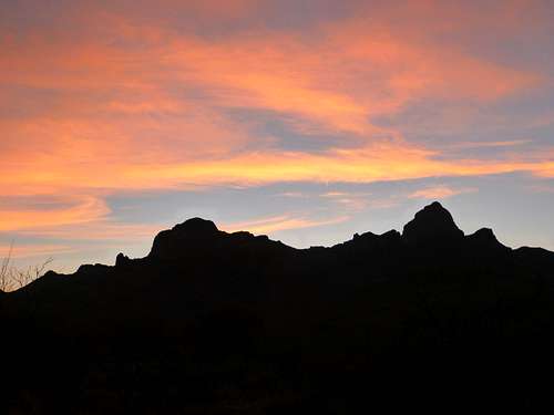
![Baboquivari at Sunrise]() Baboquivari in its pre-dawn glory
Baboquivari in its pre-dawn glory
The hike went really smoothly and the trail was really easy to follow. The scenery was gorgeous and it was amazing to see the relief between the mountains and the desert.
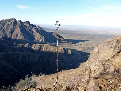
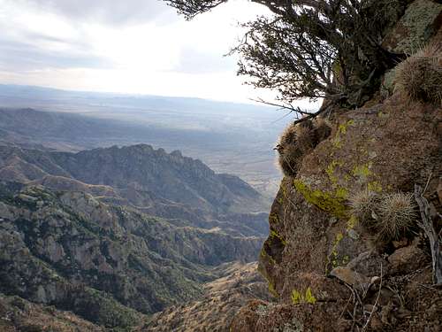
![Big Views to the South]() Awesome views along the trail
Awesome views along the trail
We arrived to the West Saddle (different from the East Saddle) around 9:30am. We were a little confused here because there was a very well defined trail that went north-south a crossed our trail. We determined this to be an immigrant/drug smuggler trail and kept moving up towards Babo. From the saddle, we could see the "Great Ramp" (not to be confused with the "Lions Ledge", which you can see from the East Saddle). This is what you want to aim for if you are trying to access the Southeast Arete from the west.
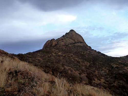
![Last View of Baboquivari]() View of Baboquivari from the west
View of Baboquivari from the west
The trail enters an area that was really burnt out (anyone know when the fire happened?) and eventually peters out on the Great Ramp. Now began the schwacking and it didn't stop till we got back to this same place on the return. There are two "Psuedo aretes" that you pass along the the Great Ramp. I kept getting hung up on these thinking that they were the start. We kept moving until the Great Ramp goes to a point. Here it meets up with the Lions Ledge and the east face of Baboquivari. Once we rounded the corner, there was knee deep snow to contend along with.
However, the route starts right above where the Great Ramp and the Lions Ledge join up. We didn't know that initially and trudged around in awful snow loaded with sharp bushes and sinister sticks trying to locate the route. There is a little notch that you can climb up from either the east or west side to access the start. The east side notch was not going to happen due to the snow so we scampered up the west side to meet up with the start of the route. Things started to look right and we decided we found the route. This decision was further affirmed when we saw a party of two rappeling the route.
The Climb
We started climbing right at 11am and I was a little concerned about the late start. I ended up starting 15 ft to the right of where the route started and that led me to some somewhat sketchy runout face moves a grade or so harder then 5.6+. We finished the first pitch ended up being at the same belay as the rappeling party.
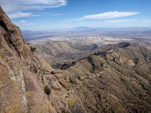
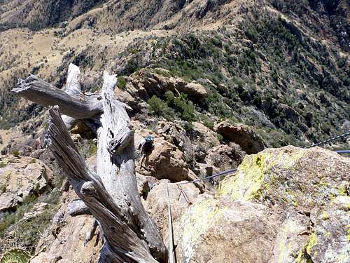
![Looking East from the Route]() Amazing views all around
Amazing views all around
I asked how the climbing was and they said "awesome, we saw 100 lbs of marijuana yesterday". Apparently they had gotten lost from the Baboquivari Campground and didn't find the right trail at all and ended up schwacking up some god forsaken canyon. In the process, they came across two drug smugglers carrying 40+ lbs of marijuana each. Upon seeing the climbers, the drug smugglers dropped their loads instantly. One of the climbers spoke spanish and so he asked them where the trail was and told them that they were lost. Apparently, one of them kept grabbing his fanny pack and was a little anxious. The climbers continued on their way and the drug smugglers ended up doing their thing (i.e smuggling drugs). The climbers got the bottom of the route at 4pm and ended up camping on the 4th pitch of the Southeast Arete and then summited early the next morning (which is why we saw them rappeling down so early in the day). Anyhow, they had an interesting experience.
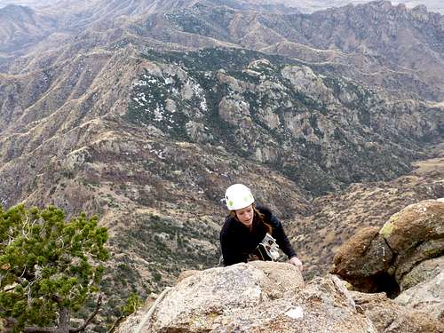
![On Pitch 2]() Erin following her way up Pitch 2
Erin following her way up Pitch 2
The 2nd pitch (the crux) went smoothly and the rock was steller along with the views. The cactus is spread out perfectly along the entire route just to keep you on your toes. I ended up doing the 3rd pitch in almost an entire 60m rope length, which was nice because it took us to the 3rd class scrambling. We scrambled up this and arrived at the "Notch"; a distinct feature in Babo's Southeast Arete. The 3rd class downclimb was made a little bit spicier with snow and ice, but it still wasn't terrible. The last pitch (5.4) is about 20 feet and that took but a few minutes. We stashed the our gear, set up the rope for the rappel back into the notch and began the scramble up to the summit of Babo. We were at the top
by 3 pm.
![Erin on Pitch 3]() Erin on pitch 3
Erin on pitch 3
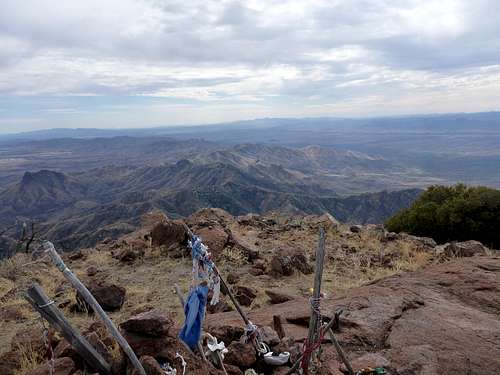
Needless to say, the summit of Baboquivari is amazing. The views stretch all the way to Tucson and way down into Mexico. The summit is an amazing place to because it is said that I'itoi, god of the Tohono O'odham people, requires a gift from all that pass over the summit. Many weird odds and ends were up there from whiskey in a film canister to a Trango Cinch.
![Looking South from Babo]() The view south from the summit
The view south from the summit![The View from the Summit]() The view north from the summit
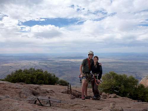
The view north from the summit![Summit Shot]() Our summit shot!
Our summit shot!![My Gift to I itoi]() A gift to I'itoi
A gift to I'itoiDescent
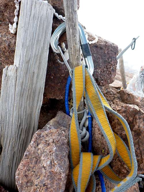
We had decicded from the start that the Forbes Route would be too snowy, so we opted to rappel the Southeast Arete route. We got back to the top of the last pitch and rappelled it at 4 pm. We then downclimbed the 3rd class sections and arrived at the top of our pitch 3. 4-5 more rappels brought us to the base of the arete. There are plenty of boulders, horns and trees to rappel off of. Bring extra webbing to replace that tatter!
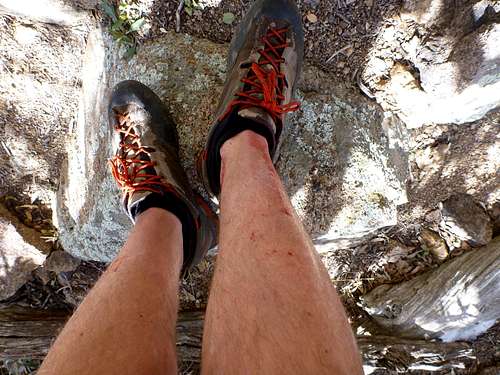
![The Bushes Won]() Evidence of the bushes getting the best of me
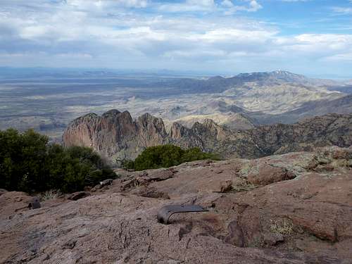
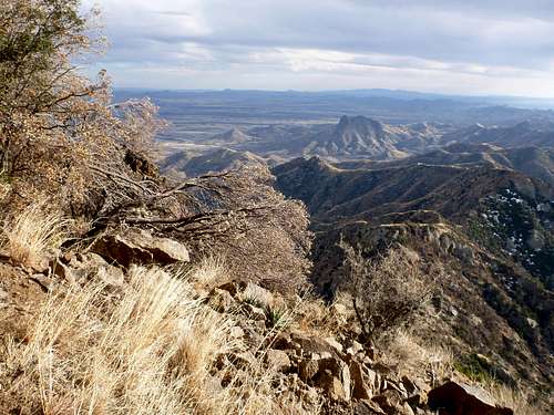
Evidence of the bushes getting the best of me![The View from the Great Ramp]() Views along the way down
Views along the way down
The schwack began again at 5 pm, but this time we knew were we were going. We made quick work of the trail and got back to our car just as it got pretty dark at 7pm Looking back up towards the mountain, we saw our climbing friends from earlier in the day (lost once again) coming down the wrong canyon. I wonder what they saw this time around.
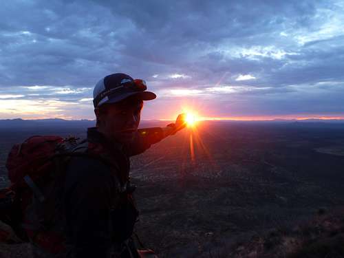
![Trying to Make the Sun Stay Up]() Sunset on the trail. We got back before it was totally dark
Sunset on the trail. We got back before it was totally dark
We did it in 12 hours car to car and did 4 pitches instead of 6. The hike was around 9 miles roundtrip and the elevation gain was around 4,200ft. It was a long day but well worth it. Thankfully, we didn't have an epic.
![Cactus Clinging to the Side]() Cactus clinging to the side of Baboquivari
Cactus clinging to the side of Baboquivari


Comments
Post a Comment