Sunset Initiation - September 4th, 2014
My plans were getting ambitious. Feeling spry after a good 8 peak Idaho trip, plans began to form for my next trip around Homers Young Peak, whose sublime silhouette had fascinated me since the beginnings of summitpost. I rested for a few days in Salt Lake taking care of errands: getting the care tuned up, getting a start on a contract project that would tide me over between jobs, and spent a few days relaxing, gchatting, eating pizza for lunch and snacking over afternoon coffees at Barnes & Noble, before setting off north again.
I actually had originally brainstormed this third leg of the Crippled Peakbagging tour to be the coup de grace of the season: swing up to Montana, get Sunset and Homers Young, then up north to see Glacier for the first time before swinging west into the fabled Pacific Northwest. In doing so, I had almost forgotten about my plane ticket in little over a week to Orlando for a wedding, which obviously was a followup to the same bachelor party in Savannah that had resulted in this whole crippled business in the first place. Accordingly I had to curtail leg 3…the first two peaks still the same, but then the plan changed to football and easy peaks near Butte before swinging east for Electric Peak, a summit that eluded my initiative in the past three years.
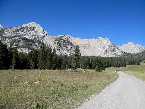
Labor Day Monday saw me arrive back from Idaho after tagging Hawley on the last day of leg 2. Friday saw my last ever early AM trek up I-15 through Idaho and Monida, reaching Lima by sunrise. After a quick stop (I got pulled over cruising down Lima’s dirt roads), I continued down the occasionally washboarded Lima Dam Road before tracking northwest down Blacktail Road, one I’d driven before from the other end en route to the route’s namesake range highpoint.
As promised by Cedron in his book Peakbagging Montana, the last few miles of driving saw the bottom of my 4Runner seriously scraped by tallgrass. I bravely bore the burden of those awful scratching noises down to the trailhead, a muddy cattle trough on open range.
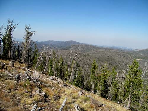
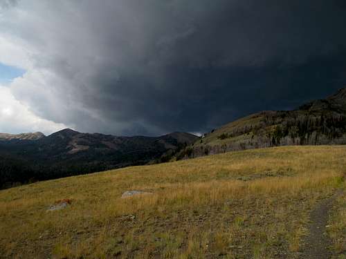
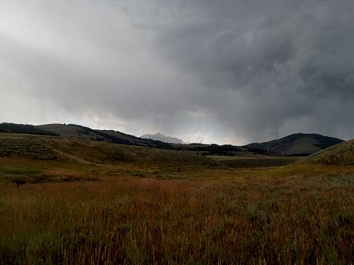
These cows were mean, many, and large and I had to yell and moo angrily at them while banging my crutches ferociously together to keep them at bay and out of my way. Greg had approached Sunset from the east via a very long approach. Fortunately I had the benefit of Cedron Jones’s guide, which recommended a route from the northwest. The cows were certainly a crux, and past that the meadows opened up.
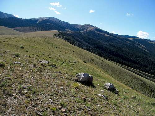
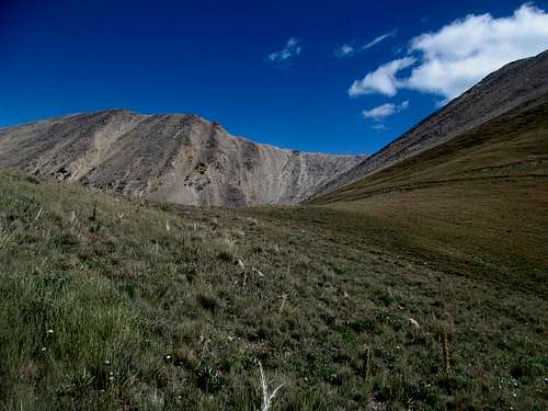
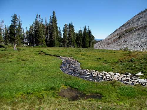
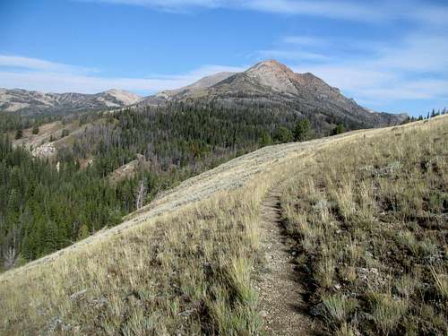
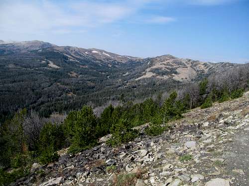
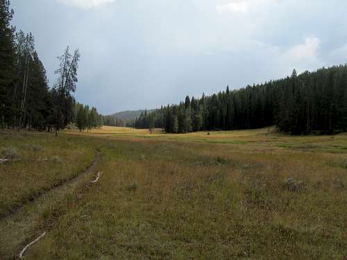
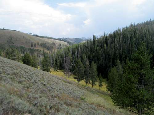
The dry late season grass crunched and crackled under my boots with each step. Following the old dirt road up the Taylor Creek drainage, all I needed was to pick any spot to gain the upper ridge as the yellow-grass headwalls closed in along the north and east sies of the drainage, leaning right to try and be efficient with distance travelled.
Some sweat and tears later I was above the drainage. The route followed the wide grassy ridge straddling the divide between the Taylor and Rock Creek drainages, aiming southeast towards a connection with Pt. 9,903, a subsummit of Sunset. Fittingly enough, in my never ending search for podcasts and entertainment on these endless drives and hikes I had stumbled upon a multipart history podcast describing the history of the Mongol Empire, and amidst this faded bleached-blonde landscape it was easy to imagine hordes of horseback warriors running roughshod through endless prairies, searching for the next outpost to sack and slaughter.
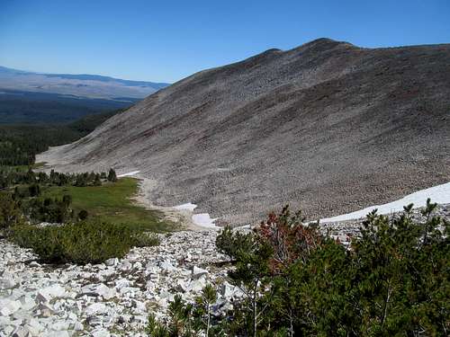
Two things concerned me about the hike itself. While I had gotten in some good mileage on Patrick Butte, Sunset with over 3,800 ft per Cedron would be, I think, the most gain I’d be attempting on the CripBag tour thus far. Secondly, Greg had reported some nasty scree from his trip. While I hoped that Cedron’s route would be more pleasant, you never know until you know, especially on more obscure peaks like this.
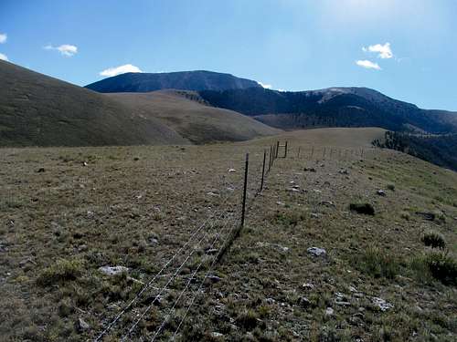
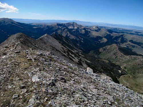
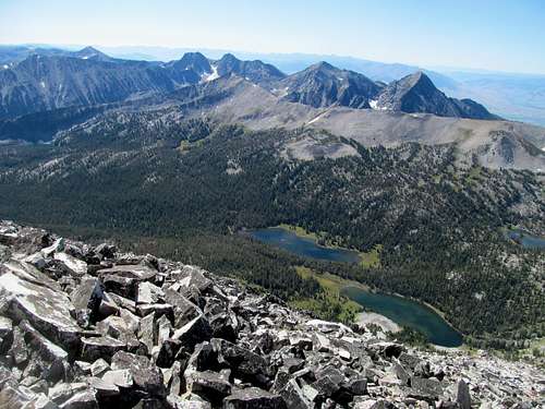
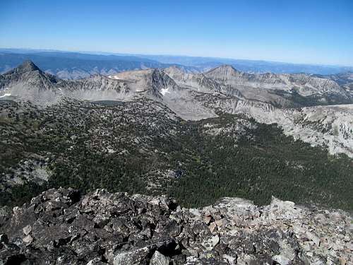
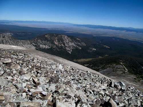
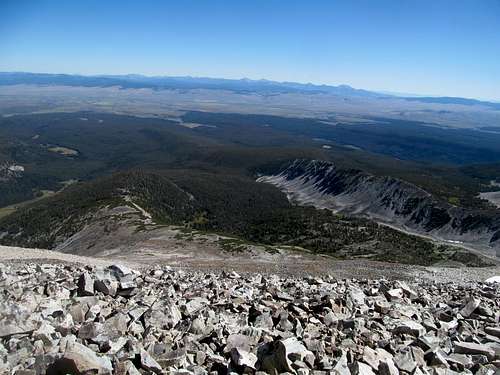
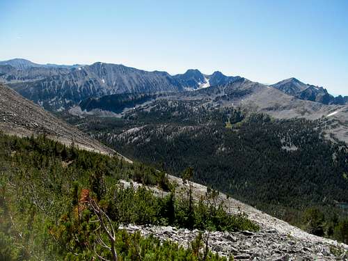
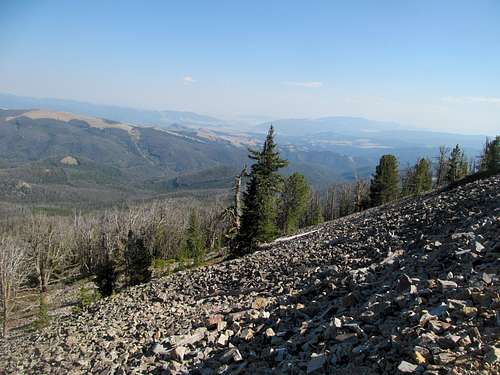
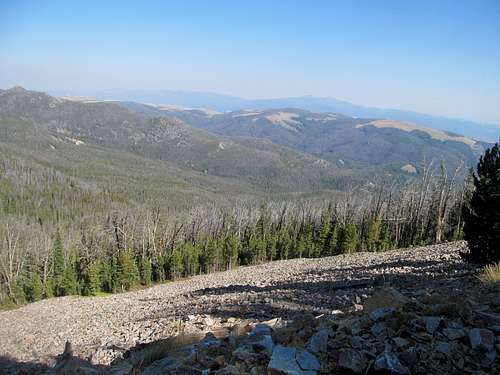
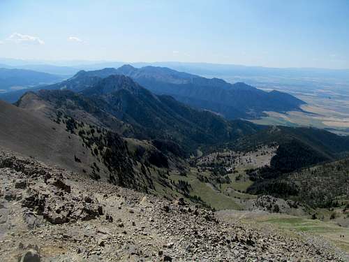
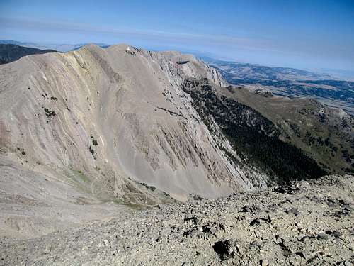
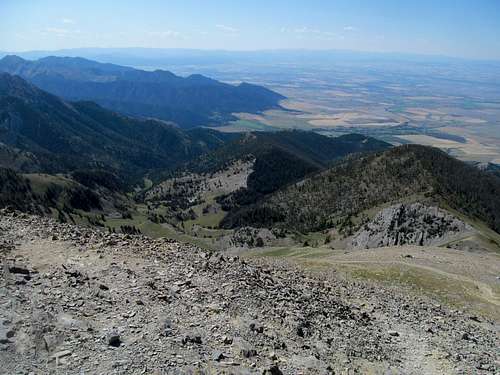
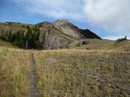
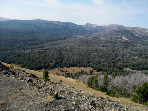
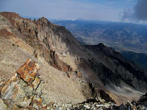
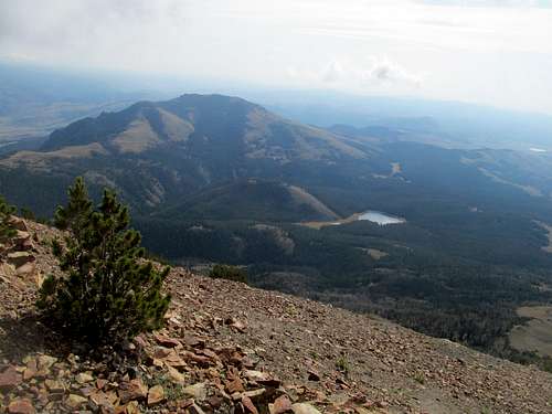
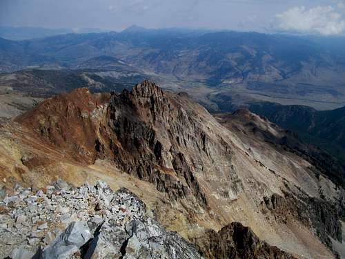
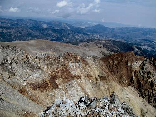
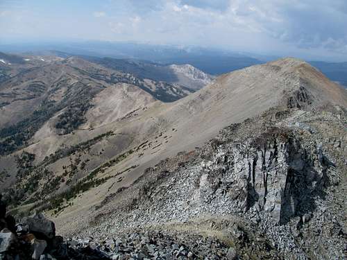
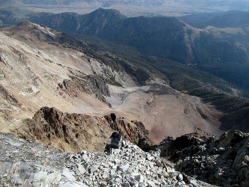
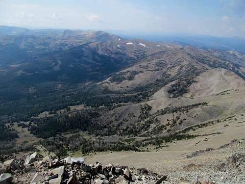
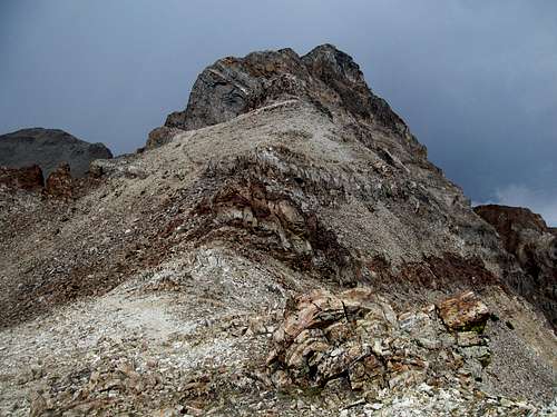
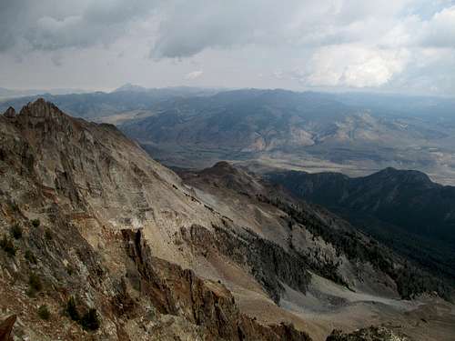
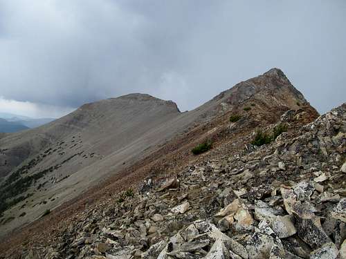
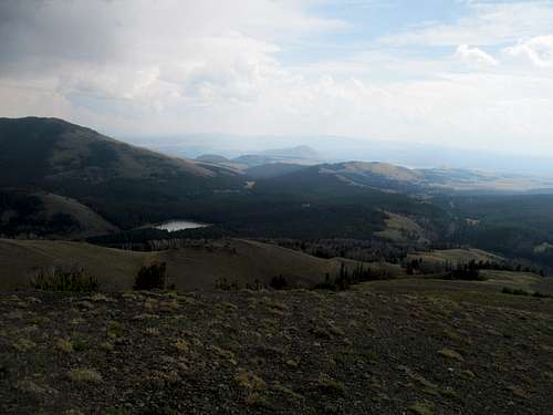
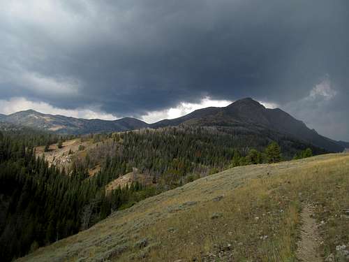
I aimed to lose and regain the least amount of elevation possible, which meant following the broad open ridge up to a certain point, then a few hundred feet short of the top, cut left aiming to hit the low saddle between 9903 and 9690. After passing through a couple of unexpected wooded spots, I reached the reach crest and glimpsed impressive views of Sunset, the saddle between it and 9903, and the aesthetically pleasing Crows Nest drainage leading down to Sawtooth Peak.
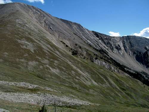
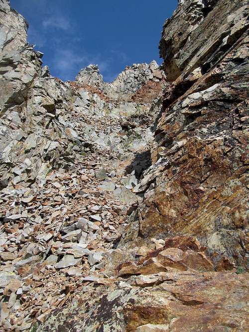
Here, I faced a traverse the challenge of trying to find the most elevationally efficient way of traversing down to the Sunset/9903 saddle, hoping to lose the least amount of footage while still avoiding loose, scree along the sidehill that would not be friendly to a knee that had met its match against a sedan’s front hood a month ago. The beginning parts were trickier but manageable, and by the time I was closing in on the saddle I was cruising through easy grassy terrain.
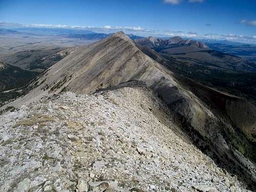
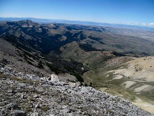
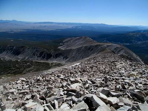
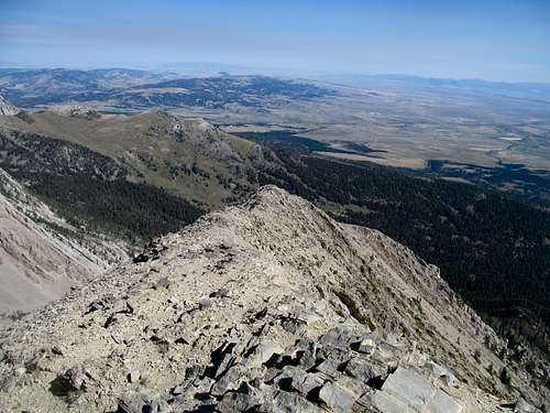
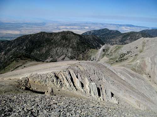
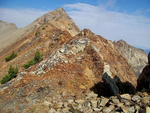
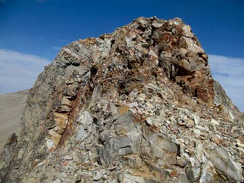
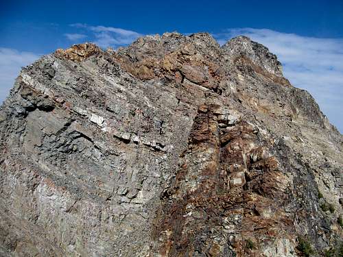
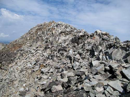
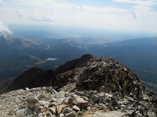
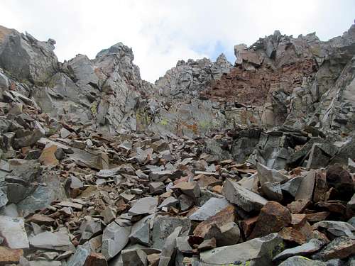
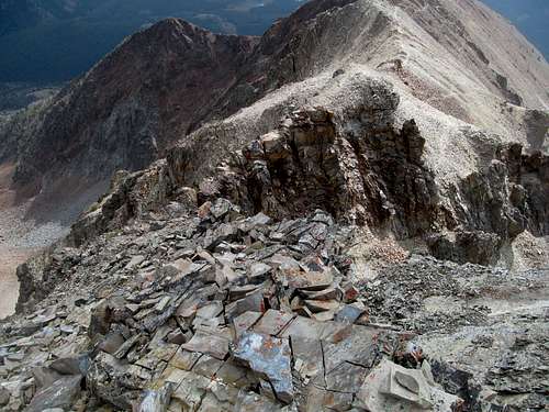
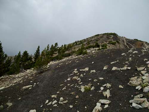
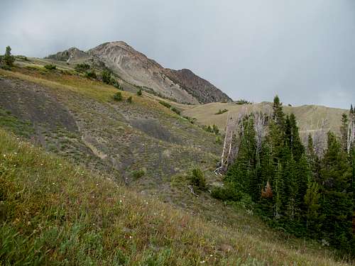
Still, caution was required on the knee, and I didn’t cruise like I normally would when 100% healthy, keeping in mind that any misplaced gopher hole could leave me lame and disabled in one of the most obscure ranges in Montana. The last thousand feet up Sunset were basic and none-too-loose as dry tundra transformed into mildly stable talus for only the last few hundred feet or so.
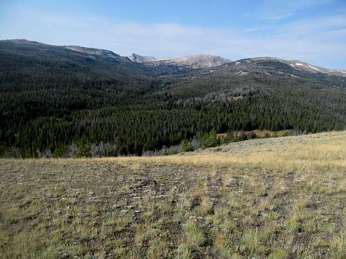
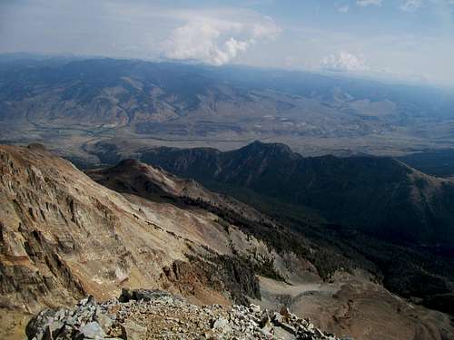
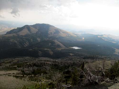
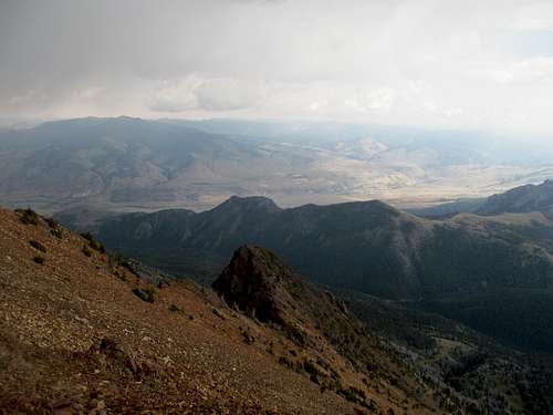
I took in the views from the summit on a perfectly clear day, noting how the summit of Olsen Peak blended in so perfectly in line with Hogsback’s that you could hardly tell that you were looking at two distinct mountains, separated by a notch replete with a Forest Service Cabin.
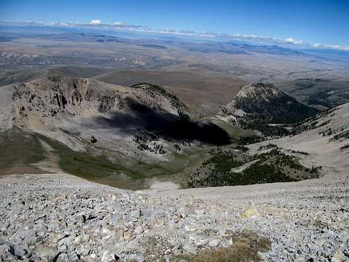
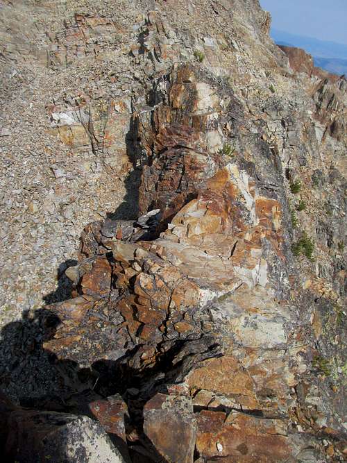
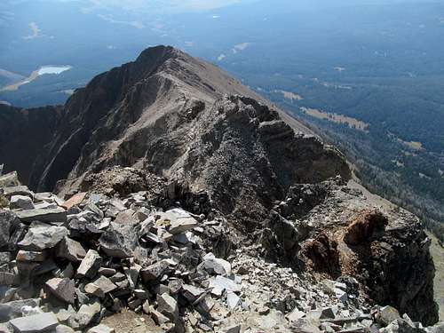
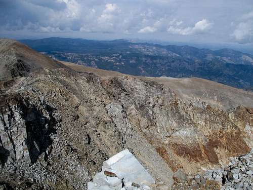
With similar caution I descended the summit block and did my best to retrace my steps back up and around 9903, predictably finding myself in some scree looser than I would have preferred.
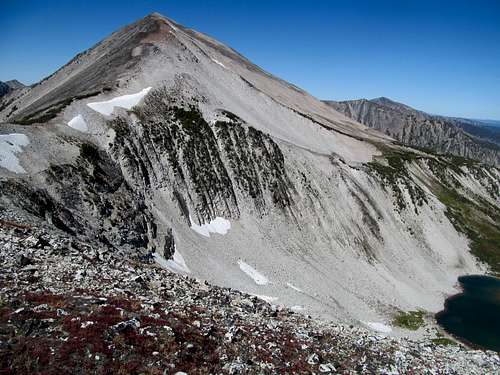
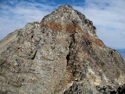
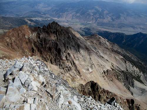
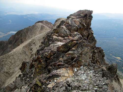
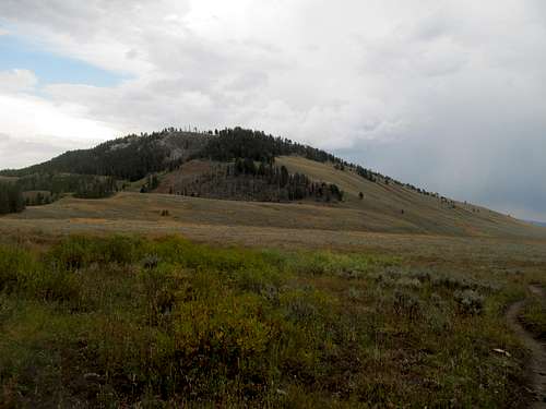
One last look back at Sunset, a gentle peak that nevertheless is pretty damn massive and tough to capture in a singular picture frame.
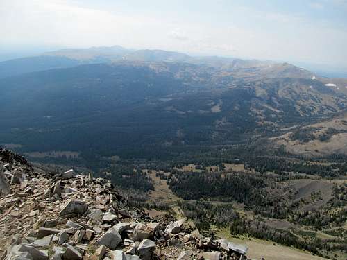
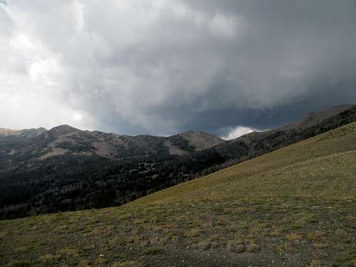
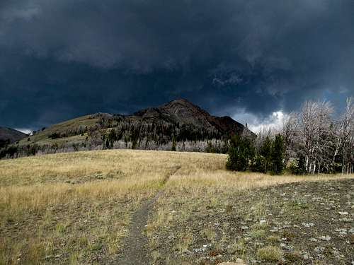
The rest of the descent was dull in the best way…no tricky terrain to fill me with trepidation, and perfect weather to accompany me all the way back down each traverse of the ridge.
Supposedly this was grizzly territory, and I called out the requisite “Hey Bear” every 45 minutes or so, but this side of the range seemed way too open and dry, and I guessed/hoped that most of my pic-a-nic basket snatching compadres were concentrated on the eastern, more wooded side of the range.
And yet, though not a bear or mountain lion (see Arc Dome Trip Report) in sight, and somehow I encountered what is still to date my most harrowing wildlife encounter even after two bear sightings in summer of 2015. I had made harsh words (noises) at this pack of heifers on my way in, and they seemed most displeased with me on my way back to my car…barking angry moos at me one by one. More troublingly, they were antsy and frisky, making towards me what seemed to be bluff charges, acting (mooing) more and more in unison. I had visions of my days back at UMass, facing down riot cops on horseback riding in unison during a typical Red Sox playoff riot, except I feared that this bovine mob would show less restraint than UMass campus police in the era before phone cameras. Having passed most of them by, I could face down the pack, getting more vocal by the second, by walking backwards, facing them and banging my crutches together while yelling, swearing, and mooing right back at them, matching their loudness with mine. Eventually I put enough distance between me and them walking backwards to put them at ease, apparently, and I could safely walk back to my truck with only a semi-occasional glance over my shoulder.
Fuck them all, those disgusting, smelly creatures. I hope by now I’ve eaten all of them in one form or another while consoling myself that I’m not getting fat, but merely putting on mass.
I pulled into Dillon, one of those towns I’d always wanted to grab a drink at, and got a room. It would have been nice to check out a few bars, grab a few Cold Smokes and gauge the local flavor, but all a sudden my buddy (and current roommate) needed a favor…he needed me to help edit his performance review at his new hedge fund. So that’s what I spent my entire night doing, and by the time I’d finished the damn thing it was late and I needed to get an early start on Homers Young the next morning. Plus I was sweepy, so sweepy time for me.
Old Homer Youngs - September 5th, 2014
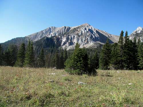
I was amped for Homer Youngs, a peak that I held special regard for. I remember specifically being introduced to the peak in the early, wild west days of Summitpost, when I was first busy browsing, cataloging, and learning about the great peaks of the country between hangovers and not going to class at UMass. Montanaboy’s Homer Youngs page was (and still is) a classic, and its emblematic picture with Homer above rolling hayfields and an old barn, has always been one of my favorites on this site. I had been struck by news several years ago that the talented page author had passed away after a climbing accident in Idaho and, despite over a decade now of online climbing sites and its unfortunate yet regular ability to act as a medium passing along the news of fellow peak enthusiasts passing whilst pursuing this hobby, reading about his death, that of someone I’ve never met or even conversated online with but yet, on that fundamental level, could identify with just based on his pages and narratives on summitpost, well, that hit harder I would have expected.
I had always been particularly inspired by that Homers Young page, and many times I had tentatively planned ascents on Homers Young but never got around to it. I had gazed furtively in its direction from Bloody Dick Peak on a hazy day, barely seeing its silhouette. I had since driven by the area, coming down from Big Hole Battlefield back to Salt Lake on leg 1 of the CripBag tour, and now finally, it was time to have my go at Homer.
It was a freezing cold morning coming out of Dillon at dawn. I soon lost reception and drove through a deadzone all the way to the trailhead, following the directions of both Montanaboy and Cedron’s guidebook. My knee in my opinion still not quite ready for loose class 3 terrain, so I shunned the SW ridge and following the SP directions, found a good spot past the Miners Lake parking lot (and bumpy cattle guard) to park after banging out a perfect 3 point turn.
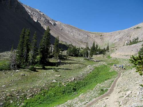
It was cold enough for mist to billow off nearby Miners Lake on the drive in, but trail 187 gains ground quickly and after about 500 steep feet I stashed the hoodie and gloves. My concern was not the workout, however, but the length of this route and the percentage of it that would be off trail travel, more than any I’ve attempted post accident. Then there’s grizzlies too...I was not keen on bumping into grizzlies traveling by myself off trail in grizzly territory. Then there’s the usual routefinding too…after double checking my GPS upon crossing Kelly Creek along trail 187, the rest of the trip would be a blank space (trademark Tay Tay) until I emerged above the trees towards the summit.
I waypointed a spot near the head of the creek and counted down the distance for this stretch, a couple of occasionally arduous miles. Both Cedron and Montanaboy’s descriptions suggested staying on the left (south) side of the creek, so I did just that. The faint trail was schizo, occasionally readily available for swift travel, then disappearing for long, deadfall choked narrow creek-side stretches at a time. The occasionally meadows were often mucky, even in the late morning frost, and this bipolar act quickly wore thin on my patience.
I aimed between Kelly Lake and the alleged trail 402 as marked on my GPS, hoping to meet the trail in the middle. Not really finding it, I kept heading west as the trees finally started thinning and I could glimpse rocky ridges ahead. Whether they were Homer Youngs or peripheral ridges, I knew not, though I correctly suspected the latter.
For now though, I ascended the lush, green layer cake cirques nature had laid in this corner of Montana, terrace after terrace of increasingly less-subtle beauty. Lower down the vistas were small and confined but the wonder no less with charming little rock slopes lined with perfectly placed white rocks interspersed among the still verdant mid-September tundra.
Up higher the ridge was long, calm, and served previews of things to come. The evergreen groves grew sparser and the talusy ridgelines nearer as I wallowed in a general southwest direction (left) towards a small cirque ending at an extension of Homer Youngs’ SW ridge.
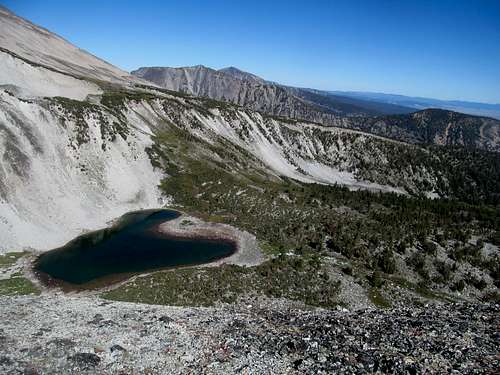
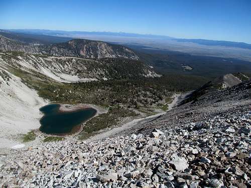
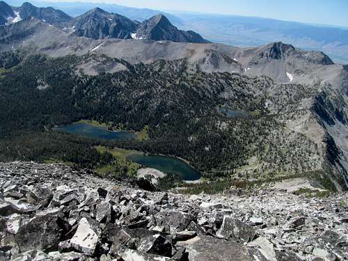
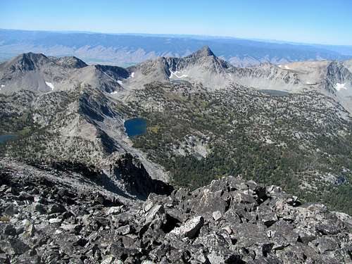
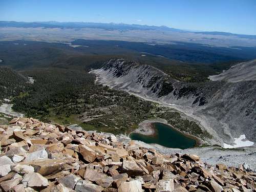
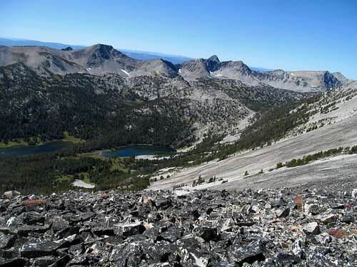
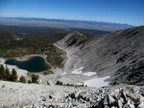
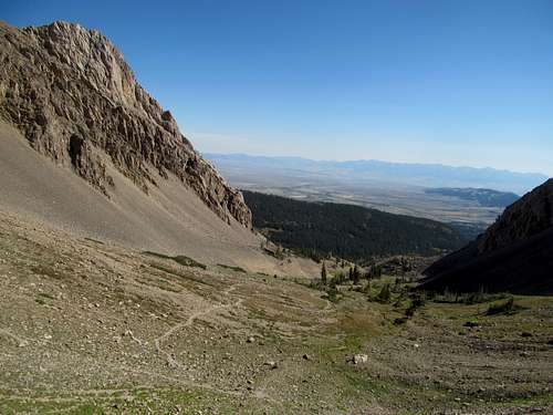
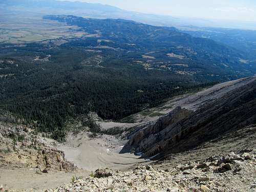
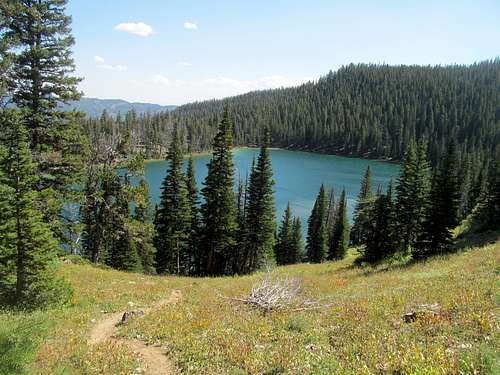
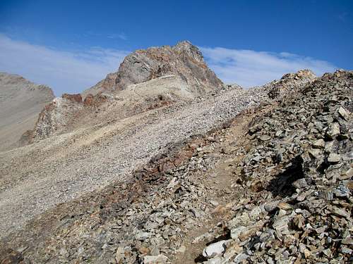
At this final headwall, I aimed for a saddle just left (SW) of Pt. 9,495, reaching the crest and was greeted with a stupendous view of my goal and below it, the weaving shoreline of Heart Lake.
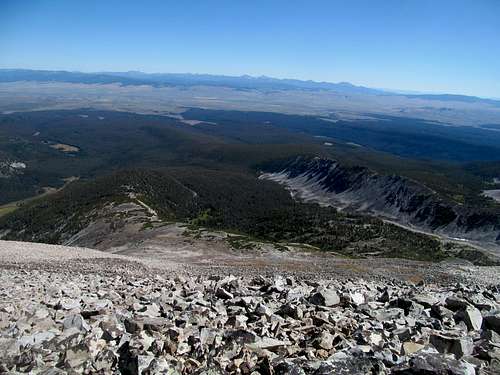
The vast Big Hole Valley stretched behind me, echoing the history of the area from the cautious optimism of Lewis and Clark to the more tragic story of the Nez Perce’s trials and tribulations across the northern Rockies. Way across the valley lay the Pintlers and the distinctly shaped West Goat, and to its right along the horizon, the stately twin summits of Tweedy and Torrey in the Pioneers.
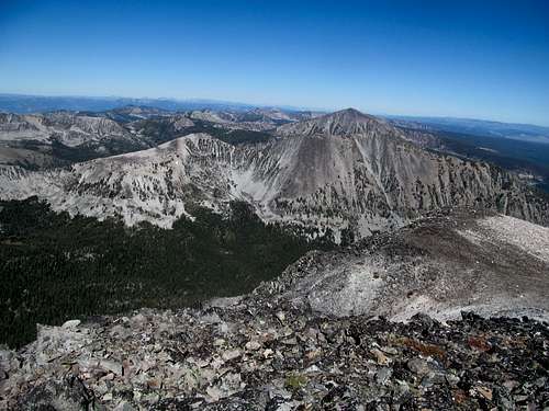
All that remained was an easy traverse around the northwest slopes of 9,966 to the final saddle below Homer, which was surprisingly tricky to navigate with its long flat stretches of rocky and uneven boulders. Again, I had hoped to protect my knee from unstable terrain, and thankfully the last 800 feet or so were pretty basic for this basic betch. After several false flat areas I reached the broad summit, where I enjoyed my granola bar amidst one of the greatest panoramas I had ever had the privilege to enjoy.
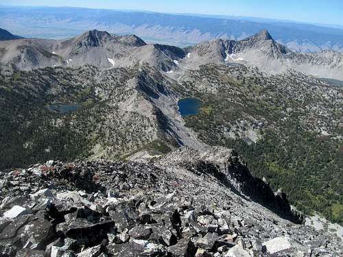
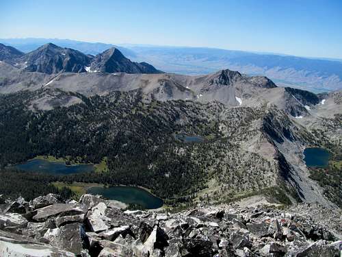
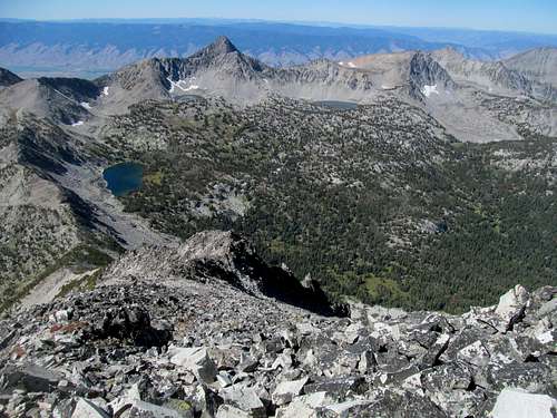
Chiefly among them were the countless lakes west between the summit and the main Beaverhead Crest and Idaho border…these lakes themselves divided by a divide…the Rock Island Lakes to the left, and Little Lake to the right, the latter of which beginning a chain of lakes rising higher and higher perched on delicate looking terraces and some still harboring sheets of ice.
The peaks were interesting too, particularly Copperhead to the northwest and the Sacajawea group south. Below, the deep valley of the town and river of Salmon, and beyond the steep and pronounce eastern flanks of the great Salmon River Mountains, with the Bighorn Crags looking particular sharp on a clear day (oh I cry and rage inside as I type those last words).
All the great peaks of Idaho were seemingly visible here, from the Lemhi’s and Lost Rivers and even further southwest to the Pioneer Range near Sun Valley. In fact I surmised that this and other nearby Beaverhead summits would be the only places in the world where you can see both the Pioneer Mountain ranges of the west, one in Montana and one in Idaho, sitting several hundred miles apart on opposite sides of the Continental Divide, in one fell swoop.
Just like Grave and Buffalo Hump from the last trip, I really lingered from this summit, trying to take in every view and ingrain every memory of a place where my shitty pictures could not come even close to portraying the sheer transcendence of this most special summit.
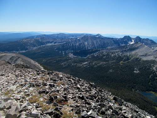
When I was finally ready to come down I did, descending carefully the main ridge, taking in still the unique views of Heart Lake and the diagonal glacier erratic slopes of the lake’s drainage.
Again I enjoyed the small and quaint terraces on my descent back into the forest, my vibe interrupted only by the constant whining of Bill Burr on his podcast about what a piece of shit his house is.
I strayed further north than my ascent route (north), and contoured back SE through woods only slightly sprayed with deadfall back to Kelly Creek, where I retraced my steps back to trail 187 and the last steep few hundred feet down to my car.
My GPS recorded 10 miles and I guesstimated 3,600-3,700 feet of overall gain, seeing that most of the elevation regain was avoidable even on the traverse around 9,966. I found the lack of cell phone reception near Jackson and Wisdom disturbing though, and even more so as I traversed the scenic highway along the Big Hole River listening to Billy RedBurr regale me with tales of his Canadian standup tour. Still no reception at Wise River, and really none until I returned to I-15, and this left me concerned; how would I stay connected to the outside world if/when I went after West Goat???
And I would have gone after West Goat on this trip except for two reasons. The peak was 14 miles round trip and high on my list, but I was more concerned about the amount off trail travel required through supposedly deadfall laden terrain to pursue it this time around. Plus, football. Week two of the college football season and NFL kickoff, which meant that I needed two quick days on the mountain. I got a good look at Fleecer and thought about that and Evans for the weekend, but neither were meant to be; Evans was out after I found out from Greg that the dirt access roads were closed further down than Google Earth indicated, and Fleecer was out after a particularly heavy night of drinking Saturday.
Needling Haystack - September 6th, 2014
Which brings me to the town of Butte. I had be to and neglected it several years ago when me and Greg got Mt. Powell Labor Day weekend, and I had slept in a small motel a few miles outside of town before getting Tweedy on a particularly hazy day. This time though I aimed to enjoy and fully take in the town, which meant, first, finding a good cheap dive motel for the night. Rest assured there was one just south of downtown, so I checked in and checked out for the night.
Checked out as in I passed out…cause I was amped to get a peak before catching a slate of college games that I in no way or shape remember anything about probably a few weeks afterwards (though via google I see there was a low scoring USC vs. Stanford game that I do vaguely recall watching).
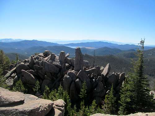
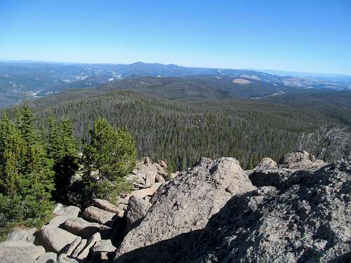
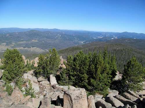
As I had mentioned, Evans was out because I wanted to get back to town to watch some forgettable top 25 vs. 1-AA matches, so my aim was an easy hike up Haystack Mountain, the unassuming highpoint of the Bolder Batholith (yes you read that right I spelled dat correctly* … *claim backed up by peakbagger.org but not Wikipedia #sorrynotsorry), a lumpy wooded range standing between Butte and Helena.
The trailhead is an easy drive up le 15 from Butte, and I drove the extra rutted and bumpy mile to the true high clearance trailhead. I don’t have much to say about this hike, except it traversed open woods and incurred some boredom as I constantly checked back and forth with my GPS, waiting and hoping I was near the summit, which promised views.
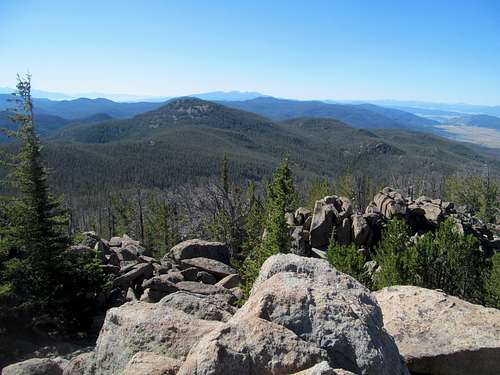
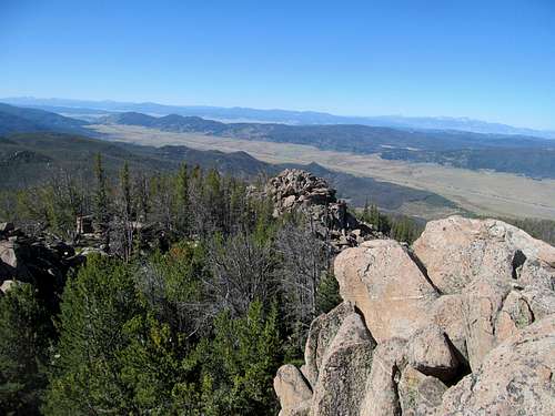
Living up to the range name I was promised a large set of bo(u)lders on the summit. The trail flirts and skirts with them before flitting past, only to switchback back right across some sandy ground to the final summit rock labyrinth.
While I was now starting to get my on trail fastwalking fastball back on track, these steep and heady bo(u)lders scared me, especially some moves were required to get from one summit clump to another to get the right views and make sure I tagged the highpoint. And the views were pretty damn good with Powell and the Flint Creeks two interstates away.
I retraced my tracks back to Butte, where I realized that I actually had some spare time until the 3 PM (EST) slate of games began. Running ahead of schedule for once, I stopped by Joe’s Pasty Shop for what was apparently the official food of Butte…a rather large and uncouth meatpie. Google told me Joe’s was the best in town, and it was delicious in that rough and tumble intermountain west sort of way.
Some Afternoon Jack - September 7th, 2014
I headed to a sports bar downtown and enjoyed the afternoon games, later stopping by a dive bar across the street from my motel for a good night of late drinks with locals. I had no aims for Sunday other than to wake up early enough to catch the Pats kick off their championship 2014 season against Miami. Running a little late for that, I stumbled back into that nice little sports bar downtown only to watch a disappointing effort in a loss against the Dolphins.
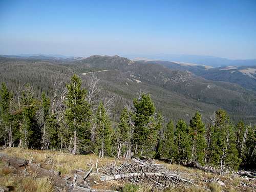
The Pats were my only goal of the day, but after that letdown I noticed I had enough time left in the day to get a drive up peak nearby…Haystack’s northern counterpart in the Bolders and a P2K to boot.
I followed directions from I-15 near the town of Basin posted by Ken Jones, following the western approach to the peak up Jack Creek and stomaching the rough and rocky dirt road up to the summit, where my views were severely inhibited by haze.
Back on the highway, I aimed to drive east; despite the weather starting to deteriorate for Electric on Tuesday I still decided to take my chances, but not before having to drive back down into Butte one last time after I realized that I’d left a blanket in my last motel. I felt almost a little sad to have to say goodbye to Butte; it had treated me well, I had enjoyed the company of a lot of great and friendly locals, and it certainly didn’t deserve the bad rap it seems to get online. It may not be a Bozeman or Missoula, but this truly old school Montana city deserves a chance and a visit.
Finding Sacagawea - September 8th, 2014
Haze accompanied me on the two hour drive to Bozeman, where it seemed to clear up and I enjoyed the twilight views of the Bridgers west of town. Sacagawea, the highpoint of the range, would be my goal for Monday, for what I figured would be yet another rest day before the big day on Electric.
After checking in to a surprisingly comfortable motel I had a quiet dinner and drinks downtown to the tune of the Sunday Night game. The highway to Sacagawea was lonely on a Monday morning but the trailhead was active with hikers coming and going.
I’ve read recently that this new Leo DiCaprio bear rape movie (The Revenant) takes place in the Bridgers, which I guess a few hundred years ago was as wild New York City during Santa-Con. Well today the area seems on the verge of gentrification, with homes and ranches lining either side of the range. Not that there’s anything wrong with that of course, but it’s just that contributed to the general smallness of the range, the popularity and its proximity to a major city, the entire hike felt quaint, comfortable, and suburban...like several hours spent not in the great northern wilderness but a mid-afternoon jogging route in civilization’s back pocket…like a Colorado 14er, for lack of better metaphors on my part.
Again, not that there’s anything wrong with that. It just was a different experience from something like Homer Youngs, is all.
Those who know me know that I absolutely adore civilization, and I certainly enjoyed the hike, and even with views still suffering the past day’s haze. The blistering winds made it a challenge and a struggle once the trail climbed out of the small, cozy bowl onto the ridge crest, and the last few hundred feet were certainly steep…in hindsight it would have been way too steep, rocky, and loose for me, despite the route’s easy stats, to have made it on my first post-bodyslammed-by-sedan hike a month ago.
I took shelter on the eastern side of the summit amidst several other parties enjoying a weekday hike, then started back down the trail.
To gauge how my knee felt at this juncture…this would be a trail that I’d love to just jog down from top back to bottom, yet while the knee was no longer posing me major issues, I still had to take the downclimb in moderation, step by step, not eclipsing anything more than a fast walk all the way down to the lake.
Which brings me to that…a sidetrip to Fairy Lake is well worth it on your way down the peak…it’s pleasant enough and requires only some modest gain to quickly loop back to the parking lot from there. But to my dismay I broke a sweat, something I hoped to avoid seeing that I would be sleeping in the truck later at night.
Fair or unfair my basic betch yuppie soul judges towns by their friendly neighborhood Barnes and Noble. Missoula…well that was a damn fine B&N, so I was dismayed that its little brother college town in Montana had such a lackluster one. Not the bookstore itself, that was alright, though no Missoula (or Burlington Mass…across the street from the very mall where Paul Blart Mall Cop was filmed), but the entire mall seemed rundown, abandoned, a relic of the 90’s in poorer shape than a Melrose Place rerun. Regardless…I had work to do, real work, so I spent the rest of the day working on spreadsheets and writing macros.
Feeling Electric - September 9th, 2014
After getting some to go dinner I loaded back up the 4Runner and took the Trail Creek/Divide Road cutoffs to make it back to US-89, rejoining the highway just as it got dark. I checked my fantasy football results while pulling into Gardiner, finding a small saloon in the tourist/olde west hybrid town for a spot to catch most of the late Monday night game between the Chargers and the Cardinals. I pulled off into a side road near town afterwards and fell asleep to the lights and sounds of a late night lightning storm crackling over the valley and Electric above.
Morning found thankfully clear but unfortunately fleeting skies, as a quick check of the weather report still indicated high chances of thunderstorms past noon. Thus my timely dawn start through the historic Roosevelt Arch and abandoned Mammoth Hot Springs to the trailhead.
Mist billowed through up from the empty fields on the backside of mammoth as the first several miles of the trail followed a rather dull dirt track through open and exposed terrain...a potential area of concern during a thunderstorm.
Electric would be my biggest challenge in many ways since getting hit by a car...it would break CripBag records for mileage, difficulty of terrain, and come damn close in terms of elevation. For a such a popular peak there is surprisingly a dearth of information regarding the technicality details of its class 3 finish to the top, so while I felt confident that my legs could handle the distance and still modest gain (less than 4000), the unknowns of crux and weather caused me modest concern.
Most of the early route was vaguely pretty yet dull...wandering through miles and miles of open flat lands, but the sharp yet clear views of the peak distant yet distinct kept my attention. The description here on SP is pretty accurate and paired with my GPS made most of the navigating mostly predictable. After a couple of miles the trail took a turn left and ascended gently through occasional tree cover but often open views of the small Glen Creek drainage harboring the trail. After a couple of rectangular meadows that once again showcased the now more impressive views of the peak, the route bobbled and weaved through denser woods for the last mile or so before it met the Electric Spur trail.
The only other hikers I really encountered thus far was a father-daughter team that had made the summit yesterday and now were on their way out after an overnight camp. They said the storms were pretty bad in the afternoon, and I told them about a similar chance of storms based on my check on the weather that morning.
It had been a chilly morning to start but as I ascended the steep spur trail I cached my hoodie as well as a couple of waters to make way for the main ascent. Most of the route thus far, despite taking up the bulk of the mileage, stayed relatively flat, while the last 3-4 miles were responsible for almost 3000 feet of gain. The trail was occasionally overgrown, then dropped maybe a hundred feet into a small drainage to finally reach and start the summit push up Electric's true se ridge.
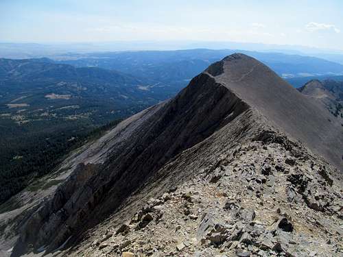
For much of the time from my vantage point the summit seemed to be a rounded grassy hump and I wondered what all the fuss was about. Upon ascending this obviously false summit I saw the rest of the route to the summit: a substantially long (for my knee) traverse through several ridgy sections to the summit above.
It looked long and had to be tackled in sections. First, a traverse along a good, rocky climber's trail reminiscent of the tougher Colorado 14ers up to a steep and rocky bump, whose scrambling is more reasonable than it looks.
Then a narrow catwalk, with easy walking but exposure on both sides led me to the main summit structure, which a climbers trail up loose dirt and scree up a chimney system took me to the summit.
The best views were to the east, with the dramatic views down to the Yellowstone River and Gardiner and past those, the complex knuckles and ridges of the heart of the Absaroka/Beartooths.
Emigrant was the dominant looking peak across the Paradise Valley, but somewhere past that lay the complex and possibly summit of Cowen, which I hoped to pursue one day...but not today, and not this trip, despite the fact that my knee felt a lot better on talus and loose rock compared to the last go round on Two-Point and Patrick Butte in Idaho.
The views of the northern Gallatins were surprisingly gentle and reserved, and I figure that the northerly high peaks were either not visible or not apparent due to their positions underneath some very dark and approaching clouds.
The grey round summits of the Southern Gallatins were more interesting to look at and accompanied me on my descent as the clouds came ever closer, but it was thankfully I didn't hear no lightning until I finished the worst of the scrambling.
Scooting down the ashy middle ridge I heard the escalating claps of the clouds behind me, and I hoped they didn't overtake me.
I bumped into a group of three college-aged kids coming up as I rounded the bottom of this open ridge. I told them weather seemed iffy up there but they had obviously heard the same thunder, and headed up unperturbed.
I breathed a sigh of relief that, despite the raging thunder, most of the rest of my route would be under tree cover. I bemoaned the short uphill section and by the time I retrieved my waters near the bottom of the spur trail the sun had re-emerged.
It remained out for maybe another mile, then the skies darkened again. Unfortunately the thunder seemed to boom the loudest as I neared that open field junction marking two miles of marching through open fields back to the trailhead, but thankfully the storms had passed by by the time I made my way down the home stretch, and I enjoyed the views of the again distant Electric as it emerged from the storms and cloud cover.
I walked by a lone bison grazing quietly maybe a mile before the trailhead, furtively taking a picture of it from afar.
Back in the car, I suffered the worst of the national park traffic, from heavy construction near Norris and Madison junction, to the tortuous stop-in-the-middle-of-the-highway-for-a-damned-deer-anyone-can-see-in-their-backyard-in-ohio procession into West Yellowstone. I was pretty enraged by all of this but had calmed down by the time I reached Ashton and I-15 after stopping for some junk food in Rexburg. Alas, at this end of this leg of the CripBag tour and with attempts Kings, Glacier, and the PNW ahead, as well as Orlando and Vegas in the nearer future, I failed to see through my irritation at this time to reflect on this most delightful and in hindsight, bittersweet trip.
I did my laundry and got packed for a nice extended weekend in Florida, enjoying a beers around the world Epcot foray, a beautiful and serene wedding, and watching the Pats notch their first win of the season in the hotel bar thousands of miles from where I had watched their opener a week prior. I managed to not get hit by a car this weekend, though had to settle for being the guy at the wedding that random people went up to and asked "are you the kid(/idiot) that got hit by the car during the bachelor party?" The lucky bride and groom hosted us that Sunday afternoon from their hotel room inside the Orlando airport, and we enjoyed pina coladas poolside overlooking the south Florida woods before I left civilization once more and arrived back at a desolate and a progressively chilly Salt Lake night.
So with such a whirlwind of a week and such more to come I didn't think about this third leg of the CripBag tour which would prove to be the apex of my last western incursions. Despite quite a few peaks to go, and even through the entire 2015 season, never again would I have such a satisfying, successful, smooth foray through my favorite part of the west, and never again (thus far) would I get to have such a trip sans souci, setbacks, frustrations, and the most draining of fatigue.


Comments
Post a Comment