
-
 5086 Hits
-
 77.48% Score
-
 8 Votes
|
|
Route |
|---|---|
|
|
47.75811°N / 120.96085°W |
|
|
Download GPX » View Route on Map |
|
|
Hiking, Mountaineering, Scrambling, Skiing |
|
|
Spring, Fall, Winter |
|
|
Most of a day |
|
|
Moderate |
|
|
Overview
This is to be considered by many the Standard Route for hiking up Arrowhead Mountain. Although this can be done any time of the year, the winter is the best time of year to do this peak when all the vegetation is over gowned. This route is pretty laid back when it comes to avalanche danger because it follows through a forest and then onto a gentile sloped ridge which makes avalanche danger rarely existent although it's always a good idea to check up on it if it's high. Note this is a non trailed hike, so a little navigation skills might be handy.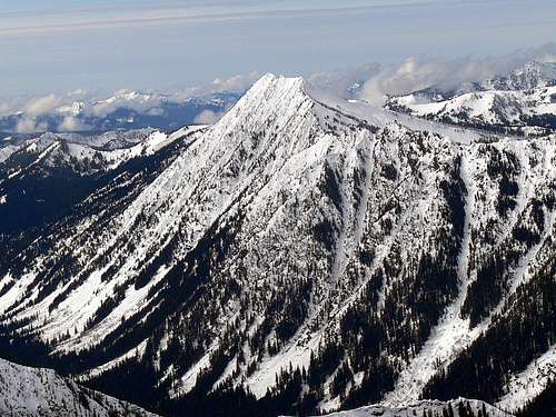
Arrowhead Mountain's East Ridge
Getting There
For those of us who love using google maps here is the directions. Note the place marker is almost exactly on the pull out for the trail head.Coming from the Seattle Area:
Drive over to Steven's Pass via Highway 2 which you should check the road conditions to make sure driving is safe over the pass. Then from Stevens Pass continue on Highway 2 for 7.6 miles, you know your very close when you see a train track bridge over the highway. The parking lot (more like a little pull out spot) will be on your next left.
Coming From Leavenworth:
It is a 27.8 mile drive Westward on Highway 2, you'll know you have gone too far if the Westbound and East bound roads have separated from each other. You'll see a Safeway 2.7 miles from the trail head (East of the Trail head) and the pull out will be on your right.
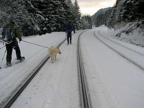
Hiking along the Railroad Track
Route Description
Start out from the Pull out area and walk East for about 100 feet, then walk directly south where you'll see a clearing of trees. In a moment you will see a train track, once your on it head East for about a mile and a half. The trains a bit quite so watch out for it. Once you see the train track heading left around the hill this is the spot you want to start heading south (to your right) up the slope which there is no trail. Remember your target is the south ridge so go mostly south but slightly east to catch the ridge at a convenient spot.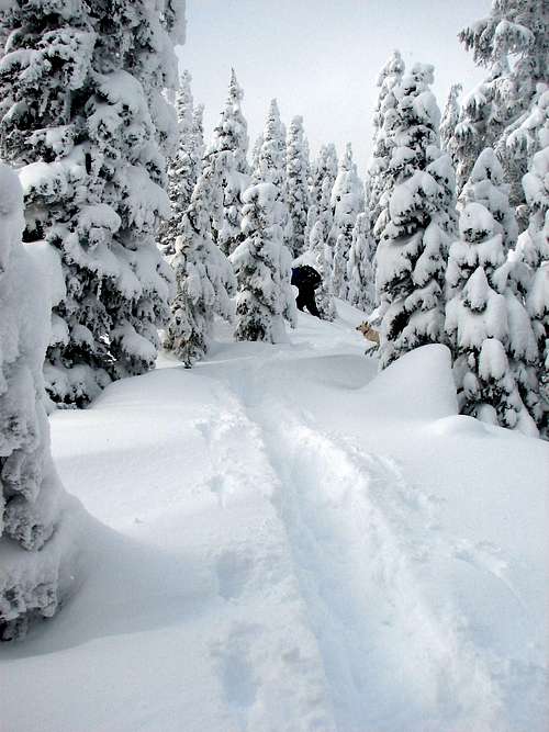
Once your on the ridge navigation is very easy here on out, you follow the ridge Westward (to your right if you were facing south) until you get to the summit. Views pop out right away so it doesn't leave you wondering "when will they come out". Mini cornices might form in later winter depending but it's relatively safe most of the winter which is what makes this one an excellent choice.
Conditions
The weather for this mountain can be seen on Noaa's ForecastThe Avalanche Forecast Can been seen on the Northwest Avalanche Center
The Sun Shining through the Clouds
Essentials
Because this route is most commonly done in winter, snowshoes are a must when there is lots of fresh powder. I went up this route without snowshoes and paid the price. An ice axe might be handy for the way down once off of the ridge for glissading, but is not required. Also bring warm clothes in case the ridge gets windy, and of course the 10 essentials.Topographic Maps
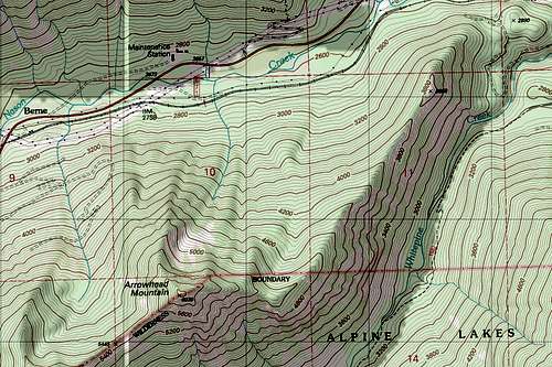
Arrowhead Topo Map
External Links
Pushing the Limits on ArrowheadJanuary 2011 Trip report on nwhikers
More Trip Reports.