
|
|
Trip Report |
|---|---|
|
|
58.07956°S / 21.0975°W |
|
|
Sep 29, 2015 |
|
|
Mountaineering |
|
|
Fall |
Heading Up
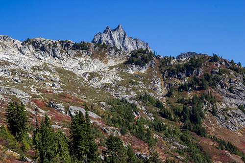
I got off of work around 10pm and frantically packed before leaving Seattle. We ended up getting to the trailhead around 2:30am and took our time getting up. We finally started the climb at 10am. The trailhead is pretty hidden. Luckily I had loaded a gps track. To get to the start of the trail, you have to walk back on Cascade River Road about 100 ft. until you reach the sign on your left and the logs to cross the river is on the right. They're pretty slippery, so be careful crossing. The trail started pretty overgrown, but opened up after a short while. It was a lot steeper than I had expected. Eventually the trail lead to a large boulder field. It was pretty slow going.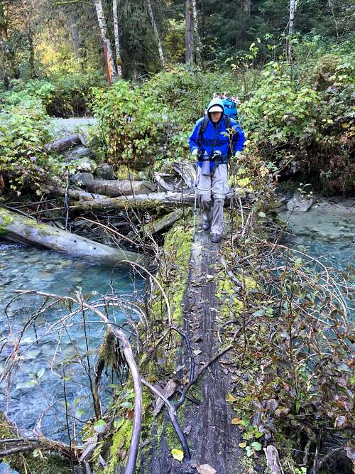
Crossing the River
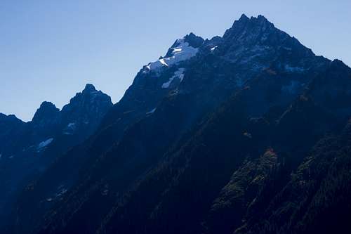
Johannesburg
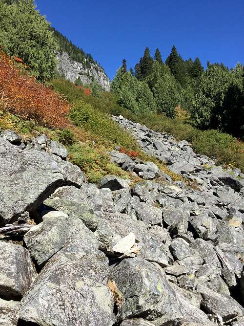
Boulder Hopping
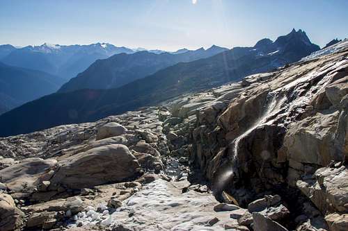
You could hear pikas squeaking all throughout the talus field, never saw any on the way up. At the end of the boulders, waterfalls were everywhere. This time of year it wasn't necessary to bring my stove to melt snow. There were waterfalls clear up to 8000 ft. A little above 5000 ft. the trail opened up to a meadow. The fall foliage was beautiful.
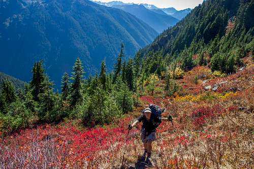
Autumn Leaves
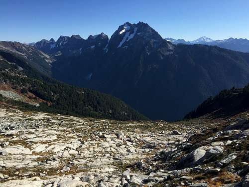
Mount Torment
At the top of the meadow we ran into two climbers who were headed back down to their tent. One of the climbers was too tire for the summit push, so he stayed behind while the other tried to summit. He said he couldn't find a way up and had tried to climb up the north side, but ran into some technical climbing. He was only a few hundred feet from the summit. He was pretty sketched out from a few sections on the way up. Climbing up the glacier, I'm surprised he made it that far unroped. Pretty ballsy.
Looking back at the meadow
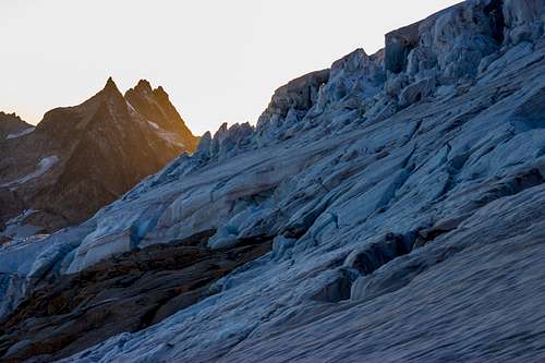
Ice breaking off the Eldorado Glacier.
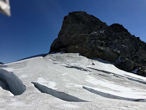
Headed up the Roush Basin
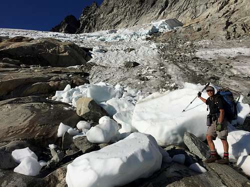
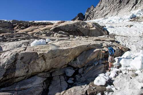
We descended the class 3 gully into the Roush Basin. Water was running all along the basin. When we got close to the glacier, we were planning on entering on the far right side. Shortly after we saw a piece of ice break off the size of a small car right down the path we were thinking of heading. So we headed a slightly off to the left.
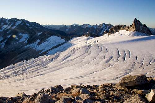
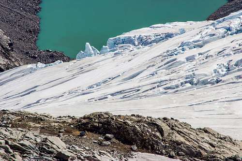
Eldorado Glacier
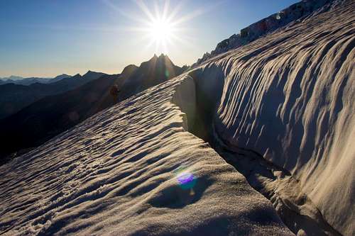
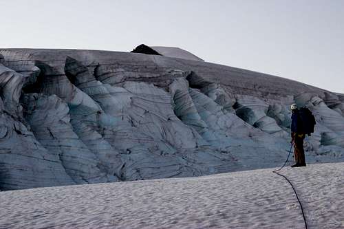
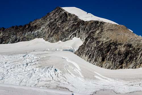
We filled up water in an ice cave and headed up the Eldorado glacier roped up. There were a couple narrow ice bridges, but it was pretty easy crossing. I would have felt a little nervous crossing them solo. The sun started to dip past the horizon as we made our way up the glacier. Our plan was to make it to at least 7,500 ft. for an easier summit day.
Eldorado Glacier
Crevasse at Sundown
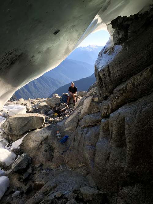
Glacial Cave
Sunset

Looking Back
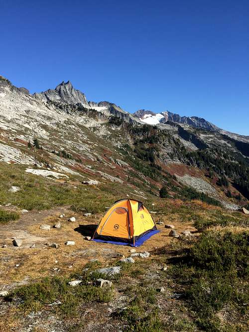
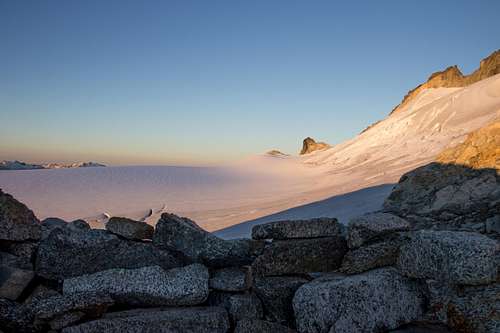
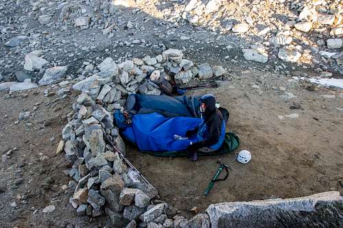
High Camp
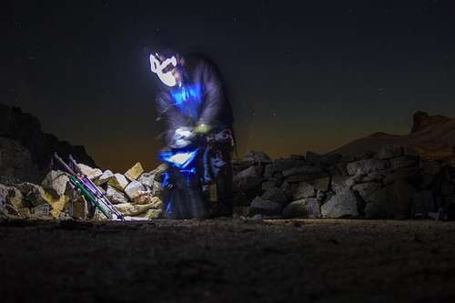
We reached the rock band that separates the Eldorado Glacier from the Inspiration Glacier around 7:30pm and decided to sleep on the rocks. We were pleasantly surprised to find wind barriers set up at high camp at 7,800 ft. The ground was a bit damp and it was a little colder than expected. The wind was blowing around 15mph. I brought my 30 degree sleeping bag and had to sleep with all my layers on to sleep comfortably. The moonrise was a beautiful orange glow. Thankfully I brought my telephoto to snap a picture.
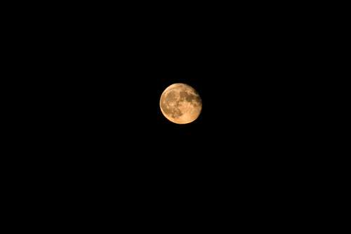
Moonrise
Sunrise on the Eldorado Glacier
Setting up camp
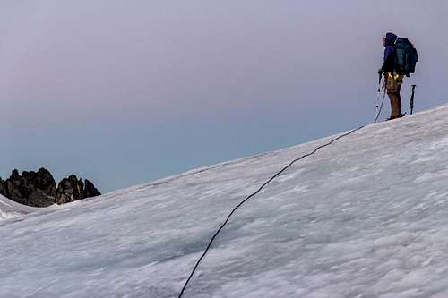
We woke up at 5:30am and the sun wasn't up yet. It was a little too cold, so we waited for sunrise and got up around 6:30am, finally heading up at 8am. Bruce had seen a mouse running around in the night. Had me a bit worried. In the morning Bruce found holes in his backpack and bivy sack. He had brought dried salmon and raisin bread. They didn't touch my dehydrated food and clif bars thankfully. We made sure to bring all our food with us. There was a raven that followed us up close to the summit.We followed rocks across to the Inspiration Glacier and followed the other climber's footpath until it veered right. Bruce wanted to follow his steps, but I saw a much easier route scrambling up the rocks on the left. I remembered seeing it in a recent trip report.
Eldorado Glacier
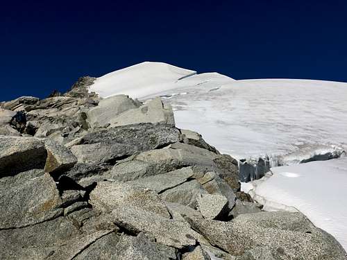
Up the east ridge
High Camp
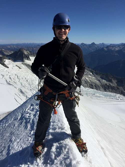
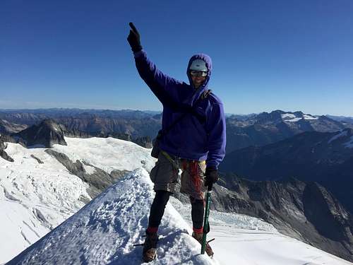
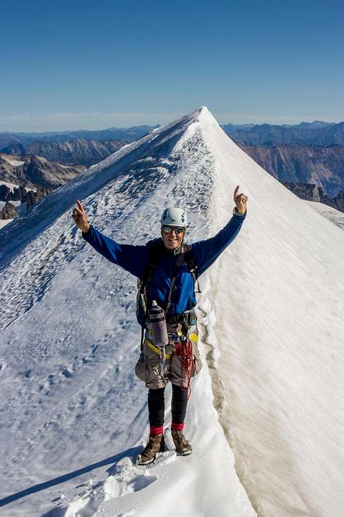
Summit and Descent
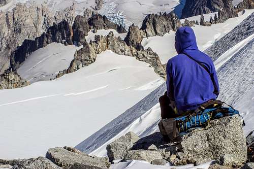
The rock scramble turned out to be the easy way up, class 3 with a couple class 4 moves. I felt bad for the other climber. If he had just headed up the rocks he would have made it to the summit. We reached the summit around 11:30am. We weren't sure whether the rocks or the knife edge ridge were higher, so we climbed both. Looks like this year the ridge is only a foot taller than the rock summit. We wore crampons, but didn't feel the need to rope up for the hundred feet walk along the ridge. The views were incredible, especially with all the fall leaves.
At the Summit!
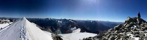
Summit Pano
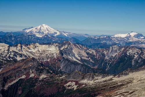
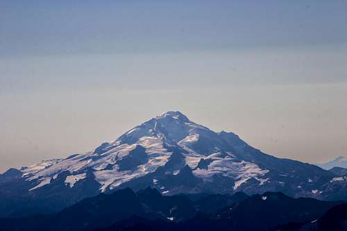
Mt. Baker and Mt. Shuksan
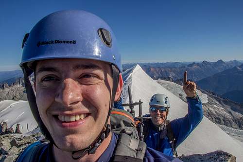
Summit Selfie!
High Camp, Eldorado Glacier and Moraine Lake
Bruce Enjoying the View
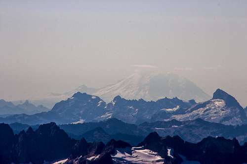
Hazy Rainier
Glacier Peak
We headed back down around noon and went unroped on the glacier following our footsteps back. We got a little mixed up on where the gully was. A lot farther from the glacier than we remembered. I had to pull out my GPS to find the entrance to the gully since we stopped following the cairns down. After the boulder field our quads were shot. The last 2,000 ft. were exhausting. My legs turned to jello. All those sloping glacier rocks and boulder hopping really wore me out. It was quite a relief to finally see the river and get back to the car. All in all it was an incredible trip!
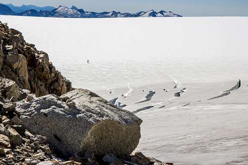
Bruce getting a head start across the glacier.
Bruce putting on his crampons.
Looking Back at the Summit


Comments
Post a Comment