The Canary Islands are a chain of volcanic islands situated just off the west coast of Africa. They were all formed by eruptions on the seabed over the last 70 million years, Lanzarote is the most easterly island.
Given that they are so close to each other and formed in a similar way, it is surprising how unique each island is. The five islands to the west of the group (El Hierro, La Palma, La Gomera, Tenerife and Gran Canaria) are formed by Stratovolcanos. This process results in the formation of typically high, conical mountain shapes, whilst Lanzarote and Fuerteventura have been formed by Fissure eruptions. This is where a vent opens in the earth and lava flows out. Consequently, there are fewer high, conical mountains and more, smaller rounded hills over a large area of similar heights.
The barren other – worldly landscape of much of Lanzarote contrasts starkly with the western islands which have large areas of green, verdant growth, especially at lower levels. Any winds from the west or northwest will bring clouds but most of these get caught on the higher mountains of the western Canary Islands – hence the greenery there. As the prevailing winds on Lanzarote come from the northeast, the weather is usually stable and fine. The lack of rain and the volcanic landscape accentuates the desert like environment which typifies the island and creates a weird almost alien landscape to those of us from northern Europe.
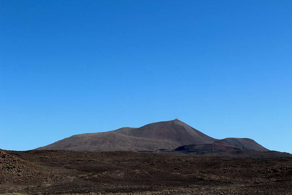
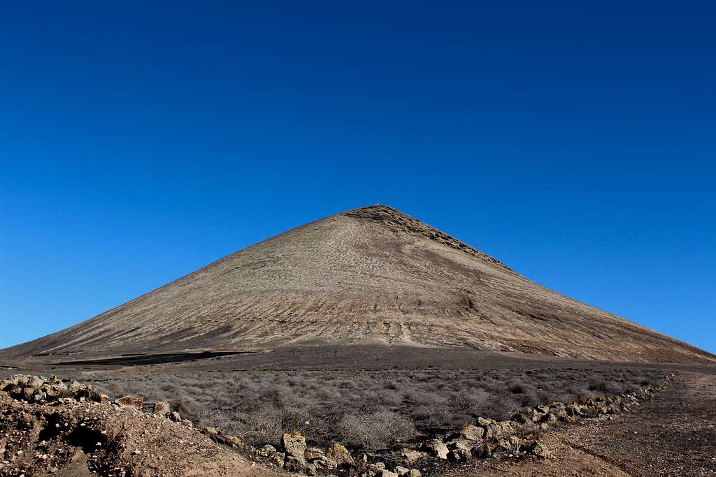
Atalaya de Femes (The Watchtower of Femes)
Atalaya de Femes, Lanzarote
December in the UK had been wet, cool and gloomy so, it was a relief to escape to the warmer weather of Lanzarote. The first day or so had been a mixture of clouds with a little sunshine and we had taken the bus from Arrecife to the small town of Yaiza in the south of the island, under a grey sky. Nevertheless, it was quite mild and better than being at home!
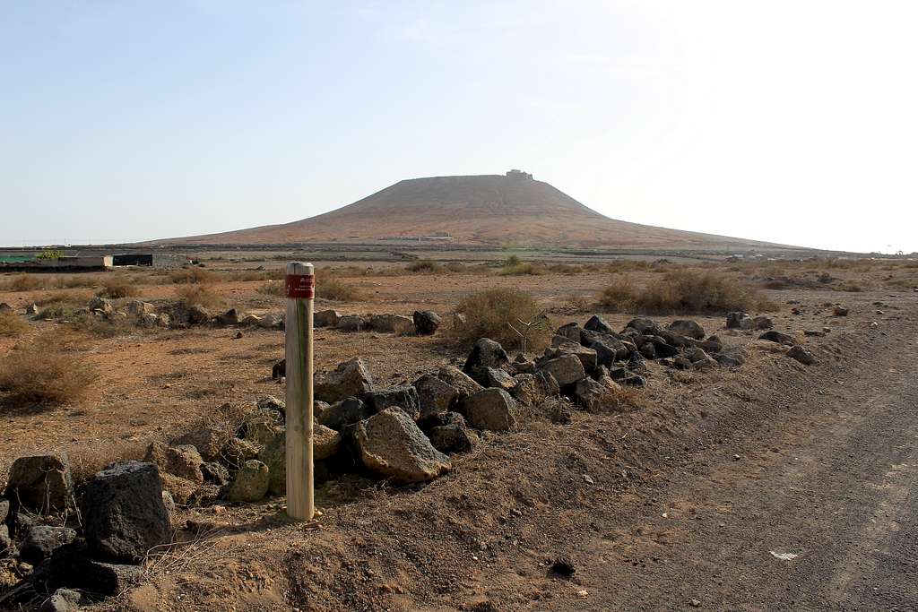
Walking through the quiet town, it was easy to find our way towards the cinder track running between poorly cultivated fields. The “soil” here is mostly dust and ash and rarely benefitting from rainfall but some plants do manage to grow.
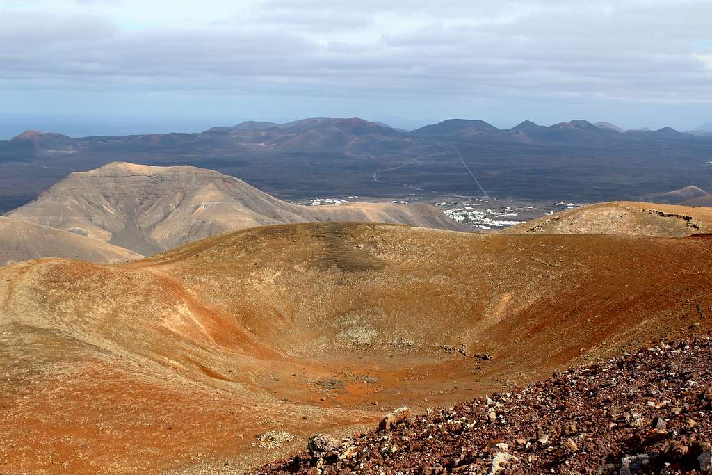
We ascended the track quickly, the only walkers on it and only a dog on a distant farm, barking to disturb us. Huge boulders line either side of the track which we followed to the brow of a hill. Looking back towards Yaiza, we saw our first views of the land to the north of the town, the Timanfaya National Park. The whole landscape here is shaped by six years of violent, volcanic eruptions during the 1730s. Nearly 300 years later, most of it has changed very little and for me, it was a constant source of amazement. Every time I looked at it, I found it surprising. Very few plants can grow in it and the ash covered, blackened landscape can seem slightly menacing at times.
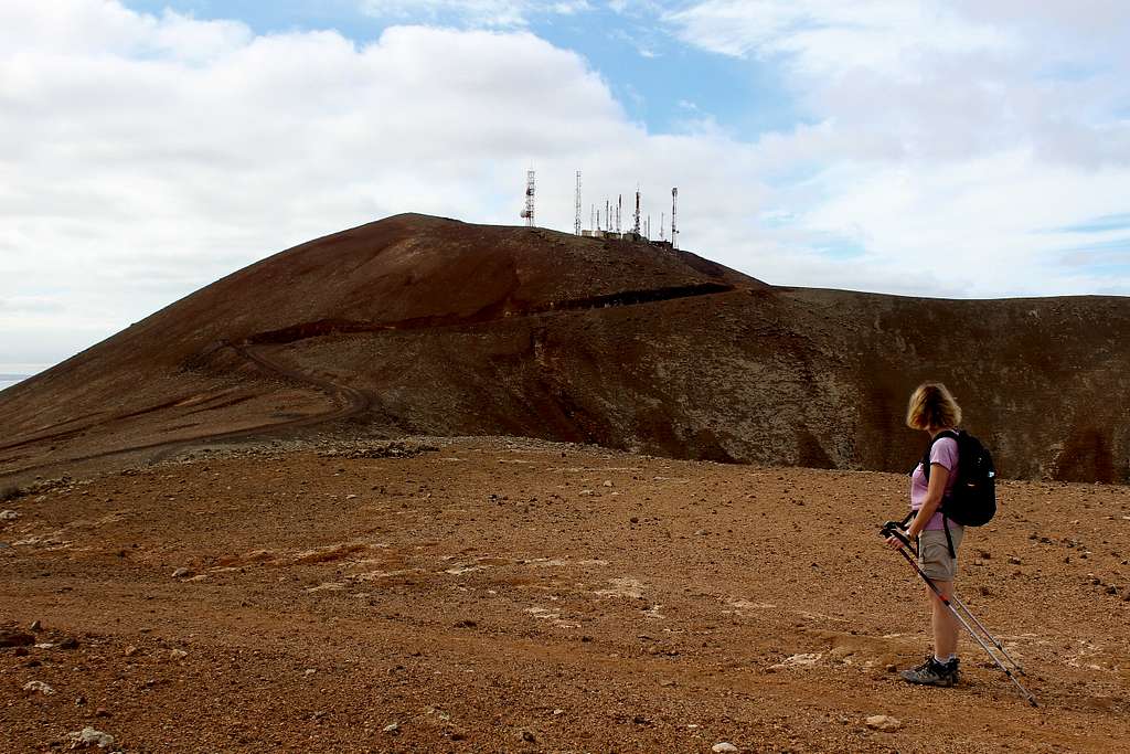
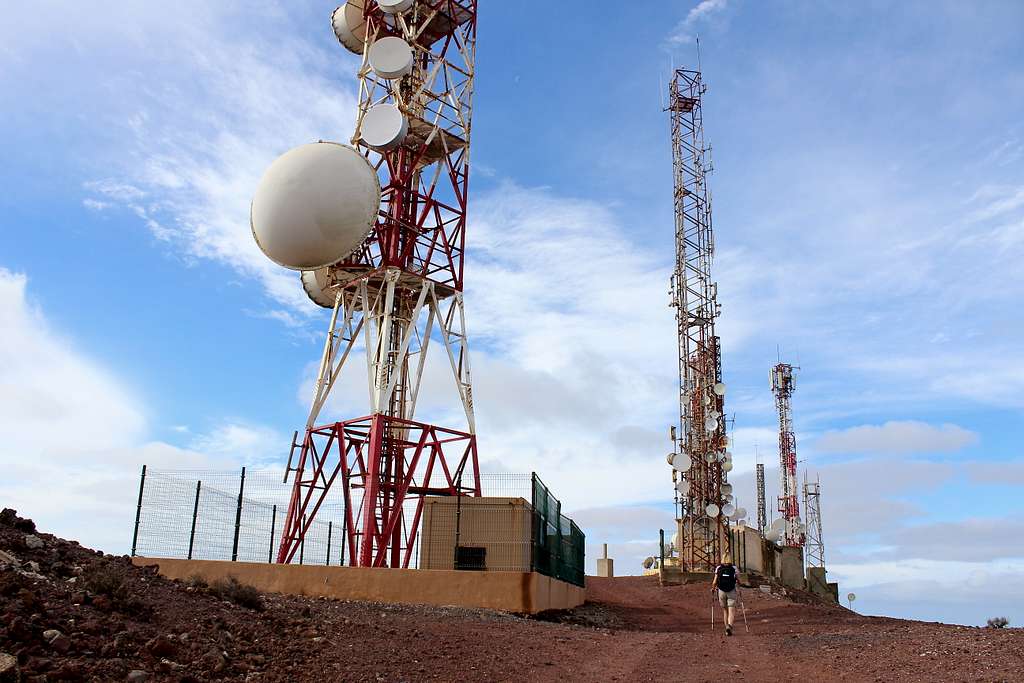
Through a gap in the boulders and marked by a cairn, we left our track and followed a feint path uphill. Now, we were on the northeast ridge proper and this path was followed as it gained height. Ahead of us we could see the communication aerials which adorn the summit, the second highest point of the island.
Atalaya de Femes (608m), Lanzarote
“Are we actually able to get to the top with all those aerials?” Marie asked me.
I thought for a moment and checked the guidebook description. “I think so.” I said.
“I guess we will find out when we get there.”
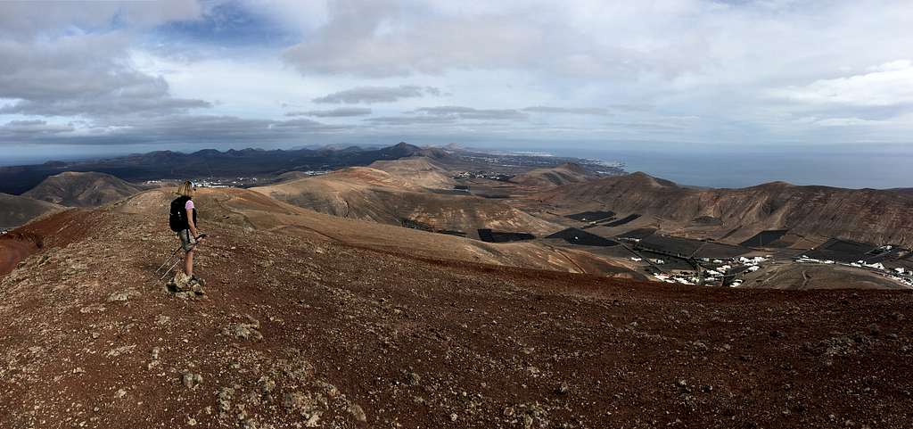
As we rose higher, the breeze from the sea picked up and we began to get views of the south coast all the way back towards Arrecife. The clouds started to break a little and the sun became stronger. It was warm enough to walk in shorts and T-shirts but we added a waistcoat for some sections. The ridge is dusty, rocky and quite broken but there is a reasonable path to stick to. The landscape had a striking feeling of openness and barren ground, a mountainous desert.
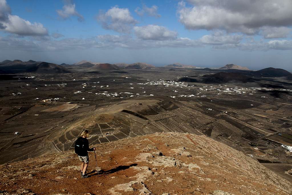
Nearer to the summit, an access track from the village of Femes joined our route and we met our first people of the day, a couple descending our route. We followed the track towards the summit. On our right, we had a view into the caldera, the original eruption point, now just a stony bowl.
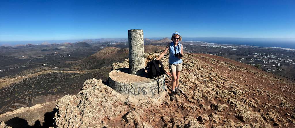
At the summit, we passed in between the communication structures and found the concrete, summit marker at 608m. In the UK, I would call this the “Trig point” but I’m not sure if that is accurate here? I climbed the ladder to the top for a photo and we both enjoyed our first view over the far south of the island towards Playa Blanca, the sea and the island of Fuerteventura, beyond.
Summit aerials, Atalaya de Femes (608m), Lanzarote
I can understand why this was called the “watchtower”, it would have been an important viewpoint in days gone by to see Pirates and marauders approaching. Nowadays, it is significant as a fabulous place to see the island.
For a while, the sun was strong and we sat on a concrete ledge, out of the wind to enjoy our lunch.
“We wouldn’t be doing this in England.” Marie said as she soaked up the sun.
It had only taken us 2 hours to get to the top, so after a while we packed up and set off back down our route to Yaiza where we knew we could catch a bus. The cloud gathered a little again for our descent and I was constantly taking photos of the dramatic views to the north, to slow us down.
We passed two sets of couples on the way up as we descended – obviously, persuaded by the improving weather to come out. Eventually, late afternoon found us back in our Arrecife hotel, watching the sun go down over the sea from our balcony.
“The weather wasn’t too bad today.” I decided. “If it stays like that for the rest of the trip, it will be quite good.”
In fact, that was probably the cloudiest day we had in the whole two weeks and only a day of gale force winds spoiled our explorations for the remainder of the holiday.
Atalaya de Femes (608m), Lanzarote
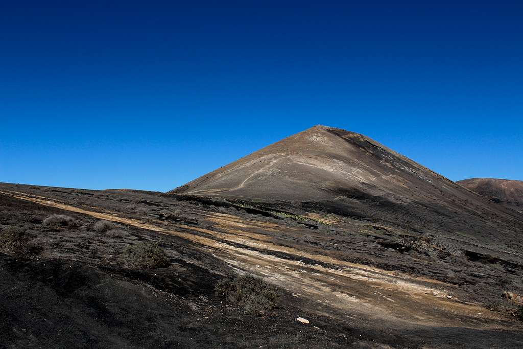
Montana de Guardilama
Montana de Guardilama (603m), Lanzarote
Before leaving the UK, we had been researching what we could do on Lanzarote. Marie had pointed out that the long-distance footpath – the GR 131 – could be a good source of walking routes. I had assumed that we might do 1 or 2 sections of it but once we arrived, it was clear we could try to complete the whole route of 72 km (45 miles), 5 sections over a period of 5 days.
This we did but there are plenty of routes on the surrounding volcanic hills which could also be taken in. Each section of the GR can be started and finished in a town with bus transportation available from the capital, Arrecife.
To get our bus we had to find the Estatacion de Guaguas (Bus station) in the north of the city. We thought this would be tough to find but it only took us 20 minutes to walk to it from our hotel and the excellent bus service took us to the town of Montana Blanca, set beneath the mountain of the same name.
It was very quiet once the bus had departed and to me, the street Christmas decorations looked strangely out of place in the warm sunshine under blue skies, it must be my British frame of mind!
We looked up at Montana Blanca.
“Are we going up that today?” Marie asked.
“I don’t think so.” I replied. “The guidebook says it takes 2 -3 hours. It might be better to do this walk and come back to it another day, in case the walk takes longer than we think.”
Marie agreed. I didn’t mention I had another mountain option, nearer the end of the walk that we might try.
The GR 131 is very well signposted and we easily made our way around the north side of the hill on another dusty ash track. We reached the pass and enjoyed the views southwest along the spine of the island. Our route passed along the lower slopes of a string of ancient volcanoes laid out before us.
As we descended, I noticed something sitting on a post ahead of us, a Kestrel. These birds are slightly smaller than the species we have in northern Europe and much less afraid of people. We advanced slowly as he sat there watching us. A gust of wind knocked him sideways but he stuck out a wing to balance himself. Eventually, he decided we had come close enough. He hopped upwards, spread his wings and soared away, watching us nonchalantly all the time.
We continued in lovely warm, sunny, December weather. Although this type of walking is not technically challenging, there is a lot to be said to recommend it for fitness and enjoyment of the outdoors. Particularly for those of us from the cooler, wetter areas of the world.
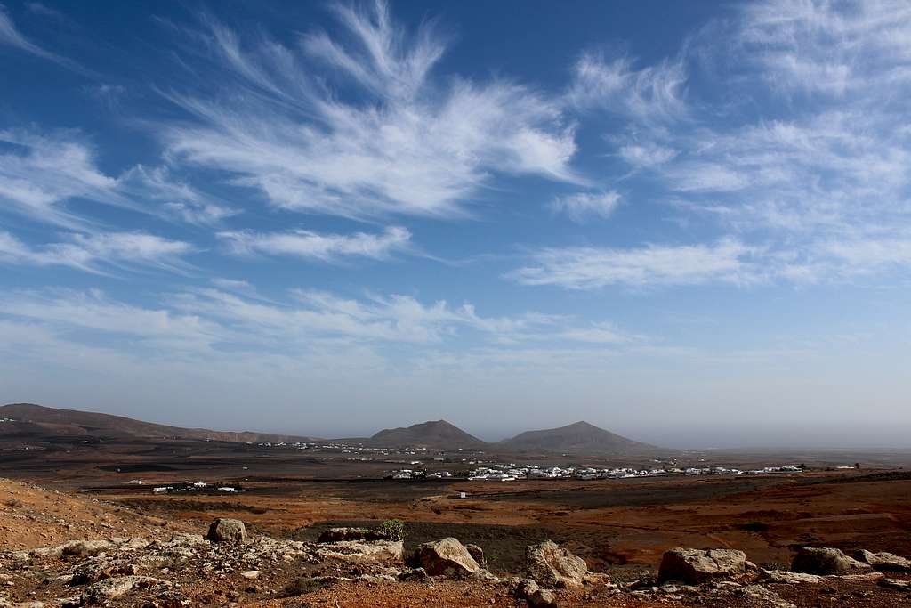
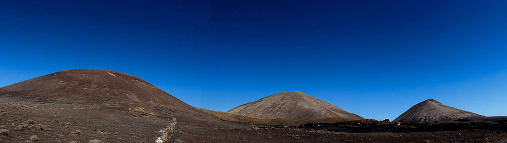
The route passed beneath Montana Tersa and La Monaneta, two rounded, extinct volcanoes and forward on rough, dusty tracks to the tarmac road through the hamlet of Conil and on past the mountain of Cerro Tegoyo, towards the larger settlement of La Asomada.
From here, we headed back upwards on a dusty track, to the pass at 419m – the high point of the GR 131 in this section – between the mountains of Tinasoria and Guadilama.
As we climbed upwards, we saw the small lava, drystone walls which were built to protect the vines from the winds that scour these slopes. We had reached the vineyards and the wine growing region of Lanzarote.
We sat in the lee of a wall, out of the wind to eat lunch around 12.30.
Looking up towards Montana de Guadilama above us, I said.
“We could go up that, the views are supposed to be really good.”
Marie looked a bit surprised. “You didn’t mention that before! What about the rest of the walk?”
“Didn’t I mention it the other day? I replied.
“Not today.” She reiterated. “Have we got time?”
“It should only take about 2 hours, maybe less, to get back to here. Then, we’ve still got plenty of time to get to Yaiza.”
So, 1.00 pm saw us heading up towards the hill.
Montana de Guardilama (603m), Lanzarote
A man descending, passed us, “It’s a great view from the top.” He said in English. (How does everyone know we’re English just by looking at us?!!)
We headed upwards, the steepest part of the day. I put my head down and made as quick a pace as possible, just in case it took longer than I thought!
The path was easy to follow although, the ground underfoot was formed by the remains of volcanic ash and lava and was very rough and loose. Around us the views opened up in every direction.
Quite quickly, I found myself in sight of the familiar shaped, concrete, summit pillar. I looked at my watch, it was only 1.20 pm! 5 minutes later, we were at the summit, a much quicker ascent than I had expected.
At 603m, the views were spectacular! We could see nearly all of the island. To the northeast, far away, I could see the cliffs beneath Penas del Chache, the highest point of the island. The resorts along the southeast coast from Costa Teguise to Puerto Calero and westerly towards the hills of Los Ajaches. North of us the wine growing land and the Timanfaya National Park with its array of extinct volcanoes were a million different shades of yellow, red through to brown and black. All under a blue sky.
We stayed for around 15 minutes, enjoying the sunshine. We could see our route heading west and north, a line across the black, ashen vineyard landscape. The towns of Uga and Yaiza – the destination for the day - looked a long way off!
We descended as quickly and carefully as we could on the rough ground. A couple on the way up had stopped in the same place for quite some time and I was worried that one of them was injured. They seemed fine as we passed them and they set off for the summit with no problems.
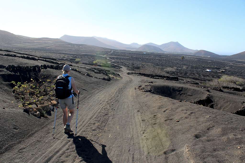
GR 131, La Geria, Lanzarote
We returned to our lunch spot by 2.00pm (only 1 hour!) and continued on the GR 131. The track passed through acres of black, ash soiled vineyard, there is no shade here and it was hot in December. It must be unbearable during the summer months.
After a long hot section, we reached Uga and found our way through the town to the Camel track (for the tourist Camel rides!) which lies on the far side of the town and continues on towards Yaiza.
Soon after this, we found ourselves on a cleared path, passing through the preserved lava fields from the 1730 eruptions, another amazing landscape experience.
We reached Yaiza before 4.00pm and celebrated with cans of Coke form the supermarket fridge!
An excellent day with some truly spectacular views of an amazing and memorable landscape.
Guanapay
Guanapay (447m), Lanzarote
The bus drove away, leaving us at a lonely stop on the edge of Teseguite, a small town in the hills of Lanzarote. To say it was quiet would be an understatement, there was no sign of life and only the wind from the distant sea, blowing through the roadside Cacti, caused any sounds.
Growing older is difficult! I won’t bore you with the whole story, suffice to say… we had both checked the timetable, noted the bus stop we wanted in Teguise and both had been fully awake during the journey! And yet, here we were, in the next town along having missed our stop!
“Have we got to walk back along the road?” Marie asked.
I consulted our map. “No, there is a footpath, I think. If we can find it.”
Eventually, we found the town graveyard, got our bearings and found the footpath we wanted, heading north and uphill, back towards Teguise.
The route was easy to follow across the barren and dusty hillside. It was a bright, sunny morning with only a few scattered clouds in the skies but the wind was stronger than previous days and any distant view was quite hazy. We had read that a Calima was on the way, the dusty wind from the Sahara and already a change was evident.
Southeast coast of Lanzarote.
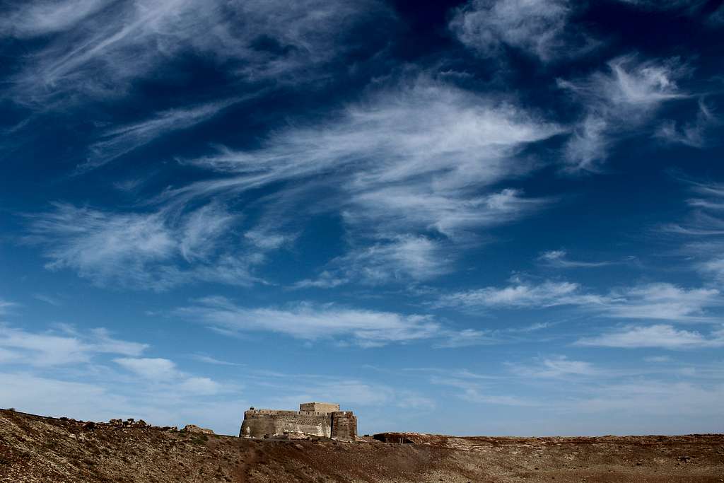
Soon, we reached a tarmac road and a signpost directing us up the final, short climb to the summit of Guanapay at 452m. Before that, we had to walk around to see the Castillo Santa Barbara.
The previous week, as our plane came into land, I had looked out the window and seen a hilltop castle beneath us. It looked dramatic and out of place in the desert landscape but I had looked it up out of curiosity. I didn’t plan for us to come here.
It was built in the 16th century to watch for pirates in the days when nearby Teguise was the capital of Lanzarote. It makes an imposing silhouette on the top of the hill but nowadays it’s just a tourist attraction and closed when we were there.
The summit itself is a great viewpoint, with fine views over the southern coast of the island. It took a look back towards the castle, to see a view of the caldera beneath us, to remember this was once a volcano.
Castillo Santa Barbara, Lanzarote.
We returned to the access road and descended into Teguise. Out of the wind, it was a warm day and we stopped at a shop to buy cans of drink.
By the time we found the GR 131, it was 12.30 pm, a little late to be starting our walk to the town of Montana Blanca, but we persevered. This is probably the poorest part of the footpath, heading across the wide-open, dusty farmlands towards the volcanoes of the south.
Looking into the sunlight, the hill of Montana Blanca was a hazy, rounded silhouette for most of the day but looking back we had great views of Guanapay, with its hilltop castle standing guard over the town of Teguise.
We reached San Bartolome and found our way through it and followed our path on its convoluted course. We got a great view back over San Bartolome, across the open lands towards Teguise. The sight reminded us of the Middle East rather than a Spanish island.
I have to tell you about the bus stop in Montana Blanca.
It has a sign saying “Bus”, it has a typical bus shelter, with seats and a local bus timetable on the wall of the shelter. It has a layby off the road which has the word “Bus” painted on the road.
And yet, this isn’t the Bus stop!
We made it to the town a little after 4.30 pm – the bus was due around 5.00 pm – and sat in the shelter.
Around 5.00 pm a man passed by, he looked at us in a strange way, stopped and said “Arrecife”?
We both thought he was taxi driver, touting for business but he ran down the road shouting “Arrecife, Arrecife,” and gesturing to us to follow him.
He ran into the road and stopped a bus at a junction. We ran down the road and found other people getting on the bus! We made it on, thanks to the local passerby.
The bus doesn’t stop at the bus stop. It stops in the middle of the next street – invisible from the bus stop - where it blocks the traffic. There is no bus stop sign and only a wall on the other side of the road to sit!
Only a local would know this, so we were lucky.
Montana Blanca (White Mountain)
Montana Blanca (595m), Lanzarote
We didn’t manage to return to Montana Blanca until the last day of the trip. The Calima had blown through, in doing so it had caused us to abandon a walk at the southern end of the island – as we couldn’t stand – at least the atmosphere was clear of dust once again.
The town itself stands at around 350m above sea level and with the volcano summit less than 250m above it, it was always going to be a short ascent.
We followed our route on the GR 131 around the north side of the mountain. We were looking for a path next to a wooden hut (according to our guidebook) but the hut had been replaced by a smart, fenced and concreted paddock enclosing two dogs who loved to bark at everyone who passed by!
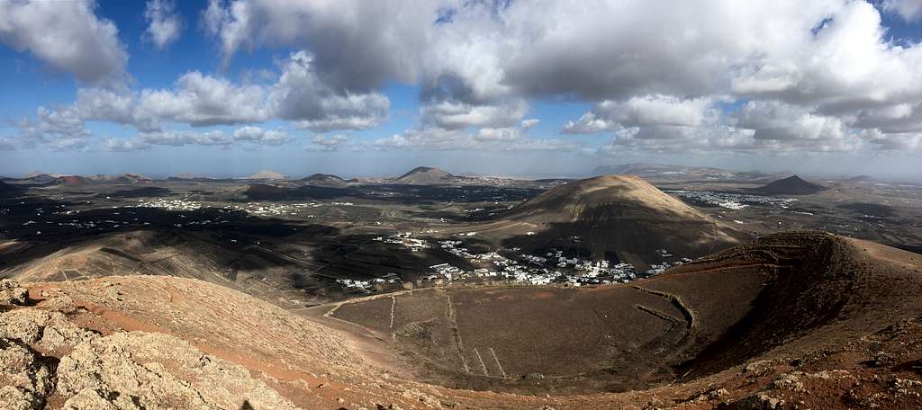
The path climbed the mountainside in a clockwise direction, climbing up over the town. As we got higher, we saw more of the volcanic landscape to the north and of Montana Guatisea to the northwest. Finally, San Bartolome and Monte Mina with its aerials and wind farm were visible.
As we reached a stone hut and crossed over the low point of the caldera rim, we came onto the southern side of the mountain and caught the breeze as it came up from the sea.
The white, puffy clouds cast dark shadows across the burnt landscape, creating a patchwork of different colours and shades which forever changed.
Montana Blanca ( 595m), Lanzarote
We headed for a wooden cross and then turned upwards to follow the ridge to the summit at 595m, complete with its concrete pillar and ubiquitous communications aerial.
Another summit with fabulous views in all directions, it had only taken us about 1 hour to get there. We sat and enjoyed the views, picking out places we had earlier visited.
Atalaya de Femes, Montana Guardilama, Arrecife and a huge chunk of the GR 131 path, we could see for miles.
Eventually, we decided to leave. We descended into the caldera on a path we had not yet trodden, then regained our original ascent route at the stone hut.
We reached the town in time for the lunch time bus back to Arrecife – not from the bus stop but from around the corner!
Montana Blanca, Lanzarote.
Afterword
Lanzarote has an exciting and interesting landscape in which to enjoy walking and exploring. Much of this landscape is both ancient and comparatively new as volcanic activity has been occurring throughout history and man’s pre – history.
Although not as high or as difficult as many mountain objectives, these mountains offer fabulous views and an unusual environment to spend many sunny and enjoyable days.
When it comes to getting old being difficult, what I find funny about making mistakes like the one you mention is that we've forgotten we made the same blunders and a lot more when we were young. :)
Cheers,
Jacek
Hi Jacek,
Yes, you are probably right... I can't remember!!!
Luckily, this mistake wasn't too costly and we still had a good day.
Thanks for the comment.
Mike
Parents refers to a larger category under which an object falls. For example, theAconcagua mountain page has the 'Aconcagua Group' and the 'Seven Summits' asparents and is a parent itself to many routes, photos, and Trip Reports.


Comments
Post a Comment