Northwest Passage - August 12th, 2015
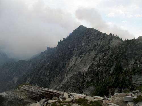
Climbing Holland and Snowshoe Peaks after hibernating for a year is no joke. I was hurt and hurter after getting those two peaks back to back with Greg and Sam, and took a rest day Tuesday on McGuire Peak north of Libby while Greg got South Selkirk Crest in Idaho. Wednesday I planned another rest day, this one rejoining Greg on Northwest Peak in the far, well, northwest of Montana. Greg wanted an early start around 7, but I ended up being late by attrition, having taken a bit longer to pack up from the motel, then taking the wrong highway for several miles before noticing on my way from Bonners Ferry back to Montana, then having underestimated the long paved but windy drive towards Yaak, then the equally windy but passenger car friendly gravel road into the Northwest Peak Scenic Area.
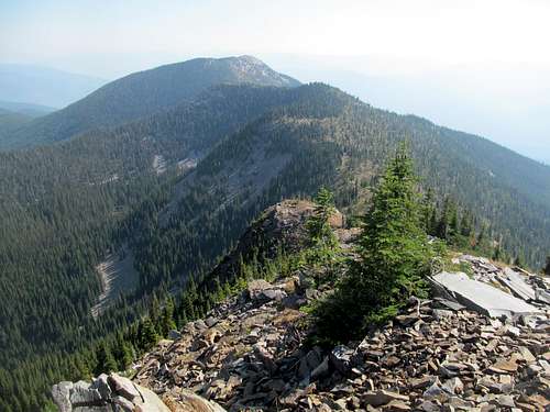
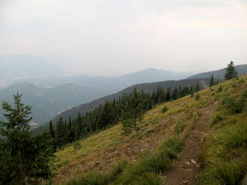
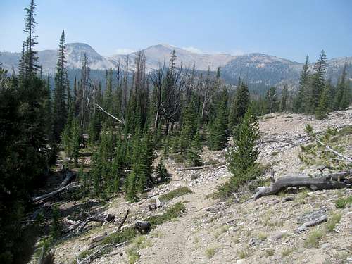
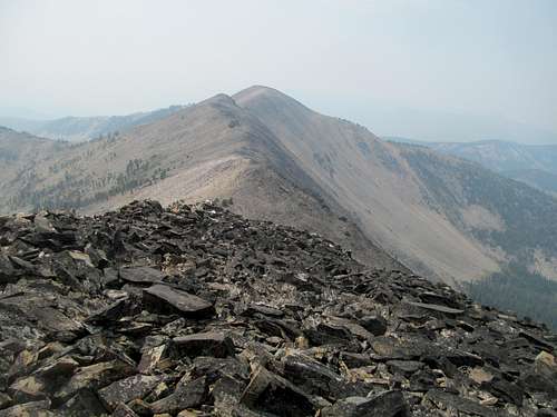
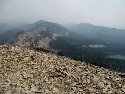
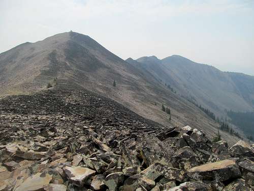
I saw Greg’s 4Runner parked but no signs of him and presumed that he had gotten tired of waiting. On my own timetable now, I took my time getting ready and started up the fairly boring but easy trail. The route is as easy of a hike as it gets, 1,600 feet and two miles one way to a pretty major P4K in the Purcell Mountains of Montana.
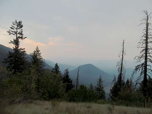
Yet like McGuire the day before, it’s pretty dull, at least for 90% of the way up through the trees. I finally ran into Greg more than halfway up; he had waited and gotten impatient and a bit perturbed waiting for me. We chatted a bit and he told me that the summit and the small lookout was quite delightful. We worked out plans to meet on Abercrombie Peak in Washington the next day, and he set off to get a second peak near Bonners Ferry (Clifty or Queen, I forget).
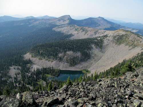
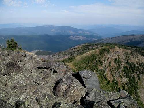
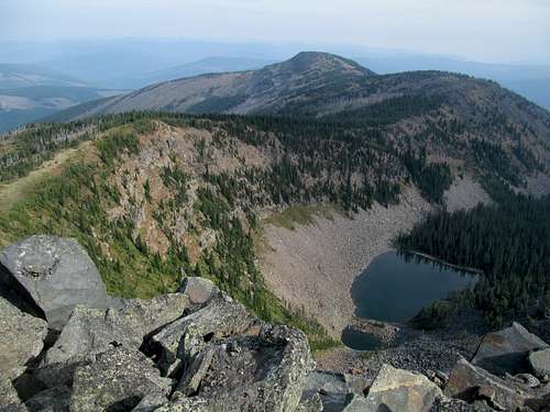
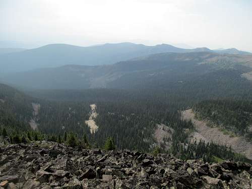
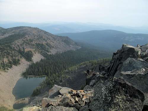
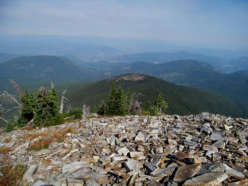
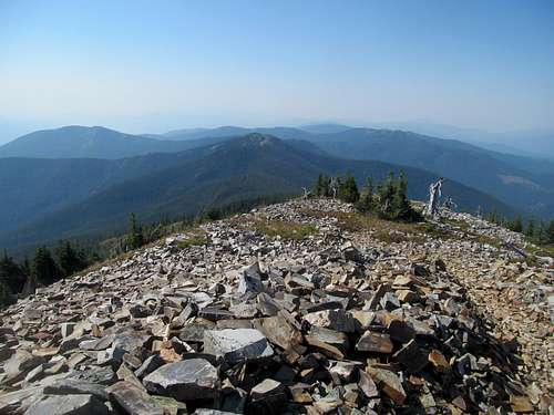
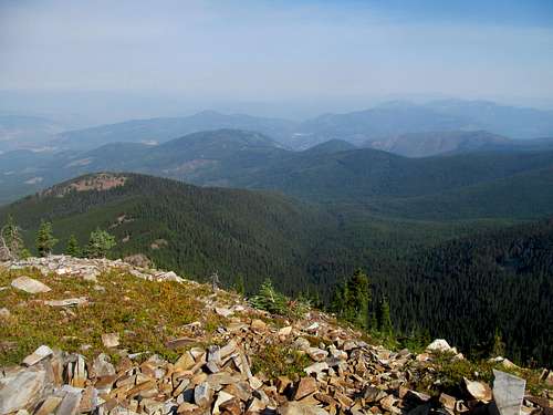
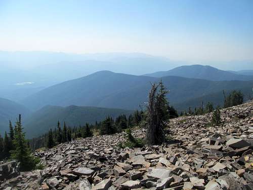
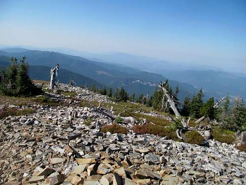
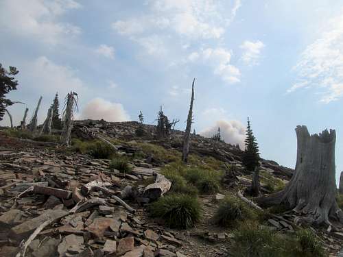
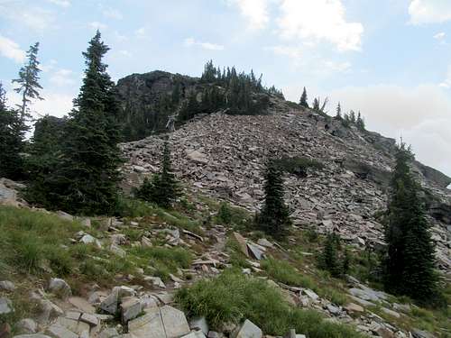
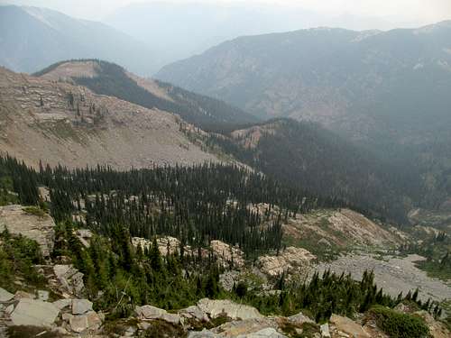
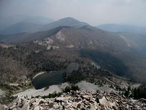
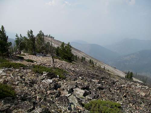
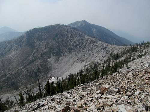
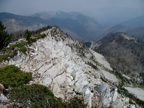
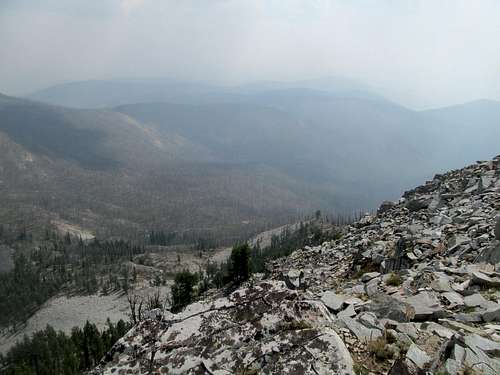
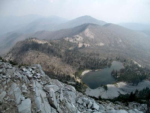
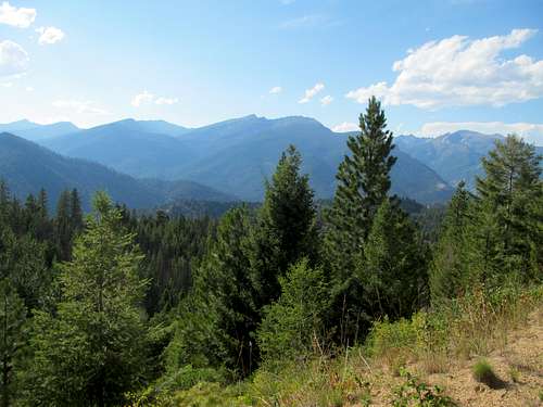
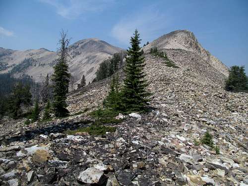
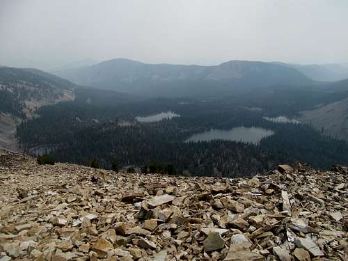
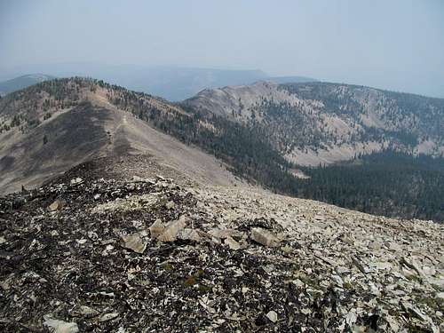
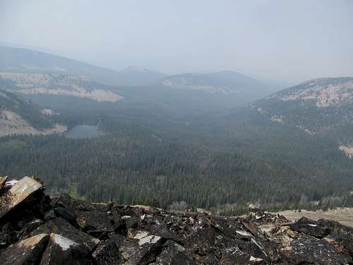
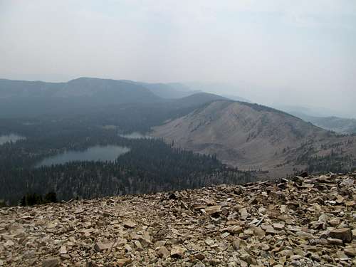
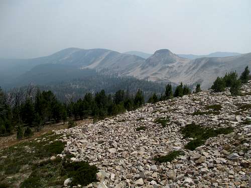
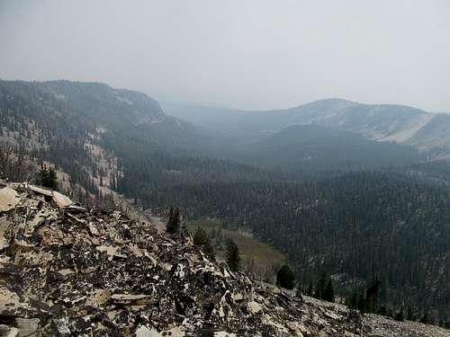
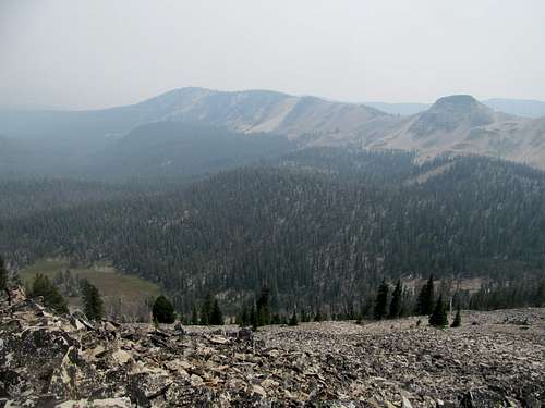
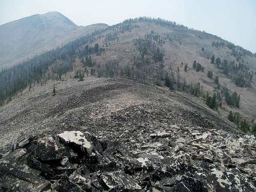
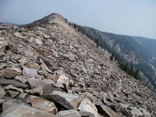
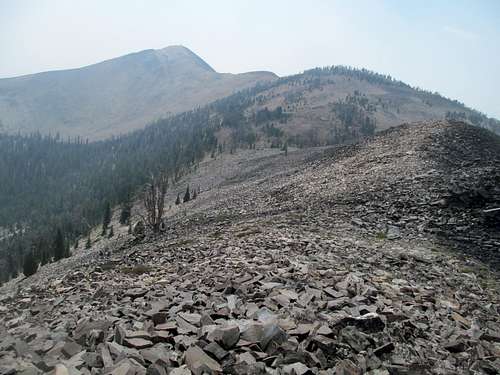
Soon I found myself on unexpected talus, which the trail picked through for a few hundred feet. Cedron underplays this peak for the most part, describing it as pretty dull, albeit with good views and prominence. The views were pretty great actually, with very quaint chain lake basins on either side of the mountain, and the early start helped with the views as the haze stayed low.
Had Greg not mentioned something I would have left the lookout, wholly boarded up on all sides, alone. But he had said it was cool and worth checking out, so after identifying which door was the boarded up one I managed to remove the barriers for a glimpse inside the abandoned structure.
A nonchalant hike down and longer ensuing drive along the pretty Yaak River, replete with a stop at Yaak Falls, took me back towards Bonners Ferry, where I had a choice.
Well, several choices really. I could get a nearby P2K, Clifty or Queen or Saddle, all of which were quick half day peaks. But I hadn’t really done the research, was still trying to rest my legs, and plus, laziness. So my other option was to continue on towards Metaline Falls through Idaho via enjoying all the amenities and bright lights the city of Sandpoint had offer. This was tempting, but I was planning to hit up Sandpoint upon my return anyway, which made option three optimal…a sidetrip through Canada along the Selkirk Loop.
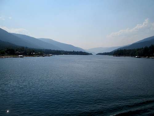
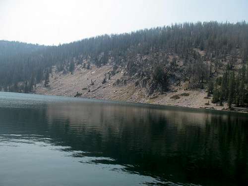
The scenery was appealing, and the distance to Metaline Falls seemed similar relative to the Sandpoint route. I happened to have my passport in the car and no weapons, so I drove north towards the border crossing via ID-1. Canada, or really the idea of travelling to any foreign country, terrified me though, what with all its unknowns of how to spend money, how much over the speed limit I can drive, etc. A few very nonchalant Canadian customs agents waved me across the border, and first up was Creston, a small town with a Tim Hortons along the highway, a bunch of oddly dressed religious people in 19th century clothing playing along a river (the nearby FLDS?), and not much else. Past that the highway crested some charming countryside before dropping into spectacular Kootenay Lake, which provided eye candy for me the rest of the way towards the free ferry on the northern end of the lake. The Selkirks, though not all that high in this still southern portion of the range, belied perception through its sheer relief as endless ridges and peaks rose and fell over 5000 feet above Kootenay’s vast azure depths.
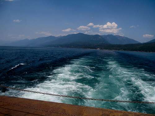
I lined up my car in one of the 10 or so laned queues at the Kootenay Lake/Balfour Ferry, apparently the world’s longest free ferry, and tried my best to relax and enjoy the scenery (aka not be bored as hell waiting for my free ride). The ferry was pretty but its slow progress meant that Hooker and Crawford and all the other sharp and colorful peaks on the eastern Purcell Range side of the lake revealed themselves seemingly one block of talus at a time.
To the north we enjoyed great views of Mt. Cond and the Kokanee Glacier area which, added to the fact that it’s the namesake for the crisp Kokanee Beer, gave it more impetus as it added itself to my future spots to see list.
The area on either side of the ferry, what with all its little quiet and quaint motels tucked away behind trees and hills, gave the entire area for me a nostalgic 90’s movie/summer camp feel. I had intended to check out Nelson, maybe grab a beer and slash or brew, but much of its downtown area was under construction and I ended up just driving through.
The rest of the drive back to the states was pretty dull actually, reaching rock bottom recrossing the border as one agent meticulously checked inch by inch and artifact by artifact each of the two or three cars in line ahead of me (apparently there was some hippie music festival nearby thus probable cause).
I grabbed a beer and delicious burger at the only (rowdy and local, in the most delightful way) bar/restaurant in town, then drove across the river to meet up with Greg at the Abercrombie trailhead, only to see his 4Runner parked well before the end of the road. Apparently he had already made it to the trailhead and found the entire area closed due to a fire closure of some sort. We camped there and decided to try out the western approach the next morning.
Shopping Abercrombie - August 13th, 2015
I have either a Delorme or Benchmark atlas of pretty much all the western states with the exception of the three Pacific coast ones. As a result I was practically much travelling blind here in Washington outside of my Rand McNally US atlas, but fortunately Greg had his mapping software and felt a traverse over to the western side of the range via Smackout Pass would be plausible. Indeed it was yet another camry-friendly road to Northport, and we found the west side trailhead without much difficulty.
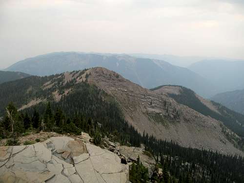
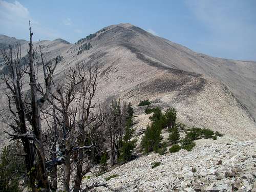
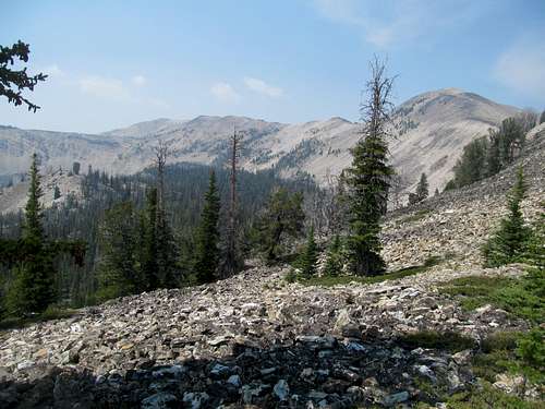
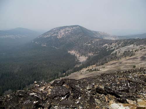
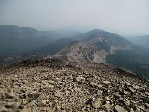
And the peak itself wasn’t much either…same as the prior two days: several miles of easy hiking through a tree tunnel, to quote Cedron Jones, and then a last huff above the trees. This time it was different as I traded solitude for chatting with Greg, and further up we wondered about grizzlies as Greg saw tracks we observed Oquirrh fidgeting nervously.
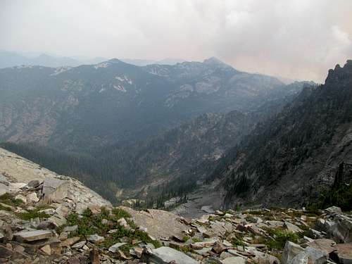
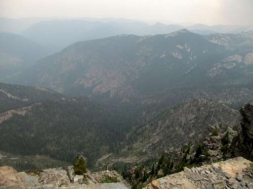
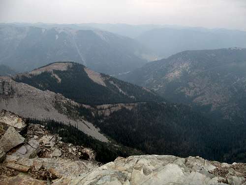
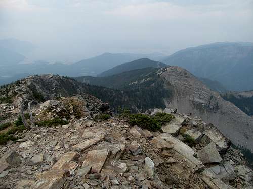
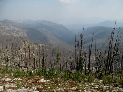
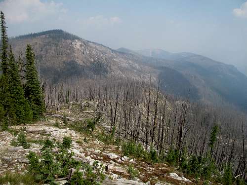
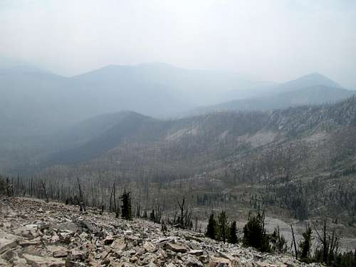
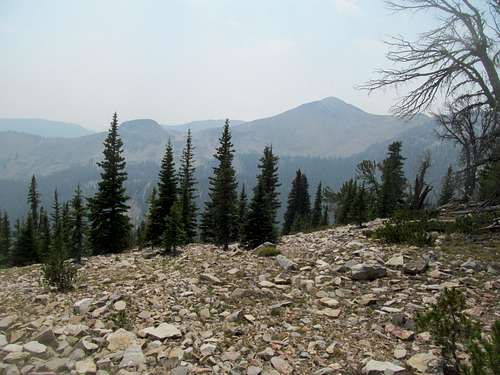
On a nice day the views would’ve been great but today it was mostly haze from the serious fires further west in eastern Washington, the same ones that would contributing to making my life an aggravating hell the next week.
But for now we could maek out outlines of the distance mountains to the west, unknown and anonymous bumps yet intriguing and unclimbed P2K’s to both me and Greg. There wasn’t much else to look at, so we headed down and parted ways. We were both headed back to Idaho, Greg via Spokane and me via Sandpoint and Couer D’Alene, the plan to meet on Bennett Peak in two days.
I blindly retraced the dirt roads back over Smackout Pass hoping not to get lost, and afterwards drove through the stark landscape back into Idaho, looking forward to checking out Sandpoint, the popular lakeside Northern Idaho tourist town not rhyming with Pour D’Alene. First though, a number of errands, from restocking on supplies to getting an oil change and a haircut. That done I stopped by first the Laughing Dog Brewery north of town and had a delightful time at the canine themed establishment. My beer flight came on a doggie bone shaped tray, the bar welcomed its namesake and was filled with cute pups chilling by the brewery’s patrons, the huckleberry beer was delicious, and the bonus was that the owner/manager was a huge Pats fan and we all watched Tom Brady make his 2015 preseason debut.
A Shot of Scotchman Burning - August 14th, 2015
Sweaty and unshowered from my haircut I hurried back to town, refreshed myself and checked out Sandpoint’s other Brewery, Mick Duff’s, in downtown. I was underwhelmed by Sandpoint the rest of the night, as the brewery and the general vibe of the town was unexpectedly too hipster for my liking. Still I got plenty drunk and found myself plenty hungover Saturday morning when my alarm woke me around 5 AM for Scotchman Peak.
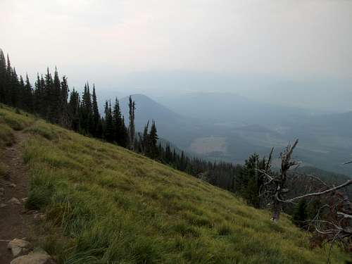
The alpine start was due to anticipated lightning storms past 11 AM. The trailhead was a short ways away from Sandpoint but I got mighty lost stumbling about some of the pretty rough dirt roads between the highway and the trailhead, driving around in circles after missing a hastily marked turn. It was already really damned hot and humid by the time I started up what was reputed to be the steepest damn class 1 trail in Idaho, and while it lived up to its reputation, a few off-days and a week of constant hiking meant I was in reasonable shape to tackle/suffer it.
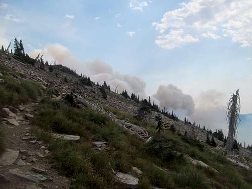
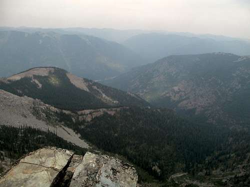
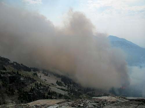
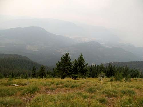
The grade lessened higher up and the trail meandered through a few open meadows but my mind began to turn towards views as I slowly recognized the reality of the haze barely allowing for even much views down onto Lake Pend O’Reille below me. I knew there was gonna be some smog given conditions the last half week, but my main goal was to somehow still be able to discern the just climbed Snowshoe Peak from the summit of Scotchman.
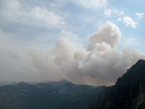
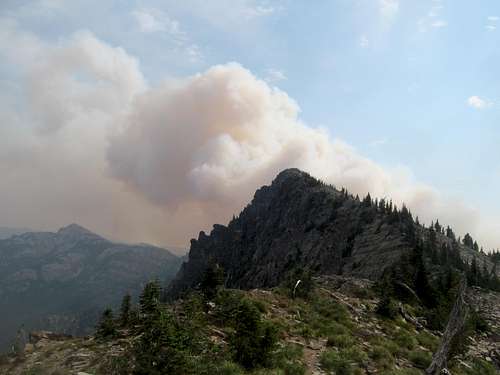
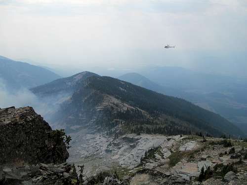
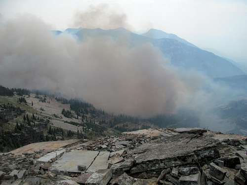
This became more and more in peril the first views over the other side of the mountain and ridge opened up, and I saw huge, ominous plumes of smoke coming from the other side of the mountain. Obviously there was a fire up there somewhere, and it would likely block out views of Snowshoe and the Cabinets. Even more immediately pressing was where this fire was, and whether or not I’d be in danger slash walking right into the conflagration on my way to the summit. Due to my late start I bumped into a few hikers coming down, including a gentleman that had spent the night on the summit. He remarked that the fire had started on the other side of the mountain from lightning overnight and was definitely spreading; however, given that it was not in or around the immediate summit ridges of Scotchman, I could continue my hike to the top.
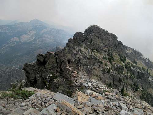
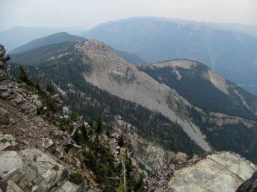
The rest of the trail continued at a rather average grade to a shoulder as the trees begin opening up and bore right for the final summit ridge of Scotchman. You see the rocky face of the peak looming above you and for me, it looked closer than it actually was, the experience amplified by the ominous clouds of smoke rising above the tip of the mountain. I knew logically that fire wasn’t that close to the summit, but it’s hard to translate that to actually seeing the fine and granular details of it so close (which has to make you remember how amazing it is that you have an entire profession of people dedicated to running towards this shit on a daily basis). I wondered if there was any actual danger in continuing to the summit, but figured that a trail crew working just a hundred feet or so above the parking lot would’ve warned me/blocked me from continuing had there been an actual and merited closure.
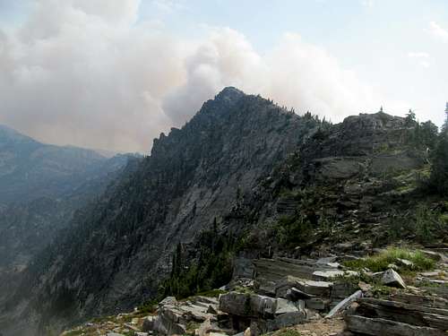
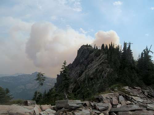
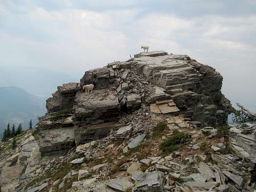
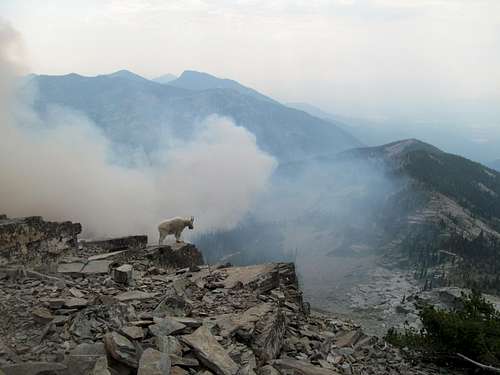
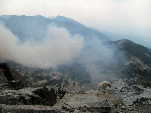
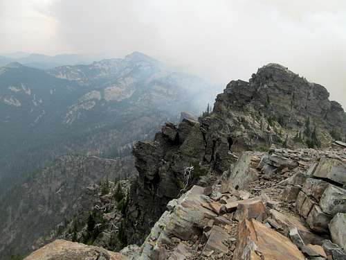
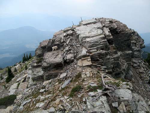
I hopped past signs telling you to not bother the ample goats and followed the trail as it wound around and then finally up to the summit. Here I beheld this most unique situation, a volatile mixture of frustration and awe. Yes, my views of the Cabinets in Montana were blocked, but it’s not everyday you stand next to a pack of wild goats and together all stare down at a live wildfire merely about a thousand feet or so below you.
A mild breeze was blowing the smoke north thus far, keeping it from swamping the Scotchman summit, but the thought that it could turn and engulf me and my four legged compatriots stayed in the back of my head.
I walked around the summit goats to the true summit block, requiring an aforementioned mildly less than basic scrambling move that was more awkward on the descent than vice versa, eyes rarely leaving the fiery settings in the basin below…and not just because the haze pretty much blocked useful views of anything besides the fire.
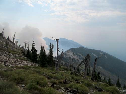
I returned to the false summit block and continued to observe the surreal scene below as a helicopter, surprisingly small from my vantage point, flitted around the edge of the smoke. The scene below was mesmerizing, especially where you could the faded yellow/orange flames consuming the individual trees below.
Shit got a bit too real though when, after long moments of gazing wistfully into and past the plumes, I noticed a tree maybe 100-200 feet upwind of the main fire aflame that I didn’t observe to be burning even minutes ago. Seeing that the fire could leapfrog like this jolted me back to reality, and while I realized that the odds were low that my summit area would actually catch fire, I decided to retreat just on the off chance too that a change in the woods would literally suffocate me on the summit.
So while I dealt with smoke on Abercrombie and McGuire days before, this would be the first summit I’d descend filled with unrequited rage at having missed out on optimal views; at least Scotchman gave me the surreal scene of fire in exchange for my views…the peaks that were to follow would not even suffice to be so kind.
I chatted up the rest of the upwards hikers on my way down, advising them on the scene. Being so short, the steep parts of the hike went by pretty quick on the way down, though the humid weather made for a sweaty and muggy rest of the hike. The sounds of the forest maintenance crew working below were a relief, indicating that I was almost back at the trailhead.
The weather had held: cloudy all day, but not a sign of the promised and early thunderstorms so far. I stopped and grabbed lunch in the now sunny Sandpoint and continued down to sunny Couer d’Alene, a lakefront vacation haven that I had long wanted to experience. Motels weren’t cheap, but I grabbed probably the cheapest in a neighborhood east of downtown. I had a dinner and a few drinks in the hip and lively center of CDA and even received an invitation to join a group of ladies on their boat party Sunday morning, but alas my plans to join Greg on Bennett Peak at 7 AM the next day trumped any would be day-partying.
Picking Up Piquett - August 16th, 2015
Little did I know that I would’ve been better off in more ways than one on a boat. I forced myself to wake early and drive the long, windy but mostly paved Couer D’Alene River Road up to the trailhead for Bennett, a P2K northeast of Cataldo. Once again I misunderestimated my driving time and found myself a bit late, though only by 10-15 mins: not as bad as Northwest Peak earlier in the week. Greg was there and informed me of the situation. The entire area ahead containing Bennett was closed, the ranger having informed him firsthand that a fire blazed just below the summit. Greg asked him how close the fire was, and if there was really any real danger to proceeding, or if the closure was just precautionary. The ranger told us that the fire was pretty much just on the other side of the ridge, and if we proceeded we’d probably die.
Greg thought that Latour Peak would make for a good backup plan. We backtracked our way to I-90 and continued east to the town of Kellogg, where Greg thought he spotted a viable road leading us within striking distance of the summit. The road deteriorated significantly past towning, and knowing how much I hated these shitty roads, Greg offered to drive me the rest of the way. So I packed up and rode passenger as the access road for the eastern flanks of Latour Peak went from bad to nightmare for about two and a half extremely slow and bumpy miles. Then we got to a creek crossing that Greg, for all his skill and experience driving 4WD, was not comfortable fording. He estimated that it would be around a 13 mile round trip hike from here…a quick jog for him but something that I was neither mentally ready nor packed for, having only brought enough waters for what I expected to have been a 3-5 mile round trip hike. So we parted ways here, he up the mountain and me walking and backtracking the 2 miles plus of road back to my 4Runner holding my sneakers in one hand and hiking poles in the other.
I gave one last attempt at salvaging the day by swinging west on I-90 back to Cataldo to try what I vaguely recalled seeing online regarding what’s probably the standard approach before my reception ran out. The Boise Peak roads were rough, got rougher, and each fork in the road seemed a make or break decision seeing that I really didn’t know where I was going. I reached a fork where the road deteriorated in one direction and was marked for fire closure in the other (even though there wasn’t really a fire in the area); it was enough for me, and after all these setbacks I called it a day.
I could handle one peakless day this trip and my focus at this time was to keep my lest rested and ready for what would be a long day for the upcoming attempt on McGuire, a 20 mile day in the Bighorn Crags and the primary objective of this trip. I was eager to get to Missoula anyway to get my last taste of civilization before heading into the Idaho outback.
I heard from Greg from the top of Latour. He was on his way into Montana too, his plan being St. Joe’s Peak in the Bitterroots on Sunday before he drove back to Salt Lake. St. Joe’s, which apparently was borderline class 5, would be stray too far from my plan of maintaining maximum leg strength for McGuire, but seeing as we were headed the same direction I decided to car camp, drink and chill with him one last time before we parted ways for the year. I grabbed grub and a few drinks in a dive bar in Lolo as he made his way east, and we found a spot not too far from US-93 to ham it out about peaks and shit one last time between swigs of whiskey/vodka.
I woke from the trunk of the 4Runner to find Greg already gone for the last jaunt of his trip. I was fine with a later start on Piquett, fully expecting it to be a nice relaxing warmup peak for McGuire. And while the physical aspects of the hike was fine, the frustration from the prior days continued to accumulate.
I had been dismayed coming into Missoula to see that the smog from Abercrombie and Scotchman had, if anything, gotten worse. While an early start might’ve allowed me to purloin some views, my body needed the rest and I found myself starting up the trailhead in the early afternoon.
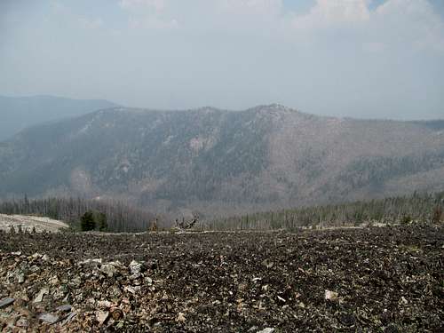
There’s not that much else to say about Piquett…a good trail takes you four or so miles to the saddle between Piquett and Rombo Mountains, and a decent ridge trail takes you the rest of the way to the summit. The terrain below was typical of lower Montana forests…surprisingly lush, dense and green. You follow the creek where the trees thin out not due to elevation, but some massive and comprehensive burns dotting the terrain en route to the ridge.
The summit, looming behind a few false bumps, looked further than it probably was due to the distortion by the ever pervasive haze. Greg had really liked Piquett, talking it up about how pretty it was with its lakes ‘n shit.
Well I got nothing out of that, with even the nearby lakes barely visible from the haze. Thinking about it (and trust me I still do), Piquett probably has some of the best amphitheater views of the Bitterroots…close enough to Trapper and the high peaks to see the details, far enough to provide a bleachers perspective of the entirety of the range rising up from its namesake valley. And here I had none of it.
My frustration was turning into hashtag pissed as I realized that I would never see the Bitterroots from this advantageous ankle unless I repeated it (insert vile vomit into mouth here). Fuck that.
I bathed in my frustration the entire walk down. The postscript is that, a year later in the summer of 2016 I would waste an hour plus driving up the windy as fuck Rombo Mountain Road searching for a comparable and ultimately disappointing view of the Bitterroots from this angle.
I was at a decision point; I could continue my plan of Taylor and McGuire, or save those for next year and backtrack east towards Yellowstone and the Absarokas, where perhaps the haze would not be as thick. Seeing questionable weather in that direction, I went all in to a decision I still regret, continuing south to Salmon Idaho. A wildfire right besides the highway greeted just before town and it should’ve been yet another warning sign. I tracked down the very nondescript forest service office in the middle of a residential area and asked a ranger walking by how bad the haze was in the Frank Church interior. She said that she had just taken a helicopter ride past the Crags and while it was bad it was still worth checking out.
Well fuck her and her advice. I really really really really really should’ve abandoned my plans for McGuire, and while I couldn’t blame her entirely, her words helped keep me on track towards a bottomless pit of rage and regret. I grabbed a delish meal at the Junkyard Bistro, a narrow dive bar type place filled with busy firefighters, tried out the savory beers at the fully western Bertram’s Brewery next door, and enjoyed a nightcap at the Shady Nook bar next door to my motel.
Bad Blood with Tay Tay - August 17th, 2015
Taylor was another late start what with getting up, packing up, and driving the long, slightly bumpy, and quite extensive forest road 20 down to Iron Lake.
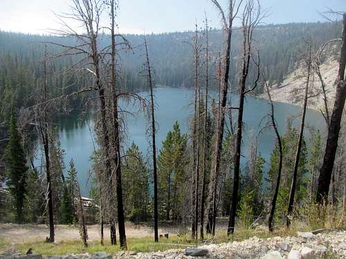
The beta on peakbagger told of a route from this direction up a trail towards the Hat Creek Lakes, ultimately following the peak’s east ridge up to its near 10,000 ft tall major Salmon River summit. It was near noon when I started, the lake was pretty, and the day was cool and chill, but the haze persisted.
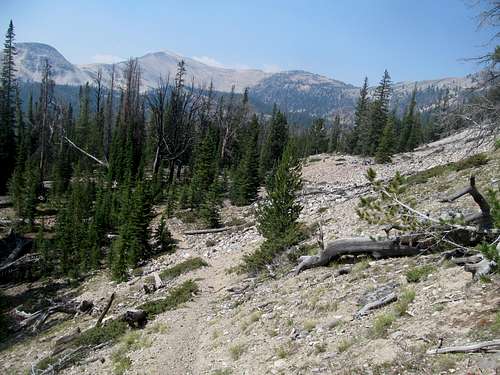
My GPS was damn close to Taylor on my way up so I was surprised that the trail kept veering east and away from the peak following a quick ascent to the top of a wooded ridge. To my dismay it dropped a few hundred feet down into a basin, but not before allowing me some decent views of Taylor, a semi-decent and alpine looking pile of talus.
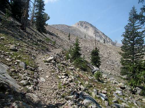
The trail continued through a middle drainage before starting up the peak’s east ridge at the base of a small talus pile. A few hundred feet up at the crest I saw the Hat Creek Lakes below me and knew it was time to leave the trail.
The ridge was a bit loose, especially enroute to a small false summit where I took an even looser traverse left of the bump to save from gaining an extra hundred or so feet of elevation.
Pretty basic rest of the way up, where once more, the lack of views anywhere but my immediate surroundings should’ve dissuaded me from my plan.
I couldn't even see the Bighorn Crags so it made no sense to commit to them, but I was too far gone, my thirst for that peak was too strong, and common sense continued to evade me.
Though I did get one thing right. My ascent route had too many up and downs and loose spots. I eyed on the GPS a much more efficient route: a straight shot down the north ridge then northeast directly back to Iron Lake with probably saving a mile plus of distance and a few hundred feet of elevation gain. The question was how loose and slash or how brushy the route would be.
I started down the north ridge which, while not affording any views of the Hat Creek Lakes, provided a good glimpsed into the wilder western backside of Taylor.
The rocks were nice and stable all the way down, and the traverse was wholly pleasant all the way back into the open forest, where I rejoined the trail just before it began its final descent back down the initial ridge.
I’d have to repeat Taylor, but at least it would be a quick hike that I could get enroute to something else.
You’re not in a good place when you find yourself planning makeup days and repeats (seriously, fuck fuck fuck that word) before you even get to your main objective, the mountain that you’ve been pining after for the last year/forever. And nevertheless, upon backtracking down FR 20 I turned left at the crossroads to plunge deep into the wilderness down into Panther Creek and my personal heart of darkness.
Comments
No comments posted yet.