Getting Started
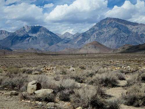
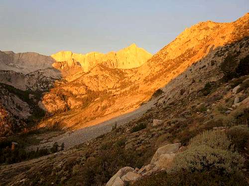
After a few nights at Four Jeffrey Campground and a warm-up hike circumnavigating and summiting Chocolate Peak off of the Bishop Pass trail, our group—Ruvicha, Brian, Steve2 and I—prepared to head for Desolation Lake via the Piute Pass, with the goal of climbing Four Gables Peak. Three of us previously had camped at Horton Lake; Four Gables, along with Mt Tom and Basin Mountain, forms something of a triangle around the lake. From our lakeside campsite, we enjoyed the early morning alpenglow on Four Gables and wanted the view from its summit. Visiting Desolation Lake on the way seemed an added bonus.
![Four Gables]() Four Gables between Mt Tom (right) and Basin Mountain (left)
Four Gables between Mt Tom (right) and Basin Mountain (left)![Four Gables Alpenglow]() Four Gables Alpenglow
Four Gables AlpenglowHiking Up Piute Pass
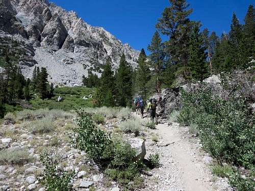
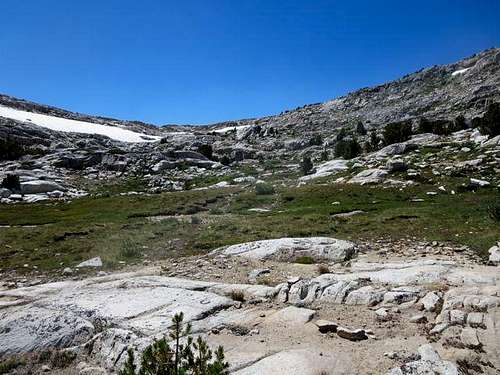
We left the car at the North Lake parking lot and hit the trail to the Piute Pass. We found a nice, well-established, sandy trail with two early log crossings over the North Fork of the Bishop Creek. The trail began climbing a series of switchbacks almost immediately. After about 1.7 miles and 1500’ altitude gain, we gained sight of Loch Leven, a pretty little lake lying under Mt Emerson to its north.
![Four Gables]() Piute Pass Trail
Piute Pass Trail![Four Gables]() Piute Pass Trail
Piute Pass Trail![Loch Leven]() View of Loch Leven
View of Loch Leven![Loch Leven]() Looking back at Loch Leven
Looking back at Loch Leven
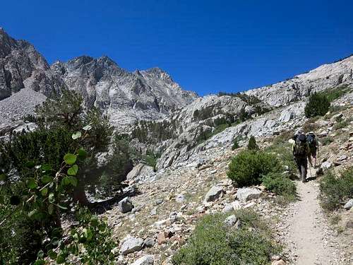
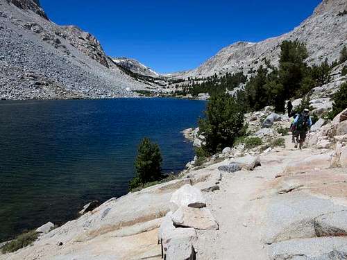
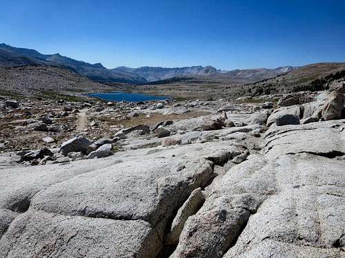
The trail passed along the north side of Loch Leven, with Emerson looming overhead on the right as we continued to climb, albeit at a lower incline than the first part of the trail. Three miles up the trail and at almost 11,000’ elevation, Piute Lake came into view.
![Piute Lake]() Piute Lake
Piute Lake![Piute Lake]() Looking back at Piute Lake
Looking back at Piute Lake
After a short break to refill water bottles, we finished the last stretch to Piute Pass, about 4.2 miles from and 2200’ above the trailhead per our GPS (the Tom Harrison Map says that the distance from the trailhead to the pass is 5 miles; I wonder if they measured from the North Lake parking lot as opposed to the actual trailhead.) At the pass, a hiker told us to watch carefully for two cairns marking the turnoff to Desolation Lake. From the pass, we had a nice view of the Humphreys Basin to the west.
![Piute Pass]() Looking up at Piute Pass
Looking up at Piute Pass![Piute Pass]() Looking west from Piute Pass
Looking west from Piute PassOn to Desolation Lake
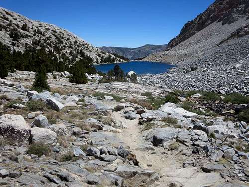
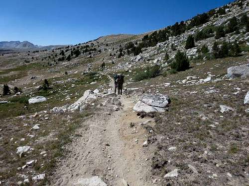
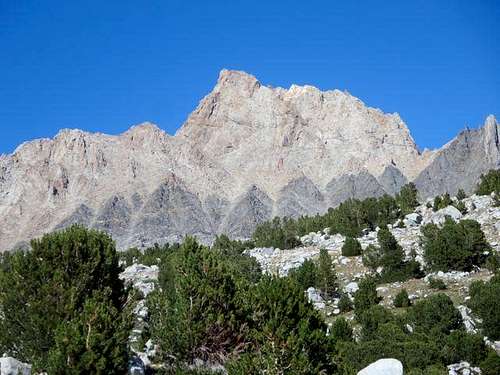
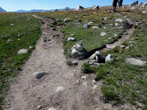
After crossing the pass, the trail, still sandy and very established, descended a few hundred feet. We encountered quite a bit of traffic, mostly backpackers heading down the Piute Trail to the John Muir/Pacific Crest Trail. Just short of two miles from the pass, we found the trail to Desolation Lake, marked by a large, unusually shaped boulder and the two large rock cairns and heading almost due north. The trail offered good views of the south face of Mt Humphreys, though it is one of the least attractive mountains in the Sierra. We had naively assumed that, since Piute Pass is at about 11,400’, the same elevation as Desolation Lake, we would have a fairly level hike—we should have checked out all of those contour lines on the map a bit more closely!
![Piute Pass Trail]() Hiking Piute Trail into Humphreys Basin
Hiking Piute Trail into Humphreys Basin![Mt Humphrey]() South face of Mt Humphreys
South face of Mt Humphreys![Cut-off for Desolation Lake]() Cairns mark cut-off to Desolation Lake
Cairns mark cut-off to Desolation Lake
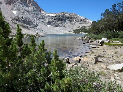
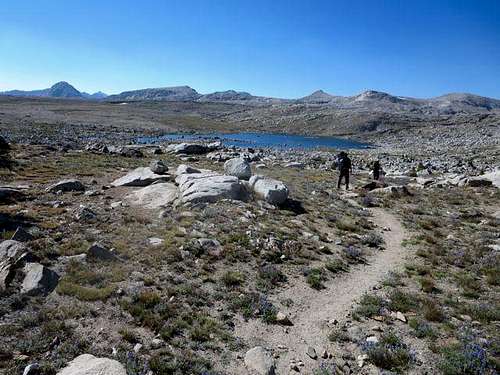
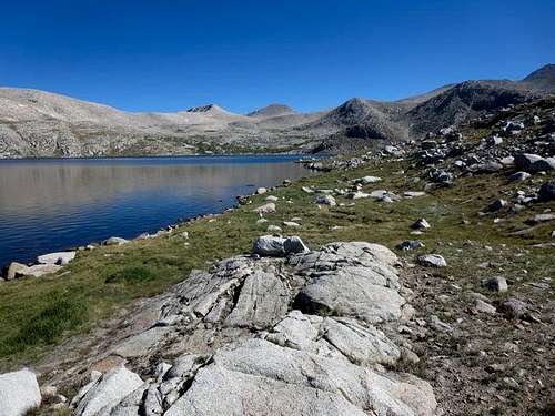
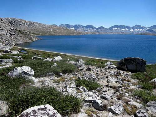
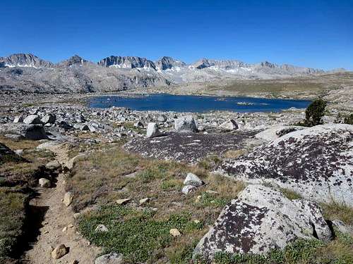
The trail gained back some of the altitude that we had lost coming down from Piute Pass as it passed Lower Desolation Lake. It then cleared another rise, bringing us into view of Desolation Lake. We proceeded up the eastern side of the lake, almost to the point where the trail peters out, and found a level spot to pitch our camp for the night, by our GPS 7.7 miles from the trailhead. It’s a beautiful area but a different type of beauty: rocks, a lake and mountains … but no trees.
![Lower Desolation Lake]() Lower Desolation Lake
Lower Desolation Lake![Trail to Desolation Lake]() Trail to Desolation Lake
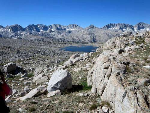
Trail to Desolation Lake![Desolation Lake and Four Gables]() Desolation Lake with Four Gables center background
Desolation Lake with Four Gables center backgroundTo the Top of Four Gables
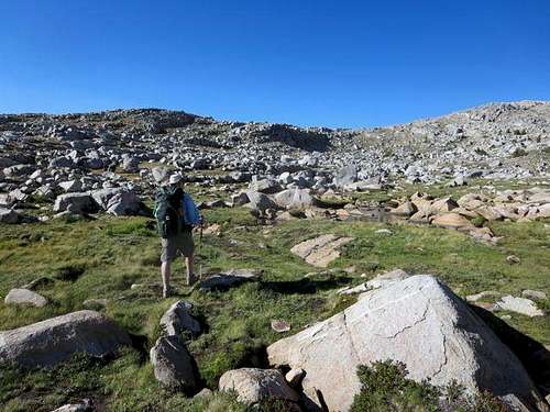
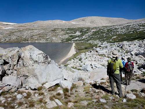
We woke the next day and made a mid-morning start for Four Gables. That meant working our way around to the north side of Desolation Lake, entailing a bit of boulder-scrambling. An inviting sandy beach lies on the lake’s north side, about a mile from our campsite on the lake’s eastern shore. From the beach, we headed directly north, ascending through some ground heath toward a green area on a ridge, where a small creek flows down toward the lake.
![Four Gables]() Hiking along eastern side of Desolation Lake
Hiking along eastern side of Desolation Lake![North Beach of Desolation Lake]() Descending to north beach of Desolation Lake
Descending to north beach of Desolation Lake![Heading to Four Gables]() Heading toward Four Gables from Desolation Lake's north beach
Heading toward Four Gables from Desolation Lake's north beach![Desolation Lake]() Looking back at Desolation Lake
Looking back at Desolation Lake
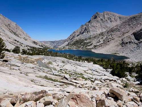
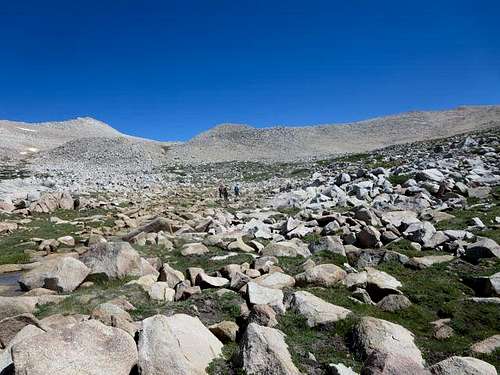
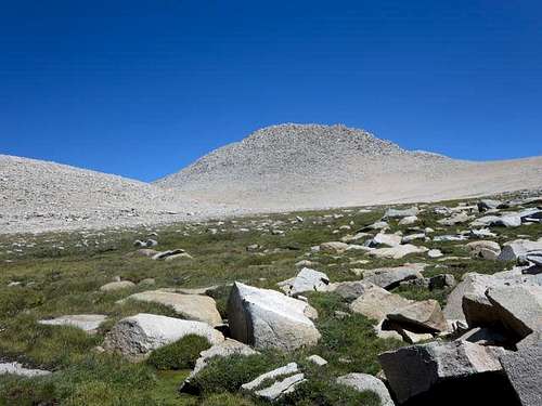
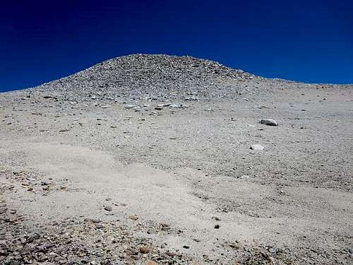
Once we gained the ridge, we had a slight incline to hike up toward Four Gables’ south face, largely on rock or stable sand. The base was about 2.4 miles from our lakeside campsite and at an altitude 12,200’, leaving us about 500’ below the Four Gables summit. We could see that, on the right side of the south face, the sand ran almost halfway up. It made for stable footing, before we transitioned to easy rock- and boulder-scrambling for the last stretch to the summit, which we measured at 3.5 miles from our camp, 11.2 miles from the trailhead.
![Four Gables South Face]() South face of Four Gables
South face of Four Gables![Four Gables]() South face of Four Gables from near the base
South face of Four Gables from near the base
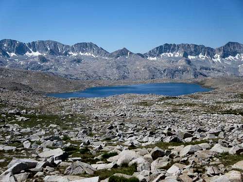
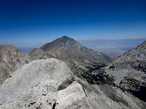
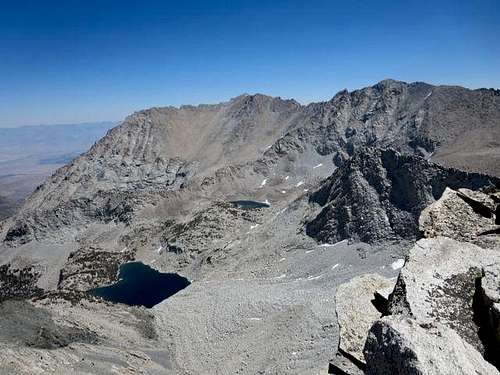
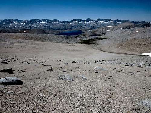
The summit offered great views of Mt Tom, Horton Lake, Upper Horton Lake and Basin Mountain to the northeast, and views to the northwest and back down over Desolation Lake toward Mt Goethe and a series of small glaciers lining the ridge running from the Pavilion Dome to Muriel Peak.
![Mt Tom]() Mt Tom and Horton Lake from Four Gables summit
Mt Tom and Horton Lake from Four Gables summit![Basin Mountain]() Basin Mountain and Upper Horton Lake from Four Gables summit
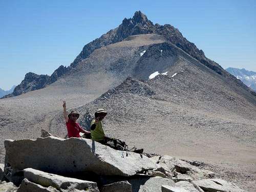
Basin Mountain and Upper Horton Lake from Four Gables summit![Mt Humphreys]() Steve2 and Brian on Four Gables with Mt Humphreys in background
Steve2 and Brian on Four Gables with Mt Humphreys in backgroundBack to Desolation Lake
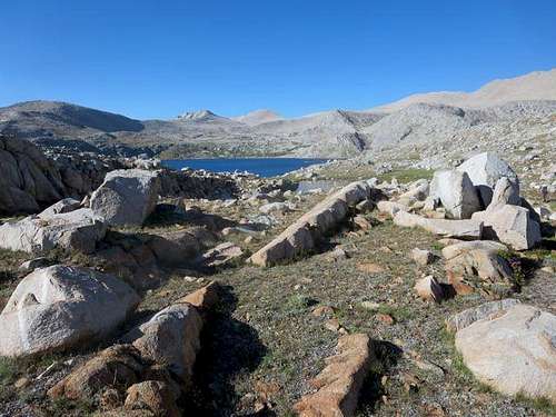
After 30 minutes on the summit, it was time to head back. We took various routes down the south face. I headed for the sand, which made for a comfortable, fast walk down to the base. From there, we largely retraced our steps back to the beach on Desolation Lake’s north shore. The cold water felt good on our feet and legs. Steve2 decided to take the full plunge. He pronounced it great, but we noticed he didn’t linger in the water.
![Desolation Lake]() Desolation Lake from the base of Four Gables
Desolation Lake from the base of Four Gables![Desolation Lake]() Back to north beach of Desolation Lake
Back to north beach of Desolation Lake
On the way back to our camp, we ran into a couple of the participants in this year’s Sierra Challenge. They impressed us, doing in one day what we would do in three.
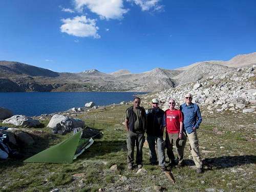
![Desolation Lake]() Back at Desolation Lake campsite
Back at Desolation Lake campsiteHeading Back Out
After a cold night (temperature got into the 30s), we broke camp the next morning and made tracks back for Piute Pass and the trailhead. More great views, and going down definitely was easier than coming up.
![Lower Desolation Lake]() Lower Desolation Lake
Lower Desolation Lake ![Lower Desolation Lake]() Lower Desolation Lake
Lower Desolation Lake ![Piute Pass Trail]() Looking down Piute Pass trail toward trailhead
Looking down Piute Pass trail toward trailhead
This was our first time to the Desolation Lake area in the Humphrey Basin. It’s a gem that we would recommend to anyone who wants to make a trip into the Sierra backcountry.


Comments
Post a Comment