Buthier Bara ... Overview ... sson Artanaz
All pictures of this fluvial page are by Antonio Giani, Emilio Bertona aka emilius, SalVal & Osw.
![]()
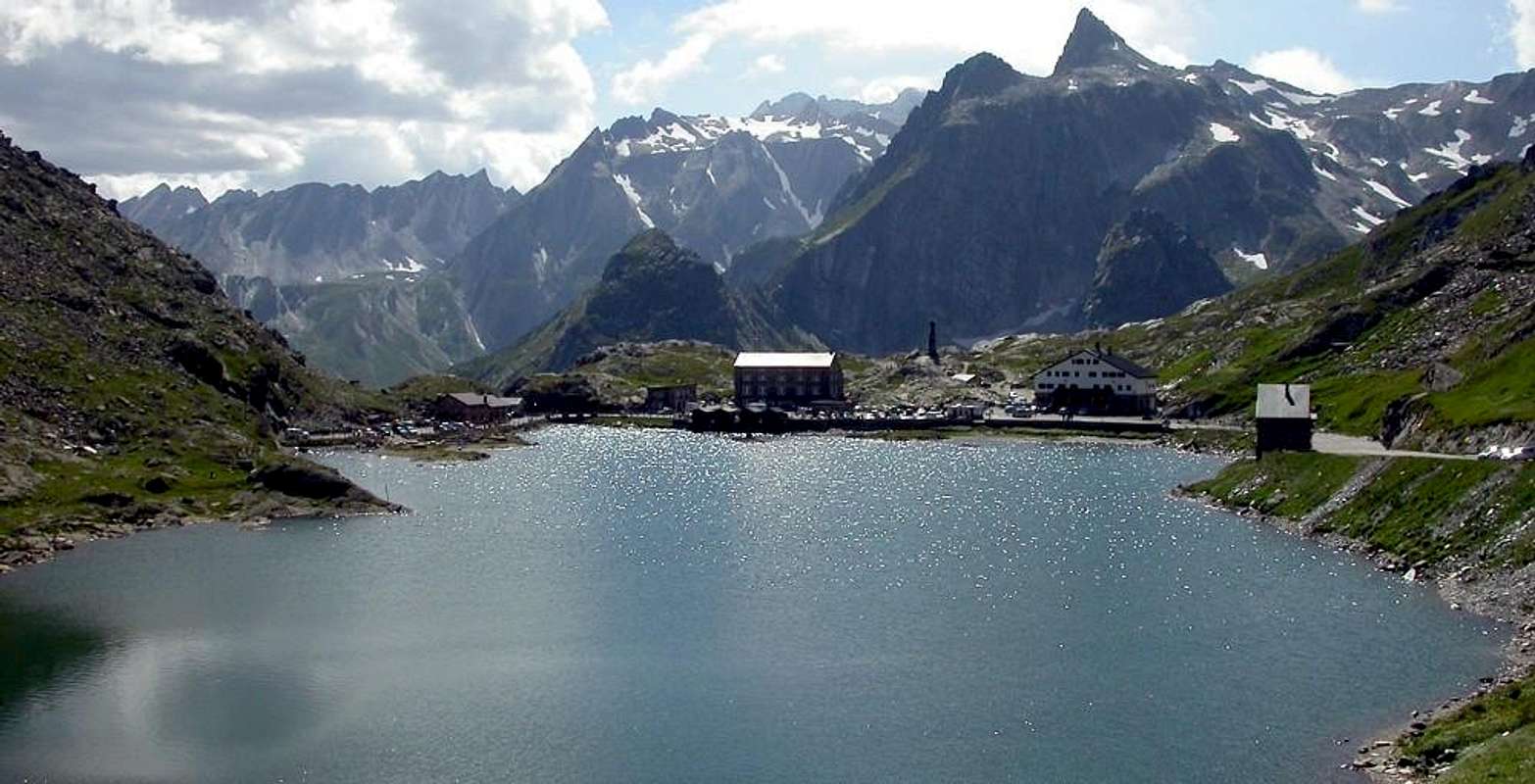
Three distinct streams down so clearly separated from the Great St. Bernard Pass, through the next Valleys of Grande (West), Barasson and Menouve (East).
Subsequently forming the course of Rio Artanavaz or Buthier des Bosses. These three courses converge at no great distance from each other, respectively, reaching the three adjacent Municipalities of St. Rhémy.en-Bosses, St. Oyen and Etroubles, all located in the middle part of the long Valley of Gran San Bernardo, starting from the homonymous hill (2469m) on the border with Switzerland, and then falls just above the city of Aosta. After or jointly with the two valleys of Ollomont and Valpelline. All these waters come together then make up the main Grand Buthier, which flows into the Dora Baltea among the Municipalities (on the opposite side of the catchment) of Charvensod Pollein. We can say, to better identify them, the first is the stream of Mont Mort, the second of the Testa or Head Barasson (2730m) and Pointe de Barasson (2962/3m), while the third, the more noble, comes from the Vallons consecutive of Molline and inferior or Menouve just located at the foot of the Southwest steep Face of the splendid Mont Vélan (3734m).
Baltea's story which derives its name by great Balteus Glacier and then scroll through the millennia for more than 168 miles to the sea. Crossing Aosta Valley ...
![]()
Tre distinti torrenti scendono in modo nettamente separato dalla Colle del Gran San Bernardo, attraverso le Valli del Grande (Ovest), Barasson e Menouve (Est).
Formando successivamente il corso del Rio Artanavaz o Buthier des Bosses. Questi tre corsi cofluiscono a non molta distanza l'uno dall'altro raggiungendo rispettivamente i tre vicini ma separati Comuni di St. Rhémy.en-Bosses, St. Oyen ed Etroubles, tutti situati nella parte media della Valle del Gran San Bernardo che, partendo dall'omonimo colle al confine con la Svizzera, scende fin sopra la Città di Aosta. Dopo essersi congiunto anche con le due Valli di Ollomont e Valpelline. Tutte queste acque che si riuniscono costituiscono poi il Grand Buthier, il quale confluisce con la Dora Baltea tra i Comuni (sul lato idrografico opposto) di Charvensod e Pollein. Possiamo dire, per meglio identificarli, che il primo é il torrente del Mont Mort, il secondo della Testa di Barasson (2730m) e dell'attigua ad Oriente Punta di Barasson (2962/3m), mentre il terzo, più nobile, proviene dai consecutivi Valloni di Molline e Menouve subito ai piedi dell'imponente nonché ripida faccia Sudovest dello splendido Mont Vélan (3734 m). Questa é la storia della Dora Baltea che deriva il suo nome dal grande Ghiacciaio Balteo per poi scorrere nei millenni per più di 168 Kilometri verso il mare. Attraversando la Valle d'Aosta ...
![]()
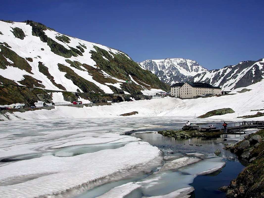
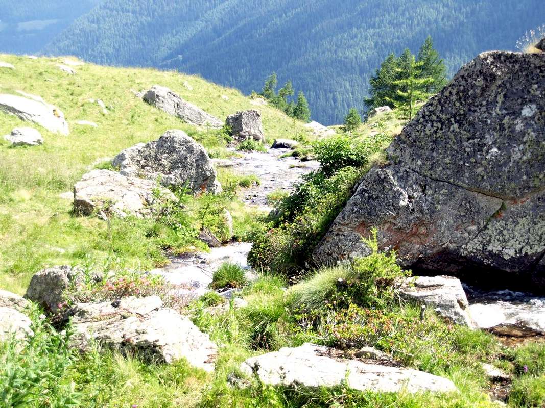
The torrents and streams begin when "die" glaciers, giving form to any hint of life with their fresh and still unspoiled waters, as willed by the Mother Nature.
The same quench the Mountaineer and Hikers returning from the goal achieved by giving him a first signal of peace, safety and contentment. After so much hard work ...
I torrenti iniziano là dove "muoiono" i ghiacciai, dando forma a qualsiasi spunto di vita con l'acque fresche ed ancora incontaminate, come sol in Madre Natura.
Le stesse dissetano l'Alpinista e l'Escursionista al rientro dalla meta raggiunta donandogli un primo segnale di riposo, sicurezza ed appagamento. Dopo tante dure fatiche ...
![]()
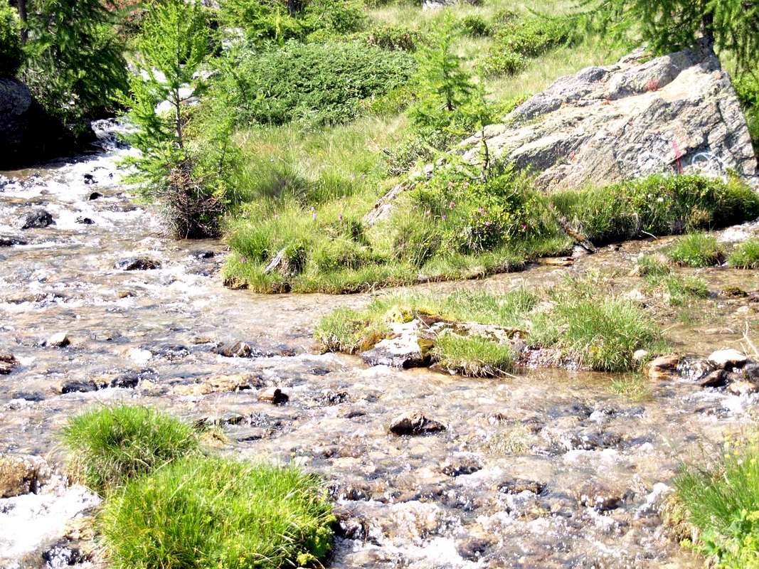
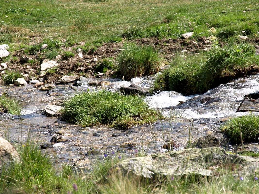
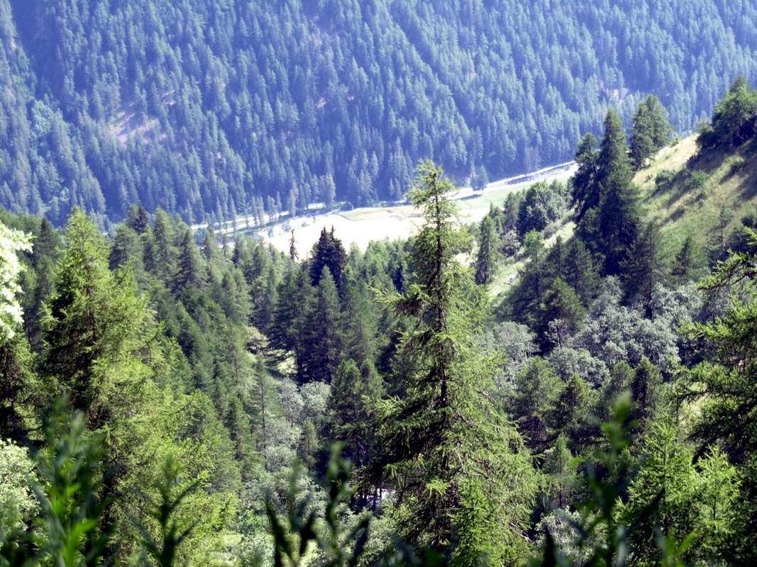
After all together down to the middle course of Baltea coming from all the valleys and vallons or small valleys. Then to the King of the Streams or great River Po.
![]()
Indi procedendo tutti insieme in "coro" giù verso il corso centrale della Dora Baltea ed arrivando da tutte le valli e da ogni vallata. Infine al Re dei fiumi o Po.
Getting There towards Great St. Bernard Valley
By car:
- From TORINO, MILANO, etc: Motorway A5. Exit at IVREA or Quincinetto (PIEDMONT)
From IVREA Town: in West (Southern side) to Pont Saint Martin, Donnas, Bard, Champdepraz, Pontey, Fénis, Saint Marcel, Grand Brissogne, Pollein, Charvensod, Gressan, Jovençan, Aymavilles, to Villeneuve, Arvier, Avise, Morgex (Internal side) and to Pré Saint Didier, Courmayeur Municipalities (Western side).
From Courmayeur Resort: in East to Morgex, La Salle, Saint Pierre, Sarre, Aosta (Norhern side), Saint Chistophe; Quart, Nus, Chambave, Verrayes, Saint Denis, Châtillon, Saint Vincent, Emarese, Arnad, Verrès, Hone, Donnas, Pont Saint Martin (Northern and Northeastern sides) Municipalities.
![]()
Southwestern Side:
From Aosta Town to Merdeux Basin
From Gignod Commune (988m) with Great Saint Bernard State Road n° 27 to alternative nearby Condemine Hamlet (1137m); leaving left through Municipal Road to Grand e Petit Buthier Villages (1302m, 1439m) in Chaligne Comba. From this last, with private dirt farms roads and through Mendey, Roncaille, Rombason Pastures up to the Chaligne Shelter (1936m), below Costa Tardiva (2380m), Tardiva Hill (2410m) and neighbor the Punta Chaligne (2608m).
From Etroubles Commune (1270m), with dirt road and through Champ-Reclos (1425m), Yettes (1591m), Eteley (1716m), fork before Praz-Gallet (1626m), Ars (1975m) Pastures on Arsy Vallon, up to Chaz d'Arsy (2543mn); from this paths to Ars Pass (2534m), Costa Labiez (2632m).
From Etroubles Commune (1270m), with dirt road through Champex (1411m; fork), Flassin de Meitin (1654m), Flassin (1700m), Tsa de Flassin (2258m) Pastures on Flassin Vallon; from this paths to Fenêtre Pass (2729m), Flassin Hill (2605m), Testa Cordella (2663m) and Tête Bois de Quart (2248m).
From Saint-Oyen Commune (1377m), with State Road n° 27 to alternative 1502 metres; leaving North the same to great St. Bernard Hill, continue West to St. Leonard Fraction. From this to Citrin Vallon up to the Mont Flassin (2772m) Citrin Hill (2484m), Punta Valletta (2801m) and La Raye du Sodzé (2640m).
From Saint-Oyen Commune (1377m), with previous Municipal Road to Mottes (1660m) Fraction, Farettes (1666m) Village; from this, with path through Arp du Bois Dèsott Pastures (1936m), alternative 1959 metres to Serena Vallon up to the Hill Serena (2547m) and Testa Serena (2830m). Variant: continue West from Farettes Village to Saint Michel (1732m) Fraction; from this last, tourning South always with Municipal Road, to Arp du Bois Dèsott Pastures.
Northwestern Side:
From Malatrà Hill to Grand Saint Bernard Basin Basin up to the
From Saint-Oyen (1377m), with previous road to Mottes, continue West-northwest to Devies Village (1723m) at the beginning of Merdeux Comba; from this with paths through Merdeux Dèsott (1919m), Cotes (1930m), Manda (1973m), Tsa de Merdeux (2285m) Pastures to Malatrà Hill (2928m).
From Saint Rhémy en Bosses Commune (1619m), through Municipal Road, on Merdeux Comba to Tsa de Merdeux (2285m) and Malatrà Hill (2928m).
From Saint Rhémy en Bosses Commune (1619m) to Tula Comba to Saulié Pass (2817m), Aiguille des Cengles (2869m) and Angroniettes Pass (2936m).
From Saint Rhémy en Bosses Commune (1619m) to Grand Saint Bernard Valley up to the Crévacol Hill and Testa (2498m, 2610m) Saint Rhémy Hill (2540m), Mont Rodzo (2632m), Pain de Sucre (2900m), Mont Fourchon (2902m), Fenêtre de Ferret Hill (2600m) and Grand Saint Bernard Hill (2469m).
![]()
- From FRANCE: through the Mont Blanc Tunnel to Entrèves-crossroads to Vény/Ferret Valleys - Mountain Guides of Courmayeur - La Saxe Rock Gym - Courmayeur. By Little Saint Bernard Pass, closed since November until half May to La Thuile Valley - Pré Saint Didier - Courmayeur.
It is not necessary to take Motorway A5: you can drive on State Road n° 26, in the direction of AOSTA - IVREA - TURIN.
By plane:
- Aeroporto Internazionale "Corrado Gex" Saint Christophe (Aosta)
Comments
No comments posted yet.