Bagging on Bradley - July 21st, 2013
Note: Once again this TR is likely overly lengthy and overly saturated with pictures. If you look at one section skip down to Doubletop...that remote and remarkable peaks ranks as one of the most uniquely spectacular places that I've ever been, and words can't come close to describing that peak and range, but I hope the pictures scratch the surface.
I had been working hard trying to find a go-to drink for a nightcap, having slowly made the post-college transition from beers to liquor and red wine. I still prefer a Jack & Diet as an off-the-bat order requiring little thought, but with its caffeine the J&D is more of a party drink than something to calm me down before bed. On a night such as this when I checked in to a cheap motel in Alpine Wyoming already well behind on sleep and well exhausted after a fifteen mile hike of Mt. Fitzpatrick the last thing I needed was to go full rave mode. Instead I walked up to the little saloon down the road from the motel, knowing that ordering a wine or a fancy schmancy cocktail (like a pineapple upside down cake martini), which I would order without shame when with friends, or back east, was out of the question in these rough cowboy everyone be carryin' honky-tonk bars.
My buddy had gotten me to try an old-fashioned on the past month’s trip to Vegas, and I had acquired a taste for it, the drink having just the right kick while being strong enough to force me to take it slowly and enjoy in small sips (rather than chugging it down like I’m apt to do with beer or other more refreshing cocktails such as a Tom Collins), and I spent the summer ordering the drink, which involves a lengthy muddling process, in various hole in the wall bars out west, curious to see how it would turn out and watching with some bemusement as the bartenders had to dust off their recipe books and make the drink one step and instruction at a time (and lest you think me too much of a jerk, I always made sure I tip extra for a more difficult drink). It’s a hit or miss process, more often the latter, but the old and weathered bartender in Alpine actually did a pretty good job, and I returned rested and buzzed to the motel.
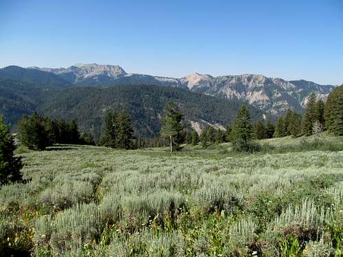
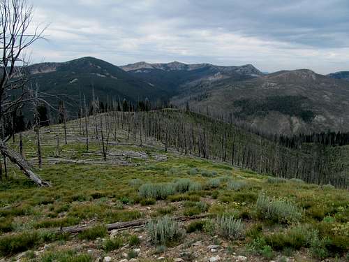
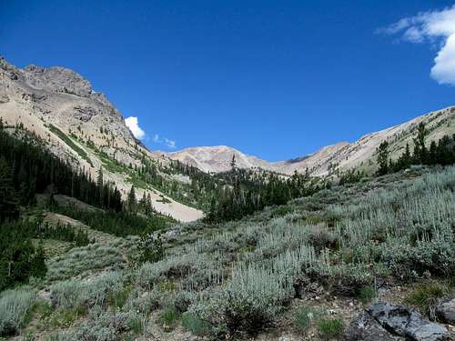
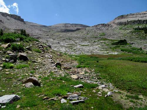
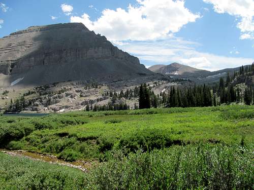
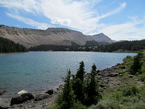
Bradley Mountain was my goal for Sunday, and apart from Greg’s beta I didn’t have a lot of information on this Wyoming P2K. Access is from the Greys River Road as it leaves Alpine; Greg had approached the peak along its direct south face and had described a nightmarish ascent featuring endless and tortuous bushwhacking, but mentioned that on his way down he had managed to follow a decent trail all the way back down to the road. The trick was finding the trail from below; Greg said his best advice was to aim for a high meadow at 7,700 feet below a southeast flank of the peak, and that the trail would be easy to find from there. I tried my best to scout Google Earth to reach that point, trying to decide upon the best, seemingly brush free way to ascent the south east ridges from the main road and, lacking a GPS, trying to figure out the best way to locate my intended starting point in real life.
I did some scouting while driving down the Greys River Road into Alpine the day before, so I had a decent idea of where I wanted to park as I headed out of town on Sunday morning. It was somewhat hot and humid by the time I started trudging through the dirt and grass covered lower slopes of the peak; it was steep work but the brush wasn’t bad, and I passed through maybe half a dozen herd paths, following them when convenient and leaving when they led in the wrong direction.
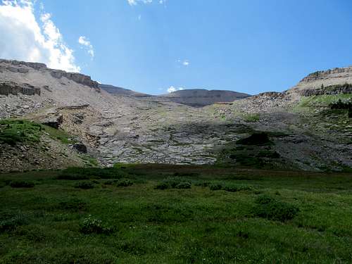
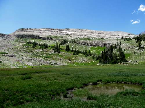
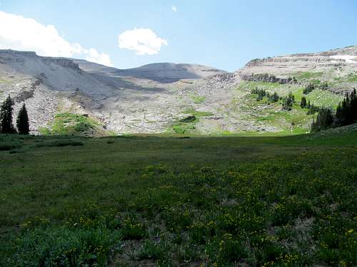
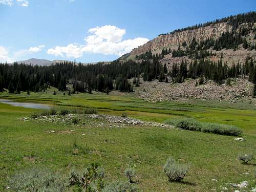
Eventually I reached a higher grassy area which I judged to be the meadow Greg had referenced, having already found one of the trails branching into the meadow by then. The ascent got steeper afterwards, and I though it was actually tougher to follow this trail once located. It ascended steeply up some knolls that you see along the lower ramparts of the hike, and I lost it several times in some wooded and brushy areas where deadfall obscured the route. In general I eventually realized that when in doubt the trail curves left, but not knowing that then I had to trudge through one bad section of loose dirt.
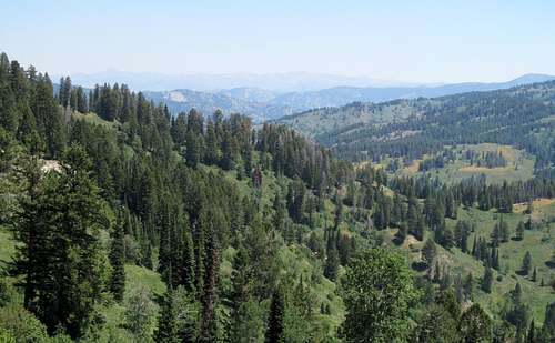
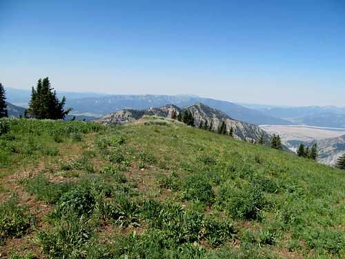
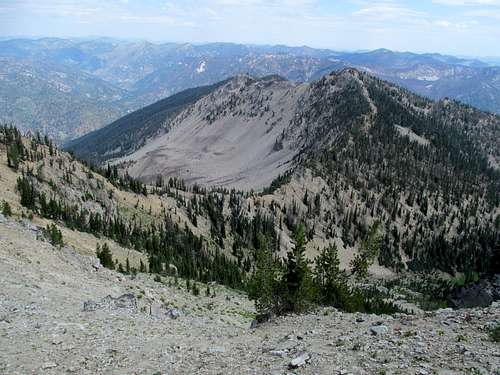
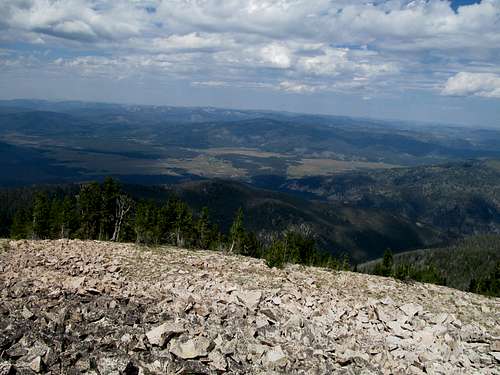
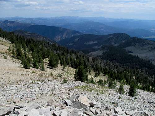
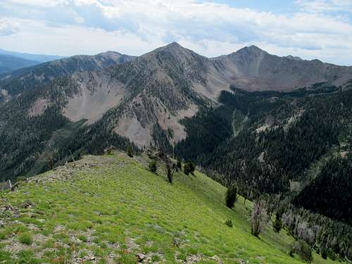
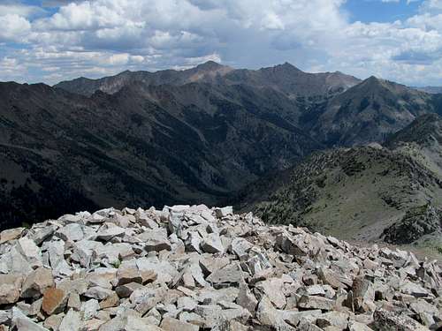
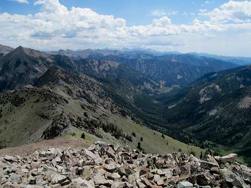
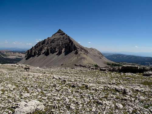
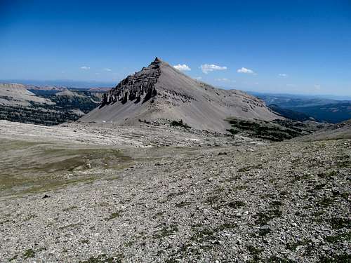
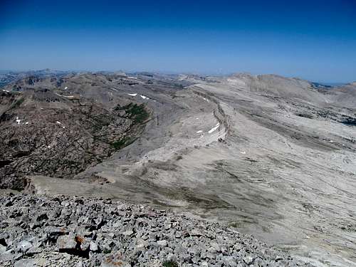
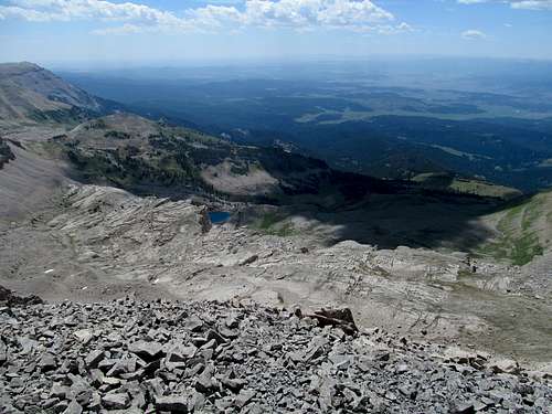
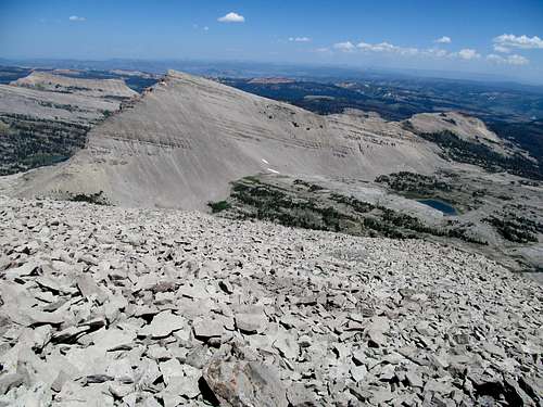
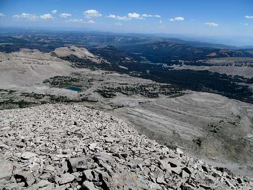
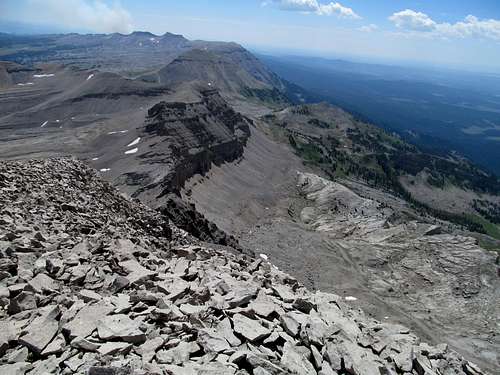
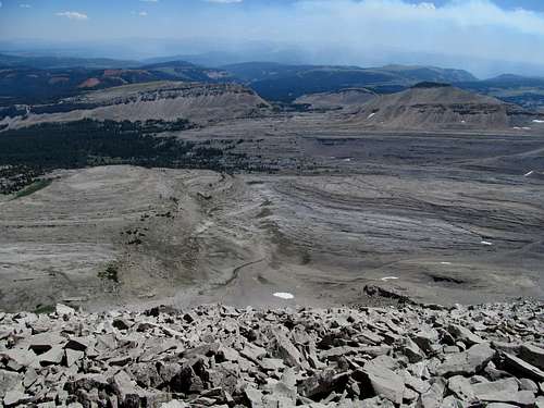
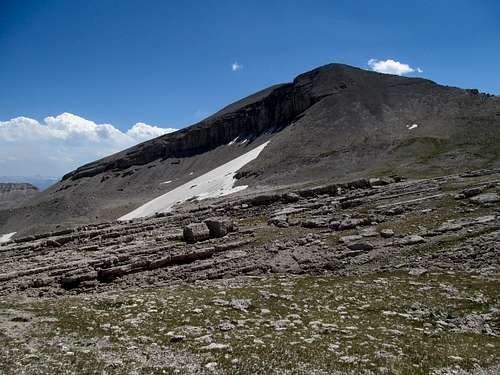
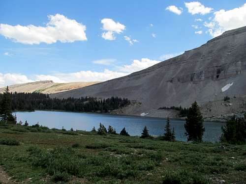
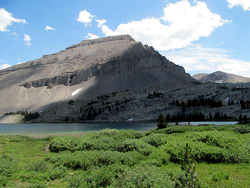
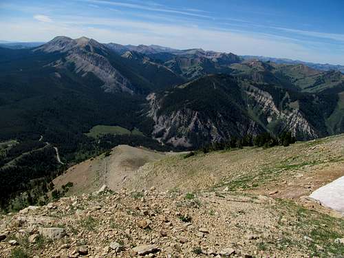
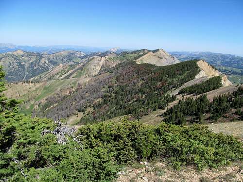
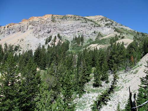
The trail eventually hits the left side of the ridge through a pleasantly shaded area. Unfortunately here is where you see for the first time the true summit of Bradley, a discouraging distance away. I had some minor difficulties following the trail the rest of the way to the summit but there were no major difficulties.
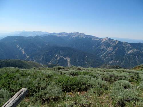
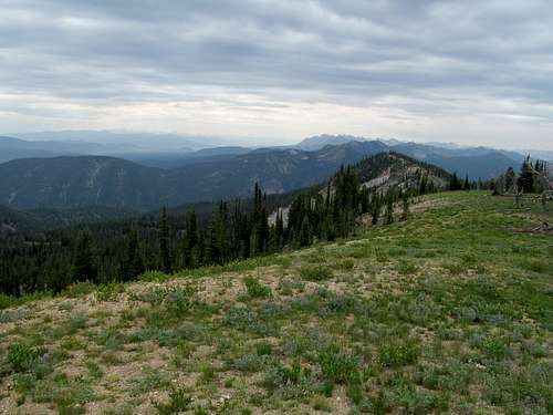
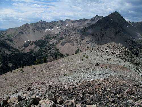
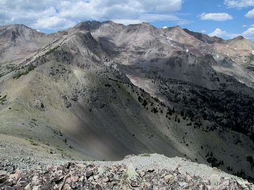
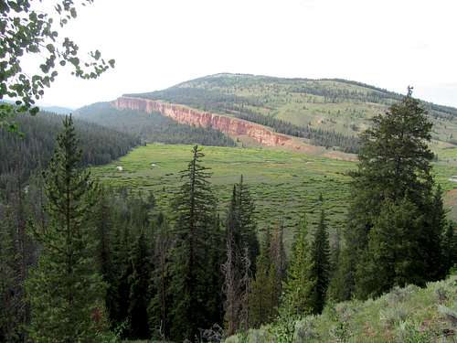
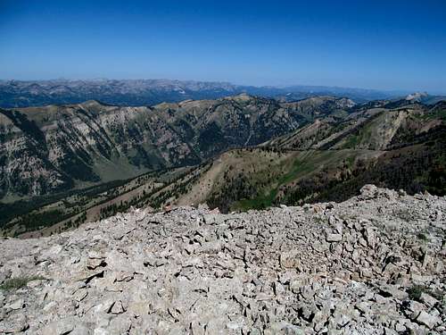
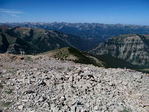
The views were good, interesting, but far from the fireflames hotness that I had been accustomed to in the last few weeks. Haze was certainly a factor, obscuring peaks and ranges further away and even diminishing the quality of nearby peaks like Stewart to the south, which had been far prettier earlier in the morning and lower along the ascent. The Wyoming Range stretching down the Greys River was, unfortunately, mere shadows, and my still yet unfulfilled dream to see the Tetons from a nearby summit was only slightly requited by the vague outline of the Grand barely discernible behind the Snake Rivers. Like the Wyoming Range, the early morning had yield some halfway reasonable views of the Gros Ventres earlier in the morning, but now all I could make out were outlines.
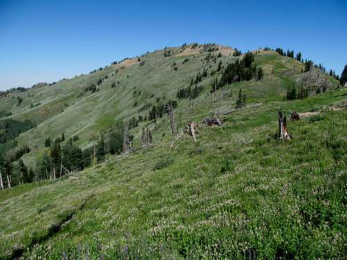
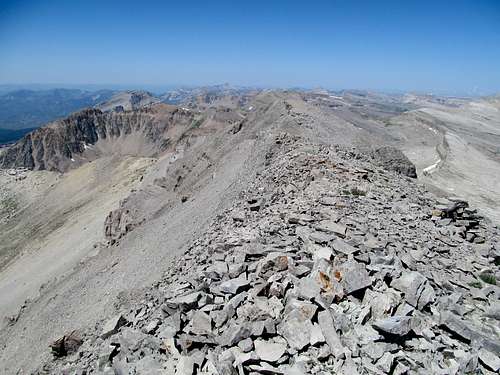
It’s an interesting feeling on Bradley too, different from standing atop your typical P2K’s that loom over all its neighbors. Being the Napoleon that it is, despite its topography prominence Bradley is immediately overshadowed by the higher peaks in Stewart to the south and Ferry to the north.
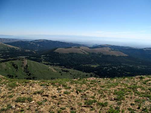
I took in the views and headed down, able to follow the trail down for the most part without incident back to the road, maybe a quarter mile east or so of where I parked.
I returned to town needing a does of caffeine but alas all of Alpine was practically closed early on Sunday, even the little coffee shop that I had enjoyed earlier that same morning. Coffee would have to wait until during the drive back, where I finally found a nice little cafe doubling as a chocolate shop in Afton.
Rounding Cape Horn - July 27th, 2013
The next week was once more slated for Idaho. The weather was iffy for Saturday with good chances of TStorms but better for Sunday, and with the longer drive I decided for an easier ascent of Cape Horn Mountain, a P2K at the southern end of the Central Salmon River Range.
The weather was inconsistent, clear in Utah, a downpour when I left the interstate towards Hailey and Ketchum, and clear once more by the time I entered the mountains. I ventured for the first time up ID-21 north of Sun Valley, enjoying the views of the Smokies and Boulders and then gasping audibly as the highway descended into a small, cozy valley sitting below the massive and dramatic rise of the Sawtooth Range. The valley was cold, chilly, only in the 30’s in the early morning, and an eerie mist hovered over the plains lining the Salmon River. The views were straight out of a postcard and I stayed mesmerized as I drove past the mountains and Stanley towards the Cape Horn trailhead.
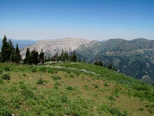
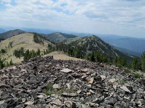
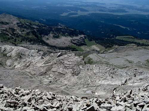
The hike started out in clouds and shade and the trail circled around gently before hitting a side ridge of the main massif. Here it traversed through a burn area where the deadfall through a few sections was pretty bad, but the rest of the trail up to the main ridge was pretty easy, with some shaded areas.
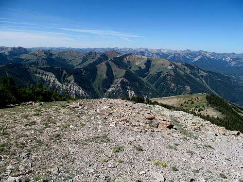
Some of the best views of the day came early in the day, before the temperatures rose and with it the haze from nearby forest fires. The views were especially dramatic to the south, with the Sawtooths looking as sharp as their name suggests and Castle Peak once more looming impressively behind many flanks of lower summits in the White Clouds. Midway through the hike the trail passes the Lola Lakes junction, with good views of the lakes and cliffs below.
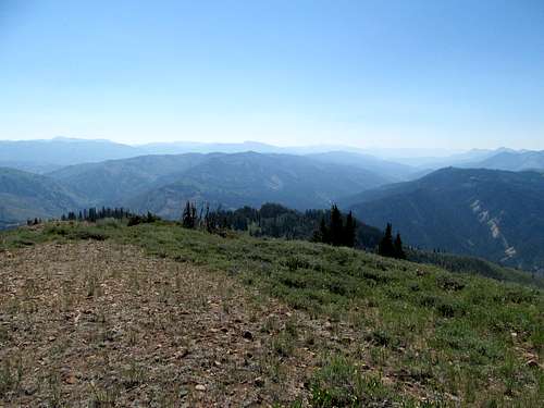
The main trail heads downhill towards the lake here, and the rest of the way to the summit is a mix of goat trails and cross country hiking, though of the very easy variety.
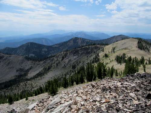
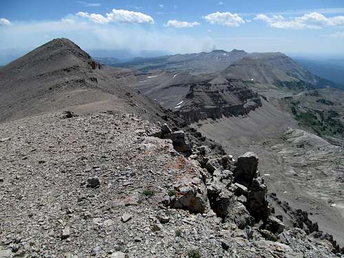
I made my way through some interestingly colorful terrain for the rest of the hike, skipping the southern false summit to reach the northern true summit, then tagging the false summit on the way back.
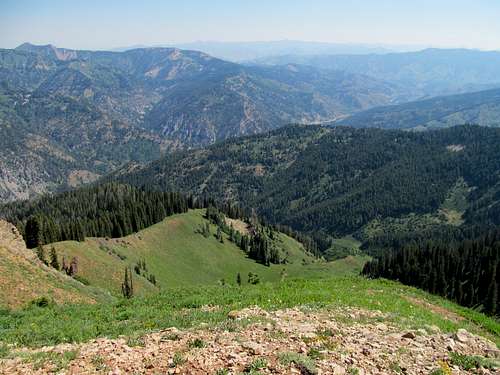
Haze had all but obscured the White Clouds by now, but the views of the vastness of the Salmon River Range in every direction from the west to north to east made up for it. The weather seemed to hold up down in the Sawtooths, defying the 30-40% chance of thunderstorms, and in hindsight I probably should have gone for Thompson this day instead, especially in light of what would happen the next day. Oh well, shoulda coulda woulda.
The descent was as mild as the ascent, and I drove all the way back to Hailey, which was the closest place I could find a reasonably priced (and still vacant) motel room close to the mountains. I had myself quite a night, drank a shitload in town, and woke Sunday morning still tired from the night before.
Wrong Way on Ryan - July 28th, 2013
It would be nice to blame this fatigue for my failings on the mountain later on in the day, and perhaps I would’ve scrutinized the route descriptions a little more had I been operating with a clearer head. Ryan Peak in the Boulders was my goal, and while I familiarized myself one last time on the SP route description I focused on only one aspect of the beta, the part about the trail leaving the north end of the parking lot, and skimmed much of the rest, temporarily forgetting to note the trail name or the fact that the first quarter mile or so involved a steep ascent.
So the North Fork of the Wood River Trail left the east side of the parking lot, and the West Fork Wood River Trail left the north side. The SP description says to take the North Fork from the north end of the lot, and since that was the part of the description I had keyed in on I followed the trail north only to see it disappearing shortly along the creek. I fumbled around back and forth for quite a bit before finding the trail further north, thinking I was on the right path while all the while traversing further and further away from Ryan.
Eventually I made it to a high basin where the trail disappeared. I looked for a trail leading up to the saddle of West Pass, but obviously I was nowhere near the basin and the pass I was supposed to be. I meandered around for quite a bit, trying to figure out what I did wrong, which junction I missed, etc, wandering up and down the basin, eventually backtracking half a mile along the trail before returning once again to the basin. Thoroughly confused and still thinking that I was in the same ballpark as Ryan, I decided to say fuck it and just ascended the pretty steep slope on my right, figuring that once I had a good vantage point of the area above treeline I could regain my bearings towards where Ryan Peak was.
The ascent sucked, I was already exhausted from my routefinding efforts, and just before I made it to the top of the ridge I found that I had cell phone reception once more. Using the cell phone GPS I discovered my routefinding errors and the fact that Ryan wasn’t just a merely short route correction away, but lay miles away on an entirely different ridge across an entire fucking valley.
I made it to a small cairned bump along the ridge, later discovered to be an unranked summit boasting an elevation of all of 10,183, took pictures of the admittedly impressive summits around me (including Ryan and Kent), and headed down dejected and filled with rage at a precious and now increasingly rare summer day wasted. The rage accompanied me on the drive home and well into the next week, but this failure to get Ryan sowed seeds of self doubt, especially considering that my next target would be the very remote and rarely visited Doubletop Peak in the Gros Ventres, a prospect that I was increasingly apprehensive about as the weekend approached.
A Shot of Doubletop - August 3rd, 2013
Rage brought me full circle from a year ago. I had climbed Baird with Greg in the Snake River Range on a Saturday, and was driving to Big Piney where I planned to climb Wyoming Peak Sunday. Along the drive I recognized the peaks of the Gros Ventre Range for the first time, a range that had long fascinated me by its exotic remoteness. It was late in the summer, a week before Labor Day, and rage filled my heart as I gazed at these beautiful peaks in the evening twilight, realizing that the season was growing short and I would not have a chance to visit the range for at least another year.
Well, almost another year had passed, and less than a week after my failure in the Boulders my salivation at a chance at Doubletop were interspersed with worries that I wouldn’t find the route, that I’d get lost, that I’d get attacked by a grizzly hiking 22 remote miles by myself, that after Ryan my mountain mojo had left me and that failure would become contagious.
I searched the REI after work on Friday looking for the Turiano Greater Yellowstone guidebook, but couldn’t find one. I looked it up and found to my dismay that it was out of print, and officially considered a rare (and valuable) book. Unfortunately my copy was back home at my good friends’ house, but fortunately my friend was able to take a few cell phone pics of the book describing the route. With that, and the SP beta, I set off nervously into the evening, especially concerned about the section between Brewster Lake and the West Ridge, where the beta becomes sketchy.
To allow myself as much time as possible I left Friday after work and drove all the way to the tiny hamlet of Cora northwest of Pinedale, where I slept in the back of the truck at a turnoff. I woke in the early morning with the sun shining and the temperatures frigid, the thermometer having dropped to the 30’s the previous night, but fortunately I was huddled well under a thick layer of blankets in the car slept relatively snugly.
I drove the rest of the way up the trailhead, hoping in addition to a successful trip to avoid the haze that had marred my views my last trip to Wyoming two weeks prior, but I was realistic knowing that the fires were still indeed raging further west in Idaho.
To my dismay I saw a small fresh plume of smoke rising from the southern foothills of the Gros Ventres. I had noticed its dark shadow the night before but had hoped that it a cloud, or fog, rather than smoke, and were it smoke it was some kind of burn coming from maybe a ranch. Driving by it now in the morning I realized that it was indeed a wildfire, brand spanking new (as it was not yet on the inciweb tracking website yet). Now my worries multiplied about being too proximate to a growing wildfire, possibly being stuck in one, but on the other hand the burn area seemed pretty far to the south of Doubletop, and on the other side of the range to boot. I called the local offices about the fire, and they informed me that they were aware and efforts were already underway to fight the fire. Comforted I continued driving north down the mostly smooth dirt roads to the Kinky Creek Trailhead. (The fire I saw would become the Packer Creek Fire, a moderate fire that fortunately didn’t go too out of control).
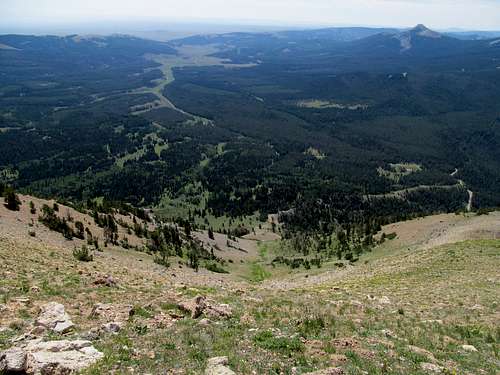
It was still cool as I laced up and started. The route leaned lengthy, at least 22 miles round trip, so I was a little worried about time and daylight being a factor; all things going well it wouldn't be an issue, but my margin of error decreased if I took a wrong turn or two, or if I were to reinjure my ankle in any way, or if any other unforeseen obstacle chose to rear its ugly Black Swan end of the bell curve head. Fortunately a trail covers a large portion of the route, so I started my way down the initial descent several hundred feet down into Kinky Creek on a charming, but already slightly smoggy, Wyoming morning. I realized that I was running short on granola bars, which prompted me to emergency measures. I had a takeout pizza from the previous night that I ate along the drive and I figured I’d save for dinner tonight after the hike. Instead, I found an unused grocery bag, tossed the rest of the pizza into it, and tossed the bag into my backpack. I certainly wouldn’t have to worry about carbo-loading for this hike now, long as it was.
It took me awhile to find the right trail once down at the creek, as I backtracked and forth several times. I crossed the creek at first before noticing the trail disappearing too quickly; the only trail I could locate wound along the creek itself and didn’t ascend the ridge as it was supposed to. I eventually backtracked to the crossing and found that the correct trail actually follows the right bank of the creek further, crossing further to the north. This trail was good, the signage fit the description, and I bounded up the initial uphill sections through steep fir woods to ascend the ridge.
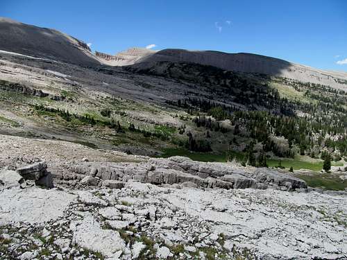
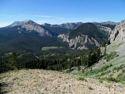
My first views of the Gros Ventre interior along the route once the views opened up on the ridge left me with dismay, as the rocky slopes of the peaks were enshrouded in a haze that I figured would deteriorate as the day went on and the temperatures rose. The trail continued switching backing a little and undulated up and down along the left side of the ridge, with good views of the Dry Fork drainage to the left.
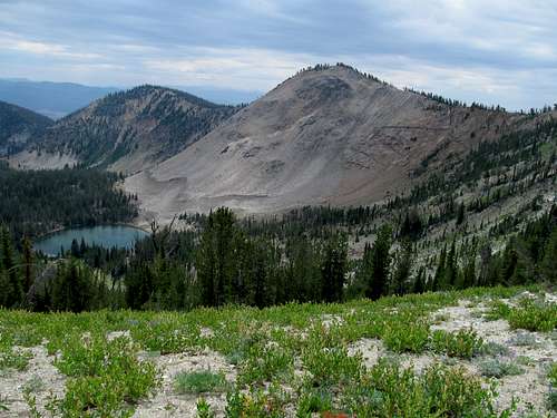
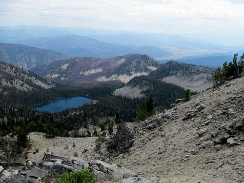
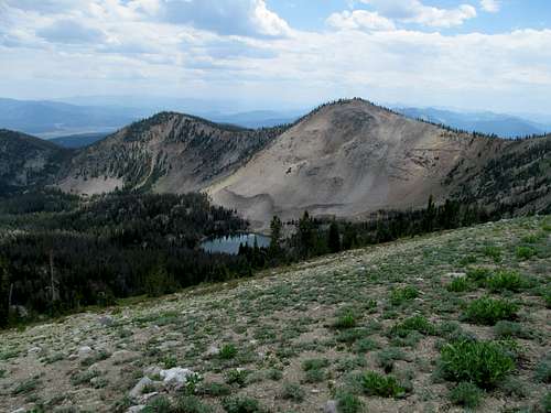
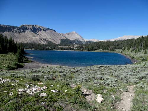
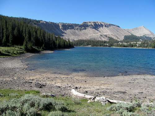
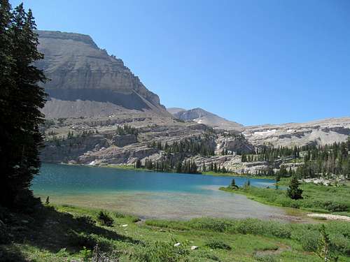
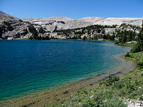
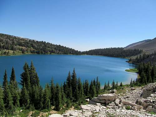
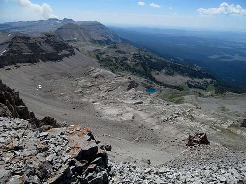
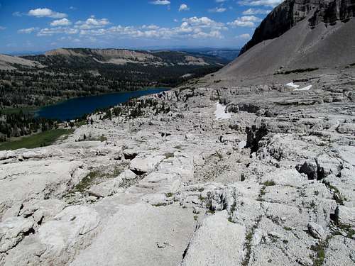
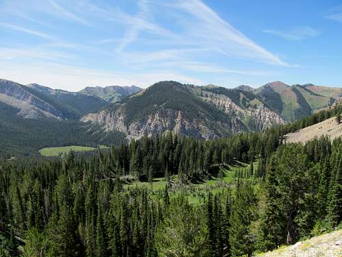
Eventually the drainage started leveling up with the ridge, and a downhill section brought me alongside a rocky ravine like area of Dry Fork. I continued and was greeted by the wide expanse of Lunch Lake, five miles into the hike. The crisp clear blue lake was a sight for sore eyes despite the haze, and I celebrated with a slice of pizza and kept going. The next three miles of trail to Brewster Lake wandered past some cliffs, a few marshy areas, and a pond or two, climbing through some small drainages before another sharp descent into the lake, which was magnificently matched with the precipitous slopes of Triangle Peak above it.
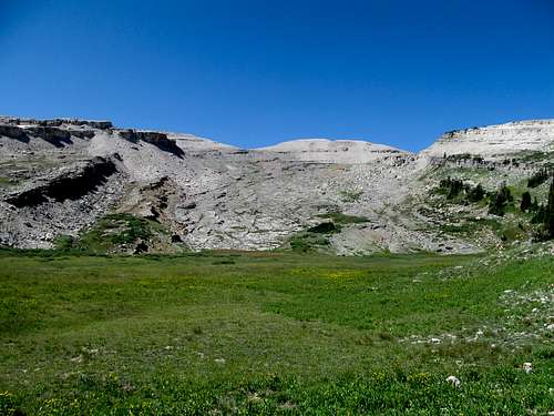
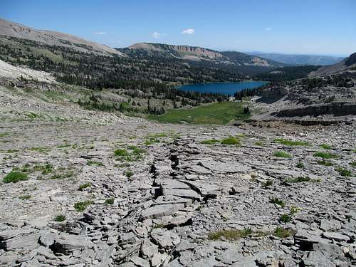
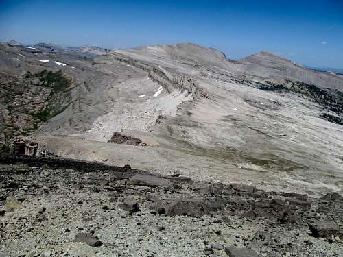
I could hardly enjoy the views, knowing that the crux of the routefinding lay in the next three miles between the lake here and the summit. Various reports have you circumventing the lake all the way to the base of Triangle, but I had spotted a small marshy area on Google Earth that I thought, combined with the SP route details, would provide for a reasonable ascent to the ridge without cliffing out. First I followed the now spotty trail as it traversed by the lake and through an overgrown meadow. I trudged through this wet area, then as the terrain steepened to my right past the meadow I ascended it a little to pop out at the marshy area I had targeted it and, even more spectacularly, one of the most remarkable ascent routes I’ve ever seen.
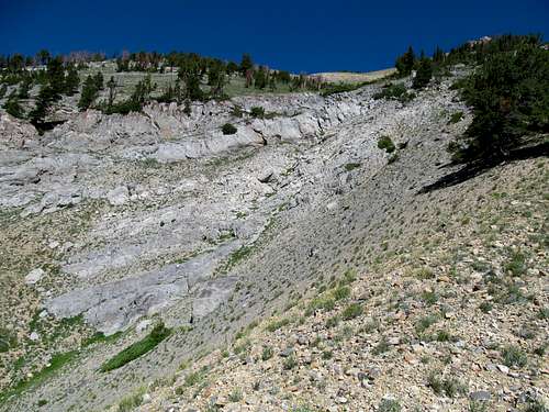
I call it the Moon Ramp, as it’s the only thing to describe this otherworldly terrain. It was a giant ramp, probably many football fields across, extending in a shape almost manmade up several hundred to a thousand feet into the crest of the Gros Ventres. It reminded me of Lizzie’s Basin at Hole-in-the-Mountain Peak in Nevada, except bigger, wider, and shaped like a take-off ramp for a spaceship.
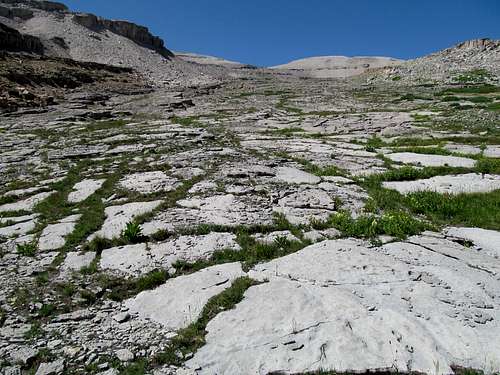
The Moon Ramp was a delight to ascend, with slightly precipitous steps over the included granite rocks while avoiding the many crevices. Tens of thousands of little miniature canyons and ravines lined the terrain, some you could step over, others requiring more dedicated circumvention further up, and finally a few necessitating even some backtracking.
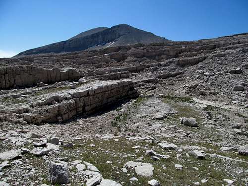
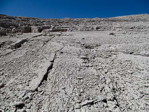
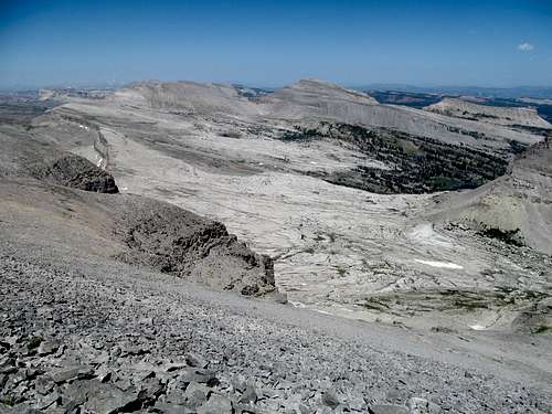
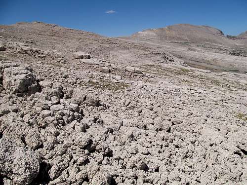
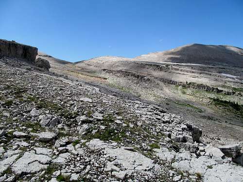
While the ramp was a delight and seemingly led to the ridge crest, the peak was in a different direction, so about 2/3rds of the way up the ramp I made a class 3-4 exit out of the ramp and into yet another world. The Moon Ramp had, appropriately enough, brought me to a moonscape, a vast field of endless waves of ledges and crevices composed out of some kind of tuff that looked pretty much like hardened clay. Picture the Devils Golf Course in Death Valley if you’ve ever been, bleach it, and lump it onto the side of a mountain ridge and level it so that it comprises endless ledges as far as the eye could see.
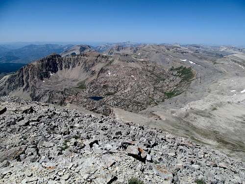
I felt like I was stepping through the bleachers of an extraterrestrial stadium here as the routefinding and the scrambling became a little more challenging. You can keep it to class 2-3 but I’m sure if you wanted you could make the route any shade of class 5 if you wanted. I had a few tricky spots and more importantly stared at Doubletop, now visible in the distance but, unfortunately looking very distance, perhaps miles and miles away and miles above the endless ledges I trudged through.
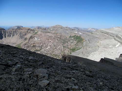
The view down through this otherworldly landscape was a bit more comforting, with the azure blue shades of the lake reflecting back at me further down and Triangle Peak looking more and more like, well, a triangle. The lesson you learn in this hobby is that, with persistence and avoidance of disaster, all things end, and eventually I found myself on a grassy plain above the moonscape and walked towards the still distant looking West Saddle, from which I could finally ascend the peak proper.
I was surprised to find that the west ridge was significantly shorter and easier than it looked. A few hops along the sometimes faint climbers trail brought me to the shorter end of the double top, and the true summit was just a quick hop away from the false. The views were among the best I’ve ever seen…to the northwest the Gros Ventres stretched with glacier carved granted ledges, crevices, and pretty alpine lakes interspersed in between.
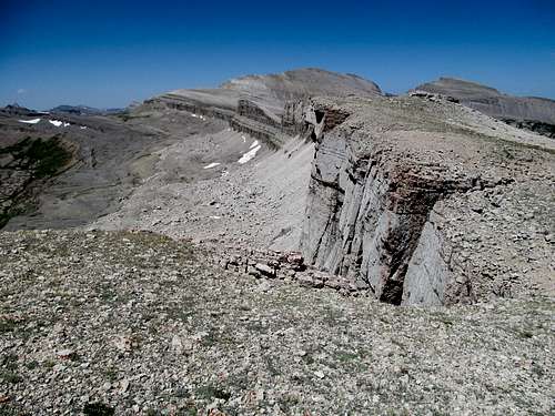
The line of cliffs marking the sudden southern boundary of the ridge stretched towards and then immediately below me as I viewed another terrace and tarn immediately below me marking the sheer southern cliffs of Doubletop, the reason the southern approach to the peak from the Bondurant area requires such careful routefinding.
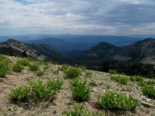
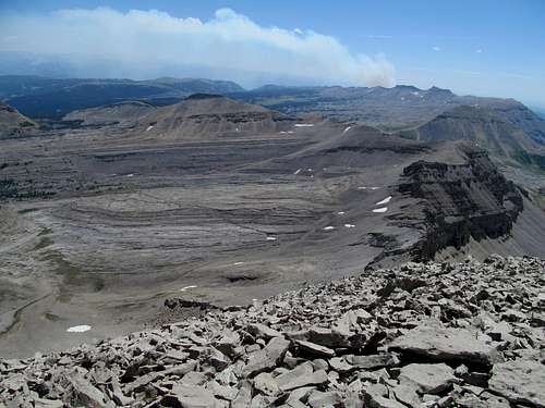
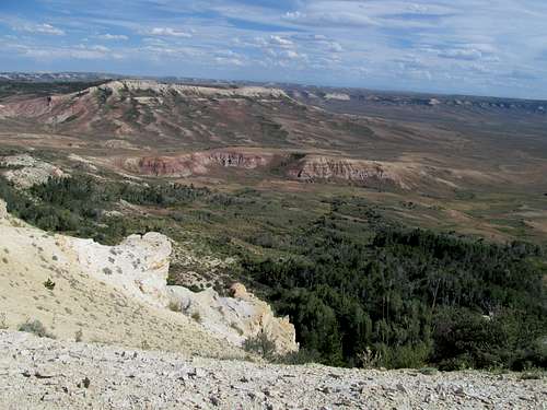
And perhaps the most remarkable sight was to the southeast of me, the vast stretches of the otherworldly Tosi Plateau, another moonscape far vaster and larger than the one I traversed, in view below and leading up to the summit of Tosi Peak. Behind Tosi, the Packer Creek Fire, now fresh into its adolescence, a dark grey plume of smoke rising up into the air and fortunately for me, not blowing towards me. The haze blocked any detailed views of the Wind River and Wyoming Ranges besides mere outlines, but the views of the Gros Ventres on either side was more than sufficient for my viewlust, and I could even spot the snow on the Tetons in the distance.
I housed yet another slice of day old Dominos on the summit and lingered as long as I can, not wanting to leave a spot that I knew was unforgettable and would likely rank as one of my all time favorites. Alas, another 11 miles remained in the day, and I trudged down the summit, descended the ridge and, instead of heading straight for the clay ledges, stuck a little closer to the cliff to the left and enjoyed this different perspective of the northwestern Gros Ventres.
Finally I turned right and started my way through the labyrinthian moonscape, descending step by step and ledge by ledge, hoping that I wouldn’t cliff out on the way back to the Moon Ramp. There are sections where you cliff out and face some more precipitous drops of 10-30 feet or so, but you can easily backtrack and cross different crevices further up before they become cliffs, and continue your way through the landscape.
After a few scrambling downclimbs and a traverse around a small snowy area I reached some gently grassy ramps that brought me back into and through the Moon Ramp, returning a little further below than where I had exited it along my ascent.
I savored the rest of my descent down the ramp and to the marsh, where I veered left aiming for the woods to backtrack my way to the trail. After a quick cross country section and downclimb I hit the Brewster Lake trail again, and started the long but now basic trail walk back to the car.
Some places were tedious, especially along the many various uphill sections along the descent, but the stupendous views made it bearable. I was running a little short of water though, having brought maybe one or two less than what I in hindsight would have preferred, so the last few miles were a little more tortuous as I fought my aching throat to conserve my water for the home stretch and especially that last uphill section back to the trailhead. There were a few areas where deadfall caused some minor routefinding issues on the way back.
Eventually I began my final descent to Kinky Creek, the downhill seemingly dragging longer than I had remembered from earlier in the morning. The last reascent back to the trailhead was not as bad as I feared, as the trail was good and the slope gentle, and I returned to the 4Runner nine hours and fifteen minutes after I had left it.
It was a relaxing drive into Pinedale, where now the Wind River Range loomed impressively above the town and the valley. I was too tired to do anything but grab some shitty food, check into a motel, and plan my final preparations and scouting for the route on Sunday.
Mt. McDougal Chaser - August 4th, 2013
I thought about maybe Hoback Peak for Sunday, but my legs were a little sore from Doubletop and after slightly later wakeup I caved and settled for McDougal in the Wyoming Range, swayed by its promisingly brief stats. The roads leading to McDougal Gap from the highway were surprisingly long as they traversed wide ravines and hillsides in the low prairie valley between the Wind Rivers and the Wyoming Range, but the roads were even easier than the day before. I reached McDougal Gap and found the trailhead easily, lacing up and starting north on the 4WD road.
I hoped to find the supposed class 1 trail that climbs to the summit, but after awhile lost patience as the 4WD road bogged through some muddy areas. I saw a small goat trail leading through the thick but low brush and followed it, eventually backtracking through steep terrain southwest. I ended up ascending Bob Sihler’s ascent route as he describes here on SP, following a small use trail as it wound along the right side of the dry drainage before crossing it.
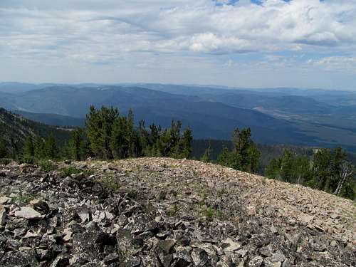
The trail disappeared as I ascended a steep hillside cross country before finally reaching the summit area, where some rocky scree and minor scrambling brought me to the summit.
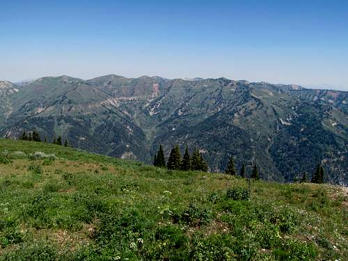
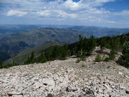
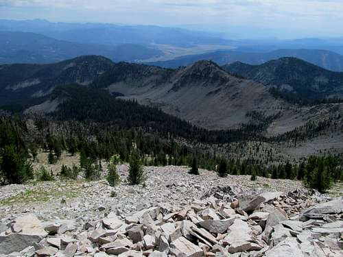
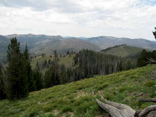
Triple Peak dominates the view as you drive towards the peak and your view during the entire climb. The profile of the peak from the top of McDougal is still as impressive, but now your view is more distracted by the endless undulating waves of the Wyoming Range stretching on either end of you, and the clear views of the cliffs of the Salt River Range Crest across the valley.
I walked around the summit area and enjoyed the views before descending, following the use trail all the way down along the left (from the downclimber’s perspective) side of the drainage as it seemingly followed the ridge all the way down to the gap.
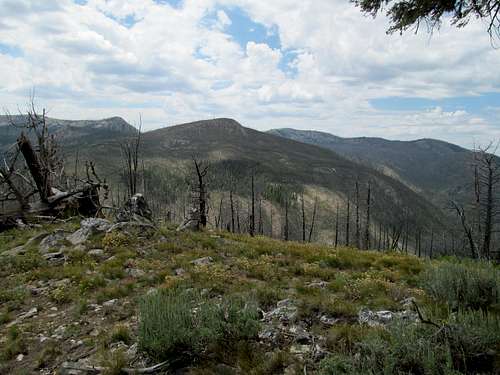
I left the ridge as the trail disappeared further down, but not before enjoying the dramatic views of the fault line cliffs of McDougal’s lower southeast face.
I then contoured left and southeast through open woods, brush, and high meadows, trying to aim in a straight line towards the 4WD road further down. This lasted longer than I had anticipated, but eventually I reached the road and walked the rest of the way back to the car. McDougal is short, but she’s a steep bitch and my legs were pretty sore after the ascent coupled with the long day before.
I continued down the other side of beautiful McDougal Gap, driving through scenic, pretty meadows before linking up with the wider and more popular Greys River Road. I followed it up under a surprisingly blistering early afternoon heat, rushing in an attempt to get to Kemmerer as soon as possible, as I hoped to get some hikes in at Fossil Butte National Monument before I headed back to SLC. I hoped to follow the Fontenoy/Sublette road all the way back to the town, but somehow ended up on the La Barge road. With no signs and no GPS to match up with my map, I didn’t realize my mistake until I was only miles from the highway near the town of La Barge. Time and miles wasted, I meverthelessmade my way through Kemmerer, where I bought some snacks for the rest of the afternoon.
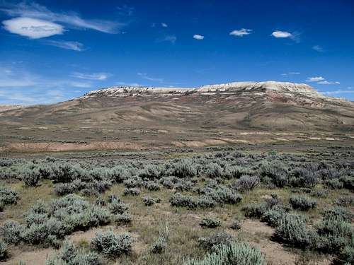
I battled fatigue and 90 degree temperatures as I rested in the Fossil Butte Visitor Center, watching the quick intro movie before driving further into the monument.
I noted that the highest point on the map and, after checking, in the NM was a peak named “Cundick.” How could I not climb this????
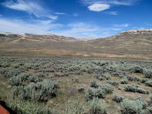
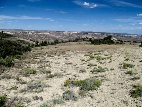
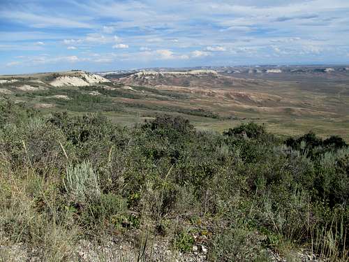
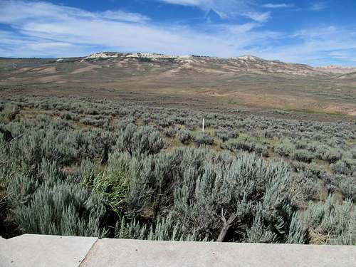
It was a quick walk up a grassy slope to the unranked summit, and I later walked the Cundick Ridge Road hike, getting some views of the nearby badlands, before driving out and making a detour through Bear Lake to get some lottery tickets across the Idaho State Line. It would have been nice to get another trail or two in the monument, but unfortunately the wrong turn at La Barge cut my plans short.
I returned to Utah satiated somewhat, happy to have redeemed myself and gotten my summit mojo back somewhat, but as was my nature, the recent success inflamed my inner fury at the prior week's failure as I raged at what could have been. It was only one peak I had missed thus far, but that meant one precious summer weekend day wasted, one summit dream left unfilled, and that small part of my mind, probably part and parcel of the strange and fervent OCD that drives me week in week out towards this hobby (and not to mention the ordeal of having to live in Utah), still greedily bemoaned a vague sense of a summer incomplete, wasted, and peaks not fully and absolutely requited.


Comments
Post a Comment