Introduction
Open Source Map, centered on Gänsekragen.Click here for a larger map. I had already been in the Alps for a while, but my friend Wilco had arrived in Austria only two days ago. As one of our acclimatization goals we picked Gänsekragen (2914m).
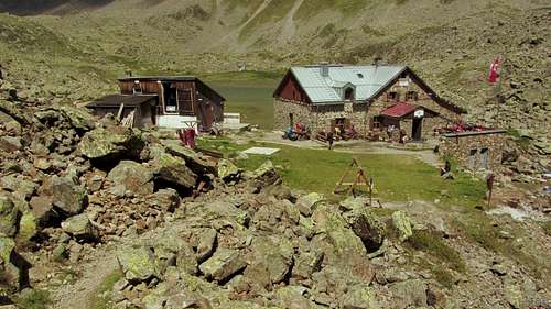
![Winnebachseehütte]() Winnebachseehütte
Winnebachseehütte
The trailhead at the end of the road at Gries is at almost 1600 m, so it's a solid 1300 m up and down. But, just in case, we knew that just over half way up we would pass the Winnebachseehütte (2362m). If we didn't feel like continuing, we could simply have a couple of lazy hours up right there and trod back down again.
Not that that was ever likely to happen, mind you. When there is a nice and easy to reach summit nearby, neither Wilco nor I can resist going up there.
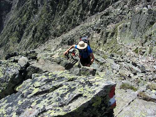
![Occasional use of hands is called for high on Gänsekragen]() Occasional use of hands
Occasional use of hands
The route up is mostly a hiking trail. Up to the hut it's a broad and very well maintained one. Higher up it's smaller, and the higher it gets the more it fades away in the talus, but with lots of fresh paint marks there was no way to get lost. Only on the very last bit using a hand was occasionally helpful. It was a perfect acclimatization hike.
External Links
Winnebachseehütte
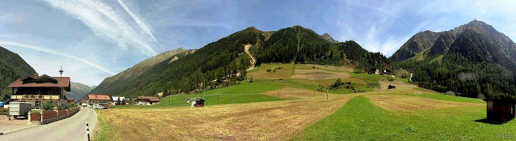
![Panorama from the end of the road at Gries. Our goal is Gänsekragen, the rocky peak right of center.]() Panorama from the end of the road at Gries. Our goal, Gänsekragen, is the rocky peak right of center.
Panorama from the end of the road at Gries. Our goal, Gänsekragen, is the rocky peak right of center.
Comments
No comments posted yet.