
|
|
Route |
|---|---|
|
|
29.22341°N / 13.4525°W |
|
|
Hiking |
|
|
Spring, Fall, Winter |
|
|
A few days |
|
|
Overview
This long-distance footpath is just under 72 km long (about 45 miles) and was completed in 2014.
It begins in the north of the island in the town of Orzola and travels southwards down the spine of the island to Playa Blanca on the southwest coast. Along the way, it passes through several of Lanzarote’s major towns and runs across the lonelier areas of farmland and volcanic higher ground, looking down on the coastal resorts.
It was designed to allow visitors and locals the opportunity to explore Lanzarote on foot and to take in many of its scenic and cultural highlights along the way. It gives the hiker an opportunity to see some of the island’s agricultural areas – such as the vineyards and Aloe farming fields – as well as the stunning volcanic landscapes. The path passes through towns which house several museums and places of architectural and artistic interest as well as traditional churches.
There is virtually no natural water along the route – except what you can buy from a shop or bar in the towns – so it’s very important to carry plenty to drink with you.
This route is considered to be easy for a long-distance footpath and is a good route for beginners although, it still requires a high level of fitness.
In places, the hiker will be passing through some quite remote areas and over some very rough ground so, good footwear and good route-finding abilities are essential.
Getting There
Arrecife is the capital of the island and it has its own international airport (aka César Manrique-Lanzarote Airport) which has flights from many major European destinations.
For travel around Lanzarote, car hire, taxi and bus services (known as Guagua) operate from the airport.
The bus service from the airport is surprisingly limited given that it is so busy. However, the bus service from the Estación de Guaguas (Bus station) in Arrecife itself is excellent.
Hiring a car negates the need for bus travel but apart from the cost involved, the sections are A – B walks (not circular). This means that at the end of the day’s walk, it will be necessary to return to wherever the car is parked. Either by retracing your steps along the route or hiring a taxi to take you back. It is unlikely (but not impossible) that there will be a bus back to your starting point.
For the hiker wanting to complete the GR 131, I would recommend using the bus service as a means to travel to and from the main towns along the route.
Accommodation
As a popular holiday destination, there are a large number of hotels, houses and apartments in several different towns all over the island, available for rent through the usual agents.
For the purpose of this route, Arrecife is probably the best place to base yourself. There are many different bus routes which begin in the capital and allow the visitor to travel to any of the towns along the route. Once a section is completed, the return journey to the capital can be equally easy. However, there is a large element of planning involved here. The timetable will need to be consulted before setting off – it changes on weekend and holidays – in order to ensure there are buses running to where you want to go to and come back from.
Staying in other resorts is possible but you are likely to have to travel into Arrecife in order to get a bus to some of the destinations. This can make the travel time for a day too long to be practical.
It is possible to camp on Lanzarote. At the southern end of the island, Papayagayo Beach, Playa Blanca is the only official camp site and this is well equipped for both tents and motor homes.
Wild camping is officially illegal but does happen on some beaches – although you may be asked to move on!
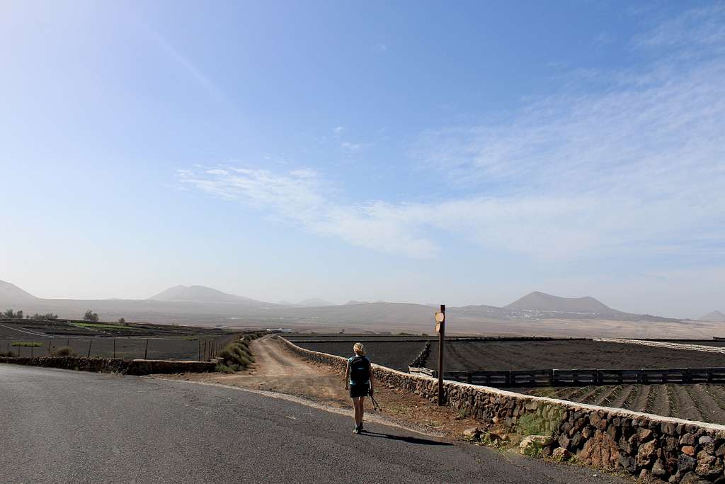
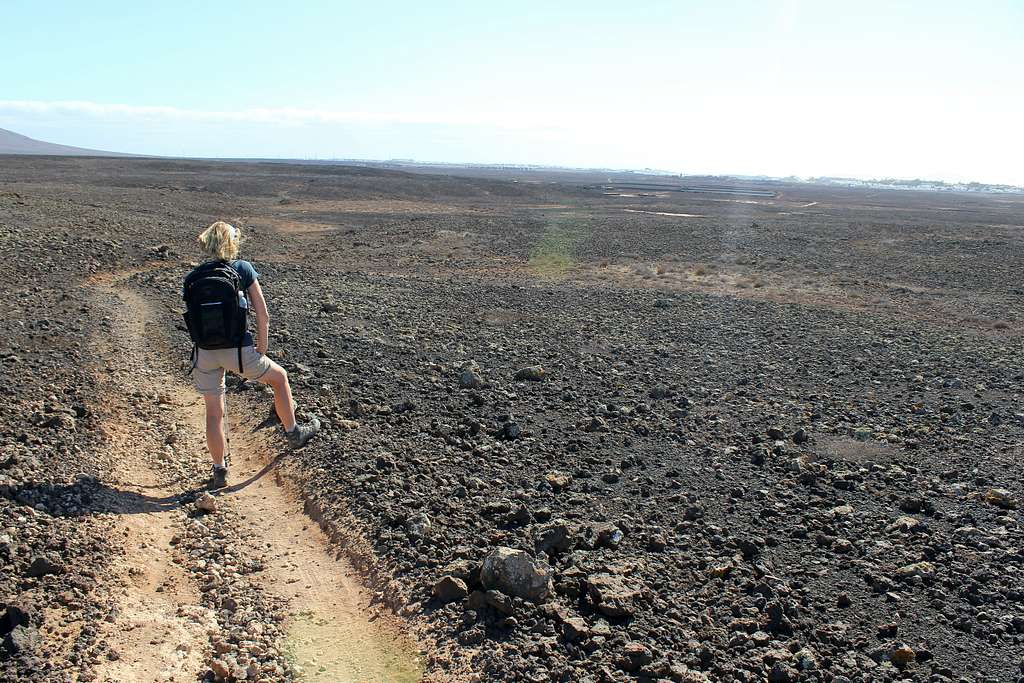
Route Description
The GR 131 runs down the centre of the island for 72 km but can be easily divided into five separate sections. Each section can be completed separately or joined together, if desired. The start and end of each section is located within a town.
It is not my intention to give a detailed route description here as there are many available already through guidebooks and the internet. I would rather give a more general description and some idea of the character of each section of the route as well as what can be seen and experienced along the way.
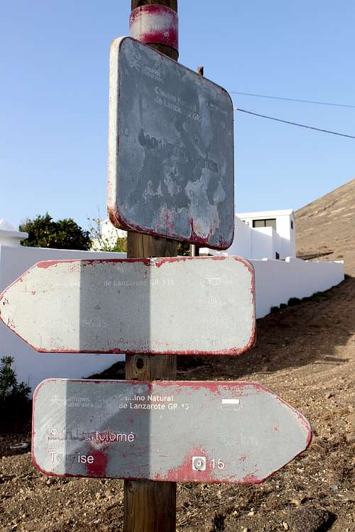
Generally speaking, the route is very well signposted in the wilder areas however, some of the signposts need replacing as the originals have been eroded, presumably by the high winds that can affect Lanzarote.
A strong wind from Africa, known as the Calima, picks up sand from the Sahara Desert and blows across the Canary Islands. It can be very difficult to walk in this weather and in extreme circumstances, it will close the airports.
Local conditions may dictate a need to change the route from one year to the next so it’s best to follow the signposts on the ground.
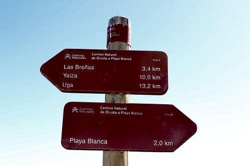
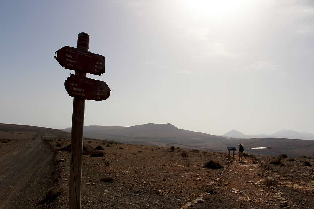
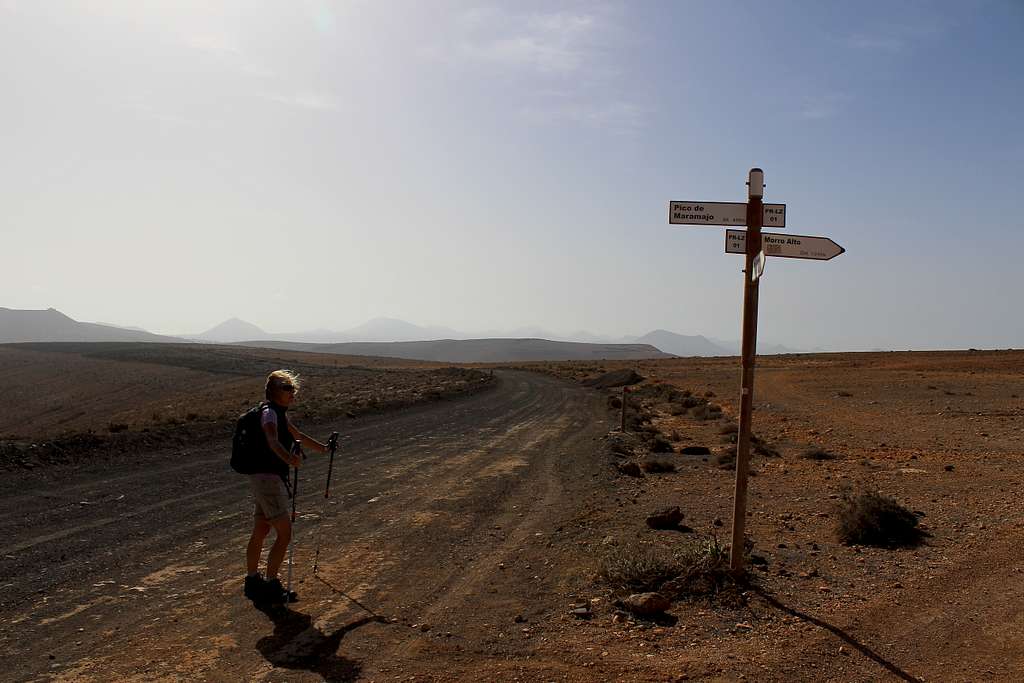
There are several different types of signposts used on the GR 131 for the hiker to look out for, they are all characterised by the maroon colouring used on each signpost. The smaller ones are mostly used in the towns whilst the larger ones tend to be more visible in the wilder, open spaces. Having said that, I don’t think that there is a strict rule applied here.
The only route-finding difficulties we encountered were when following the footpath as it passed through the towns. There are route signposts which send the walker in the correct direction down particular streets. A general rule to follow is to continue in the same direction until a new signpost is found to re-direct you. This can be a little trying when there are so many different streets to choose from but the towns are not too big and we usually found our way ok.
GR 131 route sign posts and markers
|
|
|
|
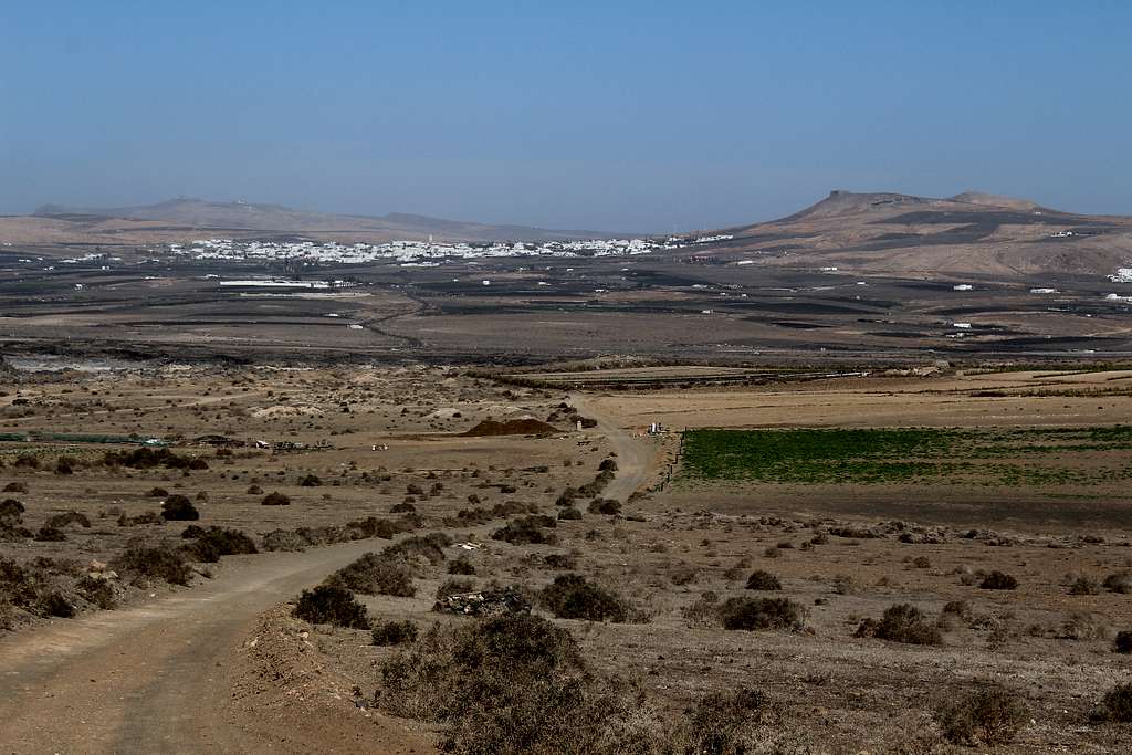
Section 1 - Orzola to Haria
Orzola to Haria
(12km – 7.5 miles)
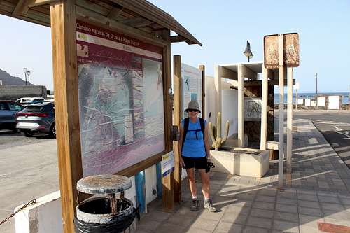
The route begins in Orzola, the most northerly town of the island, opposite the ferry port to nearby Isla Graciosa. There is a bus shelter and information board at the start which directs you to head up the main street in a southerly direction. Orzola is a small town but has the usual bars and at least one supermarket along the route.
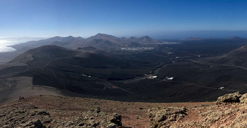
The route continues south on roads and tracks. It is well signposted and crosses the edge of the “Malpais de la Corona” – the lava and debris from an eruption of the nearby Montana Corona volcano which happened around 4000 years ago. This is rough inhospitable ground but some land has been cleared in places for farms and houses.
The route passes the Lanzaloe Park where they grow many species of Aloe Vera for commercial use. This type of agriculture is one of the many interesting peculiarities of Lanzarote, particularly for those of us from more northerly, cooler areas.
It later turns right along an ash track and leaves the roads, passing through more agricultural plantations. The environment is dry but greener than the lands further south. It is fair to say that this section of the route has the most green growth that is encountered on Lanzarote.
The dusty track heads uphill, turning left towards the extinct Montana Corona volcano and has good views back to the north. The ash track ends where it joins the LZ 201 road and the GR 131 continues down the straight tarmac. I imagine that when the footpath was devised, this was a quiet road. When we were there, it was busy and has no footpath, so care is needed on this part.
After about 300 meters, the route leaves the main road on another ash track which passes uphill beneath Montana Corona, on the right. There are tracks here which make it possible to climb to the rim summit of the extinct volcano. However, the official route for this is on the north side of the of the mountain, so these tracks are not maintained or signposted. Allow 2-3 hours for the round trip to the summit if you want to take this in.
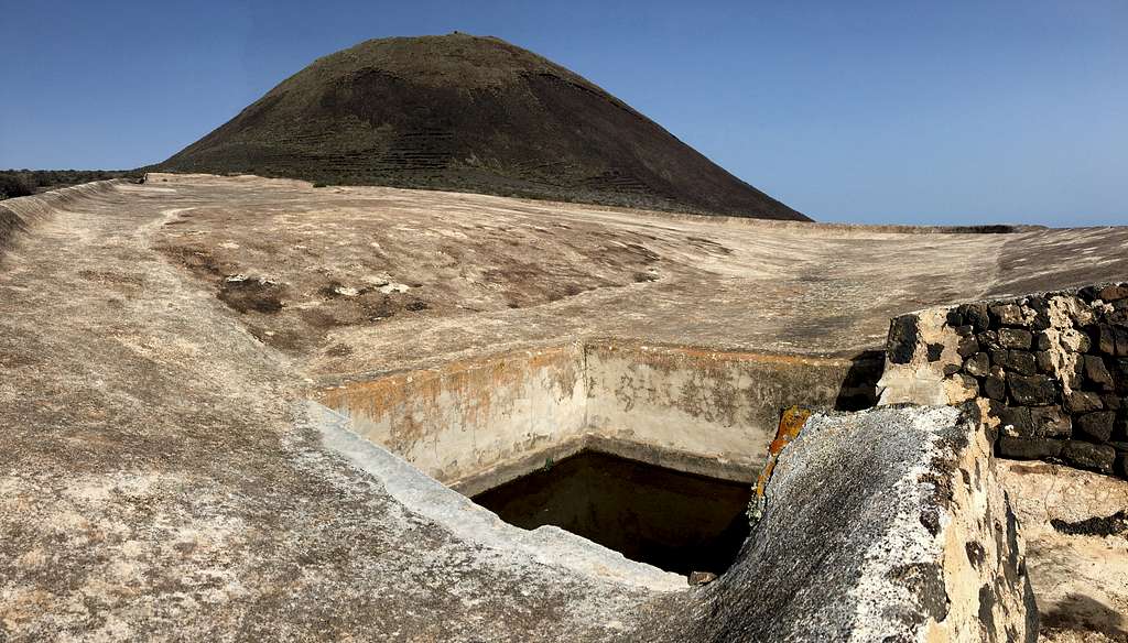
The GR 131 climbs through plantations beneath the southern slopes of Montana Corona. There are the remains of ash pits formed by the volcanic eruption to see and as the route crests its high point, it passes concrete and stone built water storge facilities. These belong to the local farmers and villages and are designed to collect and store any drop of moisture that condenses on the slopes. When we were there in December – the wettest month – there was hardly any water collected, proof of how dry Lanzarote can be.
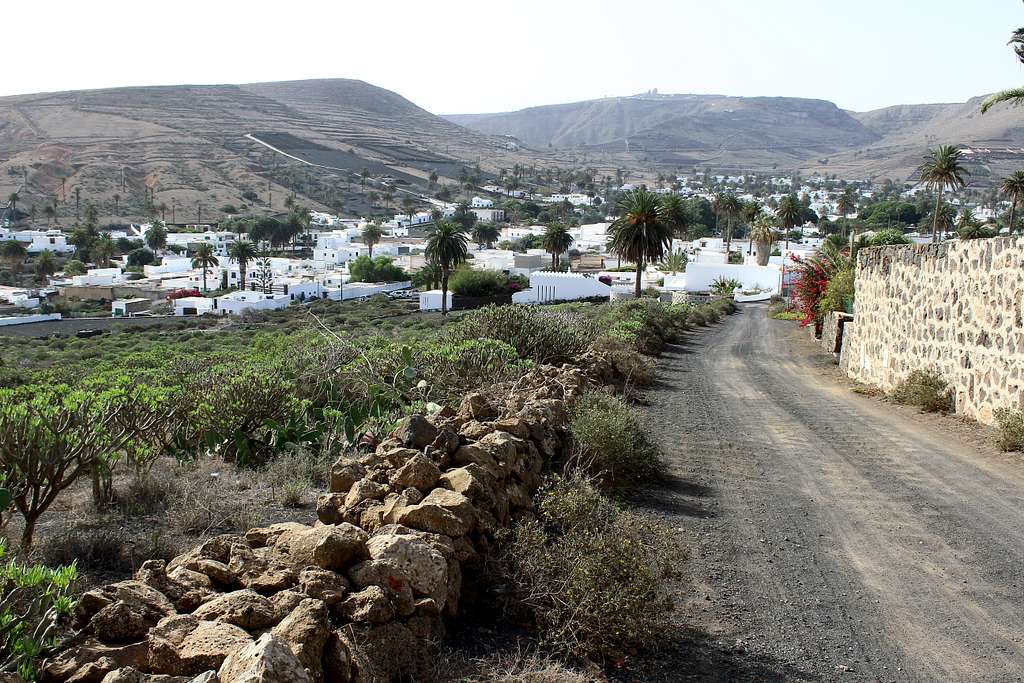
The track descends towards the village of Maguez passing through old vineyards that also have Prickly Pear Cactus, the commonly seen Verode and types of Gorse.
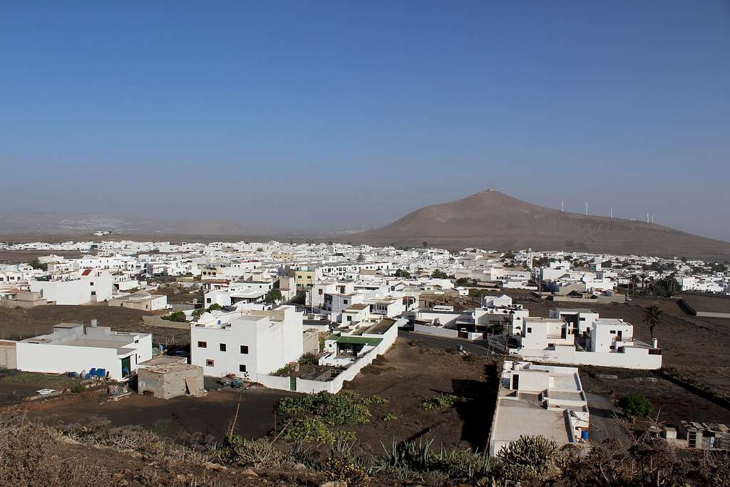
At Maguez, the route is signposted well as it passes through the eastern side of the village and then, it turns on a dog – leg along a road to once again pass through plantations on a track ascending La Atalaya (the watchtower) a hill on the edge of Haria.
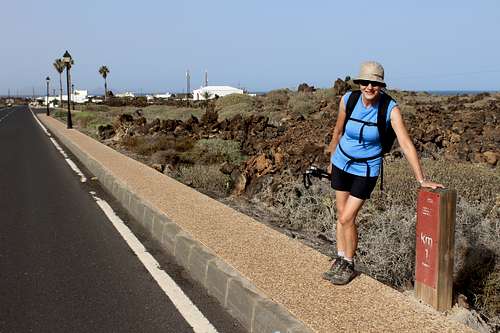
Head downhill, into the town of Haria and find the beautiful Plaza Leon y Castillo, just in front of the church and in the shade of Eucalyptus trees. There is a 12km marker here to show the progress for the day.
There are bars and shops here and the main bus stops lie behind the church on the Calle Fajardo road through the town.
Section 2 - Haria to Teguise
Haria to Teguise
(14.5 km – 9 miles)
Finding the route of the GR131 through the larger towns can be one of the few difficulties of this walk.
Starting in Haria at the Plaza Leon y Castillo, just in front of the church. Walk through the plaza and left to the Plaza de la Constitucion. Follow the signs along the road passing the statue of the basket weaver, then left uphill towards the Cesar Manrique Museum.
This is one of two museums on Lanzarote dedicated to this artist, who is more celebrated for his architectural and environmental achievements, than his art. The second is at Tahiche on the edge of Arrecife. Both are well worth a visit if time allows.
Pass the museum and continue out of Haria and uphill. Once again, the route passes through plantations and crosses over the LZ 10 road several times as it snakes its way up the hill towards the highest part of Lanzarote.
As the angle of ascent starts to level out, the military station at the Penas del Chache, the highest point on Lanzarote, can be seen. It looks like a giant golf ball and is off limits to unauthorized personnel!
The route continues around it and starts a gentle descent.
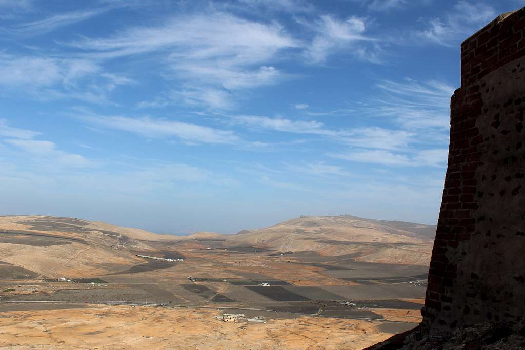
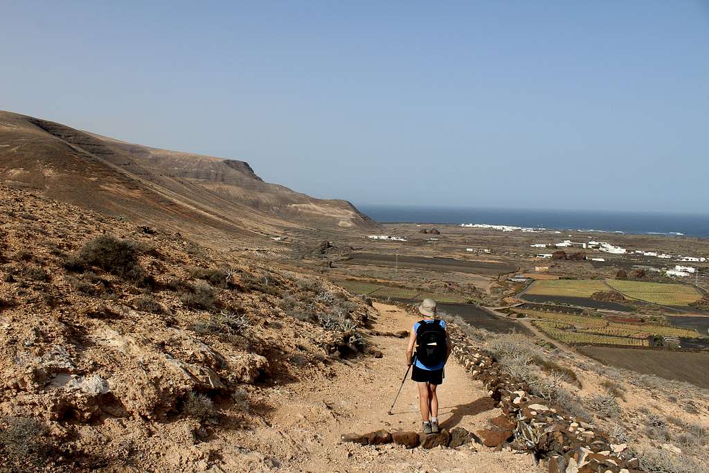
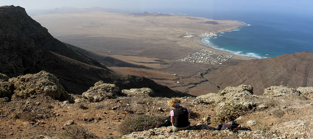
On the right, a huge escarpment falls away steeply towards a desert and the sea. The settlements of La Caletta de Famara and Famara Beach can be seen far below, this is a spectacular viewpoint as you traverse the cliff top. There is only low growing vegetation on the cliff top and this area is usually breezy and should be avoided in high winds.
It is a high, barren plateau with only the military stations and the Ermita de la Nieves (Chapel of the snows) which was built in the 18th century, ahead on a hilltop, as significant buildings.
From the cliff edge, the route continues up towards the Ermita – a good sheltering place on a windy day - and passes it to descend a dirt track southward. After passing another military station, the track continues gently downwards across the desert – like landscape.
Ahead, in the distance, the rounded hillsides of ancient volcanos which lie in the central and southern parts of the island can now start to be seen. However, in the near distance, one hillside has a square, angled building on its summit.
This is the Castillo Santa Barbara, built on the top of Mount Guanapay and overlooking the town of Teguise and all the lands eastwards to the sea and southwards down the island. The castle was originally built in the 16th century as a watchtower to protect the island from pirates, in those days, Teguise was the island capital. It has been modified over the years and is now open as an historic attraction.
The track becomes a path which descends towards Teguise, passing plantations, the ruined Ermita de San Jose and finally a football ground on the edge of the town. Castillo Santa Barbara watches over your progress from its high point on your left.
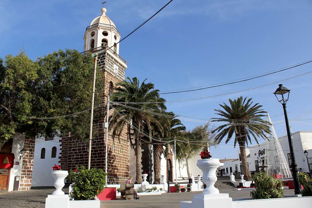
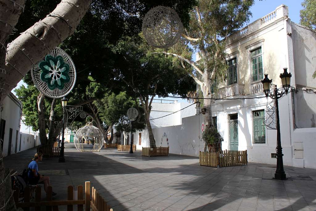
In Teguise, the route finds a way to the church of Nuestra Senora de Guadalupe, in the centre of town. There is a market here on Sundays and plenty in the way of historical interest to visit.
Continue onwards to the Plaza General Franco. The bus stops are here on the Calle Guadalupe.
Section 3 - Teguise to Montana Blanca
Teguise to Montana Blanca
(14.5 km – 9 miles)
The route southwest out of Teguise for this section of the GR 131 seems to have been modified as we had a map that showed one route version and a guidebook that showed another. We followed the signposts on the ground which corresponded with our book.
From the bus stops on Calle Guadalupe, follow the road south as it bends to the right. A signpost directs the walker to the right again onto Calle Siemprevivas. This is followed until another right turn at a signpost into Calle Crisantemo takes the route back to the north.
Before the main road is reached, a left turn on a path cuts a corner, turning the way back to the southwest. After a short section on the tarmac road, the route continues on a dirt track between dry stone walls enclosing farmland.
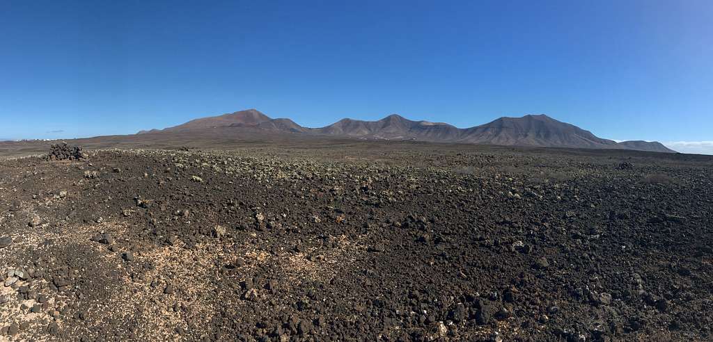
Looking ahead, in the distance it’s possible to see the rounded hills of Montana Guatisea, Montana Blanca – the town at its feet is our destination - and further to the right, the aerial topped Monte Mina.
In some ways, this is the least interesting part of the whole path. The route is generally quite straight and finds a way through flat and dusty fields. As progress is made southwards, the environment becomes dryer and shows more evidence of volcanic activity. Geologically, this section marks a change from the north of the island, to the desolate, moon-like south of the island.
Gradually the route rises towards the town of San Bartolome, crossing the LZ-408 road and continuing into the town. The way continues, following signposts, in a southwesterly direction through the streets. Keep your nerve here, the signposts are few but appear when a change of direction is needed.
The route passes by Casa Mayor Guerra, an 18th century former house, now a museum. This is a popular tourist attraction and has its own street signposts, if you do lose the route, head for this.
The GR 131 passes the Casa Mayor Guerra and the 35 Km marker as it leaves San Bartolome. At this point, the town of Montana Blanca is very close up ahead but the path takes a route anti-clockwise around the small hill of Caldera Llana.
It’s not clear why it does this as, apart from making the path a little longer, the only bonus is a view over San Bartolome and back over the days walking towards the distant town of Teguise.
Much of this diversion is on a quiet tarmac road, before it takes a left turn through farms towards Montana Guatisea. The caldera lies ahead as the route passes through the walled fields then, passes it on our right. A short descent heads towards a main road a short distance from the Casa Mayor Guerra.
The final part of this section heads towards the town and volcano both named Montana Blanca.
After a short section through a residential area, the path passes a bus stop – this is the stop arriving from Arrecife. The bus stop is further down the road and a right turn uphill which brings you to the bus stop.
It says it’s a bus stop and it looks like one but the bus doesn’t stop here! Head back down the road and turn left, wait here the bus will stop here. It doesn’t even pass the actual “Bus stop”!
This is something only the locals would know! We were lucky a passerby helped us!
Section 4 - Montana Blanca to Yaiza
Montana Blanca to Yaiza
(16 km – 10 miles)
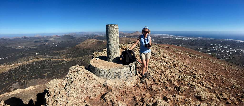
From the bus stop in Calle Lomo de Tesa in Montana Blanca, head westwards along this street. The eponymous volcano rises up on your left, it is possible to climb this for fantastic views of this central part of the island, allow at least 2 hours extra for this side excursion.
Follow the signs along a dirt track around the volcano with ever growing views to the south and this section of the route.
To your right, a succession of brown, sandy, extinct volcanoes mark the way as the route passes beneath them. To your left, the dusty hillsides give way to farms, towns and the sea.
The route continues through the hamlets of Conil and Tegoyo before passing through La Assomada and a steady ascent up a dusty track to a height of 419m, a broad pass between Montana de Guardilama (605m) and Montana Tinasoria (507m).
Both summits can be climbed if time allows but the view from Montana de Guardilama is truly spectacular and can be accomplished in a round trip of an hour or so.
From this pass, the route now enters a different environment.
In 1730, the priest from the nearby town of Yaiza, Father Andrés Lorenzo Curbelo, recorded his account of the start of a new volcanic eruption to the north of the town. This continued, on and off for six years, transforming the whole area into a desolate wilderness of lava and ash.
Nowadays, part of this land is the centre of the wine industry of the island with acres of tiny vines growing in the ash, each one protected by small drystone walls. The route passes through this strange environment on black, cinder tracks, there is little shade here and it is best traversed on any cooler days.
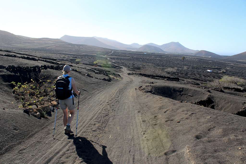
The views to the north of the Timanfaya national park – the extinct volcano calderas and lava flows from the eruption – dominate your attention and accentuate the feeling that you have arrived on some strange, alien world!
Eventually, the route descends into the town of Uga, passes the church in the centre of town and climbs back up towards the LZ 2, the main road through the south of the island.
Before the road is reached, the route veers away from it on a track made especially for the Camel trekkers – a popular tourist attraction! In the morning, you would be trying to avoid lines of these tourist clad animals but by late afternoon, they have all gone.
This route now passes through the edge of the Timanfaya national park, a prepared track takes you through the twisted and charred volcanic landscape before it turns at a roundabout to pass underneath the main road and enter the outskirts of Yaiza.
The bus stops are on the Calle Vista de Yaiza, opposite the supermarket.
Section 5 - Yaiza to Playa Blanca
Yaiza to Playa Blanca
(15 km – 9.5 miles)
From the bus stop at Calle Vista de Yaiza, the route travels down the road as it heads west until a signpost indicates a climb up a manmade, lava - rock staircase to a dirt track above the road.
This track runs parallel to the road in a southwest direction and leaves Yaiza behind. Continue past “La Finca”, a luxury villa and soon the road veers away and the track wends its way across the desert like lava field. There is a feeling of wilderness in this section which is a foretaste of what to expect later in the day.
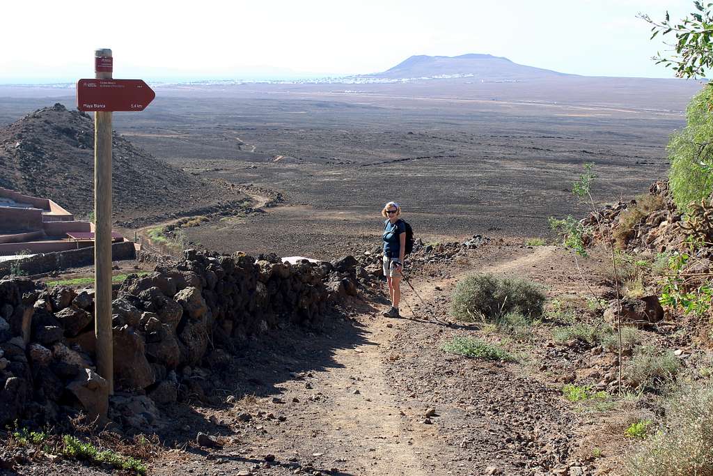
The path rises gently up towards the well-heeled hamlet of Las Brenas with its luxury villas and beautifully kept cactus gardens. GR 131 route signposts lead through the quiet roads to an exit on the southwest side.
Ahead, the final part of the route down to Playa Blanca can be seen across the Rubicon Plain, a lava strewn desert formed during the eruptions of the 1730s. To describe it as a barren wasteland seems an understatement.
There is no shade at all for the next 5 km or so and as this is the southern end of the island and probably the hottest part, make sure you have plenty to drink. If it is a windy day, there is no protection here from the buffeting of the wind or the dust it will carry.
The dusty hills to the left are known as Las Ajaches and were here before the more recent eruptions covered this plain. The aerial topped Atalaya de Femes can also be seen to the left and lays claim to being the second highest point on the island, this can be climbed from Yaiza. A cleared path leads the hiker across this dramatic wilderness, it is easy to follow and leaving it would be very unpleasant underfoot. There are no reasonable escape routes except to return the way you came.
Eventually, the path approaches a lonely farm and joins a dirt track as it heads southwards towards the white buildings of Playa Blanca.
When a modern development of villas is reached, the path avoids it on the left and reaches a busy main road. The journey across the wilderness is finished and all that remains is to find the route through the tourist town.
Follow the road as it heads to the southwest, until at the fourth roundabout, the Estacion de Guaguas (Bus station) can be seen on the far side.
Turn right to follow the road down into the old part of Playa Blanca and a rather inauspicious end to the route at the sea. I could not find an official sign to signify that the journey was over.
Essential Gear
A map of the route.
The best time of the year to walk on Lanzarote is from October through to the end of April. It may be possible to walk at other times but it can very hot during the summer months and on many of the sections, there is literally no shade and only the water you have in your rucksack!
Although Lanzarote is famous for its sunny, dry climate, showers are possible and it is sensible to take a light waterproof jacket. This is not only for the possible showers but also as a windproof jacket. The winds can be cold and very strong on occasions.
Good walking boots/shoes are essential as the paths can be very rough.
A sunhat or similar head covering.
Some food and plenty of fluid to drink as you will pass through areas with no shops or bars.
External Links and References
https://lanzaroteinformation.co.uk/
https://en.wikipedia.org/wiki/Geology_of_the_Canary_Islands
https://www.lanzaroteguide.com/lanzarote-bus-routes-and-timetables/
Lanzarote tour and trail map – David Brawn (Discovery walking guides Ltd.)
Walking on Lanzarote and Fuertaventura – Paddy Dillon (Cicerone)
Landscapes of Lanzarote – Noel Rochford (Sunflower books)