
-
 29325 Hits
-
 82.32% Score
-
 15 Votes
|
|
Route |
|---|---|
|
|
36.57860°N / 118.293°W |
|
|
Hiking |
|
|
Expedition |
|
|
Overview
The High Sierra Trail begins with a trailhead in Crescent Meadow of Sequoia National Park and ends up 72.2 miles later at Whitney Portal. The elevation gain/loss is +15,531/-13,866 feet according to Paul Richins, Jr., author of Mount Whitney (2nd Ed., The Mountaineers Books). This hike was created by the National Park Service and was completed in 1930. You should assume it is a six to eight day hike, from start to finish, not including any transportation time, for most average hikers. Here is an official overview of the hike published by the National Park Service (the link is noted below):
“The High Sierra Trail leads from Crescent Meadow up the canyon of the Middle Fork of the Kaweah River, crossing the Great Western Divide by the 10,700' (3261 meters) pass known as Kaweah Gap. It descends into Big Arroyo, then climbs up to the Chagoopa Plateau, and drops down again into the Kern River Canyon. After running up the bottom of the Kern Canyon, it turns east, climbing parallel to Wallace Creek up to the junction with the John Muir Trail, 49 miles (79 km) from the starting point. You can then follow the John Muir Trail about 13 more miles (21 km) to the summit of Mount Whitney.”
This is a great hike; the biggest problem with the hike is not the hike itself, but the logistics of a shuttle or being dropped off and then picked up from the trailheads on opposite sides of the Sierras.
Getting There
Although it is possible to hike East to West, the standard route is West to East, in which case you begin in Sequoia National Park with Crescent Meadow as a trailhead.
There are two standard approaches to Sequoia National Park, one from the North through Fresno, the other from the South through Visalia. The Northern approach takes CA-180 east to the Big Stump entrance to Kings Canyon National Park. The Southern approach takes CA-198 east to Ash Mountain Entrance to Sequoia National Park. Both entrances are connected by roads inside of the parks. If you are taking the Southern approach, note that it can be subject to delays due to road repair or construction (and this is the case in 2013), so you should check the website for Sequoia National Park which contains current information for road conditions and vehicle restrictions.
Campgrounds are available in Crescent Meadow, so you can spend the night there and begin the trail fresh on your first morning. (The campground you want is Lodgepole Campground; links for this campground and reservations are provided below.) Also, this gives you the opportunity to explore the giant Redwood trees easily accessible by a short day hike in the Giant Forest (which can be accessed during the summer by an in-park free shuttle) if you arrive early enough the day before your hike.
Because you end up on the other side of the Sierras, you probably will not want to leave a car that must be retrieved at Crescent Meadow. Depending upon when you do this hike, if you must leave a car on the Western side (i.e., if you cannot get somebody to drop you off), then you should consider leaving your car in Visalia and taking the Sequoia Shuttle (see external link below for more info) up to the Sequoia National Park. This option avoids the need to take the long and tedious drive up to the park to retrieve your car, and then a return back the same way, which should be reason enough. But there is another advantage because there have been some complaints about small animals eating engine hoses in cars left long term. The National Park Service does not seem to say anything about this in the main park, but I’ve met some people who unhappily had this experience.
Route Description
The National Park Service has a very good detailed description of this hike (see link below) which is worth reviewing, especially since it is free and so readily available. Rather than try and paraphrase this or recreate such a description, let me instead give some of my own thoughts about this trail and let some pictures speak for themselves. First, however, let me quote from the National Park Service regarding trail distances, as it is very useful:
Summary of distances along the High Sierra Trail
| Site | Distance from Previous Point | Distance from Crescent Meadow | Distance from Whitney Portal |
| Crescent Meadow | 72.2 mi. | ||
| Nine Mile Creek | 8.8 mi. | 8.8 mi. | 63.4 mi.*** |
| Bearpaw Meadow | 2.6 mi. | 11.4 mi. | 63.4 mi.*** |
| Lone Pine Creek | 1.7 mi. | 13.1 mi. | 59.1 mi.*** |
| Big Hamilton Lake | 3.5 mi. | 16.6 mi. | 55.6 mi.*** |
| Big Arroyo Junction | 5.9 mi. | 22.5 mi. | 49.7 mi.*** |
| Moraine Lake* | 8.0 mi. | 30.5 mi. | 41.7 mi.*** |
| Upper Funston Meadow | 12.0 mi.** | 34.5 mi. | 37.7 mi.*** |
| Kern Hot Spring | 2.3 mi. | 36.8 mi. | 35.4 mi.*** |
| Junction Meadow | 7.4 mi. | 44.2 mi. | 28.0 mi.*** |
| Wallace Creek Junction | 4.7 mi. | 48.9 mi. | 23.3 mi.*** |
| Crabtree Ranger Station | 4.2 mi. | 53.1 mi. | 19.1 mi.*** |
| Guitar Lake | 3.5 mi. | 56.6 mi. | 15.6 mi.*** |
| Mt. Whitney Summit | 4.9 mi. | 61.5 mi. | 10.7 mi. |
| Trail Camp | 4.2 mi. | 65.7 mi.*** | 8.3 mi. |
| Outpost Camp | 3.0 mi. | 68.7 mi.*** | 6.5 mi. |
| Whitney Portal | 3.5 mi. | 72.2 mi.*** | 3.5 mi. |
* If you take the side trip to Moraine Lake, add .8 miles to all subsequent distances.
** From Big Arroyo Junction, excluding the trip to Moraine Lake
*** The climb to the summit includes a 2.4-mile (each way) spur trail. These distances include the 4.8 mile side trip to the summit.
Crescent Meadow Trailhead to Bearpaw Meadow
This is a relatively level section that starts to suck you into the scenery, and the scenery gets better as you go. It is easy to make good mileage on this section. The only steep elevation gain comes at the end as you ascend to Bearpaw Meadow where there is a hiking campsite, and water is available (when the Bearpaw Meadow Camp is open). If you do not go all the way to Bearpaw Meadow, you can also camp at Nine Mile Creek.
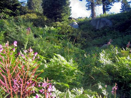
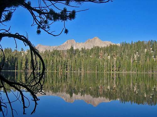
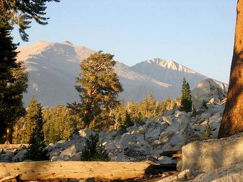
This is a picture taken as the scenery begins to change from the start of the trail.
 This view is early on the trail from Crescent Meadow.
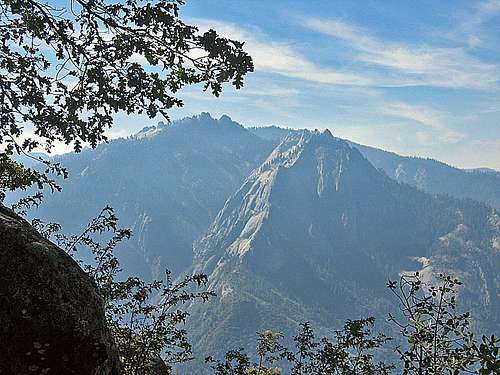
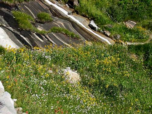
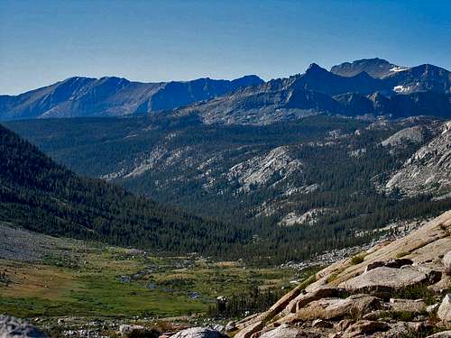
 Scenery late in first day from Crescent Meadow
Bearpaw Meadow to Kaweah Gap
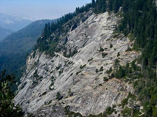
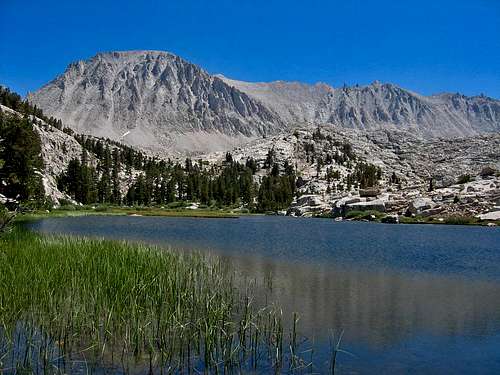
This is one of the highlights of this hike. It is a varied and beautiful segment of this trip, and maybe the best single day. It is immediately interesting as you see why Bearpaw Meadow got its name, then you go through a lush, almost tropical area, go through a trail hewn into rock, reach Hamilton Gorge with the remnants of a prior failed bridge, ascend up to the astonishingly beautiful Hamilton Lake, ascend from Hamilton Lake up its bluff through a trail that includes a tunnel cut into the rock and then proceeds to Precipe Lake, and then from there goes maybe a mile or so through a narrow and beautiful area until you come up to a panoramic view at Kaweah Gap in the Great Western Divide. Hamilton Lakes is a great camp site, and it has a pit toilet, but it is not that far along the trail, so it is probably preferable to continue on, which takes you up a steep ascent with no place for camping until you get over the bluff, and then there are limited campsites near Precipe Lake.
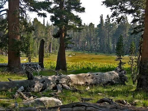
This is an area of lush greenery just as you leave Bearpaw Meadow and head toward Lone Pine Creek
This picture is taken from the other side of Hamilton Gorge looking back at the High Sierra Trail where the path has been hewn into the rock.
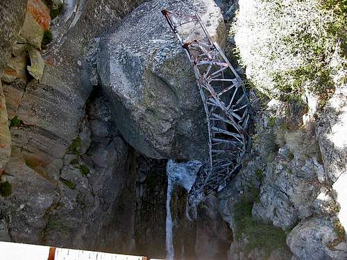 This picture is taken from the new bridge at Hamilton Gorge looking down into the gorge and a prior failed bridge.
This picture is taken along the trail between Bearpaw Meadow and Lone Pine Creek
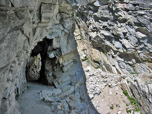
This tunnel is hewn into the rock on the trail leading from Hamilton Lake up to Precipe Lake. It gives you an idea of the amount of work that was put into creating this trail.
 This picture is taken at Hamilton Lake along the lakeshore as one goes from the scenic camping area over to find the trail going up the bluff. The trail is going to take you above the bluffs in the center of this picture. Note the water coming down from the bluffs in the right side of this picture to feed the lake.
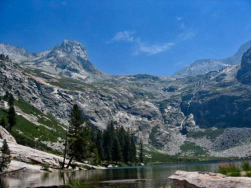
This picture was taken above Hamilton Lake, looking down at it, on August 19, 2006. It was a time when wildflowers were very much in bloom.
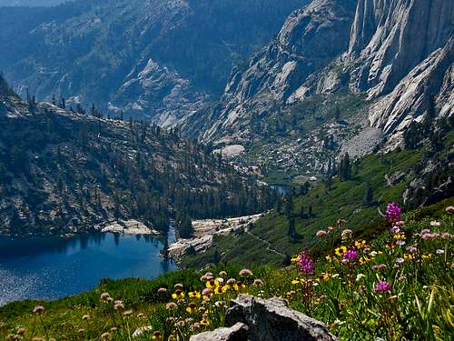
This picture is taken high on the trail going up the bluffs above Upper Hamilton Lake and gives you an idea of some of the scenery near this lake.
 This shot was taken on the trail that climbs the bluff above Hamilton Lake. You would not know this existed from a view of the bluffs seen from the elevation of Hamilton Lake. This picture was shot in the summer of 2006.
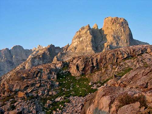
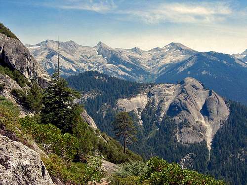
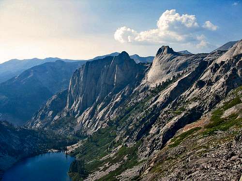
From bluffs above Upper Hamilton Lake
Trail to Kaweah Gap from Precipe Lake
 From bluffs above Upper Hamilton Lake
Kaweah Gap to Moraine Lake
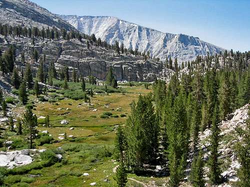
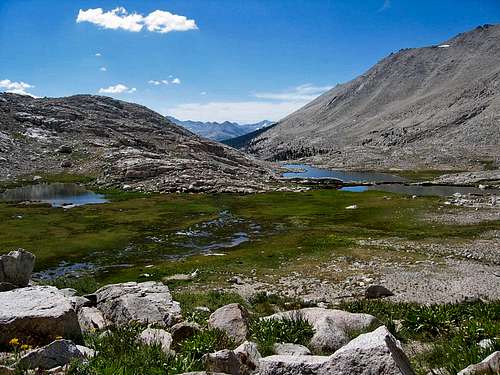
Coming down from Kaweah Gap the trail takes on a new characteristic because you are no longer hugging a trail along a mountainside but descending into a wide valley surrounded by mountain views of both sides. You go through Big Arroyo, where there are plenty of campsites, but it is preferable to camp at Moraine Lake. Although Moraine Lake is not technically on the High Sierra Trail (see the distance table above), there is no reason to skip this marvelous lake just to save a 0.8 mile detour. Besides, there are great campsites here and it seems tailor made for getting great lake pictures with reflected mountains. This trail segment is the first segment with a net loss in elevation.
Kaweah Gap looking toward Big Arroyo
This was a wide open level area of the trail
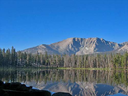
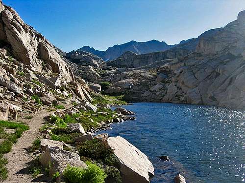
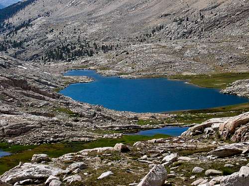
Moraine Lake
Moraine Lake
his picture was taken in the morning on August 21, 2006.
Moraine Lake to Junction Meadow
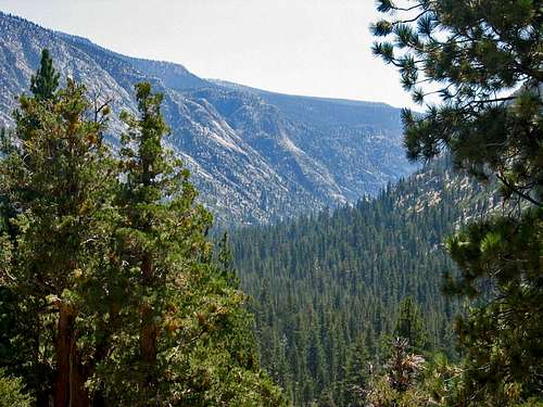
While this segment can be done in a day, it is likely many hikers will not cover this distance in a day. The highlight of this segment is the view of the Kern Trench. The trail comes down steeply as you descend down to the Kern River, and the views of the Kern Trench are something you will never forget. Once the descent is over, the trail has some rather different characteristics, one area sandy, another made of small black rocks, and then returns to normal as you approach the Kern River hot springs. This is an obligatory stop where hot springs are captured in a tub that has some wood boards around it. Be warned: the water in the tub is unbelievably hot, whereas there are some pools that also combine river water to create something a little more enjoyable. The hot springs mark an approximate midpoint of this hike. Some people may chose to camp at the hot springs, while others might press on. Something to remember is that camping in the valley leads to very cold mornings as the cold air comes down into the valley from the mountains and the sun does not hit the valley until later in the morning due to the steep canyon walls. This trail segment has a net loss in elevation.
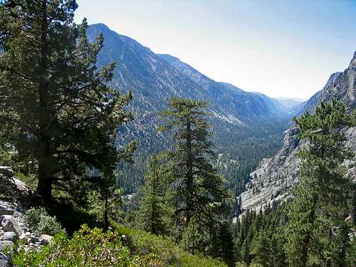
This is taken along the trail ascending out of the Kern River Valley.
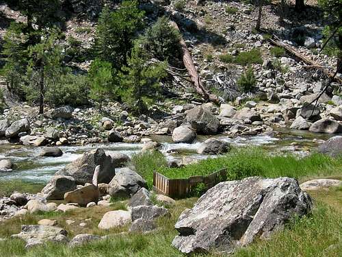 The Kern Hot Springs are in the little area with a wood wall; the river is the Kern River.
Junction Meadow to Crabtree Meadow
Now that you have enjoyed the hot springs and the valley hiking, it is time to regain the elevation lost descending down into the Kern River Valley. This is a stretch of steady uphill gain, and rather steep gain, as you leave the Kern River to hike up Wallace Creek to eventually join the John Muir Trail. You can camp near the juncture with the John Muir Trail (JMT) or at Crabtree Meadow, and the trail from the juncture with the JMT to Crabtree Meadow is more or less level, which is a welcome change from coming up Wallace Creek. Crabtree Meadow is a very beautiful and scenic area. One thing that you must remember to do when you reach Crabtree Meadow is to pick up your Wag Bag kit for use in the Whitney Zone. This trail segment has a noticeable gain in elevation.
Campsite between Junction Meadow and Crabtree Ranger Station
Crabtree Meadow to Guitar Lake
The trail from Crabtree Meadow to Guitar Lake once again begins gaining elevation. In the middle of this segment you reach Timberline Lake which is a beautiful area that should be enjoyed. No camping is allowed in Timberline Lake at present, but it makes a great rest stop. From Timberline Lake the trail goes up to Guitar Lake which ends up being a wide open area with plenty of camping (and marmots) at an elevation of 11,400. Depending upon the time of day you reach Guitar Lake, you may want to take a side excursion if you have done some research prior to your arrival. Guitar Lake gets its name from its shape, which becomes more apparent from a higher elevation. The shoreline of Guitar Lake has a sandy area that makes you think the lake is somewhere else. Another option, other than staying at Guitar Lake, is to proceed several hundred feet more in elevation along the trail and stay at some more Spartan campsites located at higher elevation tarns to get a head start on the next segment. This trail segment has a noticeable gain in elevation.
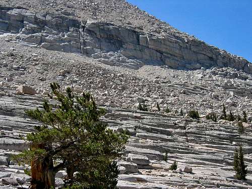
This picture was taken along the trail from Crabtree Meadow to Guitar Lake, below Timberline Lake. I thought this rock strata formation was interesting.
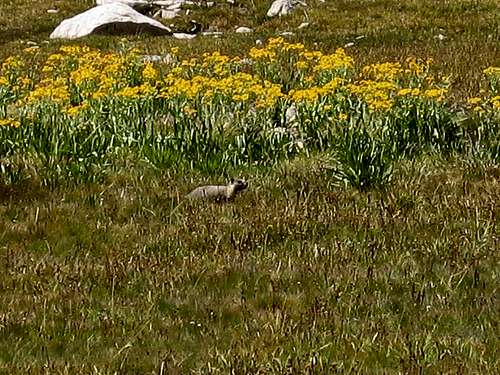
There are so many marmots at Guitar Lake that they show no fear. This picture was taken mid-afternoon August 22, 2006.
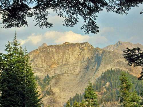
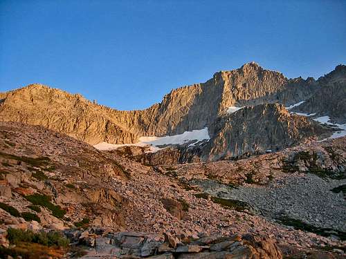
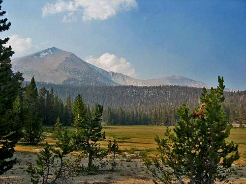
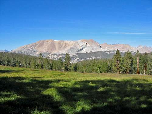
 Mt. Whitney viewed from the west from Timberline Lake
Going up the trail from Guitar Lake
Tarn campsite above Guitar Lake
 Guitar Lake
 Guitar Lake to Mt. Whitney to Whitney Portal
The trip up to Trail Crest from Guitar Lake is not that long, although it does cover a number of switchbacks. It is very hard to see the trail from below, as the rocks obscure it, and as you ascend you can look down and now see the previously hidden trail. Most people will drop their pack at the junction of the 2.4 spur trail hike to the summit Mt. Whitney. Along this trail you can also summit Mt. Muir with a short scramble up from the trail. The spur trail up to Mt. Whitney is rocky and offers many spectacular views of local mountains, of Guitar Lake below, of interesting rock and trail formations along the way, views through the various needles, and then it makes the ascent up to Mt. Whitney. It is a very nice hike, and one of the highlights of this hike.
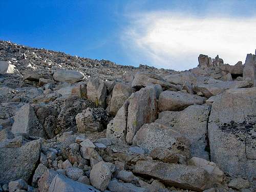
This is the trail, with switchbacks, that ascends up to the spur trail for Mt. Whitney. You cannot make out the trail from below unless you happen to see somebody ascending the switchbacks above you.
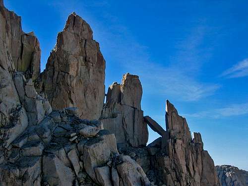
There are numerous interesting rock formations and photo opportunities on the spur trail leading up to the summit of Mt. Whitney. This is one of them.
 This picture gives you some idea of the elevation gain up to the spur trail leading to Mt. Whitney. You can see Guitar Lake in the right side of this picture, closer to the top.
There are numerous interesting rock formations and photo opportunities on the spur trail leading up to the summit of Mt. Whitney. This is one of them.
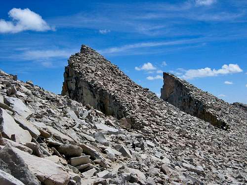
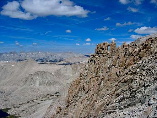
In this picture you can clearly see the pinnacles that you pass on the Whitney spur trail. This is looking back at them from the Whitney side of the trail.
Atop Mt. Whitney you have a hut that was built in 1909 and great views in many directions. After enjoying the summit, one retraces the spur trail, retrieves any dropped backpack, and then begins down the trail to Whitney Portal. Note that some people actually forego the exit to Whitney Portal and either retrace their way back to the starting point at Crescent Meadow or to some other exit point. But, if one is ending at Whitney Portal, the trail down goes through Trail Camp (which is highly overused and preferably avoided as a campsite) and Outpost Camp down to Whitney Portal. If you do not have a car or ride waiting at Whitney Portal, it may be desirable to camp at Outpost Camp and then hike down the short 3.5 miles to Whitney Portal in the morning. Reasons for such an approach include the following. Camping at Outpost Camp is nice, and there is a waterfall at the camp. Whitney Portal camping is crowded. Finally, you can get hot food, cold beer and warm showers at the Whitney Portal Store, when it is open; so if you arrive late at night, you will not get these at the conclusion of your trip, whereas you will get these if you arrive mid-morning after a leisurely hike down from an overnight stay at Outpost Camp.
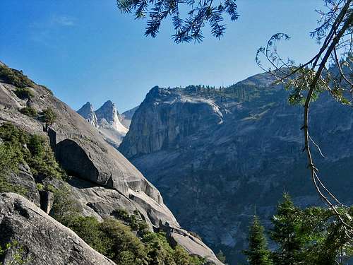
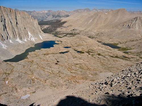
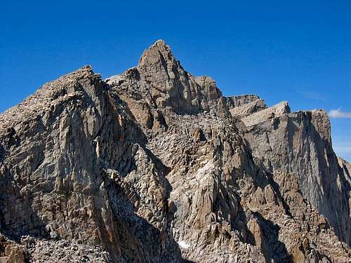
This picture is shot from the summit of Mt. Whitney looking south. The spur trail travels along below and to the right of the Pinnacles or Needles you see in the right center of the picture.
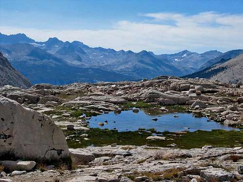
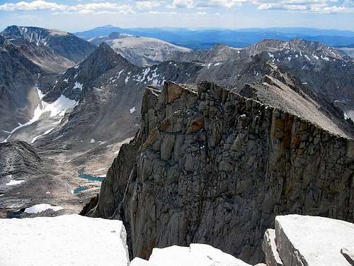
The Kaweahs are the prominent mountains visible in the background of this picture. So this picture is looking across the Sierras and some of the distance covered by the High Sierra Trail. You can see the Kern River Trench in the foreground of the picture.
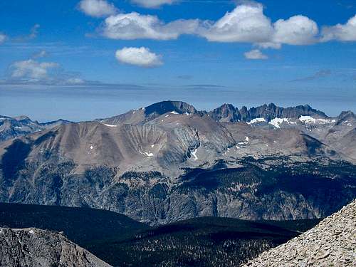
 Mt. Muir, the Pinnacles (Needles) and Mt. Whitney
Essential Gear
Multiday camping gear and the Ten Essentials. You will need a way to purify your water. You will need a bear canister. You need a Wag Bag kit for the Whitney zone (one such kit is provided with the Whitney Zone entry fee).
Red Tape
You need a wilderness hiking permit for this hike and quotas are in effect during the quota period that begins in May and goes into September, so you will want to plan your trip and make sure you can get a permit. You can get a single permit for entry at Crescent Meadow and then have the Whitney Zone added to it, which is really nice because it means you can access the Whitney Zone without having to go through the risk and uncertainty of getting a permit through the Whitney lottery!
There is an entry fee for Sequoia National Park, a wilderness permit fee and a separate Whitney Zone fee ($15/person). If you camp at Crescent Meadow, it also requires a separate fee. Current details regarding all of the fees are accessed from the Sequoia National Park site and links below will lead you to information you will need to get permits.
You need to pack out all human waste from the Whitney Zone, so you will need to pick up a Wag Bag kit, free of charge (because the Whitney Zone fee covers it), at the trail junction by Crabtree Meadow.
External Links
www.nps.gov/seki/planyourvisit/high-sierra-trail.htm High Sierra Trail description
www.nps.gov/seki/index.htm Homepage link for Sequoia National Park
www.nps.gov/seki/planyourvisit/wilderness_permits.htm Wilderness permits and reservations
www.nps.gov/seki/planyourvisit/reservation-availability.htm Information re availability of wilderness permit reservations
www.nps.gov/seki/planyourvisit/entrance_fees.htm Entrance fee information
www.ci.visalia.ca.us/depts/transit/sequoia_shuttle/ Sequoia shuttle from Visalia
www.nps.gov/seki/planyourvisit/lodgepole.htm Information re the Lodgepole campground
www.recreation.gov/ Link to get reservations for campsite prior to starting hike (You want the Lodgepole campsite at Sequoia National Park)