The Strip was quiet as I drove past it along an empty I-15 towards points north, but knowing Vegas full well I’m sure on a Saturday morning there were still plenty stragglers about, loitering around the late-night casinos and scavenging for breakfast and other stragglers. I would be back in less than a week for the Bachelor Party, the reason I was in Nevada in the first place, but for now I had a week in the desert all to myself, just man and mountain(s). Appropriately enough the Desert National Wildlife Refuge was my destination for today, along with Hayford Peak, an ultra prominent that falls just short of 10,000’.
![Sheep Range]() Hayford from US-93 Hayford from US-93 |
Monotonous and bumpy, Alamo Road was trying experience, while the higher peaks of the Sheep Range were often hidden behind more proximate foothills. Like many of the mountains I eventually make my way to, this range had caught my attention in the past, several years ago, as dry, seemingly inaccessible desert peaks looming above US-93 running along its eastern side.
I had been hoping for an early start to avoid the afternoon heat, but having flown out and done
Hualapai on no sleep the day before I got up later than I had planned, so I was already toiling under the desert sun by the time I started up Deadman’s Canyon. The rocky, uneven road wrecked havoc on the knee that I had strained the day before, as it traversed through the bare, Joshua Tree lined desert gracing the entrance of the canyon, but the surface improved to more trail-like conditions as it ascended (very (very)) gently into the Piñon pine zone. The Canyon walls loomed steep and high, its exotic angles and corners concealed by the shade of a shy and slow sun still emerging from the other side of the range. The road soon transitions completely to a trail, with another sandy wash parallel to it on the right. Slowly the desert floor turns grassy, and conifers appear as you near Hidden Forest Cabin. At this point almost half the elevation had been gained, but the grade is so gentle that barely a drop of sweat was shed.
It got cooler too, starting at 6,500 ft or so, as the sweet smell of alpine evergreens graced my senses. I had passed some groups in the canyon, many of which seemed content to stay in the canyon. I was greeted at the cabin by a small group that had camped there overnight. They were planning to summit Hayford after breakfast. I bid them adieu as I preceded them up the obvious climber’s trail that ascends immediately from the cabin up the SW ridge.
The trail soon dissolved into sagebrush slopes, and I contoured along the eastern edge for great open views towards Hayford Peak and the drainage below (the other ascent option). Some of the rock was blue and dusty, if not volcanic then certainly resembling that. I rounded the false summit and descended one or two hundred feet to the saddle below the summit. Seeing the split for the descent route into the drainage I began the final trudge to the top.
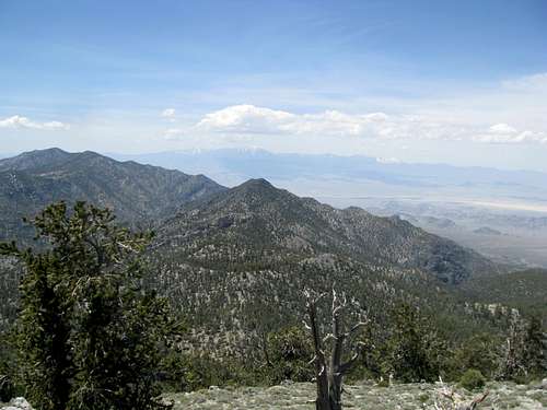
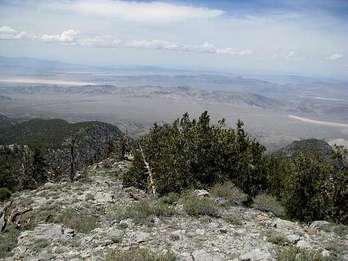
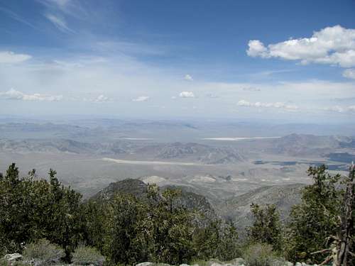
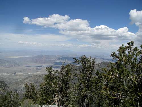
The last 800’ was tedious, traversing through brush, narrow bands of rock, and talus. The route fades several times and the top looked distant, even from 100 feet below. But no matter the effort you always eventually arrive, and I was greeted at the top by spectacular views towards the Springs, west towards area 51, south towards Sheep Peak, and east towards Morman and Moapa.
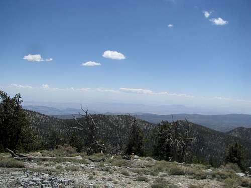
In pursuit of less immediate views I found some ledges north and below the summit.
Despite a very cold wind I lingered atop Hayford for more than 40 minutes.
Descending I opted to head directly south (I had come up from the SW). The terrain was easier but I soon spotted the saddle from whence I came several small drainages away.
![Cool Tree]() Cool Tree Cool Tree |
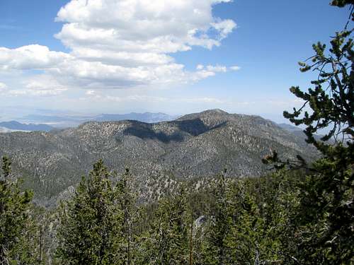
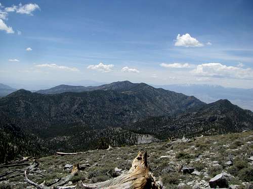
![Hayford Summit]() Back towards Hayford Back towards Hayford |
I contoured SW through the sparsely brushed slopes, arriving at the main ridge just above the saddle and right as I crossed paths with the group camped by the cabin. I wished them well on the last legs of their ascent and upon arriving at the saddle turned left to descend the canyon route.
It was an easy, mellow descent through open ravines and gentle washes.
The last leg of the hike from the cabin to the trailhead was long but never dragged, the sky having gone overcast so that the lower elevations were actually cooler compared to that morning, and I arrived at my rental 6 hours after departing it. I stretched my legs; the left knee actually felt better, and I was almost optimistic.
![Joshua Tree Desert]() JTrees near Trailhead JTrees near Trailhead |
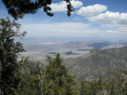
![Spring Mountains]() Spring Mtns Spring Mtns |
![Mummy Mtn]() Mummy Mtn Mummy Mtn |
I drove straight to Beatty, stopping at Indian Springs for some gas and beef jerky. If my knee felt good, I would try Grapevine Peak the next day. If not, I always had the option to do the casual tourist thing in Death Valley.
Several hours of inactivity later it was clear that my knee had stiffened, and I felt an unnatural click when I was descending stairs. Unless it miraculously improved overnight I was not optimistic about prospects for a hike the next day.


Comments
Post a Comment