
|
|
Route |
|---|---|
|
|
46.54117°N / 10.64355°E |
|
|
Mountaineering |
|
|
Summer |
|
|
A long day |
|
|
PD (UIAA II) |
|
|
Overview
Hoher Angelus & Vertainspitze by Konrad Sus
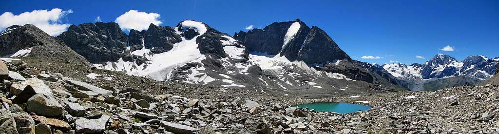
The traverse of Hoher Angelus and Vertainspitze is one of the classic routes in the area. In a single day two prominent mountains of the Ortler Group can be climbed. The route starts by climbing the Hoher Angelus along the Reinstadler route from the Dusseldorfer Hut. From the summit of Hoher Angelus one descends into the Angelusscharte inbetween the 2 mountains. From here a direct route leads up to the summit of Vertainspitze along the east ridge (rock UIAA II). A variation to this ridge is to cross the Laaser Ferner (glacier) to the Rosimjoch and from there to the summit of Vertainspitze. The latter route is less difficult but requires the crossing of a glacier. The final section of the route is descending along the Rosimferner into the Rosimtal and back to Kanzel / Sulden.
This route is a popular objective for climbers and there are some good reasons for it. First of all, the route is not too difficult: PD (UIAA II), but can be considered as a proper high alpine experience: a mixed climb with rock and snow. Also, by traversing the mountains you don't have to descent along the route you came up, but you make a beautiful round-tour instead. Last but not least, the views from the route are tremendous and of course the route involves Climbing two major 3500m+ peaks in a single day.
 Hoher Angelus and Vertainspitze | 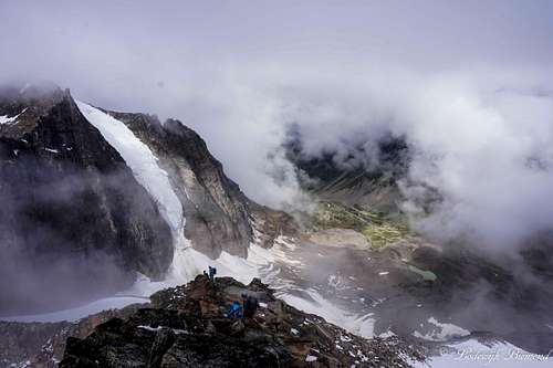 Climbers on the NW-ridge with Vertainspitze |
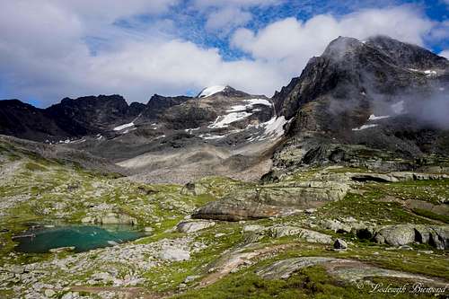
The traverse route requires a full day of climbing and it is advisable to start early and be in time to take the Kanzellift back down to Sulden. This will save you the last 450 vertical meters of hiking back down to Sulden. Views from the route are tremendous. The Hoher Angelus offers views to the Vinschau and Otzal Alps and of course the next objective for the day: Vertainspitze. From Vertainspitze the views to the dreigestirn Gran Zebru - Monte Zebru - Ortler are wonderful. The route is also a perfect warm-up for the higher mountains in the area like Koenigspitze and Ortler.
The gradation of the route can be decreasded to PD-: If you have the proper experience the route along the east ridge is shorter, but somewhat more demanding involving rock climbing up to the second grade (UIAA II). Alternatively, use the route over the glacier to the Rosimjoch and from there along the south flank to the summit of Vertainspitze. The difficulty of the route decreases to PD- (UIAA I to II-).
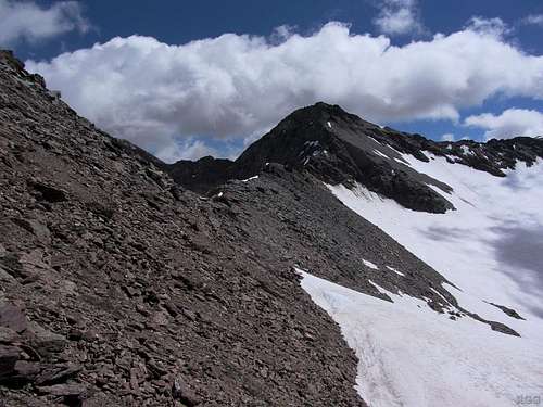
 Vertainspitze (3545m) and Angelusscharte | 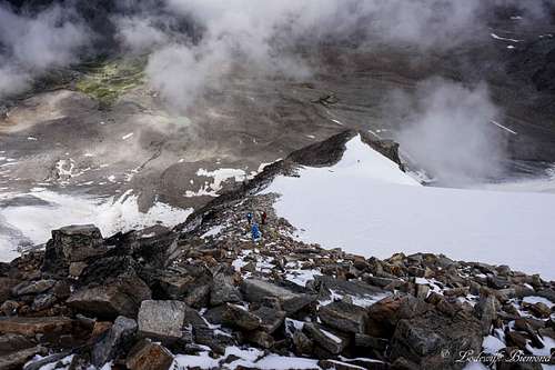 Reinstadler Route / NW-ridge |
Route Description

Hoher Angelus - Vertainspitze Traverse Route Map
The route starts at the Dusseldorfer Hut. To get to the hut from Sulden see the section ''Getting There'' below. From the Dusseldorfer Hut the first stage of the traverse is to climb Hoher Angelus along the Reinstadler route. The Reinstadler route goes over the Northwest ridge to the mountain and is considered as the normal route. This section takes about 3 hours and is graded PD- (UIAA I to II-). This route is described in full detail on the SP Reinstadler Route page. Click on the link to read the details about this first part of the route.
1. Angelus NW-ridge with Vertainspitze | 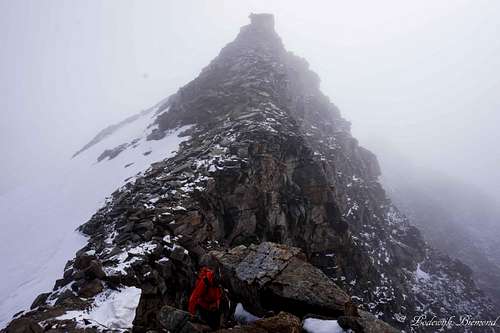 2. Descending SW-ridge | 3. SW ridge to Angelusscharte |
From the summit of Hoher Angelus, descend along the summit ridge for some minutes. After leaving the summit ridge there is a junction: The NW ridge can be clearly followed back down, but to the left of it another ridge goes down towards the Angelusscharte (3337m), which separates Hoher Angelus from Vertainspitze. Follow this ridge, the SW-ridge, down towards the Angelusscharte. Be careful not to slip on the sometimes quite narrow ridge. The climbing is never difficult though (UIAA I). It takes about 30 minutes to reach the Scharte. From the Angelusscharte descend along a steepish flank onto the glacier. This short flank is covered with debris and snow/ice. Do watch your step at this point and avoid slipping. You have now entered the Laaser Ferner glacier. At this point it is time to rope up and put on crampons. There are now two options to choose from:
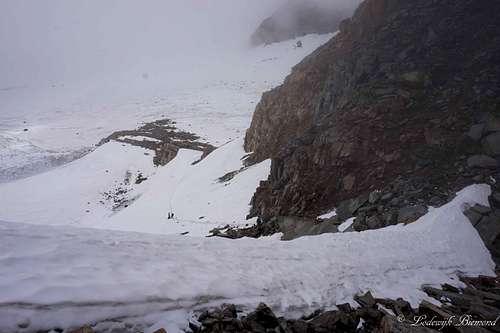 4. Angelusscharte (3337m) | 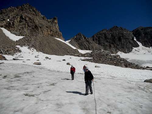 5. Laaser Ferner | 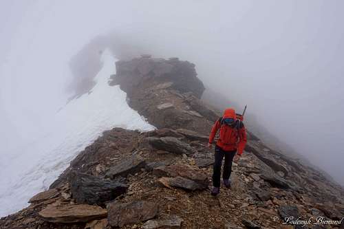 6. Rosimjoch (3288m) |
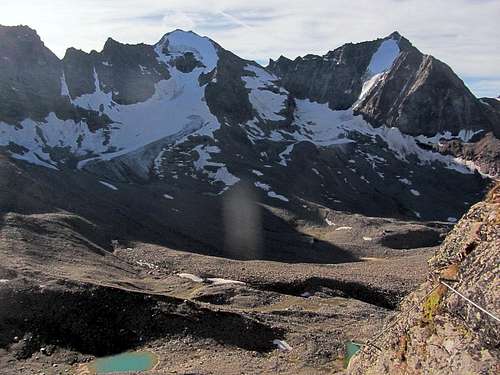
1. Enter the glacier and cross it in a Southern direction. The Laaser Ferner can be considered a "friendly" glacier, and the crossing is relatively easy, since the altitude difference between the Angelusscharte (3338m) and Rosimjoch (3288m) is small. Although friendly, a glacier is a glacier and can contain crevasses. Therefore, be sure to rope up. The crossing will take up to 30-45 minutes and after reaching the Rosimjoch the glacial equipment is no longer obligatory, but some people choose to go along with it to the summit. From the Rosimjoch, head along the south flank in the direction of Vertainspitze. Keep left of the S-SE ridge and head up along the snowfield. After the snowfield keep heading up along the rocky south flank to the summit. This last part requires some easy scrambling (UIAA I) and contains a lot of loose rocks, so watch out here. Keep heading up until you reach the summit of Vertainspitze at 3545m.
 7. View back to Rosimjoch | 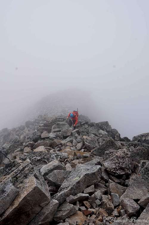 8. South Flank of Vertainspitze | 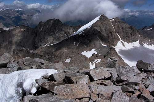 9. Hoher Angelus from Vertainspitze |
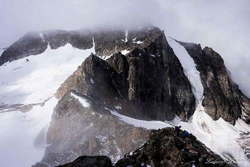
2. Enter the glacier for a little bit and pass the first part of the East ridge that starts at the Angelusscharte. At about 400 meters after the Angelusscharte itself, enter the East ridge of Vertainspitze. This is the part of the ridge that is easiest to access from the Laaser Ferner. There are yellow markers present here. After entering the east ridge follow the yellow markers along the ridge. The route goes up just south of the actual ridge. Keep following the yellow markers until you arrive at the secondary summit of Vertainspitze. This part requires climbing up to the second grade (UIAA II). From the secondary summit is only some 5 minutes more before reaching the summit of Vertainspitze.
 10. Vertainspitze Summit | 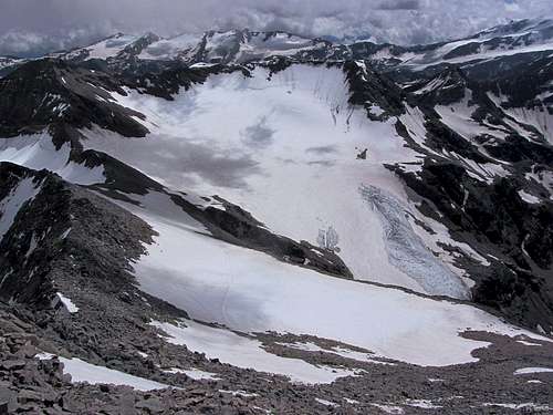 11. South flank, snowfield & Rosimjoch | 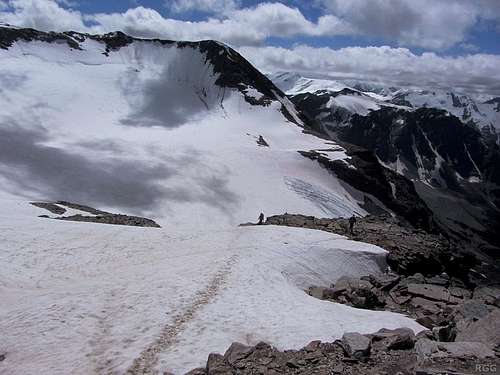 12. Heading to the Rosimferner |
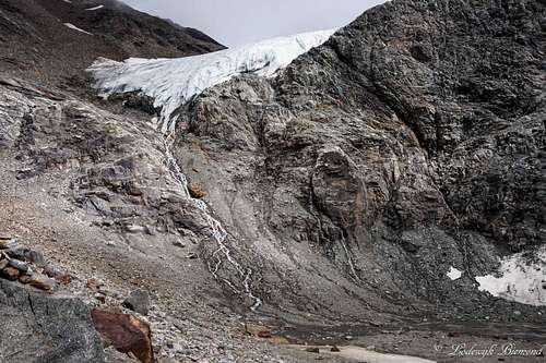
Descent is back along the rocky south flank until the snowfield is reached. Follow the snowfield to the Rosimjoch. Before arriving at the Rosimjoch itself go down the Moraine/rocks until just before the glacier (Rosimferner). The rocks are loose, so once again watch your step. Just before the glacier you will arrive at the marked trail (number 11). Follow the trail down into the Rosimtal. At first the trail goes down along with the flowpath of the glacier. After heading further down the glacier stops (incredible glacier tongue) and keeps heading down the Rosim valley. Eventually Rosimboden is reached, a small plateau at +/- 2400m. At this point there is a junction. Follow the trail (no number) towards the Kanzellift and take the chairlift down to Sulden. Alternatively stay on trail number 11 and hike back down to Sulden. This will take about 1,5 hours extra. The total route takes about 8 to 10 hours (without the use of the Kanzellift).
 13. Rosimtal & -Ferner | 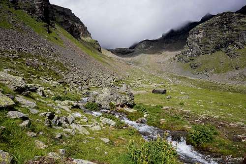 14. Lower Rosim valley | 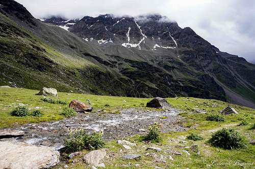 15. River at Rosimboden |
Getting There
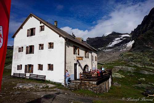
Dusseldorfer Hut with Hoher Angelus (3521m)
Essential Gear & When to climb
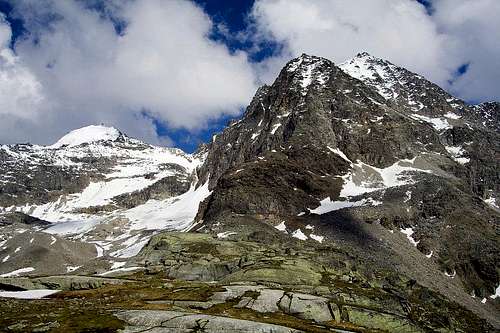
Hoher Angelus and Vertainspitze
Full glacial equipment is advisable, especially when using the route along the Laaser Ferner.
External Links
Vertainspitze and Angelo Grande
How to get to the Hut Description + Topo
Kanzellift Seilbahn Internet Page
Interactive Map Vinschau region