Big Creek On Fleek - July 11th, 2014
I took a three day weekend and decided that finishing the Lemhi P2K’s were due. Salt Lake City is as close as any major city to this range, including Boise, and I figured it would make logistical sense to get these in my remaining months left in Utah still employed and limited to occasionally extended weekends.
My goals: Big Creek Peak and Lem Peak in the northern half of the Lemhi’s, and Scott Peak, the highest peak of the Beaverhead Mountains. My constraints: lots of elevation gain for each peak, and some Sunday World Cup world championship game that I’d struggle not to pass out watching but yet can’t miss due to the fact that it’s (was) now 2014 and you as a human being really can’t function in society and still afford to miss out on stuff that everyone else is watching (at least back east).
Since Scott was both the easiest peak on paper as well as the one closest to a city with maybe one or two bars with TV’s, it would have to do for Sunday. Which meant leaving Friday morning for Big Creek, with a stay in Salmon and Lem Peak in between.
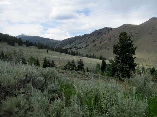
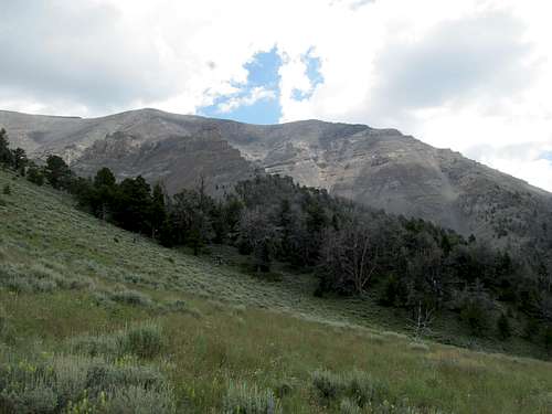
There’s not a lot of information on Big Creek Peak out there save for a couple trip reports, but the route from maps and Google Earth seemed pretty basic. Start from the Big Creek Campground, follow the trail, leave the trail, go through the woods, and eventually end up basic talus slopes to the top.
I tried to get a little too fancy in my route scouting. Shortly upon leaving the trail a side ravine comes in from the right below the bump marked 7,613 on the topo maps. I thought this would be a straight forward way to gain the drainage and head in a straight line towards the summit: 10 miles, 4,700 feet gain, with some minor ups and downs.
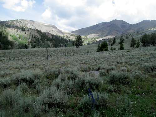
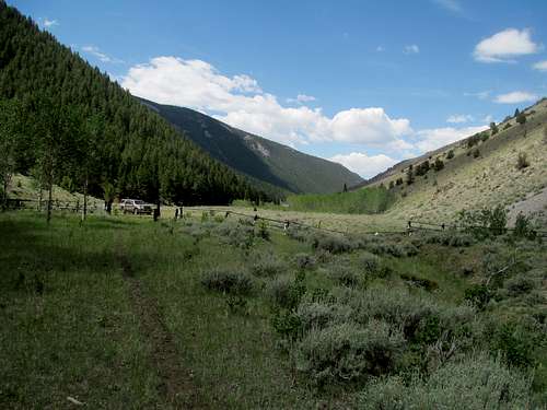
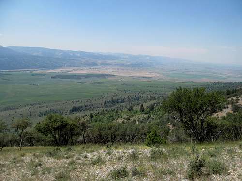
But before there was the drive, new roads for me in the Pahsimeroi Valley between the Lemhi’s and the Lost Rivers. If the Lemhis are the forgotten mountain range of eastern Idaho, then this valley is the forgotten side of the Lemhi’s: no towns past Howe, and few miles of paved roads.
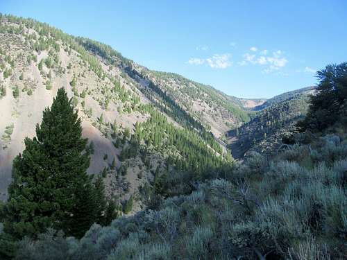
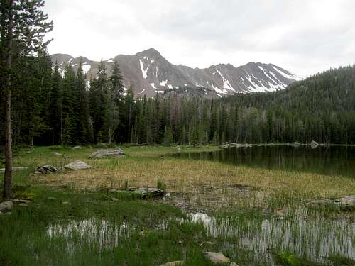
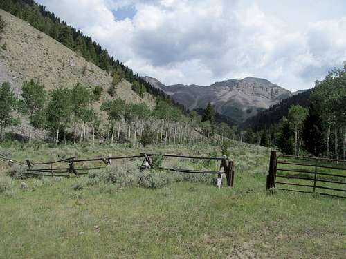
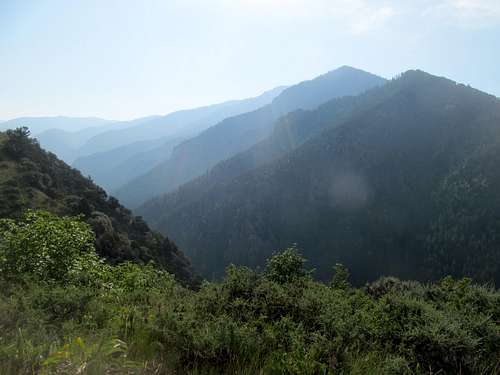
But the scenery was spectacular, especially the profile of Bell Mountain. I found the turnoff for Big Creek Campground, passed the wider passenger car parking area, and drove down a steep rocky pitch to the smaller parking lot right near the banks of the Creek. A few other cars were parked surprisingly, as there seemed to be some girl scout camp activity going on, but I saw not another soul after embarking on the trail.
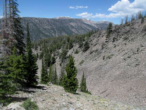
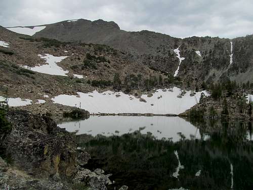
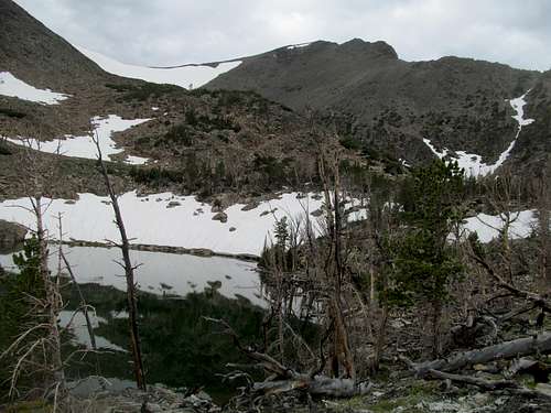
I followed my planned course and left the trail after crossing the tributary from the right, heading up the spine of the ridge directly to 7,613. This route proved brushy and gnarly with some tricky bits of scrambling, more annoying than difficult. Reaching the top of the bump I had a good view of Big Creek, still far away and 4000 feet above.
I descended to a small saddle NE of the bump and continued my way. In the absence of any other landmarks between me and the top, I simply followed my GPS up towards the summit, through several thousand feet of woods, some open, some more thickly choked, trying to stay high along the spine of a minor ridge the entire time.
The route was evenly paced, a bit of climbing, then some flat spots, then more climbing, then a respite and so forth.
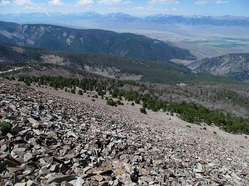
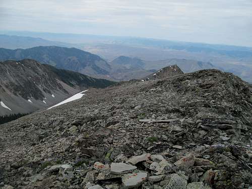
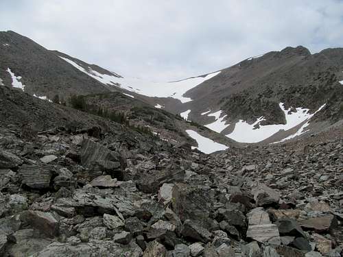
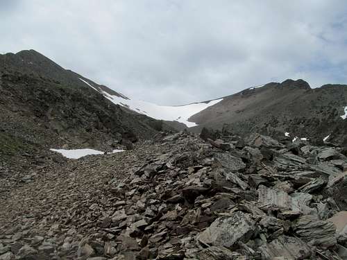
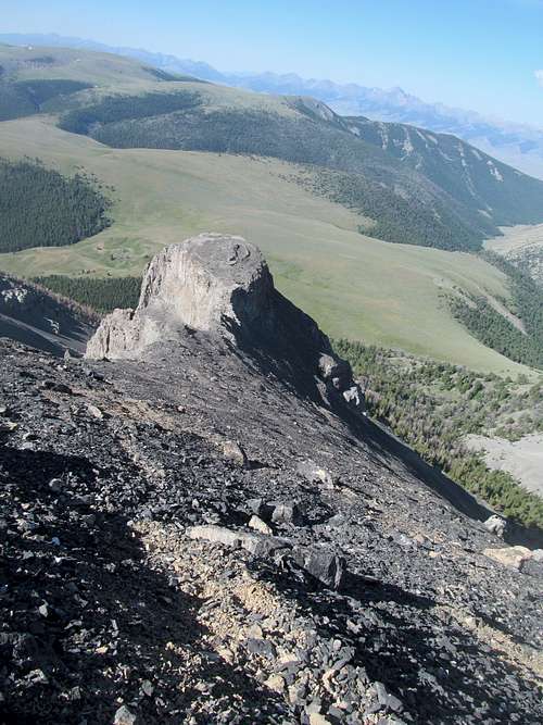
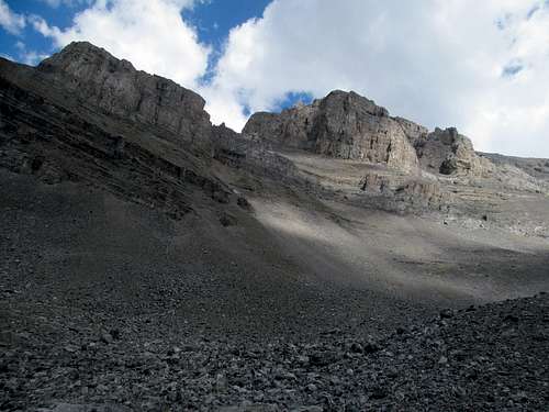
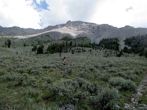
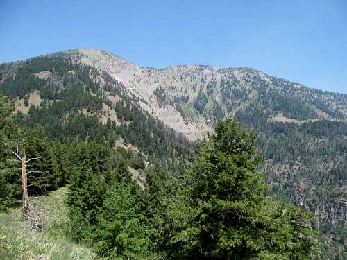
Eventually the trees opened up and greeted me with the vision of endless talus ahead.
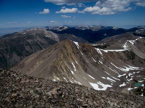
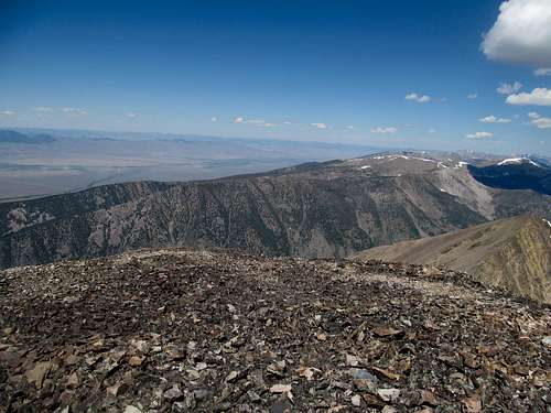
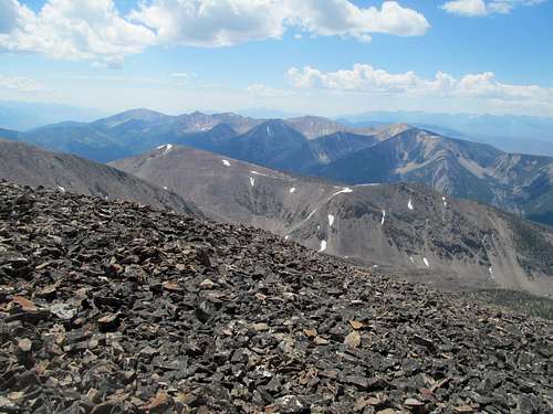
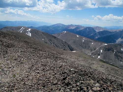
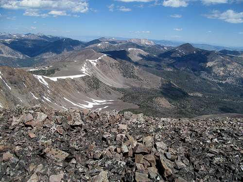
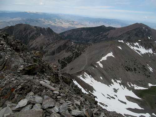
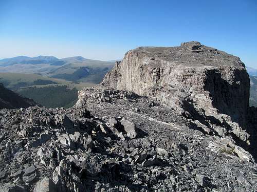
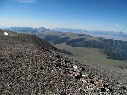
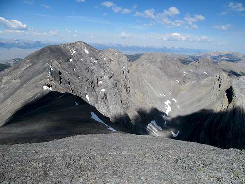
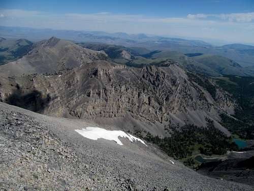
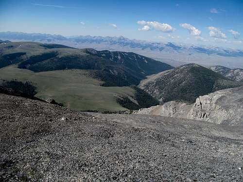
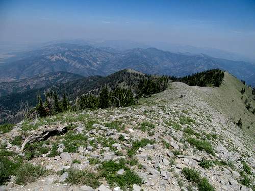
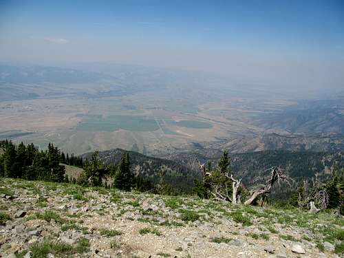
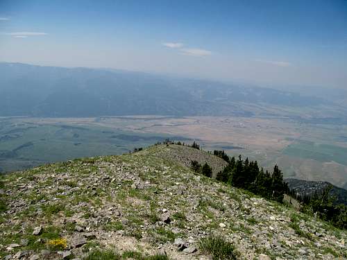
Clearing the trees meant 1000 feet of monotonous talus to the top. The going was basic, nothing too loose, or difficult, and a fairly fast grind brought me to great views of the Lemhis at the top.
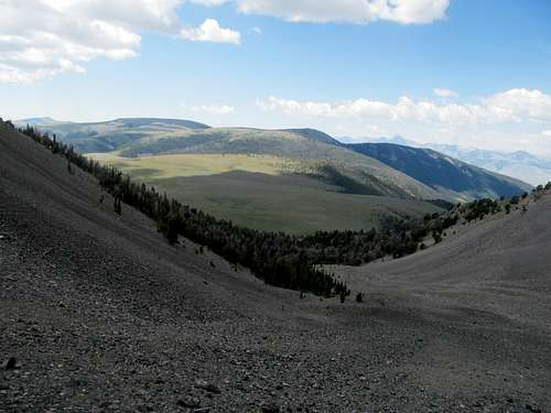
The peak is situated off the main crest, which is what gives Big Creek its prominence, and I enjoyed a bleacher view of the range from the high rugged peaks to the north to the visage of Diamond and Bell in the afternoon sun to the right.
I strayed right on the way down. Back in the forest, I tried to get low as quickly as possible, and ended up through some small rocky drainages that made for pleasant going.
Further down though I realized that the higher route I had taken on the way up was better, as the lower areas were sometimes choked with deadfall.
I had to make a concerted effort to contour back left to my original route, ending up at the original saddle near 7,613. Not wanting to descend the way I came up, I decided to straight shot it back to Big Creek and the trail from here. I was in for a pleasant surprise, as halfway down I found a small climber’s trail that switchbacked back to the main one.
I followed the creek back to my car, making it door to door in exactly six hours, and followed the beautiful Salmon River to its namesake town.
Lemhi Temerity - July 12th, 2014
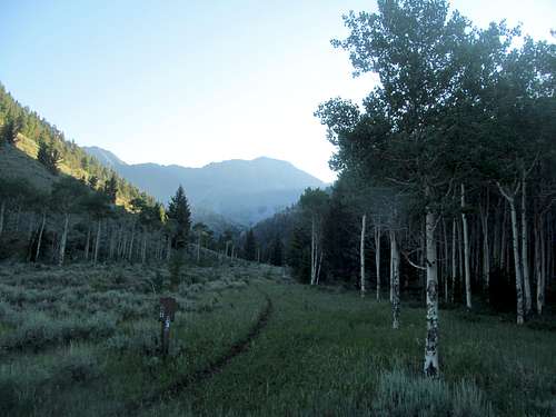
The weather for Lem Peak had deteriorated for Saturday, with 60% chance of Tstorms by noon. Knowing I needed an early start I forsook the local bars and got up early, driving south of town to the Bear Valley Trailhead.
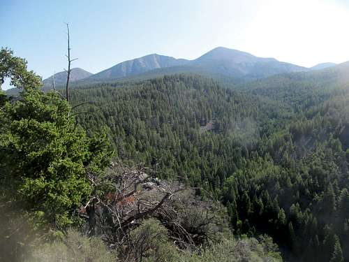
This was a side of the Lemhi’s I’d never seen before, lush, green, and cool. A dark cloud cover made for a slightly ominous ambiance; I wasn’t sure this was grizzly territory, and it probably wasn't, but it sure felt like grizzly territory, and I made extra sure to bring my bear spray.
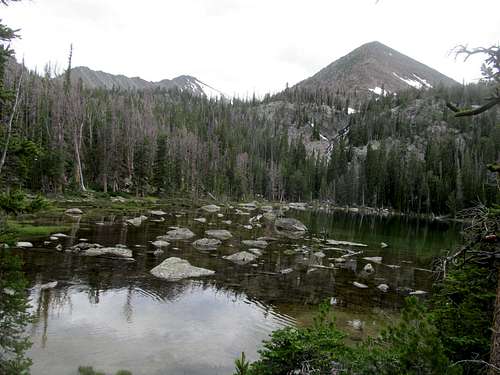
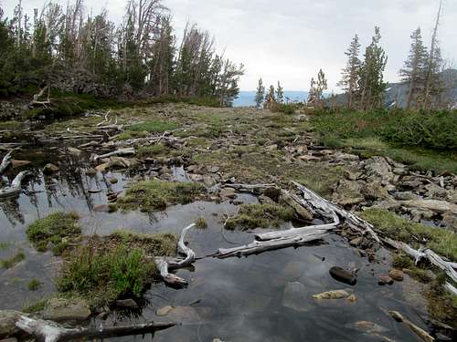
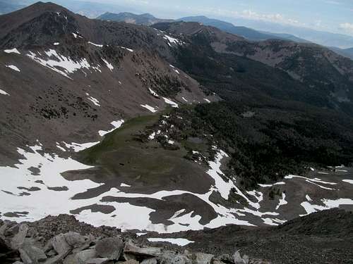
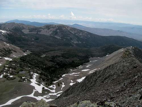
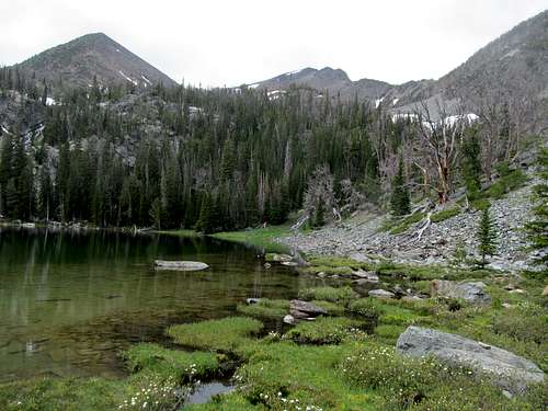
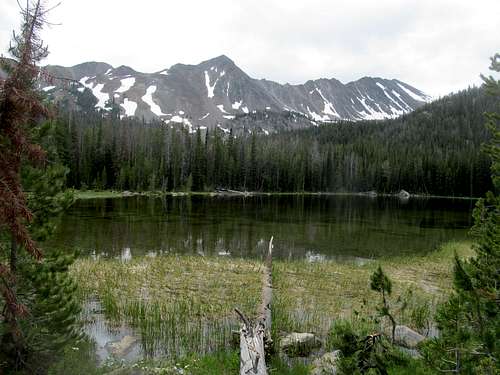
It’s a long walk to the junction with the Buck Lakes trail, mostly flat and viewless, though with occasional glimpses of the rocky ridges above. As it dragged I was apprehensive about having missed the junction, especially after having passed the junction with Buck Creek. The junction is actually a bit past that, where you drop maybe 50-100 feet to cross Bear Valley Creek and join Buck Creek. Pretty and pastoral Lower Buck Lake was where the trail ended. And the rest of the route sucked from here.
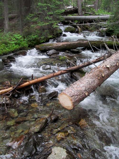
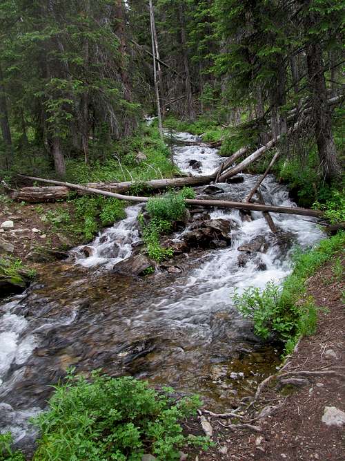
There’s no trail from here to the Middle and largest of the Buck Lakes, 800 feet above and some distance away. The creek here whittles away as the terrain became choked with brush, mud, deadfall, and a surprising amount of soft residual snow. I alternated back and forth between either side of the creek, trying to discern the path of least resistance. Due to a left turn it takes approaching the middle lake the left bank would’ve made for less distance, but it was far more dense with brush and downed trees. The right bank wasn’t much better: slippery boggy and muddy, but at least I found a faint herd path from time to time.
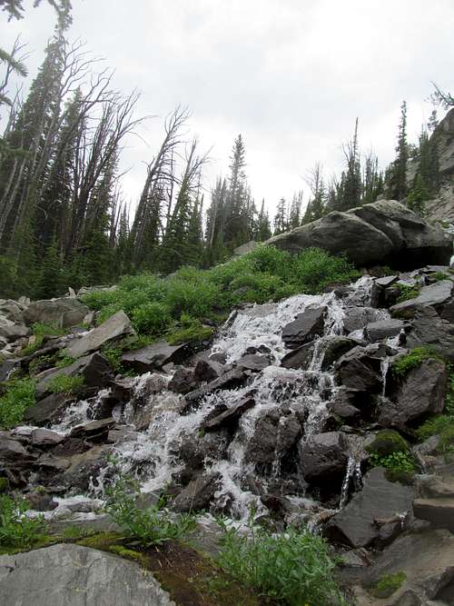
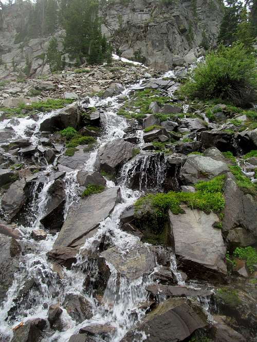
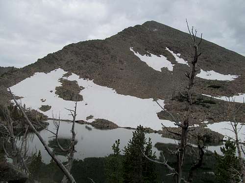
Thus I cut a wider path around the right bank of the creek to arrive at the scenic Middle Lake, where views of Lem and the surrounding peaks were more obvious. Cutting around its right bank you see two cascades ahead, a smaller one to the right and a larger one left. The route pretty much demands you ascend by or on these cascades. I ascended through the larger left one and descended along the right one.
This section would’ve spectacular and surreal in every way if it weren’t for the fact that climbing through a very large and wide expanse of cascades means going through one of the densest hordes of mosquitoes I’ve ever experienced. Splish splash pitter patter bite bite swipe swipe…midway up I escaped via some steep and slippery scrambling on the ledges to the right, which offered me a milder respite from the bugs and brought me to a small cirque below the upper lake. Easy scrambling took me to the last in this chain of lakes.
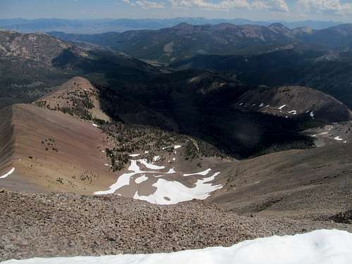
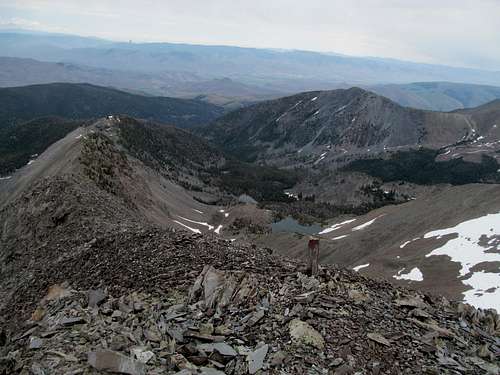
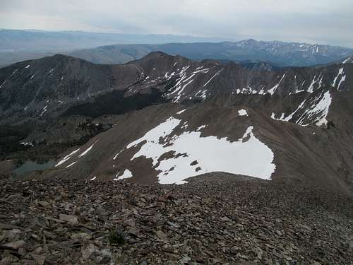
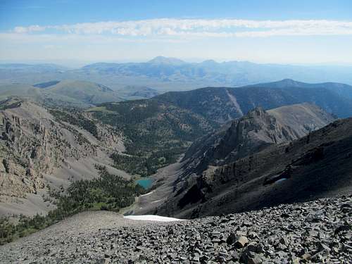
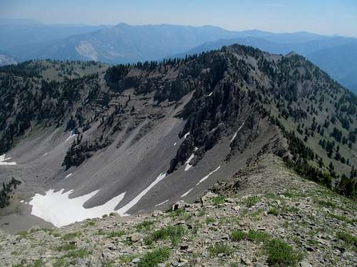
The morning sun, cloud cover, and bowl like confines of the Upper Lake made for unique optics. One more traverse right around the right side of a lake, then across a ridge where I tried to contour my path so as to minimize my elevation loss approaching the drainage leading southwest towards the saddle at the base of Lem Peak’s southeast ridge.
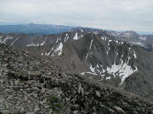
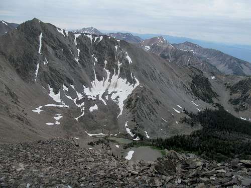
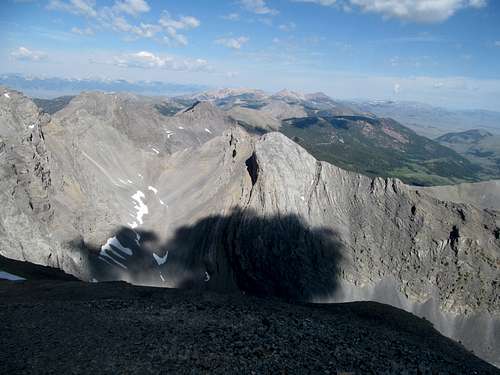
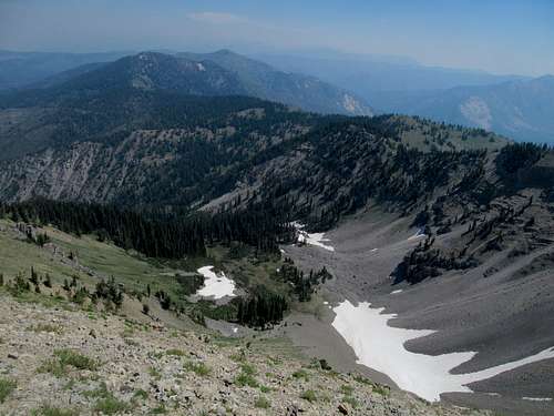
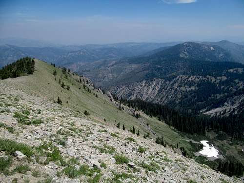
The scree was pretty loose here and made for tiresome progress. The overall hassle and obstacles the route presented was really adding up at this point, and I was pretty tired, stopping for quick breaks more often than usual. I found a few lines of snow, which made for easier progress. Rather than aiming for the saddle I cut towards the southeast ridge, reaching it around halfway up, yet based on the amount of climbing I had left, lower than I expected. At least this summit, thoroughly earned, was a most rewarding one.
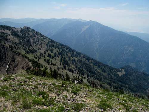
Take heed, folks, Lem Peak is a good one. My pictures don’t do it justice, but the lush basins and steeper, more rugged terrain here in the northern Lemhi’s really stood out to me. Don’t get me wrong, Saddle, Diamond and Big Creek were all great peaks, and I certainly hope to return one day to get Bell, and others in this range, but Lem was special. Lem felt northern, Lem felt rich, Lem felt greater than the sum of its parts.
It was maybe around 10:30 in the morning as I lingered at the summit, watching precipitation already cruising down the valley and hitting Scott Mountain and the Beaverheads, reminding me that, as much as I wanted to linger here, watching the early afternoon clouds over every expanse from the Salmon River Mountains over the Beaverheads, I better scram before those 60% tstorms started forming my way.
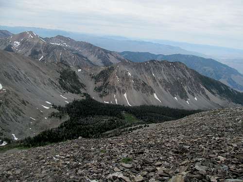
I decided against my ascent route for the downclimb, what with all the bugs along the cascades. Instead of retreating back to Upper Buck Lake I descended the scree and continued down the drainage north (left) of it instead. It wasn’t a bad route, stretches of hard, crusty snow interspersed with rock, and good views back at Lem and its subpeak to the left as the small drainage winds alongside directly below Lem’s northeast ridge.
Things did get a little trickier approaching the steeper drop off back down to Middle Buck Lake. A small creek ran nearby, and I followed along its left bank, descending steep wet grass, brush, and nests of branches back to the Middle Lake, emerging at the right cascade that I had initially crossed en route to ascending the larger middle cascade.
After soaking up the pastoral scenery at Middle Lake and its host of unknown snow lined peaks nearby, I made the most of the trailless route back to lower Buck Lake, following my GPS tracks where I could to avoid straying too far; I’d think bottom line though it’d hard to get lost in this section…just follow the terrain downwards as all paths drain down into the Lower Lake.
It was a very long walk back to the trailhead, and the usual story blah blah blah, hot afternoon sun, tired legs and feet, cool refreshing creek to the right, no bears, random dirtbike a couple miles before the trailhead, etc. I talked to some backpackers at the trailhead who arrived shortly before me and who had spent the last couple days camping in the Bear Valley Lakes, then drove off, got a little lost on the dirt roads back to the highway, and enjoyed the dramatic views of the valleys and ridges of the Lemhi’s.
Saturday night entailed sleeping in the 4Runner. In preparation, I journeyed up to Sharkey Hot Springs near Lemhi Pass to wash off. These are well developed hot springs with concrete pool-like area, and I talked to a few locals enjoying the waters and the afternoon heat, listening to the sound of rolling thunder from unknown parts above.
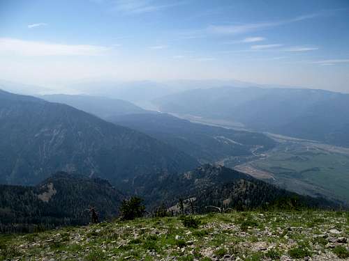
Clean as a whistle, I drove further up the pass. Labor Day weekend in 2013 I had driven over this pass from Salmon into Montana to climb Bloody Dick Peak, but the overwhelming haze that day had wiped away any views to be had. My return trip yielded better results: brilliant views of the Northern Lemhi’s just the same as they once were to Lewis and Clark (and Sacajawea) hundreds of years ago. I stood in awe at this historic juncture, contemplating those that came before me and, given the relatively unspoiled nature of the place, whether they saw the same views that I glimpsed now. (Or at least until I get some money and start building resort casinos in all my favorite places).
Great Scott - July 13th, 2014
Then my own petrifying exploration into the unknown began…venturing back down ID-28 into a verizon dead zone and the prospect of another night spent in the back of the car as opposed to some shitty mediocre excuse of a bed and a motel room (I exaggerate…I’ve really found that most mom and pop motels out west run a great operation with rooms much cleaner than what you can get for even more money back east).
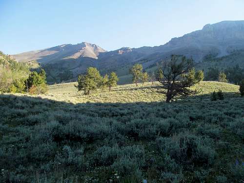
I was in for a pleasant surprise. Leadore, a collection of shacks I vaguely recalled driving by a few times to and from Salmon, actually had a few restaurants and bars. I stopped at the small bar/café on the right side of the highway, had a beer and a great burger, chatted with the proprietors and an older couple from Idaho Falls, then walked out to brilliant colours over the Lemhi’s before I drove NE out of town to find a good car camping spot between town and Bannock Pass.
I said good night to sunset and woke to a tranquil sunrise, continuing down the highway as the spectre of Scott grew nearer and nearer.
It’s a decent amount of dirt road driving from the highway to the trailhead, and the last few miles were pretty rough and rutted.
Moving on to the next section of this trip report, aka the trail to Scott, aka cowshit alley, aka MOOnbat Boulevard. Yeah, there’s a lot of cow doodies from the trailhead all the way through the flat section towards Scott Peak and Huh’s Horn and yeah, plenty of it looked mighty fresh and juicy. The perpetrators themselves were anything but shy, and as I shooed and yelled at them to get out of my way from the drive in on to the hike in, I heard plenty of moo’s echoing from behind me to ahead and above as they quite aggressively warned other heifers further up about my approach. (Sitenote, looking back on it now I’m kind of convinced that these cows either communicated to or were indeed the same herd that tried to kill my on Sunset Peak a few ranges over and a few months afterwards.)
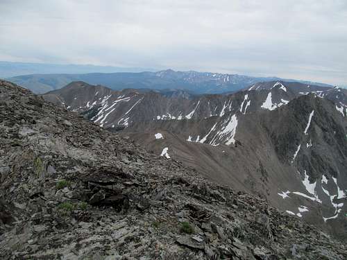
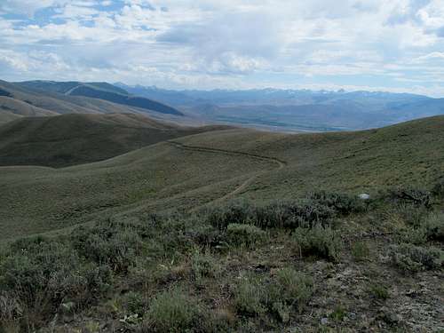
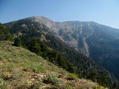
Scott’s a real odd one. The trail switchbacked up to a broad Serengeti style plain stretching down south from the Beaverhead Crest, and I tried my best to not lose elevation while traversing down through a lower brushy area.
Dean/Dennis’s picture on SP from their outing provides a really good look at the intended route, traversing to the left of several rocky pinnacles before reaching the saddle and ridge between Scott and Webber.
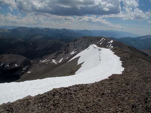
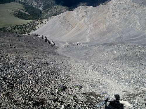
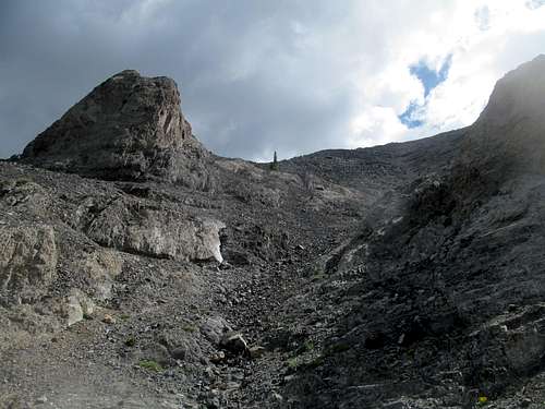
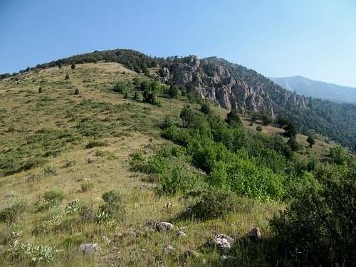
Getting up to the pinnacles was the basic shiznit, and I actually marveled at how the rock was pretty decent in and around that first pinnacle. The scree underwhelmed my brief delusions of grandeur (re stability) shortly afterwards, and it was a slog to get to the ridge proper.
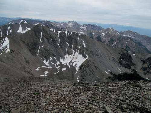
Light at the end of the tunnel (re top of the ridge). I could see the summit, or something (mildly) close to that, but more slogging lay in between. Gaining the ridge I traversed a cool looking helipad rock pinnacle that, along with Diamond Peak across the valley, made for a good pictorial backdrop as I struggled up the rest of the route, which featured several broad ledges making for fun easy scrambling (a much flatter, spread out, and geologically different version of GNP terrain?).
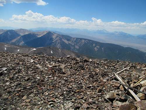
I traversed a flat area before the summit proper, taking note that this offered the best views of Webber to the south.
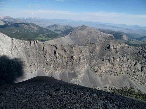
It’s hard to get great views from the broad summit plateau, especially north, so I wandered in that direction down maybe a hundred feet or so to get a glimpse of the rugged Italian Peaks subsection of the Beaverheads.
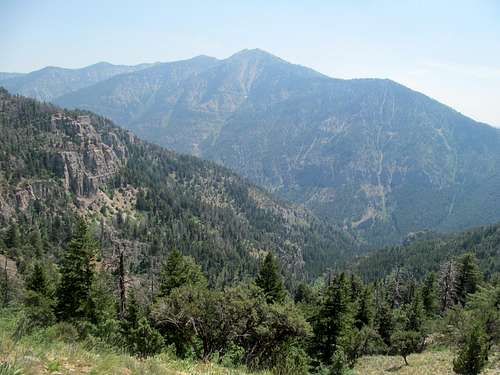
Nearby was Garfield Mountain, which was surprisingly separated from the range proper.
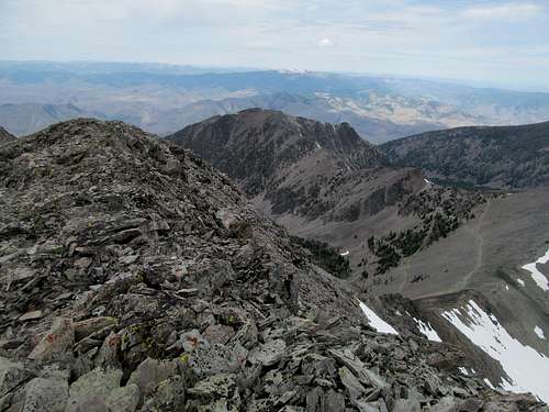
There’s not much worth noting about my descent from Scott besides to serve as a cautionary tale. Fresh from my direct scree-ski descent on Ryan and a good route finding decision on the way down from Lem, I decided to try to repeat my antics straight SW from just south of Scott’s summit, thinking it an easy scree ski down into the basin between it and Huh’s Horn.
Even when the scree skiing was easy it wasn’t; the action varied from the entire slope sliding down well past me and myself struggling to put on the brakes and maintain control. Other times a thin layer of rocks hid hard, slippery granite just below, which made me slow in caution to avoid slipping and falling on what would surely be a hard and bloodletting surface.
Then came the hard part; the closer I came to the basin the more I noticed the seeming lack of a smooth transition of scree to lower basin. Instead I began to suspect the existence of steep, immediately, most likely cliffy drop off between me and where I wanted to be.
Yet I was too lazy to reascend thousands of feet of the worst scree, so I decided to try my luck/dig myself deeper. I ventured through a rotten downclimb, flitting from one rotten ledge to the next, carefully maneuvering myself on my hands and ass through a couple small loose gullies to a flatter midsection. Continuing down I confirmed the existence of really real cliffs, no way around or down. I traversed left (south), descended what I could, working ledge by ledge through fortunately non-impossible terrain until I finally made it back down into the bowl.
The cliffs that I actually cliffed out on were pretty big cliffs, a large visible overhanging cleft shaped rock visible from afar as I put more and more distance between me and that whole unpleasant incident.
The rest of the trip back through surreal landscape was a blur as I tried to make it back as quickly as possible while all the while stopping to snap pictures of this raw landscape.
I tried to straight shot it down some dirt roads to join ID-28 further south but ended up wasting probably over an hour circling back and forth on non existing roads, around abandoned farms, and then following an extremely questionable road/rutted high grass and round after round of impossible cattle gates to arrive back at the highway.
The Buffalo Wild Wings in Idaho Falls was too crowded, so I went to the MacKenzie River Pub and Grill to catch the game. 80 minutes into the game and I had missed nothing because the score was still 0-0…soccer everybody!!!!! I enjoyed some good brews and a sandwich, the game went into extra minutes (free…{scoreless}…soccer!!!) before mercifully ending (hashtag soccerlife). Still, I had appeased my FOMO, survived three good peaks with my legs (not to mention limbs) intact, and settled yet another three hour stretch from Idaho Falls back to Salt Lake.
Going Baldy - July 19th, 2014
As mentioned in a prior TR, my main regret in the month of July was not using the weekend after the Lemhi’s to go after Kings Peak. A last check at the 4 AM weather scared me away, and I drove north instead back into Idaho. I dallied between North Twin in the Lost Rivers and Baldy in the Snake Rivers, eventually deciding upon the latter due to a supposedly better smog forecast.
Well, it was too late to reverse course after the weather forecast all of a sudden reversed course on Kings by the time I reached Idaho Falls, going from maybe 50-60% storms to 20-30%. Well, on to Baldy.
The day was hot, humid and, against the best efforts of the weather.gov forecasters, damned smoggy as I started up from the Palisades Creek Campground listening to a podcast on 12 Byzantine Rulers. The route though, sadistic though it may flirt, was certainly not Byzantine, but a rather straight shot steeply up over 4000 feet of pain and gain. There are interspersed parking areas along the dirt road leading to the campground, and I parked short of the main parking lot at the end of the road (where there begins I think a trail for Palisades Creek proper), and started through brush directly from my car, gaining several hundred feet of the initial range to emerge onto open ground.
There were very short interspersed game trail sections through the initial climb, but it was annoying enough for me to look for an alternative on the way down. I spotted open ground on the east side of the ridge down into a housing development area, which looked tempting for my downclimb.
The rest of the climb was steep, unrelenting, and unremarkable. I was dismayed to find a small downhill section at the top of Little Baldy, where still 1,300 feet of gain remained. This last section got tougher; veering right (west) from Little Baldy found me traversing steep and slippery dirt gullies, and on my way down, trying the east line of attack resulted in typical Idaho bushwhacking with thicker brush and deadfall.
The last few hundred feet are the toughest. First, it seems to never end. Evar. Second, the steep dirt gets even steeper, the hardpacked soil making for very difficult footing on both the ascent and the descent.
And each apparent summit turns into merely an extension of the never ending ridge, torturing the weary climber until he or she finally makes it to the top and enjoys the views.
Or for me, the lack of them. Damned smog; for some reason it has ever plagued me in this range and area in particular. To list, Big Elk Peak and Baird in 2012, Bradley Mountain in 2013, with only one chance to glimpse the Tetons from this angle on a clear and tortuous day on Observation Peak in late summer of ’13 a month or two after Bradley.
Baldy was more of the same, and I took a few shots of the area before starting down, trying not to slip and fall on the upper sections, and not to get tangled up in the mid sections.
By the time I reached the lower third of the peak I had witnessed (via audio) the rise and fall of the entire damned Byzantine Empire while taking the right angle of descent off the ridge, grazing through tall grass to a storage tank in the weeds of the housing development, then straight shotting it as quickly as possible to the paved cul-de-sacs to avoid as much as possible trespass.
Following the road looped me further down the access road from my parking spot, and I shed a tear for poor Emperor Constantine Palaeologus as huffed it the half to quarter mile back to my car.
The rest of the weekend was covered in the prior TR as well, from my delicious beer and meal at the Portneuf Brewing Company in Pocatello, to a possible encounter with a ghost at the motel that night, to a rather dull day on Old Tom and Samaria in southern Idaho. Fortunately this July lull was temporary, as the following weekend was, in addition to being the my last weekend not hiking crippled from a car vs drunk pedestrian showdown, but also was perhaps the highlight of a long summer spent up North.


Comments
Post a Comment