
|
|
Mountain/Rock |
|---|---|
|
|
47.05795°N / 10.52969°E |
|
|
Hiking, Scrambling |
|
|
Spring, Summer, Fall |
|
|
9416 ft / 2870 m |
|
|
Overview
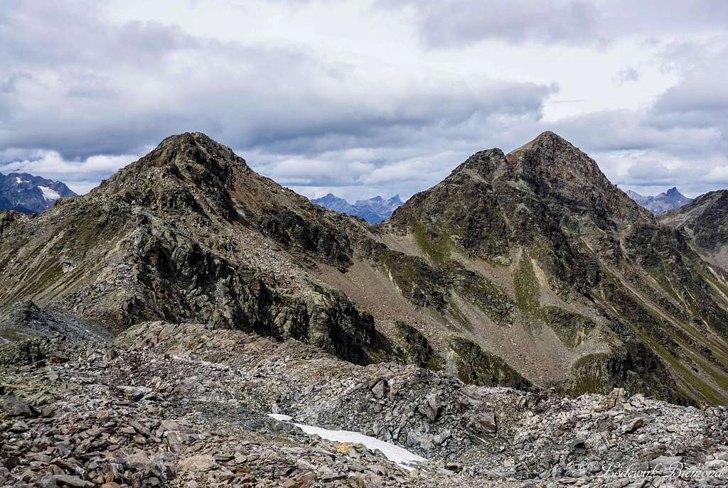
Kübelgrubenkopf (2870m) & Rotpleiskopf (2936m)
Kübelgrubenkopf is a lonely summit in the eastern part of the Samnaun Group. I think it sees about a dozen (or 2) visitors on its summit every year. The mountain has no real trail up to its summit and it neither has a summit cross. This in contrary to many of the surrounding mountains like Furgler, Planskopf and Rotpleiskopf. These mountains all have a marked trail up to the summit and are visited much more frequently. The loneliness of Kübelgrubenkopf is also its charm, you can be all alone on this summit in an area that is quite crowded due to the lift facilities on both sides of the mountain. (See in the Paznauntal and Serfaus/Fiss in the Oberinntal).
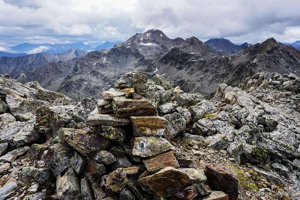
Kübelgrubenkopf can be climbed from both the Paznauntal on the SW side of the mountain as well as the Oberinntal on the NE side. The approach routes are all on well-marked hiking trails up to the T3 gradation. Along these trails the base of Kübelgrubenkopf can be reached, the Kübelgrubenscharte, which is 100 vertical meters below the summit. From this point the summit is reached along the NNE-flank with some easy scrambling up to UIAA-I. The summit is marked by a small stone-man. The overall gradation of the climb is T4, due to the summit part.
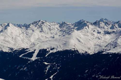
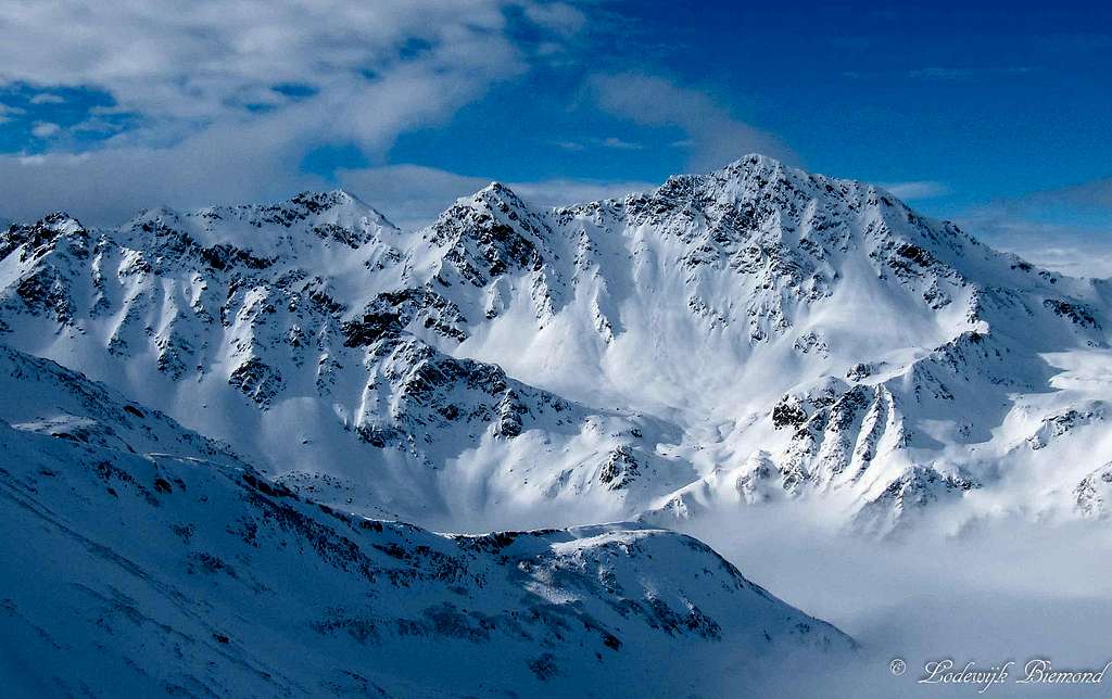 Kübelgrubenkopf & Rotpleiskopf in Winter | 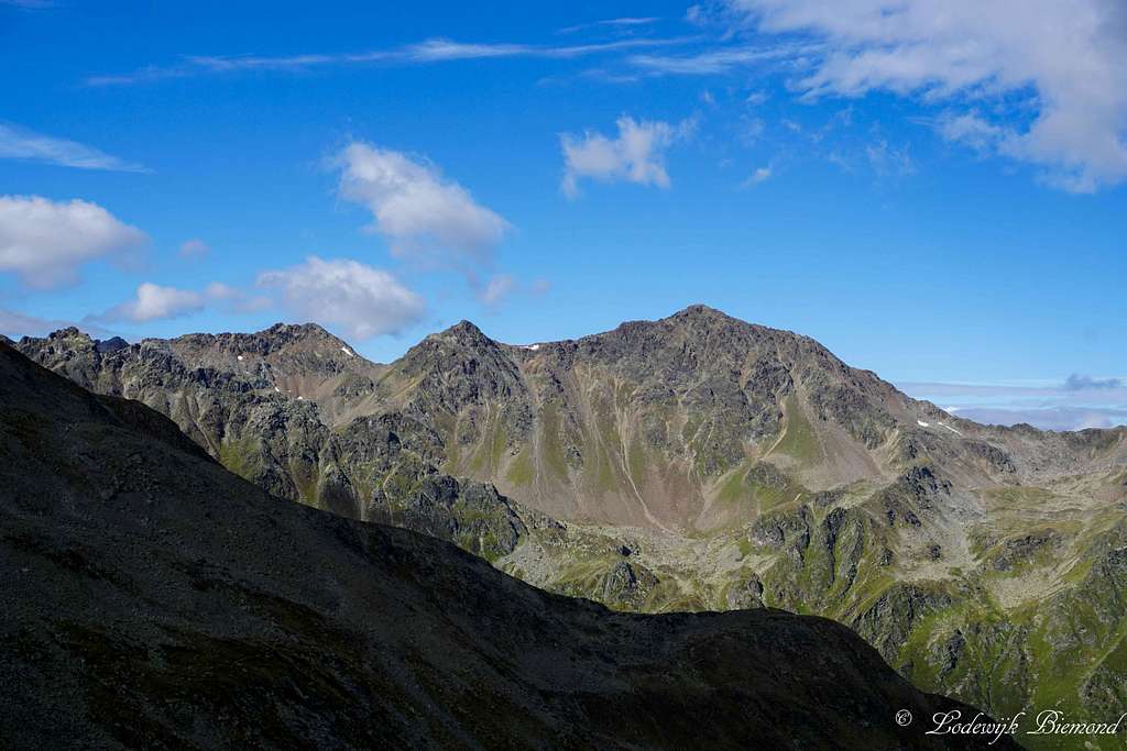 Kübelgrubenkopf & Rotpleiskopf in Summer |
Kübelgrubenkopf is located in the eastern part of the Samnaun Group between the Paznauntal (See) and the Oberinntal (Serfaus, Fiss). At Kübelgrubenkopf, 3 ridges of mountains join each other. Kübelgrubenkopf is bordered by Planskopf (to the SE; saddle: Urgjoch) , Rotpleiskopf (to the N; saddle: Kübelgrubenscharte) and Blankakopf (to the WNW, saddle: Glockscharte)
If you are looking for a nice and quiet peak in this somewhat busy part of the Alps (especially Serfaus and Fiss are to blame for this) Kübelgrubenkopf is the mountain to go for.
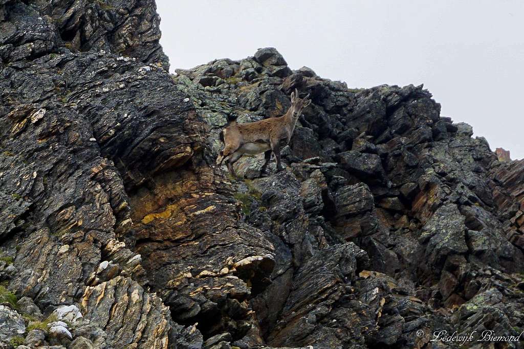 Little mountain goat keeping guard | 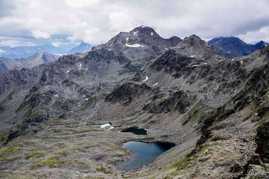 Furgler (3007m) and Blankasee from the summit |
Routes Overview
There are 2 main routes to the summit of Kübelgrubenkopf, one from See (Paznauntal) and one from Serfaus (Oberinntal). Both routes are quite long at take up most of a day, even when using the lift facilities of See or Serfaus. Both routes are described in more detail below.
Route I: From Serfaus/Oberinntal

Urgjoch
Kübelgrubenscharte & Planskopf
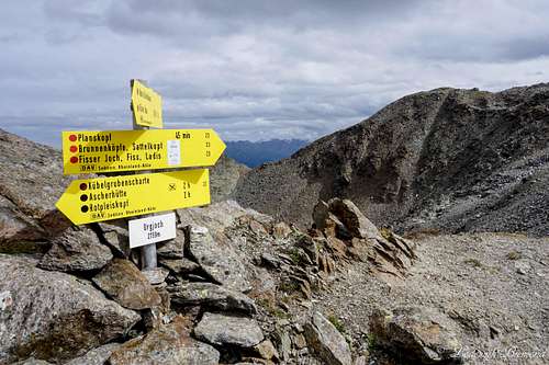
Take a left here in the direction of the Ascherhuette and Rotpleiskopf. Follow the trail (no. 22) towards the Kübelgrubenscharte, the saddle between Kübelgrubenkopf and Rotpleitskopf. Just before the scharte you can see Kübelgrubenkopf to the left of you. The NNE-flank is the flank that is most gradual and easiest to ascend. Find your way up the large blocks (some easy scrambling, UIAA I) and up to the summit of Kübelgrubenkopf, marked by a small stone-man. This last part is without a marked trail, and graded T4.
Descent is the same way back, but there are nice alternatives for a round trip as well. The first option is to descent back to the Kübelgrubenscharte, then follow trail 24 to the west to the Glockscharte (inbetween Blankakopf and Kübelgrubenkopf) and descend back via the scenic Blankasee lake to the Unterer Glockhaus. From here it is back down along the way you came up (down to Komperdell / Koelnerhaus).
Another variant is to descend from the summit to the Kübelgrubenscharte. Follow trail 22 towards the south back to the Urgjoch and from the Urgjoch follow the trail up to Planskopf (2804m). Traverse Planskopf along trail 23 and take a right at the first junction (this is before Vord. Brunnenkopf) and along trail 20A and B back down to Komperdell/Koelner Haus. The routes take up most of a day. When Planskopf is included take a full day.
Route II: From See/Paznauntal

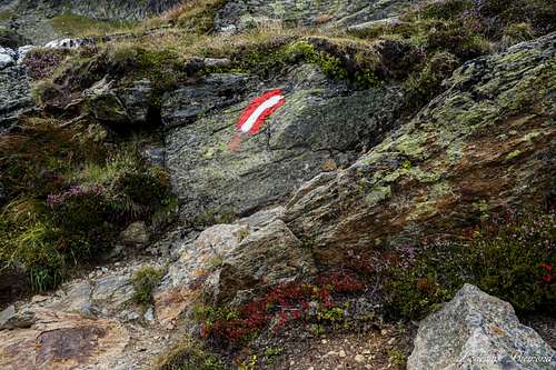
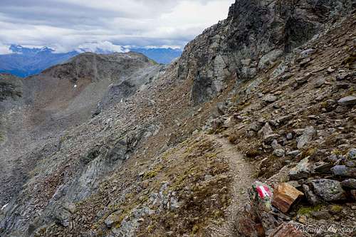
Sign along the Trail
Kubelgrubenkopf from Paznaun
The NNE-flank is the flank that is most gradual and easiest to ascend. Find your way up the large blocks (some easy scrambling, UIAA I) und up to the summit of Kübelgrubenkopf, marked by a small stone-man. This last part is
without a marked trail, and graded T4.
Descent is the same way back, but a nice alternative is to descent back to the scharte and ascend Rotpleiskopf (2934m) along the south flank and via trail 22. Traverse the mountain and descend along the North flank (trail 16) to the Spinnscharte. From here follow trail 711 towards the west and back to the Ascherhuette. From the Huette it is the same way back as you came up. The route takes up most of a day. When Rotpleiskopf is included take a full day for the route.
How to get there

How to get There Map
Fiss (& Serfaus and Ladis) are located in the heart of Tirol and can be reached most easily by car. The official website of Serfaus-Fiss and Ladis includes a route-planner. Fill in your home address for your route information. The route planner can be found here. This link also provides information about Train & Bus schedules as well as Taxi services.
See this link for getting to See im Paznauntal . The link provides information about getting to See by car, bus, train and taxi.
When to Climb
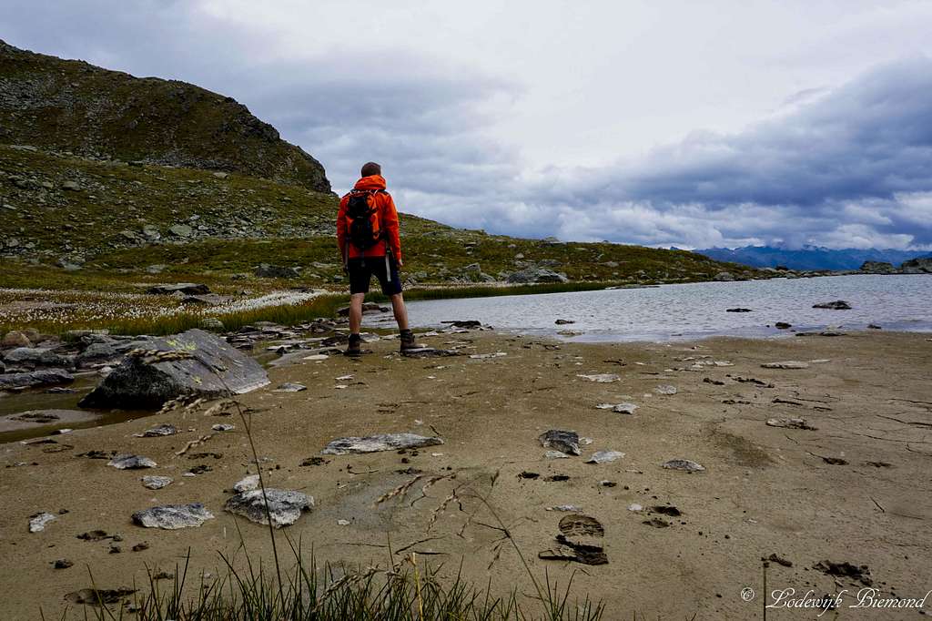
At the Unterer Glockhaus lake
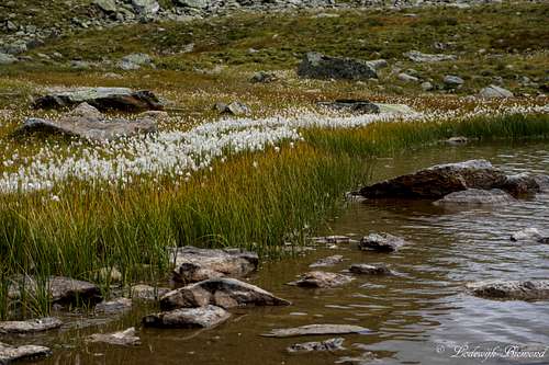
Unterer Glocckhaus lake
Maps and Books
Kummerleyand Frey – Ischgl & Serfaus - 1:35.000 - ISBN 9783259007136
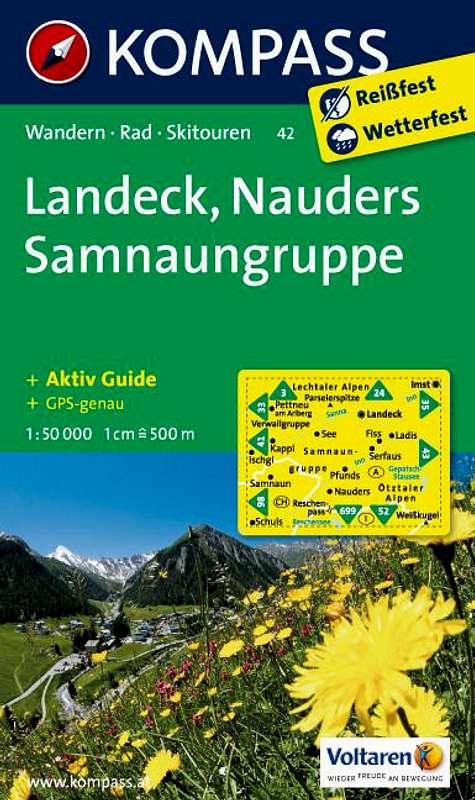
Kompass 42- Landeck Nauders Samnaun Group – 1:50.000 - ISBN 9783850265423
 |  |
External Links
Kubelgrubenkopf Summit
See im Paznauntal cableway system: Operating hours and Prices
Bergfex Weather Fiss and Serfaus
Webcam from See
Accomodation in Fiss & Serfaus
Accomodation in See
Weather
Panorama with Kubelgrubenkopf
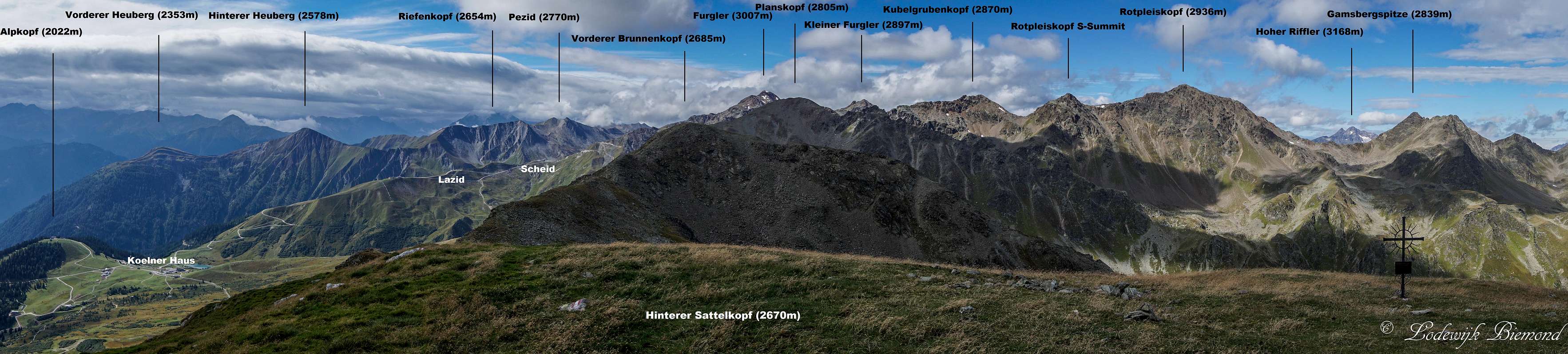  Panorama from Hinterer Sattelkopf (2670m) towards Kubelgrubenkopf |