
|
|
Route |
|---|---|
|
|
47.26890°N / 11.27030°E |
|
|
Via Ferrata |
|
|
Spring, Summer, Fall |
|
|
Half a day |
|
|
E |
|
|
Overview
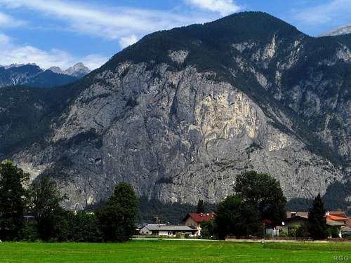
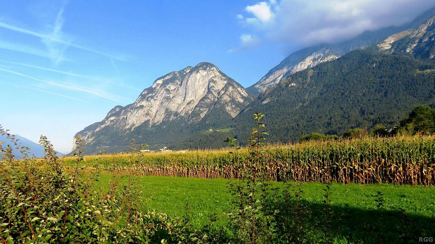
The Martinswand seen from the south (from Kematen).
If you think this face isn't all that high, think again. The minor summit above the face is the Kleiner Wandkopf (1346m) while Kematen is barely above 600 m. It's just that the buildings are much closer than the mountain.
That said, the summit may look close to the top of the rock face, but lies well back.
I estimate the height of the face to be close to 400 m.
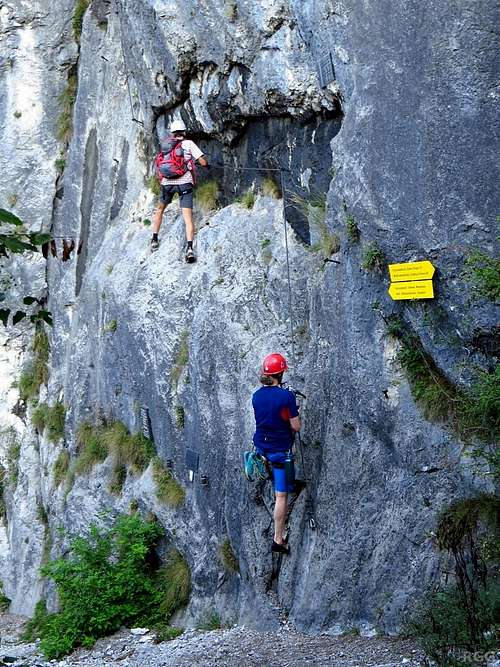
While for the original routes all that mattered was to make the climbing easier and safer, modern Vie Ferrata are built for recreation. Safety is still the highest priority, but making it easy isn't. That said, a lot of them are not particularly difficult, so many amateurs can climb them, and they have elements like wobbly bridges, ladders or wires, often combined with great exposure, to add excitement and fun.
On the other hand, there are so-called sports routes, which offer a different kind of amusement: very difficult to extreme climbing. Some can be approached as rock climbs, using the cable only for protection while climbing the rocks, others scale sheer cliffs with few features and the cable is meant to be used. Of these sports routes, the Kaiser Max Klettersteig is one of the hardest in Austria. If you really want to put your Via Ferrata skills to the test, this just might be the route for you.
Located on the Martinswand, a striking cliff just west of Innsbruck, the route ascends a very steep rock face with a steel cable along the length of the route. And while it's possible, and indeed very useful, to save energy by rock climbing some of the route, the hardest parts offer few holds on the rocks, so upper body strength and stamina are required to work yourself upwards with the help of the cable.
Halfway up the route is the "Maximilliansgrotto" or "Kaiser Max Grotto", a big cave in the rock face. The main route passes the cave on the right, and in fact you can't even see it, but it's possible to escape the route shortly before and walk down from the cave. That's a very good thing, because the route up to the cave is "only" rated D on the Austrian scale (i.e. very difficult), but the upper part is E, or "extremely difficult", which will probably slow you down. And while the cave is halfway up in elevation, the upper part starts with a traverse which means the length of the upper part is almost double that of the lower. So, if you're approaching the cave and feel you're already getting tired, or feel you are at your limit, take the exit. On my first attempt I did just that.
Both the cave and the route are named after Emperor Maximilian, who, according to local legend, climbed up the rock face to the cave in the 15th century, found that he couldn't move up or down anymore and ended up being stuck there for two days...
Getting There
Map centered on the start of the route. Click here to view a larger map
From the East

Martinswand from the east
From Innsbruck, take the motorway to the west to exit "Zirl-Ost" and turn east on the Tiroler Straße (local road 171), back in the direction of Innsbruck. 700 m down the road, past a quarry, is the Martinswand and the parking lot (on the left). Alternatively, to avoid the motorway, you can take the Tiroler Straße directly from Innsbruck towards Zirl.
If you're based in Innsbruck, it's a two hour walk from the city center or one hour from Kranebitterhof, a hotel and campground on the Tirolerstraße right at the edge of town.
From the West

Martinswand from the west
Public Transport
ÖBB is the site for public transport in Austria.Almost at the trailhead is the bus stop "Zirl Martinsbühel", along the Tiroler Straße between the Zirl-Ost motorway exit and the Martinswand.
There are railway stations at Innsbruck, Zirl and Kematen (between Innsbruck and Zirl, but on the other side of the river Inn).
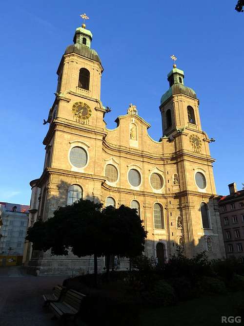
Innsbruck Cathedral
If your plane arrives from the west, you can get a spectacular view of the Martinswand as the plane lands - get a window seat on the left side of the plane!
Innsbruck Airport has a limited schedule and no long distance flights. Consequently Munich Airport is a viable alternative, in particular for those traveling from far away. Munich is a couple of hours from Innsbruck (or Zirl) by train or car.
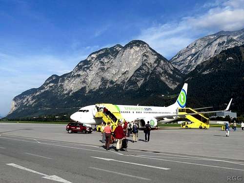
Insbruck Airport - on the far, far left is the Martinswand
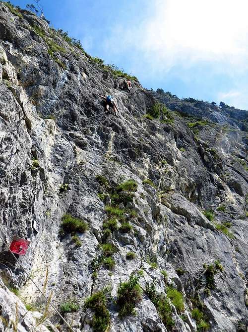
Route Description
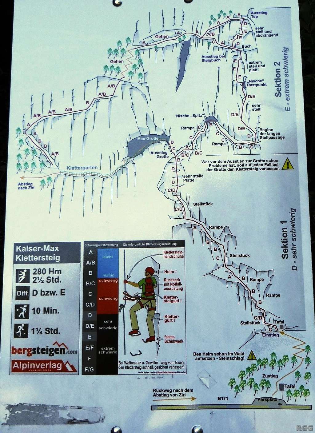
This sign with Kaiser Max Klettersteig topo is close to the start of the route
The Climb
The route is a Via Ferrata, or, in German, a Klettersteig, with steel cables along the length of the route. Up to the cave it's grade D, above it grade E. Total elevation gain is about 300 m, length about 560 m. Not counting breaks, three hours is a good time for the whole route. The descent takes another hour.The Lower Part: To the Cave
Martinswand - the start of the Kaiser Max Klettersteig
After these initial skirmishes, the route gets easier for a while. You do well to conserve energy by watching your foot placements and let your legs do the work instead of pulling on the cable all the time.
Look mama, I'm free climbing!
The Upper Part: To the Top
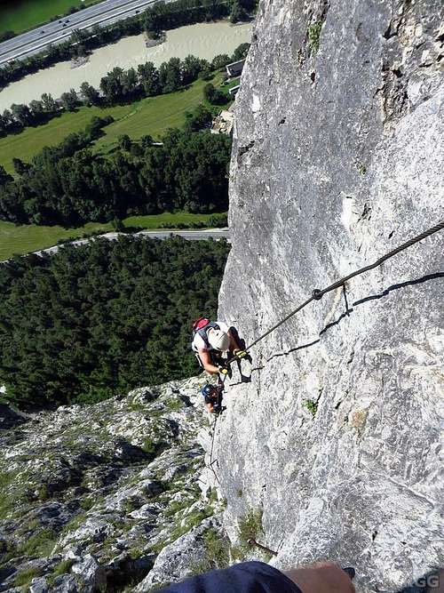
Near vertical
Climbers on the final section, above the last escape
Finally, at the top is plenty of room to rest, enjoy the view and eat and drink something, to be fresh again for the descent.
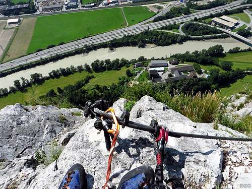
View from the top
The Descent
Be careful, and remember that accidents tend to happen when you let your guard down on the descent. This applies in particular to the way down down from the top of the route.If you took the exit to the cave, a hiking trail leads down from there to the road near Zirl, well west of the start.
If you climbed the whole route, another Via Ferrata, grade B but mostly easier, leads down to the cave, or, more precisely, to the descent trail from the cave. There is a sports climbing area where the Via Ferrata meets the trail, and immediately next to that is the cave. If you haven't seen it before, do have a look.
Warning: This is a serious route, with sustained difficulties high up. If you haven't climbed it before, be prepared that you may find it harder than expected. Make sure to start early enough to have plenty of daylight, just in case. And if you're unsure whether to continue when you reach the decision point right before the cave, remember that it's better to be safe than sorry.
Red Tape
From November to March the route is closed due to winter.When to Climb
Don't climb when it's wet, and stay far away if there is any chance of lightning - you don't want to be stuck on an almost 600 m long lightning rod when that happens.The cliff faces south and can get very hot on a warm sunny day. It was when I climbed it. It's not that having sweaty hands made the climbing any more difficult. I didn't see tiny handholds that I might have used, so I held on to the cable for most of route. But afterwards, when I took off my Via Ferrata gloves, I was surprised to have blisters on my hands. In hindsight it's obvious: heat, sweat and friction...
Essential Gear
- Harness
- Via Ferrata set
- Helmet
- Via Ferrata gloves are advisable to protect your hands against damage by the steel cables.
- Mountain boots will do for the lower part, but for the upper part rock climbing shoes are advisable. And if you bring them anyway, you might as well use them on the lower part too.
External Links
Kaiser Max Klettersteig on bergsteigen.comInnsbruck
The story of Kaiser Max
The Hechenberg, with on the very left, in profile, the Martinswand