

-
 24242 Hits
-
 83.51% Score
-
 17 Votes
|
|
Route |
|---|---|
|
|
19.17770°N / 98.6428°W |
|
|
Download GPX » View Route on Map |
|
|
Hiking, Mountaineering |
|
|
Spring, Summer, Fall, Winter |
|
|
A long day |
|
|
Class I/II |
|
|
Overview
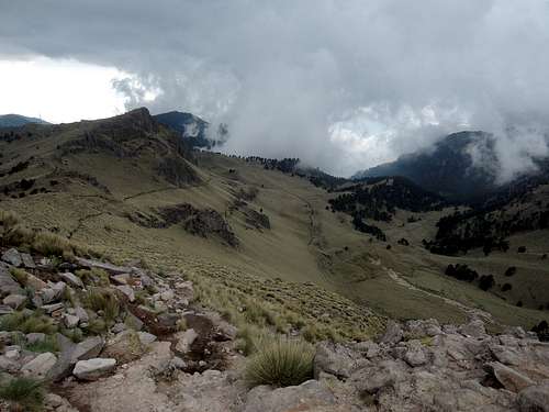
This page was originally written by Haliku. I have preserved his text from 2008, but have added some information and a picture guide as of 2017.The route is called ruta de los pies (feet route) on the trail head sign.
![La Joya on a sunday afternoon...]()
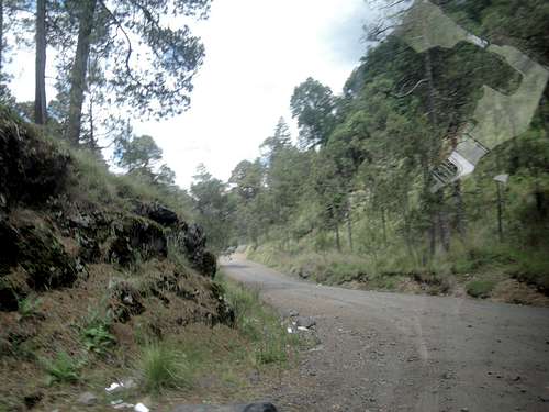
Arrange for transport or drive up to the La Joya parking lot. From La Joya start hiking up the main trail, opposite the small hut, that leads to the 'feet' and eventually the hut. The parking lot can get crowded so park any vehicles so you are not able to be blocked in.
About public transport from Puebla. 1. The bus to Cholula is on the left outside of CAPU proper and takes an hour (7.50 pesos). 2. Cholula may not be its last stop; we naively went past it. 3. The colectivo to San Nicolas is at 6 Poniente and 5 Norte in Cholula. 4. It gets to Santiago Xalitzintla in 45 minutes (12 pesos), where a colectivo runs to Paso de Cortes (80 pesos) and Amecameca. The driver proposed a gringo price for La Joya (800 pesos), so we refused and waited 2 hours until it filled up. 5. No success to hitchhike meanwhile (only saw 2 cars) and no taxi in town. 6. Off-season, we found no ride to La Joya.
We took 8 hours from Puebla to La Joya, got tired and ran out of time just short of the summit as we were afraid to have no ride back... But we got lucky and met an eastbound climber who had a shiny Lincoln SUV; screw the colectivo!
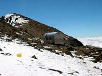
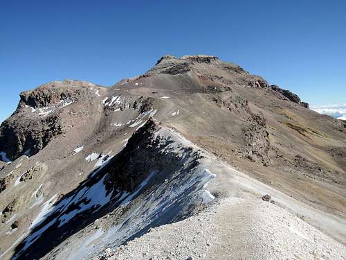
![Grupo de Los Cien hut. Jan 04.]() After a couple of hours you will reach an old, but usable hut (Grupo de los Cien hut) that can sleep half a dozen close friends (I think he meant 2 dozens). Above the hut the trail gets steeper and may consist of large snowfield crossing. As you climb look for a large dark metal cross on the first summit above the hut. You can go up either side of the rock outcrop. The left side is Class I the right side is Class II. There will be the remains of an old hut. At this point, you are about 16,800 feet, the trail continues up and over some minor peaks and moraines.
After a couple of hours you will reach an old, but usable hut (Grupo de los Cien hut) that can sleep half a dozen close friends (I think he meant 2 dozens). Above the hut the trail gets steeper and may consist of large snowfield crossing. As you climb look for a large dark metal cross on the first summit above the hut. You can go up either side of the rock outcrop. The left side is Class I the right side is Class II. There will be the remains of an old hut. At this point, you are about 16,800 feet, the trail continues up and over some minor peaks and moraines.
![The route after the knees,...]()
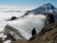
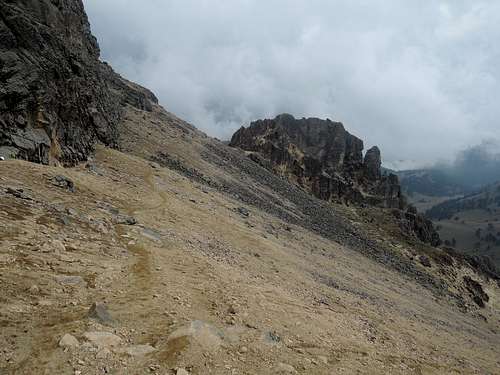
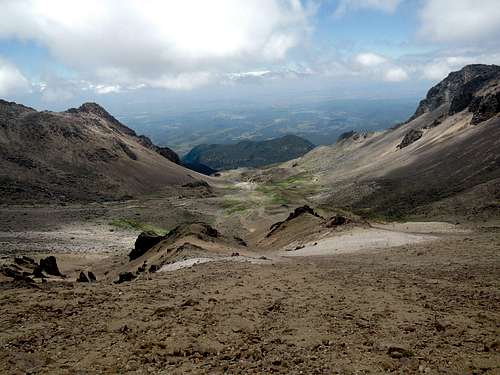
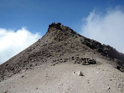
Soon you will reach the 'stomach', a receding glacier, which is a simple ice field but has been known to have crevasses to worry about. From there angle left to the ridge again and continue on to the crater rim and the second glacier on this route.
![The Belly glacier from Itza...]()
The broad summit plateau has three points that could be the summit. The route to the rim brings you to one of them. Another is straight ahead along the eastern side with the third farther off to the west. The true summit lies a little to the west of the false summit that is across the rim from where you gained the summit plateau approximately 100 feet to the west of the false summit. Depending on the amount of snow you might have to look for the tops of the crosses. The summit rim is often dry dirt so the crosses are easy to see.
Then, if your only map is the picture of the sign you took at the trail head, you realize the names and distances don't fit what you have read on the Internet. Strike two.
All my pictures were taken in June 2017. Whether it is the glaciers retreating or just being in the summer, everyone else seem to have had more snow.
Our timings: 2 hours Paso de Cortes to La Joya, 3.5 to hut (make that 2.5 if you drove the approach), 1.5 to knee, 2 to summit (estimated), 1.5 to knee, 1 to hut, 1.5 to La Joya.
With the glaciers melting, there is less and less chance you will need an ice ax and crampons. Hiking traction devices (the spiked ones from Kahtoola, Hillsound...) may be an alternative. Despite some people wearing climbing helmets, there is no rock or ice fall risk. There is no liquid water on the route.
Getting There
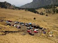
Arrange for transport or drive up to the La Joya parking lot. From La Joya start hiking up the main trail, opposite the small hut, that leads to the 'feet' and eventually the hut. The parking lot can get crowded so park any vehicles so you are not able to be blocked in.
About public transport from Puebla. 1. The bus to Cholula is on the left outside of CAPU proper and takes an hour (7.50 pesos). 2. Cholula may not be its last stop; we naively went past it. 3. The colectivo to San Nicolas is at 6 Poniente and 5 Norte in Cholula. 4. It gets to Santiago Xalitzintla in 45 minutes (12 pesos), where a colectivo runs to Paso de Cortes (80 pesos) and Amecameca. The driver proposed a gringo price for La Joya (800 pesos), so we refused and waited 2 hours until it filled up. 5. No success to hitchhike meanwhile (only saw 2 cars) and no taxi in town. 6. Off-season, we found no ride to La Joya.
We took 8 hours from Puebla to La Joya, got tired and ran out of time just short of the summit as we were afraid to have no ride back... But we got lucky and met an eastbound climber who had a shiny Lincoln SUV; screw the colectivo!
Route Description

Soon you will reach the 'stomach', a receding glacier, which is a simple ice field but has been known to have crevasses to worry about. From there angle left to the ridge again and continue on to the crater rim and the second glacier on this route.
The broad summit plateau has three points that could be the summit. The route to the rim brings you to one of them. Another is straight ahead along the eastern side with the third farther off to the west. The true summit lies a little to the west of the false summit that is across the rim from where you gained the summit plateau approximately 100 feet to the west of the false summit. Depending on the amount of snow you might have to look for the tops of the crosses. The summit rim is often dry dirt so the crosses are easy to see.
A photographic journey
At the trail head, you may think : "I see no woman here". It can be challenging to identify its "body parts" and these important landmarks. Strike one about always knowing where you are when you hike.Then, if your only map is the picture of the sign you took at the trail head, you realize the names and distances don't fit what you have read on the Internet. Strike two.
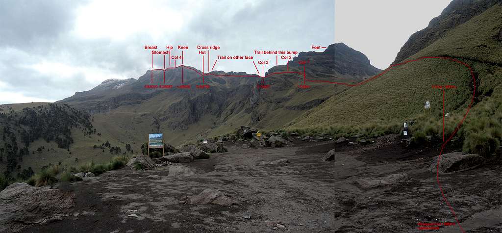 Trail head. GPS distances and SRTM elevations. Total vertical +1399/-166m | 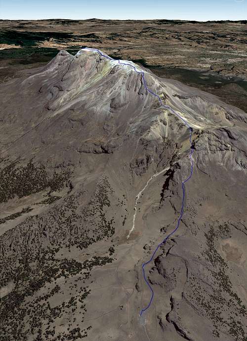 Satellite view, looking NNW |
All my pictures were taken in June 2017. Whether it is the glaciers retreating or just being in the summer, everyone else seem to have had more snow.
 Road east of Paso de Cortes. Bring your helmet (ok, not really, but it is bumpy). From the west it is paved. | 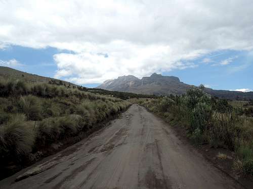 Road from Paso de Cortes. Tiring to hike, but the views are beautiful (look back at Popo too). Add 7.4km/+400m | 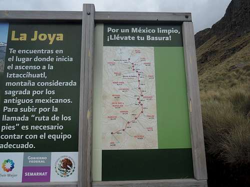 Map at trail head. The distances are wrong. Two topo maps from fellow sp members here and here. |
 Looking back from col 1. | 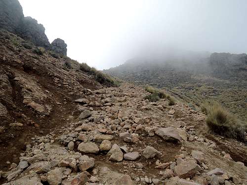 Getting up from col 1 and 2. | 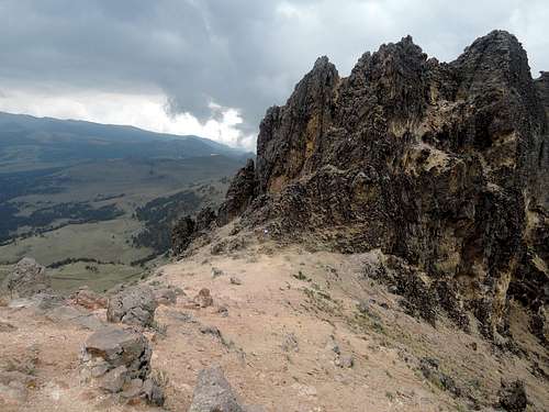 Looking back at col 2. Nice rock formations all around. |
 Traverse between col 2 and 3, looking back. |  Col 3, between feet and knee. Tent spots, but can be windy. Perfect saddle shape. | 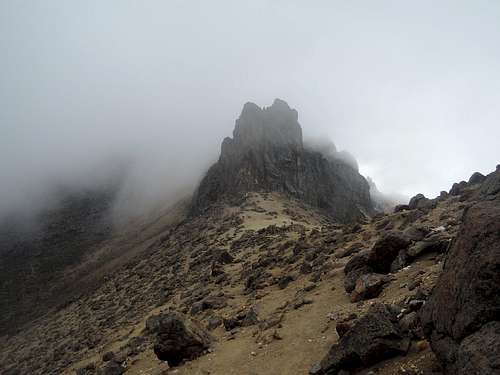 On east face, looking back at col 3 and more rock formations. |
 View to the east on the traverse on the back side. |  End of traverse. Aim up the cleft center-right, many options. |  On the ridge, before the hut. Arrive from picture's right and continue on center. |
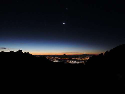 Twilight at our campsite, looking east at Malinche, Pico de Orizaba and the moon. |  Crosses above trail to climber's right after hut. See this daytime picture of the trail. | 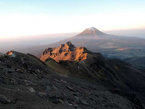 Looking back at hut and feet 2/3rd up the knee. It is a big slog up. Easier on snow. |
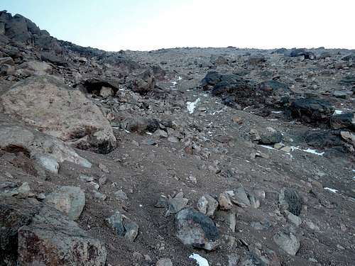 Near the knee, class 1-2. You can traverse left for col 4 after the rock band in picture, avoiding climbing 10m; class 3. | 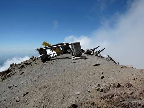 Top of knee and ruins of the Luiz Mendez hut. | 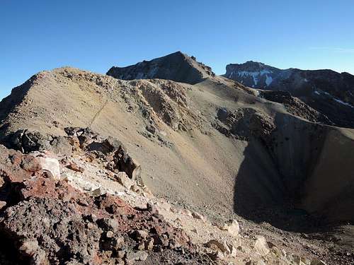 View from knee to hip to summit. Drop from the left outside picture to col 4. Straight is less steep, but very loose. |
 Knee from col 4. Class 3 descent around the overhanging rock on climber's left. | 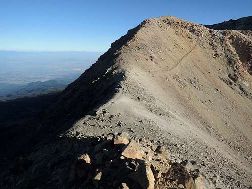 Col 4 and unnamed subpeak from knee. | 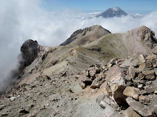 Looking back from the hip at unnamed subpeak (right), knee (center) and Popo. |
 Orographic clouds forming on Malinche, Pico de Orizaba and us, as happened all 7 days we were on mountains in June. | 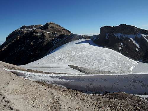 Stomach or Ayoloco glacier, from partly down the hip. Ridge of the Sun (across) and south summit (center-left) in sight. | 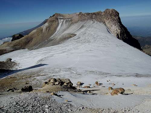 Looking back at hip. The trail enters from the horizontal snow band on top and met, in our case, frozen scree before the glacier. Slope is milder than it appears. |
 Ridge of the Sun, or arista del sol, and south summit, from across the glacier. | 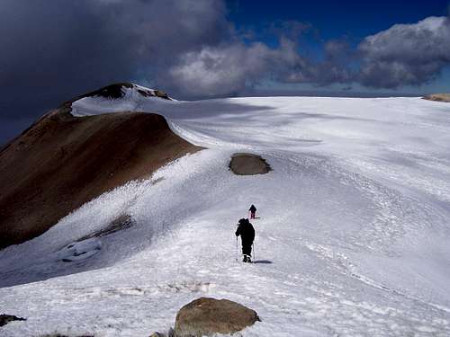 Real summit across summit plateau (not my picture). | 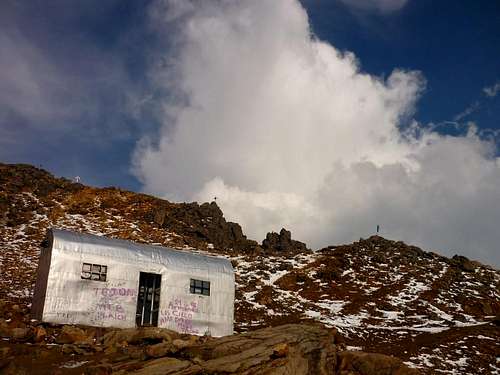 Grupo de los Cien hut (not my picture). Inside. Campsites just before and around. Grupo de los Cien hut (not my picture). Inside. Campsites just before and around. |
Our timings: 2 hours Paso de Cortes to La Joya, 3.5 to hut (make that 2.5 if you drove the approach), 1.5 to knee, 2 to summit (estimated), 1.5 to knee, 1 to hut, 1.5 to La Joya.
Essential Gear
What gear you takes depends a lot on the current conditions. Often you can climb it with hiking boots and trekking poles. Many climbers still take an ice axe and crampons to ensure the glacier sections do not give them any problems. Warm clothing is especially needed for the predawn and for safety in case of a change in the weather.With the glaciers melting, there is less and less chance you will need an ice ax and crampons. Hiking traction devices (the spiked ones from Kahtoola, Hillsound...) may be an alternative. Despite some people wearing climbing helmets, there is no rock or ice fall risk. There is no liquid water on the route.
ncst - Sep 3, 2009 10:23 am - Hasn't voted
Iztaccíhuatl - update 26 August 2009This route is also called 'ruta de los pies', as described on a sign at La Joya (I added a photo). From the Grupo de los Cien hut I would recommend going the left side of the rock outcrop (photo added). I went up to the right the first day to acclimatize and it took me a lot longer. I suppose the cross mentioned in this route description and depicted in the photo in the heading of the route description is the 'Cruz de Guadelajara', also called 'Cruz de las Once'. I found it flat on its back (photo added). You see another big cross from the hut, one by the Club Alpino Mexicano(photo added), but if you are going left of the rock outcrop you won't pass it so don't go for it. Both way leads to the Cruz de Guadelajara. At the summit there was only one cross(photo added). I walked back to Paso de Cortéz from La Joya, which took me two hours and hitchhiked to Amecameca from there.