Back to the Southern Wasatch
The weather forecast showed one last weekend of warm temperatures before the first big cold front of the fall moved in, and with snow on the way in just a few days, it seemed like a good time to get in one last summer/fall hike. It looked like a prior commitment might prevent me from hiking Mount Nebo with James, a friend from work, but when that fell through I was good to go. I wasn’t sure if James was still going to do the hike, so I invited my brother Chris to come, since he had enjoyed his first big mountain hike of Mount Sneffels a month earlier in Colorado.
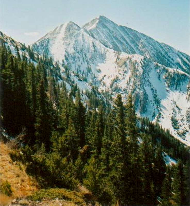
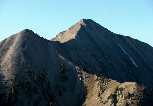
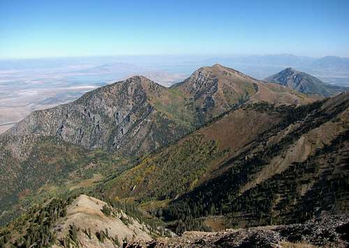
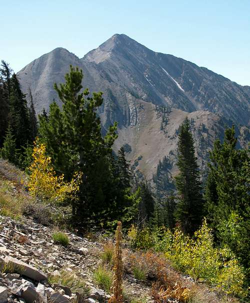
![Mt. Nebo (on the right) and a...]() Mount Nebo snow hike (10/15/05)
Mount Nebo snow hike (10/15/05)![Gabe at the bottom of a...]() Buswhacking
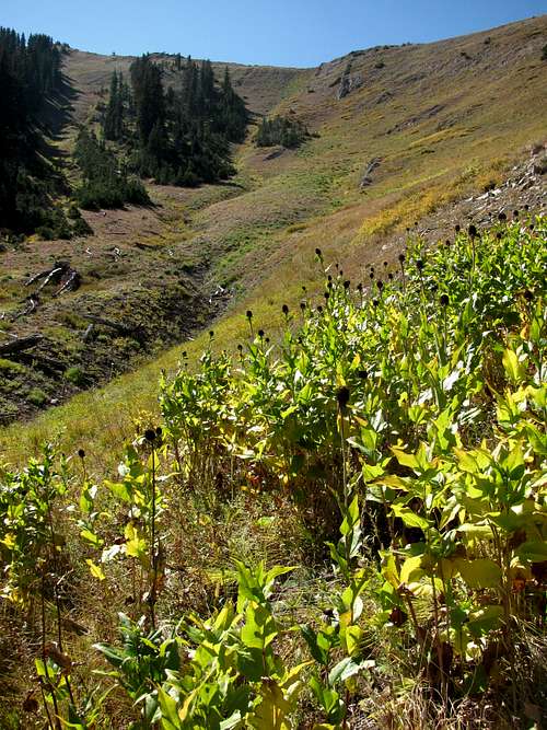
Buswhacking![The summit of Mt. Nebo as...]() 8/24/05 attempt
8/24/05 attempt
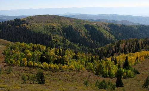
Despite almost always preferring new mountain locations over places I’ve already been, Mount Nebo was one of a handful of mountains in the Wasatch that I wanted to do again. The first time I tried it with my best friend Gabe, we didn’t do enough research on the north trailhead location and ended up bushwhacking up and down the ravines on the east side of the mountain (followed a cow trail splitting off from the Nebo Bench trail instead of continuing along Mona Pole Road from the paved parking lot to the main trail), so after finally finding the right trail we were too exhausted to keep going. At the time it was my first failed summit attempt (8/24/05), so anxious for redemption I came back a couple months later and solo-climbed it in the snow (10/15/05). That was back when I was naïve enough to not even take an ice axe even though the conditions warranted it, so even though this time there would be less drama involved, I was looking forward to seeing the fall colors on the Nebo Scenic Byway and returning to the area with my new digital camera (instead of the cheap film camera I had the first time).
Mount Nebo (Without the Snow)
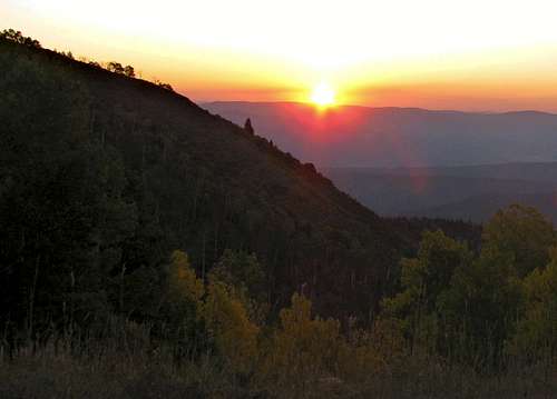
![Nebo Scenic Byway Sunrise]() Sunrise on the Nebo Scenic Byway
Sunrise on the Nebo Scenic Byway
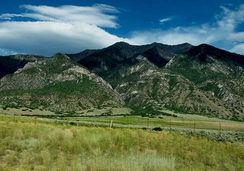
I left the Salt Lake area around 5:30, swung by my brother’s place in Provo at 6:00, and we picked up his friend Chantel at the McDonald’s in Payson at 6:30. The drive up the Nebo Scenic Byway to the trail head was a bit slow due to cows crossing the road in a few places, but the fall colors looked really nice in the early morning light.
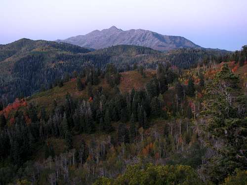
![Nebo Northeast Aspect]() Mount Nebo before sunrise
Mount Nebo before sunrise![Mount Nebo alpenglow]() Mount Nebo alpenglow
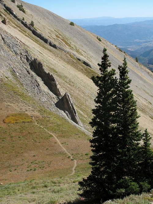
Mount Nebo alpenglow![Slope below North Peak ridge]() Slopes below North Peak ridge
Slopes below North Peak ridge![North Peak]() North Peak
North Peak
Chris left his car in the parking lot, and he and Chantel hopped into the Explorer for the short 0.3 mile trip along the dirt road to the trailhead (even though it’s not that rough and definitely doable for a passenger car). This was Chantel’s first big hike, but she was keeping pace just fine at the beginning of the hike. From what I remembered, it seemed like there were 5 main segments to the north ridge hike. I’m not sure if each one is a mile or not, but I like separating the segments into the part that follows the barbed-wire fence towards the trees below the north ridge of North Peak, the part that goes through the wooded part below North Peak and up to the ridge where you get your first view looking down on I-15 and the town of Mona, the trail that gains and then loses elevation leading to Wolf Pass, the steep ascent from Wolf Pass up to the false summit at around 11,500 feet, and the part that traverses the ridge leading to the summit.
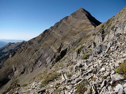
![Mount Nebo from North Peak ridge]() Mount Nebo from North Peak ridge
Mount Nebo from North Peak ridge![Nebo North Route Trail]() Trail around North Peak
Trail around North Peak
Upon getting to the second part of the ascent where the trail steepens considerably, Chantel began feeling the effects of the altitude and I wondered if we had been going too fast for her at the beginning. We played leapfrog with another group consisting of a dad and his daughters, and after chatting with him I learned that like me, it had been awhile since he had been to the top as well. The trail cut across a steep meadow (my first time up, the trail was covered in snow so I just went straight up the steepest part) and then switch-backed up through a cluster of trees to the west. We took a long break at the ridge looking down towards Mona, and Chantel couldn’t believe she was over 6,000 feet above the town, somewhere she thought she’d never be. It’s always fun seeing first-time hikers’ reactions when they try something they never thought they could do.
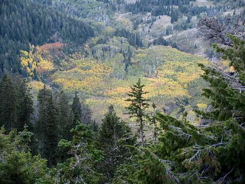
![Fall Yellows Below]() Fall yellows down below
Fall yellows down below![View north from Nebo sub-peak]() Looking north from the north ridge
Looking north from the north ridge
The sun was low enough that the third part of the hike leading to Wolf Pass was still shaded by North Peak, and the easy trail seemed quite different from when I had climbed Nebo in the snow four years earlier (it was actually the one spot I thought about turning back, since the shady snow-slopes were icy and slick and a fall would have sent me well on my way down the west side of the mountain). We took another snack break at Wolf Pass, and we encouraged Chantel to keep going. I increased my speed going up the fourth section to see if she could go any faster, but her energy was starting to run out. Upon catching a glimpse of the remaining fifth of the hike from the sub-peak at around 11,500 feet she said she was done, so she and Chris agreed to wait there while I continued on.
![Wolf Pass]() Wolf Pass
Wolf Pass
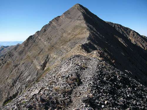
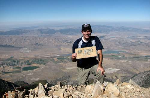
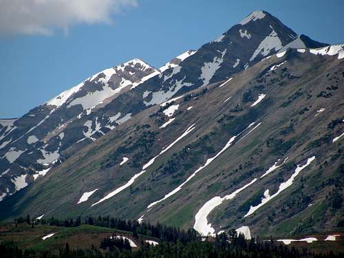
The ridge leading up to the summit of Mount Nebo is my favorite part. Although there aren’t really any spots that could be considered scrambling (the only time I had to use my hands was around the loose scree just below the northeast side of the summit), there is some nice exposure on both sides, and instead of taking the trails that come and go mostly on the west side of the ridge, I opted to go straight over the sharp rocks on top of the ridge itself. At the summit, which rises over 7,500 feet above the valley below to the west, I saw a cardboard sign and summit register, and even though I’ve never bothered to fill one out in the past I decided to do it for fun this time.
![Mount Nebo summit to the south]() Mount Nebo summit from north ridge
Mount Nebo summit from north ridge![Nebo north ridge trail]() Mount Nebo north ridge trail
Mount Nebo north ridge trail![Nebo south summit]() South summit
South summit![Nebo north sub-peak]() Sub-peak to the north
Sub-peak to the north
Soon after heading back down, I passed several people (a couple with dogs who surprisingly seemed to be handling the steep terrain just fine) on their way up. One of them was my friend James from work. Neither of us knew that the other was still doing the hike, so it was funny that we ran into each other. After taking a few pictures, I asked him to let me know if he found a green rechargeable battery at the top (which I just realized must have come out of the front pocket of my camera case, which I accidentally left unzipped), and fortunately for me he found it and was able to return it to me a few days later at work. I returned to the small peak where Chris and Chantel were waiting, and we then made our way down the mountain.
![Cheesy Summit Shot]() Cheesy summit shot
Cheesy summit shot![Unexpected meeting]() Unexpected meeting
Unexpected meeting![Nebo group photo]() Group photo
Group photo
From near the top we could see the parking lot to the northeast which was our final destination, but going down seemed harder this time than I remembered. Part of that could be attributed to the fact that I was in better shape the first time around and this time it was actually hot on the way down (no clouds and not much wind, with temps around 89 degrees in the valleys below), but the hike still took six hours, which is the same time it took me the first time in the snow.
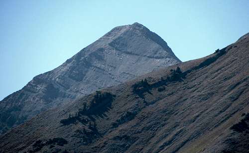
![Fall colors below Mount Nebo]() Mount Nebo from North Peak trail
Mount Nebo from North Peak trail![Mount Nebo Summit Cone]() Mount Nebo summit cone from near the north route trailhead
Mount Nebo summit cone from near the north route trailhead![Loafer Mountain]() Loafer Mountain
Loafer Mountain
Although the views aren’t quite as good as those found in the central Wasatch, Nebo is an impressive mountain that every hiker in the Wasatch Front should try at least once, especially since it’s actually one of the easiest 11ers to summit. It was good to finally get back down to the southern Wasatch again, and I’m sure I’ll be back again in the future.
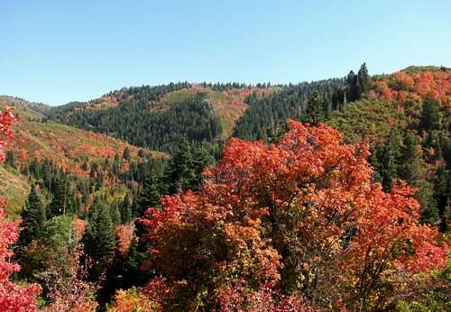
![Nebo Scenic Byway Fall Colors]() Nebo Scenic Byway fall colors
Nebo Scenic Byway fall colors![Nebo Fall Colors]() Nebo north route fall colors
Nebo north route fall colorsMount Nebo Stats
DISTANCE: 9
miles roundtrip
NORTH ROUTE TRAILHEAD:
9,200 feet
SUMMIT ELEVATION:
11,928 feet
ELEVATION GAIN:
3,400 feet
DIFFICULTY:
Class 2
TIME:
6 hours
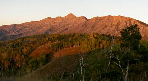
![North Peak & Mt. Nebo from I-15]() Mount Nebo from I-15 ...
Mount Nebo from I-15 ...![Nebo summits]() ... and from the Nebo Scenic Byway.
... and from the Nebo Scenic Byway.


Comments
Post a Comment