
-
 14176 Hits
-
 77.4% Score
-
 10 Votes
|
|
Mountain/Rock |
|---|---|
|
|
35.69676°N / 83.57267°W |
|
|
Hiking |
|
|
Spring, Summer, Fall, Winter |
|
|
3583 ft / 1092 m |
|
|
Overview

Mountain Laurels
This is a hiking destination, though with 2121 feet of elevation gain from Sugarlands. Include Cove Mountain to reach a summit 4150 feet. This would give you 2688 feet of elevation gain and a 17-mile round trip. The stretch between Holy Butt and Mount Harrison will twice touch residential neighborhoods on the park boundary, and you may be able to hear the bustle of the Ober Gatlinburg destination.
And yes, the smallest of the trio really is called Holy Butt. It began life as Holly Butte but spelling is apparently not a strong point in the region.
Getting There
Access these peaks from the Gatlinburg on the Tennessee side of Great Smoky Mountains National Park. The nearest airport is Knoxville.
Route
There are three options.
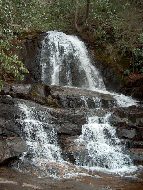
1. Out-and-back from Sugarlands Visitor Center (1462 feet). Take the nature trail toward Cataract Falls, which begins on the back side of the Visitor Center. You may make hundreds of new friends on a summer weekend. From the Falls, find the trail to Laurel Falls to begin your steady ascent. It's probably about six miles to Phils View.
Laurel Falls (TN)
3. Shuttle from Laurel Falls to Sugarlands. Follow Option #2 and then keep going all the way to Sugarlands Visitor Center. Total distance is 12.4 miles, or 12.6 miles if you include the side trip to Cove Mountain fire tower. Starting elevation is 2363, maximum elevation 4150 at Cove Mountain fire tower, final elevation 1462. Hike in the reverse direction to increase your elevation gain. If you don't have two cars, you could walk a few miles down the road from Laurel Falls trailhead to Sugarlands to complete the loop.