
|
|
Route |
|---|---|
|
|
31.06608°N / 7.91689°W |
|
|
Hiking, Scrambling |
|
|
Spring, Summer, Fall |
|
|
One to two days |
|
|
T4 / UIAA I |
|
|
Overview
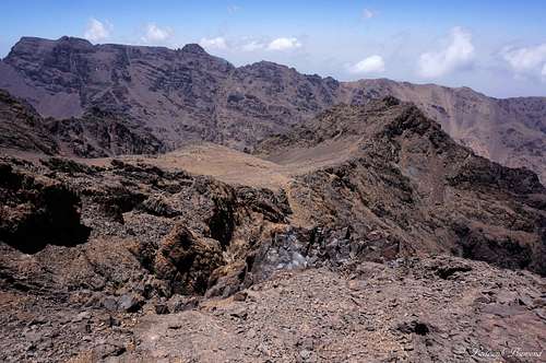 Imouzzer summit view towards Biiguinnoussene (4002m) | 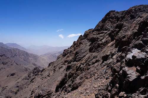 The Steep Imouzzer N-NW Face |
Imouzzer is a 4000-meter peak in the Moroccan Central High Atlas. It is among the highest peaks in Morocco and Northern Africa. Imouzzer is part of the Toubkal Massif and is close to the highest mountain in Northern Africa: Jbel Toubkal with an altitude of 4167 meters (13671ft). For a large part, the normal route follows the well-known North Cwm Route, which goes to the summit of Jbel Toubkal. It branches off at the Tikint 'n Ouanas, the saddle between Imouzzer and Tibherine. The difficulty of the route is graded T4, although the most part of the route is graded T3. The very last part of the route is the most difficult and involves some scrambling. The summit is built up of large blocks which have to be climbed to reach the actual summit of Imouzzer. The climbing is rather easy (UIAA grade I, T4) and short.
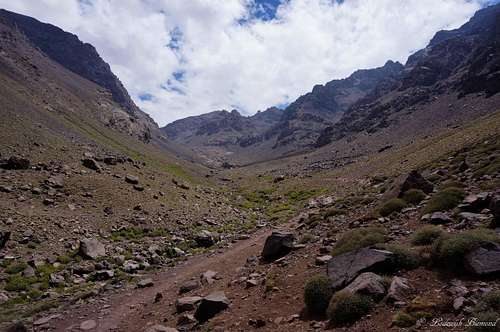 The Toubkal Refuges (3204m) | 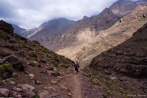 Descending Imouzzer; Trail between Refuges and Chamharouch |
Climbing Imouzzer requires two days. The first day starts in Imlil (1740m) and ends at the Toubkal Refuge (3207m). After spending the night in the Refuge follow the North Cwm up and climb Imouzzer (and optional Jbel Toubkal as well). Descent back to the Toubkal Refuges and stay another night here or descent back to Imlil the same day. If you choose for the last option; prepare for a long day with a vertical drop of almost 2500 meters in a single day.
Imouzzer is occasionally climbed together with its higher neighbor Jbel Toubkal. Although most people in the region just climb Toubkal and use the easiest South Cwm route up and down, it is more rewarding to use the North Cwm route up and the South Cwm route down (or the other way around). Imouzzer is a great peak to climb. The views towards the north are better from Imouzzer compared to Toubkal. Also the north Cwm route is more quiet and last but not least: The remains of an old aircraft are scattered along this route.
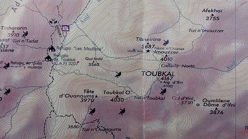
Imouzzer Normal Route MAP
Route Description
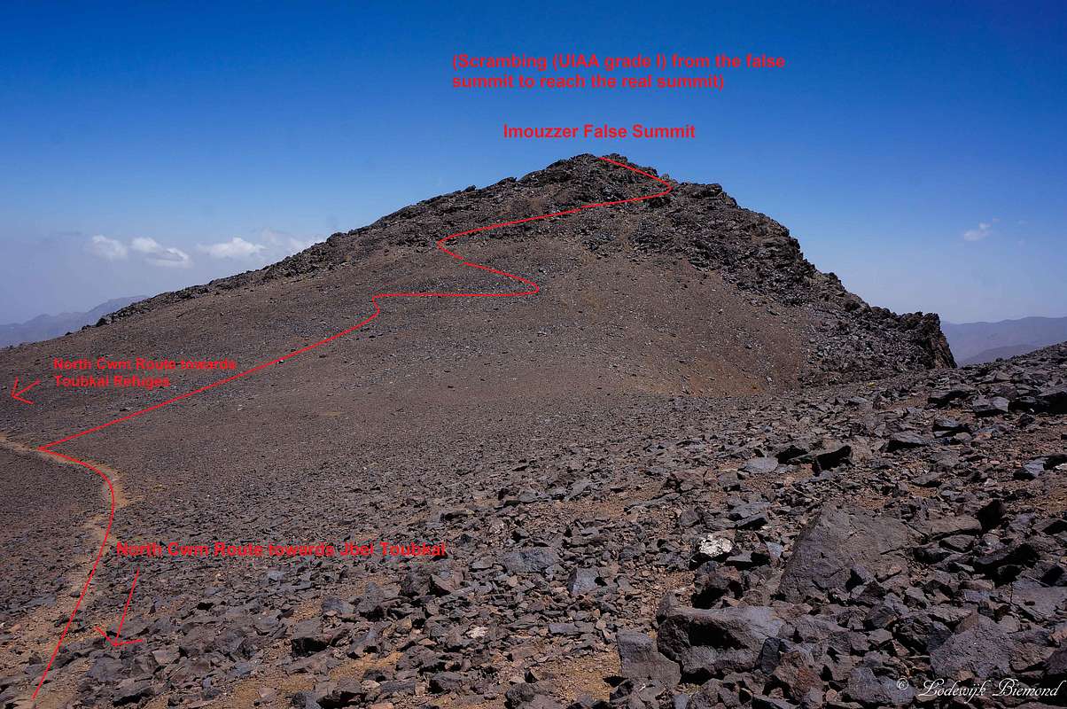
Imouzzer Normal Route; Route beta I; Tikint ’n Ouanas towards the False summit
The route starts at the village of Imlil (1740m). From here it is 6-8 hours walking to the two Toubkal Refuges at an altitude of 3207 meters. The route is described on the Ikhibi Sud / Normal Route page here on SP. After spending the night in one of the Refuges you have to find the starting point of the North Cwm Route. Leave the hut in a northerly direction (yes indeed, back where you came from) for about 200 meters. Eventually you have to cross the river to the eastern side ofthe valley where a clearly visible trail starts. This trail leads into the West-East oriented North-Cwm valley and is the starting point of the North Cwm Route. Once you are on this trail route finding is easy. The trail is visible at all time and leads up the valley towards the Tikint ‘n Ouanas at about 3900 meters of altitude. This is the saddle between Imouzzer and Tibherine. This part of the route is graded T3. Although not very difficult, you have to be careful: The whole route is covered with loose scree making it very easy to slip. Watch your step and be careful. Along this part of the route you will encounter many remains of an old aircraft that are scattered along the whole West Face of the mountain. The propeller of the aircraft was put up in a straight position to mark the trail. A weird thing to encounter in this barren land high up in the Atlas mountains. At the Tikint ‘n Ouanas the North Cwm route branches off towards the south and heads up the south face of Jbel Toubkal. This is the point where you leave the North Cwm Route.
The North Cwm route up the mountain (also named Ikhibi Nord) is described on SP as well.

Imouzzer Normal Route; Route beta for climbing the summit block
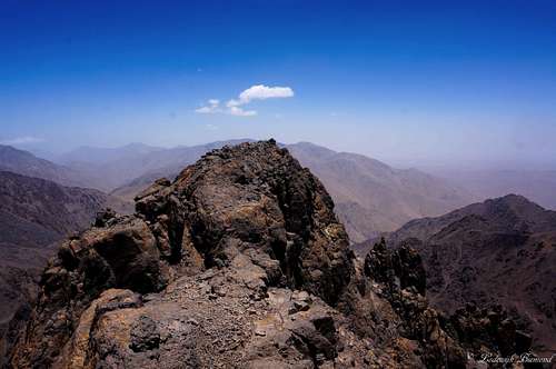
From Tikint ‘n Ouanas keep heading towards the East. You are now gaining elevation on the South-East face of Imouzzer. The first part is easy and there are multiple small trails to be recognized. Keep heading up to what appears to be the summit and eventually you will arrive at the shoulder of the mountain. From here a rocky ridge starts with large ‘blocks’. Because of the large size of the blocks the way to go to the actual summit is not as straightforward as the previous part of the route. Also it is hard to see which of the blocks is the highest. I chose to traverse from west to east directly to the north of the west-east oriented summit ridge. The actual summit becomes clear now. Climb up to reach the actual summit (UIAA I / T4+). Views from the summit are awesome. Towards the north you can see the villages Aremd and Imlil deep down below you. Also you can see the larger part of the route between Imlil and the Toubkal Refuges. Towards the east you look straight into the massive Sahara desert, a funny thing since you are above 4000 meters and it’s quite cold. Towards the south you can see the massive North Face of Toubkal with the North Cwm trail to its summit clearly visible.
Descent is the same way back. An alternative is to go back to the saddle of Imouzzer with Toubkal and follow the North Cwm route along the south face of Toubkal to its summit. From here take the South Cwm route back to the Toubkal Refuges and eventually back to Imlil.
 The Imouzzer Summit Block (4010m) | 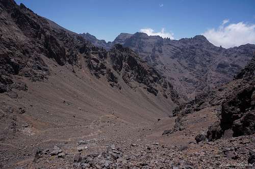 North Cwm Route below Tikint 'n Ouanas |
Getting There
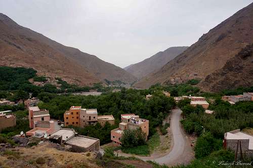
Imlil (1740m) and a view north
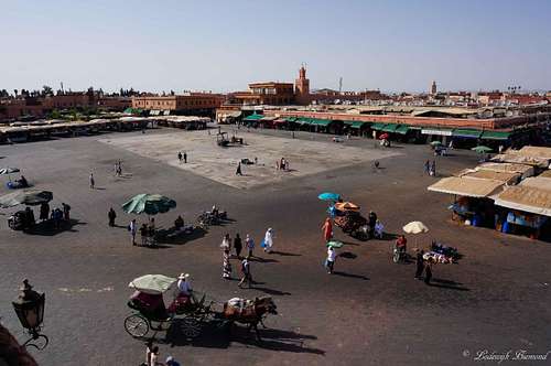
Jemaa El Fnaa
The starting point for the ascent of Imouzzer, Toubkal and the other surrounding mountains is the village of Imlil (1740m). In past days it was hard to get there, but some years ago a good paved road (up to western Standards) was opened. Nowadays it will take you about an hour and a half by car to get to Imlil from Marrakech. Take a grand Taxi from Marrakech to Asni. In Asni take a Taxi to Imlil. You have to switch Taxi’s there, since the normal Taxi’s do not go further. Easier is to just arrange a Taxi with the Hotel you are staying in. I can recommend Riad Atlas Toubkal in Imlil. The hotel arranged a pick-up at the airport and directly drove us to the Riad in Imlil.
Of course you can also rent you own car and drive there yourself. Although the roads are good, I didn’t see too many people using a rental car to get to Imlil. Furthermore, traffic is much more chaotic compared to Western Europe.
Essential Gear
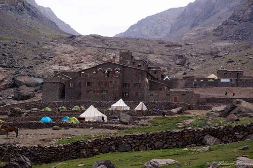
The Toubkal Refuges (3207m)
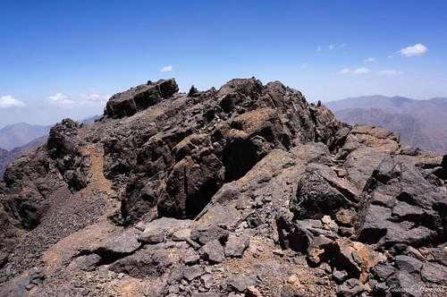
Summit Block (4010m)
In spring and winter the biggest part of the mountain is covered with snow. Along with the warm clothing climbing gear can be useful. Especially crampons and an ice axe. Check the conditions of the mountain if you are planning a trip and take the appropriate gear and clothing.
Last but not least. You have to spend the night at one of The Refuges (or camp in front of them), so take a sleeping bag with you along with some cash money to pay for the hut. The hut sells all kinds of food and drinks.
Weather
Maps and Books
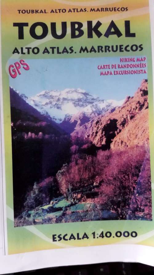
There aren’t many good maps available of the Toubkal area. In Imlil all kiosks sell the same map. The map is not perfect, but it shows the most important trails and waypoints:
Publisher: Editorial Piolet
EAN/ISBN: 9788495945426
Scale: 1:40,000
Size Folded: 11x17cm
Size: 99x68cm
Another map of the area:
Publisher: Orientazion
EAN/ISBN: 9788493560003
Scale: 1:50,000
Size Folded: 12x24cm
Size: 70x50cm
 |  |  |
Books:
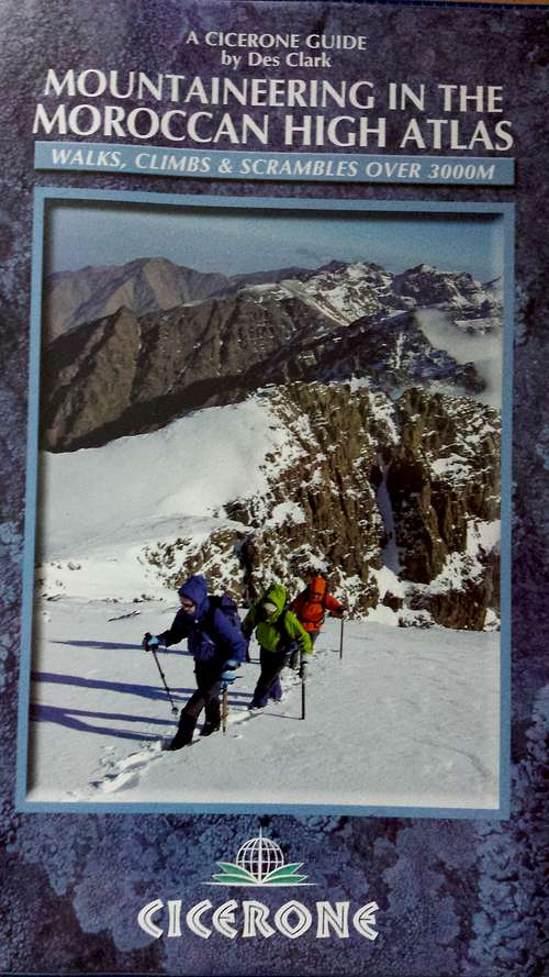
Mountaineering in the High Atlas
Author: Des Clark
Publisher: Cicerone Press
EAN/ISBN: 9781852846114
Size: 12x17cm
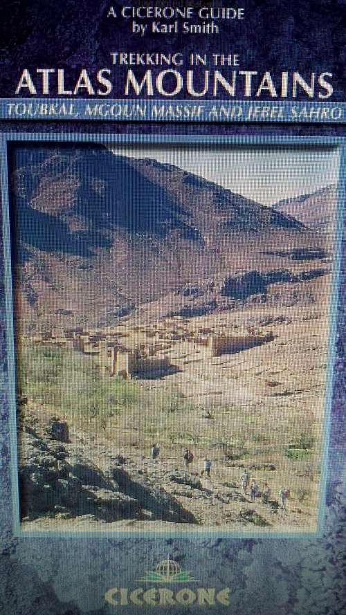
Trekking in the Atlas Mountains
Author: Karl Smith
Publisher: Cicerone Press
EAN/ISBN: 9781852844219
Size: 12x17cm
Both books and maps can be ordered online at Stanfords
External Links
Hotels in Marrakech: Click Here
Flights to Marrakech (Skyscanner): Click Here
Toubkal/Imouzzer Weather Forecast (All elevations!): Click Here
Toubkal National Park: Click Here