
|
|
Route |
|---|---|
|
|
46.28038°N / 8.79067°E |
|
|
Hiking |
|
|
Spring, Summer, Fall |
|
|
A long day |
|
|
T3+ |
|
|
Overview
Madom da Sgiof & Lago di Starlaresc by Mathias Zehring

Cima del Masnee Route Map
Madom da Sgiof is one of the classic hiking tours in the Verzasca area. There are several routes to Madom da Sgiof. They can be divided in two main routes: One from the Maggia valley and one from the Verzasca valley. Both routes are long since the valley floors are low in elevation in Ticino and the mountains reach altitudes of far above 2000 meters. The route from the Verzasca side however, is somewhat less strenuous and is considered. Both routes are indicated with a red arrow on the map at right.
The normal route actually consists of two different routes. After Matar it there is a junction. Both trails go to the summit of Madom da Sgiof, but follow a different route. Both routes are described on this page. That is the reason this page is called ''the normal routes''. Both trails can be used, one up and one down, to make for a nice round tour. The normal route is graded T3+, but is largely T2 and T3. The climb can be done in a single day, but prepare for a long day out since the elevation gain is over 1500 vertical meters up and back down again. It is also possible to spent the nght in the somewhat spartanic, but very nice mountain hut Capanna Starlaresc.
Route Description
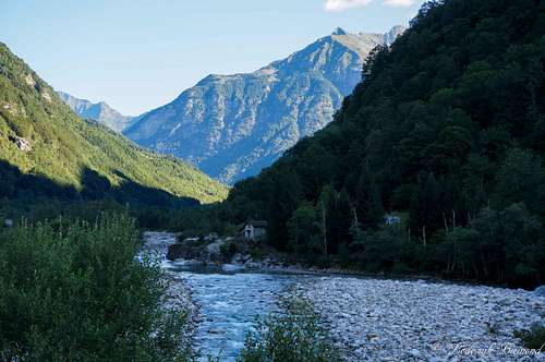 Verzasca River from Brione | 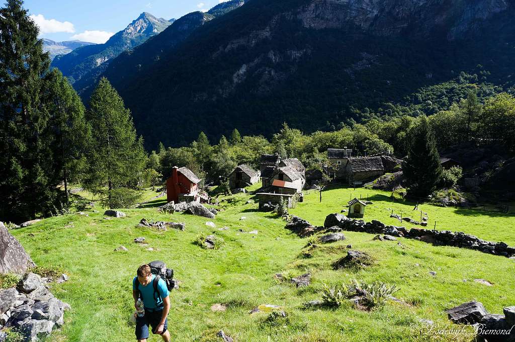 Pianesc | 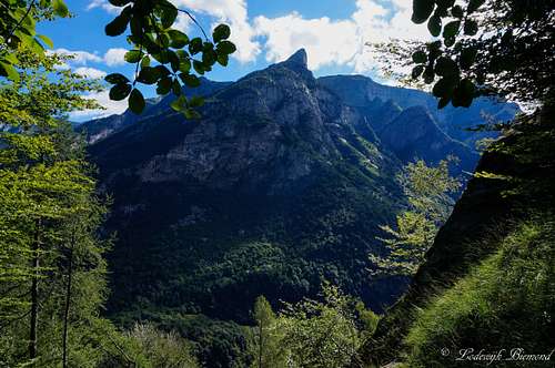 Poncione d'Alnasca |
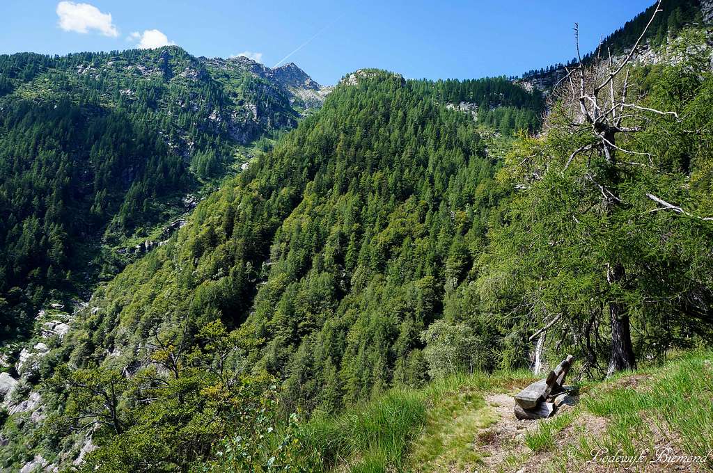
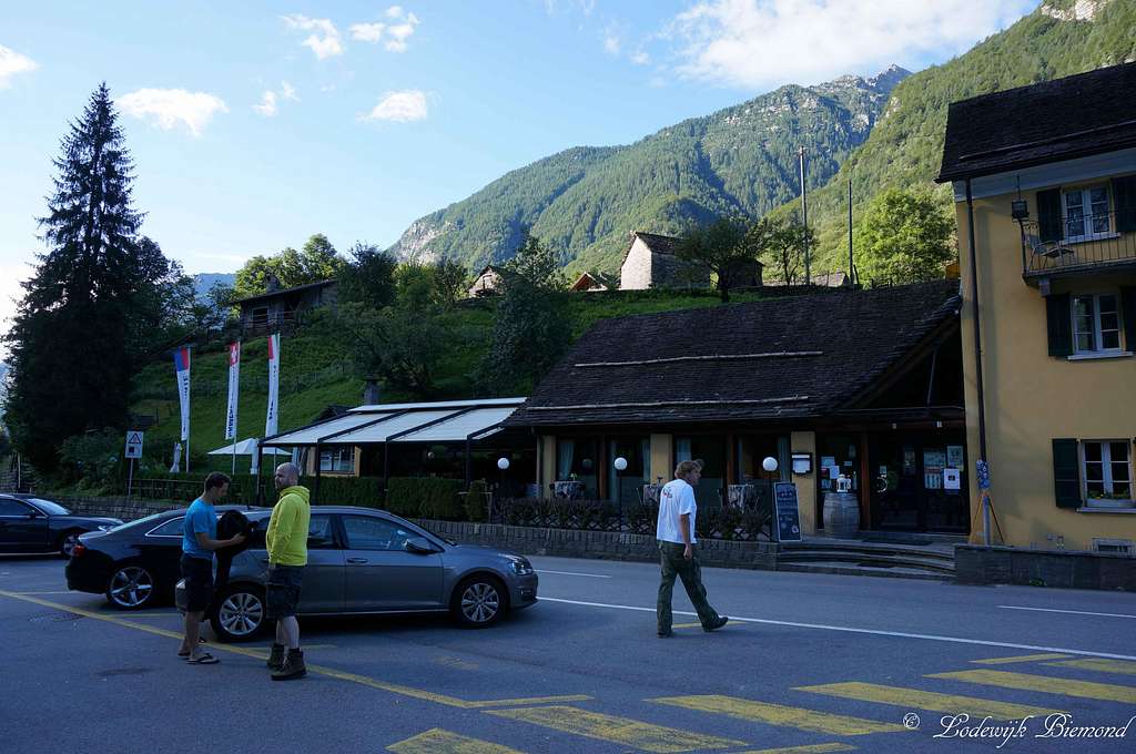
The route starts near Hotel/Restaurant Piee, which is located just outside Brione, a small village in Val Verzasca. You can recognize the start of the route by the yellow signpost along the main road just west (50 meters) of Piee. Follow the trail (well-marked, T2) towards ‘’Piano del Vald’ and ‘’Capanna Starlaresc’’. After a short hike you will reach the small settlement of Pianesc at 819 meters a.s.l. Follow the trail through this scenic village until you reach the treeline. At this point the trail enters the thick forest and the route starts gaining in elevation. The gradation goes up to T3-. Keep following the trail. This part is rather strenuous due to the steepness of the trail. Do try to look through the forest, to the other side of the valley once in a while, since the mighty Poncione d‘Alnasca is looming above the valley, as well as the Cresta della Fopia, an impressive vertical wall.
 Madom da Sgiof as seen from Matar | 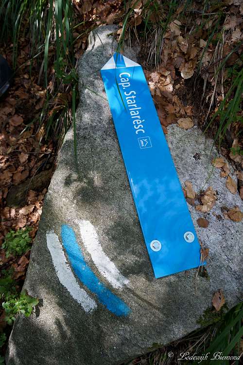 Blue-White-Blue Route | 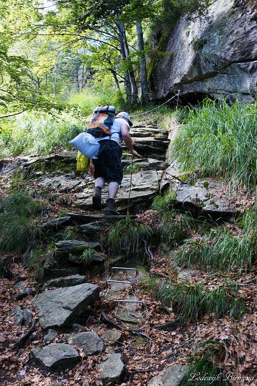 Secured section of the trail |
After about an hour and a half, or an hour if you are fast, you will reach Matar (1304 meters), recognizable by the yellow signpost. The route temporarily stops gaining elevation at this point. From Matar the views towards the Northern part of the Verzasca valley are wonderful. Shortly after passing Matar , there is a split-up in the trail. The red-white-red trail continues in straight line, but a white-blue-white marked route branches off to the right. Both routes meet up at the Capanna Starlaresc, but the white-blue trail gets you there much faster. If you take the red-white-red trail, the trail keeps heading through th forest until you reach Alpe di Sgiof and eventually Mottaruch at 2011m. Continue from Mottaruch down towards the Capanna Starlaresc at 1875 meters or continue from Mottaruch directly up the East Face of Madom da Sgiof. Keep following the trail up along the ridge until you reach the summit.
 Waterfall along the Trail | 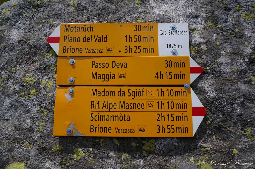 Signpost @ Capanna Starlaresc | 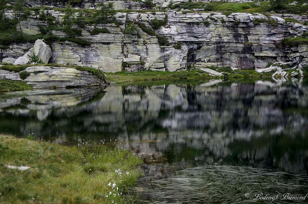 Reflection @ Starlaresc |
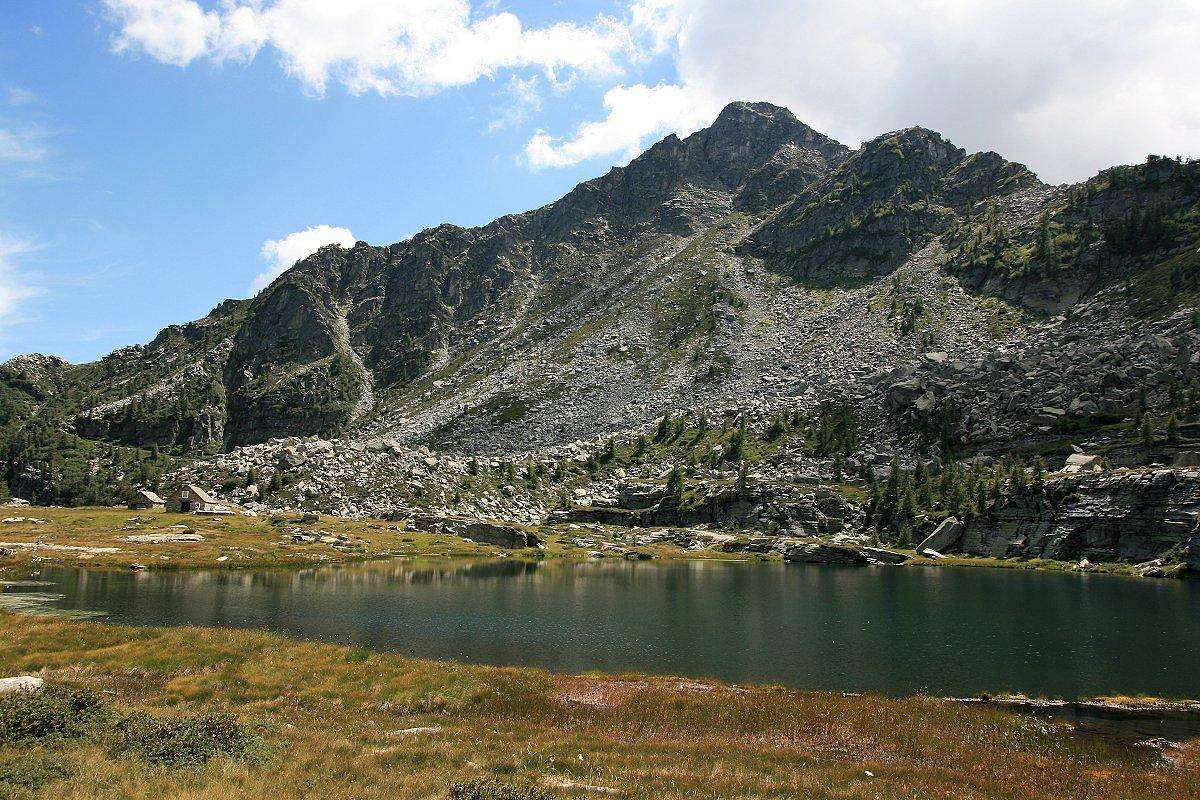
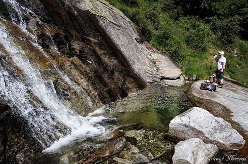
I previously mentioned the other , blue-white-blue route, up. These colors indicate the route should be harder compared to the red-white one and it is, but only slightly. I would grade this part of the route T3+ at max. It involves some sections secured with steel cables, but nothing difficult in my opinion. Follow the trail, which follows a small river/waterfall for most of this part of the route. The route is gaining in elevation fast and is rather strenuous again. The waterfall and surrounding mountains make up for a fantastic scenery. After an hour of climbing, the route becomes less steep agai and the treeline comes in sight. Keep heading up along the trail and eventually you are able to see the capanna Starlaresc (mountain Hut) and the beautiful Lago di Strarlaresc, a small lake next to the capanna.

Lago di Starlaresc from Passo Deva
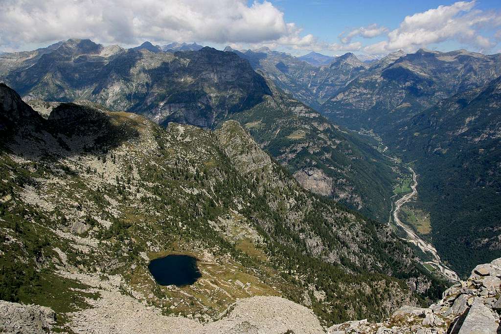
The capanna Starlaresc is a great place to spend some time to relax or to stay for the night. For more information see the Capanna Starlaresc section below. From the capanna the trail continuous (red-white-red), passes the lake and goes up to the passo Deva (2035m). This part takes about 30 minutes. At the Passo Deva you are on the ridge (saddlepoint) between Madom da Sgiof and Cima del Masnee. You can look down into the Maggia valley for the first time now. At Passo Deva the trails from both the Maggia and Verzasca valley's meet.
 Madom da Sgiof Summit | 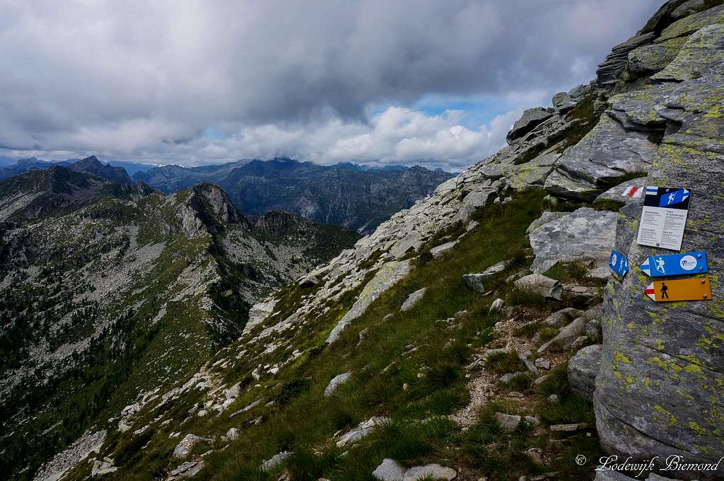 Saddlepoint Sgiof - Cima Bois | 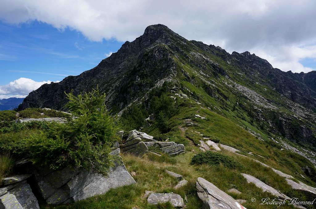 Madom da Sgiof (2265m) |
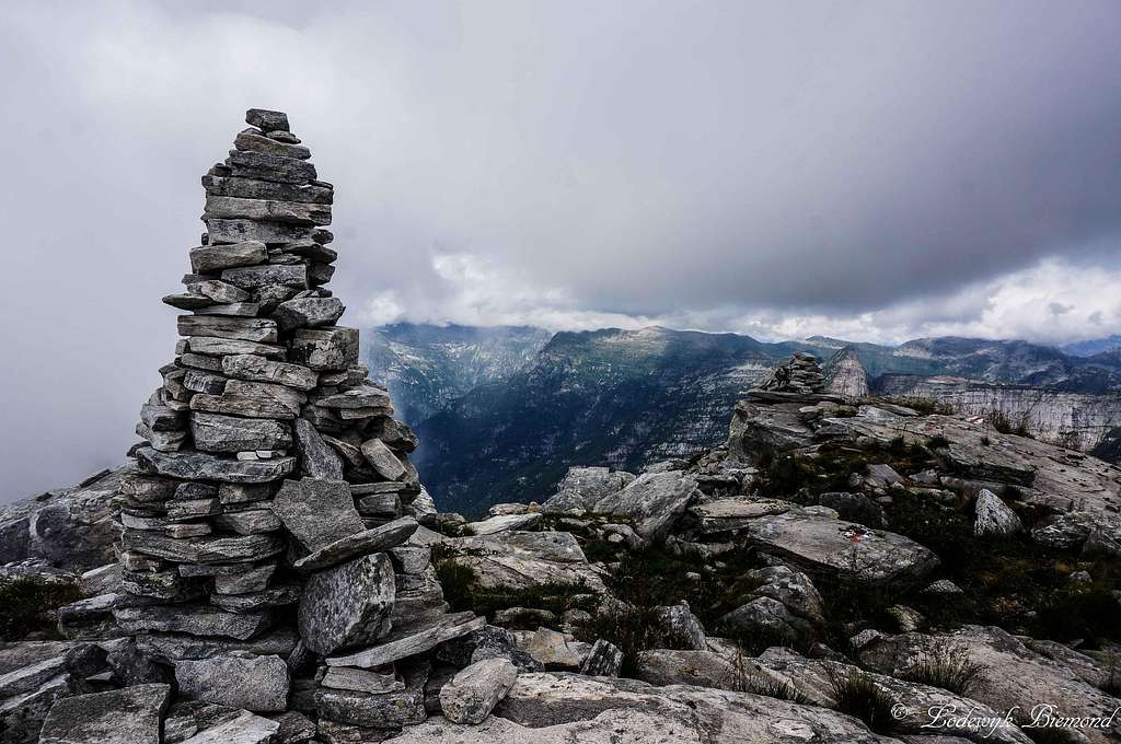
At passo Deva there is a large yellow signpost. Follow the sign towards ''Madom da Sgiof''. You are now heading towards the south along the ridge that seperates the Verzasca and Maggia valley. After some minutes of hiking the steepness increases. The trail zigzags up to the saddlepoint connecting Madom da Sgiof with Cima di Nimi and Cima Bois. Another signpost indicates to take a left. Shortly after you will find yourself on top of Madom da Sgiof. Although no summit cross is present here, the summit is marked by a large pile of stones.
Descent is the same way back or a traverse of the mountain. This last option is preferable and creates a nice round tour: After Matar take the blue-white-blue route up towards the summit. At the summit follow the East ridge back down to Mottaruch and then back to Matar.
![]()

How to get there
Hotel Piee; Starting point
Verzasca Route:
The A2 highway crosses Switzerland from north to south. On this highway take exit 47 'Bellinzona- Sud'
Now you are on the secondary road no. 2. Follow the signs to ''Locarno''
Before reaching Locarno Val Verzasca will appear on the road signs. Follow these signs until you reach Val Verzasca.
In the Verzasca valley is only one major road. Follow this road and you will first pass the village of Vogorno, than you will pass Lavertezzo and the 3rd major village is Brione. The route starts just before the actual village at Restaurant Piee, which can be recognized by the parking space in front of the Hotel/Restaurant.
A Route Planner to Brione (Restaurant Piee) on Google Maps can be found here
Essential Gear
Summit view by Mathias Zehring
Good hiking shoes are mandatory. Trekking poles can be useful. In summer temperatures are usually high in this southern part of the Alps. The weather can change rapidly though (thunderstorms in summer); so some extra clothes against possible colder temperatures and/or rain can be useful.
When to Climb
Madom da Sgiof in Autumn by Cyrill
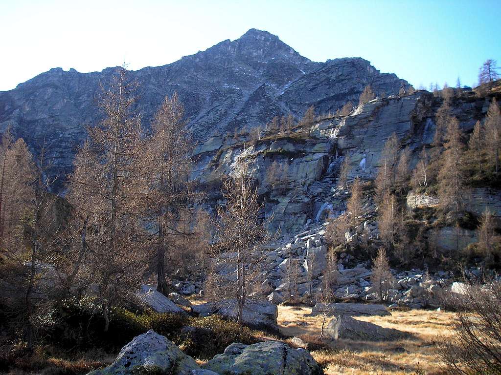
Madom da Sgiof can be climbed in summer as well as autumn and spring. Winter ascents can be done, but with snow present the difficulty level will quickly exceed the original T3+ grading. Most people climb Gaggio in the summer months, so it's most likely to encounter other hikers on the mountain in this period. In spring and autumn the chance is really big you won't see another soul all day long.
Capanna Starlaresc
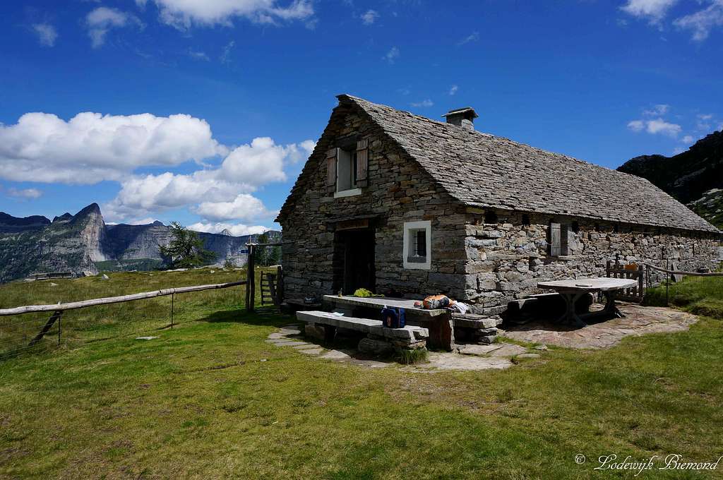
Capanna Starlaresc da Sgiof
Capanna Starlaresc da Sgiof is a very nice, unguarded mountain hut situated next to the lake carrying the same name. The hut provides all basic supplies like matrasses, blankets, a stove etc.
Reservation is not neccessary. You should bring some money to leave behind when spending the night.
Altitude: 1880m
Owner: Compadroni Starlaresc
Guardian: Raffaele Scolari ; raffasco@bluewin.ch
Phone number: +41 (0)91 745 64 02
Beds: 10
Costs: CHF 15.– / EURO 12.– a night
Maps and Books
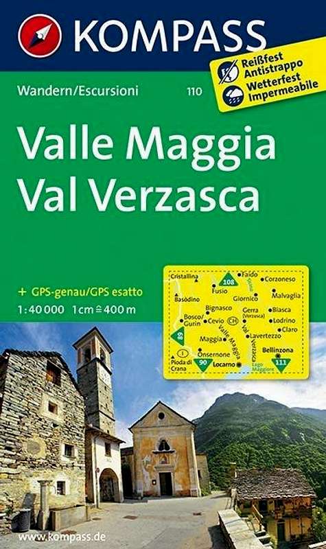 | Kompass Map WK110 Valle Maggia ValVerzasca Scale 1:50.000 ISBN13:9783854913368 | ||
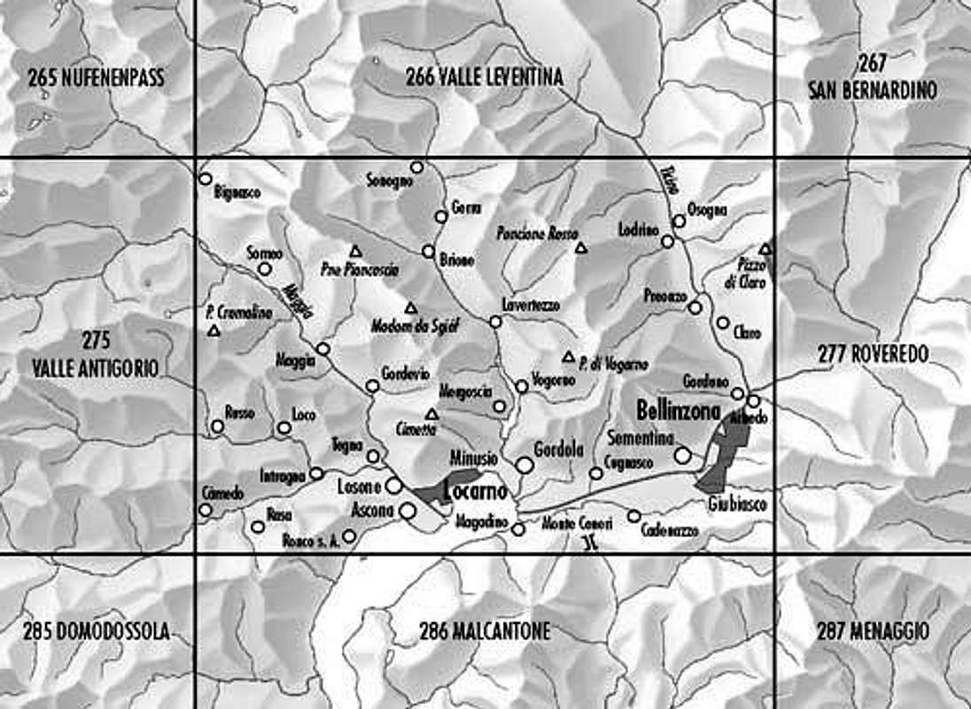 | Bundes Landkarte (BLT) 276 Scale 1:50.000
Verzasca-Locarno-Bellinzona |