
-
 20063 Hits
-
 75.81% Score
-
 6 Votes
|
|
Route |
|---|---|
|
|
37.96670°N / 105.5847°W |
|
|
Steep Snow with possible Ice in late season |
|
|
One to two days |
|
|
Class 3 |
|
|
Approach
The approach can be long (17 miles) with a 2WD or relatively short (4 miles) with a 4WD. The recommended trailhead is the South Colony outside of Westcliffe, CO. This is the same approach as for Crestone Needle, Kit Carson, and Humboldt peaks. See the main page for more approach information. From the 4WD parking area at about 11,100 feet follow the forest service road (gated) southwest to the Lower South Colony lake. There is lots of camping at both Lower and Upper South Colony Lakes as well as higher up on the Bear's Playground at just over 13,000 feet.
From Lower South Colony Lake hike northwest to Upper South Colony Lake. From here you can often see the switch-backing trail that leads to the ridge connecting Humboldt on the right and Crestone Peak around the corner to the left. During early spring there are excellent snow gullies leading up to the same ridge which avoid the scree and switch-backing of the main trail, as well as the ascent over Obstruction Point. Later in the season it may be better to take the trail to the west ridge of Humboldt, then around Obstruction Point though (more ridge scrambling up to Class 3). Either way, follow the ridge to the left/west until you reach a broad area around 13,000 feet known as the Bear's Playground. From here you get great views of Kit Carson and Crestone Needle's classic Ellingwood Arete.
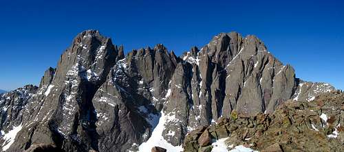
The Crestones from Obstruction Peak
Route Description
From the Bear's Playground the climbing and route finding begin. Follow the ridge west towards Crestone Peak and then traverse right at around 13,500 to reach the Northwest Couloir which is in the center of the peaks Northwest Face. Several false couloirs must be passed before reaching the proper one. You must enter the couloir at the highest accessible point to avoid the very steep and dangerous cliffs at the bottom of the couloir.
Now that you are in the couloir, ascend snow and ice between 30-40 degrees, depending on conditions, for about 800 feet to the saddle between the two summits of Crestone Peak. Ropes are not required, but an ice axe is a must as a sliding fall here could mean falling over the cliffs at the base of the couloir. From the saddle scramble west/right for about 250 vertical feet on class 3 rock to the true summit.
Descend the climbing route or continue down the South Face for a longer but more interesting return to South Colony Lakes. When descending the Northwest Couloir, take care to not glissade or have an uncontrolled slide until safely out of the couloir. Also make sure to exit the couloir at the point of entry and not below to avoid the steep cliffs below.attm adds the following:
There is a fork in the couloir that can be confusing. They look very similar in difficulty but only the left fork is the correct route. The right fork will get steeper and steeper and dead end. I found out this the hard way. Be sure and take the left hand fork!
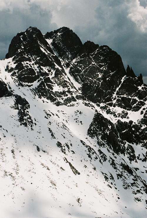 Northwest Couloir | 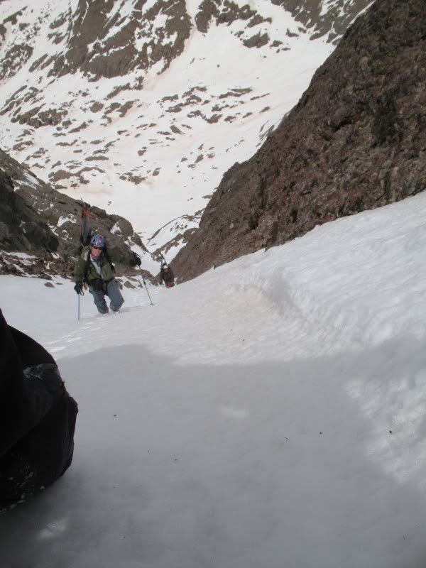 Climbing the NW Couloir |
Essential Gear
Ice axe and possibly crampons. A helmet is highly recommended as rocks and ice can fall from climbers above. This route is best done when the couloir has stable snow. Without snow the route would be somewhat looser, but it has been said the scrambling is pretty good if the rock is dry.
External Links
Good Trip Report of the Northwest Couloir
ericnoel - Sep 6, 2010 4:40 pm - Voted 10/10
NW CouloirThis is a good route page. However, I do take issue with the statement that the route would be a dangerous shooting gallery without snow. In fact we ascended this route and then descended the standard red gully route. Conditions were basically dry though a slight amount of verglass was present. While the NW Couloir is certainly steeper and has more scrambling, it is also much more stable than the chossy red gully. Plus it has fewer people around so less danger of rockfall from other parties. We found it be a good late season route. Just my opinion of course.
BMS914 - Sep 3, 2013 4:55 am - Hasn't voted
Re: NW CouloirI concur - summitted via this route 8/30/2013. No snow or ice, but some piled-up hail was present. Also, water was flowing down the gully in many places making the rock more slippery. There was also some wet moss in spots that was tricky. Rockfall was a concern but not to the point of ruining the experience. Our party of two did not have helmets, though care was required. I would rate this route exposed Class 3 rather than Class 4 (as the main Crestone Peak page suggests). The climbing was easier than Mount Sill in California I did two weeks before, for example. The climbing in the NW Couloir is sustained for a good 90 minutes. Our descent was via the standard (Red Gully) route, which seemed to go all Class 2 and was much easier.