
-
 6352 Hits
-
 0% Score
-
 0 Votes
|
|
Route |
|---|---|
|
|
47.41869°N / 121.55308°W |
|
|
Hiking |
|
|
Winter |
|
|
Most of a day |
|
|
Getting There
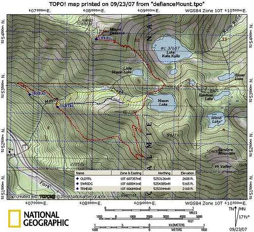
Route Map
This trail begins on the usual mason lake approach trailhead. The difference is that it skips that long shallow incline over toward Bandera Mountain and back, shaving off a few miles in the process.