Purpose
The purpose of this album is to provide climbers with photo reconnaissance of the Wadi Rum.
Please attach your photos to this album, then contact me to have your photos displayed in the correct section of this album.
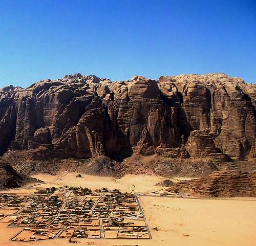
The village of Rum (Photo: Jek)
![]()
|
References
Please see
Jek's SummitPost page on the
Wadi Rum, for details on the Wadi Rum mountains.
Also for reference please see Jek's outstanding
photo map of the Wadi Rum mountains.
Jek's photo map of the Wadi Rum
Geography
Please see
Jek's SummitPost page on the
Wadi Rum, for details on the Wadi Rum mountains.
According the Jek's page, the Wadi Rum mountains can be divided into seven areas. This page provides detailed photos of these seven areas:
From Jek's page:
Jebel Rum massif
J.Rum (1754m)
East Dome(1560m)
Jebel um Ishrin massif
J.um Ishrin (1753m)
J.Al Kharazeh (1580m)
J.Nassrani,North & South summits (1560m)
Barrah Canyon
J.Barrah (1653m)
J.Abu Judaidah (1640m)
J.Arashrasha (1466m)
J.Annafishiyyah (1424m)
Burdah and Domes of Abu Khsheibah
J.Burdah (1574m)
J.Abu Khsheibah (1399m)
Jebel Khazali massif
J.Khush Khasah (1514m)
J.Khazali (1420m)
Jebel Al Qattar
J.Al Qattar (1425m)
Al Maghrar
J.Al Maghrar (1260m)
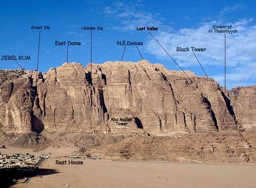
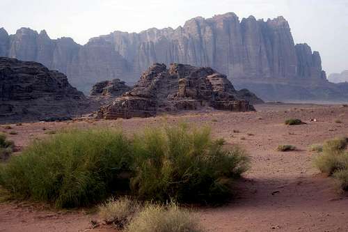
Jebel Rum Massif
The Jebel Rum massif is a north-south ridge, 6 kilometers long, that lies immediately west of the village of Rum. The highest summit is Jebel Rum (1,743 meters).
The photos below are arranged to show the towers from north to south.
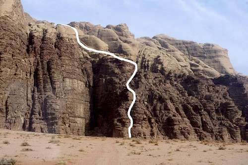
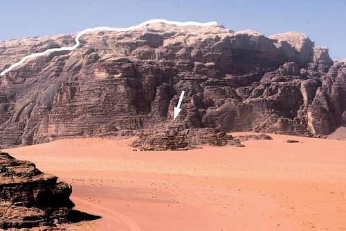
The numbers in the photographs (at the bases of the towers) correlate to route numbers in Tony Howard's rock-climbing guide to the Wadi Rum.
N PLATEAU & EAST DOME (1,560 meters)
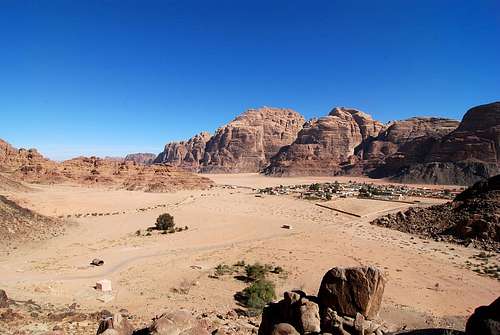
The N Plateau and E Dome are just north Jebel Rum, above the village of Rum.
Please see
Jek's detailed informational page about the
North Plateau and East Domes.
The E face of NE Domes above the village of Rum (Photo: Jek)
![]()
|
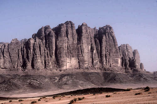
JEBEL RUM (1,754 meters)
The east face the J. Rum massif (Photo: drorfid)
![]()
|
The E face of the J. Rum massif above the village of Rum (Photo: Jek)
![]()
|
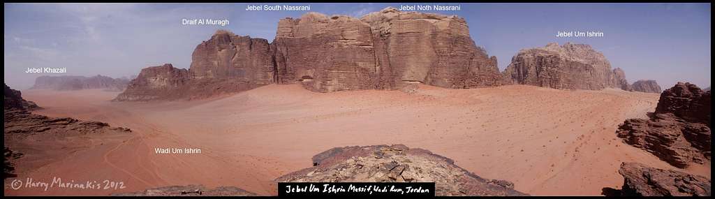
Jebel Um Ishrin Massif
The Jebel um Ishrin massif is a north-south ridge, 8 kilometers long, that lies immediately east of the village of Rum. The highest summit is Jebel um Ishrin (1753 meters). The massif is bordered by Wadi Rum on the west and Wadi um Ishrin on the east.
The photos below are arranged to show the towers from north to south.
The numbers in the photographs (at the bases of the towers) correlate to route numbers in Tony Howard's rock-climbing guide to the Wadi Rum.
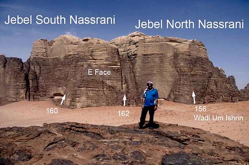
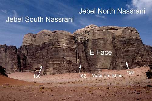
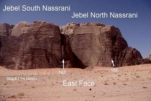
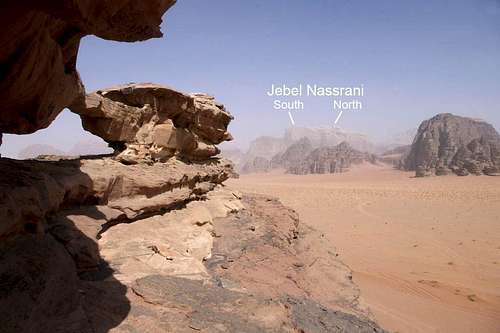
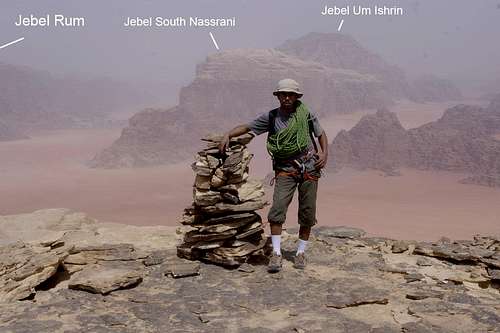
NASSRANI TOWERS (north and south summits)
Panorama of the east faces of the Nassrani towers from the east
The east faces of the Nassrani towers
The east faces of the Nassrani towers
![]()
|
The west faces of the Nassrani towers from Abu Meleh Tower (Photo: Jek)
![]()
|
JEBEL NORTH NASSRANI (1,560 meters)
The west face of the Jebel North Nassrani from the NW

|
The west face of the Jebel North Nassrani from the SW

|
The east face of the Jebel North Nassrani

|
The east face of the Jebel North Nassrani

|
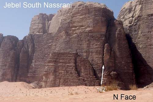
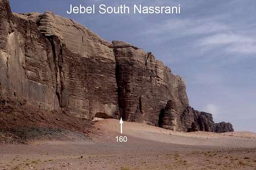
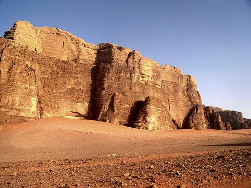
JEBEL SOUTH NASSRANI (1,560 meters)
The east face of the Jebel South Nassrani from the NE
![]()
|
The east face of the Jebel South Nassrani

|
The east face of the Jebel South Nassrani from the SE
![]()
|
The SE face of the J. South Nassrani (Photo: drorfid)
![]()
|
Barrah Canyon
The highest summit is Jebel Barrah (1,653 meters).
The photos below are generally arranged to show the towers from north to south.
The numbers in the photographs (at the bases of the towers) correlate to route numbers in Tony Howard's rock-climbing guide to the Wadi Rum.
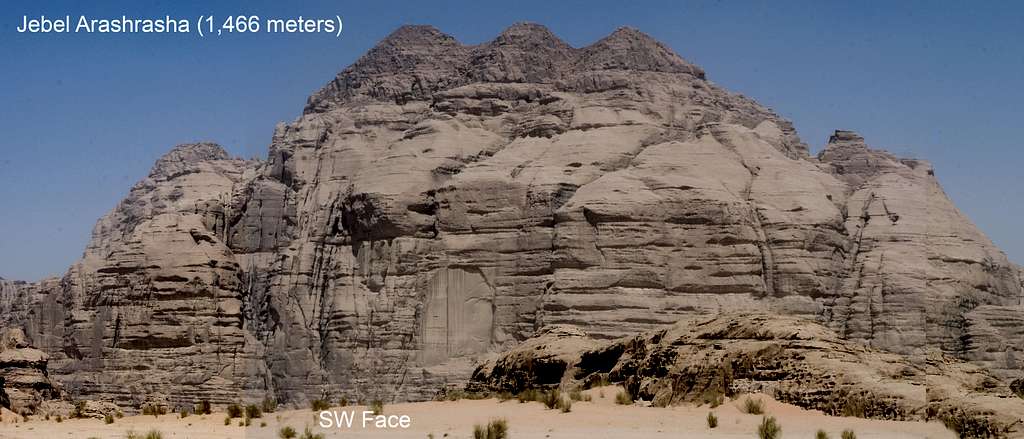
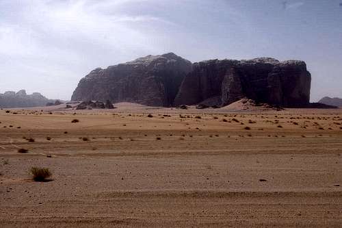
JEBEL ARASHRASHA (1,466 meters)
"As yet no climbs recorded."
Panorama of J. Arashrasha from the SW
![]()
|
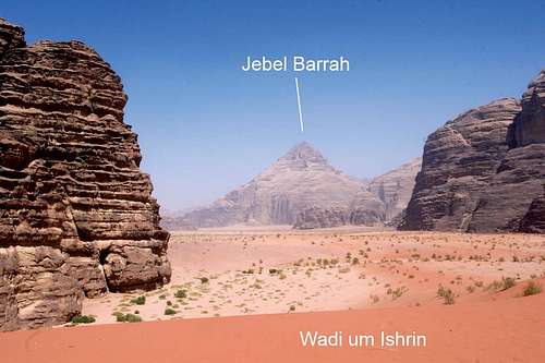
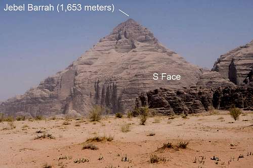
JEBEL BARRAH (1,653 meters)
Jebel Barrah from the south
![]()
|
Jebel Barrah from the south
![]()
|
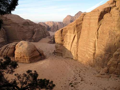
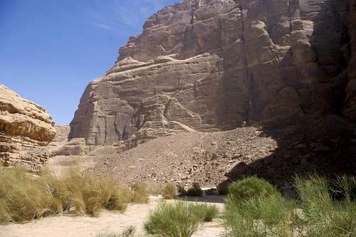
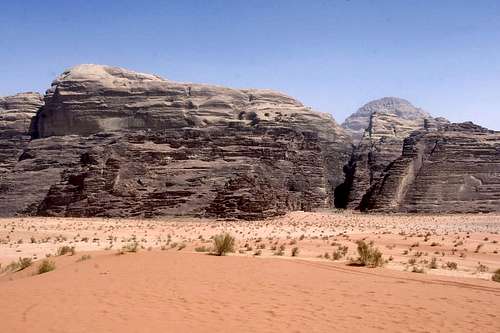
BARRAH CANYON
Barrah Canyon (Photo: Jek)
![]()
|
The view NW of south Barrah area, looking at J. Barrah S Summit (pyramid) (Photo: soderkisen)
![]()
|
JEBEL ABU JUDAIDAH
A large S-facing wall on the W side of J. Abu Judaidah from Barrah Canyon
![]()
|
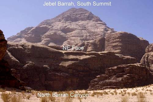
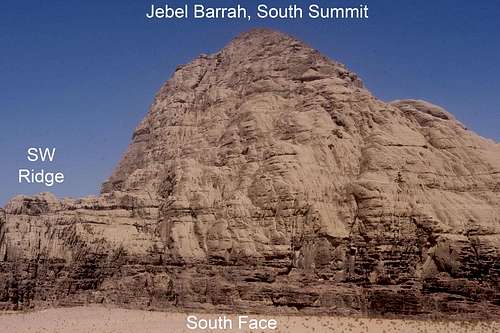
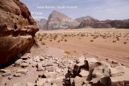
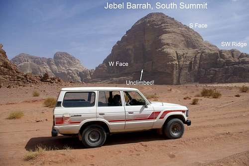
JEBEL BARRAH (South Summit)
J. Barrah (South Summit) from the NE in Barrah Canyon
![]()
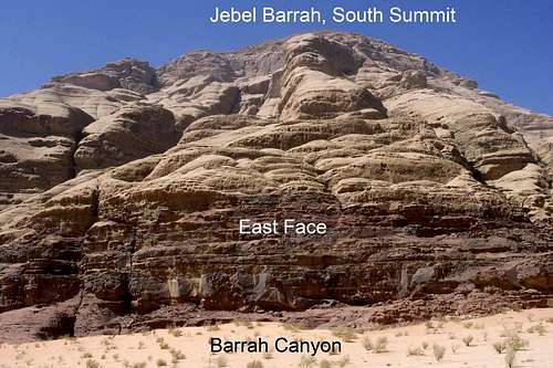
|
J. Barrah (South Summit) from the E in Barrah Canyon
![]()
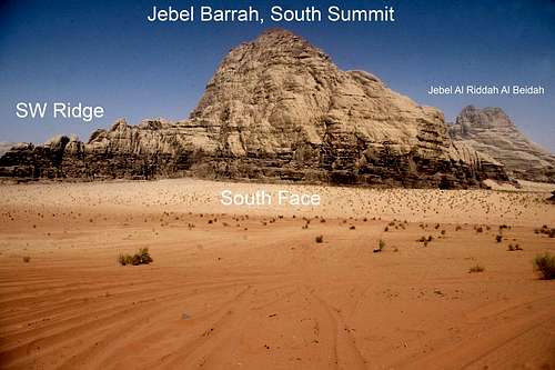
|
J. Barrah (South Summit) from the S
![]()
|
J. Barrah (South Summit) from the S
![]()
|
J. Barrah (South Summit) from the SW
![]()
|
J. Barrah (South Summit) from the SW
![]()
|
JEBEL ANNAFISHIYYAH
W Face of J. Annafishiyyah from Wadi um Ishrin
![]()
|
SW Face of J. Annafishiyyah from Wadi um Ishrin
![]()
|
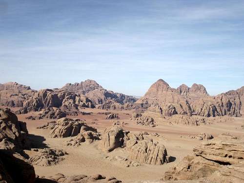
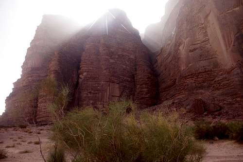
Burdah and Domes of Abu Khsheibah
The highest peak in this area is Jebel Burdah (1574 meters). Many tourists climb the North Ridge of Jebel Burdah (Class II, 5.3), but stop halfway up the peak at Burdah Arch.
The numbers in the photographs (at the bases of the towers) correlate to route numbers in Tony Howard's rock-climbing guide to the Wadi Rum.
Burdah and Domes of Abu Khsheibah (Photo: Jek)
![]()
|
JEBEL QABR AMRA (meters)
The W Face of J. Qabr Amra from J. Khazali
![]()
|
The W Face of J. Qabr Amra from J. Khazali
![]()
|
The Qbar Amra Arch at the north end of the J. Qabr Amra ridge, looking NW
![]()
|
Jebel Khazali Massif
Jebel Khazali (1,420 meters) is a massive, isolated block approximately 4 kilometers due south of the village of Rum. The peak is prominent from amy vantage point in Wadi Rum.
The numbers in the photographs (at the bases of the towers) correlate to route numbers in Tony Howard's rock-climbing guide to the Wadi Rum.
JEBEL KHAZALI (1,420 meters)
J. Khazali from the the J. Rum massif (Photo: Jek)
![]()
|
J. Khazali from the north (from Wadi Rum), showing the Great Siq that splits the N Buttress in half
![]()
|
N Buttress of J. Khazali (just W of the Great Siq)
![]()
|
J. Khazali from the NE (from the J. Qabr Amra arch)
![]()
|
Lower half of Sabbah's Route on E Face
![]()
|
Upper half of Sabbah's Route on E Face (with rap route)
![]()
|
Jebel Al Qattar
Jebel Al Qatter (1,425 meters) is an isolated peak about 4 kilometers southwest of the village of Rum.
The big walls of the SE face are impressive!!
Jebel Al Qatter from the northeast
![]()
|
Panorama of the southeast face of Jebel Al Qattar
The southeast face
![]()
|
The southeast face
![]()
|
Al Maghrar
No information yet
.
.
.
.
.
.
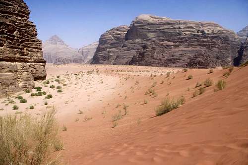
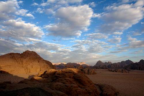
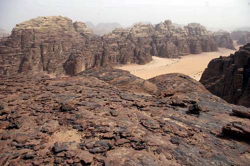
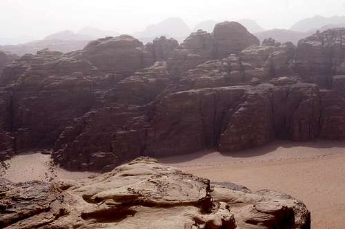
. General Photos
This section is for miscellaneous photos that don't neatly fit into one of the above categeories.
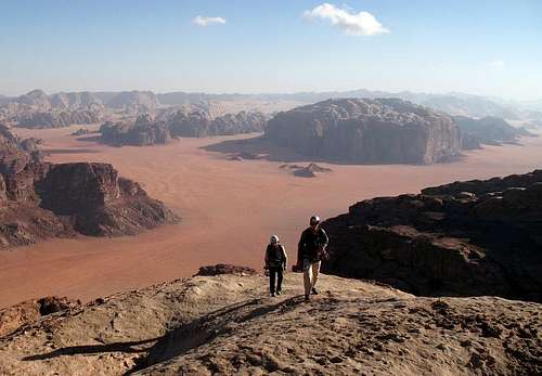
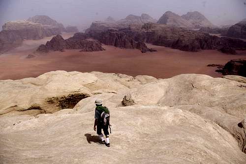
View N from the summit of J. Khazali, with the J. um Ishrin massif in the distance
![]()
|
Looing N-NE towards the W faces of J. Nassrani (Photo: Jek)
![]()
|
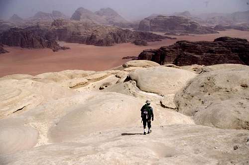
View N from E of the summit of J. Khazali, showing the peaks in the distance: J. Rum (left), J. um Ishrin (center), J. Barrah (right)
![]()
|
Similar view as the photo to the left, looking more NE
![]()
|
The Doodle tower of the Gabel Rum, Wadirum (Photo: israserg)
![]()
|
Comments
No comments posted yet.