
-
 4694 Hits
-
 77.48% Score
-
 8 Votes
|
|
Mountain/Rock |
|---|---|
|
|
47.30156°N / 15.73693°E |
|
|
Hiking |
|
|
Spring, Summer, Fall, Winter |
|
|
4199 ft / 1280 m |
|
|
Topographic isolation: 12 km
Nearest higher peak: Offner Berg, 1293 m
Prominence: 473 m![Rabenwaldkogel - view from south]()
Rabenwaldkogel - view from south![Lichen, Cranberry, Fog]()
Lichen, Cranberry, Fog![Spruce forest]()
Mystic spruce forest
From Vienna:
Vienna (A2 highway) – Hartberg - Pöllau
From Graz:
Graz (A2 highway) – Gleisdorf - Hirnsdorf - Stubenberg
From Budapest:
Budapest (M7 highway) – Székesfehérvár – Veszprém – Körmend – Rábafüzes – Fürstenfeld – Bad Waltersdorf – Kaindorf - Pöllau
With train
Graz – Gleisdorf – Weiz – Anger. On summer Sundays you can travel with oldtimer train from Weiz to Anger.
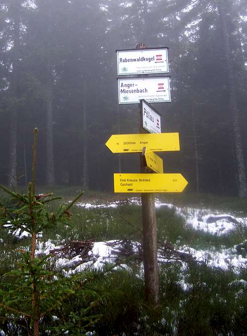
![Trails are marked very accurately on Rabenwaldkogel]()
Many marked trails![Spruce forest]()
Mark route through the dark forestRabenwaldkogel can be accessed from many villages:
- from Pöllau (400 m a.s.l.) – if you start from here, then you can perform a good 880 meter elevation gain while ascending to Rabenwaldkogel
- from Koglhof (580 m a.s.l.)
- from Anger (480 m a.s.l.)
- from Fresen (550 m a.s.l.)
- from Oberfeistritz (455 m a.s.l.)
- from Birkfeld (625 m a.s.l.)
- from Stubenberg am See (450 m a.s.l.)
There are two easier trailheads, too:
- at saddle (1025 m) of the road connecting Pöllau with Stubenberg
- at saddle (807 m) of the road connecting Pöllau with Birkfeld.
As there are „too many” trails around Rabenwaldkogel, and it’s not really possible to describe them here. Better if you buy a map and follow the marked trails according to it.
The summit of Rabenwaldkogel can be ascended from two directions:
- From south on a trail with minimal steepness
- From northeast on a trail that is short but very steep. Not recommended for families or in winter.
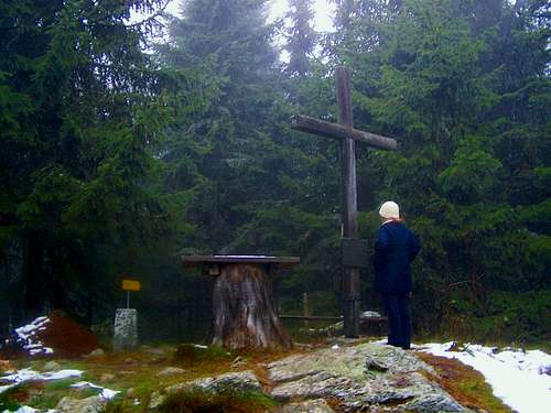
![The summit of Rabenwaldkogel]()
On the summitThe summit is surrounded by trees so there is no panoramic view from there. In general Rabenwaldkogel is not the best mountain for those who want to enjoy good outlooks. Though there are a few points on each trail where you can enjoy some views.
On the summit there is a wooden cross erected, with a plate on it. The plate has the following text:
Give me the peace that the World cannot give me.
------------------------------------------------
Rabenwaldkogel 1280 m
The cross on the summit was erected on the 2nd July 1988 by the Mountain and Nature Guards of Anger.
In addition to the cross there are some wooden benches and a wooden table on the summit.![Map of Rabenwaldkogel]()
Map of RabenwaldkogelFreytag & berndt WK 131 "Grazer Bergland – Schöckl – Teichalm - Stubenbergsee", 1:50 000
Naturpark Pöllauer Tal (in English)
Nearest higher peak: Offner Berg, 1293 m
Prominence: 473 m
Overview
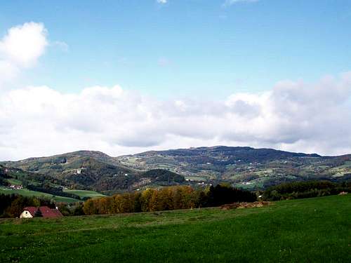
Rabenwaldkogel - view from south
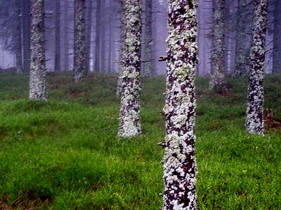
Lichen, Cranberry, Fog
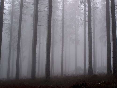
Mystic spruce forest
Pöllau is a small historic town in Austria. It is called as the „Pearl of Styria”. Not only the town is beautiful but its surrounding, too.
In 1983 Pöllauer Tal (Pöllau Valley) was awarded the rating "Natural Park" by the province of Styria. This award was presented for the beauty of the landscape, the traditional and careful farming of the land and the way traditions and customs are kept alive in the region. With this title, the region commits itself to demonstrating exemplary sustainable development in the areas of nature conservation, recreation, education and regional development. The Naturpark Pöllauer Tal covers a 124 km2 area.
There are many excellently developed and signposted hiking trails in the Pöllauer Tal natural park. You can explore them with trained natural park guides or on your own. The hiking trails that has their own names are listed here:
- Hirschbirne pear hiking trail
- Pilgrim's path
- Adventure trail in the wood
- The park of natural ENERGY (NaturKRAFTpark)
- Forest nature trail on the Masenberg mountain
- Schönegg nature trail
- Natural park adventure loop hike.
There are many other hiking trails, too. But they don’t have own name – they are just numbered and marked trails.
The highest point of the Naturpark Pöllauer Tal is the mountain called Rabenwaldkogel, with its elevation of 1280 m. Rabenwaldkogel is the highest point of an approximately 17 km long mountain ridge stretching from north to southeast, so from the saddle called Gschaid (807 m) down to the village Kaindorf. Not the whole area of Rabenwaldkogel belongs to the Natural Park. The boundary of the Natural Park is on the ridge of the mountain, and so only the eastern slope of the mountain belongs to the park. And really there is some difference between the eastern and the western slopes. While the eastern slope is covered by meadows and by dense forest of spruce on higher elevations (with a total of 220 different plant species), on the western slope – beside meadows and forests – there is a mining area, too. It’s an open-pit talc mine. Talc mining started here in 1820. The following minerals have been identified there:
Adularia, Albite, Anatase, Antigorite, Apatite, Brookite, Calcite, Chabazite, Chalcopyrite, Chlorite Group, Diopside, Goethite, Grossular, Hematite, Kyanite, Magnesite, Melanterite, Phengite, Prehnite, Pumpellyite, Pyrite, Quartz, Smoky Quartz, Rutile, Siderite, Sulphur, Talc, Tremolite, Vanadinite, Vesuvianite, Wollastonite and Xenomite.
Though there is a high variety of minerals here, the mountain is basically built of gneiss. It is rarely seen on the surface because of the soil and vegetation, but near the summit there are some rocky pyramids made of this stone. The highest of these rocky pyramids forms the peak of Rabenwaldkogel.
Classification of the Alps by SOIUSA:
Wechsel-Joglland Range (that belongs to the Pre-Alps of Styria)
o Wechsel (1743 m)
o Joglland
- Rabenwaldkogel-Wildwiesen Group (1280 m)
- Masenberg Group (1261 m)
According to this source Rabenwald is the highest point of Joglland – in addition to being the highest point of the Naturpark Pöllauer Tal. But according to other sources the Wechsel mountain belongs to Joglland, too, and if we accept this, then the highpoint of Joglland is in the Wechsel mountain.
Rabenwaldkogel is on the eastern-southeastern perimeter of the Alps. There are no higher summits east to it or south-east to it. The nearest higher point east to Rabenwaldkogel is in Romania, in 520 km distance. The nearest higher point south-east to Rabenwaldkogel is in Bosnia, in 360 km distance.
Getting There
With carFrom Vienna:
Vienna (A2 highway) – Hartberg - Pöllau
From Graz:
Graz (A2 highway) – Gleisdorf - Hirnsdorf - Stubenberg
From Budapest:
Budapest (M7 highway) – Székesfehérvár – Veszprém – Körmend – Rábafüzes – Fürstenfeld – Bad Waltersdorf – Kaindorf - Pöllau
With train
Graz – Gleisdorf – Weiz – Anger. On summer Sundays you can travel with oldtimer train from Weiz to Anger.
Routes
Many marked trails
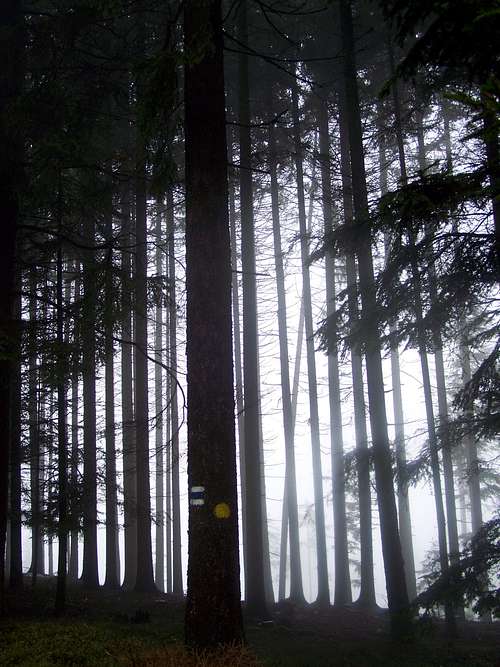
Mark route through the dark forest
- from Pöllau (400 m a.s.l.) – if you start from here, then you can perform a good 880 meter elevation gain while ascending to Rabenwaldkogel
- from Koglhof (580 m a.s.l.)
- from Anger (480 m a.s.l.)
- from Fresen (550 m a.s.l.)
- from Oberfeistritz (455 m a.s.l.)
- from Birkfeld (625 m a.s.l.)
- from Stubenberg am See (450 m a.s.l.)
There are two easier trailheads, too:
- at saddle (1025 m) of the road connecting Pöllau with Stubenberg
- at saddle (807 m) of the road connecting Pöllau with Birkfeld.
As there are „too many” trails around Rabenwaldkogel, and it’s not really possible to describe them here. Better if you buy a map and follow the marked trails according to it.
The summit of Rabenwaldkogel can be ascended from two directions:
- From south on a trail with minimal steepness
- From northeast on a trail that is short but very steep. Not recommended for families or in winter.
The Summit
On the summit
On the summit there is a wooden cross erected, with a plate on it. The plate has the following text:
Give me the peace that the World cannot give me.
------------------------------------------------
Rabenwaldkogel 1280 m
The cross on the summit was erected on the 2nd July 1988 by the Mountain and Nature Guards of Anger.
In addition to the cross there are some wooden benches and a wooden table on the summit.
Red Tape
Access is forbidden to the area of the mine and into its protection zone on the southwestern slope of Rabenwaldkogel.Camping
Camping Steinmann in Stubenberg am SeeMap
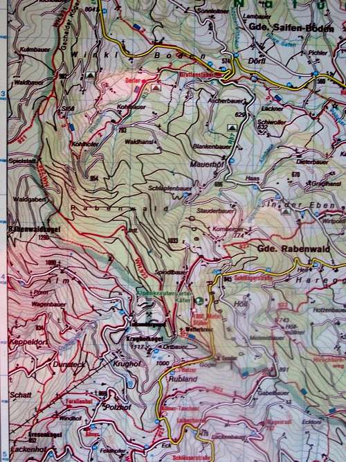
Map of Rabenwaldkogel
External Links
Stubenberg am See (in German)Naturpark Pöllauer Tal (in English)