
|
|
Route |
|---|---|
|
|
47.32347°N / 11.23764°E |
|
|
Hiking, Mountaineering |
|
|
Spring, Summer, Fall |
|
|
Overview
Maximum walking distance – 23.6 km/14.6 miles (approx.)
Minimum walking distance – 13 km/6 miles (approx.)
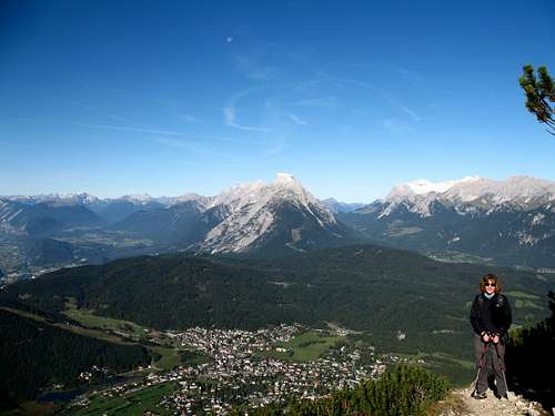
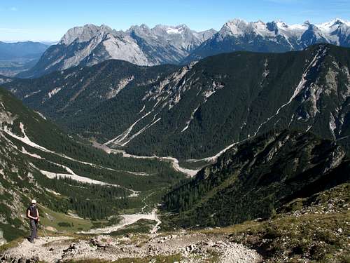
The Reither spitze dominates the skyline to the east of Seefeld and its summit provides an amazing viewpoint for miles around.
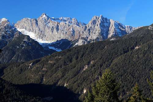
From its slopes, it’s possible to see over the town to the Hohe Munde and beyond, the Leutasch valley and Wetterstein mountains at the German border (including the distant Zugspitze), an array of peaks in the Karwendel mountains, the Inn valley and many high mountains to the south.
This route has many permutations and can utilise different forms of public transport which changes the length “walked” as opposed to “travelled”.
Do this route on a good weather day to fully enjoy the views and the wonderful airy, high level paths encountered early in the day.
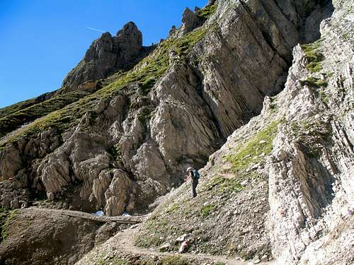
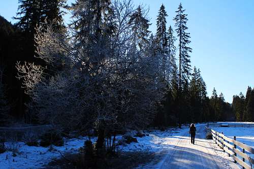
Section 1. Seefeld - Reither spitze summit.
I don’t want to recreate the details of the Reither spitze main page on SP, suffice to say, there are many routes that can take you from the town to the summit.
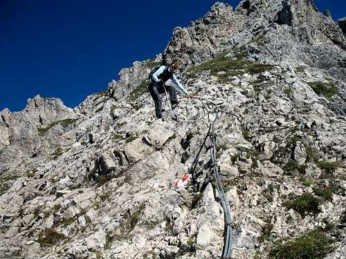
Many mountaineers enjoy the ascent part of the mountain experience and the Reither spitze has everything from easy angled paths, through steep, rough paths to cable protected scrambling. So, there is a lot to enjoy but if that is your choice, it may be prudent to spend two days on the Reither spitze. One to enjoy the climb of the mountain and one to do this longer route. It is possible to spend a night in the Nordlinger hutte if you so desire.
My advice would be to make a decision to get to the summit as soon as possible in order to enjoy the rest of this long walk at an enjoyable pace.
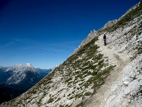
When we did this, we got the first finicula up to the Rosshutte, then the cable car over to the Harmelekopf and followed path no 10 around the mountain towards the Nordlinger hutte. From there, up the cable protected path to the summit to enjoy the views before the crowds arrive.
|
|
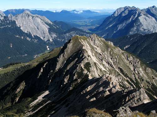
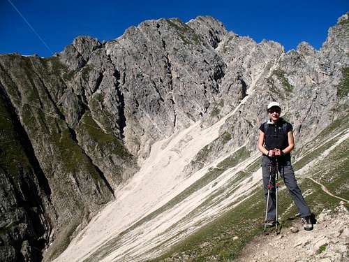
Section 2. Reither spitze summit - Ursprungsattel.
Descend from the summit down towards the Nordlinger hutte, there is some cable protection on the way although, it is not really needed. Just before reaching the hut, there is a yellow signpost detailing the direction for several routes. The Ursprungsattel is reached by descending eastwards, quite steeply at first on path no 17.
(If the weather is looking like it might deteriorate, this is the time to turn around and descend back to Seefeld.)
Continue on the marked, descending path. It can be quite broken in places and there is a need to scramble down the occasional rocky stretch although, it is never really difficult. As you descend, you can clearly see the path ahead as it levels out on its way to the Ursprungsattel.
|
|
Section 3. Ursprungsattel - Eppzirler tal.
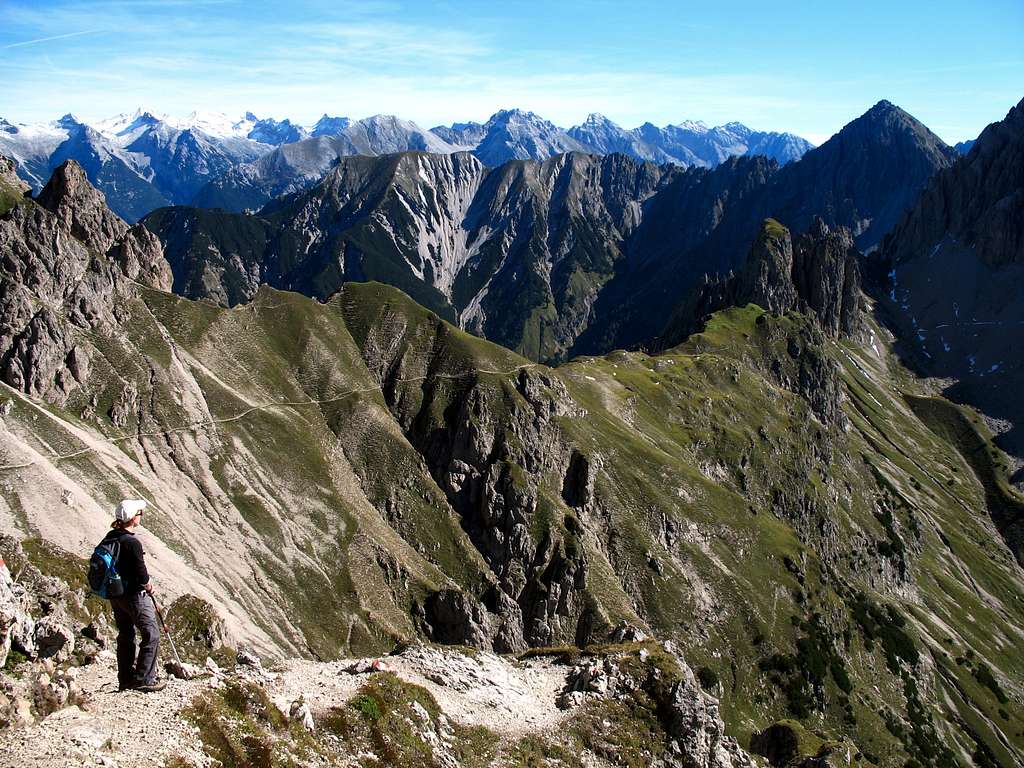
From the Ursprungsattel, the path descends clearly at first but less so later down a loose, muddy slope. When we did this route, this was the worst part of the day as some of the slope had been swept away by the melting winter snows.
As the path levels out, the way ahead splits. From here, it’s possible to descend straight down the rocky hillside on path no 74. Taking this direct route will bring you further down the Eppzirler tal below the Eppzirler alm.
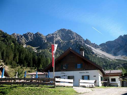
However, path (no 17) heads upwards to the right towards a grassy spur, the Breiter sattel. We arrived here at about 1pm and decided it would be a good place for a bite to eat as it is in an open, sunny position.
Continue on path no 17 that descends about 350m at first easily, then in steeper zig zags east and down towards the Eppzirler alm on the far side of the (possibly dry) river.
Here is a good place to stop for some well-earned refreshments.
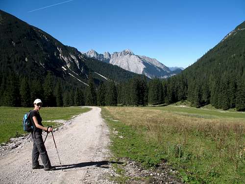
Section 4. Descending the Eppzirler tal (Part 1).
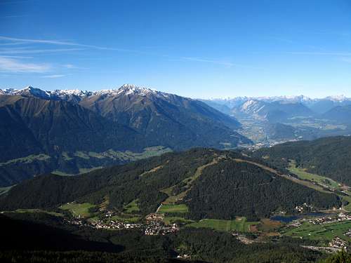
Leaving the alm, you head down on a broad, metalled jeep track shown as path no 212 (and later as no 15) on the map. The going is easy and it would be difficult to lose your way here. Looking back, you can see the Seefelder spitze and Seefelder joch to the right and the Erlspitze behind the Eppzirler alm.
The direct route down from the Ursprungsattel, (path no 74) soon joins from your left. Continue down the valley, the river may be flowing or dry depending on the time of the year and it’s clear that the landscape can be changed by spring floods. The river was dry when we were there but lower down, we passed a lake where the valley narrowed.
After the lake, the track rises to the Schonwald (1303m) and a yellow footpath sign can be seen on the left. The sign tells us that path no 73 takes us to Seefeld, 3hrs away.
From here, you can take this path towards the Schlagsattel, or continue down the track, shown as path no 15.
Section 5. Westwards towards the Schlagsattel and Seefeld (alternative route)
Leaving the main track on path no. 73, the route wends its way up through the trees. In places the actual path can disappear, you need to look out for the red and white flashes on trees and rocks to find the way. There are good views of the Eppzirler tal as you ascend.
As you get higher, the path can be seen clearly although, the tree cover increases.
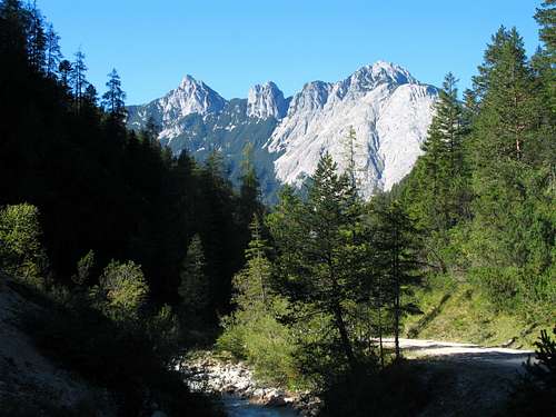
This continues around the mountain to a shoulder, the Schlagsattel (1480m). There are good views northwards here towards the Ahrnplattenspitze and the Wetterstein mountains beyond.
After this, you emerge onto a service road and this continues down towards the main Seefeld – Scharnitz railway line and road. The shortest route is to continue on the pathway to the left (no 6) and follow the railway line back to Seefeld.
Alternatively, cross the railway and the road to gain the path to the Bodenalm and continue back towards Seefeld via the Lehenwald area.
|
|
Section 6. Descending the Eppzirler tal (Part 2).
Continue easily down the track (path nos 15 or 212 on the map) towards Geissenbach. Ahead you will see views of the Grosse Ahrnspitze.
Continue for about 3.2km/2 miles until the track ends at a car park and a crossing point for the railway line, the station is to your left about 100m away.
Section 7. Geissenbach to Seefeld.
Once you have reached Geissenbach, you have several choices:
Firstly, you can catch the train back to Seefeld from the station. See the timetable for options.
At certain times, this station is a “request” stop so take care with this. On one occasion, we had to make the journey between Seefeld and Scharnitz 3 times before we could get the train to stop to let us off, and this was with the assistance of the ticket collector!
Secondly, there is a bus stop on the main road in front of the station so, it’s possible to get a bus back instead again, see the timetable.
Across the main road from here there is a Hotel/Bar serving refreshments if you have to wait for any length of time. On our visit, they had a fine collection of caged birds of prey.
Thirdly, you can walk back to Seefeld along paths no 19 and 65 parallel to the main Seefeld – Scharnitz road. Cross at the bus stop and continue past houses to join path no 19. Take path no 65 to return to Seefeld via the Bodenalm.
Essential Gear
Walking gear, food, water, map.
No technical equipment required.
|
|
External Links
https://www.seefeld.com/en/summer-3
http://www.noerdlingerhuette.at/