|
|
Trip Report |
|---|---|
|
|
47.45507°N / 11.77297°E |
|
|
Sep 6, 2018 |
|
|
Hiking, Mountaineering |
|
|
Summer, Fall |
Rofan circuit
(Rotspitze 2067m, Dalfazer Rosskopf 2143m, Dalfazer Wande 2233m, Streichkopf 2243m, Hochiss 2299m)
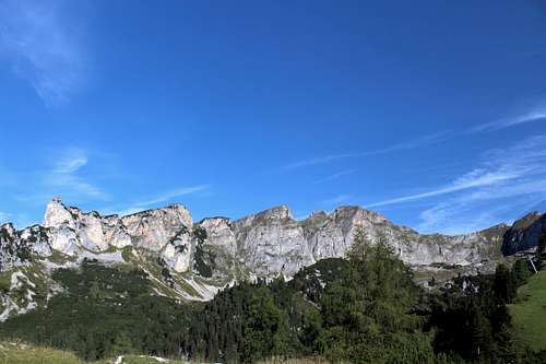
I am often surprised at how my expectation of how an area looks is confounded by the reality once I visit it. I had read descriptions of the Rofan mountains (Brandenberger Alpen) and even seen photos, my impressions of what I would find were of rough, Limestone rock ridges, complete with the occasional “sport” Klettersteig and some cabling to protect some of the scrambling. Similarities with the Italian dolomites came to mind but I found these mountains to be different.
Rotspitze (2067m)
We performed our (by now) familiar routine of bus from Pertisau to Maurach, then cable car to whisk us up to 1834m to start our route.
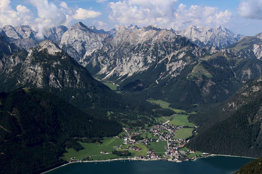
It was a lovely clear morning, for once even the low Achensee cloud had cleared and the air had a fresh feel to it.
From the Rofanseilbahn we had great views of the Ebner Joch in early morning mist. Whichever way you look at it, the Ebner Joch looks steep and seems to be a more formidable mountain than it actually is.
Our route looked good on the map. A circuit – mainly on high ridges - described as “an average “Red” mountain path” according to the local website with some sections “secured by ropes”. I had a suspicion that this might be a popular route.
We descended from the Rofanseilbahn westwards on the “Enzianweg” towards the Dafazalm mountain hut under clear blue skies and warm, pleasant sunshine.
Along the way, we spoke to some Austrians who asked where we were from. They were surprised to find we were from England and Ireland. We have noticed that even the most popular resorts in Austria and Italy seem to have fewer UK visitors now… is this part of the “Brexit” effect or just a modern lack of interest in traditional mountain holidays? The main sounds we heard as walked along were the birds singing and the jingles from a multitude of Cow bells! Gradually, we descended.
At the signpost for the Rotspitze, we sat on a bench to change into shorts and have a drink. A sole walker arrived and continued on our proposed route, seemingly confirming my suspicions that in good weather, this route would be crowded.
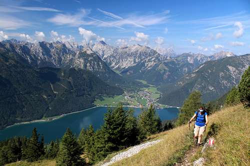
Refreshed, we set off up the steeper path at first through the long grass, then later through trees which shrank in size as we ascended until they were all the familiar low growing pine trees.
Fantastic views across the Achensee towards Pertisau and the Karwendel range spreading westwards, the town of Maurach beneath us and across to the Barenkopf, Stanser Joch ridge and the Inn valley beyond. Is that the Hintertux glacier we can see in the distance? The going through the trees got steeper and rougher.
Behind me, I could near Marie muttering to herself.
“Are you ok?” I asked.
“This is really awkward, especially with my poles,” Marie replied. “I’m putting them away.”
The roots of the trees, damp in the morning dew were making progress slippery and uncomfortable. However, the roots can be good hand holds on the steeper parts. We emerged from the trees onto rock and scrambled upwards, meeting the lone walker we had seen earlier on her way down.
The wooden cross on the summit of the Rotspitze became visible as we neared a buttress of rock, scrambling around and up it we looked across to the summit of the Rotspitze (2067m), a separate pinnacle of rock, overlooking the grassy alps below.
Two walkers were there already and as we scrambled upwards, they flew their drone around to film their spectacular position on the summit.
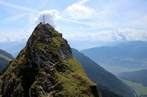
We arrived and chatted to the young lady.
“Where were we from”…”Was this our first time in Austria”…”Where had we been?”
We told them where we were from and of our travels over the years…
“all the Tyrol hotspots!”, she joked but she was impressed that we had climbed so many Austrian mountains.
She took a photo of us and we left them alone to continue our route.
We retraced our steps back down from the pinnacle and sat on the grass in the sunshine for a break and a bite to eat.
Soon we heard approaching voices, so we packed up and continued on our route, once again scrambling through low growing pine trees.
Dalfazer Rosskopf 2143m, Dalfazer Wande 2233m.
We emerged onto a grassy slope and soon were on the Dalfazer Rosskopf (2143m) standing next to the TV mast/aerial we had been aiming for.
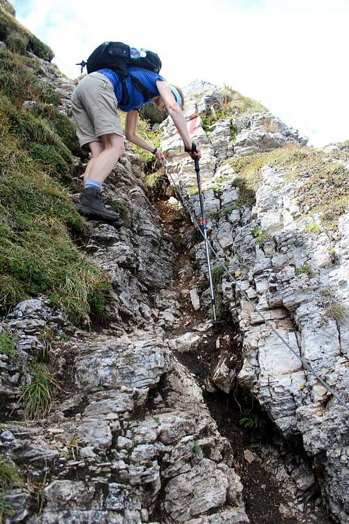
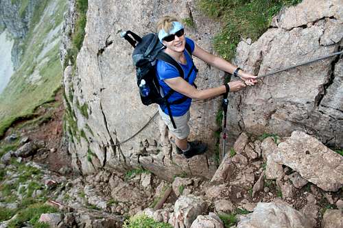
The way ahead looked easy, just a grassy slope but as we continued I started to have doubts. The hillside seemed to drop away steeply and sure enough we found ourselves at the top of a steep, rocky gully albeit one protected by a cable.
Down we went, not as bad as it looked once we got started and soon we reached the next grassy slope.
Looking back towards the Rotspitze, a large group had arrived at the top. No doubt the owners of the voices we had heard earlier. I expected either the new group or the couple we had met on the summit to catch us up later but we saw no more of any of them during the rest of the day.
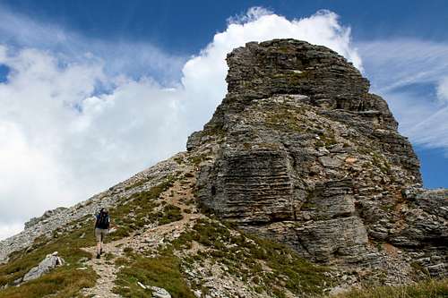
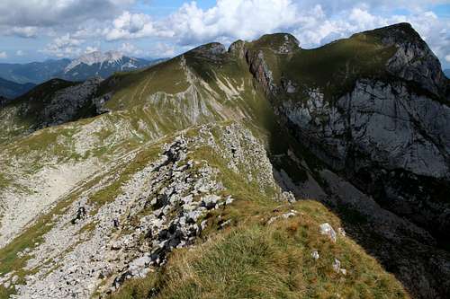
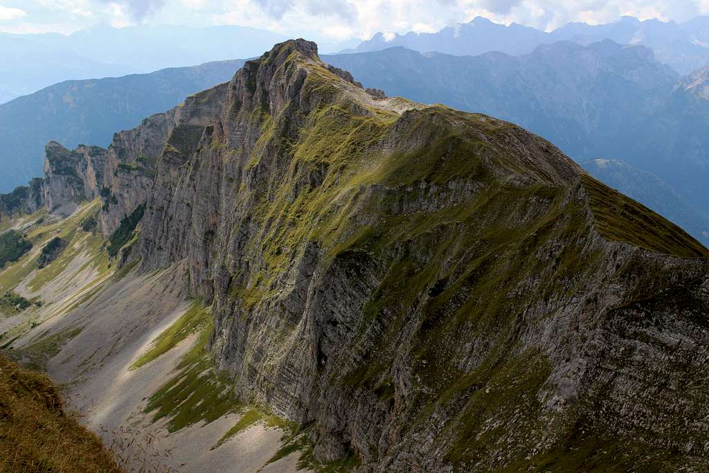
We traversed the Dalfazer Wande, passing the broken rock pillars that stand guard along the crest of the ridge until we reached the high point at 2233m. Marie continued along the path beneath the summit whilst I scrambled up the grassy slope to the top.
I saw no cross or cairn to suggest which was the highest point and soon continued along the broken, grassy crest to rejoin Marie on the path below.
Around this time, we heard shouts and laughs from somewhere ahead of us. Scanning the mountain Marie suddenly exclaimed, “Look at that group of people!”
I followed her pointing finger and saw a large group descending a gully ahead and causing quite a commotion whilst doing it. (Later we realised they were descending the cables of the Rote Kamml”, hence the shouting.)
“I count 25 I think,” Marie announced.
My heart sank, they would all have to pass us going the opposite way, I assumed we would have to stand aside while they took ages to pass. In reality, they all descended towards Steinernes Tor above the Dalfazalm, on a path well beneath us and we only heard their shouts and laughter from a distance.
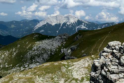
The views were getting better all the time. We could see across the Achensee towards the Seekarlspitze – Seebergspitze traverse we had done the previous day. The descent and re-ascent that the traverse entailed looked nowhere near as steep from a distance, as it did at the time.
Northwards, the Guffertspitze stood out in the sunshine. The brilliant white limestone rock looked like an iceberg floating in a “sea” of green grass and trees. Southwards the view was dominated by the Gschollkopf (2038m), its summit providing the jumping off point for the “Rofanair” zipwire and the Rofanseilbahn, the Inn valley and beyond, hazy ridges and mountains.
We stopped to have our lunch and were immediately surrounded by the cheeky Choughs that inhabit every mountain, on the lookout for scraps. Although we sat just off the path, it was really quiet and no one passed us in either direction.
|
|
|
Streichkopf 2243m, Hochiss 2299m
After lunch, more clouds had appeared but it was still very pleasant. We continued along underneath the Streichkopf (2243m) and descended around the mountainside to the Rote Kamml gully, where we met the first people we had seen for ages, a woman with 3 children descending the stemples/cables.
Looking back over our route, the Dalfazer Wande looked spectacular, its grassy slopes shone like velvet in the afternoon sun.
Our path joined the main path rising up from the Rofanseilbahn at a col and after a short stop, we continued.
We headed for the summit of Hochiss (2299m) and finally, we encountered numerous groups either going up or down the final slope to the highest of the Rofan summits.
I took a few photos and looking eastwards, I spied the Wilder Kaiser mountains through the afternoon haze. We had been used to solitude for most of the day but the summit was crowded and soon we headed back the way we had just come to the meeting of the paths at the col.
From here we headed eastwards and down on path 413, passing first underneath the summit and then the start of the “5 Gipfel Klettersteig”.
Down, passing the Gschollkopf and back to the Rofanseilbahn whilst paragliders launched themselves into the afternoon air.
The Erfurter Hutte was crowded in the late afternoon sun so we jumped onto the next gondola to bring us back to earth.
Good day?
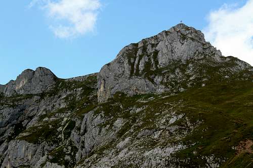
A very good route, it was surprising how few people there were around considering how nice the weather was. Although it had only taken us 5 ½ hours for the whole trip, looking back it looked a long, spectacular route.
The Rofan massif was not how I had imagined it would be. There were a lot more grassy pastures and it was more open than I had thought. It has its own atmosphere.
We had both imagined it would be like the Catinacco and much rougher than it was! The crowds the Catinacco attract were also absent although, that may not be the case all year round.
I had studied the view to the east as we descended, those tops would have to wait until next time.

