
-
 5234 Hits
-
 73.06% Score
-
 3 Votes
|
|
Route |
|---|---|
|
|
39.82136°N / 111.76134°W |
|
|
Mixed |
|
|
Spring, Summer, Fall |
|
|
A long day |
|
|
Class 4 |
|
|
Exposure and Rotten Rock |
|
|
Overview
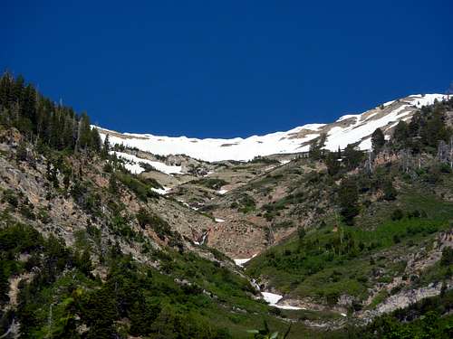 The South Basin from Bear Canyon Campground and the Right Fork Salt Creek Trail, early morning, late June. | 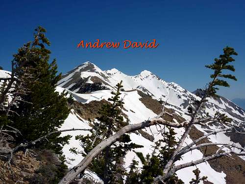 Taken from the buried Mount Nebo Trail to South Summit, before we "invented" The Wet Ladder. A good reason to head up Mount Nebo. | 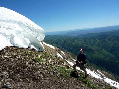 Posing near the top of South Basin area. |
This is another route I discovered by accident, although with a friend for once. In late June we lost the Nebo Bench Trail in heavy snow on a descent from the South Summit and wound up looking straight down the South Basin directly to Bear Canyon Campground below. Having hiked 8 miles up and scrambled some of the ridge to the Middle Summit, this short cut looked inviting in early afternoon, and I said I thought it would "go". Well, it does, though the terrain includes loose scree, crumbly ledges, bushwhack, waterfalls, snow, and wet feet- all are possible depending on season. This likely will not reduce your time on the mountain much, but it offers the chance to create a more interesting loop, test your off-trail skills, and to prepare for more wild adventures, such as trips to the Picketts or the Mission Range, or any adventure where you will be route-finding and dealing with the unknown.
The route can be done on ascent or descent, and is probably easier to follow as an ascent the first time, starting at Bear Canyon Campground. At elevation near the Nebo Bench Trail, at or around 9500 feet, a snowfield is probable until late summer, at which point you can take Nebo Bench Trail south if you find it, or pick any line you like up towards the South summit, avoiding typical and prominent cornices.
Bailing once committed is no easy task. The fellow I was with was trooping through, but had blisters, the wrong sort of boots, and clearly was not enjoying the descent. I was worried he was heading towards a stress-out and fall, and so talked him into climbing our way back out. That turned out to be much worse than just following the drainage and sticking near the water and after some trying hours we eventually found the Andrew's Ridge Trail and reached our cars near the Southern TH of the Nebo's Bench Trail a little after midnight- after starting at 6 am! I tracked the route from the bottom next morning to see how the rest of the descent would have been and it looks like the worst of the basin is near the elevations between about 8,500 feet and 7,000 feet.
This is definitely a route that can lead to problems, injury, and helicopter rescues, so do not go in light in spirit. Have the right attitude and take this seriously if you try it. Take emergency gear, plenty of food, water pills, drops, or filter, and overnight gear may be a good idea also.
***I should note that for those wondering why the South Basin is on the East of Mount Nebo, that there are 3 summits of Nebo, and each has an associated basin to the East. So South Summit has South Basin, Middle Nebo has Middle Basin, and North Summit has North Basin. To North of that is Hell Hole Basin, likely a real charmer. I have not tested all of these, and probably will not.***
Getting There
 This is either your approach trail or your last stretch. A treat either way. Right Fork Salt Creek Trail from Bear Canyon Campground. And flat. | 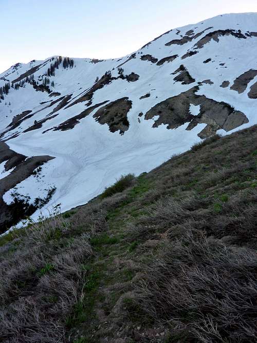 Nebo Bench Trail after our retreat. Heavy snow makes it disappear in places early summer, as you may notice. | 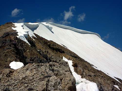 Cornices near South Summit must be avoided on descent by any route. |
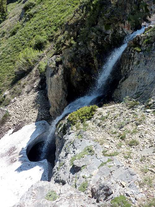
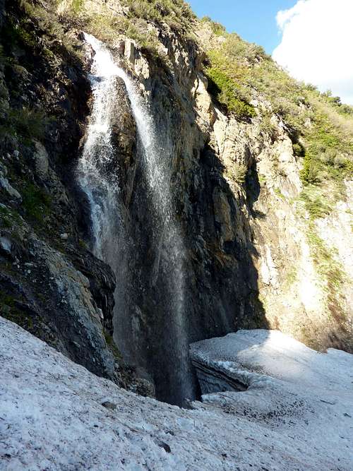 Third waterfall from the top of the basin. |  |
For an ascent:
Bear Canyon Campground is located along the Nebo Loop Road, near the South end. From the town of Nephi take the 132 Road to the Nebo Loop, and watch for appropriate signs. Take a left fork once on the Loop Road leading to Ponderosa and Bear Canyon Campgrounds as well as the Nebo Bench Trail Trailhead. Bear Canyon Campground is at the end of this fork and is a beautiful area with several hiking options. An obvious trail heads West towards the South Basin of Mount Nebo. This is the Right Fork Salt Creek Trail. Follow this to the first minor stream crossing and then head West into the basin, aiming for some prominent waterfalls.
For a descent:
From the South Summit of Mount Nebo, follow the standard Mount Nebo Trail 1/2 mile South until past cornices seen on the way to the summit. Using crampons and axe take any line you like down the snowfields to the East and into the South Basin. Look for a granite fin, or pyramid down below, and signs of the campground thousands of feet below. The fin sticks out of the forest and is easy to notice. This fin shares an elevation with the campground, will remain central to your view for the whole descent and is located right on the Right Fork Salt Creek Trail, less than 1/2 mile from the campground. See the pictures to get a good look at it if you are worried about picking it out. There is no way to lose the route once in the basin as long as you stay near the drainage and water. You will have to cross it several times, go over snow patches, may need to get your feet wet, climb some cliffs or ledges on either side, bushwhack around it, or do any other number of things, but keep near the water and you literally cannot get lost.
Route Description
This route follows the drainage of the South Basin, passing around and near 4 or 5 waterfalls. The mileage from Bear Canyon Campground to the South Summit of Mount Nebo using this "wet ladder" route is approximately 2.5 miles. As the more typical walk to the South Summit is on the order of 8 miles, this is clearly a shortcut which will be steep and challenging. If it were not, the real trail would go up this way. As it is, I speculate very few humans have ever gone via this route. That is part of the appeal, and part of the warning. You need route-finding skills, should know how to build and tie anchors, belay, and need to anticipate difficulties. The route is intuitive and obvious and needs little more in the way of words. Check the pictures for examples of the travel and what your experience will be like if you and your team decide to bail. This can be a high stress route and is a bit of a proving ground for off-trail exploration. If you have never stepped off a trail before, then please try doing so elsewhere first so you do not get in trouble in the South Basin and put a curse on me.In winter, this route would require a long ski approach, and would be avalanche dangerous. However, this would be a direct snow climb then. In early spring, most of the water and scree hazards would be solved as well with a very direct crampon run. The entire route might be glissaded or skied as a descent in very little time. I am only speculating though. I thought conditions were nearly perfect in June, in that we had a mix of every kind of footing. If I am going to carry crampons, I want to use them, but I also like lush green forests below and not being on snow continuously. June and July, are the ideal season, in my opinion.
That should spark the interest of a few. If you need or want a whole lot more information, then probably steer clear of this particular trip. A long detailed guide won't save anyone on The Wet Ladder.
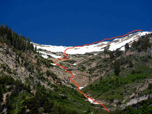 Approximate route of travel marked in orange. | 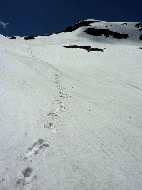 Snowfield descent due East into the South Basin. | 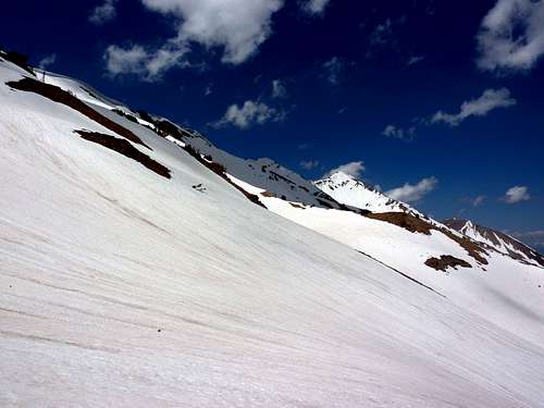 Snowfields near elevation of the Nebo Bench Trail which crosses above the South, Middle, and North Basins on the East of Mount Nebo's 3 summits. |
 Closer to canyoneering than mountaineering at times, this route can get pretty scenic, while being pretty steep. | 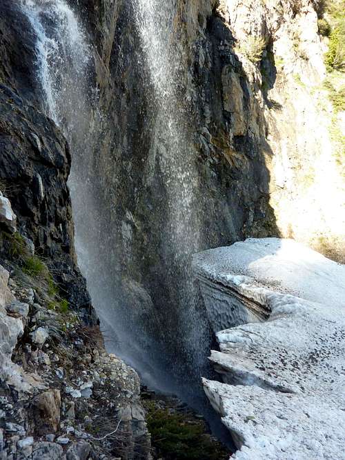 The crux of our snow travel. Steep and hard ice with collapse potential, water audible beneath us. | 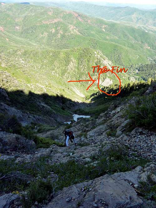 Your marker circled and pointed to by arrow. More visible from near the drainage. This was taken during our 2,000 foot elevation GAIN bail. Campground would be visible just right of fin for most of the descent. |
Essential Gear
This route could be soloed and done without rope. Solo travel is not advisable, however. I think for most of the way, it should be done unroped as the footing is bad and steep often. You do not want a minor slip by one team member injuring everyone. However, strongly recommended is a 20 meter rope- or longer, and at least one belay device. Protection will do little good on scree ledges and crumbling rock, but at some spots many climbers will want at least some gear, even if the benefit is compromised. Water should be available, but in late August or September, it may not be for much of the way. Having not gone in those months, I cannot say. Crampons recommended, as well as alpine axe, or trekking poles. Bring food for at least 10 hours, as it is difficult to imagine any party going up Mount Nebo and descending in less than that, even with this short cut, unless it has been explored previously. All of this gear would have made the experience of my friend and I much better- especially for him, because he is used to roped climbing, mostly in the gym.Wear pants! And I suggest long sleeves. I hate bushwhacking when my skin is exposed to slashing and thorns.