
|
|
Route |
|---|---|
|
|
47.09920°N / 12.74530°E |
|
|
Hiking, Scrambling |
|
|
Spring, Summer, Fall, Winter |
|
|
Half a day |
|
|
F, UIAA I |
|
|
Overview
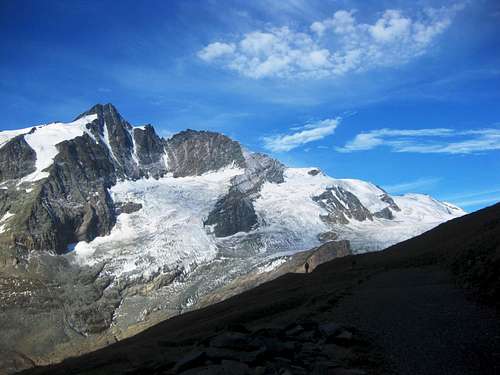
The Fuscherkarkopf is a deceptively easy mountain in the Glockner group. It might appear a nice goal for a day hike, but even the easiest route, along the South Ridge to the NW summit, is very exposed at some places, and the final part of the normal route involves a bit scrambling. Not quite a walk up.All along the route, from the Gamsgrubenweg to the summit, there are excellent views of the mountains of the Glockner group.
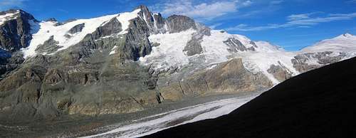
The main ridge of the Glockner group

On the exposed summit ridge
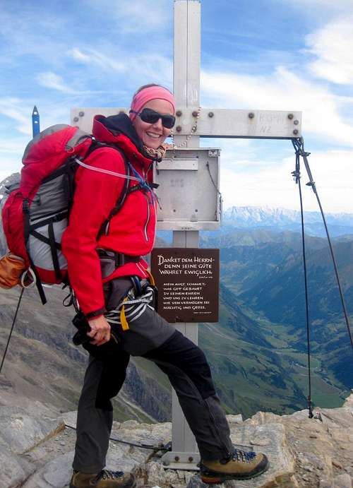
Summit cross
Even so, the south ridge to the NW-summit offers the easiest route to the main summit of the Fuscherkarkopf. It starts at the Gamsgrubenweg, and after the NW-summit it turns east to southeast, following the ridge to the true summit. For hikers, the south ridge is a difficult and sometimes exposed hiking trail, partly secured by steel cables, but for climbers it's easy.
The summit ridge between the NW summit and the true one has no such protection, but is even more exposed and involves a bit of scrambling. Not really a hiking trail anymore!
Getting There
By public bus or by car (via the Glocknerstraße, a toll road) to the Franz-Josefshöhe (47.075,12.751). Parking is free.Route Description
On the Gamsgrubenweg

The trailhead

Low on the trail to the south ridge
From the Franz-Josefshöhe, walk along the gently ascending Gamsgrubenweg to the north-east for an hour or so, past the Hofmannshütte (47.08594,12.73800). Despite its prime location, it has been closed due to its poor condition for quite a while now, and according to its site it will be torn down soon. Not far past the hut, you'll see the sign to the Fuscherkarkopf, just before reaching the south ridge to the NW summit. Before you reach the sign, there are several other vague trails heading off to the north as well, but the area north of the road, the Gamsgrube, is a protected environment and off limits.

The exposed summit ridge

False summit
If the slabs are dry, you can continue up the south ridge, over more slabs, along some cables, a short downward section, and then up again, all the way to the north west summit (3252m) (47.09980,12.73993). At times, the rocks can be a bit loose. It is a difficult hiking route, but still feasible without using hands. From the Gamsgrubenweg, it takes about 2,5 hours to get here.
To get to the real summit, is a little bit beyond mere hiking. Go west along the exposed summit ridge. There is one false summit, and a couple of easy scrambling sections, UIAA I. While the scrambling is easy, falling would be very dangerous, and there are no cables on this part anymore! We roped up.
 Mittlerer Bärenkopf seen from the south ridge trail
 |  Scrambling down
 |  Almost at the NW summit
 |  On the summit ridge
 |
Some route suggestions
From Franz-Josefshöhe to the true summit takes about 4 hours, one way. Of course, you also have to go back down, which, while faster, still makes it a full day trip. After returning to the NW summit, instead of descending the S ridge, we continued by the NW-ridge instead. With sections UIAA II that took a bit longer.
Another option is the east ridge down to "Der Rinner", the saddle with the Sonnenwelleck, which is also UIAA II. From this saddle it's possible to descend to the south and return directly to Franz-Josefshöhe, or to continue along the ridge, go over the Sonnenwelleck itself and descend its SE-ridge.
Essential Gear
Sturdy hiking boots.Harness and rope are optional.
When there is snow or ice on the route, crampons and ice ax can be necessary.
External Links
The Grossglockner High Alpine RoadOEBB, public transport in Austria. Search for Franz-Josefshöhe.
Glocknerhaus, a nice place to stay, not far from Franz-Jozefshöhe. Great food!