|
|
Route |
|---|---|
|
|
40.70700°N / 110.912°W |
|
|
Scrambling |
|
|
Summer, Fall |
|
|
Half a day |
|
|
Mostly 3rd & 4th class, 5.4 crux. |
|
|
5.4 (YDS) |
|
|
Overview
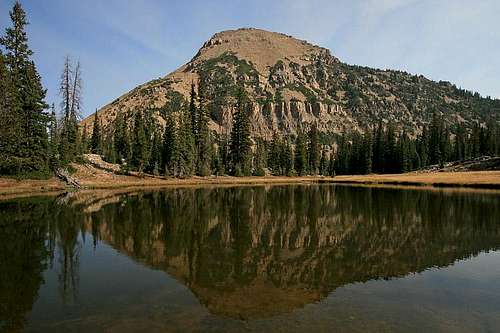
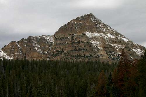
The Southeast Ridge of Reids Peak is a superb scramble that is readily accessible from the Mirror Lake Highway. There are already two route descriptions of the southeast ridge noted on summitpost.org, yet they describe the easier terrain on the ridge. I felt this additional route description would be helpful for climbers looking for a beautiful, exposed scramble that only requires a half-day, or less, to climb. Much of the ridge is 3rd and 4th class, with some spectacular exposed 5th class that I felt was around 5.4.Most hikers summit this mountain via the southeast ridge, but they avoid the ridge proper and ascend the lower west side of the ridge, which is 3rd class terrain. The ridge proper is a phenomenal scramble with exciting exposure requiring climbing skill and experience. This is the perfect climb when you only have a few hours to get away. In addition, the breathtaking size of the wilderness views and the stunning silence and solitude are incredible.
Click for the Full Trip Report on my photography website.
![Reids Peak]()
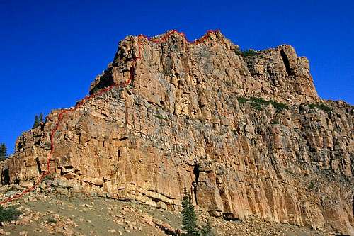
Great profile view of the Southeast Ridge Direct route. ![Bald Mountain sunrise]()
![Reids Peak]()
![Reids Peak]()
The upper block of the Southeast Ridge that contains the hardest climbing. ![Reids Peak]()
![Reids Peak]()
![Reids Peak]()
The following is copied from the Reids Peak main page:
"The main access route to the peak is from the Bald Mountain Trailhead. This signed trailhead is located off Highway 150, 29 miles east and north of Kamas or 49 miles south of Evanston. There is a sign that marks the trailhead.
Another access is from the Pass Lake Trailhead, which is located off Highway 150, 32 miles north, and east of Kamas or 46 miles south of Evanston. There is a sign that marks the trailhead."
Simply follow the ridge proper to the summit. The most difficult terrain is directly on the ridge, to avoid certain areas, always travel to the west (left) on to easy 3rd class terrain. Stick with the ridge for the best climbing.
![Reids Peak]()
![Reids Peak]()
Great profile view of the Southeast Ridge Direct route.


The upper block of the Southeast Ridge that contains the hardest climbing.

Getting There


"The main access route to the peak is from the Bald Mountain Trailhead. This signed trailhead is located off Highway 150, 29 miles east and north of Kamas or 49 miles south of Evanston. There is a sign that marks the trailhead.
Another access is from the Pass Lake Trailhead, which is located off Highway 150, 32 miles north, and east of Kamas or 46 miles south of Evanston. There is a sign that marks the trailhead."
Route Description
Depending on the trailhead you choose (Bald Mountain or Pass Lake), your goal is to follow the trail, then leave the trail and routefind as necessary to reach the saddle between Bald Mountain and Reids Peak. This saddle is the base of the Southeast Ridge.Simply follow the ridge proper to the summit. The most difficult terrain is directly on the ridge, to avoid certain areas, always travel to the west (left) on to easy 3rd class terrain. Stick with the ridge for the best climbing.
Essential Gear
10 essentials, boots, water, etc. No rock climbing gear necessary.