
|
|
Route |
|---|---|
|
|
47.03687°N / 10.50928°E |
|
|
Hiking, Mountaineering |
|
|
Spring, Summer, Fall |
|
|
Most of a day |
|
|
T3 |
|
|
Overview
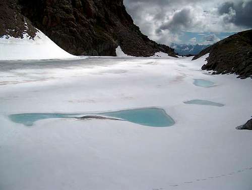
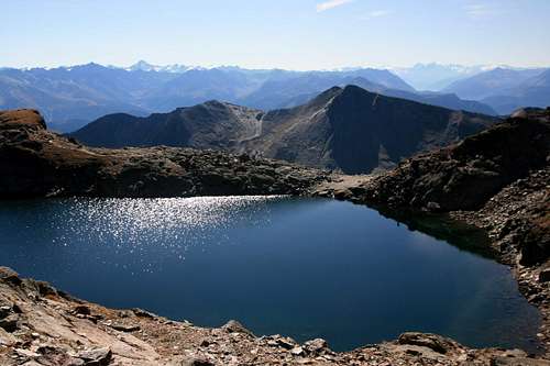
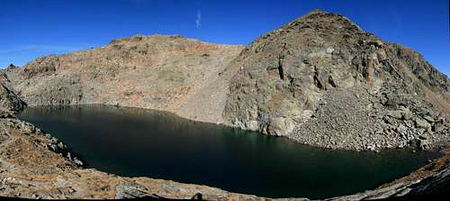 Tieftalsee panorama with Furgler behind by Mathias Zehring |
The Tieftalsee route is one of the two normal routes up to the summit of Furgler. Furgler is 3007 meters high and therefore a popular objective for collectors of 3000meter peaks. Furgler is mostly climbed from the east. This is because of the easy access from the village of Serfaus. A cableway takes you up to 2300 meters to shorten the ascent. Furgler is often referred to as the home mountain of the village of Serfaus (1427m).
Furgler has two normal routes up to the summit. The first one is the Tieftalsee route and the second the Furglersee route. This page describes the Tieftalsee route.The Tieftalsee route starts at the end of the Lazid cableway (2300m), passes the Tieftalsee (a small lake) and goes over the south side to the summit. The route is grade T3, which makes it a hike rather than a climb. It therefore is a very popular destination for hikers.
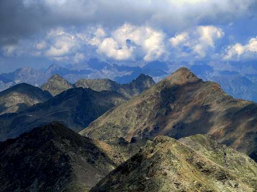
Furgler is the northernmost 3000-meter peak of the Samnaun Group. Because most peaks in the surrounding area are of lower elevation, views from the summit are excellent. You can see the whole Samnaun Group in the South. Towards the west you can see the Otztal Alps with peaks like Watzespitze, Rofelewand and Wildspitze. To the north you can see as far as Zugspitze in southern Germany.
Furgler is a great mountain to climb in a single day due to the presence of the Komperdell and Lazidbahn (cableway). Especially a round trip using one of the two main routes up and the other one down. (Tieftalsee & Furglersee routes)
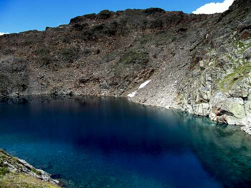 Tieftalsee (2750m) | 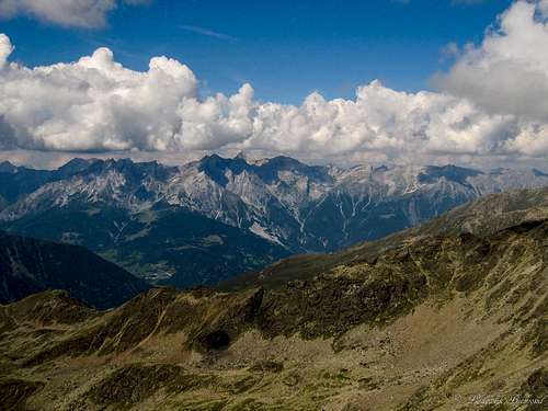 View to Hoher Riffler from the trail | 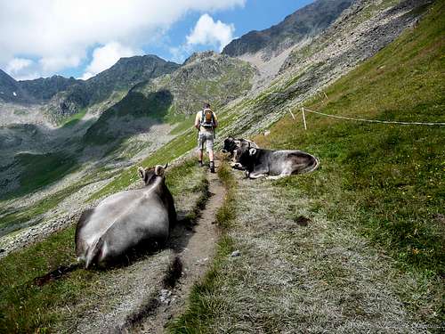 Cows on the Tieftalsee Route |
Route Description
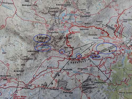 Tieftalsee Route MAP; See purple circles for the Tieftalsee Route (See Full Size image for Details) |
The Tieftalsee route starts at the Lazida restauarant at the end of the Lazid Cabelway (which starts from the village of Serfaus). The whole route is marked very well by red-white-red paintes stripes as well as yellow signposts. In addition, the trail is visible at any point on the route. Orientation therefore is easy on this mountain.
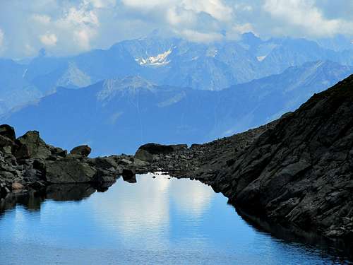
From the Lazida restaurant follow trail number 712 (see map above) towards Scheid at 2429 meters above sea level. The yellow signposts say ‘’Scheid’’. The path is very broad here. It can best be described as an unpaved road. This road leads to the Scheid at 2429m. It can be recognized by the top station of the Scheid chairlift which is part of the Serfaus ski area. Behind the chairlift a hiking trail starts, leading further up the mountain (number 25 on the map). The trail is marked very well and the trail itself is visible at any point. This trail leads up to the beautiful lake called Tieftalsee at an elevation of 2890 meters. It is a great spot for a swim or just a break. The water is coloured deep blue/green. From this point the large summit cross of Furgler can be seen clearly. Follow the trail around the lake at head up the last part of the trail.
This last part is still marked very well and at all times the trail is visible. The route becomes somewhat steeper though. Because of this last part the route is graded T3. The trail zigzag’s further up until you eventually reach the summit of Furgler at 3007 meters. (it used to be 3004 meters, but new calculations have led to the now accepted 3007 meters). As described above, summit views are exceptional.
Use the same route down again back to the Lazid cableway. Or make a traverse and take the Furglersee route down to the Komperdell or Lazid cableway. Walking down to Serfaus from Lazid is an option as well, but it will take you an additional 2,5/3 hours over easy, well marked trails (T2)
 Route planning @ Lazida | 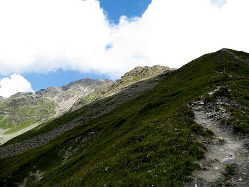 The trail above Scheid to the Tieftalsee | 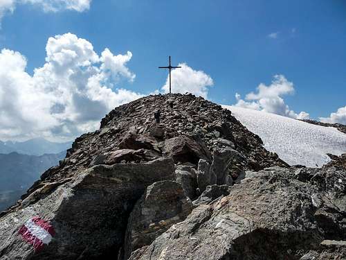 The large Summit Cross at 3007m |
Timetable
The frozen Tieftalsee (2783m). July...
Lazid – Tieftalsee - Furgler 2,5 hours
Furgler- Tieftalsee – Lazid 2 hours
Furgler – Furglersee- Lazid 2/2,5 hours
Lazid - Komperdell - Serfaus 2,5 hours
Getting There

Getting in Serfaus
By Car From Germany and Benelux:
München - Garmisch - Fernpaß - Imst - Landeck - Ried -Serfaus-Fiss-Ladis
Autobahn München - Innsbruck - Landeck - Ried - Serfaus-Fiss-Ladis
Ulm - Lindau - Bregenz - Arlberg - Landeck - Ried - Serfaus-Fiss-Ladis
Ulm - Kempten - Fernpaß - Landeck - Ried - Serfaus-Fiss-Ladis
Bozen - Meran - Rechenpaß - Ried - Serfaus-Fiss-Ladis
From Switzerland:
through the Arlberg Tunnel, then take direction Landeck.
In Landeck follow the roadsigns to Serfaus/Fiss/Ladis.
From Italy:
via the Reschen Pass or Brenner Pass.
By Train
The nearest train station is Landeck. From there via Post bus or taxi via Ried to Serfau oder Taxis über Ried nach Serfaus.
Komperdell & Lazid Cableway
For information about the Komperdell and Lazid Cableway including prices and operation hours follow this link
 Tieftalsee (2700m) | 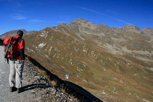 Furgler from Lazid | 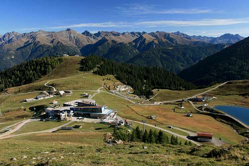 Komperdell |
Weather
sparkling Tieftalsee
With te following links you can see ther weatherforecast for Serfaus for three days.
Forecast for Serfaus at 1427m
Forecast for Serfaus at 2056m this is the endstation of the Komperdellbahn
Forecast for Serfaus at 2684m this is the endstation of the Lazidbahn
What to take & When to Climb
Summit View to the NW
The best time to climb is in the summermonths: june,july,august,september
But also winter ascents can be done!
Places to Stay
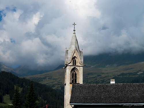
Serfauser Church with Furgler in the Clouds
Hotel
Staying in a hotel is the easiest option in Serfaus. Serfaus is a well known Winter sport's village in Tirol and therefore there are many hotels where you can stay during the summer. For hotels in Serfaus: check: Hotels
Camping
A beautiful campground in the Serfaus-area is camping Prutz. This campsite is situated in the village of Prutz, about 20 minutes (by car) aay from Serfaus. The campsite lays along the beautiful river Inn and from this campsite you have a good starting position for hikings around Serfaus and many other places (like the Kaunertal) check: Camping Prutz
Find a place to stay
With the following link you can find a place to stay in Serfaus.
On the map you can see the hotels & apartments.
You can also book directly online.
Find a place