
Comments
No comments posted yet.
|
|
Trip Report |
|---|---|
|
|
19.17979°N / 98.64241°W |
|
|
Feb 13, 2024 |
|
|
Hiking, Mountaineering, Scrambling |
|
|
Winter |
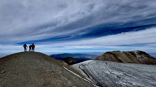
Iztaccíhuatl (5,220m) was our second acclimatization summit in preparation for Pico de Orizaba (5,564m). Our first acclimatization hike was Volcan La Malinche (4,430m). On February 13, 2024 we started on the standard route named La Arista del Sol (Ridge of the Sun). Along this route, we stood on 6 named peaks: Primera Rodilla (5,047m), Segundo Rodilla (5,074m), Monte de Venus (5108m), Pena Ordonez (5,119m), and two named Iztaccíhuatl (5,200m and 5215m). To spend more time at higher elevations, we decided to split the climb between two days and camp at 4,700 meters.
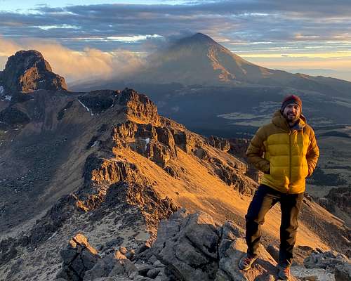
Iztaccíhuatl is the third highest mountain in Mexico, and the seventh highest in North America. The name means "White woman" in the Nahuatl language. When viewing the snow covered mountain from the west, distinct peaks resemble the head, chest, knees and feet. Iztaccíhuatl is connected by the Paso de Cortés to the active volcano Popocatépetl (Popo). The night sky is lit up on the West side by Mexico City, and the East Side by Puebla. The volcano is also known as Ixtaccihuatl, Izta, or Ixta.
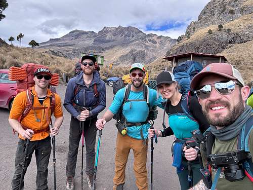
Team: Mike Gonzc, Cam Crosby, Ken Dalton, Chelsea Stedford, Ivo Stedford
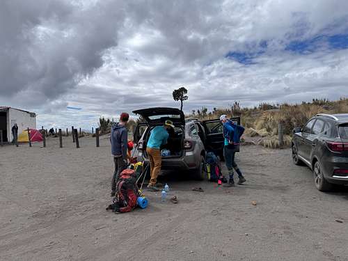
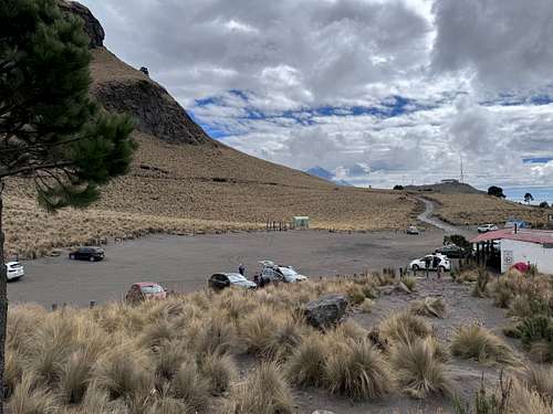
After some sightseeing in Cholula, we made our way to Izta and arrived at the La Joya Trailhead around 2:00 pm. The trail starts at a large parking lot with tent pads and shelters, a few buildings, and locked outhouse. We geared up and started hiking around 2:30 pm.
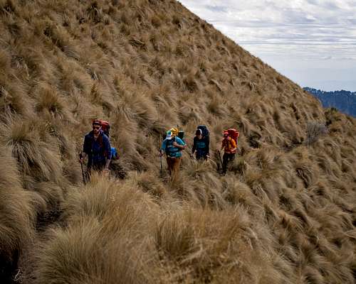
The trail is very well established and in mostly good condition. We found the grade pretty gradual as we traversed across grassy hills and below cliff-bands. The few steep sections had decent switchbacks to follow. There were a few viewpoints along the way that made for good rest stops.
There are no water sources on Izta, so we each carried five to six litres of water along with the additional gear required for camping overnight. We all felt the affects of high elevation, especially with heavy packs.
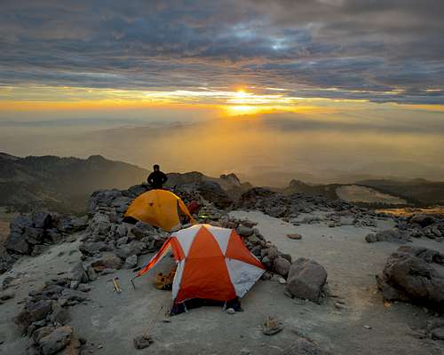
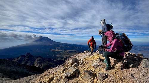
Our plan was to hike until either someone was exhausted, affected by elevation, or we found a kick-ass spot to setup camp. After four hours, we reached a high point on the ridge before it drops down to the Grupo de Los Cien hut. The sun was setting and we had an epic view of Popo spewing smoke and ash from the other side of Paso de Cortés. We were exhausted, and this was a kick-ass spot, so we stopped for the night.
Things cooled off quickly with the higher elevation, setting sun, and an unanticipated windstorm. We expected 30-45 kmh winds, but they were intensified by the valley and ridge we chose the camp on. Of course the best location for viewing Popo during sunset and sunrise would be on the most exposed part of the ridge. We took a few photos and spent the rest of the evening in shelter from the growing intensity of the wind. After sharing a stove to boil water and cook meals, we all retired to our tents and tried to sleep. The temperature plummeted with the windchill, I would guess it was around -15 celsius. The wind howling across the rocky ridge and the flapping of the tent made it difficult to sleep, even with earplugs. Our little tents were cold and noisy, but they seemed to protect us from a perceivably extreme environment around us.
The next day we met a gentleman at the Grupo de Los Cien hut who mentioned there was an extreme wind warning. We didn't get that memo when registering at the National Park Office, but that explains why no other groups had made the approach to climb the same day we did.
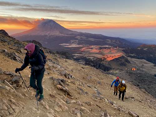
We woke up at 5:30am, had breakfast, and caught first light for an incredible sunrise.
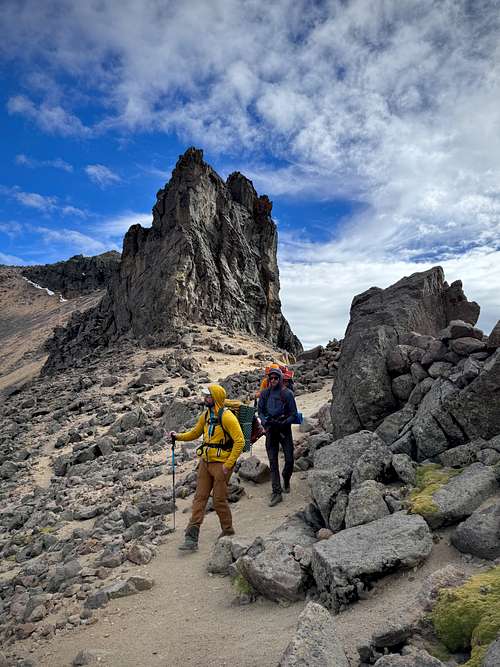
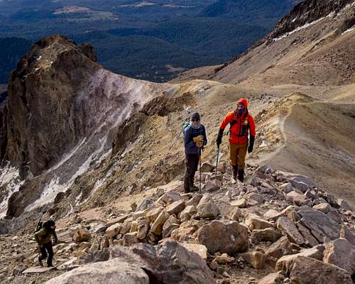
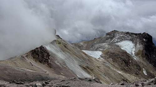
We left our tents just before 7:00 am. After passing the Grupo de Los Cien hut, a steep slope led to a section that required some scrambling and a little route-finding. This section is sometimes referred to as the crux in trip reports, or “Tumbaburros” on maps. With dry conditions and great visibility, we didn’t find this section very difficult and there was only minimal exposure in a few spots (compared to Rockies standards).
Travelling on the ridge was significantly easier as the elevation gain tapered off. The first two peaks we travelled over were “the knees” of Iztaccíhuatl, named Primera Rodilla and Segunda Rodilla. While hiking up Segunda Rodilla, we noticed a bypass trail to our right that would save gaining unnecessary elevation on the way back. We noticed a few more bypasses along the way.
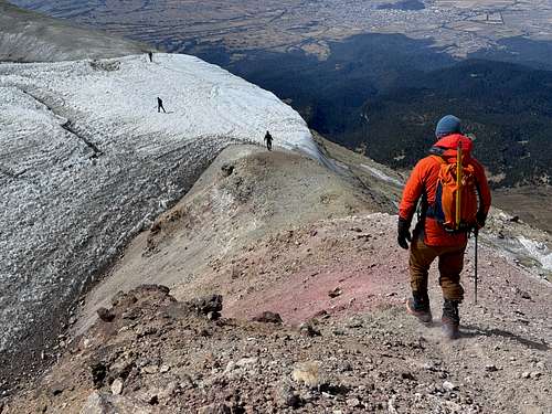
Next was Monte de Venus. From this peak, we had a great perspective of the whole mountain. It was still windy, so we found shelter behind a small cliff and took a break. The glacier started about 50 meters below us, so we put on crampons here.
The glacier is steep, and somewhat intimidating from a distance. However, the sun-beat ice had lots of little divots and ledges for solid footholds. We occasionally followed the remanence of a path that had been established in previous snow, which made it a little easier on the ankles. After descending the ice, we walked across glacial till and 100 meters or so of horizontal glacier. With bare ice, we could see there were no crevasses.
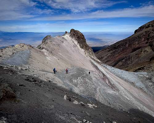
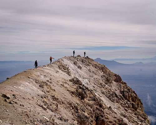
A steep slope brought us back to the ridge line and to the section I think is considered “Arista del Sol” (Ridge of the Sun). The terrain and the views are quite extraordinary.
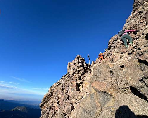
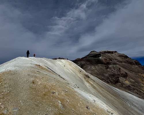
We were faced with a few discrepancies as to the true summit of Iztaccíhuatl. The “official” summit on the map was noticeably lower than other accessible peaks nearby, even though most public .gpx tracks ended here. A faint trail led us to a peak on the west side of the crater. From there we determined a peak to the northeast could be higher, so we descended and crossed a short section of glacier to ascend the north side of the crater.
At this peak, we found a survey monument, a cairn, a cross, and other evidence that this is considered the true high point summit of Iztaccíhuatl. After four hours, we were finally on top of the third highest summit in Mexico!
At approximately 5,220 meters above sea level, our GPS devices all indicated this peak was the highest elevation we had reached. With that said, we found our recorded peak elevations to be ten to twenty meters lower than what was noted on topographic maps. For the map elevation of 5,230 meters for the summit, my guess is this may have been true when standing on a glacier that is no longer there.
Following the same route, and taking as many bypasses as possible, it took 2.5 hours to return to camp. One trail bypassing the highpoint on Arista del Sol led to some pretty good exposure. The narrow part of the ledge was loose, but short.
We quickly packed up camp and eagerly made our way back to the parking lot in 1.5 hours. We only took a few water breaks, and one to sign a register at “Portillo 2” (lookout point). There were a few large groups on their way up, a reminder of how lucky we were to have had the mountain to ourselves all day.
This is one of my favourite trips. Our bivy spot on the ridge had the most amazing view of an erupting Popocatépetl during the sunset and sunrise. I recall peaking out from the tent to see the night sky brightly lit by the night lights of Mexico City and Puebla. I remember feeling safe and secure in the tent as the temperatures dropped and the wind relentlessly howled. Theres just something about that feeling I can’t put into words.
I love long ridges with variable terrain, and Izta had all that and more. Sharing all this with an awesome group of friends made it a memory that will last for life. It was also a pretty epic Valentines Day for Chelsea and I.
Based on our factors of success, this trip was a SUCCESS!
Elevations are based on what I recorded on my Garmin Fenix 6 watch
We used google to plot our route and checked GaiaGPS as a backup. It proved wise to have a backup as google took us on a route that wouldn’t have worked because it bypassed the National Park Office and entrance. We rented a Renault Duster, which we aptly named “El Dusto”. For a small SUV with bald tires, it did fine on the dirt roads that switchback up to the National Park Office. Travel time was about 3 hours for the 65 km trip from Puebla. On the way, we stopped in Cholula to visit the impressive Santuario de Nuestra Señora de los Remedios.
With good weather and dry conditions, we found this route to be a mostly non-technical hike. The exception was about 60m of steep ice, that required crampons and an ice axe. We didn’t use crampons when crossing the second glacier to access the north side of the crater. Fresh snow or wet rock would likely increase the overall difficulty.
Splitting the trip into two days made things a lot easier, especially managing the affects of high elevation. This route is almost entirely above 4,000 meters.
For camping, Chelsea and I brought a 3 season tent, sleep pads, -9*C sleeping bags, and a Jetboil stove. We picked up propane for our stove in Puebla at Orígenes Puebla. Our clothing layers would keep us comfortable to -20*C, even though we didn’t have temperatures that cold.
A few of us were cold overnight, so a warmer sleeping bag or clothing would have made a difference.
I would recommend splitting this trip up into two days as we did. Spending this much time camping and hiking above 4,700 meters was great for acclimatization in preparation for Pico de Orizaba.
More photos from this trip on Flickr
You can also find me on Instagram