
-
 2329 Hits
-
 71.06% Score
-
 1 Votes
|
|
Area/Range |
|---|---|
|
|
38.01033°N / 23.76353°E |
|
|
Hiking, Bouldering, Scrambling |
|
|
Spring, Summer, Fall, Winter |
|
|
1050 ft / 320 m |
|
|
Overview
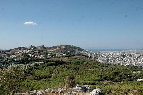
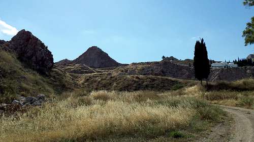
A multy activity mountain range amidst Athens. With two main mountains, multiple 300+ meter peaks and amazing views it offers hours of activities. Many trails, peaks, walls and boulders make up the lunar landscape of the area. The two mounts, throne of zeus located at (38.025246, 23.769025) overlooking filothei; and the psyxiko plateau, home of many high peaks.
It offers great scrambling routes and fun hiking just above Athens, most of the routes on the peaks are empty and are quite dangerous but fun.
Upper Athenian Pano
Getting There
There are roads that head up both hills. You can drive all the way up to the throne of zeus hill but you can't really drive up to the plateau. There are many trails running around both hills and access to all the highest peaks is rather easy. Here are the primary locations for you to explore the area.Psyxiko Plateau
There are three acsses points, the North, main and fianly miners entrance.
- North: Perseos 11B (38.014244, 23.763448)
- Middle: Dolasik 24 (38.011421, 23.765315)
- Miners: Xrusanthemon 4 (38.009410, 23.769281)
You can acsses every peak from all these points but it depends on where you want to start. My personal favourite is the Middle that has fast acsses to Outcrop Tower my favourite peak. Use the map to find better acsses points for your climbing plan, since the range is in an urban area there are many roads all around the area.
Public Transport
You can acsses Miners entrance by public transport by the bus 653 at the stop NTAMARIA.
Throne of Zeus
The filothei peak is only acssesed by two points:
- West: Karaiskaki 6 (38.023282, 23.768622)
- East: Athanasiou Diakou 43 (38.027387, 23.769730)
You can acsses the West enterance by public transport using the bus 610 at the stop IDRIMA KON.KARAMANLI.
Divisions
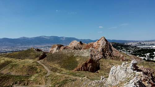
These mountains are divided in multiple areas, the first division is between the Filothei and Psyxiko where you can find in the filothei area the hill called "Throne of Zues" and in the Psyxiko area you can find all of the following:

The Phxixiko Area Map
Denoted with green is the Northern range, home of the highest and best climbs of the areas.
Denoted with red is the Outback range, home of smaller more extreme and out of reach peaks
Denoted with yellow is the Miner plateau the reminant of an old mine and some areas of no interest.
This area is the main area of this page and the area where the coordinates are directed to. We have seen the sumdivisions of the Psyxiko area, here are the peaks:

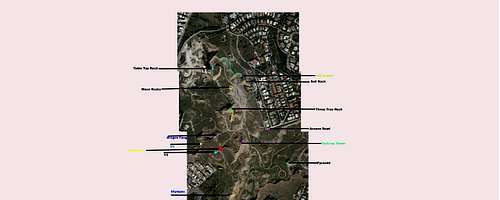
The Psyxiko Area map
In the map you can see the peaks denoted with colors.
Denoted with Purple (top) is Table Top Rock at 300m elevation.
Denoted with Green is Sail Rock at 305m elevation.
Denoted with Yellow is Three Tree Rock at an elevation of 322m being the highest in the area.
Denoted with Orange is Outcrop Tower at 310m elevation.
Denoted with Blue is Dragon Fang at 303m elevation.
Denoted with Light Blue is Church Tower at unkonwn elevation
Denoted with Red is Olympus at 308m elevation.
Denoted with Pink is Pyramid Ridge at unkonwn elevation.
Northern Range
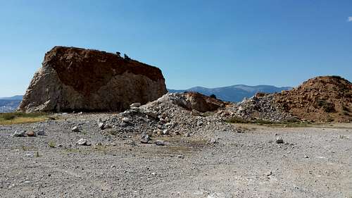
Table Top Rock
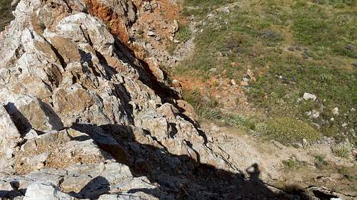
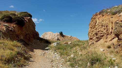
The insane vertical face of Table Top Rock with one of the most extreme acsses trails is a fun and small climb with only a small non technical walk to summit. The crux of the trail a thin spot just 20cm wide with 20+m high cliffs on both sides make for a fun and scary climb.
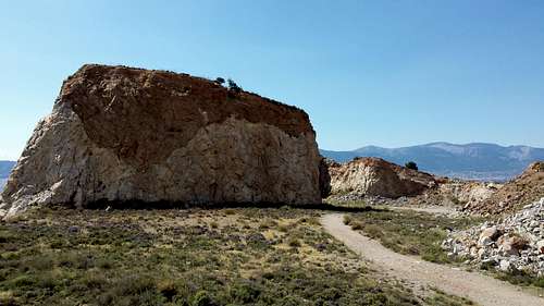
Table Top Rock from the plateau
The crux
Click on the link to the main page.
Three Tree Rock
Click on the link to the main page
Outcrop Tower
Click on the link to the main page
Dragon Fang
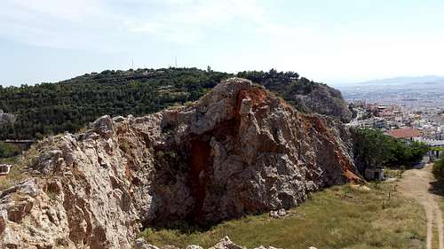
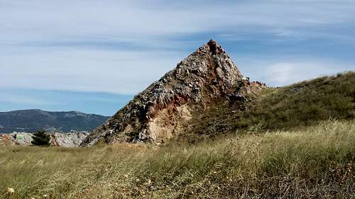
At 303m high its not an impresive summit but more of a vantage point to see the other summits. Located SW of the Outcrop tower it is directly visible to your left.
Route Up Drgon Fang
The ridge from the summit
To climb this peak head towards Hell Gates and just before entering the gates head right (West). There is no trail but you can head towards the peak. Head for the high point and a bit to the right that is the route entrance.
Outback Range
Church Tower
The steep looking Curch Tower that due to weather restrictions i didn't climb.
View of church tower from V1
Do not atempt to climb this peak with strong winds as the ridge is quite exposed and a tumble down both sides would prove fatal.
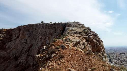
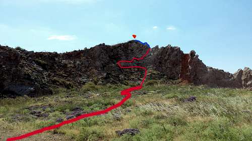
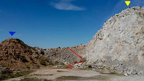
Olympus
At 308m it was the highest i climbed during the second exploration. Named after Olympus here in Greece due to it's likness to Olympus South Face.
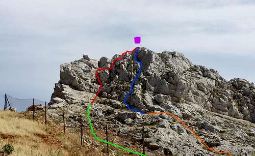
Denoted with red is Standard Route i used on the acsent. With Blue is the South Chimney a fun and pretty good route. The initial acsses is either the green route that is the dirt area which is not recommended whilst the orange route is a scramble route that is fun and safe.
It is by far one of the best peaks in the area, relatively hard to reach and the routes are insane. It is also the only peak with a view of mount Lecabytous (South).
To acsses Olympus head from the acsses road up to Hell Gates and Further to vantage V2. Then head left (East) you will see Olympus, follow the eastbound road until you will, on your right see the trail. Follow the trail until the tree on the image below, The follow the route upwards.
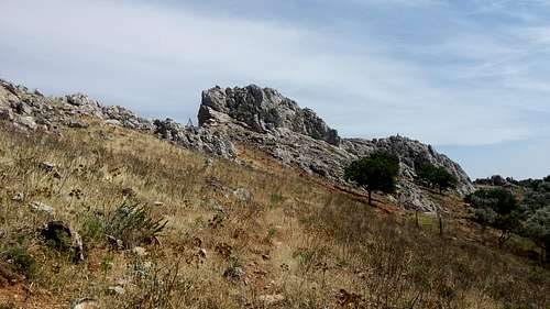
Pyramid Peak seen from the main road
Points of Interest
Here are other points of interest that are not peaks.
Moon Rocks
A small vantage point that is mainly a colection of rocks stacked on each other. It stands out as it is made from granite white rock and not red soil like the larger portion of the peaks in the area. It is just 2m higher than the surrounding plateu and is just a fun side location.
Moon Rocks is not a very interesting location by any means but is a fun referance point and vantage point.
UIA CRATER
The most interesting sublocation is by far is the crater ridge that connects Table Top Rock and Sail Rock. It is 3-6m deep and is mainly made from large white boulders on red soil it is stacked and there is almost no danger of rockfall. Between Crater EAST and WEST there is a small hill made from red soil and is about 4m high. You can see it on the photo above. There are also Three exit trails, main West, main East and Middle.
Crater West with Exit West in green and Exit Middle in orange
Crater West with Exit East in red
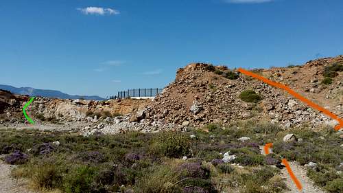
Hell Gates
Hell gates are the connecting part between the Northern and Outback Range, and are the main passage to acsses all the Outback peaks. They are maybe the best looking location. On the East of the gates is the end of the South Bowl Ridge of the Outcrop Tower South Bowl whilst on the West it is the end of the Dragon Fang Ridge. If the hell gates didn't exist the two peaks would be connected.
Hell Gates with a direct view of Three Tree Rock
Hell Gates as seen from Olympus
We can see Outcrop Tower, Three Tree Rock , Dragon Fang and Table Top Rock (Right Image)
VANTAGE POINTS
There are a bunch of Vantage Points around the range.

Vantage Point Map
Denoted with Yellow is vantage point V1
Denoted with Light Blue is vantage point V2
Denoted with Red are Hell Gates
Denoted with Green is the acsses trail for both V1 and Church Tower
There are no major View/Vantage points North of Hell Gates, i will update if anything interesting is found.
Miners Plateau
The lower altitude area of the miners plateau home to an now closed mine, there are many high peaks that are ridge like and climable most peaks require a mid level scramble to be summited and have difficult acsses. Here are some pictures of the mine.
Aproaching the mine from the Northern Range
Miner Village seen from the South Entrance
The Northern Range as seen from Miners Plateau
Detailed Referance Map
The HQ map
This map seems crappy but open it in a new tab for the full high quality map.