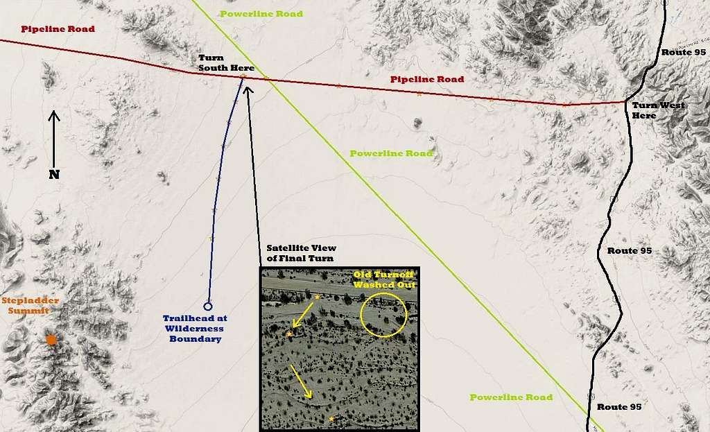
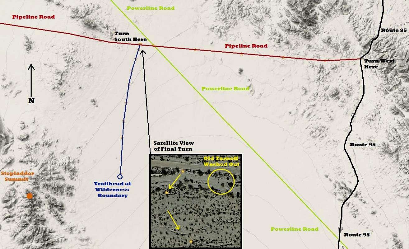
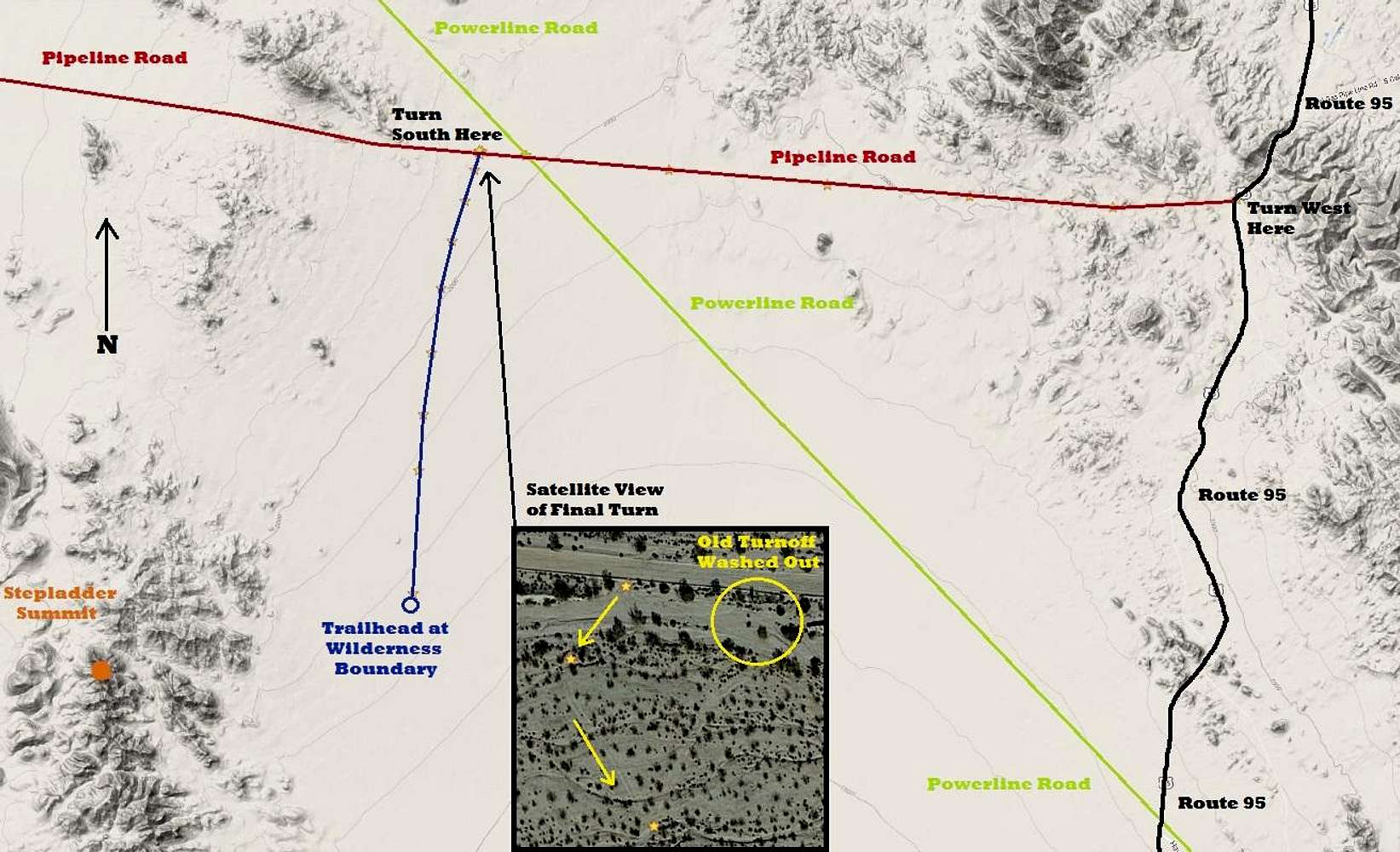
Note: none of these roads aside from Route 95 appear on Google Maps unless you use satellite view.
Drive US Route 95, either 13 miles south from Needles, or 36 miles north from Vidal Junction, to the pipeline road (34.670295, -114.628857). Turn west onto this dirt road and watch for sandy sections. After 8.8 miles, cross a diagonally intersecting powerline road, but stay on the original pipeline road.
Continue west another 0.6 miles to (34.678770,-114.791461). No road junction is visible here. It is suggested that you park here and get out and walk around to locate the junction. Tire tracks in the wash on the south side of the road might give you the clue you need. The old junction has washed out completely and a new access point slightly farther west has been created.
Drive across the sandy wash and carefully follow the new access track for a few hundred yards until you locate the better defined road heading south. This road is overgrown with brush and small cacti but easy to follow. Maximum speed is about 7 miles per hour because of hundreds of dips and micro washes that bisect the old road.
Continue south for 5.5 miles to the wilderness boundary which is marked with posts (34.600655,-114.805714).


