
-
 10478 Hits
-
 81.84% Score
-
 14 Votes
|
|
Route |
|---|---|
|
|
48.50077°N / 121.19761°W |
|
|
Download GPX » View Route on Map |
|
|
Hiking, Mountaineering |
|
|
Winter |
|
|
Most of a day |
|
|
Moderate |
|
|
Overview

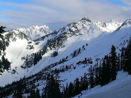
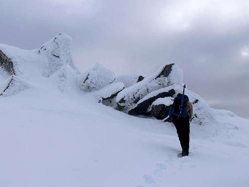
Hiking up the West Ridge
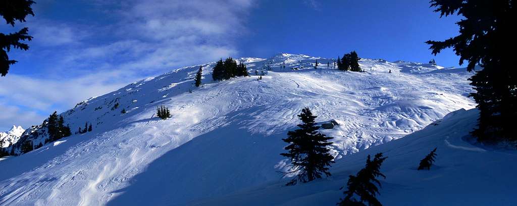
The West Ridge View: Taken December 6, 2009
Getting There
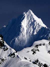
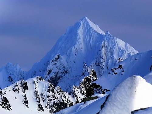
Eldorado Contrast

Eldorado Peak from the Road

The Woods you start off in
Coming in from Seattle:
Drive North to Seattle until you get to Darrington which you get off at exit 208 to Arlington. Take a right onto highway 530 which goes into Arlington. From Arlington take a left briefly onto highway 9 which in a few seconds you'll then turn right back onto highway 530 (don't ask me why they have the road set up this way). Then continue heading East for 27 miles until you get to Darrington. In Darrington you'll see a shell gas station which you take a left (north) which continues highway 530 (to the right is the Mountain Loop Highway). Eventually you'll end up in Rockport which you should take a right onto highway 20. From here you'll pass through the city of Marblemount. In Marblemount as your heading east you will see a turn section (after passing a gas station on your left) which you'll want to go straight which turns off of highway 20 and crosses a bridge which now you'll be on the Cascade River Road. After about 9.7 miles from the bridge crossing, to your left there is a road called Sibley Creek No. 1540. The road is a bit steep, I suppose most cars might be able to make it, but with my mom's olds mobile car, forget it! Although you drive most of the road up, for this route you don't actually start out at the standard trailhead of Hidden Lake Peaks. After crossing the East Fork Sibley Creek you do a few switch backs on the road which the start is a little after the last major bend in the road. (Refer to the Map)
Coming from Mount Vernon or Bellingham:
Drive South on I-5 until you get to Burlington (near Mount Vernon) which you get off at exit 230 and head east on highway 20. From here you follow this highway until you get to Marblemount. (Refer to Directions from Seattle for the Rest of the Driving)
Hidden Lake Peak's West Face from the Road
Route Description
At the beginning of the trip you go up in the woods. As your going up you should try to find the ridge which no matter what conditions your in it should not be that hard. From here your in the woods for a while, but don't worry when you get out of the woods, you'll be rewarded in no time! And believe me, it's very nice. Hiking Slightly off the Ridge |  Looking South | 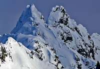 The Triads |  Dorado Needle |
The First View
You may encounter spots where you end up leaving the ridge off to the left (North) but that's fine, as long as your heading up, although try to stay as close the ridge as possible. Then the ridge kinda phases out which the slope becomes quite open and very easy to navigate. So on a good weather day you will be able to see the summit which from here you can just go up to the summit, even in bad weather as long as your heading South East is shouldn't be too bad. Often during winter the rocks are snowed over, but be warned, it might be possible for those annoying snow holes to appear if there is a low amount of snow, particularly around the summit.
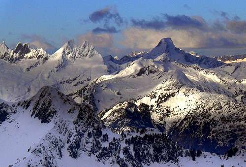
View of Eldorado Peak on the way up
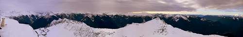
Summit View during December
The Picket Range
The Last Few Steps
Gear to Bring
10 EssentialsCamera!
Snowshoes
Ski Polls
Ice Axe (optional, it's not required but may come in handy, and helps for the glissade down)
Crampons (Optional, depends if there is a lot of ice in the woods)
Mountain Conditions

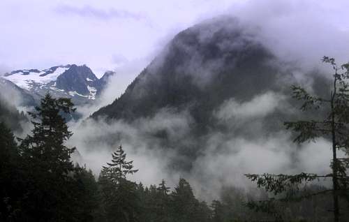
Devils Peak in Winter

Jburg with a Storm Coming
For Avalanche forecast's check in with the North West Avalanche Center. (Seasonal)
Click here for the road conditions to the trail head, and contact nps if you have any questions regarding roads, permits (if your going beyond the summit), ect.
Depending on snow conditions, from personal experience and many of the trip reports I've seen this place seems to get a lot of wind blown snow. So be sure to check the avalanche forecast before heading out.
Topographic Maps
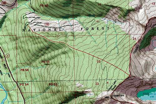
Topographic Map of the Route
External Links
Here are some trip reports of Ascents of the West Ridge:- West Ridge February 21, 2010
- Hidden Lake Peak, 12.9.2009
- Hot Time on Hidden Lake Peaks 12-27-09
- Hidden Lake Peaks - 6/19/2010